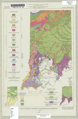
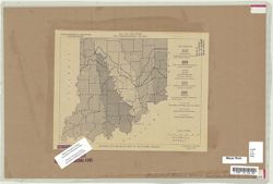
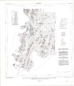
"Modified from Regional Geologic Map Series, Indiana Geological Survey." Includes insets of "Thickness of unconsolidated materials" and &...
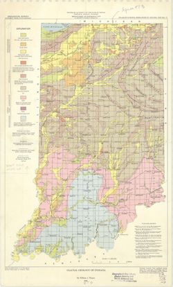
Geographic Subject: Clay County (Ind.), Topical Subject: IGS Annual Reports, and Topical Subject: Coal
Creator:
Levette, G. M. (Gilbert M.)
Publisher:
Indiana. Geological Survey
Date Created:
1869
Identifier:
VAC3073-M-00669
Genre:
Thematic maps
Geographic Location:
Coordinates: W0871400 W0865700 N0393700 N0391000
Related URL:
Catalog URL: https://iucat.iu.edu/catalog/2800455
Abstract:
Shows cities and towns, railroads, coal, iron ore, and blast furnaces. "For the first annual report of Prof. E. T. Cox, State Geologist." Detach...
Call Number:
G4093 .C5H1 1869 .L3
Caption:
Imprint: [Indianapolis] : [Alexander M. Conner], [1869]
Physical Description:
Dimensions: 77 x 69 cm and Scale: Approximately 1:85,000
Alternate Identifier:
Alternate ID: CAH3779BB and Title Control Number: a18224823
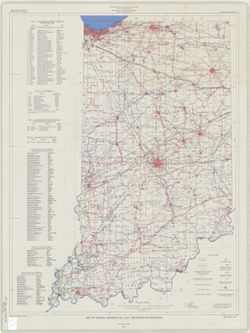
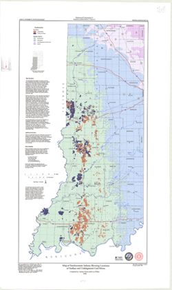
Geographic Subject: Indiana, Topical Subject: Mineral industries, and Topical Subject: Mineral resources
Creator:
Smith, Ned M. (Ned Myron), Guennel, G. K., Patton, John B. (John Barratt), 1915-, Wayne, William J. (William John), 1922-, and Murray, Haydn H. (Haydn Herber...
Publisher:
Indiana. Geological Survey
Date Created:
1953
Identifier:
VAC3073-M-00645
Genre:
Thematic maps
Geographic Location:
Coordinates: W0880500 W0844700 N0414500 N0374600
Related URL:
Catalog URL: No Record at this time
Abstract:
"Base from Map of Indiana, 1950 edition, published by U.S. Geological Survey. Minor revisions made from Indiana Dept. of Conservation, Geological Survey...
Call Number:
0.00E+00
Caption:
Imprint: [Bloomington, In.:] Indiana Department of Conservation, Geological Survey, 1953.
Physical Description:
Scale: 1:1,000,000 and Dimensions: 46 x 31 cm
Alternate Identifier:
Title Control Number: https://iucat.iu.edu/catalog/18571114 and Alternate ID: a18571114
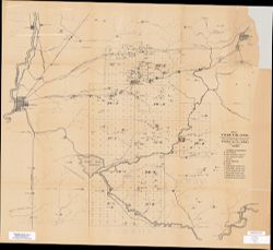
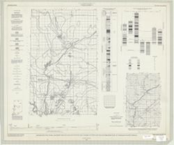
Geographic Subject: Warren County (Ind.), Topical Subject: Coal mines and mining, Geographic Subject: Vermillion County (Ind.), and Geographic Subject: Fount...
Creator:
Hutchison, Harold C. (Harold Christy), 1925-
Publisher:
Indiana. Geological Survey
Date Created:
1961
Identifier:
VAC3073-M-00418
Genre:
Mine maps
Geographic Location:
Coordinates: W0873200 W0870533 N0402800 N0395645
Related URL:
Catalog URL: https://iucat.iu.edu/catalog/4898738
Abstract:
"Preliminary coal map no. 9"--Margin. Includes 1 ancillary map, 1 diagram showing township enumeration, 1 index map, 1 stratigraphic column, and 1 ...
Call Number:
G4093.F6H9 1961 .H88
Caption:
Imprint: Bloomington : Indiana Dept. of Conservation, Geological Survey, 1961.
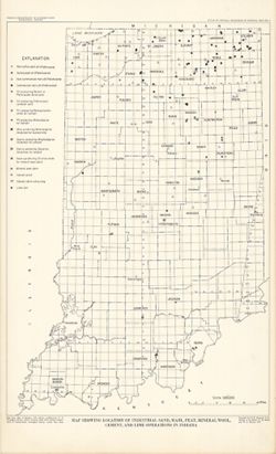
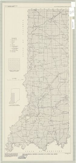
Geographic Subject: Indiana and Topical Subject: Coal mines and mining
Publisher:
Indiana. Geological Survey
Date Created:
2000
Identifier:
VAC3073-M-00283
Genre:
Geological maps
Related URL:
Catalog URL: https://iucat.iu.edu/catalog/4898390
Abstract:
"Minde data compilation complete through October 1997." "All mine data shown on this map are recompiled by IGS personnel as part of the Co...