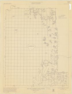
Blue line map. "May 1, 1951, revised January 1, 1968." Shows township and range numbers, section boundaries without numbers, State and National Fo...
Topical Subject: Administrative and political divisions and Geographic Subject: Indiana
Creator:
Moran, W. H. (William H.)
Publisher:
Indiana. Geological Survey
Date Created:
1952
Identifier:
VAC3073-M-00215
Genre:
Maps
Geographic Location:
Coordinates: W0880500 W0844700 N0414500 N0374600
Related URL:
Catalog URL: https://iucat.iu.edu/catalog/1233088
Abstract:
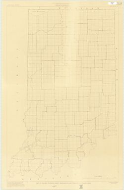
"January 1952." Black line print. "Traced from Map of Indiana, edition of 1950, published by U.S. Geological Survey. Minor revisions and addit...
Topical Subject: Administrative and political divisions and Geographic Subject: Indiana
Creator:
Moran, W. H. (William H.)
Publisher:
Indiana. Geological Survey
Date Created:
1951
Identifier:
VAC3073-M-00001
Genre:
Maps
Geographic Location:
Coordinates: W0880500 W0844700 N0414500 N0374600
Related URL:
Catalog URL: https://iucat.iu.edu/catalog/1233513
Abstract:
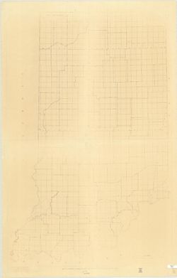
Photocopy, 118 x 77 cm "November, 1951." "Traced from compilation proof sheets of new base map of Indiana, prepared by the U.S. Geological Sur...