
Search Constraints
You searched for:
Campus
IUB
Remove constraint Campus: IUB
County
Inyo
Remove constraint County: Inyo
Type
Image
Remove constraint Type: Image
Pages
0-99 pages
Remove constraint Pages: 0-99 pages
« Previous |
1 - 50 of 345
|
Next »
Search Results
-
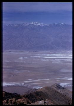
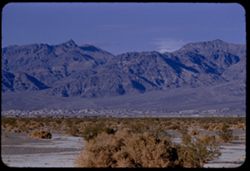
- Description:
- 100 f 6.3 50mm
- Subject:
- Snow, Craters, Valleys, Fog, Dantes View (Calif.), Mountains, Death Valley (Calif. and Nev.), and Telescope Peak (Inyo County, Calif.)
- Series:
- 8-55
- Creator:
- Cushman, Charles W., 1896-1972
- Date Created:
- 1955-03-22
- Genre:
- Landscape photographs
- Frame Number:
- 35
- County:
- Inyo
- Abstract:
- Tel PK & Bad Water
- Call Number:
- P07790
- City:
- Badwater
- Country:
- United States
- State/Province:
- California
- Physical Description:
- Image was originally mounted in a glass enclosure. Before digitization, the image was removed and placed in a Wess Plastic, Inc. brand, 2" x 2", pl...
- Alternate Identifier:
- 855.35
- Persistent URL:
- http://purl.dlib.indiana.edu/iudl/archives/cushman/P07790
- Holding Location:
- Bloomington - University Archives
Wells Library E460
1320 E 10th St.
Bloomington, IN 47405
Contact at archives@indiana.edu, 812-855-1127
-

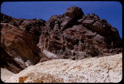
- Description:
- 100 f 6 tl
- Subject:
- Golden Canyon (Inyo County, Calif.), Canyons, Valleys, Death Valley (Calif. and Nev.), Clouds, and Rock formations
- Series:
- 9-55
- Creator:
- Cushman, Charles W., 1896-1972
- Date Created:
- 1955-03-22
- Frame Number:
- 23
- County:
- Inyo
- Abstract:
- made inside Golden Canyon
- Call Number:
- P07814
- Country:
- United States
- State/Province:
- California
- Alternate Identifier:
- 955.23
- Persistent URL:
- http://purl.dlib.indiana.edu/iudl/archives/cushman/P07814
- Holding Location:
- Bloomington - University Archives
Wells Library E460
1320 E 10th St.
Bloomington, IN 47405
Contact at archives@indiana.edu, 812-855-1127
-
- Description:
- 100 f 6 tl
- Subject:
- Valleys, Rock formations, Death Valley (Calif. and Nev.), Golden Canyon (Inyo County, Calif.), and Canyons
- Series:
- 9-55
- Creator:
- Cushman, Charles W., 1896-1972
- Date Created:
- 1955-03-22
- Genre:
- Landscape photographs
- Frame Number:
- 22
- County:
- Inyo
- Abstract:
- made inside Golden Canyon
- Call Number:
- P07813
- Country:
- United States
- State/Province:
- California
- Alternate Identifier:
- 955.22
- Persistent URL:
- http://purl.dlib.indiana.edu/iudl/archives/cushman/P07813
- Holding Location:
- Bloomington - University Archives
Wells Library E460
1320 E 10th St.
Bloomington, IN 47405
Contact at archives@indiana.edu, 812-855-1127
-

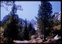
- Description:
- 100 f 7+ tl
- Subject:
- Snow, Trees, Mountains, Buildings, Shrubs, and Whitney, Mount (Calif.)
- Series:
- 3-55
- Creator:
- Cushman, Charles W., 1896-1972
- Date Created:
- 1955-02-27
- Genre:
- Landscape photographs
- Frame Number:
- 34
- Street Address:
- Portal Road
- County:
- Inyo
- Abstract:
- view of Whitney Road from 9 mi. up the Whitney Portal rd.
- Call Number:
- P07625
- City:
- Lone Pine
- Country:
- United States
- State/Province:
- California
- Alternate Identifier:
- 355.34
- Persistent URL:
- http://purl.dlib.indiana.edu/iudl/archives/cushman/P07625
- Holding Location:
- Bloomington - University Archives
Wells Library E460
1320 E 10th St.
Bloomington, IN 47405
Contact at archives@indiana.edu, 812-855-1127
-
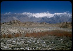
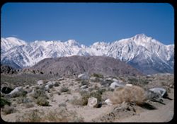
- Description:
- 25 f 8 Pola
- Subject:
- Rocks, Inyo Mountains (Calif.), Boulders, Owens Valley (Calif.), Mountains, Shrubs, Hills, and Snow
- Series:
- 14-52
- Creator:
- Cushman, Charles W., 1896-1972
- Date Created:
- 1952-04-08
- Genre:
- Landscape photographs
- Frame Number:
- 32
- Street Address:
- Mount Whitney Road
- County:
- Inyo
- Abstract:
- Across Owens Valley to Inyo Mtns.
- Call Number:
- P06015
- City:
- Lone Pine
- Country:
- United States
- State/Province:
- California
- Alternate Identifier:
- 1452.32
- Persistent URL:
- http://purl.dlib.indiana.edu/iudl/archives/cushman/P06015
- Holding Location:
- Bloomington - University Archives
Wells Library E460
1320 E 10th St.
Bloomington, IN 47405
Contact at archives@indiana.edu, 812-855-1127
-
- Description:
- 100 f 8 tl
- Subject:
- Park headquarters, Valleys, Fog, Mountains, Shrubs, and Panamint Range (Calif.)
- Series:
- 11-55
- Creator:
- Cushman, Charles W., 1896-1972
- Date Created:
- 1955-03-23
- Genre:
- Landscape photographs
- Frame Number:
- 14
- County:
- Inyo
- Abstract:
- Valley floor from near Park Hqtrs
- Call Number:
- P07876
- Country:
- United States
- State/Province:
- California
- Alternate Identifier:
- 1155.14
- Persistent URL:
- http://purl.dlib.indiana.edu/iudl/archives/cushman/P07876
- Holding Location:
- Bloomington - University Archives
Wells Library E460
1320 E 10th St.
Bloomington, IN 47405
Contact at archives@indiana.edu, 812-855-1127
-
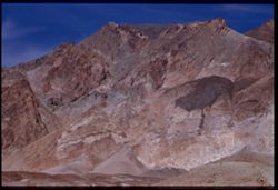
- Description:
- 100 f 8 + tl 40 ft.
- Subject:
- Minerals, Alkali, and Shrubs
- Series:
- 12-55
- Creator:
- Cushman, Charles W., 1896-1972
- Date Created:
- 1955-03-24
- Genre:
- Landscape photographs
- Frame Number:
- 5
- County:
- Inyo
- Abstract:
- Closeup
- Call Number:
- P07901
- City:
- Shoshone
- Country:
- United States
- State/Province:
- California
- Alternate Identifier:
- 1255.5
- Persistent URL:
- http://purl.dlib.indiana.edu/iudl/archives/cushman/P07901
- Holding Location:
- Bloomington - University Archives
Wells Library E460
1320 E 10th St.
Bloomington, IN 47405
Contact at archives@indiana.edu, 812-855-1127
-
- Description:
- 100 f 8 + tl
- Subject:
- Valleys, Greenwater Range (Calif.), Minerals, Alkali, Mountains, Shrubs, and Hills
- Series:
- 12-55
- Creator:
- Cushman, Charles W., 1896-1972
- Date Created:
- 1955-03-24
- Genre:
- Landscape photographs
- Frame Number:
- 4
- County:
- Inyo
- Abstract:
- Alkali beds south of Shoshone
- Call Number:
- P07900
- City:
- Shoshone
- Country:
- United States
- State/Province:
- California
- Alternate Identifier:
- 1255.4
- Persistent URL:
- http://purl.dlib.indiana.edu/iudl/archives/cushman/P07900
- Holding Location:
- Bloomington - University Archives
Wells Library E460
1320 E 10th St.
Bloomington, IN 47405
Contact at archives@indiana.edu, 812-855-1127
-
- Description:
- 25 f 16
- Subject:
- Deserts, Valleys, Cliffs, Mountains, Rock formations, and Death Valley (Calif. and Nev.)
- Series:
- 15-52
- Creator:
- Cushman, Charles W., 1896-1972
- Date Created:
- 1952-04-09
- Genre:
- Snapshots
- Frame Number:
- 36
- Street Address:
- Artists Drive
- County:
- Inyo
- Abstract:
- From top of Artists Drive. Up from Artists Dr.
- Call Number:
- P06055
- Country:
- United States
- State/Province:
- California
- Alternate Identifier:
- 1552.36
- Persistent URL:
- http://purl.dlib.indiana.edu/iudl/archives/cushman/P06055
- Holding Location:
- Bloomington - University Archives
Wells Library E460
1320 E 10th St.
Bloomington, IN 47405
Contact at archives@indiana.edu, 812-855-1127
-
- Description:
- 200 f 4.5 tl
- Subject:
- Rocks, Dantes View (Calif.), Mountains, Shrubs, Death Valley (Calif. and Nev.), Rock formations, and Furnace Creek Inn (Death Valley Junction, Calif.)
- Series:
- 2-55
- Creator:
- Cushman, Charles W., 1896-1972
- Date Created:
- 1955-02-27
- Genre:
- Landscape photographs
- Frame Number:
- 26
- County:
- Inyo
- Abstract:
- Elephant hide 10 miles SE of Furnace Ck. Inn
- Call Number:
- P07584
- City:
- Death Valley Junction
- Country:
- United States
- State/Province:
- California
- Alternate Identifier:
- 255.26
- Persistent URL:
- http://purl.dlib.indiana.edu/iudl/archives/cushman/P07584
- Holding Location:
- Bloomington - University Archives
Wells Library E460
1320 E 10th St.
Bloomington, IN 47405
Contact at archives@indiana.edu, 812-855-1127
-
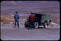
- Description:
- 100 f 6.3 tl
- Subject:
- Valleys, Roads, Automobiles, Shrubs, Indigenous peoples, Masonry, Zabriskie Point (Calif.), and Hills
- Series:
- 9-55
- Creator:
- Cushman, Charles W., 1896-1972
- Date Created:
- 1955-03-22
- Genre:
- Identification photographs
- Frame Number:
- 10
- County:
- Inyo
- Abstract:
- A couple of natives and a jeep
- Call Number:
- P07802
- Country:
- United States
- State/Province:
- California
- Alternate Identifier:
- 955.10
- Persistent URL:
- http://purl.dlib.indiana.edu/iudl/archives/cushman/P07802
- Holding Location:
- Bloomington - University Archives
Wells Library E460
1320 E 10th St.
Bloomington, IN 47405
Contact at archives@indiana.edu, 812-855-1127
-
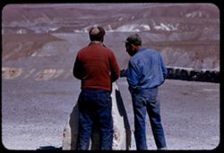
- Description:
- 100 f 6.3 tl
- Subject:
- Sundials, Indigenous peoples, and Zabriskie Point (Calif.)
- Series:
- 9-55
- Creator:
- Cushman, Charles W., 1896-1972
- Date Created:
- 1955-03-22
- Genre:
- Identification photographs
- Frame Number:
- 9
- County:
- Inyo
- Abstract:
- A couple of natives and a jeep
- Call Number:
- P07801
- Country:
- United States
- State/Province:
- California
- Alternate Identifier:
- 955.9
- Persistent URL:
- http://purl.dlib.indiana.edu/iudl/archives/cushman/P07801
- Holding Location:
- Bloomington - University Archives
Wells Library E460
1320 E 10th St.
Bloomington, IN 47405
Contact at archives@indiana.edu, 812-855-1127
-
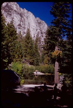
- Description:
- 50 f 9
- Subject:
- Bodies of water, Trees, Boulders, Shadows, Mountains, Shrubs, Lakes & ponds, Whitney, Mount (Calif.), People, and Reflections
- Series:
- 12-54
- Creator:
- Cushman, Charles W., 1896-1972
- Date Created:
- 1954-09-18
- Genre:
- Landscape photographs
- Frame Number:
- 22
- Street Address:
- Mt. Whitney Road
- County:
- Inyo
- Abstract:
- Vacationers at Mt Whitney Portal campground.
- Call Number:
- P07412
- Country:
- United States
- State/Province:
- California
- Alternate Identifier:
- 1254.22
- Persistent URL:
- http://purl.dlib.indiana.edu/iudl/archives/cushman/P07412
- Holding Location:
- Bloomington - University Archives
Wells Library E460
1320 E 10th St.
Bloomington, IN 47405
Contact at archives@indiana.edu, 812-855-1127
-
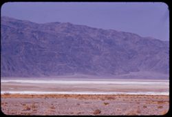
- Description:
- 25 f 9 Pola
- Subject:
- Lakes & ponds, Deserts, Valleys, Death Valley (Calif. and Nev.), Roads, Cliffs, Mountains, Boulders, and Rocks
- Series:
- 15-52
- Creator:
- Cushman, Charles W., 1896-1972
- Date Created:
- 1952-04-09
- Genre:
- Snapshots
- Frame Number:
- 29
- County:
- Inyo
- Abstract:
- Mtns at Bad Water, 279.6 ft. below
- Call Number:
- P06049
- City:
- Badwater
- Country:
- United States
- State/Province:
- California
- Alternate Identifier:
- 1552.29
- Persistent URL:
- http://purl.dlib.indiana.edu/iudl/archives/cushman/P06049
- Holding Location:
- Bloomington - University Archives
Wells Library E460
1320 E 10th St.
Bloomington, IN 47405
Contact at archives@indiana.edu, 812-855-1127
-
- Description:
- 100 f 8 tl
- Subject:
- Snow, Canyons, Trees, Lone Pine Peak (Calif.), Mountains, and Shrubs
- Series:
- 3-55
- Creator:
- Cushman, Charles W., 1896-1972
- Date Created:
- 1955-02-28
- Genre:
- Landscape photographs
- Frame Number:
- 32
- Street Address:
- Mount Whitney Road
- County:
- Inyo
- Abstract:
- Base of Lone Pine Peak
- Call Number:
- P07623
- Country:
- United States
- State/Province:
- California
- Alternate Identifier:
- 355.32
- Persistent URL:
- http://purl.dlib.indiana.edu/iudl/archives/cushman/P07623
- Holding Location:
- Bloomington - University Archives
Wells Library E460
1320 E 10th St.
Bloomington, IN 47405
Contact at archives@indiana.edu, 812-855-1127
-
- Description:
- 100 f 8 tl
- Subject:
- Rocks, Bell towers, Trees, Arches, Mountains, Shrubs, Clock towers, Scotty's Castle (Calif.), Death Valley (Calif. and Nev.), Columns, Castles & pala...
- Series:
- 11-55
- Creator:
- Cushman, Charles W., 1896-1972
- Date Created:
- 1955-03-23
- Genre:
- Architectural photographs
- Frame Number:
- 28
- County:
- Inyo
- Abstract:
- Scotty's Tower from gate
- Call Number:
- P07887
- Country:
- United States
- State/Province:
- California
- Alternate Identifier:
- 1155.28
- Persistent URL:
- http://purl.dlib.indiana.edu/iudl/archives/cushman/P07887
- Holding Location:
- Bloomington - University Archives
Wells Library E460
1320 E 10th St.
Bloomington, IN 47405
Contact at archives@indiana.edu, 812-855-1127
-
- Description:
- 100 f 8 tl
- Subject:
- Valleys, Furnace Creek Inn (Death Valley Junction, Calif.), Mountains, and Black Mountains (Inyo County, Calif.)
- Series:
- 9-55
- Creator:
- Cushman, Charles W., 1896-1972
- Date Created:
- 1955-03-22
- Genre:
- Landscape photographs
- Frame Number:
- 27
- Street Address:
- Bad Water Road
- County:
- Inyo
- Abstract:
- East from Bad Water Road 6 miles south of Furnace C K Inn
- Call Number:
- P07818
- City:
- Death Valley Junction and Badwater
- Country:
- United States
- State/Province:
- California
- Alternate Identifier:
- 955.27
- Persistent URL:
- http://purl.dlib.indiana.edu/iudl/archives/cushman/P07818
- Holding Location:
- Bloomington - University Archives
Wells Library E460
1320 E 10th St.
Bloomington, IN 47405
Contact at archives@indiana.edu, 812-855-1127
-
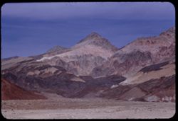
- Description:
- 100 f 6.3
- Subject:
- Canyons, Valleys, Black Mountains (Inyo County, Calif.), and Mountains
- Series:
- 3-55
- Creator:
- Cushman, Charles W., 1896-1972
- Date Created:
- 1955-02-27
- Genre:
- Landscape photographs
- Frame Number:
- 17
- Street Address:
- Bad Water Road
- County:
- Inyo
- Abstract:
- From a mile or two farther south
- Call Number:
- P07609
- Country:
- United States
- State/Province:
- California
- Alternate Identifier:
- 355.17
- Persistent URL:
- http://purl.dlib.indiana.edu/iudl/archives/cushman/P07609
- Holding Location:
- Bloomington - University Archives
Wells Library E460
1320 E 10th St.
Bloomington, IN 47405
Contact at archives@indiana.edu, 812-855-1127
-
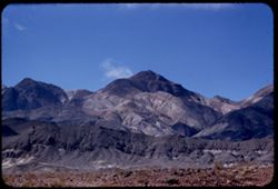
- Description:
- 100 f 6.3 tl
- Subject:
- Valleys, Mountains, Death Valley (Calif. and Nev.), and Black Mountains (Inyo County, Calif.)
- Series:
- 2-55
- Creator:
- Cushman, Charles W., 1896-1972
- Date Created:
- 1955-02-27
- Genre:
- Landscape photographs
- Frame Number:
- 30
- County:
- Inyo
- Abstract:
- West toward Black Mtns
- Call Number:
- P07587
- City:
- Ryan
- Country:
- United States
- State/Province:
- California
- Alternate Identifier:
- 255.30
- Persistent URL:
- http://purl.dlib.indiana.edu/iudl/archives/cushman/P07587
- Holding Location:
- Bloomington - University Archives
Wells Library E460
1320 E 10th St.
Bloomington, IN 47405
Contact at archives@indiana.edu, 812-855-1127
-
- Description:
- 100 f 8 tl
- Subject:
- Snow, Valleys, Mountains, and Death Valley National Park (Calif. and Nev.)
- Series:
- 10-55
- Creator:
- Cushman, Charles W., 1896-1972
- Date Created:
- 1955-03-22
- Genre:
- Landscape photographs
- Frame Number:
- 15
- Street Address:
- Bad Water Road
- County:
- Inyo
- Abstract:
- Streaks down the chocolate ice cream from Bad Water road
- Call Number:
- P07840
- Country:
- United States
- State/Province:
- California
- Alternate Identifier:
- 1055.15
- Persistent URL:
- http://purl.dlib.indiana.edu/iudl/archives/cushman/P07840
- Holding Location:
- Bloomington - University Archives
Wells Library E460
1320 E 10th St.
Bloomington, IN 47405
Contact at archives@indiana.edu, 812-855-1127
-
- Description:
- 100 f 8 tl
- Subject:
- Furnace Creek Inn (Death Valley Junction, Calif.), Hills, Mountains, Clouds, Valleys, and Black Mountains (Inyo County, Calif.)
- Series:
- 9-55
- Creator:
- Cushman, Charles W., 1896-1972
- Date Created:
- 1955-03-22
- Genre:
- Landscape photographs
- Frame Number:
- 29
- Street Address:
- Bad Water Road
- County:
- Inyo
- Abstract:
- From 7 mi so. of Furnace Crk Inn eastward
- Call Number:
- P07820
- City:
- Death Valley Junction
- Country:
- United States
- State/Province:
- California
- Alternate Identifier:
- 955.29
- Persistent URL:
- http://purl.dlib.indiana.edu/iudl/archives/cushman/P07820
- Holding Location:
- Bloomington - University Archives
Wells Library E460
1320 E 10th St.
Bloomington, IN 47405
Contact at archives@indiana.edu, 812-855-1127
-
- Description:
- 100 f 8 tl
- Subject:
- Valleys, Mountains, Furnace Creek Inn (Death Valley Junction, Calif.), Death Valley (Calif. and Nev.), and Black Mountains (Inyo County, Calif.)
- Series:
- 9-55
- Creator:
- Cushman, Charles W., 1896-1972
- Date Created:
- 1955-03-22
- Genre:
- Landscape photographs
- Frame Number:
- 31
- Street Address:
- Death Valley Road
- County:
- Inyo
- Abstract:
- From 9 mi so. of Furn. Crk Inn (those are the Black Mtns from the west)
- Call Number:
- P07822
- City:
- Death Valley Junction and Badwater
- Country:
- United States
- State/Province:
- California
- Alternate Identifier:
- 955.31
- Persistent URL:
- http://purl.dlib.indiana.edu/iudl/archives/cushman/P07822
- Holding Location:
- Bloomington - University Archives
Wells Library E460
1320 E 10th St.
Bloomington, IN 47405
Contact at archives@indiana.edu, 812-855-1127
-
- Description:
- 100 f 8 tl
- Subject:
- Valleys, Mountains, Death Valley (Calif. and Nev.), and Black Mountains (Inyo County, Calif.)
- Series:
- 9-55
- Creator:
- Cushman, Charles W., 1896-1972
- Date Created:
- 1955-03-22
- Genre:
- Landscape photographs
- Frame Number:
- 30
- County:
- Inyo
- Abstract:
- Strawberry and chocolate cone from 9 mi so. of Furn. Crk Inn
- Call Number:
- P07821
- City:
- Badwater
- Country:
- United States
- State/Province:
- California
- Alternate Identifier:
- 955.30
- Persistent URL:
- http://purl.dlib.indiana.edu/iudl/archives/cushman/P07821
- Holding Location:
- Bloomington - University Archives
Wells Library E460
1320 E 10th St.
Bloomington, IN 47405
Contact at archives@indiana.edu, 812-855-1127
-
- Description:
- 100 f 5.6 tl
- Subject:
- Rocks, Dantes View (Calif.), Mountains, Shrubs, Clouds, Death Valley (Calif. and Nev.), and Black Mountains (Inyo County, Calif.)
- Series:
- 2-55
- Creator:
- Cushman, Charles W., 1896-1972
- Date Created:
- 1955-02-27
- Genre:
- Landscape photographs
- Frame Number:
- 32
- County:
- Inyo
- Abstract:
- Black Mtns on way to Dante's View from road near Ryan
- Call Number:
- P07589
- City:
- Ryan
- Country:
- United States
- State/Province:
- California
- Alternate Identifier:
- 255.32
- Persistent URL:
- http://purl.dlib.indiana.edu/iudl/archives/cushman/P07589
- Holding Location:
- Bloomington - University Archives
Wells Library E460
1320 E 10th St.
Bloomington, IN 47405
Contact at archives@indiana.edu, 812-855-1127
-
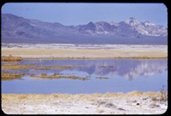
- Description:
- 100 f 6 tl
- Subject:
- Lakes & ponds, Deserts, Reflections, Valleys, Black Mountains (Inyo County, Calif.), Death Valley (Calif. and Nev.), Mountains, and Shrubs
- Series:
- 12-55
- Creator:
- Cushman, Charles W., 1896-1972
- Date Created:
- 1955-03-24
- Genre:
- Landscape photographs
- Frame Number:
- 8
- County:
- Inyo
- Abstract:
- Desert lake near Tecopa - view N.W.
- Call Number:
- P07904
- City:
- Tecopa
- Country:
- United States
- State/Province:
- California
- Alternate Identifier:
- 1255.8
- Persistent URL:
- http://purl.dlib.indiana.edu/iudl/archives/cushman/P07904
- Holding Location:
- Bloomington - University Archives
Wells Library E460
1320 E 10th St.
Bloomington, IN 47405
Contact at archives@indiana.edu, 812-855-1127
-
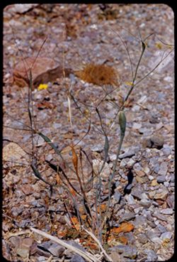
- Description:
- 100 f 8 tl 11 ft.
- Subject:
- Rocks, Shrubs, Death Valley (Calif. and Nev.), and Buckwheat
- Series:
- 11-55
- Creator:
- Cushman, Charles W., 1896-1972
- Date Created:
- 1955-03-23
- Genre:
- Identification photographs
- Frame Number:
- 4
- County:
- Inyo
- Abstract:
- Little bean stalk plant Buckwheat
- Call Number:
- P07866
- Country:
- United States
- State/Province:
- California
- Alternate Identifier:
- 1155.4
- Persistent URL:
- http://purl.dlib.indiana.edu/iudl/archives/cushman/P07866
- Holding Location:
- Bloomington - University Archives
Wells Library E460
1320 E 10th St.
Bloomington, IN 47405
Contact at archives@indiana.edu, 812-855-1127
-
- Description:
- 100 f 6.3 tl
- Subject:
- Valleys, Stovepipe Wells Hotel (Stovepipe Wells, Calif.), Buttes, and Death Valley (Calif. and Nev.)
- Series:
- 8-55
- Creator:
- Cushman, Charles W., 1896-1972
- Date Created:
- 1955-03-21
- Genre:
- Landscape photographs
- Frame Number:
- 9
- Street Address:
- California State Highway 190
- County:
- Inyo
- Abstract:
- [Treenish] Buttes a few miles east of SPW Hotel
- Call Number:
- P07768
- City:
- Stovepipe Wells
- Country:
- United States
- State/Province:
- California
- Alternate Identifier:
- 855.9
- Persistent URL:
- http://purl.dlib.indiana.edu/iudl/archives/cushman/P07768
- Holding Location:
- Bloomington - University Archives
Wells Library E460
1320 E 10th St.
Bloomington, IN 47405
Contact at archives@indiana.edu, 812-855-1127
-
- Description:
- 100 f 6.3 tl
- Subject:
- Valleys, Buttes, Stovepipe Wells Hotel (Stovepipe Wells, Calif.), Traffic signs & signals, and Death Valley (Calif. and Nev.)
- Series:
- 8-55
- Creator:
- Cushman, Charles W., 1896-1972
- Date Created:
- 1955-03-21
- Genre:
- Landscape photographs
- Frame Number:
- 8
- Street Address:
- California State Highway 190
- County:
- Inyo
- Abstract:
- [Treenish] Buttes a few miles east of SPW hotel
- Call Number:
- P07767
- City:
- Stovepipe Wells
- Country:
- United States
- State/Province:
- California
- Physical Description:
- masked.
- Alternate Identifier:
- 855.8
- Persistent URL:
- http://purl.dlib.indiana.edu/iudl/archives/cushman/P07767
- Holding Location:
- Bloomington - University Archives
Wells Library E460
1320 E 10th St.
Bloomington, IN 47405
Contact at archives@indiana.edu, 812-855-1127
-
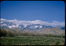
- Description:
- 50 f 11
- Subject:
- Alfalfa, White Mountains (Calif. and Nev.), Farms, Trees, Meadows, Croplands, Shrubs, and Mountains
- Series:
- 12-54
- Creator:
- Cushman, Charles W., 1896-1972
- Date Created:
- 1954-09-17
- Genre:
- Landscape photographs
- Frame Number:
- 2
- Street Address:
- United States Highway 6, United States Highway 395, and California State Highway 14
- County:
- Inyo
- Abstract:
- From 2 miles further north, Colorful mountain wall east side Owen Valley from US 6 about 20 mi. north of Bishop, across alphalfa field.
- Call Number:
- P07393
- City:
- Bishop
- Country:
- United States
- State/Province:
- California
- Physical Description:
- Image was originally mounted in a glass enclosure. Before digitization, the image was removed and placed in a Wess Plastic, Inc. brand, 2" x 2", pl...
- Alternate Identifier:
- 1254.2
- Persistent URL:
- http://purl.dlib.indiana.edu/iudl/archives/cushman/P07393
- Holding Location:
- Bloomington - University Archives
Wells Library E460
1320 E 10th St.
Bloomington, IN 47405
Contact at archives@indiana.edu, 812-855-1127
-
- Description:
- 100 f 9 tl
- Subject:
- Canyons, Mountains, Death Valley National Park (Calif. and Nev.), and Rocks
- Series:
- 10-55
- Creator:
- Cushman, Charles W., 1896-1972
- Date Created:
- 1955-03-22
- Genre:
- Landscape photographs
- Frame Number:
- 14
- Street Address:
- Artist's View Drive
- County:
- Inyo
- Abstract:
- Back up Artists Drive
- Call Number:
- P07839
- Country:
- United States
- State/Province:
- California
- Alternate Identifier:
- 1055.14
- Persistent URL:
- http://purl.dlib.indiana.edu/iudl/archives/cushman/P07839
- Holding Location:
- Bloomington - University Archives
Wells Library E460
1320 E 10th St.
Bloomington, IN 47405
Contact at archives@indiana.edu, 812-855-1127
-
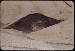
- Description:
- 100 f 9 tl
- Subject:
- Twenty Mule Team Canyon (Calif.), Valleys, Dirt roads, Death Valley National Park (Calif. and Nev.), Hibiscus, Canyons, and Cinder cone
- Series:
- 10-55
- Creator:
- Cushman, Charles W., 1896-1972
- Date Created:
- 1955-03-23
- Genre:
- Landscape photographs
- Frame Number:
- 36
- County:
- Inyo
- Abstract:
- Cinder cone in 20 M T canyon
- Call Number:
- P07860
- Country:
- United States
- State/Province:
- California
- Alternate Identifier:
- 1055.36
- Persistent URL:
- http://purl.dlib.indiana.edu/iudl/archives/cushman/P07860
- Holding Location:
- Bloomington - University Archives
Wells Library E460
1320 E 10th St.
Bloomington, IN 47405
Contact at archives@indiana.edu, 812-855-1127
-
- Description:
- 50 f 7.5
- Subject:
- Roads, Whitney, Mount (Calif.), Mountains, Shrubs, Trees, and Rocks
- Series:
- 12-54
- Creator:
- Cushman, Charles W., 1896-1972
- Date Created:
- 1954-09-18
- Genre:
- Landscape photographs
- Frame Number:
- 23
- Street Address:
- Mt. Whitney Road
- County:
- Inyo
- Abstract:
- Closest to Mt Whitney - backlighted.
- Call Number:
- P07413
- Country:
- United States
- State/Province:
- California
- Physical Description:
- Image was originally mounted in a glass enclosure. Before digitization, the image was removed and placed in a Wess Plastic, Inc. brand, 2" x 2", pl...
- Alternate Identifier:
- 1254.23
- Persistent URL:
- http://purl.dlib.indiana.edu/iudl/archives/cushman/P07413
- Holding Location:
- Bloomington - University Archives
Wells Library E460
1320 E 10th St.
Bloomington, IN 47405
Contact at archives@indiana.edu, 812-855-1127
-
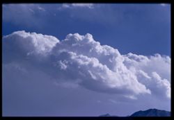
- Description:
- 100 f 8 tl
- Subject:
- Mountains, Clouds, and Sierra Nevada (Calif. and Nev.)
- Series:
- 26-55
- Creator:
- Cushman, Charles W., 1896-1972
- Date Created:
- 1955-09-25
- Genre:
- Landscape photographs
- Frame Number:
- 22
- County:
- Inyo
- Abstract:
- Cloud mass over Sierra - from Bishop
- Call Number:
- P08404
- City:
- Bishop
- Country:
- United States
- State/Province:
- California
- Physical Description:
- Image was originally mounted in a glass enclosure. Before digitization, the image was removed and placed in a Wess Plastic, Inc. brand, 2" x 2", pl...
- Alternate Identifier:
- 2655.22
- Persistent URL:
- http://purl.dlib.indiana.edu/iudl/archives/cushman/P08404
- Holding Location:
- Bloomington - University Archives
Wells Library E460
1320 E 10th St.
Bloomington, IN 47405
Contact at archives@indiana.edu, 812-855-1127
-
- Description:
- 50 f 9
- Subject:
- Snow, Trees, Croplands, Clouds, Sierra Nevada (Calif. and Nev.), Hills, Mountains, and Whitney, Mount (Calif.)
- Series:
- 14-52
- Creator:
- Cushman, Charles W., 1896-1972
- Date Created:
- 1952-04-08
- Genre:
- Landscape photographs
- Frame Number:
- 16
- County:
- Inyo
- Abstract:
- Mt. Whitney et al. Behind cloud.
- Call Number:
- P06000
- City:
- Lone Pine
- Country:
- United States
- State/Province:
- California
- Alternate Identifier:
- 1452.16
- Persistent URL:
- http://purl.dlib.indiana.edu/iudl/archives/cushman/P06000
- Holding Location:
- Bloomington - University Archives
Wells Library E460
1320 E 10th St.
Bloomington, IN 47405
Contact at archives@indiana.edu, 812-855-1127
-
- Description:
- 100 f 6.3 sl with 50mm
- Subject:
- Mountains, Sierra Nevada (Calif. and Nev.), Trees, and Clouds
- Series:
- 26-55
- Creator:
- Cushman, Charles W., 1896-1972
- Date Created:
- 1955-09-25
- Genre:
- Landscape photographs
- Frame Number:
- 23
- County:
- Inyo
- Abstract:
- Cloud mass over Sierra - from Bishop
- Call Number:
- P08405
- City:
- Bishop
- Country:
- United States
- State/Province:
- California
- Alternate Identifier:
- 2655.23
- Persistent URL:
- http://purl.dlib.indiana.edu/iudl/archives/cushman/P08405
- Holding Location:
- Bloomington - University Archives
Wells Library E460
1320 E 10th St.
Bloomington, IN 47405
Contact at archives@indiana.edu, 812-855-1127
-
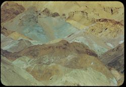
- Description:
- 25 f 13
- Subject:
- Rocks, Colored mountains, Valleys, Cliffs, Boulders, Mountains, Rock formations, Death Valley (Calif. and Nev.), Deserts, and Hills
- Series:
- 15-52
- Creator:
- Cushman, Charles W., 1896-1972
- Date Created:
- 1952-04-09
- Genre:
- Landscape photographs
- Frame Number:
- 33
- Street Address:
- Artists Drive
- County:
- Inyo
- Abstract:
- Colored mtns from Artists Drive.
- Call Number:
- P06052
- Country:
- United States
- State/Province:
- California
- Physical Description:
- Image was originally mounted in a glass enclosure. Before digitization, the image was removed and placed in a Wess Plastic, Inc. brand, 2" x 2", pl...
- Alternate Identifier:
- 1552.33
- Persistent URL:
- http://purl.dlib.indiana.edu/iudl/archives/cushman/P06052
- Holding Location:
- Bloomington - University Archives
Wells Library E460
1320 E 10th St.
Bloomington, IN 47405
Contact at archives@indiana.edu, 812-855-1127
-

- Description:
- 25 f 13
- Subject:
- Rocks, Colored mountains, Valleys, Cliffs, Mountains, Rock formations, Death Valley (Calif. and Nev.), Deserts, and Hills
- Series:
- 15-52
- Creator:
- Cushman, Charles W., 1896-1972
- Date Created:
- 1952-04-09
- Genre:
- Landscape photographs
- Frame Number:
- 38
- Street Address:
- Artists Drive
- County:
- Inyo
- Abstract:
- From top of Artists Drive. Off Artists Drive.
- Call Number:
- P06057
- Country:
- United States
- State/Province:
- California
- Alternate Identifier:
- 1552.38
- Persistent URL:
- http://purl.dlib.indiana.edu/iudl/archives/cushman/P06057
- Holding Location:
- Bloomington - University Archives
Wells Library E460
1320 E 10th St.
Bloomington, IN 47405
Contact at archives@indiana.edu, 812-855-1127
-
- Description:
- 100 f 6.3
- Subject:
- Rocks, Mountains, Rock formations, Clouds, and Black Mountains (Inyo County, Calif.)
- Series:
- 2-55
- Creator:
- Cushman, Charles W., 1896-1972
- Date Created:
- 1955-02-27
- Genre:
- Landscape photographs
- Frame Number:
- 31
- County:
- Inyo
- Abstract:
- colored rock mass
- Call Number:
- P07588
- Country:
- United States
- State/Province:
- California
- Alternate Identifier:
- 255.31
- Persistent URL:
- http://purl.dlib.indiana.edu/iudl/archives/cushman/P07588
- Holding Location:
- Bloomington - University Archives
Wells Library E460
1320 E 10th St.
Bloomington, IN 47405
Contact at archives@indiana.edu, 812-855-1127
-
- Description:
- 50 f 10
- Subject:
- Lone Pine Peak (Calif.), Cows, Langley, Mount (Calif.), Whitney, Mount (Calif.), Mountains, Shrubs, Snow, Rocks, Farms, and Sierra Nevada (Calif. and Nev.)
- Series:
- 14-52
- Creator:
- Cushman, Charles W., 1896-1972
- Date Created:
- 1953-04-08
- Genre:
- Landscape photographs
- Frame Number:
- 23
- County:
- Inyo
- Abstract:
- 3 cows + high peak. SE of Whitney. Langley, 14,042.
- Call Number:
- P06007
- City:
- Lone Pine
- Country:
- United States
- State/Province:
- California
- Alternate Identifier:
- 1452.23
- Persistent URL:
- http://purl.dlib.indiana.edu/iudl/archives/cushman/P06007
- Holding Location:
- Bloomington - University Archives
Wells Library E460
1320 E 10th St.
Bloomington, IN 47405
Contact at archives@indiana.edu, 812-855-1127
-

- Description:
- 25 f 11
- Subject:
- Hills, Mountains, Shrubs, Boulders, Rocks, Rock formations, and Crazy rocks
- Series:
- 14-52
- Creator:
- Cushman, Charles W., 1896-1972
- Date Created:
- 1952-04-08
- Genre:
- Landscape photographs
- Frame Number:
- 33
- Street Address:
- Mount Whitney Road
- County:
- Inyo
- Abstract:
- Crazy rocks along lower Mt. Whitney rd.
- Call Number:
- P06016
- City:
- Lone Pine
- Country:
- United States
- State/Province:
- California
- Alternate Identifier:
- 1452.33
- Persistent URL:
- http://purl.dlib.indiana.edu/iudl/archives/cushman/P06016
- Holding Location:
- Bloomington - University Archives
Wells Library E460
1320 E 10th St.
Bloomington, IN 47405
Contact at archives@indiana.edu, 812-855-1127
-
- Description:
- 50 f 9
- Subject:
- Hills, Roads, Whitney, Mount (Calif.), Mountains, Shrubs, Sierra Nevada (Calif. and Nev.), Boulders, Rocks, Rock formations, and Snow
- Series:
- 14-52
- Creator:
- Cushman, Charles W., 1896-1972
- Date Created:
- 1952-04-08
- Genre:
- Landscape photographs
- Frame Number:
- 21
- County:
- Inyo
- Abstract:
- Whitney's neighbors to the South.
- Call Number:
- P06005
- Country:
- United States
- State/Province:
- California
- Alternate Identifier:
- 1452.21
- Persistent URL:
- http://purl.dlib.indiana.edu/iudl/archives/cushman/P06005
- Holding Location:
- Bloomington - University Archives
Wells Library E460
1320 E 10th St.
Bloomington, IN 47405
Contact at archives@indiana.edu, 812-855-1127
-
- Description:
- 100 f 8+ tl
- Subject:
- Valleys, Mountains, Clouds, Death Valley (Calif. and Nev.), and Black Mountains (Inyo County, Calif.)
- Series:
- 9-55
- Creator:
- Cushman, Charles W., 1896-1972
- Date Created:
- 1955-03-22
- Genre:
- Landscape photographs
- Frame Number:
- 33
- Street Address:
- Artist's View Drive
- County:
- Inyo
- Abstract:
- Up from Artists (View) Drive
- Call Number:
- P07823
- Country:
- United States
- State/Province:
- California
- Physical Description:
- Image was originally mounted in a glass enclosure. Before digitization, the image was removed and placed in a Wess Plastic, Inc. brand, 2" x 2", pl...
- Alternate Identifier:
- 955.33
- Persistent URL:
- http://purl.dlib.indiana.edu/iudl/archives/cushman/P07823
- Holding Location:
- Bloomington - University Archives
Wells Library E460
1320 E 10th St.
Bloomington, IN 47405
Contact at archives@indiana.edu, 812-855-1127
-
- Description:
- 100 f 8
- Subject:
- Valleys, Mountains, Death Valley National Park (Calif. and Nev.), and Artists Palette (Calif.)
- Series:
- 10-55
- Creator:
- Cushman, Charles W., 1896-1972
- Date Created:
- 1955-03-22
- Genre:
- Landscape photographs
- Frame Number:
- 11
- County:
- Inyo
- Abstract:
- From observation pt of Artists Palette SD To Safety Box Slides from Feb. and March 1955 trips in Bank Vault
- Call Number:
- P07836
- Country:
- United States
- State/Province:
- California
- Alternate Identifier:
- 1055.11
- Persistent URL:
- http://purl.dlib.indiana.edu/iudl/archives/cushman/P07836
- Holding Location:
- Bloomington - University Archives
Wells Library E460
1320 E 10th St.
Bloomington, IN 47405
Contact at archives@indiana.edu, 812-855-1127
-
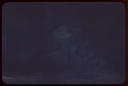
- Description:
- 100 f 4.5 tl
- Subject:
- Owens Valley (Calif.), Clouds, and Storms
- Series:
- 26-55
- Creator:
- Cushman, Charles W., 1896-1972
- Date Created:
- 1955-09-25
- Genre:
- Night photographs
- Frame Number:
- 26
- County:
- Inyo
- Abstract:
- Dark cloud mass above Owens Valley near Bishop
- Call Number:
- P08408
- City:
- Bishop
- Country:
- United States
- State/Province:
- California
- Physical Description:
- extremely dense.
- Alternate Identifier:
- 2655.26
- Persistent URL:
- http://purl.dlib.indiana.edu/iudl/archives/cushman/P08408
- Holding Location:
- Bloomington - University Archives
Wells Library E460
1320 E 10th St.
Bloomington, IN 47405
Contact at archives@indiana.edu, 812-855-1127
-
- Description:
- 100 f 4.5 sl
- Subject:
- Owens Valley (Calif.), Clouds, and Storms
- Series:
- 26-55
- Creator:
- Cushman, Charles W., 1896-1972
- Date Created:
- 1955-09-25
- Genre:
- Night photographs
- Frame Number:
- 27
- County:
- Inyo
- Abstract:
- Dark cloud mass above Owens Valley near Bishop
- Call Number:
- P08409
- City:
- Bishop
- Country:
- United States
- State/Province:
- California
- Physical Description:
- extremely dense.
- Alternate Identifier:
- 2655.27
- Persistent URL:
- http://purl.dlib.indiana.edu/iudl/archives/cushman/P08409
- Holding Location:
- Bloomington - University Archives
Wells Library E460
1320 E 10th St.
Bloomington, IN 47405
Contact at archives@indiana.edu, 812-855-1127
-
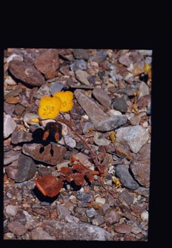
- Description:
- 100 f 8 tl 5 ft.
- Subject:
- Rocks, Flowers, and Death Valley (Calif. and Nev.)
- Series:
- 11-55
- Creator:
- Cushman, Charles W., 1896-1972
- Date Created:
- 1955-03-23
- Genre:
- Identification photographs
- Frame Number:
- 6
- County:
- Inyo
- Abstract:
- Two little yellow flowers
- Call Number:
- P07868
- Country:
- United States
- State/Province:
- California
- Physical Description:
- masked.
- Alternate Identifier:
- 1155.6
- Persistent URL:
- http://purl.dlib.indiana.edu/iudl/archives/cushman/P07868
- Holding Location:
- Bloomington - University Archives
Wells Library E460
1320 E 10th St.
Bloomington, IN 47405
Contact at archives@indiana.edu, 812-855-1127
-
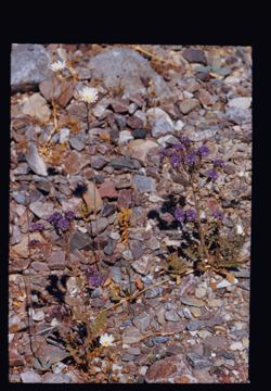
- Description:
- 100 f 8 tl 11 ft
- Subject:
- Flowers, Death Valley (Calif. and Nev.), and Rocks
- Series:
- 11-55
- Creator:
- Cushman, Charles W., 1896-1972
- Date Created:
- 1955-03-23
- Genre:
- Identification photographs
- Frame Number:
- 5
- County:
- Inyo
- Abstract:
- White & purple
- Call Number:
- P07867
- Country:
- United States
- State/Province:
- California
- Physical Description:
- masked.
- Alternate Identifier:
- 1155.5
- Persistent URL:
- http://purl.dlib.indiana.edu/iudl/archives/cushman/P07867
- Holding Location:
- Bloomington - University Archives
Wells Library E460
1320 E 10th St.
Bloomington, IN 47405
Contact at archives@indiana.edu, 812-855-1127
-
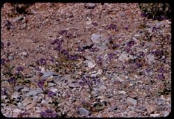
- Description:
- 100 f 8 tl 20'
- Subject:
- Rocks, Flowers, and Death Valley (Calif. and Nev.)
- Series:
- 11-55
- Creator:
- Cushman, Charles W., 1896-1972
- Date Created:
- 1955-03-23
- Genre:
- Identification photographs
- Frame Number:
- 7
- County:
- Inyo
- Abstract:
- Purple flowers
- Call Number:
- P07869
- Country:
- United States
- State/Province:
- California
- Alternate Identifier:
- 1155.7
- Persistent URL:
- http://purl.dlib.indiana.edu/iudl/archives/cushman/P07869
- Holding Location:
- Bloomington - University Archives
Wells Library E460
1320 E 10th St.
Bloomington, IN 47405
Contact at archives@indiana.edu, 812-855-1127
-
- Description:
- 100 f 6.3
- Subject:
- Valleys, Grapevine Mountains (Calif. and Nev.), Mountains, Shrubs, Clouds, Death Valley (Calif. and Nev.), and Amargosa Range (Nev. and Calif.)
- Series:
- 8-55
- Creator:
- Cushman, Charles W., 1896-1972
- Date Created:
- 1955-03-21
- Genre:
- Landscape photographs
- Frame Number:
- 2
- Street Address:
- California State Highway 190
- County:
- Inyo
- Abstract:
- NE toward Grapevine Mtns of Amargosa Range from near Stovepipe Wells
- Call Number:
- P07763
- City:
- Stovepipe Wells
- Country:
- United States
- State/Province:
- California
- Alternate Identifier:
- 855.2
- Persistent URL:
- http://purl.dlib.indiana.edu/iudl/archives/cushman/P07763
- Holding Location:
- Bloomington - University Archives
Wells Library E460
1320 E 10th St.
Bloomington, IN 47405
Contact at archives@indiana.edu, 812-855-1127
-
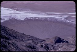
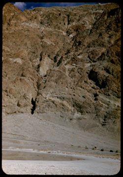
- Description:
- 100 f 6.3 tl
- Subject:
- Craters, Valleys, Roads, Fog, Dantes View (Calif.), Mountains, and Death Valley (Calif. and Nev.)
- Series:
- 8-55
- Creator:
- Cushman, Charles W., 1896-1972
- Date Created:
- 1955-03-22
- Genre:
- Landscape photographs
- Frame Number:
- 31
- County:
- Inyo
- Abstract:
- Down at floor
- Call Number:
- P07787
- City:
- Badwater
- Country:
- United States
- State/Province:
- California
- Alternate Identifier:
- 855.31
- Persistent URL:
- http://purl.dlib.indiana.edu/iudl/archives/cushman/P07787
- Holding Location:
- Bloomington - University Archives
Wells Library E460
1320 E 10th St.
Bloomington, IN 47405
Contact at archives@indiana.edu, 812-855-1127