
Search Constraints
You searched for:
Campus
IUB
Remove constraint Campus: IUB
County
Inyo
Remove constraint County: Inyo
Subject
Clouds
Remove constraint Subject: Clouds
1 - 64 of 64
Search Results
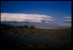
-
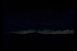
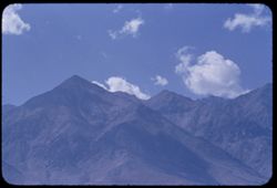
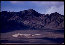
- Description:
- 100 f 4.5 or 5.6 tl
- Subject:
- Night, Owens Valley (Calif.), and Clouds
- Series:
- 26-55
- Creator:
- Cushman, Charles W., 1896-1972
- Date Created:
- 1955-09-25
- Genre:
- Night photographs
- Frame Number:
- 28
- County:
- Inyo
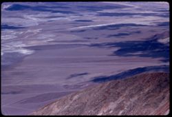
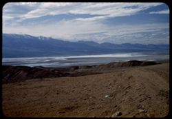
- Abstract:
- Evening sky at north end of Owens Valley - from Bishop
- Call Number:
- P08410
- City:
- Bishop
- Country:
- United States
- State/Province:
- California
- Physical Description:
- extremely dense.
- Alternate Identifier:
- 2655.28
- Persistent URL:
- http://purl.dlib.indiana.edu/iudl/archives/cushman/P08410
- Holding Location:
- Bloomington - University Archives
Wells Library E460
1320 E 10th St.
Bloomington, IN 47405
Contact at archives@indiana.edu, 812-855-1127
-
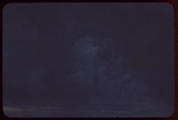
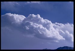
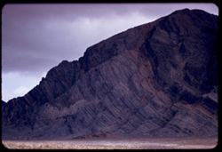
- Description:
- 100 f 4.5 sl
- Subject:
- Owens Valley (Calif.), Clouds, and Storms
- Series:
- 26-55
- Creator:
- Cushman, Charles W., 1896-1972
- Date Created:
- 1955-09-25
- Genre:
- Night photographs
- Frame Number:
- 27
- County:
- Inyo
- Abstract:
- Dark cloud mass above Owens Valley near Bishop
- Call Number:
- P08409
- City:
- Bishop
- Country:
- United States
- State/Province:
- California
- Physical Description:
- extremely dense.
- Alternate Identifier:
- 2655.27
- Persistent URL:
- http://purl.dlib.indiana.edu/iudl/archives/cushman/P08409
- Holding Location:
- Bloomington - University Archives
Wells Library E460
1320 E 10th St.
Bloomington, IN 47405
Contact at archives@indiana.edu, 812-855-1127
-
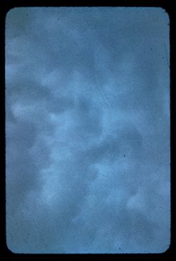
- Description:
- 100 f 4.5 tl
- Subject:
- Owens Valley (Calif.), Clouds, and Storms
- Series:
- 26-55
- Creator:
- Cushman, Charles W., 1896-1972
- Date Created:
- 1955-09-25
- Genre:
- Night photographs
- Frame Number:
- 26
- County:
- Inyo
- Abstract:
- Dark cloud mass above Owens Valley near Bishop
- Call Number:
- P08408
- City:
- Bishop
- Country:
- United States
- State/Province:
- California
- Physical Description:
- extremely dense.
- Alternate Identifier:
- 2655.26
- Persistent URL:
- http://purl.dlib.indiana.edu/iudl/archives/cushman/P08408
- Holding Location:
- Bloomington - University Archives
Wells Library E460
1320 E 10th St.
Bloomington, IN 47405
Contact at archives@indiana.edu, 812-855-1127
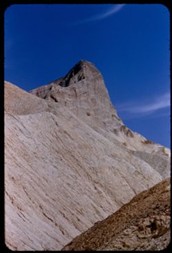
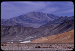
-
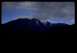
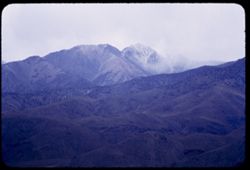
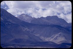
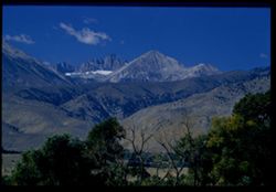
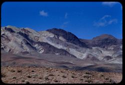
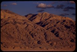
- Description:
- 100 f 4 tl
- Subject:
- Snow, Shadows, Mountains, Clouds, and White Mountain Peak (Inyo County, Calif.)
- Series:
- 26-55
- Creator:
- Cushman, Charles W., 1896-1972
- Date Created:
- 1955-09-25
- Genre:
- Landscape photographs
- Frame Number:
- 25
- County:
- Inyo
- Abstract:
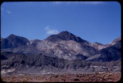
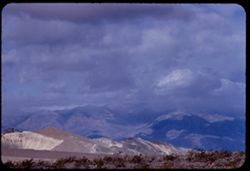
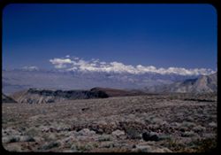
- From US 6 NE of Bishop: White Mtn. Pk under heavy clouds with a little more light
- Call Number:
- P08407
- City:
- Bishop
- Country:
- United States
- State/Province:
- California
- Physical Description:
- Image was originally mounted in a glass enclosure. Before digitization, the image was removed and placed in a Wess Plastic, Inc. brand, 2" x 2", pl...
- Alternate Identifier:
- 2655.25
- Persistent URL:
- http://purl.dlib.indiana.edu/iudl/archives/cushman/P08407
- Holding Location:
- Bloomington - University Archives
Wells Library E460
1320 E 10th St.
Bloomington, IN 47405
Contact at archives@indiana.edu, 812-855-1127
-
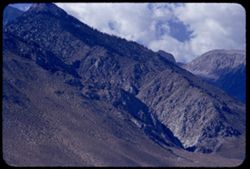
- Description:
- 25 f 4 tl
- Subject:
- Mountains, Clouds, White Mountain Peak (Inyo County, Calif.), and Mists
- Series:
- 26-55
- Creator:
- Cushman, Charles W., 1896-1972
- Date Created:
- 1955-09-25
- Genre:
- Landscape photographs
- Frame Number:
- 24
- Street Address:
- United States Highway 6
- County:
- Inyo
- Abstract:
- From US 6 NE of Bishop: White Mtn. Pk under heavy clouds
- Call Number:
- P08406
- City:
- Bishop
- Country:
- United States
- State/Province:
- California
- Alternate Identifier:
- 2655.24
- Persistent URL:
- http://purl.dlib.indiana.edu/iudl/archives/cushman/P08406
- Holding Location:
- Bloomington - University Archives
Wells Library E460
1320 E 10th St.
Bloomington, IN 47405
Contact at archives@indiana.edu, 812-855-1127
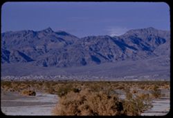
-
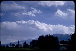
- Description:
- 100 f 6.3 sl with 50mm
- Subject:
- Mountains, Sierra Nevada (Calif. and Nev.), Trees, and Clouds
- Series:
- 26-55
- Creator:
- Cushman, Charles W., 1896-1972
- Date Created:
- 1955-09-25
- Genre:
- Landscape photographs
- Frame Number:
- 23
- County:
- Inyo
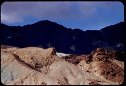
- Abstract:
- Cloud mass over Sierra - from Bishop
- Call Number:
- P08405
- City:
- Bishop
- Country:
- United States
- State/Province:
- California
- Alternate Identifier:
- 2655.23
- Persistent URL:
- http://purl.dlib.indiana.edu/iudl/archives/cushman/P08405
- Holding Location:
- Bloomington - University Archives
Wells Library E460
1320 E 10th St.
Bloomington, IN 47405
Contact at archives@indiana.edu, 812-855-1127
-
- Description:
- 100 f 8 tl
- Subject:
- Mountains, Clouds, and Sierra Nevada (Calif. and Nev.)
- Series:
- 26-55
- Creator:
- Cushman, Charles W., 1896-1972
- Date Created:
- 1955-09-25
- Genre:
- Landscape photographs
- Frame Number:
- 22
- County:
- Inyo
- Abstract:
- Cloud mass over Sierra - from Bishop
- Call Number:
- P08404
- City:
- Bishop
- Country:
- United States
- State/Province:
- California
- Physical Description:
- Image was originally mounted in a glass enclosure. Before digitization, the image was removed and placed in a Wess Plastic, Inc. brand, 2" x 2", pl...
- Alternate Identifier:
- 2655.22
- Persistent URL:
- http://purl.dlib.indiana.edu/iudl/archives/cushman/P08404
- Holding Location:
- Bloomington - University Archives
Wells Library E460
1320 E 10th St.
Bloomington, IN 47405
Contact at archives@indiana.edu, 812-855-1127
-
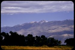
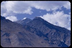
- Description:
- 100 f 5.6 tl
- Subject:
- Grasses, Trees, Mountains, Clouds, and White Mountain Peak (Inyo County, Calif.)
- Series:
- 26-55
- Creator:
- Cushman, Charles W., 1896-1972
- Date Created:
- 1955-09-25
- Genre:
- Landscape photographs
- Frame Number:
- 20
- Street Address:
- East Line Street
- County:
- Inyo
- Abstract:
- White Mtn Pk. from East Line St., Bishop
- Call Number:
- P08403
- City:
- Bishop
- Country:
- United States
- State/Province:
- California
- Alternate Identifier:
- 2655.20
- Persistent URL:
- http://purl.dlib.indiana.edu/iudl/archives/cushman/P08403
- Holding Location:
- Bloomington - University Archives
Wells Library E460
1320 E 10th St.
Bloomington, IN 47405
Contact at archives@indiana.edu, 812-855-1127
-
- Description:
- 100 f 5.6 tl
- Subject:
- Owens Valley (Calif.), Mountains, Clouds, and Sierra Nevada (Calif. and Nev.)
- Series:
- 26-55
- Creator:
- Cushman, Charles W., 1896-1972
- Date Created:
- 1955-09-25
- Genre:
- Landscape photographs
- Frame Number:
- 18
- County:
- Inyo
- Abstract:
- Another bit of saw tooth
- Call Number:
- P08401
- City:
- Big Pine and Independence
- Country:
- United States
- State/Province:
- California
- Alternate Identifier:
- 2655.18
- Persistent URL:
- http://purl.dlib.indiana.edu/iudl/archives/cushman/P08401
- Holding Location:
- Bloomington - University Archives
Wells Library E460
1320 E 10th St.
Bloomington, IN 47405
Contact at archives@indiana.edu, 812-855-1127
-
- Description:
- 100 f 6.3 tl
- Subject:
- Mountains, Sierra Nevada (Calif. and Nev.), and Clouds
- Series:
- 26-55
- Creator:
- Cushman, Charles W., 1896-1972
- Date Created:
- 1955-09-25
- Genre:
- Landscape photographs
- Frame Number:
- 16
- Street Address:
- United States Highway 395 and United States Highway 6
- County:
- Inyo
- Abstract:
- From US 6/395 between Independence & Big Pine - toward a [push?] in the high Sierra
- Call Number:
- P08399
- City:
- Independence and Big Pine
- Country:
- United States
- State/Province:
- California
- Alternate Identifier:
- 2655.16
- Persistent URL:
- http://purl.dlib.indiana.edu/iudl/archives/cushman/P08399
- Holding Location:
- Bloomington - University Archives
Wells Library E460
1320 E 10th St.
Bloomington, IN 47405
Contact at archives@indiana.edu, 812-855-1127
-
- Description:
- 100 f 6.3 tl
- Subject:
- Mountains, Clouds, and Sierra Nevada (Calif. and Nev.)
- Series:
- 26-55
- Creator:
- Cushman, Charles W., 1896-1972
- Date Created:
- 1955-09-25
- Genre:
- Landscape photographs
- Frame Number:
- 15
- Street Address:
- United States Highway 6 and United States Highway 395
- County:
- Inyo
- Abstract:
- From US 6/395 between Independence & Big Pine - toward a [push?] in the high Sierra
- Call Number:
- P08398
- City:
- Big Pine and Independence
- Country:
- United States
- State/Province:
- California
- Alternate Identifier:
- 2655.15
- Persistent URL:
- http://purl.dlib.indiana.edu/iudl/archives/cushman/P08398
- Holding Location:
- Bloomington - University Archives
Wells Library E460
1320 E 10th St.
Bloomington, IN 47405
Contact at archives@indiana.edu, 812-855-1127
-
- Description:
- 100 f 5.6 tl
- Subject:
- Mountains, Light, Clouds, and Sierra Nevada (Calif. and Nev.)
- Series:
- 26-55
- Creator:
- Cushman, Charles W., 1896-1972
- Date Created:
- 1955-09-25
- Genre:
- Landscape photographs
- Frame Number:
- 17
- Street Address:
- United States Highway 6 and United States Highway 395
- County:
- Inyo
- Abstract:
- Backdrop of high Sierra from US 6/395 between Independence & Big Pine (back ltd)
- Call Number:
- P08400
- City:
- Big Pine and Independence
- Country:
- United States
- State/Province:
- California
- Alternate Identifier:
- 2655.17
- Persistent URL:
- http://purl.dlib.indiana.edu/iudl/archives/cushman/P08400
- Holding Location:
- Bloomington - University Archives
Wells Library E460
1320 E 10th St.
Bloomington, IN 47405
Contact at archives@indiana.edu, 812-855-1127
-
- Description:
- 100 f 6.3 tl
- Subject:
- Mountains, Clouds, and Sierra Nevada (Calif. and Nev.)
- Series:
- 26-55
- Creator:
- Cushman, Charles W., 1896-1972
- Date Created:
- 1955-09-25
- Genre:
- Landscape photographs
- Frame Number:
- 13
- Street Address:
- United States Highway 395
- County:
- Inyo
- Abstract:
- After lunch = Tp of Sierra ridge from Hwy so. of Independence back lighted
- Call Number:
- P08396
- City:
- Independence
- Country:
- United States
- State/Province:
- California
- Alternate Identifier:
- 2655.13
- Persistent URL:
- http://purl.dlib.indiana.edu/iudl/archives/cushman/P08396
- Holding Location:
- Bloomington - University Archives
Wells Library E460
1320 E 10th St.
Bloomington, IN 47405
Contact at archives@indiana.edu, 812-855-1127
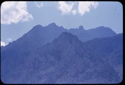
-
- Description:
- 100 f 8 TL
- Subject:
- Snow, Trees, Palisade Glacier (Calif.), Tree limbs, Mountains, Clouds, and Sierra Nevada (Calif. and Nev.)
- Series:
- 25-55
- Creator:
- Cushman, Charles W., 1896-1972
- Date Created:
- 1955-09-25
- Genre:
- Landscape photographs
- Frame Number:
- 29
- County:
- Inyo
- Abstract:
- Palisade (?) west of Big Pine
- Call Number:
- P08374
- City:
- Big Pine
- Country:
- United States
- State/Province:
- California
- Physical Description:
- Image was originally mounted in a glass enclosure. Before digitization, the image was removed and placed in a Wess Plastic, Inc. brand, 2" x 2", pl...
- Alternate Identifier:
- 2555.29
- Persistent URL:
- http://purl.dlib.indiana.edu/iudl/archives/cushman/P08374
- Holding Location:
- Bloomington - University Archives
Wells Library E460
1320 E 10th St.
Bloomington, IN 47405
Contact at archives@indiana.edu, 812-855-1127
-
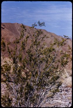
- Description:
- 100 f 8 tl
- Subject:
- Valleys, Greasewood, Mountains, Shrubs, Clouds, and Death Valley (Calif. and Nev.)
- Series:
- 11-55
- Creator:
- Cushman, Charles W., 1896-1972
- Date Created:
- 1955-03-23
- Genre:
- Identification photographs
- Frame Number:
- 8
- County:
- Inyo
- Abstract:
- Greasewood in bloom.
- Call Number:
- P07870
- Country:
- United States
- State/Province:
- California
- Alternate Identifier:
- 1155.8
- Persistent URL:
- http://purl.dlib.indiana.edu/iudl/archives/cushman/P07870
- Holding Location:
- Bloomington - University Archives
Wells Library E460
1320 E 10th St.
Bloomington, IN 47405
Contact at archives@indiana.edu, 812-855-1127
-
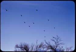
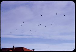
- Description:
- 200 f 5.6 tl
- Subject:
- Helicopters, Mountains, Trees, and Clouds
- Series:
- 10-55
- Creator:
- Cushman, Charles W., 1896-1972
- Date Created:
- 1955-03-23
- Frame Number:
- 23
- County:
- Inyo
- Abstract:
- Another flight of whirly birds
- Call Number:
- P07848
- City:
- Death Valley Junction
- Country:
- United States
- State/Province:
- California
- Alternate Identifier:
- 1055.23
- Persistent URL:
- http://purl.dlib.indiana.edu/iudl/archives/cushman/P07848
- Holding Location:
- Bloomington - University Archives
Wells Library E460
1320 E 10th St.
Bloomington, IN 47405
Contact at archives@indiana.edu, 812-855-1127
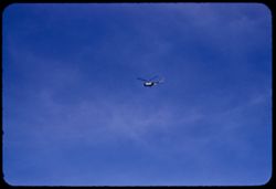
-
- Description:
- 200 f 5.6 tl
- Subject:
- Roofs, Helicopters, Utility poles, Electric lines, and Clouds
- Series:
- 10-55
- Creator:
- Cushman, Charles W., 1896-1972
- Date Created:
- 1955-03-23
- Frame Number:
- 22
- County:
- Inyo
- Abstract:
- Another flight of whirly birds
- Call Number:
- P07847
- City:
- Death Valley Junction
- Country:
- United States
- State/Province:
- California
- Alternate Identifier:
- 1055.22
- Persistent URL:
- http://purl.dlib.indiana.edu/iudl/archives/cushman/P07847
- Holding Location:
- Bloomington - University Archives
Wells Library E460
1320 E 10th St.
Bloomington, IN 47405
Contact at archives@indiana.edu, 812-855-1127
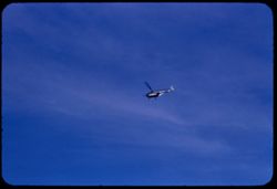
-
- Description:
- 200 f 5.6 tl
- Subject:
- Clouds and Helicopters
- Series:
- 10-55
- Creator:
- Cushman, Charles W., 1896-1972
- Date Created:
- 1955-03-23
- Frame Number:
- 21
- County:
- Inyo
- Abstract:
- From Death Valley Junction Helicopter flock from north
- Call Number:
- P07846
- City:
- Death Valley Junction
- Country:
- United States
- State/Province:
- California
- Alternate Identifier:
- 1055.21
- Persistent URL:
- http://purl.dlib.indiana.edu/iudl/archives/cushman/P07846
- Holding Location:
- Bloomington - University Archives
Wells Library E460
1320 E 10th St.
Bloomington, IN 47405
Contact at archives@indiana.edu, 812-855-1127
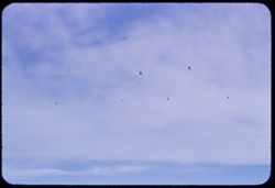
-
- Description:
- 100 f 8
- Subject:
- Clouds and Helicopters
- Series:
- 10-55
- Creator:
- Cushman, Charles W., 1896-1972
- Date Created:
- 1955-03-23
- Frame Number:
- 19
- County:
- Inyo
- Abstract:
- From Death Valley Junction Helicopter flock from north
- Call Number:
- P07844
- City:
- Death Valley Junction
- Country:
- United States
- State/Province:
- California
- Alternate Identifier:
- 1055.19
- Persistent URL:
- http://purl.dlib.indiana.edu/iudl/archives/cushman/P07844
- Holding Location:
- Bloomington - University Archives
Wells Library E460
1320 E 10th St.
Bloomington, IN 47405
Contact at archives@indiana.edu, 812-855-1127
-
- Description:
- 100 f 8 tl
- Subject:
- Clouds and Helicopters
- Series:
- 10-55
- Creator:
- Cushman, Charles W., 1896-1972
- Date Created:
- 1955-03-23
- Frame Number:
- 18
- County:
- Inyo
- Abstract:
- From Death Valley Junction Helicopter flock from north
- Call Number:
- P07843
- City:
- Death Valley Junction
- Country:
- United States
- State/Province:
- California
- Alternate Identifier:
- 1055.18
- Persistent URL:
- http://purl.dlib.indiana.edu/iudl/archives/cushman/P07843
- Holding Location:
- Bloomington - University Archives
Wells Library E460
1320 E 10th St.
Bloomington, IN 47405
Contact at archives@indiana.edu, 812-855-1127
-
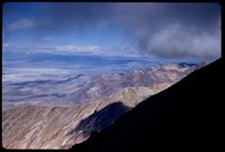
- Description:
- 100 f 8 tl
- Subject:
- Mountains, Clouds, and Death Valley (Calif. and Nev.)
- Series:
- 10-55
- Creator:
- Cushman, Charles W., 1896-1972
- Date Created:
- 1955-03-22
- Genre:
- Landscape photographs
- Frame Number:
- 13
- Street Address:
- Artist's View Drive
- County:
- Inyo
- Abstract:
- Green land at top
- Call Number:
- P07838
- Country:
- United States
- State/Province:
- California
- Alternate Identifier:
- 1055.13
- Persistent URL:
- http://purl.dlib.indiana.edu/iudl/archives/cushman/P07838
- Holding Location:
- Bloomington - University Archives
Wells Library E460
1320 E 10th St.
Bloomington, IN 47405
Contact at archives@indiana.edu, 812-855-1127
-
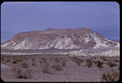
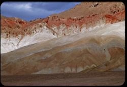
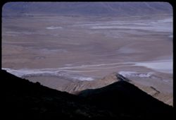
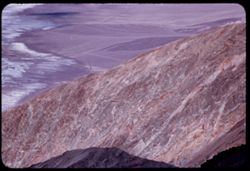
- Description:
- 100 f 8+ tl
- Subject:
- Valleys, Mountains, Clouds, Death Valley National Park (Calif. and Nev.), and Artists Palette (Calif.)
- Series:
- 10-55
- Creator:
- Cushman, Charles W., 1896-1972
- Date Created:
- 1955-03-22
- Genre:
- Landscape photographs
- Frame Number:
- 10
- Street Address:
- Artist's View Drive
- County:
- Inyo
- Abstract:
- From observation pt of Artists Palette
- Call Number:
- P07835
- Country:
- United States
- State/Province:
- California
- Physical Description:
- Image was originally mounted in a glass enclosure. Before digitization, the image was removed and placed in a Wess Plastic, Inc. brand, 2" x 2", pl...
- Alternate Identifier:
- 1055.10
- Persistent URL:
- http://purl.dlib.indiana.edu/iudl/archives/cushman/P07835
- Holding Location:
- Bloomington - University Archives
Wells Library E460
1320 E 10th St.
Bloomington, IN 47405
Contact at archives@indiana.edu, 812-855-1127
-
- Description:
- 100 f 8+ tl
- Subject:
- Rocks, Mountains, Clouds, and Death Valley National Park (Calif. and Nev.)
- Series:
- 10-55
- Creator:
- Cushman, Charles W., 1896-1972
- Date Created:
- 1955-03-22
- Frame Number:
- 2
- Street Address:
- Artist's View Drive
- County:
- Inyo
- Abstract:
- From top of Artists Drive
- Call Number:
- P07830
- Country:
- United States
- State/Province:
- California
- Alternate Identifier:
- 1055.2
- Persistent URL:
- http://purl.dlib.indiana.edu/iudl/archives/cushman/P07830
- Holding Location:
- Bloomington - University Archives
Wells Library E460
1320 E 10th St.
Bloomington, IN 47405
Contact at archives@indiana.edu, 812-855-1127
-
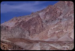
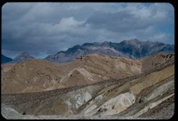
- Description:
- 100 f 8
- Subject:
- Mountains, Rock formations, Clouds, Death Valley National Park (Calif. and Nev.), and Black Mountains (Inyo County, Calif.)
- Series:
- 9-55
- Creator:
- Cushman, Charles W., 1896-1972
- Date Created:
- 1955-03-22
- Genre:
- Landscape photographs
- Frame Number:
- 38
- Street Address:
- Artist's View Drive
- County:
- Inyo
- Abstract:
- From top of Artists Drive Death Valley Nat'l Mon
- Call Number:
- P07828
- Country:
- United States
- State/Province:
- California
- Alternate Identifier:
- 955.38
- Persistent URL:
- http://purl.dlib.indiana.edu/iudl/archives/cushman/P07828
- Holding Location:
- Bloomington - University Archives
Wells Library E460
1320 E 10th St.
Bloomington, IN 47405
Contact at archives@indiana.edu, 812-855-1127
-
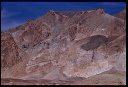
- Description:
- 100 f 8 tl
- Subject:
- Valleys, Mountains, Clouds, Death Valley (Calif. and Nev.), and Black Mountains (Inyo County, Calif.)
- Series:
- 9-55
- Creator:
- Cushman, Charles W., 1896-1972
- Date Created:
- 1955-03-22
- Genre:
- Landscape photographs
- Frame Number:
- 34
- Street Address:
- Artist's View Drive
- County:
- Inyo
- Abstract:
- Up from Artists (View) Drive
- Call Number:
- P07824
- Country:
- United States
- State/Province:
- California
- Alternate Identifier:
- 955.34
- Persistent URL:
- http://purl.dlib.indiana.edu/iudl/archives/cushman/P07824
- Holding Location:
- Bloomington - University Archives
Wells Library E460
1320 E 10th St.
Bloomington, IN 47405
Contact at archives@indiana.edu, 812-855-1127
-
- Description:
- 100 f 8+ tl
- Subject:
- Valleys, Mountains, Clouds, Death Valley (Calif. and Nev.), and Black Mountains (Inyo County, Calif.)
- Series:
- 9-55
- Creator:
- Cushman, Charles W., 1896-1972
- Date Created:
- 1955-03-22
- Genre:
- Landscape photographs
- Frame Number:
- 33
- Street Address:
- Artist's View Drive
- County:
- Inyo
- Abstract:
- Up from Artists (View) Drive
- Call Number:
- P07823
- Country:
- United States
- State/Province:
- California
- Physical Description:
- Image was originally mounted in a glass enclosure. Before digitization, the image was removed and placed in a Wess Plastic, Inc. brand, 2" x 2", pl...
- Alternate Identifier:
- 955.33
- Persistent URL:
- http://purl.dlib.indiana.edu/iudl/archives/cushman/P07823
- Holding Location:
- Bloomington - University Archives
Wells Library E460
1320 E 10th St.
Bloomington, IN 47405
Contact at archives@indiana.edu, 812-855-1127
-
- Description:
- 100 f 8 tl
- Subject:
- Furnace Creek Inn (Death Valley Junction, Calif.), Hills, Mountains, Clouds, Valleys, and Black Mountains (Inyo County, Calif.)
- Series:
- 9-55
- Creator:
- Cushman, Charles W., 1896-1972
- Date Created:
- 1955-03-22
- Genre:
- Landscape photographs
- Frame Number:
- 29
- Street Address:
- Bad Water Road
- County:
- Inyo
- Abstract:
- From 7 mi so. of Furnace Crk Inn eastward
- Call Number:
- P07820
- City:
- Death Valley Junction
- Country:
- United States
- State/Province:
- California
- Alternate Identifier:
- 955.29
- Persistent URL:
- http://purl.dlib.indiana.edu/iudl/archives/cushman/P07820
- Holding Location:
- Bloomington - University Archives
Wells Library E460
1320 E 10th St.
Bloomington, IN 47405
Contact at archives@indiana.edu, 812-855-1127
-

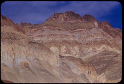
- Description:
- 100 f 6 tl
- Subject:
- Golden Canyon (Inyo County, Calif.), Canyons, Valleys, Death Valley (Calif. and Nev.), Clouds, and Rock formations
- Series:
- 9-55
- Creator:
- Cushman, Charles W., 1896-1972
- Date Created:
- 1955-03-22
- Frame Number:
- 23
- County:
- Inyo
- Abstract:
- made inside Golden Canyon
- Call Number:
- P07814
- Country:
- United States
- State/Province:
- California
- Alternate Identifier:
- 955.23
- Persistent URL:
- http://purl.dlib.indiana.edu/iudl/archives/cushman/P07814
- Holding Location:
- Bloomington - University Archives
Wells Library E460
1320 E 10th St.
Bloomington, IN 47405
Contact at archives@indiana.edu, 812-855-1127
-
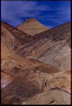
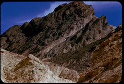
- Description:
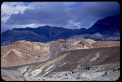
- 100 f 8+ tl
- Subject:
- Canyons, Rock formations, Clouds, Death Valley (Calif. and Nev.), Golden Canyon (Inyo County, Calif.), and Valleys
- Series:
- 9-55
- Creator:
- Cushman, Charles W., 1896-1972
- Date Created:
- 1955-03-22
- Genre:
- Landscape photographs
- Frame Number:
- 19
- County:
- Inyo
- Abstract:
- made inside Golden Canyon
- Call Number:
- P07811
- Country:
- United States
- State/Province:
- California
- Alternate Identifier:
- 955.19
- Persistent URL:
- http://purl.dlib.indiana.edu/iudl/archives/cushman/P07811
- Holding Location:
- Bloomington - University Archives
Wells Library E460
1320 E 10th St.
Bloomington, IN 47405
Contact at archives@indiana.edu, 812-855-1127
-
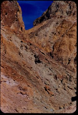
- Description:
- 100 f 8+ tl
- Subject:
- Canyons, Mountains, Rock formations, Clouds, Death Valley National Park (Calif. and Nev.), and Golden Canyon (Inyo County, Calif.)
- Series:
- 9-55
- Creator:
- Cushman, Charles W., 1896-1972
- Date Created:
- 1955-03-22
- Genre:
- Landscape photographs
- Frame Number:
- 15
- County:
- Inyo
- Abstract:
- made inside Golden Canyon
- Call Number:
- P07807
- Country:
- United States
- State/Province:
- California
- Alternate Identifier:
- 955.15
- Persistent URL:
- http://purl.dlib.indiana.edu/iudl/archives/cushman/P07807
- Holding Location:
- Bloomington - University Archives
Wells Library E460
1320 E 10th St.
Bloomington, IN 47405
Contact at archives@indiana.edu, 812-855-1127
-
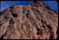
- Description:
- 100 f 8 tl
- Subject:
- Valleys, Furnace Creek Wash (Calif.), Boulders, Buttes, Mountains, Shrubs, Clouds, and Death Valley National Park (Calif. and Nev.)
- Series:
- 9-55
- Creator:
- Cushman, Charles W., 1896-1972
- Date Created:
- 1955-03-22
- Genre:
- Landscape photographs
- Frame Number:
- 4
- County:
- Inyo
- Abstract:
- The butte like a brown-crusted biscuit
- Call Number:
- P07796
- Country:
- United States
- State/Province:
- California
- Alternate Identifier:
- 955.4
- Persistent URL:
- http://purl.dlib.indiana.edu/iudl/archives/cushman/P07796
- Holding Location:
- Bloomington - University Archives
Wells Library E460
1320 E 10th St.
Bloomington, IN 47405
Contact at archives@indiana.edu, 812-855-1127
-
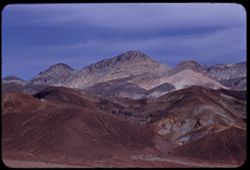
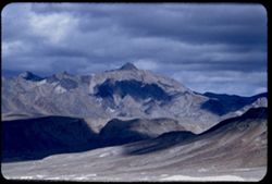
- Description:
- 100 f 8 tl
- Subject:
- Snow, Valleys, Pyramid Peak (Inyo County, Calif.), Mountains, Shrubs, and Clouds
- Series:
- 9-55
- Creator:
- Cushman, Charles W., 1896-1972
- Date Created:
- 1955-03-22
- Genre:
- Landscape photographs
- Frame Number:
- 2
- County:
- Inyo
- Abstract:
- Comb seen from [view] top of Ryan probably Pyramid PK
- Call Number:
- P07794
- City:
- Ryan
- Country:
- United States
- State/Province:
- California
- Alternate Identifier:
- 955.2
- Persistent URL:
- http://purl.dlib.indiana.edu/iudl/archives/cushman/P07794
- Holding Location:
- Bloomington - University Archives
Wells Library E460
1320 E 10th St.
Bloomington, IN 47405
Contact at archives@indiana.edu, 812-855-1127
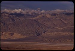
-

- Description:
- 50 f 4 tl
- Subject:
- H-bomb, Bombs, Explosions, Clouds, and Hydrogen bomb
- Series:
- 8-55
- Creator:
- Cushman, Charles W., 1896-1972
- Date Created:
- 1955-03-22
- Frame Number:
- 17
- County:
- Inyo
- Abstract:
- H Bomb cloud 15 minutes after explosion - seen from Death Valley Junctn
- Call Number:
- P07775
- City:
- Death Valley Junction
- Country:
- United States
- State/Province:
- California
- Alternate Identifier:
- 855.17
- Persistent URL:
- http://purl.dlib.indiana.edu/iudl/archives/cushman/P07775
- Holding Location:
- Bloomington - University Archives
Wells Library E460
1320 E 10th St.
Bloomington, IN 47405
Contact at archives@indiana.edu, 812-855-1127
-
- Description:
- 100 f 6.3
- Subject:
- Valleys, Grapevine Mountains (Calif. and Nev.), Mountains, Shrubs, Clouds, Death Valley (Calif. and Nev.), and Amargosa Range (Nev. and Calif.)
- Series:
- 8-55
- Creator:
- Cushman, Charles W., 1896-1972
- Date Created:
- 1955-03-21
- Genre:
- Landscape photographs
- Frame Number:
- 2
- Street Address:
- California State Highway 190
- County:
- Inyo
- Abstract:
- NE toward Grapevine Mtns of Amargosa Range from near Stovepipe Wells
- Call Number:
- P07763
- City:
- Stovepipe Wells
- Country:
- United States
- State/Province:
- California
- Alternate Identifier:
- 855.2
- Persistent URL:
- http://purl.dlib.indiana.edu/iudl/archives/cushman/P07763
- Holding Location:
- Bloomington - University Archives
Wells Library E460
1320 E 10th St.
Bloomington, IN 47405
Contact at archives@indiana.edu, 812-855-1127
-
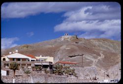
- Description:
- 200 f 5.6 tl
- Subject:
- Valleys, Resorts, Automobiles, Trees, Chimneys, Arches, Mountains, Furnace Creek Inn (Death Valley Junction, Calif.), Hotels, Masonry, Death Valley (Calif. a...
- Series:
- 3-55
- Creator:
- Cushman, Charles W., 1896-1972
- Date Created:
- 1955-02-27
- Frame Number:
- 23
- County:
- Inyo
- Abstract:
- Furnace Ck. Inn
- Call Number:
- P07614
- City:
- Death Valley Junction
- Country:
- United States
- State/Province:
- California
- Alternate Identifier:
- 355.23
- Persistent URL:
- http://purl.dlib.indiana.edu/iudl/archives/cushman/P07614
- Holding Location:
- Bloomington - University Archives
Wells Library E460
1320 E 10th St.
Bloomington, IN 47405
Contact at archives@indiana.edu, 812-855-1127
-
- Description:
- 100 f 6.3 tl
- Subject:
- Black Mountains (Inyo County, Calif.), Death Valley (Calif. and Nev.), Mountains, Rocks, Clouds, and Rock formations
- Series:
- 3-55
- Creator:
- Cushman, Charles W., 1896-1972
- Date Created:
- 1955-02-27
- Genre:
- Landscape photographs
- Frame Number:
- 22
- Street Address:
- Bad Water Road
- County:
- Inyo
- Abstract:
- Red stripe across Black Mtns
- Call Number:
- P07613
- Country:
- United States
- State/Province:
- California
- Alternate Identifier:
- 355.22
- Persistent URL:
- http://purl.dlib.indiana.edu/iudl/archives/cushman/P07613
- Holding Location:
- Bloomington - University Archives
Wells Library E460
1320 E 10th St.
Bloomington, IN 47405
Contact at archives@indiana.edu, 812-855-1127
-
- Description:
- 200 f 5.6 tl
- Subject:
- Valleys, Funeral Mountains (Calif.), Mountains, Death Valley National Park (Calif. and Nev.), Shadows, and Clouds
- Series:
- 3-55
- Creator:
- Cushman, Charles W., 1896-1972
- Date Created:
- 1955-02-27
- Genre:
- Landscape photographs
- Frame Number:
- 10
- County:
- Inyo
- Abstract:
- Funeral Mtns.
- Call Number:
- P07602
- Country:
- United States
- State/Province:
- California
- Alternate Identifier:
- 355.10
- Persistent URL:
- http://purl.dlib.indiana.edu/iudl/archives/cushman/P07602
- Holding Location:
- Bloomington - University Archives
Wells Library E460
1320 E 10th St.
Bloomington, IN 47405
Contact at archives@indiana.edu, 812-855-1127
-
- Description:
- 100 f 6.3
- Subject:
- Valleys, Mountains, Clouds, and Death Valley National Park (Calif. and Nev.)
- Series:
- 3-55
- Creator:
- Cushman, Charles W., 1896-1972
- Date Created:
- 1955-02-27
- Genre:
- Landscape photographs
- Frame Number:
- 9
- County:
- Inyo
- Abstract:
- Closer view of same
- Call Number:
- P07601
- City:
- Ryan
- Country:
- United States
- State/Province:
- California
- Alternate Identifier:
- 355.9
- Persistent URL:
- http://purl.dlib.indiana.edu/iudl/archives/cushman/P07601
- Holding Location:
- Bloomington - University Archives
Wells Library E460
1320 E 10th St.
Bloomington, IN 47405
Contact at archives@indiana.edu, 812-855-1127
-
- Description:
- 200 f 4.5 tl
- Subject:
- Valleys, Mountains, Clouds, and Death Valley National Park (Calif. and Nev.)
- Series:
- 3-55
- Creator:
- Cushman, Charles W., 1896-1972
- Date Created:
- 1955-02-27
- Genre:
- Landscape photographs
- Frame Number:
- 7
- County:
- Inyo
- Abstract:
- Brown & mauve mtns near Ryan
- Call Number:
- P07600
- City:
- Ryan
- Country:
- United States
- State/Province:
- California
- Alternate Identifier:
- 355.7
- Persistent URL:
- http://purl.dlib.indiana.edu/iudl/archives/cushman/P07600
- Holding Location:
- Bloomington - University Archives
Wells Library E460
1320 E 10th St.
Bloomington, IN 47405
Contact at archives@indiana.edu, 812-855-1127
-
- Description:
- 100 f 8 tl
- Subject:
- Rocks, Valleys, Dantes View (Calif.), Mountains, Shrubs, Clouds, Death Valley National Park (Calif. and Nev.), and Black Mountains (Inyo County, Calif.)
- Series:
- 3-55
- Creator:
- Cushman, Charles W., 1896-1972
- Date Created:
- 1955-02-27
- Genre:
- Landscape photographs
- Frame Number:
- 6
- County:
- Inyo
- Abstract:
- East side of Black Mtns from road below Dante's View from another angle.
- Call Number:
- P07599
- Country:
- United States
- State/Province:
- California
- Alternate Identifier:
- 355.6
- Persistent URL:
- http://purl.dlib.indiana.edu/iudl/archives/cushman/P07599
- Holding Location:
- Bloomington - University Archives
Wells Library E460
1320 E 10th St.
Bloomington, IN 47405
Contact at archives@indiana.edu, 812-855-1127
-
- Description:
- 50 mm lens
- Subject:
- Deserts, Craters, Valleys, Dantes View (Calif.), Mountains, Clouds, Death Valley (Calif. and Nev.), and Black Mountains (Inyo County, Calif.)
- Series:
- 3-55
- Creator:
- Cushman, Charles W., 1896-1972
- Date Created:
- 1955-02-27
- Genre:
- Landscape photographs
- Frame Number:
- 4
- County:
- Inyo
- Abstract:
- West across floor of Death Valley
- Call Number:
- P07597
- Country:
- United States
- State/Province:
- California
- Alternate Identifier:
- 355.4
- Persistent URL:
- http://purl.dlib.indiana.edu/iudl/archives/cushman/P07597
- Holding Location:
- Bloomington - University Archives
Wells Library E460
1320 E 10th St.
Bloomington, IN 47405
Contact at archives@indiana.edu, 812-855-1127
-
- Description:
- 50 mm lens
- Subject:
- Valleys, Dantes View (Calif.), Mountains, Death Valley (Calif. and Nev.), Black Mountains (Inyo County, Calif.), and Clouds
- Series:
- 3-55
- Creator:
- Cushman, Charles W., 1896-1972
- Date Created:
- 1955-02-27
- Genre:
- Landscape photographs
- Frame Number:
- 3
- County:
- Inyo
- Abstract:
- View north along ridge of Black Mtns
- Call Number:
- P07596
- Country:
- United States
- State/Province:
- California
- Alternate Identifier:
- 355.3
- Persistent URL:
- http://purl.dlib.indiana.edu/iudl/archives/cushman/P07596
- Holding Location:
- Bloomington - University Archives
Wells Library E460
1320 E 10th St.
Bloomington, IN 47405
Contact at archives@indiana.edu, 812-855-1127
-
- Description:
- tl
- Subject:
- Valleys, Roads, Dantes View (Calif.), Black Mountain (Inyo County, Calif.), Clouds, Death Valley (Calif. and Nev.), and Mountains
- Series:
- 2-55
- Creator:
- Cushman, Charles W., 1896-1972
- Date Created:
- 1955-02-27
- Genre:
- Landscape photographs
- Frame Number:
- 37
- County:
- Inyo
- Abstract:
- Up valley - NNW.
- Call Number:
- P07594
- Country:
- United States
- State/Province:
- California
- Alternate Identifier:
- 255.37
- Persistent URL:
- http://purl.dlib.indiana.edu/iudl/archives/cushman/P07594
- Holding Location:
- Bloomington - University Archives
Wells Library E460
1320 E 10th St.
Bloomington, IN 47405
Contact at archives@indiana.edu, 812-855-1127
-
- Description:
- tl
- Subject:
- Valleys, Black Mountains (Inyo County, Calif.), Death Valley (Calif. and Nev.), Roads, Mountains, Clouds, and Dantes View (Calif.)
- Series:
- 2-55
- Creator:
- Cushman, Charles W., 1896-1972
- Date Created:
- 1955-02-27
- Genre:
- Landscape photographs
- Frame Number:
- 36
- County:
- Inyo
- Abstract:
- Floor of valley 5,475 ft. below Dante's View in Black Mtns.
- Call Number:
- P07593
- Country:
- United States
- State/Province:
- California
- Alternate Identifier:
- 255.36
- Persistent URL:
- http://purl.dlib.indiana.edu/iudl/archives/cushman/P07593
- Holding Location:
- Bloomington - University Archives
Wells Library E460
1320 E 10th St.
Bloomington, IN 47405
Contact at archives@indiana.edu, 812-855-1127
-
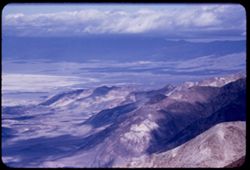
- Description:
- tl
- Subject:
- Valleys, Panamint Range (Calif.), Dantes View (Calif.), Mountains, Clouds, and Death Valley (Calif. and Nev.)
- Series:
- 2-55
- Creator:
- Cushman, Charles W., 1896-1972
- Date Created:
- 1955-02-27
- Genre:
- Landscape photographs
- Frame Number:
- 35
- County:
- Inyo
- Abstract:
- West by north across valley toward Panamints
- Call Number:
- P07592
- Country:
- United States
- State/Province:
- California
- Alternate Identifier:
- 255.35
- Persistent URL:
- http://purl.dlib.indiana.edu/iudl/archives/cushman/P07592
- Holding Location:
- Bloomington - University Archives
Wells Library E460
1320 E 10th St.
Bloomington, IN 47405
Contact at archives@indiana.edu, 812-855-1127
-
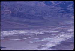
- Description:
- tl
- Subject:
- Valleys, Dantes View (Calif.), Mountains, Clouds, Death Valley (Calif. and Nev.), and Black Mountains (Inyo County, Calif.)
- Series:
- 2-55
- Creator:
- Cushman, Charles W., 1896-1972
- Date Created:
- 1955-02-27
- Genre:
- Landscape photographs
- Frame Number:
- 34
- County:
- Inyo
- Abstract:
- Northward over tops of Black Mtns.
- Call Number:
- P07591
- Country:
- United States
- State/Province:
- California
- Alternate Identifier:
- 255.34
- Persistent URL:
- http://purl.dlib.indiana.edu/iudl/archives/cushman/P07591
- Holding Location:
- Bloomington - University Archives
Wells Library E460
1320 E 10th St.
Bloomington, IN 47405
Contact at archives@indiana.edu, 812-855-1127
-
- Description:
- tl
- Subject:
- Valleys, Dantes View (Calif.), Mountains, Clouds, and Death Valley (Calif. and Nev.)
- Series:
- 2-55
- Creator:
- Cushman, Charles W., 1896-1972
- Date Created:
- 1955-02-27
- Genre:
- Landscape photographs
- Frame Number:
- 33
- County:
- Inyo
- Abstract:
- Cloud-flecked floor of Death Valley NNW of Dante's View
- Call Number:
- P07590
- Country:
- United States
- State/Province:
- California
- Alternate Identifier:
- 255.33
- Persistent URL:
- http://purl.dlib.indiana.edu/iudl/archives/cushman/P07590
- Holding Location:
- Bloomington - University Archives
Wells Library E460
1320 E 10th St.
Bloomington, IN 47405
Contact at archives@indiana.edu, 812-855-1127
-
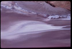
- Description:
- 100 f 5.6 tl
- Subject:
- Rocks, Dantes View (Calif.), Mountains, Shrubs, Clouds, Death Valley (Calif. and Nev.), and Black Mountains (Inyo County, Calif.)
- Series:
- 2-55
- Creator:
- Cushman, Charles W., 1896-1972
- Date Created:
- 1955-02-27
- Genre:
- Landscape photographs
- Frame Number:
- 32
- County:
- Inyo
- Abstract:
- Black Mtns on way to Dante's View from road near Ryan
- Call Number:
- P07589
- City:
- Ryan
- Country:
- United States
- State/Province:
- California
- Alternate Identifier:
- 255.32
- Persistent URL:
- http://purl.dlib.indiana.edu/iudl/archives/cushman/P07589
- Holding Location:
- Bloomington - University Archives
Wells Library E460
1320 E 10th St.
Bloomington, IN 47405
Contact at archives@indiana.edu, 812-855-1127
-
- Description:
- 100 f 6.3
- Subject:
- Rocks, Mountains, Rock formations, Clouds, and Black Mountains (Inyo County, Calif.)
- Series:
- 2-55
- Creator:
- Cushman, Charles W., 1896-1972
- Date Created:
- 1955-02-27
- Genre:
- Landscape photographs
- Frame Number:
- 31
- County:
- Inyo
- Abstract:
- colored rock mass
- Call Number:
- P07588
- Country:
- United States
- State/Province:
- California
- Alternate Identifier:
- 255.31
- Persistent URL:
- http://purl.dlib.indiana.edu/iudl/archives/cushman/P07588
- Holding Location:
- Bloomington - University Archives
Wells Library E460
1320 E 10th St.
Bloomington, IN 47405
Contact at archives@indiana.edu, 812-855-1127
-
- Description:
- 100 f 8 tl
- Subject:
- Hills, Funeral Mountains (Calif.), Funeral Mountains Wilderness (Calif.), Mountains, Shrubs, Furnace Creek (Calif.), Rocks, and Clouds
- Series:
- 2-55
- Creator:
- Cushman, Charles W., 1896-1972
- Date Created:
- 1955-02-27
- Genre:
- Landscape photographs
- Frame Number:
- 29
- Street Address:
- Furance Creek-Death Valley Junction Road
- County:
- Mono and Inyo
- Abstract:
- North toward Funeral Mtns
- Call Number:
- P07586
- City:
- Death Valley Junction
- Country:
- United States
- State/Province:
- California
- Alternate Identifier:
- 255.29
- Persistent URL:
- http://purl.dlib.indiana.edu/iudl/archives/cushman/P07586
- Holding Location:
- Bloomington - University Archives
Wells Library E460
1320 E 10th St.
Bloomington, IN 47405
Contact at archives@indiana.edu, 812-855-1127
-
- Description:
- 200 f 4.5 tl
- Subject:
- Mountains, Clouds, Hills, Black Mountains (Inyo County, Calif.), and Death Valley (Calif. and Nev.)
- Series:
- 2-55
- Creator:
- Cushman, Charles W., 1896-1972
- Date Created:
- 1955-02-27
- Genre:
- Landscape photographs
- Frame Number:
- 27
- County:
- Inyo
- Abstract:
- Black Mtns from east
- Call Number:
- P07585
- Country:
- United States
- State/Province:
- California
- Alternate Identifier:
- 255.27
- Persistent URL:
- http://purl.dlib.indiana.edu/iudl/archives/cushman/P07585
- Holding Location:
- Bloomington - University Archives
Wells Library E460
1320 E 10th St.
Bloomington, IN 47405
Contact at archives@indiana.edu, 812-855-1127
-
- Description:
- 100 f 4 tl
- Subject:
- Furnace Creek Inn (Death Valley Junction, Calif.), Death Valley (Calif. and Nev.), Funeral Mountains (Calif.), Mountains, Shrubs, Rock formations, and Clouds
- Series:
- 2-55
- Creator:
- Cushman, Charles W., 1896-1972
- Date Created:
- 1955-02-27
- Genre:
- Landscape photographs
- Frame Number:
- 25
- County:
- Inyo
- Abstract:
- Funeral Mtn in overcast between D.V. Juctn and Furnace Ck. Inn
- Call Number:
- P07583
- City:
- Death Valley Junction
- Country:
- United States
- State/Province:
- California
- Alternate Identifier:
- 255.25
- Persistent URL:
- http://purl.dlib.indiana.edu/iudl/archives/cushman/P07583
- Holding Location:
- Bloomington - University Archives
Wells Library E460
1320 E 10th St.
Bloomington, IN 47405
Contact at archives@indiana.edu, 812-855-1127
-
- Description:
- 100 f 5.6 tl
- Subject:
- Roads, Mountains, Clouds, and Panamint Range (Calif.)
- Series:
- 2-55
- Creator:
- Cushman, Charles W., 1896-1972
- Date Created:
- 1955-02-26
- Genre:
- Landscape photographs
- Frame Number:
- 24
- County:
- Inyo
- Abstract:
- Panamints from west
- Call Number:
- P07582
- Country:
- United States
- State/Province:
- California
- Alternate Identifier:
- 255.24
- Persistent URL:
- http://purl.dlib.indiana.edu/iudl/archives/cushman/P07582
- Holding Location:
- Bloomington - University Archives
Wells Library E460
1320 E 10th St.
Bloomington, IN 47405
Contact at archives@indiana.edu, 812-855-1127
-
- Description:
- 100 f 6.3 tl
- Subject:
- Panamint Range (Calif.), Mountains, Clouds, and Hills
- Series:
- 2-55
- Creator:
- Cushman, Charles W., 1896-1972
- Date Created:
- 1955-02-26
- Genre:
- Landscape photographs
- Frame Number:
- 23
- Street Address:
- Trona Road
- County:
- Inyo
- Abstract:
- Panamint Mtns east of rd north from Trona
- Call Number:
- P07581
- Country:
- United States
- State/Province:
- California
- Alternate Identifier:
- 255.23
- Persistent URL:
- http://purl.dlib.indiana.edu/iudl/archives/cushman/P07581
- Holding Location:
- Bloomington - University Archives
Wells Library E460
1320 E 10th St.
Bloomington, IN 47405
Contact at archives@indiana.edu, 812-855-1127
-
- Description:
- 100 f 6.3 tl
- Subject:
- Valleys, Mountains, Snow, Clouds, and Panamint Range (Calif.)
- Series:
- 2-55
- Creator:
- Cushman, Charles W., 1896-1972
- Date Created:
- 1955-02-26
- Genre:
- Landscape photographs
- Frame Number:
- 22
- Street Address:
- Trona Road
- County:
- Inyo
- Abstract:
- Panamint Mtns east of rd north from Trona
- Call Number:
- P07580
- Country:
- United States
- State/Province:
- California
- Alternate Identifier:
- 255.22
- Persistent URL:
- http://purl.dlib.indiana.edu/iudl/archives/cushman/P07580
- Holding Location:
- Bloomington - University Archives
Wells Library E460
1320 E 10th St.
Bloomington, IN 47405
Contact at archives@indiana.edu, 812-855-1127
-
- Description:
- 25 f 8 Pola
- Subject:
- Deserts, Valleys, Hills, Death Valley (Calif. and Nev.), Mountains, Rocks, and Clouds
- Series:
- 15-52
- Creator:
- Cushman, Charles W., 1896-1972
- Date Created:
- 1952-04-09
- Genre:
- Landscape photographs
- Frame Number:
- 35
- Street Address:
- Artists Drive
- County:
- Inyo
- Abstract:
- From top of Artists Drive. Back across valley.
- Call Number:
- P06054
- Country:
- United States
- State/Province:
- California
- Alternate Identifier:
- 1552.35
- Persistent URL:
- http://purl.dlib.indiana.edu/iudl/archives/cushman/P06054
- Holding Location:
- Bloomington - University Archives
Wells Library E460
1320 E 10th St.
Bloomington, IN 47405
Contact at archives@indiana.edu, 812-855-1127
-
- Description:
- 25 f 8 Pola
- Subject:
- Snow, Panamint Range (Calif.), Mountains, Shrubs, Clouds, Hills, and Rocks
- Series:
- 15-52
- Creator:
- Cushman, Charles W., 1896-1972
- Date Created:
- 1952-04-08
- Genre:
- Landscape photographs
- Frame Number:
- 2
- Street Address:
- California State Highway 190
- County:
- Inyo
- Abstract:
- Snow-covered Panamints from Hwy 190 40 mi. from Lone Pine.
- Call Number:
- P06023
- City:
- Lone Pine
- Country:
- United States
- State/Province:
- California
- Alternate Identifier:
- 1552.2
- Persistent URL:
- http://purl.dlib.indiana.edu/iudl/archives/cushman/P06023
- Holding Location:
- Bloomington - University Archives
Wells Library E460
1320 E 10th St.
Bloomington, IN 47405
Contact at archives@indiana.edu, 812-855-1127
-
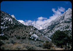
- Description:
- 25 f 13
- Subject:
- Snow, Roads, Trees, Mountains, Rock formations, Whitney, Mount (Calif.), Sierra Nevada (Calif. and Nev.), Shrubs, and Clouds
- Series:
- 14-52
- Creator:
- Cushman, Charles W., 1896-1972
- Date Created:
- 1952-04-08
- Genre:
- Landscape photographs
- Frame Number:
- 28
- County:
- Inyo
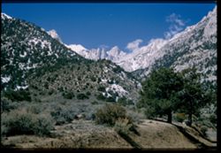
- Abstract:
- Mt. Whitney + spires.
- Call Number:
- P06012
- Country:
- United States
- State/Province:
- California
- Physical Description:
- Image was originally mounted in a glass enclosure. Before digitization, the image was removed and placed in a Wess Plastic, Inc. brand, 2" x 2", pl...
- Alternate Identifier:
- 1452.28
- Persistent URL:
- http://purl.dlib.indiana.edu/iudl/archives/cushman/P06012
- Holding Location:
- Bloomington - University Archives
Wells Library E460
1320 E 10th St.
Bloomington, IN 47405
Contact at archives@indiana.edu, 812-855-1127
-
- Description:
- 25 f 9 Pola
- Subject:
- Snow, Trees, Mountains, Shrubs, Whitney, Mount (Calif.), Sierra Nevada (Calif. and Nev.), Rock formations, and Clouds
- Series:
- 14-52
- Creator:
- Cushman, Charles W., 1896-1972
- Date Created:
- 1952-04-08
- Genre:
- Landscape photographs
- Frame Number:
- 27
- Street Address:
- Lone Pine-Whitney Road
- County:
- Placer and Inyo
- Abstract:
- Mt. Whitney + spires.
- Call Number:
- P06011
- City:
- Lone Pine
- Country:
- United States
- State/Province:
- California
- Physical Description:
- Image was originally mounted in a glass enclosure. Before digitization, the image was removed and placed in a Wess Plastic, Inc. brand, 2" x 2", pl...
- Alternate Identifier:
- 1452.27
- Persistent URL:
- http://purl.dlib.indiana.edu/iudl/archives/cushman/P06011
- Holding Location:
- Bloomington - University Archives
Wells Library E460
1320 E 10th St.
Bloomington, IN 47405
Contact at archives@indiana.edu, 812-855-1127
-
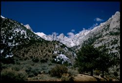
- Description:
- 25 f 13
- Subject:
- Snow, Trees, Mountains, Shrubs, Whitney, Mount (Calif.), Sierra Nevada (Calif. and Nev.), and Clouds
- Series:
- 14-52
- Creator:
- Cushman, Charles W., 1896-1972
- Date Created:
- 1952-04-08
- Genre:
- Landscape photographs
- Frame Number:
- 25
- County:
- Inyo
- Abstract:
- Whitney's peak.
- Call Number:
- P06009
- Country:
- United States
- State/Province:
- California
- Alternate Identifier:
- 1452.25
- Persistent URL:
- http://purl.dlib.indiana.edu/iudl/archives/cushman/P06009
- Holding Location:
- Bloomington - University Archives
Wells Library E460
1320 E 10th St.
Bloomington, IN 47405
Contact at archives@indiana.edu, 812-855-1127
-
- Description:
- 25 f 8 Pola
- Subject:
- Croplands, Hills, Whitney, Mount (Calif.), Mountains, Shrubs, Snow, Trees, Farms, Clouds, Agricultural facilities, and Sierra Nevada (Calif. and Nev.)
- Series:
- 14-52
- Creator:
- Cushman, Charles W., 1896-1972
- Date Created:
- 1952-04-08
- Genre:
- Landscape photographs
- Frame Number:
- 17
- County:
- Inyo
- Abstract:
- Mt. Whitney this time.
- Call Number:
- P06001
- City:
- Lone Pine
- Country:
- United States
- State/Province:
- California
- Alternate Identifier:
- 1452.17
- Persistent URL:
- http://purl.dlib.indiana.edu/iudl/archives/cushman/P06001
- Holding Location:
- Bloomington - University Archives
Wells Library E460
1320 E 10th St.
Bloomington, IN 47405
Contact at archives@indiana.edu, 812-855-1127
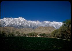
-
- Description:
- 50 f 9
- Subject:
- Snow, Trees, Croplands, Clouds, Sierra Nevada (Calif. and Nev.), Hills, Mountains, and Whitney, Mount (Calif.)
- Series:
- 14-52
- Creator:
- Cushman, Charles W., 1896-1972
- Date Created:
- 1952-04-08
- Genre:
- Landscape photographs
- Frame Number:
- 16
- County:
- Inyo
- Abstract:
- Mt. Whitney et al. Behind cloud.
- Call Number:
- P06000
- City:
- Lone Pine
- Country:
- United States
- State/Province:
- California
- Alternate Identifier:
- 1452.16
- Persistent URL:
- http://purl.dlib.indiana.edu/iudl/archives/cushman/P06000
- Holding Location:
- Bloomington - University Archives
Wells Library E460
1320 E 10th St.
Bloomington, IN 47405
Contact at archives@indiana.edu, 812-855-1127
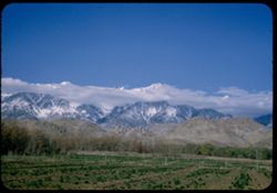
-

- Description:
- 50 f 9
- Subject:
- Snow, Houses, Farms, Trees, Croplands, Fences, Whitney, Mount (Calif.), Sierra Nevada (Calif. and Nev.), Hills, Agricultural facilities, Mountains, Williamso...
- Series:
- 14-52
- Creator:
- Cushman, Charles W., 1896-1972
- Date Created:
- 1952-04-08
- Genre:
- Landscape photographs
- Frame Number:
- 15
- County:
- Inyo
- Abstract:
- Mt. Whitney et al. Behind cloud.
- Call Number:
- P05999
- City:
- Lone Pine
- Country:
- United States
- State/Province:
- California
- Alternate Identifier:
- 1452.15
- Persistent URL:
- http://purl.dlib.indiana.edu/iudl/archives/cushman/P05999
- Holding Location:
- Bloomington - University Archives
Wells Library E460
1320 E 10th St.
Bloomington, IN 47405
Contact at archives@indiana.edu, 812-855-1127
-
- Description:
- 25 f 9
- Subject:
- Panamint Mountains (Calif.), Deserts, Panamint Range (Calif.), Rocks, Rock formations, Mountains, and Clouds
- Series:
- 14-52
- Creator:
- Cushman, Charles W., 1896-1972
- Date Created:
- 1952-04-07
- Genre:
- Landscape photographs
- Frame Number:
- 14
- County:
- Inyo and San Bernardino
- Abstract:
- White cloud + distant Panamint Mtns. from few miles south of Trona.
- Call Number:
- P05998
- City:
- Trona
- Country:
- United States
- State/Province:
- California
- Physical Description:
- Image was originally mounted in a glass enclosure. Before digitization, the image was removed and placed in a Wess Plastic, Inc. brand, 2" x 2", pl...
- Alternate Identifier:
- 1452.14
- Persistent URL:
- http://purl.dlib.indiana.edu/iudl/archives/cushman/P05998
- Holding Location:
- Bloomington - University Archives
Wells Library E460
1320 E 10th St.
Bloomington, IN 47405
Contact at archives@indiana.edu, 812-855-1127