
Search Constraints
You searched for:
Campus
IUB
Remove constraint Campus: IUB
County
Inyo
Remove constraint County: Inyo
Subject
Mountains
Remove constraint Subject: Mountains
« Previous |
1 - 100 of 283
|
Next »
Search Results
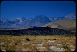
-
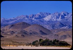
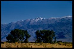
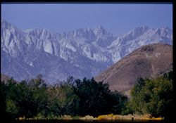
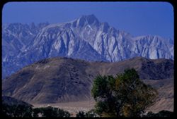
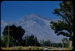
- Description:
- 100 f 7 tl
- Subject:
- Trees, Mountains, Tom, Mount (Inyo County, Calif.), Facilities, Sierra Nevada (Calif. and Nev.), Hills, and Utility poles
- Series:
- 26-55
- Creator:
- Cushman, Charles W., 1896-1972
- Date Created:
- 1955-09-26
- Genre:
- Landscape photographs
- Frame Number:
- 33
- Street Address:
- United States Highway 395
- County:
- Inyo
- Abstract:
- Distant ridge further south of Mt Tom
- Call Number:
- P08415
- City:
- Bishop
- Country:
- United States
- State/Province:
- California
- Alternate Identifier:
- 2655.33
- Persistent URL:
- http://purl.dlib.indiana.edu/iudl/archives/cushman/P08415
- Holding Location:
- Bloomington - University Archives
Wells Library E460
1320 E 10th St.
Bloomington, IN 47405
Contact at archives@indiana.edu, 812-855-1127
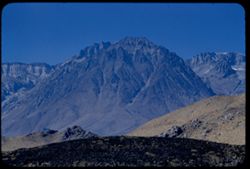
-
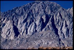
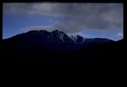
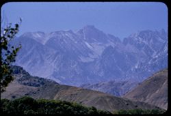
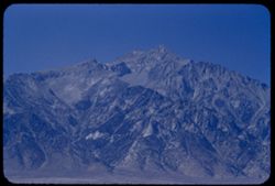
- Description:
- 100 f 8 tl
- Subject:
- Mountains, Rock formations, Tom, Mount (Inyo County, Calif.), and Sierra Nevada (Calif. and Nev.)
- Series:
- 26-55
- Creator:
- Cushman, Charles W., 1896-1972
- Date Created:
- 1955-09-26
- Genre:
- Landscape photographs
- Frame Number:
- 34
- County:
- Inyo
- Abstract:
- Chiseled face of huge mtn. NW of Tom
- Call Number:
- P08416
- Country:
- United States
- State/Province:
- California
- Physical Description:
- Image was originally mounted in a glass enclosure. Before digitization, the image was removed and placed in a Wess Plastic, Inc. brand, 2" x 2", pl...
- Alternate Identifier:
- 2655.34
- Persistent URL:
- http://purl.dlib.indiana.edu/iudl/archives/cushman/P08416
- Holding Location:
- Bloomington - University Archives
Wells Library E460
1320 E 10th St.
Bloomington, IN 47405
Contact at archives@indiana.edu, 812-855-1127
-
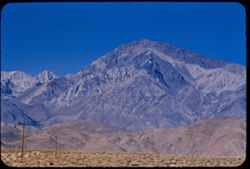
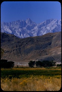
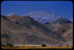
- Description:
- 100 f 8 tl
- Subject:
- Plains, Hills, Mountains, Utility poles, and Tom, Mount (Inyo County, Calif.)
- Series:
- 26-55
- Creator:
- Cushman, Charles W., 1896-1972
- Date Created:
- 1955-09-26
- Genre:
- Landscape photographs
- Frame Number:
- 31
- County:
- Inyo
- Abstract:
- Mt. Tom from 4 miles NW of Bishop
- Call Number:
- P08413
- City:
- Bishop
- Country:
- United States
- State/Province:
- California
- Alternate Identifier:
- 2655.31
- Persistent URL:
- http://purl.dlib.indiana.edu/iudl/archives/cushman/P08413
- Holding Location:
- Bloomington - University Archives
Wells Library E460
1320 E 10th St.
Bloomington, IN 47405
Contact at archives@indiana.edu, 812-855-1127
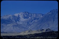
-
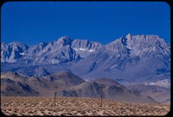
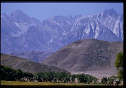
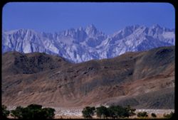
- Description:
- 100 f 8 tl
- Subject:
- Plains, Mountains, Tom, Mount (Inyo County, Calif.), Sierra Nevada (Calif. and Nev.), Hills, and Utility poles
- Series:
- 26-55
- Creator:
- Cushman, Charles W., 1896-1972
- Date Created:
- 1955-09-26
- Genre:
- Landscape photographs
- Frame Number:
- 32
- County:
- Inyo
- Abstract:
- Ridge south of Mt Tom
- Call Number:
- P08414
- City:
- Bishop
- Country:
- United States
- State/Province:
- California
- Alternate Identifier:
- 2655.32
- Persistent URL:
- http://purl.dlib.indiana.edu/iudl/archives/cushman/P08414
- Holding Location:
- Bloomington - University Archives
Wells Library E460
1320 E 10th St.
Bloomington, IN 47405
Contact at archives@indiana.edu, 812-855-1127
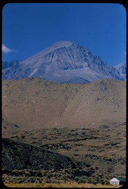
-
- Description:
- 100 f 8 tl
- Subject:
- Snow, Grasses, Trees, Mountains, Fences, and White Mountain Peak (Inyo County, Calif.)
- Series:
- 26-55
- Creator:
- Cushman, Charles W., 1896-1972
- Date Created:
- 1955-09-26
- Genre:
- Landscape photographs
- Frame Number:
- 30
- County:
- Inyo
- Abstract:
- Fresh snow on White Mtn. Pk. (from Bishop)
- Call Number:
- P08412
- City:
- Bishop
- Country:
- United States
- State/Province:
- California
- Physical Description:
- Image was originally mounted in a glass enclosure. Before digitization, the image was removed and placed in a Wess Plastic, Inc. brand, 2" x 2", pl...
- Alternate Identifier:
- 2655.30
- Persistent URL:
- http://purl.dlib.indiana.edu/iudl/archives/cushman/P08412
- Holding Location:
- Bloomington - University Archives
Wells Library E460
1320 E 10th St.
Bloomington, IN 47405
Contact at archives@indiana.edu, 812-855-1127
-
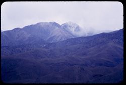
- Description:
- 100 f 4 tl
- Subject:
- Snow, Shadows, Mountains, Clouds, and White Mountain Peak (Inyo County, Calif.)
- Series:
- 26-55
- Creator:
- Cushman, Charles W., 1896-1972
- Date Created:
- 1955-09-25
- Genre:
- Landscape photographs
- Frame Number:
- 25
- County:
- Inyo
- Abstract:
- From US 6 NE of Bishop: White Mtn. Pk under heavy clouds with a little more light
- Call Number:
- P08407
- City:
- Bishop
- Country:
- United States
- State/Province:
- California
- Physical Description:
- Image was originally mounted in a glass enclosure. Before digitization, the image was removed and placed in a Wess Plastic, Inc. brand, 2" x 2", pl...
- Alternate Identifier:
- 2655.25
- Persistent URL:
- http://purl.dlib.indiana.edu/iudl/archives/cushman/P08407
- Holding Location:
- Bloomington - University Archives
Wells Library E460
1320 E 10th St.
Bloomington, IN 47405
Contact at archives@indiana.edu, 812-855-1127
-
- Description:
- 25 f 4 tl
- Subject:
- Mountains, Clouds, White Mountain Peak (Inyo County, Calif.), and Mists
- Series:
- 26-55
- Creator:
- Cushman, Charles W., 1896-1972
- Date Created:
- 1955-09-25
- Genre:
- Landscape photographs
- Frame Number:
- 24
- Street Address:
- United States Highway 6
- County:
- Inyo
- Abstract:
- From US 6 NE of Bishop: White Mtn. Pk under heavy clouds
- Call Number:
- P08406
- City:
- Bishop
- Country:
- United States
- State/Province:
- California
- Alternate Identifier:
- 2655.24
- Persistent URL:
- http://purl.dlib.indiana.edu/iudl/archives/cushman/P08406
- Holding Location:
- Bloomington - University Archives
Wells Library E460
1320 E 10th St.
Bloomington, IN 47405
Contact at archives@indiana.edu, 812-855-1127
-
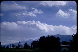
- Description:
- 100 f 6.3 sl with 50mm
- Subject:
- Mountains, Sierra Nevada (Calif. and Nev.), Trees, and Clouds
- Series:
- 26-55
- Creator:
- Cushman, Charles W., 1896-1972
- Date Created:
- 1955-09-25
- Genre:
- Landscape photographs
- Frame Number:
- 23
- County:
- Inyo
- Abstract:
- Cloud mass over Sierra - from Bishop
- Call Number:
- P08405
- City:
- Bishop
- Country:
- United States
- State/Province:
- California
- Alternate Identifier:
- 2655.23
- Persistent URL:
- http://purl.dlib.indiana.edu/iudl/archives/cushman/P08405
- Holding Location:
- Bloomington - University Archives
Wells Library E460
1320 E 10th St.
Bloomington, IN 47405
Contact at archives@indiana.edu, 812-855-1127
-
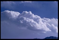
- Description:
- 100 f 8 tl
- Subject:
- Mountains, Clouds, and Sierra Nevada (Calif. and Nev.)
- Series:
- 26-55
- Creator:
- Cushman, Charles W., 1896-1972
- Date Created:
- 1955-09-25
- Genre:
- Landscape photographs
- Frame Number:
- 22
- County:
- Inyo
- Abstract:
- Cloud mass over Sierra - from Bishop
- Call Number:
- P08404
- City:
- Bishop
- Country:
- United States
- State/Province:
- California
- Physical Description:
- Image was originally mounted in a glass enclosure. Before digitization, the image was removed and placed in a Wess Plastic, Inc. brand, 2" x 2", pl...
- Alternate Identifier:
- 2655.22
- Persistent URL:
- http://purl.dlib.indiana.edu/iudl/archives/cushman/P08404
- Holding Location:
- Bloomington - University Archives
Wells Library E460
1320 E 10th St.
Bloomington, IN 47405
Contact at archives@indiana.edu, 812-855-1127
-
- Description:
- 100 f 5.6 tl
- Subject:
- Grasses, Trees, Mountains, Clouds, and White Mountain Peak (Inyo County, Calif.)
- Series:
- 26-55
- Creator:
- Cushman, Charles W., 1896-1972
- Date Created:
- 1955-09-25
- Genre:
- Landscape photographs
- Frame Number:
- 20
- Street Address:
- East Line Street
- County:
- Inyo
- Abstract:
- White Mtn Pk. from East Line St., Bishop
- Call Number:
- P08403
- City:
- Bishop
- Country:
- United States
- State/Province:
- California
- Alternate Identifier:
- 2655.20
- Persistent URL:
- http://purl.dlib.indiana.edu/iudl/archives/cushman/P08403
- Holding Location:
- Bloomington - University Archives
Wells Library E460
1320 E 10th St.
Bloomington, IN 47405
Contact at archives@indiana.edu, 812-855-1127
-
- Description:
- 100 f 6.3 tl
- Subject:
- Grasses, Trees, Owens Valley (Calif.), Mountains, Land, Hills, and Inyo Mountains (Calif.)
- Series:
- 26-55
- Creator:
- Cushman, Charles W., 1896-1972
- Date Created:
- 1955-09-25
- Genre:
- Landscape photographs
- Frame Number:
- 19
- County:
- Inyo
- Abstract:
- Red mount at foothills of Inyo Mtns
- Call Number:
- P08402
- City:
- Big Pine
- Country:
- United States
- State/Province:
- California
- Alternate Identifier:
- 2655.19
- Persistent URL:
- http://purl.dlib.indiana.edu/iudl/archives/cushman/P08402
- Holding Location:
- Bloomington - University Archives
Wells Library E460
1320 E 10th St.
Bloomington, IN 47405
Contact at archives@indiana.edu, 812-855-1127
-
- Description:
- 100 f 5.6 tl
- Subject:
- Owens Valley (Calif.), Mountains, Clouds, and Sierra Nevada (Calif. and Nev.)
- Series:
- 26-55
- Creator:
- Cushman, Charles W., 1896-1972
- Date Created:
- 1955-09-25
- Genre:
- Landscape photographs
- Frame Number:
- 18
- County:
- Inyo
- Abstract:
- Another bit of saw tooth
- Call Number:
- P08401
- City:
- Big Pine and Independence
- Country:
- United States
- State/Province:
- California
- Alternate Identifier:
- 2655.18
- Persistent URL:
- http://purl.dlib.indiana.edu/iudl/archives/cushman/P08401
- Holding Location:
- Bloomington - University Archives
Wells Library E460
1320 E 10th St.
Bloomington, IN 47405
Contact at archives@indiana.edu, 812-855-1127
-
- Description:
- 100 f 6.3 tl
- Subject:
- Mountains, Sierra Nevada (Calif. and Nev.), and Clouds
- Series:
- 26-55
- Creator:
- Cushman, Charles W., 1896-1972
- Date Created:
- 1955-09-25
- Genre:
- Landscape photographs
- Frame Number:
- 16
- Street Address:
- United States Highway 395 and United States Highway 6
- County:
- Inyo
- Abstract:
- From US 6/395 between Independence & Big Pine - toward a [push?] in the high Sierra
- Call Number:
- P08399
- City:
- Independence and Big Pine
- Country:
- United States
- State/Province:
- California
- Alternate Identifier:
- 2655.16
- Persistent URL:
- http://purl.dlib.indiana.edu/iudl/archives/cushman/P08399
- Holding Location:
- Bloomington - University Archives
Wells Library E460
1320 E 10th St.
Bloomington, IN 47405
Contact at archives@indiana.edu, 812-855-1127
-
- Description:
- 100 f 6.3 tl
- Subject:
- Mountains, Clouds, and Sierra Nevada (Calif. and Nev.)
- Series:
- 26-55
- Creator:
- Cushman, Charles W., 1896-1972
- Date Created:
- 1955-09-25
- Genre:
- Landscape photographs
- Frame Number:
- 15
- Street Address:
- United States Highway 6 and United States Highway 395
- County:
- Inyo
- Abstract:
- From US 6/395 between Independence & Big Pine - toward a [push?] in the high Sierra
- Call Number:
- P08398
- City:
- Big Pine and Independence
- Country:
- United States
- State/Province:
- California
- Alternate Identifier:
- 2655.15
- Persistent URL:
- http://purl.dlib.indiana.edu/iudl/archives/cushman/P08398
- Holding Location:
- Bloomington - University Archives
Wells Library E460
1320 E 10th St.
Bloomington, IN 47405
Contact at archives@indiana.edu, 812-855-1127
-
- Description:
- 100 f 5.6 tl
- Subject:
- Mountains, Light, Clouds, and Sierra Nevada (Calif. and Nev.)
- Series:
- 26-55
- Creator:
- Cushman, Charles W., 1896-1972
- Date Created:
- 1955-09-25
- Genre:
- Landscape photographs
- Frame Number:
- 17
- Street Address:
- United States Highway 6 and United States Highway 395
- County:
- Inyo
- Abstract:
- Backdrop of high Sierra from US 6/395 between Independence & Big Pine (back ltd)
- Call Number:
- P08400
- City:
- Big Pine and Independence
- Country:
- United States
- State/Province:
- California
- Alternate Identifier:
- 2655.17
- Persistent URL:
- http://purl.dlib.indiana.edu/iudl/archives/cushman/P08400
- Holding Location:
- Bloomington - University Archives
Wells Library E460
1320 E 10th St.
Bloomington, IN 47405
Contact at archives@indiana.edu, 812-855-1127
-
- Description:
- 100 f 6.3 tl
- Subject:
- Mountains, Clouds, and Sierra Nevada (Calif. and Nev.)
- Series:
- 26-55
- Creator:
- Cushman, Charles W., 1896-1972
- Date Created:
- 1955-09-25
- Genre:
- Landscape photographs
- Frame Number:
- 13
- Street Address:
- United States Highway 395
- County:
- Inyo
- Abstract:
- After lunch = Tp of Sierra ridge from Hwy so. of Independence back lighted
- Call Number:
- P08396
- City:
- Independence
- Country:
- United States
- State/Province:
- California
- Alternate Identifier:
- 2655.13
- Persistent URL:
- http://purl.dlib.indiana.edu/iudl/archives/cushman/P08396
- Holding Location:
- Bloomington - University Archives
Wells Library E460
1320 E 10th St.
Bloomington, IN 47405
Contact at archives@indiana.edu, 812-855-1127
-
- Description:
- 100 f 6.3 tl
- Subject:
- Hills, Initials, Whitney, Mount (Calif.), Mountains, and Trees
- Series:
- 26-55
- Creator:
- Cushman, Charles W., 1896-1972
- Date Created:
- 1955-09-25
- Genre:
- Landscape photographs
- Frame Number:
- 12
- County:
- Inyo
- Abstract:
- Whitney from Lone Pine (2nd at right)
- Call Number:
- P08395
- City:
- Lone Pine
- Country:
- United States
- State/Province:
- California
- Physical Description:
- Image was originally mounted in a glass enclosure. Before digitization, the image was removed and placed in a Wess Plastic, Inc. brand, 2" x 2", pl...
- Alternate Identifier:
- 2655.12
- Persistent URL:
- http://purl.dlib.indiana.edu/iudl/archives/cushman/P08395
- Holding Location:
- Bloomington - University Archives
Wells Library E460
1320 E 10th St.
Bloomington, IN 47405
Contact at archives@indiana.edu, 812-855-1127
-
- Description:
- 100 f 6.3
- Subject:
- Hills, Whitney, Mount (Calif.), Mountains, Sierra Nevada (Calif. and Nev.), Trees, Corcoran, Mount (Calif.), and Le Conte, Mount (Calif.)
- Series:
- 26-55
- Creator:
- Cushman, Charles W., 1896-1972
- Date Created:
- 1955-09-25
- Genre:
- Landscape photographs
- Frame Number:
- 11
- County:
- Inyo
- Abstract:
- And a little further to south (perhaps Mt. Corcoran)
- Call Number:
- P08394
- Country:
- United States
- State/Province:
- California
- Alternate Identifier:
- 2655.11
- Persistent URL:
- http://purl.dlib.indiana.edu/iudl/archives/cushman/P08394
- Holding Location:
- Bloomington - University Archives
Wells Library E460
1320 E 10th St.
Bloomington, IN 47405
Contact at archives@indiana.edu, 812-855-1127
-
- Description:
- 100 f 5.6 tl
- Subject:
- Hills, Initials, Whitney, Mount (Calif.), Mountains, Sierra Nevada (Calif. and Nev.), Le Conte, Mount (Calif.), Corcoran, Mount (Calif.), and Trees
- Series:
- 26-55
- Creator:
- Cushman, Charles W., 1896-1972
- Date Created:
- 1955-09-25
- Genre:
- Landscape photographs
- Frame Number:
- 10
- County:
- Inyo
- Abstract:
- Perhaps Le Conte? and Corcoran? south of Lone Pine Mtns
- Call Number:
- P08393
- City:
- Lone Pine
- Country:
- United States
- State/Province:
- California
- Physical Description:
- Image was originally mounted in a glass enclosure. Before digitization, the image was removed and placed in a Wess Plastic, Inc. brand, 2" x 2", pl...
- Alternate Identifier:
- 2655.10
- Persistent URL:
- http://purl.dlib.indiana.edu/iudl/archives/cushman/P08393
- Holding Location:
- Bloomington - University Archives
Wells Library E460
1320 E 10th St.
Bloomington, IN 47405
Contact at archives@indiana.edu, 812-855-1127
-
- Description:
- 100 f 8 tl
- Subject:
- Meadows, Hills, Whitney, Mount (Calif.), Mountains, Trees, Alabama Hills (Calif.), and Grasses
- Series:
- 26-55
- Creator:
- Cushman, Charles W., 1896-1972
- Date Created:
- 1955-09-25
- Genre:
- Landscape photographs
- Frame Number:
- 9
- County:
- Inyo
- Abstract:
- Mt Whitney [P] above Alabama Hills at noon
- Call Number:
- P08392
- Country:
- United States
- State/Province:
- California
- Alternate Identifier:
- 2655.9
- Persistent URL:
- http://purl.dlib.indiana.edu/iudl/archives/cushman/P08392
- Holding Location:
- Bloomington - University Archives
Wells Library E460
1320 E 10th St.
Bloomington, IN 47405
Contact at archives@indiana.edu, 812-855-1127
-
- Description:
- 100 f 8 tl
- Subject:
- Initials, Trees, Lone Pine Peak (Calif.), Mountains, Alabama Hills (Calif.), and Hills
- Series:
- 26-55
- Creator:
- Cushman, Charles W., 1896-1972
- Date Created:
- 1955-09-25
- Genre:
- Landscape photographs
- Frame Number:
- 8
- County:
- Inyo
- Abstract:
- Lone Pine Mt beyond Alabama Hills
- Call Number:
- P08391
- Country:
- United States
- State/Province:
- California
- Alternate Identifier:
- 2655.8
- Persistent URL:
- http://purl.dlib.indiana.edu/iudl/archives/cushman/P08391
- Holding Location:
- Bloomington - University Archives
Wells Library E460
1320 E 10th St.
Bloomington, IN 47405
Contact at archives@indiana.edu, 812-855-1127
-
- Description:
- 100 f 8 tl
- Subject:
- Mountains, Williamson, Mount (Inyo County, Calif.), Land, Hills, and Plants
- Series:
- 26-55
- Creator:
- Cushman, Charles W., 1896-1972
- Date Created:
- 1955-09-25
- Genre:
- Landscape photographs
- Frame Number:
- 7
- County:
- Inyo
- Abstract:
- Mt Williamson from north edge of Lone Pine at noon
- Call Number:
- P08390
- City:
- Lone Pine
- Country:
- United States
- State/Province:
- California
- Alternate Identifier:
- 2655.7
- Persistent URL:
- http://purl.dlib.indiana.edu/iudl/archives/cushman/P08390
- Holding Location:
- Bloomington - University Archives
Wells Library E460
1320 E 10th St.
Bloomington, IN 47405
Contact at archives@indiana.edu, 812-855-1127
-
- Description:
- 100 f 6.3 tl
- Subject:
- Trees, Mountains, Whitney, Mount (Calif.), and Land
- Series:
- 26-55
- Creator:
- Cushman, Charles W., 1896-1972
- Date Created:
- 1955-09-25
- Genre:
- Landscape photographs
- Frame Number:
- 6
- County:
- Inyo
- Abstract:
- Mt Whitney from north end of Lone Pine at noon
- Call Number:
- P08389
- City:
- Lone Pine
- Country:
- United States
- State/Province:
- California
- Alternate Identifier:
- 2655.6
- Persistent URL:
- http://purl.dlib.indiana.edu/iudl/archives/cushman/P08389
- Holding Location:
- Bloomington - University Archives
Wells Library E460
1320 E 10th St.
Bloomington, IN 47405
Contact at archives@indiana.edu, 812-855-1127
-
- Description:
- 100 f 8 tl
- Subject:
- Williamson, Mount (Inyo County, Calif.) and Mountains
- Series:
- 26-55
- Creator:
- Cushman, Charles W., 1896-1972
- Date Created:
- 1955-09-25
- Genre:
- Landscape photographs
- Frame Number:
- 5
- County:
- Inyo
- Abstract:
- Mt Williamson - broadside
- Call Number:
- P08388
- City:
- Independence
- Country:
- United States
- State/Province:
- California
- Alternate Identifier:
- 2655.5
- Persistent URL:
- http://purl.dlib.indiana.edu/iudl/archives/cushman/P08388
- Holding Location:
- Bloomington - University Archives
Wells Library E460
1320 E 10th St.
Bloomington, IN 47405
Contact at archives@indiana.edu, 812-855-1127
-
- Description:
- 100 f 6.3
- Subject:
- Rocks, Grasses, Mountains, Sierra Nevada (Calif. and Nev.), and Hills
- Series:
- 26-55
- Creator:
- Cushman, Charles W., 1896-1972
- Date Created:
- 1955-09-25
- Genre:
- Landscape photographs
- Frame Number:
- 3
- County:
- Inyo
- Abstract:
- Looking at base of range to SSW
- Call Number:
- P08386
- City:
- Big Pine and Independence
- Country:
- United States
- State/Province:
- California
- Alternate Identifier:
- 2655.3
- Persistent URL:
- http://purl.dlib.indiana.edu/iudl/archives/cushman/P08386
- Holding Location:
- Bloomington - University Archives
Wells Library E460
1320 E 10th St.
Bloomington, IN 47405
Contact at archives@indiana.edu, 812-855-1127
-
- Description:
- 100 f 4.5 tl
- Subject:
- Mountains, Williamson, Mount (Inyo County, Calif.), and Land
- Series:
- 26-55
- Creator:
- Cushman, Charles W., 1896-1972
- Date Created:
- 1955-09-25
- Genre:
- Landscape photographs
- Frame Number:
- 4
- County:
- Inyo
- Abstract:
- Mt Williamson from Independence - back lighted
- Call Number:
- P08387
- City:
- Independence
- Country:
- United States
- State/Province:
- California
- Alternate Identifier:
- 2655.4
- Persistent URL:
- http://purl.dlib.indiana.edu/iudl/archives/cushman/P08387
- Holding Location:
- Bloomington - University Archives
Wells Library E460
1320 E 10th St.
Bloomington, IN 47405
Contact at archives@indiana.edu, 812-855-1127
-
- Description:
- 100 f 6.3 tl
- Subject:
- Mountains and Sierra Nevada (Calif. and Nev.)
- Series:
- 26-55
- Creator:
- Cushman, Charles W., 1896-1972
- Date Created:
- 1955-09-25
- Genre:
- Landscape photographs
- Frame Number:
- 2
- Street Address:
- United States Highway 395
- County:
- Inyo
- Abstract:
- SW from same spot
- Call Number:
- P08385
- City:
- Independence
- Country:
- United States
- State/Province:
- California
- Alternate Identifier:
- 2655.2
- Persistent URL:
- http://purl.dlib.indiana.edu/iudl/archives/cushman/P08385
- Holding Location:
- Bloomington - University Archives
Wells Library E460
1320 E 10th St.
Bloomington, IN 47405
Contact at archives@indiana.edu, 812-855-1127
-
- Description:
- 100 f 8 tl
- Subject:
- Mountains, Land, and Sierra Nevada (Calif. and Nev.)
- Series:
- 26-55
- Creator:
- Cushman, Charles W., 1896-1972
- Date Created:
- 1955-09-25
- Genre:
- Landscape photographs
- Frame Number:
- 1
- Street Address:
- United States Highway 395
- County:
- Inyo
- Abstract:
- Mtn with the dark top strip (see 25-55-36/37)
- Call Number:
- P08384
- Country:
- United States
- State/Province:
- California
- Alternate Identifier:
- 2655.1
- Persistent URL:
- http://purl.dlib.indiana.edu/iudl/archives/cushman/P08384
- Holding Location:
- Bloomington - University Archives
Wells Library E460
1320 E 10th St.
Bloomington, IN 47405
Contact at archives@indiana.edu, 812-855-1127
-
- Description:
- 100 f 8 TL
- Subject:
- Mountains and Sierra Nevada (Calif. and Nev.)
- Series:
- 25-55
- Creator:
- Cushman, Charles W., 1896-1972
- Date Created:
- 1955-09-25
- Genre:
- Landscape photographs
- Frame Number:
- 37
- County:
- Inyo
- Abstract:
- The mtn with horizontal stripes - from 13 mi. so. Of Big Pine
- Call Number:
- P08382
- City:
- Big Pine and Independence
- Country:
- United States
- State/Province:
- California
- Physical Description:
- Image was originally mounted in a glass enclosure. Before digitization, the image was removed and placed in a Wess Plastic, Inc. brand, 2" x 2", pl...
- Alternate Identifier:
- 2555.37
- Persistent URL:
- http://purl.dlib.indiana.edu/iudl/archives/cushman/P08382
- Holding Location:
- Bloomington - University Archives
Wells Library E460
1320 E 10th St.
Bloomington, IN 47405
Contact at archives@indiana.edu, 812-855-1127
-
- Description:
- 100 f 6.3 tl
- Subject:
- Grasses, Volcanic rock, Mountains, and Hills
- Series:
- 26-55
- Creator:
- Cushman, Charles W., 1896-1972
- Date Created:
- 1955-09-25
- Genre:
- Landscape photographs
- Frame Number:
- 0
- Street Address:
- United States Highway 395
- County:
- Inyo
- Abstract:
- Red hill above lava field 14 mi so of Big Pine
- Call Number:
- P08383
- City:
- Big Pine
- Country:
- United States
- State/Province:
- California
- Alternate Identifier:
- 2655.0
- Persistent URL:
- http://purl.dlib.indiana.edu/iudl/archives/cushman/P08383
- Holding Location:
- Bloomington - University Archives
Wells Library E460
1320 E 10th St.
Bloomington, IN 47405
Contact at archives@indiana.edu, 812-855-1127
-
- Description:
- 100 f 8 SL
- Subject:
- Grasses, Plains, Owens Valley (Calif.), Mountains, and Sierra Nevada (Calif. and Nev.)
- Series:
- 25-55
- Creator:
- Cushman, Charles W., 1896-1972
- Date Created:
- 1955-09-25
- Genre:
- Landscape photographs
- Frame Number:
- 36
- County:
- Inyo
- Abstract:
- The mtn with horizontal stripes - from 13 mi. so. Of Big Pine
- Call Number:
- P08381
- City:
- Big Pine
- Country:
- United States
- State/Province:
- California
- Alternate Identifier:
- 2555.36
- Persistent URL:
- http://purl.dlib.indiana.edu/iudl/archives/cushman/P08381
- Holding Location:
- Bloomington - University Archives
Wells Library E460
1320 E 10th St.
Bloomington, IN 47405
Contact at archives@indiana.edu, 812-855-1127
-
- Description:
- 100 f 8 SL
- Subject:
- Houses, Plains, Owens Valley (Calif.), Mountains, Sierra Nevada (Calif. and Nev.), Hills, and Plants
- Series:
- 25-55
- Creator:
- Cushman, Charles W., 1896-1972
- Date Created:
- 1955-09-25
- Genre:
- Landscape photographs
- Frame Number:
- 35
- County:
- Inyo
- Abstract:
- And looking west
- Call Number:
- P08380
- City:
- Big Pine
- Country:
- United States
- State/Province:
- California
- Alternate Identifier:
- 2555.35
- Persistent URL:
- http://purl.dlib.indiana.edu/iudl/archives/cushman/P08380
- Holding Location:
- Bloomington - University Archives
Wells Library E460
1320 E 10th St.
Bloomington, IN 47405
Contact at archives@indiana.edu, 812-855-1127
-
- Description:
- 100 f 6.3 SL
- Subject:
- Plains, Owens Valley (Calif.), Mounds (Landforms), Mountains, Sierra Nevada (Calif. and Nev.), and Grasses
- Series:
- 25-55
- Creator:
- Cushman, Charles W., 1896-1972
- Date Created:
- 1955-09-25
- Genre:
- Landscape photographs
- Frame Number:
- 34
- County:
- Inyo
- Abstract:
- The whole view looking SW -
- Call Number:
- P08379
- City:
- Big Pine
- Country:
- United States
- State/Province:
- California
- Alternate Identifier:
- 2555.34
- Persistent URL:
- http://purl.dlib.indiana.edu/iudl/archives/cushman/P08379
- Holding Location:
- Bloomington - University Archives
Wells Library E460
1320 E 10th St.
Bloomington, IN 47405
Contact at archives@indiana.edu, 812-855-1127
-
- Description:
- 100 f 6.3 TL
- Subject:
- Rocks, Owens Valley (Calif.), Mountains, Land, and Sierra Nevada (Calif. and Nev.)
- Series:
- 25-55
- Creator:
- Cushman, Charles W., 1896-1972
- Date Created:
- 1955-09-25
- Genre:
- Landscape photographs
- Frame Number:
- 33
- County:
- Inyo
- Abstract:
- Like a huge chocolate drop
- Call Number:
- P08378
- City:
- Big Pine
- Country:
- United States
- State/Province:
- California
- Alternate Identifier:
- 2555.33
- Persistent URL:
- http://purl.dlib.indiana.edu/iudl/archives/cushman/P08378
- Holding Location:
- Bloomington - University Archives
Wells Library E460
1320 E 10th St.
Bloomington, IN 47405
Contact at archives@indiana.edu, 812-855-1127
-
- Description:
- 100 f 8 TL
- Subject:
- Houses, Owens Valley (Calif.), Mountains, Land, and Sierra Nevada (Calif. and Nev.)
- Series:
- 25-55
- Creator:
- Cushman, Charles W., 1896-1972
- Date Created:
- 1955-09-25
- Genre:
- Landscape photographs
- Frame Number:
- 32
- Street Address:
- United States Highway 395
- County:
- Inyo
- Abstract:
- From same pt. Due west to Mtn with truncated profile [P]
- Call Number:
- P08377
- City:
- Big Pine
- Country:
- United States
- State/Province:
- California
- Alternate Identifier:
- 2555.32
- Persistent URL:
- http://purl.dlib.indiana.edu/iudl/archives/cushman/P08377
- Holding Location:
- Bloomington - University Archives
Wells Library E460
1320 E 10th St.
Bloomington, IN 47405
Contact at archives@indiana.edu, 812-855-1127
-
- Description:
- 100 f 7 TL
- Subject:
- Mounds (Landforms), Mountains, and Sierra Nevada (Calif. and Nev.)
- Series:
- 25-55
- Creator:
- Cushman, Charles W., 1896-1972
- Date Created:
- 1955-09-25
- Genre:
- Landscape photographs
- Frame Number:
- 31
- Street Address:
- United States Highway 395
- County:
- Inyo
- Abstract:
- Mtn with chocolate icing from pt. 5 mi. so. of Big Pine
- Call Number:
- P08376
- City:
- Big Pine
- Country:
- United States
- State/Province:
- California
- Alternate Identifier:
- 2555.31
- Persistent URL:
- http://purl.dlib.indiana.edu/iudl/archives/cushman/P08376
- Holding Location:
- Bloomington - University Archives
Wells Library E460
1320 E 10th St.
Bloomington, IN 47405
Contact at archives@indiana.edu, 812-855-1127
-
- Description:
- 100 f 6.3 TL
- Subject:
- Snow, Mountains, and Sierra Nevada (Calif. and Nev.)
- Series:
- 25-55
- Creator:
- Cushman, Charles W., 1896-1972
- Date Created:
- 1955-09-25
- Genre:
- Landscape photographs
- Frame Number:
- 30
- County:
- Inyo
- Abstract:
- up and SW back from Big Pine
- Call Number:
- P08375
- City:
- Big Pine
- Country:
- United States
- State/Province:
- California
- Alternate Identifier:
- 2555.30
- Persistent URL:
- http://purl.dlib.indiana.edu/iudl/archives/cushman/P08375
- Holding Location:
- Bloomington - University Archives
Wells Library E460
1320 E 10th St.
Bloomington, IN 47405
Contact at archives@indiana.edu, 812-855-1127
-
- Description:
- 100 f 8 TL
- Subject:
- Snow, Trees, Palisade Glacier (Calif.), Tree limbs, Mountains, Clouds, and Sierra Nevada (Calif. and Nev.)
- Series:
- 25-55
- Creator:
- Cushman, Charles W., 1896-1972
- Date Created:
- 1955-09-25
- Genre:
- Landscape photographs
- Frame Number:
- 29
- County:
- Inyo
- Abstract:
- Palisade (?) west of Big Pine
- Call Number:
- P08374
- City:
- Big Pine
- Country:
- United States
- State/Province:
- California
- Physical Description:
- Image was originally mounted in a glass enclosure. Before digitization, the image was removed and placed in a Wess Plastic, Inc. brand, 2" x 2", pl...
- Alternate Identifier:
- 2555.29
- Persistent URL:
- http://purl.dlib.indiana.edu/iudl/archives/cushman/P08374
- Holding Location:
- Bloomington - University Archives
Wells Library E460
1320 E 10th St.
Bloomington, IN 47405
Contact at archives@indiana.edu, 812-855-1127
-
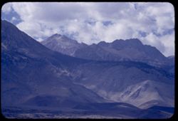
- Description:
- 100 f 8 TL
- Subject:
- Grasses, Trees, Mountains, Tom, Mount (Inyo County, Calif.), and Sierra Nevada (Calif. and Nev.)
- Series:
- 25-55
- Creator:
- Cushman, Charles W., 1896-1972
- Date Created:
- 1955-09-25
- Genre:
- Landscape photographs
- Frame Number:
- 26
- County:
- Inyo
- Abstract:
- Ridge of high Sierra south of Mt. Tom
- Call Number:
- P08373
- City:
- Bishop
- Country:
- United States
- State/Province:
- California
- Alternate Identifier:
- 2555.26
- Persistent URL:
- http://purl.dlib.indiana.edu/iudl/archives/cushman/P08373
- Holding Location:
- Bloomington - University Archives
Wells Library E460
1320 E 10th St.
Bloomington, IN 47405
Contact at archives@indiana.edu, 812-855-1127
-
- Description:
- 100 f 6.3 TL tel lens
- Subject:
- Mountains, White Mountain Peak (Inyo County, Calif.), and Plants
- Series:
- 25-55
- Creator:
- Cushman, Charles W., 1896-1972
- Date Created:
- 1955-09-25
- Genre:
- Landscape photographs
- Frame Number:
- 25
- County:
- Inyo
- Abstract:
- Toward White Mtn. Peak (14,246 ft.) from same pt. 9:15 am
- Call Number:
- P08372
- City:
- Bishop
- Country:
- United States
- State/Province:
- California
- Alternate Identifier:
- 2555.25
- Persistent URL:
- http://purl.dlib.indiana.edu/iudl/archives/cushman/P08372
- Holding Location:
- Bloomington - University Archives
Wells Library E460
1320 E 10th St.
Bloomington, IN 47405
Contact at archives@indiana.edu, 812-855-1127
-
- Description:
- 100 f 8 TL
- Subject:
- Grasses, Roads, Automobiles, Trees, Mountains, Tom, Mount (Inyo County, Calif.), Horseback riding, Utility poles, and Electric lines
- Series:
- 25-55
- Creator:
- Cushman, Charles W., 1896-1972
- Date Created:
- 1955-09-25
- Genre:
- Landscape photographs
- Frame Number:
- 24
- County:
- Inyo
- Abstract:
- Mt. Tom from road west of Bishop
- Call Number:
- P08371
- City:
- Bishop
- Country:
- United States
- State/Province:
- California
- Alternate Identifier:
- 2555.24
- Persistent URL:
- http://purl.dlib.indiana.edu/iudl/archives/cushman/P08371
- Holding Location:
- Bloomington - University Archives
Wells Library E460
1320 E 10th St.
Bloomington, IN 47405
Contact at archives@indiana.edu, 812-855-1127
-
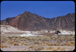
- Description:
- 100 f 8 tl
- Subject:
- Valleys, Mountains, Shrubs, Death Valley National Park (Calif. and Nev.), and Black Mountains (Inyo County, Calif.)
- Series:
- 12-55
- Creator:
- Cushman, Charles W., 1896-1972
- Date Created:
- 1955-03-24
- Genre:
- Landscape photographs
- Frame Number:
- 9
- County:
- Inyo
- Abstract:
- The colorful Black Mtns. of Death Valley Nat'l Mon. from Hwy near Tecopa
- Call Number:
- P07905
- City:
- Tecopa
- Country:
- United States
- State/Province:
- California
- Alternate Identifier:
- 1255.9
- Persistent URL:
- http://purl.dlib.indiana.edu/iudl/archives/cushman/P07905
- Holding Location:
- Bloomington - University Archives
Wells Library E460
1320 E 10th St.
Bloomington, IN 47405
Contact at archives@indiana.edu, 812-855-1127
-
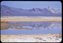
- Description:
- 100 f 6 tl
- Subject:
- Lakes & ponds, Deserts, Reflections, Valleys, Black Mountains (Inyo County, Calif.), Death Valley (Calif. and Nev.), Mountains, and Shrubs
- Series:
- 12-55
- Creator:
- Cushman, Charles W., 1896-1972
- Date Created:
- 1955-03-24
- Genre:
- Landscape photographs
- Frame Number:
- 8
- County:
- Inyo
- Abstract:
- Desert lake near Tecopa - view N.W.
- Call Number:
- P07904
- City:
- Tecopa
- Country:
- United States
- State/Province:
- California
- Alternate Identifier:
- 1255.8
- Persistent URL:
- http://purl.dlib.indiana.edu/iudl/archives/cushman/P07904
- Holding Location:
- Bloomington - University Archives
Wells Library E460
1320 E 10th St.
Bloomington, IN 47405
Contact at archives@indiana.edu, 812-855-1127
-
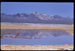
- Description:
- 100 f 8 tl
- Subject:
- Lakes & ponds, Deserts, Reflections, Valleys, Black Mountains (Inyo County, Calif.), Death Valley (Calif. and Nev.), Mountains, and Shrubs
- Series:
- 12-55
- Creator:
- Cushman, Charles W., 1896-1972
- Date Created:
- 1955-03-24
- Genre:
- Landscape photographs
- Frame Number:
- 7
- County:
- Inyo
- Abstract:
- Desert lake near Tecopa - view N.W.
- Call Number:
- P07903
- City:
- Tecopa
- Country:
- United States
- State/Province:
- California
- Alternate Identifier:
- 1255.7
- Persistent URL:
- http://purl.dlib.indiana.edu/iudl/archives/cushman/P07903
- Holding Location:
- Bloomington - University Archives
Wells Library E460
1320 E 10th St.
Bloomington, IN 47405
Contact at archives@indiana.edu, 812-855-1127
-
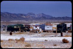
- Description:
- 100 f 8 + tl
- Subject:
- Minerals, Trucks, Valleys, Mountains, Shrubs, Tecopa Hot Springs (Calif.), and Trailers
- Series:
- 12-55
- Creator:
- Cushman, Charles W., 1896-1972
- Date Created:
- 1955-03-24
- Genre:
- Views
- Frame Number:
- 6
- County:
- Inyo
- Abstract:
- Trailer colony near Tecopa Hot Springs
- Call Number:
- P07902
- Country:
- United States
- State/Province:
- California
- Alternate Identifier:
- 1255.6
- Persistent URL:
- http://purl.dlib.indiana.edu/iudl/archives/cushman/P07902
- Holding Location:
- Bloomington - University Archives
Wells Library E460
1320 E 10th St.
Bloomington, IN 47405
Contact at archives@indiana.edu, 812-855-1127
-
- Description:
- 100 f 8 + tl
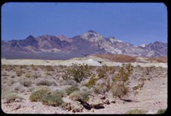
- Subject:
- Valleys, Greenwater Range (Calif.), Minerals, Alkali, Mountains, Shrubs, and Hills
- Series:
- 12-55
- Creator:
- Cushman, Charles W., 1896-1972
- Date Created:
- 1955-03-24
- Genre:
- Landscape photographs
- Frame Number:
- 4
- County:
- Inyo
- Abstract:
- Alkali beds south of Shoshone
- Call Number:
- P07900
- City:
- Shoshone
- Country:
- United States
- State/Province:
- California
- Alternate Identifier:
- 1255.4
- Persistent URL:
- http://purl.dlib.indiana.edu/iudl/archives/cushman/P07900
- Holding Location:
- Bloomington - University Archives
Wells Library E460
1320 E 10th St.
Bloomington, IN 47405
Contact at archives@indiana.edu, 812-855-1127
-
- Description:
- 100 f 8 tl
- Subject:
- Greenwater Range (Calif.), Valleys, Mountains, Shrubs, and Rock formations
- Series:
- 12-55
- Creator:
- Cushman, Charles W., 1896-1972
- Date Created:
- 1955-03-24
- Genre:
- Landscape photographs
- Frame Number:
- 3
- County:
- Inyo
- Abstract:
- Greenwater Mtns west of Shoshone
- Call Number:
- P07899
- City:
- Shoshone
- Country:
- United States
- State/Province:
- California
- Alternate Identifier:
- 1255.3
- Persistent URL:
- http://purl.dlib.indiana.edu/iudl/archives/cushman/P07899
- Holding Location:
- Bloomington - University Archives
Wells Library E460
1320 E 10th St.
Bloomington, IN 47405
Contact at archives@indiana.edu, 812-855-1127
-
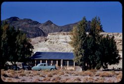
- Description:
- 100 f 8 tl
- Subject:
- Greenwater Range (Calif.), Automobiles, Mountains, People, Dwellings, Pines, Fences, and Shrubs
- Series:
- 12-55
- Creator:
- Cushman, Charles W., 1896-1972
- Date Created:
- 1955-03-24
- Genre:
- Landscape photographs
- Frame Number:
- 2
- County:
- Inyo
- Abstract:
- cottage south of Shoshone
- Call Number:
- P07898
- City:
- Shoshone
- Country:
- United States
- State/Province:
- California
- Alternate Identifier:
- 1255.2
- Persistent URL:
- http://purl.dlib.indiana.edu/iudl/archives/cushman/P07898
- Holding Location:
- Bloomington - University Archives
Wells Library E460
1320 E 10th St.
Bloomington, IN 47405
Contact at archives@indiana.edu, 812-855-1127
-
- Description:
- 100 f 8 tl
- Subject:
- Pines, Mountains, Clotheslines, and Dwellings
- Series:
- 12-55
- Creator:
- Cushman, Charles W., 1896-1972
- Date Created:
- 1955-03-24
- Genre:
- Landscape photographs
- Frame Number:
- 1
- County:
- Inyo
- Abstract:
- Shoshone
- Call Number:
- P07897
- City:
- Shoshone
- Country:
- United States
- State/Province:
- California
- Physical Description:
- masked.
- Alternate Identifier:
- 1255.1
- Persistent URL:
- http://purl.dlib.indiana.edu/iudl/archives/cushman/P07897
- Holding Location:
- Bloomington - University Archives
Wells Library E460
1320 E 10th St.
Bloomington, IN 47405
Contact at archives@indiana.edu, 812-855-1127
-
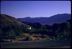
- Subject:
- Rocks, Benches, Roads, Spouses, Automobiles, Trees, Mountains, Shrubs, Scotty's Castle (Calif.), Death Valley (Calif. and Nev.), Castles & palaces, P...
- Series:
- 11-55
- Creator:
- Cushman, Charles W., 1896-1972
- Date Created:
- 1955-03-23
- Genre:
- Portraits and Identification photographs
- Frame Number:
- 37
- County:
- Inyo
- Persons Pictured:
- Cushman, Jean
- Abstract:
- Jean with old Packard touring car
- Call Number:
- P07896
- Country:
- United States
- State/Province:
- California
- Alternate Identifier:
- 1155.37
- Persistent URL:
- http://purl.dlib.indiana.edu/iudl/archives/cushman/P07896
- Holding Location:
- Bloomington - University Archives
Wells Library E460
1320 E 10th St.
Bloomington, IN 47405
Contact at archives@indiana.edu, 812-855-1127
-
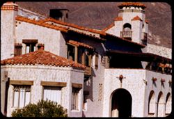
- Description:
- 50 f 9 50 mm
- Subject:
- Bell towers, Valleys, Trees, Roofs, Arches, Mountains, Flowerpots, Shrubs, Scotty's Castle (Calif.), Lamps, Castles & palaces, Gates, Courtyards, and...
- Series:
- 11-55
- Creator:
- Cushman, Charles W., 1896-1972
- Date Created:
- 1955-03-23
- Genre:
- Architectural photographs
- Frame Number:
- 36
- County:
- Inyo
- Abstract:
- View east
- Call Number:
- P07895
- Country:
- United States
- State/Province:
- California
- Alternate Identifier:
- 1155.36
- Persistent URL:
- http://purl.dlib.indiana.edu/iudl/archives/cushman/P07895
- Holding Location:
- Bloomington - University Archives
Wells Library E460
1320 E 10th St.
Bloomington, IN 47405
Contact at archives@indiana.edu, 812-855-1127
-
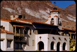
- Description:
- 100 f 9 50 mm OR 125 f 9
- Subject:
- Courtyards, Trees, Roofs, Arches, Mountains, Shrubs, Scotty's Castle (Calif.), Death Valley (Calif. and Nev.), Castles & palaces, Gates, and Bell towers
- Series:
- 11-55
- Creator:
- Cushman, Charles W., 1896-1972
- Date Created:
- 1955-03-23
- Genre:
- Architectural photographs
- Frame Number:
- 35
- County:
- Inyo
- Abstract:
- View east Wrong setting
- Call Number:
- P07894
- Country:
- United States
- State/Province:
- California
- Alternate Identifier:
- 1155.35
- Persistent URL:
- http://purl.dlib.indiana.edu/iudl/archives/cushman/P07894
- Holding Location:
- Bloomington - University Archives
Wells Library E460
1320 E 10th St.
Bloomington, IN 47405
Contact at archives@indiana.edu, 812-855-1127
-
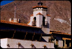
- Description:
- 100 f 9 error 50 mm
- Subject:
- Valleys, Trees, Mountains, Fences, Shrubs, Scotty's Castle (Calif.), Death Valley (Calif. and Nev.), Castles & palaces, and Hills
- Series:
- 11-55
- Creator:
- Cushman, Charles W., 1896-1972
- Date Created:
- 1955-03-23
- Genre:
- Landscape photographs
- Frame Number:
- 34
- County:
- Inyo
- Abstract:
- South from verandah of Scotty's castle
- Call Number:
- P07893
- Country:
- United States
- State/Province:
- California
- Alternate Identifier:
- 1155.34
- Persistent URL:
- http://purl.dlib.indiana.edu/iudl/archives/cushman/P07893
- Holding Location:
- Bloomington - University Archives
Wells Library E460
1320 E 10th St.
Bloomington, IN 47405
Contact at archives@indiana.edu, 812-855-1127
-
- Description:
- 100 f 8 tl
- Subject:
- Railings, Flowers, Roofs, Arches, Shutters, Mountains, Flowerpots, Shrubs, Arcades (Architectural components), Scotty's Castle (Calif.), Death Valley (Ca...
- Series:
- 11-55
- Creator:
- Cushman, Charles W., 1896-1972
- Date Created:
- 1955-03-23
- Genre:
- Architectural photographs
- Frame Number:
- 32
- County:
- Inyo
- Abstract:
- the Castle
- Call Number:
- P07891
- Country:
- United States
- State/Province:
- California
- Alternate Identifier:
- 1155.32
- Persistent URL:
- http://purl.dlib.indiana.edu/iudl/archives/cushman/P07891
- Holding Location:
- Bloomington - University Archives
Wells Library E460
1320 E 10th St.
Bloomington, IN 47405
Contact at archives@indiana.edu, 812-855-1127
-
- Description:
- 100 f 8 tl
- Subject:
- Shutters, Balconies, Roofs, Flowers, Flowerpots, Death Valley (Calif. and Nev.), Windows, Scotty's Castle (Calif.), Mountains, Shrubs, Castles & pala...
- Series:
- 11-55
- Creator:
- Cushman, Charles W., 1896-1972
- Date Created:
- 1955-03-23
- Genre:
- Architectural photographs
- Frame Number:
- 31
- County:
- Inyo
- Abstract:
- the Castle
- Call Number:
- P07890
- Country:
- United States
- State/Province:
- California
- Alternate Identifier:
- 1155.31
- Persistent URL:
- http://purl.dlib.indiana.edu/iudl/archives/cushman/P07890
- Holding Location:
- Bloomington - University Archives
Wells Library E460
1320 E 10th St.
Bloomington, IN 47405
Contact at archives@indiana.edu, 812-855-1127
-
- Description:
- 100 f 8 tl
- Subject:
- Towers, Railings, Flowers, Roofs, Arches, Shutters, Mountains, Flowerpots, Shrubs, Scotty's Castle (Calif.), Death Valley (Calif. and Nev.), Castles &...
- Series:
- 11-55
- Creator:
- Cushman, Charles W., 1896-1972
- Date Created:
- 1955-03-23
- Genre:
- Architectural photographs
- Frame Number:
- 30
- County:
- Inyo
- Abstract:
- the Castle
- Call Number:
- P07889
- Country:
- United States
- State/Province:
- California
- Alternate Identifier:
- 1155.30
- Persistent URL:
- http://purl.dlib.indiana.edu/iudl/archives/cushman/P07889
- Holding Location:
- Bloomington - University Archives
Wells Library E460
1320 E 10th St.
Bloomington, IN 47405
Contact at archives@indiana.edu, 812-855-1127
-
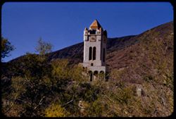
- Description:
- 100 f 8 tl
- Subject:
- Rocks, Bell towers, Trees, Arches, Mountains, Shrubs, Clock towers, Scotty's Castle (Calif.), Death Valley (Calif. and Nev.), Columns, Castles & pala...
- Series:
- 11-55
- Creator:
- Cushman, Charles W., 1896-1972
- Date Created:
- 1955-03-23
- Genre:
- Architectural photographs
- Frame Number:
- 28
- County:
- Inyo
- Abstract:
- Scotty's Tower from gate
- Call Number:
- P07887
- Country:
- United States
- State/Province:
- California
- Alternate Identifier:
- 1155.28
- Persistent URL:
- http://purl.dlib.indiana.edu/iudl/archives/cushman/P07887
- Holding Location:
- Bloomington - University Archives
Wells Library E460
1320 E 10th St.
Bloomington, IN 47405
Contact at archives@indiana.edu, 812-855-1127
-
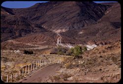
- Description:
- 100 f 8 tl
- Subject:
- Towers, Roads, Trees, Mountains, Buildings, Shrubs, Scotty's Castle (Calif.), Death Valley (Calif. and Nev.), Castles & palaces, and Rocks
- Series:
- 11-55
- Creator:
- Cushman, Charles W., 1896-1972
- Date Created:
- 1955-03-23
- Genre:
- Landscape photographs
- Frame Number:
- 27
- County:
- Inyo
- Abstract:
- First view of Scott's Tower
- Call Number:
- P07886
- Country:
- United States
- State/Province:
- California
- Alternate Identifier:
- 1155.27
- Persistent URL:
- http://purl.dlib.indiana.edu/iudl/archives/cushman/P07886
- Holding Location:
- Bloomington - University Archives
Wells Library E460
1320 E 10th St.
Bloomington, IN 47405
Contact at archives@indiana.edu, 812-855-1127
-
- Description:
- 100 f 8 tl
- Subject:
- Rocks, Valleys, Ubehebe Crater (Calif.), Shrubs, Death Valley (Calif. and Nev.), and Mountains
- Series:
- 11-55
- Creator:
- Cushman, Charles W., 1896-1972
- Date Created:
- 1955-03-23
- Genre:
- Landscape photographs
- Frame Number:
- 26
- County:
- Inyo
- Abstract:
- Ridges NE of crater long at right corrected
- Call Number:
- P07885
- Country:
- United States
- State/Province:
- California
- Alternate Identifier:
- 1155.26
- Persistent URL:
- http://purl.dlib.indiana.edu/iudl/archives/cushman/P07885
- Holding Location:
- Bloomington - University Archives
Wells Library E460
1320 E 10th St.
Bloomington, IN 47405
Contact at archives@indiana.edu, 812-855-1127
-
- Description:
- 100 f 6.3 tl
- Subject:
- Rocks, Craters, Mountains, Shrubs, Hills, Ubehebe Crater (Calif.), and Death Valley (Calif. and Nev.)
- Series:
- 11-55
- Creator:
- Cushman, Charles W., 1896-1972
- Date Created:
- 1955-03-23
- Frame Number:
- 25
- County:
- Inyo
- Abstract:
- Strange white ridge in bowl of Ubehebe Crater
- Call Number:
- P07884
- Country:
- United States
- State/Province:
- California
- Alternate Identifier:
- 1155.25
- Persistent URL:
- http://purl.dlib.indiana.edu/iudl/archives/cushman/P07884
- Holding Location:
- Bloomington - University Archives
Wells Library E460
1320 E 10th St.
Bloomington, IN 47405
Contact at archives@indiana.edu, 812-855-1127
-
- Description:
- 100 f 8 tl
- Subject:
- Valleys, Ubehebe Crater (Calif.), Shrubs, Death Valley (Calif. and Nev.), and Mountains
- Series:
- 11-55
- Creator:
- Cushman, Charles W., 1896-1972
- Date Created:
- 1955-03-23
- Genre:
- Landscape photographs
- Frame Number:
- 24
- County:
- Inyo
- Abstract:
- Valley north of Ubehebe Crate
- Call Number:
- P07883
- Country:
- United States
- State/Province:
- California
- Alternate Identifier:
- 1155.24
- Persistent URL:
- http://purl.dlib.indiana.edu/iudl/archives/cushman/P07883
- Holding Location:
- Bloomington - University Archives
Wells Library E460
1320 E 10th St.
Bloomington, IN 47405
Contact at archives@indiana.edu, 812-855-1127
-
- Description:
- 200 f 5.6 tl
- Subject:
- Rocks, Craters, Grapevine Mountains (Calif. and Nev.), Mountains, Shrubs, Death Valley (Calif. and Nev.), and Ubehebe Crater (Calif.)
- Series:
- 11-55
- Creator:
- Cushman, Charles W., 1896-1972
- Date Created:
- 1955-03-23
- Genre:
- Landscape photographs
- Frame Number:
- 23
- County:
- Inyo
- Abstract:
- Mtns above east rim Long at right
- Call Number:
- P07882
- Country:
- United States
- State/Province:
- California
- Alternate Identifier:
- 1155.23
- Persistent URL:
- http://purl.dlib.indiana.edu/iudl/archives/cushman/P07882
- Holding Location:
- Bloomington - University Archives
Wells Library E460
1320 E 10th St.
Bloomington, IN 47405
Contact at archives@indiana.edu, 812-855-1127
-
- Description:
- 100 f 8 tl
- Subject:
- Death Valley (Calif. and Nev.), Craters, Mountains, Ubehebe Crater (Calif.), and Rock formations
- Series:
- 11-55
- Creator:
- Cushman, Charles W., 1896-1972
- Date Created:
- 1955-03-23
- Genre:
- Landscape photographs
- Frame Number:
- 19
- County:
- Inyo
- Abstract:
- Mtns from top of Ubehebe Crater A little crooked
- Call Number:
- P07879
- Country:
- United States
- State/Province:
- California
- Alternate Identifier:
- 1155.19
- Persistent URL:
- http://purl.dlib.indiana.edu/iudl/archives/cushman/P07879
- Holding Location:
- Bloomington - University Archives
Wells Library E460
1320 E 10th St.
Bloomington, IN 47405
Contact at archives@indiana.edu, 812-855-1127
-
- Description:
- 100 f 8 tl
- Subject:
- Park headquarters, Valleys, Fog, Mountains, Shrubs, and Panamint Range (Calif.)
- Series:
- 11-55
- Creator:
- Cushman, Charles W., 1896-1972
- Date Created:
- 1955-03-23
- Genre:
- Landscape photographs
- Frame Number:
- 14
- County:
- Inyo
- Abstract:
- Valley floor from near Park Hqtrs
- Call Number:
- P07876
- Country:
- United States
- State/Province:
- California
- Alternate Identifier:
- 1155.14
- Persistent URL:
- http://purl.dlib.indiana.edu/iudl/archives/cushman/P07876
- Holding Location:
- Bloomington - University Archives
Wells Library E460
1320 E 10th St.
Bloomington, IN 47405
Contact at archives@indiana.edu, 812-855-1127
-
- Description:
- 100 f 8 tl
- Subject:
- Valleys, Greasewood, Mountains, Shrubs, Clouds, and Death Valley (Calif. and Nev.)
- Series:
- 11-55
- Creator:
- Cushman, Charles W., 1896-1972
- Date Created:
- 1955-03-23
- Genre:
- Identification photographs
- Frame Number:
- 8
- County:
- Inyo
- Abstract:
- Greasewood in bloom.
- Call Number:
- P07870
- Country:
- United States
- State/Province:
- California
- Alternate Identifier:
- 1155.8
- Persistent URL:
- http://purl.dlib.indiana.edu/iudl/archives/cushman/P07870
- Holding Location:
- Bloomington - University Archives
Wells Library E460
1320 E 10th St.
Bloomington, IN 47405
Contact at archives@indiana.edu, 812-855-1127
-
- Description:
- 100 f 8 + tl
- Subject:
- Rocks, Twenty Mule Team Canyon (Calif.), Canyons, Mountains, Rock formations, and Biscuit, The
- Series:
- 11-55
- Creator:
- Cushman, Charles W., 1896-1972
- Date Created:
- 1955-03-23
- Genre:
- Landscape photographs
- Frame Number:
- 2
- County:
- Inyo
- Abstract:
- The Biscuit seen from exit of 20 Mule T. canyon
- Call Number:
- P07864
- Country:
- United States
- State/Province:
- California
- Alternate Identifier:
- 1155.2
- Persistent URL:
- http://purl.dlib.indiana.edu/iudl/archives/cushman/P07864
- Holding Location:
- Bloomington - University Archives
Wells Library E460
1320 E 10th St.
Bloomington, IN 47405
Contact at archives@indiana.edu, 812-855-1127
-
- Description:
- 100 F 8 tl
- Subject:
- Rocks, Twenty Mule Team Canyon (Calif.), Canyons, Mountains, Rock formations, and Death Valley National Park (Calif. and Nev.)
- Series:
- 10-55
- Creator:
- Cushman, Charles W., 1896-1972
- Date Created:
- 1955-03-23
- Genre:
- Landscape photographs
- Frame Number:
- 37
- County:
- Inyo
- Abstract:
- In 20 Mule Team canyon
- Call Number:
- P07861
- Country:
- United States
- State/Province:
- California
- Alternate Identifier:
- 1055.37
- Persistent URL:
- http://purl.dlib.indiana.edu/iudl/archives/cushman/P07861
- Holding Location:
- Bloomington - University Archives
Wells Library E460
1320 E 10th St.
Bloomington, IN 47405
Contact at archives@indiana.edu, 812-855-1127
-
- Description:
- 100 f 6.3 tl
- Subject:
- Rocks, Twenty Mule Team Canyon (Calif.), Canyons, Mountains, Rock formations, Death Valley National Park (Calif. and Nev.), and Valleys
- Series:
- 10-55
- Creator:
- Cushman, Charles W., 1896-1972
- Date Created:
- 1955-03-23
- Genre:
- Landscape photographs
- Frame Number:
- 34
- County:
- Inyo
- Abstract:
- Same canyon
- Call Number:
- P07859
- Country:
- United States
- State/Province:
- California
- Alternate Identifier:
- 1055.34
- Persistent URL:
- http://purl.dlib.indiana.edu/iudl/archives/cushman/P07859
- Holding Location:
- Bloomington - University Archives
Wells Library E460
1320 E 10th St.
Bloomington, IN 47405
Contact at archives@indiana.edu, 812-855-1127
-
- Description:
- 100 f 6.3 tl
- Subject:
- Rocks, Twenty Mule Team Canyon (Calif.), Valleys, Mountains, Death Valley National Park (Calif. and Nev.), and Canyons
- Series:
- 10-55
- Creator:
- Cushman, Charles W., 1896-1972
- Date Created:
- 1955-03-23
- Genre:
- Landscape photographs
- Frame Number:
- 33
- County:
- Inyo
- Abstract:
- Same canyon
- Call Number:
- P07858
- Country:
- United States
- State/Province:
- California
- Alternate Identifier:
- 1055.33
- Persistent URL:
- http://purl.dlib.indiana.edu/iudl/archives/cushman/P07858
- Holding Location:
- Bloomington - University Archives
Wells Library E460
1320 E 10th St.
Bloomington, IN 47405
Contact at archives@indiana.edu, 812-855-1127
-
- Description:
- 100 f 8 tl
- Subject:
- Twenty Mule Team Canyon (Calif.), Canyons, Mountains, Death Valley National Park (Calif. and Nev.), and Valleys
- Series:
- 10-55
- Creator:
- Cushman, Charles W., 1896-1972
- Date Created:
- 1955-03-23
- Genre:
- Landscape photographs
- Frame Number:
- 32
- County:
- Inyo
- Abstract:
- In 20 mule team canyon
- Call Number:
- P07857
- Country:
- United States
- State/Province:
- California
- Alternate Identifier:
- 1055.32
- Persistent URL:
- http://purl.dlib.indiana.edu/iudl/archives/cushman/P07857
- Holding Location:
- Bloomington - University Archives
Wells Library E460
1320 E 10th St.
Bloomington, IN 47405
Contact at archives@indiana.edu, 812-855-1127
-
- Description:
- 100 f 8 tl
- Subject:
- Canyons, Valleys, Twenty Mule Team Canyon (Calif.), Mountains, Death Valley National Park (Calif. and Nev.), and Furnace Creek (Calif.)
- Series:
- 10-55
- Creator:
- Cushman, Charles W., 1896-1972
- Date Created:
- 1955-03-23
- Genre:
- Landscape photographs
- Frame Number:
- 31
- County:
- Inyo
- Abstract:
- In 20 mule team canyon
- Call Number:
- P07856
- Country:
- United States
- State/Province:
- California
- Alternate Identifier:
- 1055.31
- Persistent URL:
- http://purl.dlib.indiana.edu/iudl/archives/cushman/P07856
- Holding Location:
- Bloomington - University Archives
Wells Library E460
1320 E 10th St.
Bloomington, IN 47405
Contact at archives@indiana.edu, 812-855-1127
-
- Description:
- 100 f 8 tl
- Subject:
- Canyons, Valleys, Twenty Mule Team Canyon (Calif.), Mountains, and Furnace Creek (Calif.)
- Series:
- 10-55
- Creator:
- Cushman, Charles W., 1896-1972
- Date Created:
- 1955-03-23
- Genre:
- Landscape photographs
- Frame Number:
- 30
- County:
- Inyo
- Abstract:
- In 20 mule team canyon
- Call Number:
- P07855
- Country:
- United States
- State/Province:
- California
- Alternate Identifier:
- 1055.30
- Persistent URL:
- http://purl.dlib.indiana.edu/iudl/archives/cushman/P07855
- Holding Location:
- Bloomington - University Archives
Wells Library E460
1320 E 10th St.
Bloomington, IN 47405
Contact at archives@indiana.edu, 812-855-1127
-
- Description:
- 100 f 6.3 tl
- Subject:
- Zabriskie Point (Calif.), Telescope Peak (Inyo County, Calif.), Mountains, and Snow
- Series:
- 10-55
- Creator:
- Cushman, Charles W., 1896-1972
- Date Created:
- 1955-03-23
- Genre:
- Landscape photographs
- Frame Number:
- 29
- County:
- Inyo
- Abstract:
- South from Zab. Pt
- Call Number:
- P07854
- Country:
- United States
- State/Province:
- California
- Alternate Identifier:
- 1055.29
- Persistent URL:
- http://purl.dlib.indiana.edu/iudl/archives/cushman/P07854
- Holding Location:
- Bloomington - University Archives
Wells Library E460
1320 E 10th St.
Bloomington, IN 47405
Contact at archives@indiana.edu, 812-855-1127
-
- Description:
- 100 f 8 tl
- Subject:
- Mountains, Zabriskie Point (Calif.), and Hills
- Series:
- 10-55
- Creator:
- Cushman, Charles W., 1896-1972
- Date Created:
- 1955-03-23
- Genre:
- Landscape photographs
- Frame Number:
- 27
- County:
- Inyo
- Abstract:
- Down from below Zabriskie Pt
- Call Number:
- P07852
- Country:
- United States
- State/Province:
- California
- Alternate Identifier:
- 1055.27
- Persistent URL:
- http://purl.dlib.indiana.edu/iudl/archives/cushman/P07852
- Holding Location:
- Bloomington - University Archives
Wells Library E460
1320 E 10th St.
Bloomington, IN 47405
Contact at archives@indiana.edu, 812-855-1127
-
- Description:
- 100 f 8 tl
- Subject:
- Mountains, Zabriskie Point (Calif.), and Hills
- Series:
- 10-55
- Creator:
- Cushman, Charles W., 1896-1972
- Date Created:
- 1955-03-23
- Genre:
- Landscape photographs
- Frame Number:
- 26
- County:
- Inyo
- Abstract:
- Striped rock from Zabriskie Pt.
- Call Number:
- P07851
- Country:
- United States
- State/Province:
- California
- Alternate Identifier:
- 1055.26
- Persistent URL:
- http://purl.dlib.indiana.edu/iudl/archives/cushman/P07851
- Holding Location:
- Bloomington - University Archives
Wells Library E460
1320 E 10th St.
Bloomington, IN 47405
Contact at archives@indiana.edu, 812-855-1127
-
- Description:
- 100 f 8 tl
- Subject:
- Zabriskie Point (Calif.), Hills, Mountains, Shrubs, Furnace Creek Wash (Calif.), and Rocks
- Series:
- 10-55
- Creator:
- Cushman, Charles W., 1896-1972
- Date Created:
- 1955-03-23
- Genre:
- Landscape photographs
- Frame Number:
- 24
- County:
- Inyo
- Abstract:
- Toward Zabriskie from 8 mi SE of Furnace Creek
- Call Number:
- P07849
- Country:
- United States
- State/Province:
- California
- Alternate Identifier:
- 1055.24
- Persistent URL:
- http://purl.dlib.indiana.edu/iudl/archives/cushman/P07849
- Holding Location:
- Bloomington - University Archives
Wells Library E460
1320 E 10th St.
Bloomington, IN 47405
Contact at archives@indiana.edu, 812-855-1127
-
- Description:
- 200 f 5.6 tl
- Subject:
- Helicopters, Mountains, Trees, and Clouds
- Series:
- 10-55
- Creator:
- Cushman, Charles W., 1896-1972
- Date Created:
- 1955-03-23
- Frame Number:
- 23
- County:
- Inyo
- Abstract:
- Another flight of whirly birds
- Call Number:
- P07848
- City:
- Death Valley Junction
- Country:
- United States
- State/Province:
- California
- Alternate Identifier:
- 1055.23
- Persistent URL:
- http://purl.dlib.indiana.edu/iudl/archives/cushman/P07848
- Holding Location:
- Bloomington - University Archives
Wells Library E460
1320 E 10th St.
Bloomington, IN 47405
Contact at archives@indiana.edu, 812-855-1127
-
- Description:
- 100 f 8 tl
- Subject:
- Snow, Valleys, Mountains, and Death Valley National Park (Calif. and Nev.)
- Series:
- 10-55
- Creator:
- Cushman, Charles W., 1896-1972
- Date Created:
- 1955-03-22
- Genre:
- Landscape photographs
- Frame Number:
- 15
- Street Address:
- Bad Water Road
- County:
- Inyo
- Abstract:
- Streaks down the chocolate ice cream from Bad Water road
- Call Number:
- P07840
- Country:
- United States
- State/Province:
- California
- Alternate Identifier:
- 1055.15
- Persistent URL:
- http://purl.dlib.indiana.edu/iudl/archives/cushman/P07840
- Holding Location:
- Bloomington - University Archives
Wells Library E460
1320 E 10th St.
Bloomington, IN 47405
Contact at archives@indiana.edu, 812-855-1127
-
- Description:
- 100 f 9 tl
- Subject:
- Canyons, Mountains, Death Valley National Park (Calif. and Nev.), and Rocks
- Series:
- 10-55
- Creator:
- Cushman, Charles W., 1896-1972
- Date Created:
- 1955-03-22
- Genre:
- Landscape photographs
- Frame Number:
- 14
- Street Address:
- Artist's View Drive
- County:
- Inyo
- Abstract:
- Back up Artists Drive
- Call Number:
- P07839
- Country:
- United States
- State/Province:
- California
- Alternate Identifier:
- 1055.14
- Persistent URL:
- http://purl.dlib.indiana.edu/iudl/archives/cushman/P07839
- Holding Location:
- Bloomington - University Archives
Wells Library E460
1320 E 10th St.
Bloomington, IN 47405
Contact at archives@indiana.edu, 812-855-1127
-
- Description:
- 100 f 8 tl
- Subject:
- Mountains, Clouds, and Death Valley (Calif. and Nev.)
- Series:
- 10-55
- Creator:
- Cushman, Charles W., 1896-1972
- Date Created:
- 1955-03-22
- Genre:
- Landscape photographs
- Frame Number:
- 13
- Street Address:
- Artist's View Drive
- County:
- Inyo
- Abstract:
- Green land at top
- Call Number:
- P07838
- Country:
- United States
- State/Province:
- California
- Alternate Identifier:
- 1055.13
- Persistent URL:
- http://purl.dlib.indiana.edu/iudl/archives/cushman/P07838
- Holding Location:
- Bloomington - University Archives
Wells Library E460
1320 E 10th St.
Bloomington, IN 47405
Contact at archives@indiana.edu, 812-855-1127
-
- Description:
- 100 f 8 tl
- Subject:
- Valleys, Artists Palette (Calif.), Black Mountains (Inyo County, Calif.), Mountains, Death Valley National Park (Calif. and Nev.), Rocks, and Hills
- Series:
- 10-55
- Creator:
- Cushman, Charles W., 1896-1972
- Date Created:
- 1955-03-22
- Genre:
- Landscape photographs
- Frame Number:
- 12
- Street Address:
- Artist's View Drive
- County:
- Inyo
- Abstract:
- From observation pt of Artists Palette
- Call Number:
- P07837
- Country:
- United States
- State/Province:
- California
- Alternate Identifier:
- 1055.12
- Persistent URL:
- http://purl.dlib.indiana.edu/iudl/archives/cushman/P07837
- Holding Location:
- Bloomington - University Archives
Wells Library E460
1320 E 10th St.
Bloomington, IN 47405
Contact at archives@indiana.edu, 812-855-1127
-
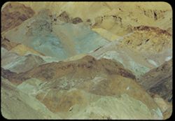
- Description:
- 100 f 8
- Subject:
- Valleys, Mountains, Death Valley National Park (Calif. and Nev.), and Artists Palette (Calif.)
- Series:
- 10-55
- Creator:
- Cushman, Charles W., 1896-1972
- Date Created:
- 1955-03-22
- Genre:
- Landscape photographs
- Frame Number:
- 11
- County:
- Inyo
- Abstract:
- From observation pt of Artists Palette SD To Safety Box Slides from Feb. and March 1955 trips in Bank Vault
- Call Number:
- P07836
- Country:
- United States
- State/Province:
- California
- Alternate Identifier:
- 1055.11
- Persistent URL:
- http://purl.dlib.indiana.edu/iudl/archives/cushman/P07836
- Holding Location:
- Bloomington - University Archives
Wells Library E460
1320 E 10th St.
Bloomington, IN 47405
Contact at archives@indiana.edu, 812-855-1127
-
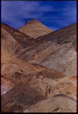
- Description:
- 100 f 8+ tl
- Subject:
- Valleys, Mountains, Clouds, Death Valley National Park (Calif. and Nev.), and Artists Palette (Calif.)
- Series:
- 10-55
- Creator:
- Cushman, Charles W., 1896-1972
- Date Created:
- 1955-03-22
- Genre:
- Landscape photographs
- Frame Number:
- 10
- Street Address:
- Artist's View Drive
- County:
- Inyo
- Abstract:
- From observation pt of Artists Palette
- Call Number:
- P07835
- Country:
- United States
- State/Province:
- California
- Physical Description:
- Image was originally mounted in a glass enclosure. Before digitization, the image was removed and placed in a Wess Plastic, Inc. brand, 2" x 2", pl...
- Alternate Identifier:
- 1055.10
- Persistent URL:
- http://purl.dlib.indiana.edu/iudl/archives/cushman/P07835
- Holding Location:
- Bloomington - University Archives
Wells Library E460
1320 E 10th St.
Bloomington, IN 47405
Contact at archives@indiana.edu, 812-855-1127
-
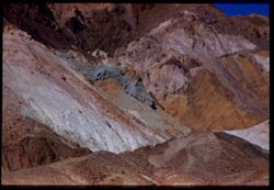
- Description:
- 100 f 8+ tel l
- Subject:
- Mountains, Death Valley National Park (Calif. and Nev.), and Artists Palette (Calif.)
- Series:
- 10-55
- Creator:
- Cushman, Charles W., 1896-1972
- Date Created:
- 1955-03-22
- Genre:
- Landscape photographs
- Frame Number:
- 9
- Street Address:
- Artist's View Drive
- County:
- Inyo
- Abstract:
- From observation pt of Artists Palette
- Call Number:
- P07834
- Country:
- United States
- State/Province:
- California
- Physical Description:
- Image was originally mounted in a glass enclosure. Before digitization, the image was removed and placed in a Wess Plastic, Inc. brand, 2" x 2", pl...
- Alternate Identifier:
- 1055.9
- Persistent URL:
- http://purl.dlib.indiana.edu/iudl/archives/cushman/P07834
- Holding Location:
- Bloomington - University Archives
Wells Library E460
1320 E 10th St.
Bloomington, IN 47405
Contact at archives@indiana.edu, 812-855-1127
-
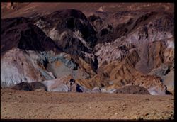
- Description:
- 100 f 8 tl
- Subject:
- Mountains, Death Valley National Park (Calif. and Nev.), and Artists Palette (Calif.)
- Series:
- 10-55
- Creator:
- Cushman, Charles W., 1896-1972
- Date Created:
- 1955-03-22
- Genre:
- Landscape photographs
- Frame Number:
- 6
- County:
- Inyo
- Abstract:
- Twice [move]
- Call Number:
- P07833
- Country:
- United States
- State/Province:
- California
- Physical Description:
- Image was originally mounted in a glass enclosure. Before digitization, the image was removed and placed in a Wess Plastic, Inc. brand, 2" x 2", pl...
- Alternate Identifier:
- 1055.6
- Persistent URL:
- http://purl.dlib.indiana.edu/iudl/archives/cushman/P07833
- Holding Location:
- Bloomington - University Archives
Wells Library E460
1320 E 10th St.
Bloomington, IN 47405
Contact at archives@indiana.edu, 812-855-1127
-
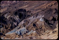
- Description:
- 100 f 6 tl
- Subject:
- Artists Palette (Calif.), Hills, Mountains, Death Valley National Park (Calif. and Nev.), and Rocks
- Series:
- 10-55
- Creator:
- Cushman, Charles W., 1896-1972
- Date Created:
- 1955-03-22
- Genre:
- Landscape photographs
- Frame Number:
- 4
- County:
- Inyo
- Abstract:
- The Artists palette
- Call Number:
- P07832
- Country:
- United States
- State/Province:
- California
- Alternate Identifier:
- 1055.4
- Persistent URL:
- http://purl.dlib.indiana.edu/iudl/archives/cushman/P07832
- Holding Location:
- Bloomington - University Archives
Wells Library E460
1320 E 10th St.
Bloomington, IN 47405
Contact at archives@indiana.edu, 812-855-1127
-
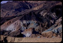
- Description:
- 100 f 6.3 tl
- Subject:
- Valleys, Mountains, Death Valley National Park (Calif. and Nev.), Hills, and Artists Palette (Calif.)
- Series:
- 10-55
- Creator:
- Cushman, Charles W., 1896-1972
- Date Created:
- 1955-03-22
- Genre:
- Landscape photographs
- Frame Number:
- 3
- County:
- Inyo
- Abstract:
- The artists Palette
- Call Number:
- P07831
- Country:
- United States
- State/Province:
- California
- Alternate Identifier:
- 1055.3
- Persistent URL:
- http://purl.dlib.indiana.edu/iudl/archives/cushman/P07831
- Holding Location:
- Bloomington - University Archives
Wells Library E460
1320 E 10th St.
Bloomington, IN 47405
Contact at archives@indiana.edu, 812-855-1127
-
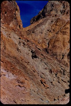
- Description:
- 100 f 8+ tl
- Subject:
- Rocks, Mountains, Clouds, and Death Valley National Park (Calif. and Nev.)
- Series:
- 10-55
- Creator:
- Cushman, Charles W., 1896-1972
- Date Created:
- 1955-03-22
- Frame Number:
- 2
- Street Address:
- Artist's View Drive
- County:
- Inyo
- Abstract:
- From top of Artists Drive
- Call Number:
- P07830
- Country:
- United States
- State/Province:
- California
- Alternate Identifier:
- 1055.2
- Persistent URL:
- http://purl.dlib.indiana.edu/iudl/archives/cushman/P07830
- Holding Location:
- Bloomington - University Archives
Wells Library E460
1320 E 10th St.
Bloomington, IN 47405
Contact at archives@indiana.edu, 812-855-1127
-
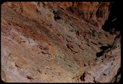
- Description:
- 100 f 8+ tl
- Subject:
- Rocks, Valleys, Mountains, and Death Valley National Park (Calif. and Nev.)
- Series:
- 10-55
- Creator:
- Cushman, Charles W., 1896-1972
- Date Created:
- 1955-03-22
- Frame Number:
- 1
- Street Address:
- Artist's View Drive
- County:
- Inyo
- Abstract:
- From top of Artists Drive
- Call Number:
- P07829
- Country:
- United States
- State/Province:
- California
- Alternate Identifier:
- 1055.1
- Persistent URL:
- http://purl.dlib.indiana.edu/iudl/archives/cushman/P07829
- Holding Location:
- Bloomington - University Archives
Wells Library E460
1320 E 10th St.
Bloomington, IN 47405
Contact at archives@indiana.edu, 812-855-1127
-
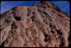
- Description:
- 100 f 8
- Subject:
- Mountains, Rock formations, Clouds, Death Valley National Park (Calif. and Nev.), and Black Mountains (Inyo County, Calif.)
- Series:
- 9-55
- Creator:
- Cushman, Charles W., 1896-1972
- Date Created:
- 1955-03-22
- Genre:
- Landscape photographs
- Frame Number:
- 38
- Street Address:
- Artist's View Drive
- County:
- Inyo
- Abstract:
- From top of Artists Drive Death Valley Nat'l Mon
- Call Number:
- P07828
- Country:
- United States
- State/Province:
- California
- Alternate Identifier:
- 955.38
- Persistent URL:
- http://purl.dlib.indiana.edu/iudl/archives/cushman/P07828
- Holding Location:
- Bloomington - University Archives
Wells Library E460
1320 E 10th St.
Bloomington, IN 47405
Contact at archives@indiana.edu, 812-855-1127
-
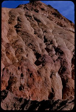
- Description:
- 100 f 8 tl
- Subject:
- Mountains, Death Valley National Park (Calif. and Nev.), and Rock formations
- Series:
- 9-55
- Creator:
- Cushman, Charles W., 1896-1972
- Date Created:
- 1955-03-22
- Genre:
- Landscape photographs
- Frame Number:
- 37
- Street Address:
- Artist's View Drive
- County:
- Inyo
- Abstract:
- From top of Artists Drive
- Call Number:
- P07827
- Country:
- United States
- State/Province:
- California
- Alternate Identifier:
- 955.37
- Persistent URL:
- http://purl.dlib.indiana.edu/iudl/archives/cushman/P07827
- Holding Location:
- Bloomington - University Archives
Wells Library E460
1320 E 10th St.
Bloomington, IN 47405
Contact at archives@indiana.edu, 812-855-1127
-
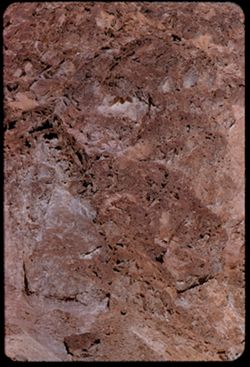
- Description:
- 100 f 8 tl
- Subject:
- Rocks, Valleys, Mountains, Death Valley National Park (Calif. and Nev.), and Black Mountains (Inyo County, Calif.)
- Series:
- 9-55
- Creator:
- Cushman, Charles W., 1896-1972
- Date Created:
- 1955-03-22
- Frame Number:
- 36
- Street Address:
- Artist's View Drive
- County:
- Inyo
- Abstract:
- Aboave Artists Drive [P]
- Call Number:
- P07826
- Country:
- United States
- State/Province:
- California
- Alternate Identifier:
- 955.36
- Persistent URL:
- http://purl.dlib.indiana.edu/iudl/archives/cushman/P07826
- Holding Location:
- Bloomington - University Archives
Wells Library E460
1320 E 10th St.
Bloomington, IN 47405
Contact at archives@indiana.edu, 812-855-1127
-
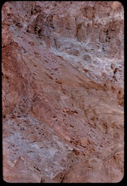
- Description:
- 100 f 8 tl
- Subject:
- Hills, Mountains, Death Valley National Park (Calif. and Nev.), Rocks, and Black Mountains (Inyo County, Calif.)
- Series:
- 9-55
- Creator:
- Cushman, Charles W., 1896-1972
- Date Created:
- 1955-03-22
- Frame Number:
- 35
- Street Address:
- Artist's View Drive
- County:
- Inyo
- Abstract:
- Above Artists Drive [P]
- Call Number:
- P07825
- Country:
- United States
- State/Province:
- California
- Alternate Identifier:
- 955.35
- Persistent URL:
- http://purl.dlib.indiana.edu/iudl/archives/cushman/P07825
- Holding Location:
- Bloomington - University Archives
Wells Library E460
1320 E 10th St.
Bloomington, IN 47405
Contact at archives@indiana.edu, 812-855-1127
-
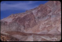
- Description:
- 100 f 8 tl
- Subject:
- Valleys, Mountains, Clouds, Death Valley (Calif. and Nev.), and Black Mountains (Inyo County, Calif.)
- Series:
- 9-55
- Creator:
- Cushman, Charles W., 1896-1972
- Date Created:
- 1955-03-22
- Genre:
- Landscape photographs
- Frame Number:
- 34
- Street Address:
- Artist's View Drive
- County:
- Inyo
- Abstract:
- Up from Artists (View) Drive
- Call Number:
- P07824
- Country:
- United States
- State/Province:
- California
- Alternate Identifier:
- 955.34
- Persistent URL:
- http://purl.dlib.indiana.edu/iudl/archives/cushman/P07824
- Holding Location:
- Bloomington - University Archives
Wells Library E460
1320 E 10th St.
Bloomington, IN 47405
Contact at archives@indiana.edu, 812-855-1127
-
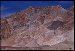
- Description:
- 100 f 8+ tl
- Subject:
- Valleys, Mountains, Clouds, Death Valley (Calif. and Nev.), and Black Mountains (Inyo County, Calif.)
- Series:
- 9-55
- Creator:
- Cushman, Charles W., 1896-1972
- Date Created:
- 1955-03-22
- Genre:
- Landscape photographs
- Frame Number:
- 33
- Street Address:
- Artist's View Drive
- County:
- Inyo
- Abstract:
- Up from Artists (View) Drive
- Call Number:
- P07823
- Country:
- United States
- State/Province:
- California
- Physical Description:
- Image was originally mounted in a glass enclosure. Before digitization, the image was removed and placed in a Wess Plastic, Inc. brand, 2" x 2", pl...
- Alternate Identifier:
- 955.33
- Persistent URL:
- http://purl.dlib.indiana.edu/iudl/archives/cushman/P07823
- Holding Location:
- Bloomington - University Archives
Wells Library E460
1320 E 10th St.
Bloomington, IN 47405
Contact at archives@indiana.edu, 812-855-1127
-
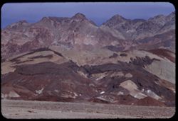
- Description:
- 100 f 8 tl
- Subject:
- Valleys, Mountains, Furnace Creek Inn (Death Valley Junction, Calif.), Death Valley (Calif. and Nev.), and Black Mountains (Inyo County, Calif.)
- Series:
- 9-55
- Creator:
- Cushman, Charles W., 1896-1972
- Date Created:
- 1955-03-22
- Genre:
- Landscape photographs
- Frame Number:
- 31
- Street Address:
- Death Valley Road
- County:
- Inyo
- Abstract:
- From 9 mi so. of Furn. Crk Inn (those are the Black Mtns from the west)
- Call Number:
- P07822
- City:
- Death Valley Junction and Badwater
- Country:
- United States
- State/Province:
- California
- Alternate Identifier:
- 955.31
- Persistent URL:
- http://purl.dlib.indiana.edu/iudl/archives/cushman/P07822
- Holding Location:
- Bloomington - University Archives
Wells Library E460
1320 E 10th St.
Bloomington, IN 47405
Contact at archives@indiana.edu, 812-855-1127
-
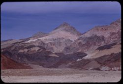
- Description:
- 100 f 8 tl
- Subject:
- Valleys, Mountains, Death Valley (Calif. and Nev.), and Black Mountains (Inyo County, Calif.)
- Series:
- 9-55
- Creator:
- Cushman, Charles W., 1896-1972
- Date Created:
- 1955-03-22
- Genre:
- Landscape photographs
- Frame Number:
- 30
- County:
- Inyo
- Abstract:
- Strawberry and chocolate cone from 9 mi so. of Furn. Crk Inn
- Call Number:
- P07821
- City:
- Badwater
- Country:
- United States
- State/Province:
- California
- Alternate Identifier:
- 955.30
- Persistent URL:
- http://purl.dlib.indiana.edu/iudl/archives/cushman/P07821
- Holding Location:
- Bloomington - University Archives
Wells Library E460
1320 E 10th St.
Bloomington, IN 47405
Contact at archives@indiana.edu, 812-855-1127
-
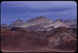
- Description:
- 100 f 8 tl
- Subject:
- Furnace Creek Inn (Death Valley Junction, Calif.), Hills, Mountains, Clouds, Valleys, and Black Mountains (Inyo County, Calif.)
- Series:
- 9-55
- Creator:
- Cushman, Charles W., 1896-1972
- Date Created:
- 1955-03-22
- Genre:
- Landscape photographs
- Frame Number:
- 29
- Street Address:
- Bad Water Road
- County:
- Inyo
- Abstract:
- From 7 mi so. of Furnace Crk Inn eastward
- Call Number:
- P07820
- City:
- Death Valley Junction
- Country:
- United States
- State/Province:
- California
- Alternate Identifier:
- 955.29
- Persistent URL:
- http://purl.dlib.indiana.edu/iudl/archives/cushman/P07820
- Holding Location:
- Bloomington - University Archives
Wells Library E460
1320 E 10th St.
Bloomington, IN 47405
Contact at archives@indiana.edu, 812-855-1127
-
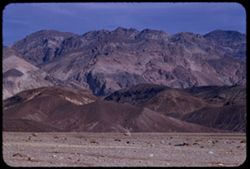
- Description:
- 100 f 8 tl
- Subject:
- Valleys, Mountains, Furnace Creek Inn (Death Valley Junction, Calif.), Black Mountains (Inyo County, Calif.), and Furnace Creek (Calif.)
- Series:
- 9-55
- Creator:
- Cushman, Charles W., 1896-1972
- Date Created:
- 1955-03-22
- Genre:
- Landscape photographs
- Frame Number:
- 28
- Street Address:
- Bad Water Road
- County:
- Inyo
- Abstract:
- East from Bad Water Road 6 miles south of Furnace C K Inn
- Call Number:
- P07819
- City:
- Death Valley Junction and Badwater
- Country:
- United States
- State/Province:
- California
- Alternate Identifier:
- 955.28
- Persistent URL:
- http://purl.dlib.indiana.edu/iudl/archives/cushman/P07819
- Holding Location:
- Bloomington - University Archives
Wells Library E460
1320 E 10th St.
Bloomington, IN 47405
Contact at archives@indiana.edu, 812-855-1127
-
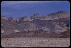
- Description:
- 100 f 8 tl
- Subject:
- Valleys, Furnace Creek Inn (Death Valley Junction, Calif.), Mountains, and Black Mountains (Inyo County, Calif.)
- Series:
- 9-55
- Creator:
- Cushman, Charles W., 1896-1972
- Date Created:
- 1955-03-22
- Genre:
- Landscape photographs
- Frame Number:
- 27
- Street Address:
- Bad Water Road
- County:
- Inyo
- Abstract:
- East from Bad Water Road 6 miles south of Furnace C K Inn
- Call Number:
- P07818
- City:
- Death Valley Junction and Badwater
- Country:
- United States
- State/Province:
- California
- Alternate Identifier:
- 955.27
- Persistent URL:
- http://purl.dlib.indiana.edu/iudl/archives/cushman/P07818
- Holding Location:
- Bloomington - University Archives
Wells Library E460
1320 E 10th St.
Bloomington, IN 47405
Contact at archives@indiana.edu, 812-855-1127
- « Previous
- Next »
- 1
- 2
- 3