
Search Constraints
You searched for:
Campus
IUB
Remove constraint Campus: IUB
County
Inyo
Remove constraint County: Inyo
Search Results
-
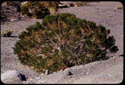
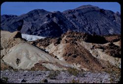
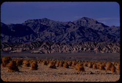
- Description:
- 100 f 6.3 tl 35 ft
- Subject:
- Deserts, Death Valley National Park (Calif. and Nev.), Furnace Creek Wash (Calif.), Shrubs, and Rocks
- Series:
- 10-55
- Creator:
- Cushman, Charles W., 1896-1972
- Date Created:
- 1955-03-23
- Genre:
- Identification photographs
- Frame Number:
- 25
- County:
- Inyo
- Abstract:
- Desert bush
- Call Number:
- P07850
- Country:
- United States
- State/Province:
- California
- Alternate Identifier:
- 1055.25
- Persistent URL:
- http://purl.dlib.indiana.edu/iudl/archives/cushman/P07850
- Holding Location:
- Bloomington - University Archives
Wells Library E460
1320 E 10th St.
Bloomington, IN 47405
Contact at archives@indiana.edu, 812-855-1127
-
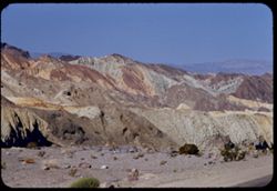
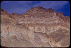
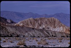
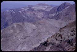
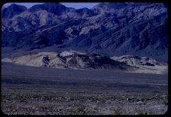
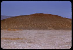
- Description:
- 100 f 8 tl
- Subject:
- Zabriskie Point (Calif.), Hills, Mountains, Shrubs, Furnace Creek Wash (Calif.), and Rocks
- Series:
- 10-55
- Creator:
- Cushman, Charles W., 1896-1972
- Date Created:
- 1955-03-23
- Genre:
- Landscape photographs
- Frame Number:
- 24
- County:
- Inyo
- Abstract:
- Toward Zabriskie from 8 mi SE of Furnace Creek
- Call Number:
- P07849
- Country:
- United States
- State/Province:
- California
- Alternate Identifier:
- 1055.24
- Persistent URL:
- http://purl.dlib.indiana.edu/iudl/archives/cushman/P07849
- Holding Location:
- Bloomington - University Archives
Wells Library E460
1320 E 10th St.
Bloomington, IN 47405
Contact at archives@indiana.edu, 812-855-1127
-
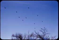
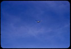
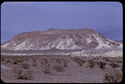
- Description:
- 200 f 5.6 tl
- Subject:
- Helicopters, Mountains, Trees, and Clouds
- Series:
- 10-55
- Creator:
- Cushman, Charles W., 1896-1972
- Date Created:
- 1955-03-23
- Frame Number:
- 23
- County:
- Inyo
- Abstract:
- Another flight of whirly birds
- Call Number:
- P07848
- City:
- Death Valley Junction
- Country:
- United States
- State/Province:
- California
- Alternate Identifier:
- 1055.23
- Persistent URL:
- http://purl.dlib.indiana.edu/iudl/archives/cushman/P07848
- Holding Location:
- Bloomington - University Archives
Wells Library E460
1320 E 10th St.
Bloomington, IN 47405
Contact at archives@indiana.edu, 812-855-1127
-
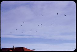
- Description:
- 200 f 5.6 tl
- Subject:
- Roofs, Helicopters, Utility poles, Electric lines, and Clouds
- Series:
- 10-55
- Creator:
- Cushman, Charles W., 1896-1972
- Date Created:
- 1955-03-23
- Frame Number:
- 22
- County:
- Inyo
- Abstract:
- Another flight of whirly birds
- Call Number:
- P07847
- City:
- Death Valley Junction
- Country:
- United States
- State/Province:
- California
- Alternate Identifier:
- 1055.22
- Persistent URL:
- http://purl.dlib.indiana.edu/iudl/archives/cushman/P07847
- Holding Location:
- Bloomington - University Archives
Wells Library E460
1320 E 10th St.
Bloomington, IN 47405
Contact at archives@indiana.edu, 812-855-1127
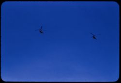
-
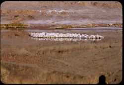
- Description:
- 200 f 5.6 tl
- Subject:
- Clouds and Helicopters
- Series:
- 10-55
- Creator:
- Cushman, Charles W., 1896-1972
- Date Created:
- 1955-03-23
- Frame Number:
- 21
- County:
- Inyo
- Abstract:
- From Death Valley Junction Helicopter flock from north
- Call Number:
- P07846
- City:
- Death Valley Junction
- Country:
- United States
- State/Province:
- California
- Alternate Identifier:
- 1055.21
- Persistent URL:
- http://purl.dlib.indiana.edu/iudl/archives/cushman/P07846
- Holding Location:
- Bloomington - University Archives
Wells Library E460
1320 E 10th St.
Bloomington, IN 47405
Contact at archives@indiana.edu, 812-855-1127
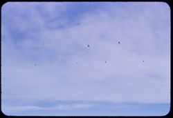
-
- Description:
- 100 f 8 tl
- Subject:
- H-bomb helicopter and Helicopters
- Series:
- 10-55
- Creator:
- Cushman, Charles W., 1896-1972
- Date Created:
- 1955-03-23
- Frame Number:
- 20
- County:
- Inyo
- Abstract:
- From Death Valley Junction Helicopter flock from north
- Call Number:
- P07845
- City:
- Death Valley Junction
- Country:
- United States
- State/Province:
- California
- Alternate Identifier:
- 1055.20
- Persistent URL:
- http://purl.dlib.indiana.edu/iudl/archives/cushman/P07845
- Holding Location:
- Bloomington - University Archives
Wells Library E460
1320 E 10th St.
Bloomington, IN 47405
Contact at archives@indiana.edu, 812-855-1127
-
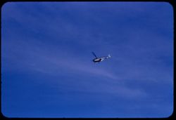
- Description:
- 100 f 8
- Subject:
- Clouds and Helicopters
- Series:
- 10-55
- Creator:
- Cushman, Charles W., 1896-1972
- Date Created:
- 1955-03-23
- Frame Number:
- 19
- County:
- Inyo
- Abstract:
- From Death Valley Junction Helicopter flock from north
- Call Number:
- P07844
- City:
- Death Valley Junction
- Country:
- United States
- State/Province:
- California
- Alternate Identifier:
- 1055.19
- Persistent URL:
- http://purl.dlib.indiana.edu/iudl/archives/cushman/P07844
- Holding Location:
- Bloomington - University Archives
Wells Library E460
1320 E 10th St.
Bloomington, IN 47405
Contact at archives@indiana.edu, 812-855-1127
-
- Description:
- 100 f 8 tl
- Subject:
- Clouds and Helicopters
- Series:
- 10-55
- Creator:
- Cushman, Charles W., 1896-1972
- Date Created:
- 1955-03-23
- Frame Number:
- 18
- County:
- Inyo
- Abstract:
- From Death Valley Junction Helicopter flock from north
- Call Number:
- P07843
- City:
- Death Valley Junction
- Country:
- United States
- State/Province:
- California
- Alternate Identifier:
- 1055.18
- Persistent URL:
- http://purl.dlib.indiana.edu/iudl/archives/cushman/P07843
- Holding Location:
- Bloomington - University Archives
Wells Library E460
1320 E 10th St.
Bloomington, IN 47405
Contact at archives@indiana.edu, 812-855-1127
-
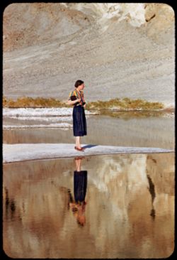
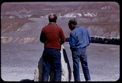
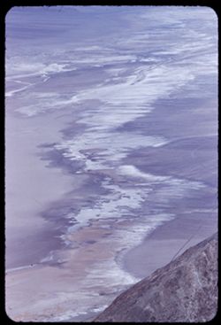
- Description:
- 100 f 5.6 tl
- Subject:
- Rocks, Valleys, Bodies of water, Spouses, Minerals, Salt, Shrubs, Death Valley (Calif. and Nev.), and Reflections
- Series:
- 10-55
- Creator:
- Cushman, Charles W., 1896-1972
- Date Created:
- 1955-03-22
- Genre:
- Portraits and Identification photographs
- Frame Number:
- 17
- County:
- Inyo
- Persons Pictured:
- Cushman, Jean
- Abstract:
- Jean at BW End of Mar. 22
- Call Number:
- P07842
- City:
- Badwater
- Country:
- United States
- State/Province:
- California
- Alternate Identifier:
- 1055.17
- Persistent URL:
- http://purl.dlib.indiana.edu/iudl/archives/cushman/P07842
- Holding Location:
- Bloomington - University Archives
Wells Library E460
1320 E 10th St.
Bloomington, IN 47405
Contact at archives@indiana.edu, 812-855-1127
-
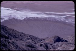
- Description:
- 100 f 6.3 tl
- Subject:
- Rocks, Bodies of water, Minerals, Salt, Shrubs, and Death Valley (Calif. and Nev.)
- Series:
- 10-55
- Creator:
- Cushman, Charles W., 1896-1972
- Date Created:
- 1955-03-22
- Frame Number:
- 16
- County:
- Inyo
- Abstract:
- Salt island at Bad Water
- Call Number:
- P07841
- City:
- Badwater
- Country:
- United States
- State/Province:
- California
- Alternate Identifier:
- 1055.16
- Persistent URL:
- http://purl.dlib.indiana.edu/iudl/archives/cushman/P07841
- Holding Location:
- Bloomington - University Archives
Wells Library E460
1320 E 10th St.
Bloomington, IN 47405
Contact at archives@indiana.edu, 812-855-1127
-
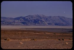
- Description:
- 100 f 8 tl
- Subject:
- Snow, Valleys, Mountains, and Death Valley National Park (Calif. and Nev.)
- Series:
- 10-55
- Creator:
- Cushman, Charles W., 1896-1972
- Date Created:
- 1955-03-22
- Genre:
- Landscape photographs
- Frame Number:
- 15
- Street Address:
- Bad Water Road
- County:
- Inyo
- Abstract:
- Streaks down the chocolate ice cream from Bad Water road
- Call Number:
- P07840
- Country:
- United States
- State/Province:
- California
- Alternate Identifier:
- 1055.15
- Persistent URL:
- http://purl.dlib.indiana.edu/iudl/archives/cushman/P07840
- Holding Location:
- Bloomington - University Archives
Wells Library E460
1320 E 10th St.
Bloomington, IN 47405
Contact at archives@indiana.edu, 812-855-1127
-
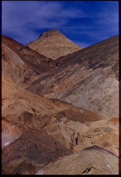
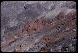
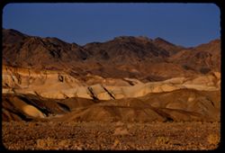
- Description:
- 100 f 9 tl
- Subject:
- Canyons, Mountains, Death Valley National Park (Calif. and Nev.), and Rocks
- Series:
- 10-55
- Creator:
- Cushman, Charles W., 1896-1972
- Date Created:
- 1955-03-22
- Genre:
- Landscape photographs
- Frame Number:
- 14
- Street Address:
- Artist's View Drive
- County:
- Inyo
- Abstract:
- Back up Artists Drive
- Call Number:
- P07839
- Country:
- United States
- State/Province:
- California
- Alternate Identifier:
- 1055.14
- Persistent URL:
- http://purl.dlib.indiana.edu/iudl/archives/cushman/P07839
- Holding Location:
- Bloomington - University Archives
Wells Library E460
1320 E 10th St.
Bloomington, IN 47405
Contact at archives@indiana.edu, 812-855-1127
-
- Description:
- 100 f 8 tl
- Subject:
- Mountains, Clouds, and Death Valley (Calif. and Nev.)
- Series:
- 10-55
- Creator:
- Cushman, Charles W., 1896-1972
- Date Created:
- 1955-03-22
- Genre:
- Landscape photographs
- Frame Number:
- 13
- Street Address:
- Artist's View Drive
- County:
- Inyo
- Abstract:
- Green land at top
- Call Number:
- P07838
- Country:
- United States
- State/Province:
- California
- Alternate Identifier:
- 1055.13
- Persistent URL:
- http://purl.dlib.indiana.edu/iudl/archives/cushman/P07838
- Holding Location:
- Bloomington - University Archives
Wells Library E460
1320 E 10th St.
Bloomington, IN 47405
Contact at archives@indiana.edu, 812-855-1127
-
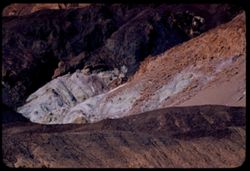
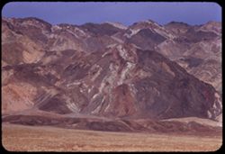
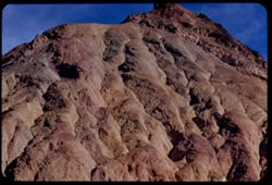
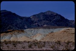
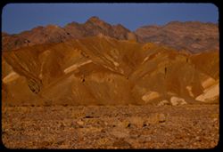
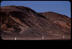
- Description:
- 100 f 8 tl
- Subject:
- Valleys, Artists Palette (Calif.), Black Mountains (Inyo County, Calif.), Mountains, Death Valley National Park (Calif. and Nev.), Rocks, and Hills
- Series:
- 10-55
- Creator:
- Cushman, Charles W., 1896-1972
- Date Created:
- 1955-03-22
- Genre:
- Landscape photographs
- Frame Number:
- 12
- Street Address:
- Artist's View Drive
- County:
- Inyo
- Abstract:
- From observation pt of Artists Palette
- Call Number:
- P07837
- Country:
- United States
- State/Province:
- California
- Alternate Identifier:
- 1055.12
- Persistent URL:
- http://purl.dlib.indiana.edu/iudl/archives/cushman/P07837
- Holding Location:
- Bloomington - University Archives
Wells Library E460
1320 E 10th St.
Bloomington, IN 47405
Contact at archives@indiana.edu, 812-855-1127
-
- Description:
- 100 f 8
- Subject:
- Valleys, Mountains, Death Valley National Park (Calif. and Nev.), and Artists Palette (Calif.)
- Series:
- 10-55
- Creator:
- Cushman, Charles W., 1896-1972
- Date Created:
- 1955-03-22
- Genre:
- Landscape photographs
- Frame Number:
- 11
- County:
- Inyo
- Abstract:
- From observation pt of Artists Palette SD To Safety Box Slides from Feb. and March 1955 trips in Bank Vault
- Call Number:
- P07836
- Country:
- United States
- State/Province:
- California
- Alternate Identifier:
- 1055.11
- Persistent URL:
- http://purl.dlib.indiana.edu/iudl/archives/cushman/P07836
- Holding Location:
- Bloomington - University Archives
Wells Library E460
1320 E 10th St.
Bloomington, IN 47405
Contact at archives@indiana.edu, 812-855-1127
-
- Description:
- 100 f 8+ tl
- Subject:
- Valleys, Mountains, Clouds, Death Valley National Park (Calif. and Nev.), and Artists Palette (Calif.)
- Series:
- 10-55
- Creator:
- Cushman, Charles W., 1896-1972
- Date Created:
- 1955-03-22
- Genre:
- Landscape photographs
- Frame Number:
- 10
- Street Address:
- Artist's View Drive
- County:
- Inyo
- Abstract:
- From observation pt of Artists Palette
- Call Number:
- P07835
- Country:
- United States
- State/Province:
- California
- Physical Description:
- Image was originally mounted in a glass enclosure. Before digitization, the image was removed and placed in a Wess Plastic, Inc. brand, 2" x 2", pl...
- Alternate Identifier:
- 1055.10
- Persistent URL:
- http://purl.dlib.indiana.edu/iudl/archives/cushman/P07835
- Holding Location:
- Bloomington - University Archives
Wells Library E460
1320 E 10th St.
Bloomington, IN 47405
Contact at archives@indiana.edu, 812-855-1127
-
- Description:
- 100 f 8+ tel l
- Subject:
- Mountains, Death Valley National Park (Calif. and Nev.), and Artists Palette (Calif.)
- Series:
- 10-55
- Creator:
- Cushman, Charles W., 1896-1972
- Date Created:
- 1955-03-22
- Genre:
- Landscape photographs
- Frame Number:
- 9
- Street Address:
- Artist's View Drive
- County:
- Inyo
- Abstract:
- From observation pt of Artists Palette
- Call Number:
- P07834
- Country:
- United States
- State/Province:
- California
- Physical Description:
- Image was originally mounted in a glass enclosure. Before digitization, the image was removed and placed in a Wess Plastic, Inc. brand, 2" x 2", pl...
- Alternate Identifier:
- 1055.9
- Persistent URL:
- http://purl.dlib.indiana.edu/iudl/archives/cushman/P07834
- Holding Location:
- Bloomington - University Archives
Wells Library E460
1320 E 10th St.
Bloomington, IN 47405
Contact at archives@indiana.edu, 812-855-1127
-
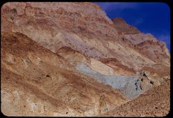
- Description:
- 100 f 8 tl
- Subject:
- Mountains, Death Valley National Park (Calif. and Nev.), and Artists Palette (Calif.)
- Series:
- 10-55
- Creator:
- Cushman, Charles W., 1896-1972
- Date Created:
- 1955-03-22
- Genre:
- Landscape photographs
- Frame Number:
- 6
- County:
- Inyo
- Abstract:
- Twice [move]
- Call Number:
- P07833
- Country:
- United States
- State/Province:
- California
- Physical Description:
- Image was originally mounted in a glass enclosure. Before digitization, the image was removed and placed in a Wess Plastic, Inc. brand, 2" x 2", pl...
- Alternate Identifier:
- 1055.6
- Persistent URL:
- http://purl.dlib.indiana.edu/iudl/archives/cushman/P07833
- Holding Location:
- Bloomington - University Archives
Wells Library E460
1320 E 10th St.
Bloomington, IN 47405
Contact at archives@indiana.edu, 812-855-1127
-
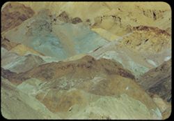
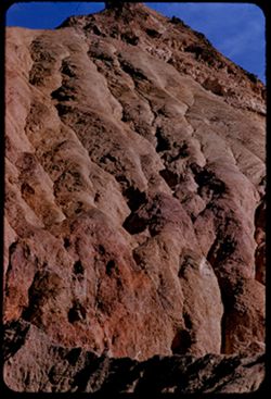
- Description:
- 100 f 6 tl
- Subject:
- Artists Palette (Calif.), Hills, Mountains, Death Valley National Park (Calif. and Nev.), and Rocks
- Series:
- 10-55
- Creator:
- Cushman, Charles W., 1896-1972
- Date Created:
- 1955-03-22
- Genre:
- Landscape photographs
- Frame Number:
- 4
- County:
- Inyo
- Abstract:
- The Artists palette
- Call Number:
- P07832
- Country:
- United States
- State/Province:
- California
- Alternate Identifier:
- 1055.4
- Persistent URL:
- http://purl.dlib.indiana.edu/iudl/archives/cushman/P07832
- Holding Location:
- Bloomington - University Archives
Wells Library E460
1320 E 10th St.
Bloomington, IN 47405
Contact at archives@indiana.edu, 812-855-1127
-
- Description:
- 100 f 6.3 tl
- Subject:
- Valleys, Mountains, Death Valley National Park (Calif. and Nev.), Hills, and Artists Palette (Calif.)
- Series:
- 10-55
- Creator:
- Cushman, Charles W., 1896-1972
- Date Created:
- 1955-03-22
- Genre:
- Landscape photographs
- Frame Number:
- 3
- County:
- Inyo
- Abstract:
- The artists Palette
- Call Number:
- P07831
- Country:
- United States
- State/Province:
- California
- Alternate Identifier:
- 1055.3
- Persistent URL:
- http://purl.dlib.indiana.edu/iudl/archives/cushman/P07831
- Holding Location:
- Bloomington - University Archives
Wells Library E460
1320 E 10th St.
Bloomington, IN 47405
Contact at archives@indiana.edu, 812-855-1127
-
- Description:
- 100 f 8+ tl
- Subject:
- Rocks, Mountains, Clouds, and Death Valley National Park (Calif. and Nev.)
- Series:
- 10-55
- Creator:
- Cushman, Charles W., 1896-1972
- Date Created:
- 1955-03-22
- Frame Number:
- 2
- Street Address:
- Artist's View Drive
- County:
- Inyo
- Abstract:
- From top of Artists Drive
- Call Number:
- P07830
- Country:
- United States
- State/Province:
- California
- Alternate Identifier:
- 1055.2
- Persistent URL:
- http://purl.dlib.indiana.edu/iudl/archives/cushman/P07830
- Holding Location:
- Bloomington - University Archives
Wells Library E460
1320 E 10th St.
Bloomington, IN 47405
Contact at archives@indiana.edu, 812-855-1127
-
- Description:
- 100 f 8+ tl
- Subject:
- Rocks, Valleys, Mountains, and Death Valley National Park (Calif. and Nev.)
- Series:
- 10-55
- Creator:
- Cushman, Charles W., 1896-1972
- Date Created:
- 1955-03-22
- Frame Number:
- 1
- Street Address:
- Artist's View Drive
- County:
- Inyo
- Abstract:
- From top of Artists Drive
- Call Number:
- P07829
- Country:
- United States
- State/Province:
- California
- Alternate Identifier:
- 1055.1
- Persistent URL:
- http://purl.dlib.indiana.edu/iudl/archives/cushman/P07829
- Holding Location:
- Bloomington - University Archives
Wells Library E460
1320 E 10th St.
Bloomington, IN 47405
Contact at archives@indiana.edu, 812-855-1127
-
- Description:
- 100 f 8
- Subject:
- Mountains, Rock formations, Clouds, Death Valley National Park (Calif. and Nev.), and Black Mountains (Inyo County, Calif.)
- Series:
- 9-55
- Creator:
- Cushman, Charles W., 1896-1972
- Date Created:
- 1955-03-22
- Genre:
- Landscape photographs
- Frame Number:
- 38
- Street Address:
- Artist's View Drive
- County:
- Inyo
- Abstract:
- From top of Artists Drive Death Valley Nat'l Mon
- Call Number:
- P07828
- Country:
- United States
- State/Province:
- California
- Alternate Identifier:
- 955.38
- Persistent URL:
- http://purl.dlib.indiana.edu/iudl/archives/cushman/P07828
- Holding Location:
- Bloomington - University Archives
Wells Library E460
1320 E 10th St.
Bloomington, IN 47405
Contact at archives@indiana.edu, 812-855-1127
-
- Description:
- 100 f 8 tl
- Subject:
- Mountains, Death Valley National Park (Calif. and Nev.), and Rock formations
- Series:
- 9-55
- Creator:
- Cushman, Charles W., 1896-1972
- Date Created:
- 1955-03-22
- Genre:
- Landscape photographs
- Frame Number:
- 37
- Street Address:
- Artist's View Drive
- County:
- Inyo
- Abstract:
- From top of Artists Drive
- Call Number:
- P07827
- Country:
- United States
- State/Province:
- California
- Alternate Identifier:
- 955.37
- Persistent URL:
- http://purl.dlib.indiana.edu/iudl/archives/cushman/P07827
- Holding Location:
- Bloomington - University Archives
Wells Library E460
1320 E 10th St.
Bloomington, IN 47405
Contact at archives@indiana.edu, 812-855-1127
-
- Description:
- 100 f 8 tl
- Subject:
- Rocks, Valleys, Mountains, Death Valley National Park (Calif. and Nev.), and Black Mountains (Inyo County, Calif.)
- Series:
- 9-55
- Creator:
- Cushman, Charles W., 1896-1972
- Date Created:
- 1955-03-22
- Frame Number:
- 36
- Street Address:
- Artist's View Drive
- County:
- Inyo
- Abstract:
- Aboave Artists Drive [P]
- Call Number:
- P07826
- Country:
- United States
- State/Province:
- California
- Alternate Identifier:
- 955.36
- Persistent URL:
- http://purl.dlib.indiana.edu/iudl/archives/cushman/P07826
- Holding Location:
- Bloomington - University Archives
Wells Library E460
1320 E 10th St.
Bloomington, IN 47405
Contact at archives@indiana.edu, 812-855-1127
-
- Description:
- 100 f 8 tl
- Subject:
- Hills, Mountains, Death Valley National Park (Calif. and Nev.), Rocks, and Black Mountains (Inyo County, Calif.)
- Series:
- 9-55
- Creator:
- Cushman, Charles W., 1896-1972
- Date Created:
- 1955-03-22
- Frame Number:
- 35
- Street Address:
- Artist's View Drive
- County:
- Inyo
- Abstract:
- Above Artists Drive [P]
- Call Number:
- P07825
- Country:
- United States
- State/Province:
- California
- Alternate Identifier:
- 955.35
- Persistent URL:
- http://purl.dlib.indiana.edu/iudl/archives/cushman/P07825
- Holding Location:
- Bloomington - University Archives
Wells Library E460
1320 E 10th St.
Bloomington, IN 47405
Contact at archives@indiana.edu, 812-855-1127
-
- Description:
- 100 f 8 tl
- Subject:
- Valleys, Mountains, Clouds, Death Valley (Calif. and Nev.), and Black Mountains (Inyo County, Calif.)
- Series:
- 9-55
- Creator:
- Cushman, Charles W., 1896-1972
- Date Created:
- 1955-03-22
- Genre:
- Landscape photographs
- Frame Number:
- 34
- Street Address:
- Artist's View Drive
- County:
- Inyo
- Abstract:
- Up from Artists (View) Drive
- Call Number:
- P07824
- Country:
- United States
- State/Province:
- California
- Alternate Identifier:
- 955.34
- Persistent URL:
- http://purl.dlib.indiana.edu/iudl/archives/cushman/P07824
- Holding Location:
- Bloomington - University Archives
Wells Library E460
1320 E 10th St.
Bloomington, IN 47405
Contact at archives@indiana.edu, 812-855-1127
-
- Description:
- 100 f 8+ tl
- Subject:
- Valleys, Mountains, Clouds, Death Valley (Calif. and Nev.), and Black Mountains (Inyo County, Calif.)
- Series:
- 9-55
- Creator:
- Cushman, Charles W., 1896-1972
- Date Created:
- 1955-03-22
- Genre:
- Landscape photographs
- Frame Number:
- 33
- Street Address:
- Artist's View Drive
- County:
- Inyo
- Abstract:
- Up from Artists (View) Drive
- Call Number:
- P07823
- Country:
- United States
- State/Province:
- California
- Physical Description:
- Image was originally mounted in a glass enclosure. Before digitization, the image was removed and placed in a Wess Plastic, Inc. brand, 2" x 2", pl...
- Alternate Identifier:
- 955.33
- Persistent URL:
- http://purl.dlib.indiana.edu/iudl/archives/cushman/P07823
- Holding Location:
- Bloomington - University Archives
Wells Library E460
1320 E 10th St.
Bloomington, IN 47405
Contact at archives@indiana.edu, 812-855-1127
-
- Description:
- 100 f 8 tl
- Subject:
- Valleys, Mountains, Furnace Creek Inn (Death Valley Junction, Calif.), Death Valley (Calif. and Nev.), and Black Mountains (Inyo County, Calif.)
- Series:
- 9-55
- Creator:
- Cushman, Charles W., 1896-1972
- Date Created:
- 1955-03-22
- Genre:
- Landscape photographs
- Frame Number:
- 31
- Street Address:
- Death Valley Road
- County:
- Inyo
- Abstract:
- From 9 mi so. of Furn. Crk Inn (those are the Black Mtns from the west)
- Call Number:
- P07822
- City:
- Death Valley Junction and Badwater
- Country:
- United States
- State/Province:
- California
- Alternate Identifier:
- 955.31
- Persistent URL:
- http://purl.dlib.indiana.edu/iudl/archives/cushman/P07822
- Holding Location:
- Bloomington - University Archives
Wells Library E460
1320 E 10th St.
Bloomington, IN 47405
Contact at archives@indiana.edu, 812-855-1127
-
- Description:
- 100 f 8 tl
- Subject:
- Valleys, Mountains, Death Valley (Calif. and Nev.), and Black Mountains (Inyo County, Calif.)
- Series:
- 9-55
- Creator:
- Cushman, Charles W., 1896-1972
- Date Created:
- 1955-03-22
- Genre:
- Landscape photographs
- Frame Number:
- 30
- County:
- Inyo
- Abstract:
- Strawberry and chocolate cone from 9 mi so. of Furn. Crk Inn
- Call Number:
- P07821
- City:
- Badwater
- Country:
- United States
- State/Province:
- California
- Alternate Identifier:
- 955.30
- Persistent URL:
- http://purl.dlib.indiana.edu/iudl/archives/cushman/P07821
- Holding Location:
- Bloomington - University Archives
Wells Library E460
1320 E 10th St.
Bloomington, IN 47405
Contact at archives@indiana.edu, 812-855-1127
-
- Description:
- 100 f 8 tl
- Subject:
- Furnace Creek Inn (Death Valley Junction, Calif.), Hills, Mountains, Clouds, Valleys, and Black Mountains (Inyo County, Calif.)
- Series:
- 9-55
- Creator:
- Cushman, Charles W., 1896-1972
- Date Created:
- 1955-03-22
- Genre:
- Landscape photographs
- Frame Number:
- 29
- Street Address:
- Bad Water Road
- County:
- Inyo
- Abstract:
- From 7 mi so. of Furnace Crk Inn eastward
- Call Number:
- P07820
- City:
- Death Valley Junction
- Country:
- United States
- State/Province:
- California
- Alternate Identifier:
- 955.29
- Persistent URL:
- http://purl.dlib.indiana.edu/iudl/archives/cushman/P07820
- Holding Location:
- Bloomington - University Archives
Wells Library E460
1320 E 10th St.
Bloomington, IN 47405
Contact at archives@indiana.edu, 812-855-1127
-
- Description:
- 100 f 8 tl
- Subject:
- Valleys, Mountains, Furnace Creek Inn (Death Valley Junction, Calif.), Black Mountains (Inyo County, Calif.), and Furnace Creek (Calif.)
- Series:
- 9-55
- Creator:
- Cushman, Charles W., 1896-1972
- Date Created:
- 1955-03-22
- Genre:
- Landscape photographs
- Frame Number:
- 28
- Street Address:
- Bad Water Road
- County:
- Inyo
- Abstract:
- East from Bad Water Road 6 miles south of Furnace C K Inn
- Call Number:
- P07819
- City:
- Death Valley Junction and Badwater
- Country:
- United States
- State/Province:
- California
- Alternate Identifier:
- 955.28
- Persistent URL:
- http://purl.dlib.indiana.edu/iudl/archives/cushman/P07819
- Holding Location:
- Bloomington - University Archives
Wells Library E460
1320 E 10th St.
Bloomington, IN 47405
Contact at archives@indiana.edu, 812-855-1127
-
- Description:
- 100 f 8 tl
- Subject:
- Valleys, Furnace Creek Inn (Death Valley Junction, Calif.), Mountains, and Black Mountains (Inyo County, Calif.)
- Series:
- 9-55
- Creator:
- Cushman, Charles W., 1896-1972
- Date Created:
- 1955-03-22
- Genre:
- Landscape photographs
- Frame Number:
- 27
- Street Address:
- Bad Water Road
- County:
- Inyo
- Abstract:
- East from Bad Water Road 6 miles south of Furnace C K Inn
- Call Number:
- P07818
- City:
- Death Valley Junction and Badwater
- Country:
- United States
- State/Province:
- California
- Alternate Identifier:
- 955.27
- Persistent URL:
- http://purl.dlib.indiana.edu/iudl/archives/cushman/P07818
- Holding Location:
- Bloomington - University Archives
Wells Library E460
1320 E 10th St.
Bloomington, IN 47405
Contact at archives@indiana.edu, 812-855-1127
-
- Description:
- 100 f 8 tl
- Subject:
- Deserts, Valleys, Black Mountains (Inyo County, Calif.), Death Valley (Calif. and Nev.), Mountains, Shrubs, and Furnace Creek (Calif.)
- Series:
- 9-55
- Creator:
- Cushman, Charles W., 1896-1972
- Date Created:
- 1955-03-22
- Genre:
- Landscape photographs
- Frame Number:
- 26
- Street Address:
- Furnace Creek-Bad Water Road
- County:
- Mono and Inyo
- Abstract:
- From Bad Water road near exit to Golden Canyon
- Call Number:
- P07817
- City:
- Badwater
- Country:
- United States
- State/Province:
- California
- Alternate Identifier:
- 955.26
- Persistent URL:
- http://purl.dlib.indiana.edu/iudl/archives/cushman/P07817
- Holding Location:
- Bloomington - University Archives
Wells Library E460
1320 E 10th St.
Bloomington, IN 47405
Contact at archives@indiana.edu, 812-855-1127
-
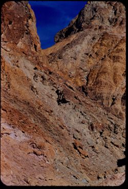
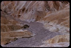
- Description:
- 100 f 8 tl
- Subject:
- Canyons, Boulders, Mountains, Rock formations, Death Valley (Calif. and Nev.), and Golden Canyon (Inyo County, Calif.)
- Series:
- 9-55
- Creator:
- Cushman, Charles W., 1896-1972
- Date Created:
- 1955-03-22
- Genre:
- Landscape photographs
- Frame Number:
- 25
- Street Address:
- Bad Water Road
- County:
- Inyo
- Abstract:
- From Bad Water road near exit to Golden Canyon
- Call Number:
- P07816
- Country:
- United States
- State/Province:
- California
- Alternate Identifier:
- 955.25
- Persistent URL:
- http://purl.dlib.indiana.edu/iudl/archives/cushman/P07816
- Holding Location:
- Bloomington - University Archives
Wells Library E460
1320 E 10th St.
Bloomington, IN 47405
Contact at archives@indiana.edu, 812-855-1127
-
- Description:
- 100 f 8 tl
- Subject:
- Furnace Creek Inn (Death Valley Junction, Calif.), Death Valley (Calif. and Nev.), Shrubs, Rocks, and Mesquite
- Series:
- 9-55
- Creator:
- Cushman, Charles W., 1896-1972
- Date Created:
- 1955-03-22
- Genre:
- Identification photographs
- Frame Number:
- 24
- County:
- Inyo
- Abstract:
- Mesquite nr. Furnace Creek Inn
- Call Number:
- P07815
- City:
- Death Valley Junction
- Country:
- United States
- State/Province:
- California
- Physical Description:
- masked.
- Alternate Identifier:
- 955.24
- Persistent URL:
- http://purl.dlib.indiana.edu/iudl/archives/cushman/P07815
- Holding Location:
- Bloomington - University Archives
Wells Library E460
1320 E 10th St.
Bloomington, IN 47405
Contact at archives@indiana.edu, 812-855-1127
-

- Description:
- 100 f 6 tl
- Subject:
- Golden Canyon (Inyo County, Calif.), Canyons, Valleys, Death Valley (Calif. and Nev.), Clouds, and Rock formations
- Series:
- 9-55
- Creator:
- Cushman, Charles W., 1896-1972
- Date Created:
- 1955-03-22
- Frame Number:
- 23
- County:
- Inyo
- Abstract:
- made inside Golden Canyon
- Call Number:
- P07814
- Country:
- United States
- State/Province:
- California
- Alternate Identifier:
- 955.23
- Persistent URL:
- http://purl.dlib.indiana.edu/iudl/archives/cushman/P07814
- Holding Location:
- Bloomington - University Archives
Wells Library E460
1320 E 10th St.
Bloomington, IN 47405
Contact at archives@indiana.edu, 812-855-1127
-
- Description:
- 100 f 6 tl
- Subject:
- Valleys, Rock formations, Death Valley (Calif. and Nev.), Golden Canyon (Inyo County, Calif.), and Canyons
- Series:
- 9-55
- Creator:
- Cushman, Charles W., 1896-1972
- Date Created:
- 1955-03-22
- Genre:
- Landscape photographs
- Frame Number:
- 22
- County:
- Inyo
- Abstract:
- made inside Golden Canyon
- Call Number:
- P07813
- Country:
- United States
- State/Province:
- California
- Alternate Identifier:
- 955.22
- Persistent URL:
- http://purl.dlib.indiana.edu/iudl/archives/cushman/P07813
- Holding Location:
- Bloomington - University Archives
Wells Library E460
1320 E 10th St.
Bloomington, IN 47405
Contact at archives@indiana.edu, 812-855-1127
-
- Description:
- 100 f 8+ tl
- Subject:
- Golden Canyon (Inyo County, Calif.), Canyons, Valleys, Death Valley (Calif. and Nev.), and Shrubs
- Series:
- 9-55
- Creator:
- Cushman, Charles W., 1896-1972
- Date Created:
- 1955-03-22
- Genre:
- Landscape photographs
- Frame Number:
- 20
- County:
- Inyo
- Abstract:
- made inside Golden Canyon
- Call Number:
- P07812
- Country:
- United States
- State/Province:
- California
- Alternate Identifier:
- 955.20
- Persistent URL:
- http://purl.dlib.indiana.edu/iudl/archives/cushman/P07812
- Holding Location:
- Bloomington - University Archives
Wells Library E460
1320 E 10th St.
Bloomington, IN 47405
Contact at archives@indiana.edu, 812-855-1127
-
- Description:
- 100 f 8+ tl
- Subject:
- Canyons, Rock formations, Clouds, Death Valley (Calif. and Nev.), Golden Canyon (Inyo County, Calif.), and Valleys
- Series:
- 9-55
- Creator:
- Cushman, Charles W., 1896-1972
- Date Created:
- 1955-03-22
- Genre:
- Landscape photographs
- Frame Number:
- 19
- County:
- Inyo
- Abstract:
- made inside Golden Canyon
- Call Number:
- P07811
- Country:
- United States
- State/Province:
- California
- Alternate Identifier:
- 955.19
- Persistent URL:
- http://purl.dlib.indiana.edu/iudl/archives/cushman/P07811
- Holding Location:
- Bloomington - University Archives
Wells Library E460
1320 E 10th St.
Bloomington, IN 47405
Contact at archives@indiana.edu, 812-855-1127
-
- Description:
- 100 f 8+ tl
- Subject:
- Canyons, Mountains, Death Valley (Calif. and Nev.), Golden Canyon (Inyo County, Calif.), and Valleys
- Series:
- 9-55
- Creator:
- Cushman, Charles W., 1896-1972
- Date Created:
- 1955-03-22
- Genre:
- Landscape photographs
- Frame Number:
- 18
- County:
- Inyo
- Abstract:
- made inside Golden Canyon
- Call Number:
- P07810
- Country:
- United States
- State/Province:
- California
- Alternate Identifier:
- 955.18
- Persistent URL:
- http://purl.dlib.indiana.edu/iudl/archives/cushman/P07810
- Holding Location:
- Bloomington - University Archives
Wells Library E460
1320 E 10th St.
Bloomington, IN 47405
Contact at archives@indiana.edu, 812-855-1127
-
- Description:
- 100 f 8+ tl
- Subject:
- Golden Canyon (Inyo County, Calif.), Death Valley (Calif. and Nev.), and Rock formations
- Series:
- 9-55
- Creator:
- Cushman, Charles W., 1896-1972
- Date Created:
- 1955-03-22
- Genre:
- Landscape photographs
- Frame Number:
- 17
- County:
- Inyo
- Abstract:
- made inside Golden Canyon
- Call Number:
- P07809
- Country:
- United States
- State/Province:
- California
- Alternate Identifier:
- 955.17
- Persistent URL:
- http://purl.dlib.indiana.edu/iudl/archives/cushman/P07809
- Holding Location:
- Bloomington - University Archives
Wells Library E460
1320 E 10th St.
Bloomington, IN 47405
Contact at archives@indiana.edu, 812-855-1127
-
- Description:
- 100 f 8+ tl
- Subject:
- Golden Canyon (Inyo County, Calif.), Canyons, Valleys, Roads, Death Valley National Park (Calif. and Nev.), and Rock formations
- Series:
- 9-55
- Creator:
- Cushman, Charles W., 1896-1972
- Date Created:
- 1955-03-22
- Genre:
- Landscape photographs
- Frame Number:
- 16
- County:
- Inyo
- Abstract:
- made inside Golden Canyon
- Call Number:
- P07808
- Country:
- United States
- State/Province:
- California
- Alternate Identifier:
- 955.16
- Persistent URL:
- http://purl.dlib.indiana.edu/iudl/archives/cushman/P07808
- Holding Location:
- Bloomington - University Archives
Wells Library E460
1320 E 10th St.
Bloomington, IN 47405
Contact at archives@indiana.edu, 812-855-1127
-
- Description:
- 100 f 8+ tl
- Subject:
- Canyons, Mountains, Rock formations, Clouds, Death Valley National Park (Calif. and Nev.), and Golden Canyon (Inyo County, Calif.)
- Series:
- 9-55
- Creator:
- Cushman, Charles W., 1896-1972
- Date Created:
- 1955-03-22
- Genre:
- Landscape photographs
- Frame Number:
- 15
- County:
- Inyo
- Abstract:
- made inside Golden Canyon
- Call Number:
- P07807
- Country:
- United States
- State/Province:
- California
- Alternate Identifier:
- 955.15
- Persistent URL:
- http://purl.dlib.indiana.edu/iudl/archives/cushman/P07807
- Holding Location:
- Bloomington - University Archives
Wells Library E460
1320 E 10th St.
Bloomington, IN 47405
Contact at archives@indiana.edu, 812-855-1127
-
- Description:
- 100 f 8 tl 12 ft.
- Subject:
- Rocks, Holly, Furnace Creek Wash (Calif.), and Deserts
- Series:
- 9-55
- Creator:
- Cushman, Charles W., 1896-1972
- Date Created:
- 1955-03-22
- Genre:
- Identification photographs
- Frame Number:
- 14
- County:
- Inyo
- Abstract:
- Desert holly blooming
- Call Number:
- P07806
- Country:
- United States
- State/Province:
- California
- Physical Description:
- masked.
- Alternate Identifier:
- 955.14
- Persistent URL:
- http://purl.dlib.indiana.edu/iudl/archives/cushman/P07806
- Holding Location:
- Bloomington - University Archives
Wells Library E460
1320 E 10th St.
Bloomington, IN 47405
Contact at archives@indiana.edu, 812-855-1127
-
- Description:
- 100 f 6.3 tl
- Subject:
- Roads, Automobiles, Trees, Mountains, Buildings, Furnace Creek Inn (Death Valley Junction, Calif.), Traffic signs & signals, Death Valley (Calif. and Nev...
- Series:
- 9-55
- Creator:
- Cushman, Charles W., 1896-1972
- Date Created:
- 1955-03-22
- Genre:
- Landscape photographs
- Frame Number:
- 13
- County:
- Inyo
- Abstract:
- Green rocks nr. Furnace Creek Inn
- Call Number:
- P07805
- City:
- Death Valley Junction
- Country:
- United States
- State/Province:
- California
- Alternate Identifier:
- 955.13
- Persistent URL:
- http://purl.dlib.indiana.edu/iudl/archives/cushman/P07805
- Holding Location:
- Bloomington - University Archives
Wells Library E460
1320 E 10th St.
Bloomington, IN 47405
Contact at archives@indiana.edu, 812-855-1127
-
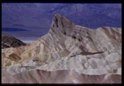
- Description:
- 100 f 8 tel l
- Subject:
- Valleys, Rock formations, Zabriskie Point (Calif.), Hills, and Death Valley (Calif. and Nev.)
- Series:
- 9-55
- Creator:
- Cushman, Charles W., 1896-1972
- Date Created:
- 1955-03-22
- Genre:
- Landscape photographs
- Frame Number:
- 12
- County:
- Inyo
- Abstract:
- Ridges WNW from pt.
- Call Number:
- P07804
- Country:
- United States
- State/Province:
- California
- Physical Description:
- Image was originally mounted in a glass enclosure. Before digitization, the image was removed and placed in a Wess Plastic, Inc. brand, 2" x 2", pl...
- Alternate Identifier:
- 955.12
- Persistent URL:
- http://purl.dlib.indiana.edu/iudl/archives/cushman/P07804
- Holding Location:
- Bloomington - University Archives
Wells Library E460
1320 E 10th St.
Bloomington, IN 47405
Contact at archives@indiana.edu, 812-855-1127
-
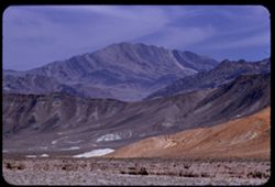
- Description:
- 100 f 6.3 tl
- Subject:
- Snow, Telescope Peak (Inyo County, Calif.), Mountains, and Zabriskie Point (Calif.)
- Series:
- 9-55
- Creator:
- Cushman, Charles W., 1896-1972
- Date Created:
- 1955-03-22
- Genre:
- Landscape photographs
- Frame Number:
- 11
- County:
- Inyo
- Abstract:
- Telescope PK from Zabriskie Pt.
- Call Number:
- P07803
- Country:
- United States
- State/Province:
- California
- Alternate Identifier:
- 955.11
- Persistent URL:
- http://purl.dlib.indiana.edu/iudl/archives/cushman/P07803
- Holding Location:
- Bloomington - University Archives
Wells Library E460
1320 E 10th St.
Bloomington, IN 47405
Contact at archives@indiana.edu, 812-855-1127
-
- Description:
- 100 f 6.3 tl
- Subject:
- Valleys, Roads, Automobiles, Shrubs, Indigenous peoples, Masonry, Zabriskie Point (Calif.), and Hills
- Series:
- 9-55
- Creator:
- Cushman, Charles W., 1896-1972
- Date Created:
- 1955-03-22
- Genre:
- Identification photographs
- Frame Number:
- 10
- County:
- Inyo
- Abstract:
- A couple of natives and a jeep
- Call Number:
- P07802
- Country:
- United States
- State/Province:
- California
- Alternate Identifier:
- 955.10
- Persistent URL:
- http://purl.dlib.indiana.edu/iudl/archives/cushman/P07802
- Holding Location:
- Bloomington - University Archives
Wells Library E460
1320 E 10th St.
Bloomington, IN 47405
Contact at archives@indiana.edu, 812-855-1127
-
- Description:
- 100 f 6.3 tl
- Subject:
- Sundials, Indigenous peoples, and Zabriskie Point (Calif.)
- Series:
- 9-55
- Creator:
- Cushman, Charles W., 1896-1972
- Date Created:
- 1955-03-22
- Genre:
- Identification photographs
- Frame Number:
- 9
- County:
- Inyo
- Abstract:
- A couple of natives and a jeep
- Call Number:
- P07801
- Country:
- United States
- State/Province:
- California
- Alternate Identifier:
- 955.9
- Persistent URL:
- http://purl.dlib.indiana.edu/iudl/archives/cushman/P07801
- Holding Location:
- Bloomington - University Archives
Wells Library E460
1320 E 10th St.
Bloomington, IN 47405
Contact at archives@indiana.edu, 812-855-1127
-
- Description:
- 100 f 8 tl
- Subject:
- Rocks, Valleys, Trails & paths, Mountains, Lara Stream, Zabriskie Point (Calif.), and Death Valley National Park (Calif. and Nev.)
- Series:
- 9-55
- Creator:
- Cushman, Charles W., 1896-1972
- Date Created:
- 1955-03-22
- Genre:
- Landscape photographs
- Frame Number:
- 8
- County:
- Inyo
- Abstract:
- natural road way below Zabriskie Pt
- Call Number:
- P07800
- Country:
- United States
- State/Province:
- California
- Alternate Identifier:
- 955.8
- Persistent URL:
- http://purl.dlib.indiana.edu/iudl/archives/cushman/P07800
- Holding Location:
- Bloomington - University Archives
Wells Library E460
1320 E 10th St.
Bloomington, IN 47405
Contact at archives@indiana.edu, 812-855-1127
-
- Description:
- 100 f 8 - tel.
- Subject:
- Valleys, Mountains, Zabriskie Point (Calif.), Death Valley (Calif. and Nev.), and Rock formations
- Series:
- 9-55
- Creator:
- Cushman, Charles W., 1896-1972
- Date Created:
- 1955-03-22
- Genre:
- Landscape photographs
- Frame Number:
- 7
- County:
- Inyo
- Abstract:
- NW from Zabriskie Pt.
- Call Number:
- P07799
- Country:
- United States
- State/Province:
- California
- Physical Description:
- Image was originally mounted in a glass enclosure. Before digitization, the image was removed and placed in a Wess Plastic, Inc. brand, 2" x 2", pl...
- Alternate Identifier:
- 955.7
- Persistent URL:
- http://purl.dlib.indiana.edu/iudl/archives/cushman/P07799
- Holding Location:
- Bloomington - University Archives
Wells Library E460
1320 E 10th St.
Bloomington, IN 47405
Contact at archives@indiana.edu, 812-855-1127
-
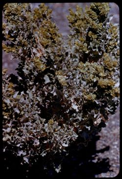
- Description:
- 100 f 8 tl 5 1/2 ft
- Subject:
- Deserts, Holly, and Furnace Creek Wash (Calif.)
- Series:
- 9-55
- Creator:
- Cushman, Charles W., 1896-1972
- Date Created:
- 1955-03-22
- Genre:
- Identification photographs
- Frame Number:
- 6
- County:
- Inyo
- Abstract:
- Desert Holly
- Call Number:
- P07798
- Country:
- United States
- State/Province:
- California
- Alternate Identifier:
- 955.6
- Persistent URL:
- http://purl.dlib.indiana.edu/iudl/archives/cushman/P07798
- Holding Location:
- Bloomington - University Archives
Wells Library E460
1320 E 10th St.
Bloomington, IN 47405
Contact at archives@indiana.edu, 812-855-1127
-
- Description:
- 100 f 8 tl
- Subject:
- Rocks, Valleys, Mountains, Shrubs, Zabriskie Point (Calif.), Death Valley National Park (Calif. and Nev.), and Hills
- Series:
- 9-55
- Creator:
- Cushman, Charles W., 1896-1972
- Date Created:
- 1955-03-22
- Genre:
- Landscape photographs
- Frame Number:
- 5
- County:
- Inyo
- Abstract:
- Yellow fan-shaped rock vicinity of Zabriskie Pt.
- Call Number:
- P07797
- Country:
- United States
- State/Province:
- California
- Alternate Identifier:
- 955.5
- Persistent URL:
- http://purl.dlib.indiana.edu/iudl/archives/cushman/P07797
- Holding Location:
- Bloomington - University Archives
Wells Library E460
1320 E 10th St.
Bloomington, IN 47405
Contact at archives@indiana.edu, 812-855-1127
-
- Description:
- 100 f 8 tl
- Subject:
- Valleys, Furnace Creek Wash (Calif.), Boulders, Buttes, Mountains, Shrubs, Clouds, and Death Valley National Park (Calif. and Nev.)
- Series:
- 9-55
- Creator:
- Cushman, Charles W., 1896-1972
- Date Created:
- 1955-03-22
- Genre:
- Landscape photographs
- Frame Number:
- 4
- County:
- Inyo
- Abstract:
- The butte like a brown-crusted biscuit
- Call Number:
- P07796
- Country:
- United States
- State/Province:
- California
- Alternate Identifier:
- 955.4
- Persistent URL:
- http://purl.dlib.indiana.edu/iudl/archives/cushman/P07796
- Holding Location:
- Bloomington - University Archives
Wells Library E460
1320 E 10th St.
Bloomington, IN 47405
Contact at archives@indiana.edu, 812-855-1127
-
- Description:
- 100 f 8 tl
- Subject:
- Valleys, Buttes, Mountains, Shrubs, Death Valley National Park (Calif. and Nev.), and Black Mountains (Inyo County, Calif.)
- Series:
- 9-55
- Creator:
- Cushman, Charles W., 1896-1972
- Date Created:
- 1955-03-22
- Genre:
- Landscape photographs
- Frame Number:
- 3
- County:
- Inyo
- Abstract:
- Green & brown butte below east side of Black Mtns
- Call Number:
- P07795
- Country:
- United States
- State/Province:
- California
- Alternate Identifier:
- 955.3
- Persistent URL:
- http://purl.dlib.indiana.edu/iudl/archives/cushman/P07795
- Holding Location:
- Bloomington - University Archives
Wells Library E460
1320 E 10th St.
Bloomington, IN 47405
Contact at archives@indiana.edu, 812-855-1127
-
- Description:
- 100 f 8 tl
- Subject:
- Snow, Valleys, Pyramid Peak (Inyo County, Calif.), Mountains, Shrubs, and Clouds
- Series:
- 9-55
- Creator:
- Cushman, Charles W., 1896-1972
- Date Created:
- 1955-03-22
- Genre:
- Landscape photographs
- Frame Number:
- 2
- County:
- Inyo
- Abstract:
- Comb seen from [view] top of Ryan probably Pyramid PK
- Call Number:
- P07794
- City:
- Ryan
- Country:
- United States
- State/Province:
- California
- Alternate Identifier:
- 955.2
- Persistent URL:
- http://purl.dlib.indiana.edu/iudl/archives/cushman/P07794
- Holding Location:
- Bloomington - University Archives
Wells Library E460
1320 E 10th St.
Bloomington, IN 47405
Contact at archives@indiana.edu, 812-855-1127
-
- Description:
- 100 f 8 tl
- Subject:
- Valleys, Mountains, Shrubs, and Black Mountains (Inyo County, Calif.)
- Series:
- 8-55
- Creator:
- Cushman, Charles W., 1896-1972
- Date Created:
- 1955-03-22
- Genre:
- Landscape photographs
- Frame Number:
- 38
- County:
- Inyo
- Abstract:
- Dark Mtns near Ryan
- Call Number:
- P07793
- City:
- Ryan
- Country:
- United States
- State/Province:
- California
- Alternate Identifier:
- 855.38
- Persistent URL:
- http://purl.dlib.indiana.edu/iudl/archives/cushman/P07793
- Holding Location:
- Bloomington - University Archives
Wells Library E460
1320 E 10th St.
Bloomington, IN 47405
Contact at archives@indiana.edu, 812-855-1127
-
- Description:
- 100 f 8 tl
- Subject:
- Mountains, Shrubs, Death Valley (Calif. and Nev.), Black Mountains (Inyo County, Calif.), and Hills
- Series:
- 8-55
- Creator:
- Cushman, Charles W., 1896-1972
- Date Created:
- 1955-03-22
- Genre:
- Landscape photographs
- Frame Number:
- 37
- County:
- Inyo
- Abstract:
- Marbled Mtns of black Mtns from SE
- Call Number:
- P07792
- Country:
- United States
- State/Province:
- California
- Alternate Identifier:
- 855.37
- Persistent URL:
- http://purl.dlib.indiana.edu/iudl/archives/cushman/P07792
- Holding Location:
- Bloomington - University Archives
Wells Library E460
1320 E 10th St.
Bloomington, IN 47405
Contact at archives@indiana.edu, 812-855-1127
-
- Description:
- 100 f 5.6 50mm
- Subject:
- Snow, Valleys, Telescope Peak (Inyo County, Calif.), Dantes View (Calif.), Mountains, Death Valley (Calif. and Nev.), and Fog
- Series:
- 8-55
- Creator:
- Cushman, Charles W., 1896-1972
- Date Created:
- 1955-03-22
- Genre:
- Landscape photographs
- Frame Number:
- 36
- County:
- Inyo
- Abstract:
- Tel PK
- Call Number:
- P07791
- Country:
- United States
- State/Province:
- California
- Alternate Identifier:
- 855.36
- Persistent URL:
- http://purl.dlib.indiana.edu/iudl/archives/cushman/P07791
- Holding Location:
- Bloomington - University Archives
Wells Library E460
1320 E 10th St.
Bloomington, IN 47405
Contact at archives@indiana.edu, 812-855-1127
-
- Description:
- 100 f 6.3 50mm
- Subject:
- Snow, Craters, Valleys, Fog, Dantes View (Calif.), Mountains, Death Valley (Calif. and Nev.), and Telescope Peak (Inyo County, Calif.)
- Series:
- 8-55
- Creator:
- Cushman, Charles W., 1896-1972
- Date Created:
- 1955-03-22
- Genre:
- Landscape photographs
- Frame Number:
- 35
- County:
- Inyo
- Abstract:
- Tel PK & Bad Water
- Call Number:
- P07790
- City:
- Badwater
- Country:
- United States
- State/Province:
- California
- Physical Description:
- Image was originally mounted in a glass enclosure. Before digitization, the image was removed and placed in a Wess Plastic, Inc. brand, 2" x 2", pl...
- Alternate Identifier:
- 855.35
- Persistent URL:
- http://purl.dlib.indiana.edu/iudl/archives/cushman/P07790
- Holding Location:
- Bloomington - University Archives
Wells Library E460
1320 E 10th St.
Bloomington, IN 47405
Contact at archives@indiana.edu, 812-855-1127
-
- Description:
- 100 f 6.3 tl
- Subject:
- Dantes View (Calif.), Mountains, and Black Mountains (Inyo County, Calif.)
- Series:
- 8-55
- Creator:
- Cushman, Charles W., 1896-1972
- Date Created:
- 1955-03-22
- Genre:
- Landscape photographs
- Frame Number:
- 33
- County:
- Inyo
- Abstract:
- North up Black Mtns
- Call Number:
- P07789
- Country:
- United States
- State/Province:
- California
- Alternate Identifier:
- 855.33
- Persistent URL:
- http://purl.dlib.indiana.edu/iudl/archives/cushman/P07789
- Holding Location:
- Bloomington - University Archives
Wells Library E460
1320 E 10th St.
Bloomington, IN 47405
Contact at archives@indiana.edu, 812-855-1127
-
- Description:
- 100 f 6.3
- Subject:
- Valleys, Fog, Dantes View (Calif.), Mountains, and Death Valley (Calif. and Nev.)
- Series:
- 8-55
- Creator:
- Cushman, Charles W., 1896-1972
- Date Created:
- 1955-03-22
- Genre:
- Landscape photographs
- Frame Number:
- 32
- County:
- Inyo
- Abstract:
- Down to NW
- Call Number:
- P07788
- Country:
- United States
- State/Province:
- California
- Alternate Identifier:
- 855.32
- Persistent URL:
- http://purl.dlib.indiana.edu/iudl/archives/cushman/P07788
- Holding Location:
- Bloomington - University Archives
Wells Library E460
1320 E 10th St.
Bloomington, IN 47405
Contact at archives@indiana.edu, 812-855-1127
-
- Description:
- 100 f 6.3 tl
- Subject:
- Craters, Valleys, Roads, Fog, Dantes View (Calif.), Mountains, and Death Valley (Calif. and Nev.)
- Series:
- 8-55
- Creator:
- Cushman, Charles W., 1896-1972
- Date Created:
- 1955-03-22
- Genre:
- Landscape photographs
- Frame Number:
- 31
- County:
- Inyo
- Abstract:
- Down at floor
- Call Number:
- P07787
- City:
- Badwater
- Country:
- United States
- State/Province:
- California
- Alternate Identifier:
- 855.31
- Persistent URL:
- http://purl.dlib.indiana.edu/iudl/archives/cushman/P07787
- Holding Location:
- Bloomington - University Archives
Wells Library E460
1320 E 10th St.
Bloomington, IN 47405
Contact at archives@indiana.edu, 812-855-1127
-
- Description:
- 100 f 6.3 tl
- Subject:
- Rocks, Dantes View (Calif.), Mountains, Rock formations, Death Valley (Calif. and Nev.), and Black Mountains (Inyo County, Calif.)
- Series:
- 8-55
- Creator:
- Cushman, Charles W., 1896-1972
- Date Created:
- 1955-03-22
- Genre:
- Landscape photographs
- Frame Number:
- 30
- County:
- Inyo
- Abstract:
- Down mtn rocks
- Call Number:
- P07786
- Country:
- United States
- State/Province:
- California
- Alternate Identifier:
- 855.30
- Persistent URL:
- http://purl.dlib.indiana.edu/iudl/archives/cushman/P07786
- Holding Location:
- Bloomington - University Archives
Wells Library E460
1320 E 10th St.
Bloomington, IN 47405
Contact at archives@indiana.edu, 812-855-1127
-
- Description:
- 100 f 8 tl
- Subject:
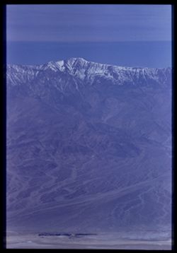
- Snow, Valleys, Telescope Peak (Inyo County, Calif.), Dantes View (Calif.), Mountains, and Death Valley (Calif. and Nev.)
- Series:
- 8-55
- Creator:
- Cushman, Charles W., 1896-1972
- Date Created:
- 1955-03-22
- Genre:
- Landscape photographs
- Frame Number:
- 26
- County:
- Inyo
- Abstract:
- Tel. Pk [P]
- Call Number:
- P07784
- Country:
- United States
- State/Province:
- California
- Physical Description:
- Image was originally mounted in a glass enclosure. Before digitization, the image was removed and placed in a Wess Plastic, Inc. brand, 2" x 2", pl...
- Alternate Identifier:
- 855.26
- Persistent URL:
- http://purl.dlib.indiana.edu/iudl/archives/cushman/P07784
- Holding Location:
- Bloomington - University Archives
Wells Library E460
1320 E 10th St.
Bloomington, IN 47405
Contact at archives@indiana.edu, 812-855-1127
-
- Description:
- 100 f 8 tl
- Subject:
- Rocks, Roads, Dantes View (Calif.), Mountains, and Black Mountains (Inyo County, Calif.)
- Series:
- 8-55
- Creator:
- Cushman, Charles W., 1896-1972
- Date Created:
- 1955-03-22
- Genre:
- Landscape photographs
- Frame Number:
- 25
- County:
- Inyo
- Abstract:
- Marbled ridge down to NW
- Call Number:
- P07783
- Country:
- United States
- State/Province:
- California
- Alternate Identifier:
- 855.25
- Persistent URL:
- http://purl.dlib.indiana.edu/iudl/archives/cushman/P07783
- Holding Location:
- Bloomington - University Archives
Wells Library E460
1320 E 10th St.
Bloomington, IN 47405
Contact at archives@indiana.edu, 812-855-1127
-
- Description:
- 100 f 8 tl
- Subject:
- Snow, Valleys, Telescope Peak (Inyo County, Calif.), Dantes View (Calif.), and Mountains
- Series:
- 8-55
- Creator:
- Cushman, Charles W., 1896-1972
- Date Created:
- 1955-03-22
- Genre:
- Landscape photographs
- Frame Number:
- 23
- County:
- Inyo
- Abstract:
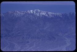
- Telescope Peak. 11045 ft.
- Call Number:
- P07781
- Country:
- United States
- State/Province:
- California
- Alternate Identifier:
- 855.23
- Persistent URL:
- http://purl.dlib.indiana.edu/iudl/archives/cushman/P07781
- Holding Location:
- Bloomington - University Archives
Wells Library E460
1320 E 10th St.
Bloomington, IN 47405
Contact at archives@indiana.edu, 812-855-1127
-
- Description:
- 100 f 8 tl
- Subject:
- Rocks, Valleys, Mountains, Shrubs, Death Valley (Calif. and Nev.), Black Mountains (Inyo County, Calif.), and Hills
- Series:
- 8-55
- Creator:
- Cushman, Charles W., 1896-1972
- Date Created:
- 1955-03-22
- Genre:
- Landscape photographs
- Frame Number:
- 22
- Street Address:
- Dante's View Road
- County:
- Inyo
- Abstract:
- colored rock in valley from closer (along Dante's V. rd.
- Call Number:
- P07780
- Country:
- United States
- State/Province:
- California
- Alternate Identifier:
- 855.22
- Persistent URL:
- http://purl.dlib.indiana.edu/iudl/archives/cushman/P07780
- Holding Location:
- Bloomington - University Archives
Wells Library E460
1320 E 10th St.
Bloomington, IN 47405
Contact at archives@indiana.edu, 812-855-1127
-
- Description:
- 100 f 6.3 tl
- Subject:
- Rocks, Mountains, Death Valley (Calif. and Nev.), and Black Mountains (Inyo County, Calif.)
- Series:
- 8-55
- Creator:
- Cushman, Charles W., 1896-1972
- Date Created:
- 1955-03-22
- Genre:
- Landscape photographs
- Frame Number:
- 21
- Street Address:
- Dante's View Road
- County:
- Inyo
- Abstract:
- colored rock in valley from closer (along Dante's V. rd.
- Call Number:
- P07779
- Country:
- United States
- State/Province:
- California
- Alternate Identifier:
- 855.21
- Persistent URL:
- http://purl.dlib.indiana.edu/iudl/archives/cushman/P07779
- Holding Location:
- Bloomington - University Archives
Wells Library E460
1320 E 10th St.
Bloomington, IN 47405
Contact at archives@indiana.edu, 812-855-1127
-
- Description:
- 100 f 6.3 tl
- Subject:
- Valleys, Black Mountains (Inyo County, Calif.), Death Valley (Calif. and Nev.), Mountains, Shrubs, and Hills
- Series:
- 8-55
- Creator:
- Cushman, Charles W., 1896-1972
- Date Created:
- 1955-03-22
- Genre:
- Landscape photographs
- Frame Number:
- 20
- Street Address:
- California State Highway 190
- County:
- Inyo
- Abstract:
- From 18 mi out - west toward Black Mtns - colored rock in valley
- Call Number:
- P07778
- Country:
- United States
- State/Province:
- California
- Alternate Identifier:
- 855.20
- Persistent URL:
- http://purl.dlib.indiana.edu/iudl/archives/cushman/P07778
- Holding Location:
- Bloomington - University Archives
Wells Library E460
1320 E 10th St.
Bloomington, IN 47405
Contact at archives@indiana.edu, 812-855-1127
-
- Description:
- 100 f 8 tl
- Subject:
- Valleys, Funeral Mountains (Calif.), Pyramid Peak (Inyo County, Calif.), Mountains, Shrubs, and Death Valley (Calif. and Nev.)
- Series:
- 8-55
- Creator:
- Cushman, Charles W., 1896-1972
- Date Created:
- 1955-03-22
- Genre:
- Landscape photographs
- Frame Number:
- 19
- County:
- Inyo
- Abstract:
- Big rock candy mtn from 12 mi. out probably Pyramid Pk
- Call Number:
- P07777
- Country:
- United States
- State/Province:
- California
- Alternate Identifier:
- 855.19
- Persistent URL:
- http://purl.dlib.indiana.edu/iudl/archives/cushman/P07777
- Holding Location:
- Bloomington - University Archives
Wells Library E460
1320 E 10th St.
Bloomington, IN 47405
Contact at archives@indiana.edu, 812-855-1127
-
- Description:
- 100 f 8 tl
- Subject:
- Funeral Mountains (Calif.), Mountains, and Shrubs
- Series:
- 8-55
- Creator:
- Cushman, Charles W., 1896-1972
- Date Created:
- 1955-03-22
- Genre:
- Landscape photographs
- Frame Number:
- 18
- Street Address:
- California State Highway 190
- County:
- Inyo
- Abstract:
- Colorful mtns north of pt 10 mi west of DV Junctn
- Call Number:
- P07776
- City:
- Death Valley Junction
- Country:
- United States
- State/Province:
- California
- Alternate Identifier:
- 855.18
- Persistent URL:
- http://purl.dlib.indiana.edu/iudl/archives/cushman/P07776
- Holding Location:
- Bloomington - University Archives
Wells Library E460
1320 E 10th St.
Bloomington, IN 47405
Contact at archives@indiana.edu, 812-855-1127
-

- Description:
- 50 f 4 tl
- Subject:
- H-bomb, Bombs, Explosions, Clouds, and Hydrogen bomb
- Series:
- 8-55
- Creator:
- Cushman, Charles W., 1896-1972
- Date Created:
- 1955-03-22
- Frame Number:
- 17
- County:
- Inyo
- Abstract:
- H Bomb cloud 15 minutes after explosion - seen from Death Valley Junctn
- Call Number:
- P07775
- City:
- Death Valley Junction
- Country:
- United States
- State/Province:
- California
- Alternate Identifier:
- 855.17
- Persistent URL:
- http://purl.dlib.indiana.edu/iudl/archives/cushman/P07775
- Holding Location:
- Bloomington - University Archives
Wells Library E460
1320 E 10th St.
Bloomington, IN 47405
Contact at archives@indiana.edu, 812-855-1127
-

- Description:
- 100 f 4
- Subject:
- H-bomb, Bombs, Explosions, and Hydrogen bomb
- Series:
- 8-55
- Creator:
- Cushman, Charles W., 1896-1972
- Date Created:
- 1955-03-22
- Frame Number:
- 16
- County:
- Inyo
- Abstract:
- H Bomb cloud 15 minutes after explosion - seen from Death Valley Junctn
- Call Number:
- P07774
- City:
- Death Valley Junction
- Country:
- United States
- State/Province:
- California
- Alternate Identifier:
- 855.16
- Persistent URL:
- http://purl.dlib.indiana.edu/iudl/archives/cushman/P07774
- Holding Location:
- Bloomington - University Archives
Wells Library E460
1320 E 10th St.
Bloomington, IN 47405
Contact at archives@indiana.edu, 812-855-1127
-
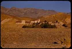
- Description:
- 100 f 5.6
- Subject:
- Valleys, Trees, Mountains, Furnace Creek Inn (Death Valley Junction, Calif.), Hotels, Hills, Funeral Mountains (Calif.), Shrubs, and Death Valley (Calif. and...
- Series:
- 8-55
- Creator:
- Cushman, Charles W., 1896-1972
- Date Created:
- 1955-03-21
- Genre:
- Architectural photographs
- Frame Number:
- 15
- County:
- Inyo
- Abstract:
- Furnace Cr Inn
- Call Number:
- P07773
- City:
- Death Valley Junction
- Country:
- United States
- State/Province:
- California
- Alternate Identifier:
- 855.15
- Persistent URL:
- http://purl.dlib.indiana.edu/iudl/archives/cushman/P07773
- Holding Location:
- Bloomington - University Archives
Wells Library E460
1320 E 10th St.
Bloomington, IN 47405
Contact at archives@indiana.edu, 812-855-1127
-
- Description:
- 100 f 5.6 tl
- Subject:
- Rocks, Valleys, Funeral Mountains (Calif.), Mountains, Shrubs, Death Valley (Calif. and Nev.), and Furnace Creek Inn (Death Valley Junction, Calif.)
- Series:
- 8-55
- Creator:
- Cushman, Charles W., 1896-1972
- Date Created:
- 1955-03-21
- Genre:
- Landscape photographs
- Frame Number:
- 14
- County:
- Inyo
- Abstract:
- Funeral mtns just north of Furnace CR Inn
- Call Number:
- P07772
- City:
- Death Valley Junction
- Country:
- United States
- State/Province:
- California
- Alternate Identifier:
- 855.14
- Persistent URL:
- http://purl.dlib.indiana.edu/iudl/archives/cushman/P07772
- Holding Location:
- Bloomington - University Archives
Wells Library E460
1320 E 10th St.
Bloomington, IN 47405
Contact at archives@indiana.edu, 812-855-1127
-
- Description:
- 100 f 6.3 tl
- Subject:
- Hibiscus, Valleys, Death Valley (Calif. and Nev.), Funeral Mountains (Calif.), Mountains, Shrubs, and Furnace Creek Ranch
- Series:
- 8-55
- Creator:
- Cushman, Charles W., 1896-1972
- Date Created:
- 1955-03-21
- Genre:
- Landscape photographs
- Frame Number:
- 13
- County:
- Inyo
- Abstract:
- Funeral Mtns east of Furnace Creek Ranch at 5:30 pm
- Call Number:
- P07771
- Country:
- United States
- State/Province:
- California
- Alternate Identifier:
- 855.13
- Persistent URL:
- http://purl.dlib.indiana.edu/iudl/archives/cushman/P07771
- Holding Location:
- Bloomington - University Archives
Wells Library E460
1320 E 10th St.
Bloomington, IN 47405
Contact at archives@indiana.edu, 812-855-1127
-
- Description:
- 100 f 6.3 tl
- Subject:
- Valleys, Mountains, Shrubs, Death Valley (Calif. and Nev.), Black Mountains (Inyo County, Calif.), and Salt flats
- Series:
- 8-55
- Creator:
- Cushman, Charles W., 1896-1972
- Date Created:
- 1955-03-21
- Genre:
- Landscape photographs
- Frame Number:
- 12
- Street Address:
- Sand Dune Junction, Bealty Road, California State Highway 190, and Scotty Castle Road
- County:
- Inyo
- Abstract:
- View southeast in late afternoon toward Black Mtns from near Sand Dune junction of 190 & [Bealty] road & Scotty Castle road
- Call Number:
- P07770
- Country:
- United States
- State/Province:
- California
- Alternate Identifier:
- 855.12
- Persistent URL:
- http://purl.dlib.indiana.edu/iudl/archives/cushman/P07770
- Holding Location:
- Bloomington - University Archives
Wells Library E460
1320 E 10th St.
Bloomington, IN 47405
Contact at archives@indiana.edu, 812-855-1127
-
- Description:
- 100 f 9 tl
- Subject:
- Devils Cornfield (Calif.), Valleys, Grapevine Mountains (Calif. and Nev.), Mountains, Shrubs, Death Valley (Calif. and Nev.), Amargosa Range (Nev. and Calif....
- Series:
- 8-55
- Creator:
- Cushman, Charles W., 1896-1972
- Date Created:
- 1955-03-21
- Genre:
- Landscape photographs
- Frame Number:
- 10
- County:
- Inyo
- Abstract:
- Folded rocks of Grapevine Mtns of Amargosa range and Devil's cornfield
- Call Number:
- P07769
- City:
- Stovepipe Wells
- Country:
- United States
- State/Province:
- California
- Alternate Identifier:
- 855.10
- Persistent URL:
- http://purl.dlib.indiana.edu/iudl/archives/cushman/P07769
- Holding Location:
- Bloomington - University Archives
Wells Library E460
1320 E 10th St.
Bloomington, IN 47405
Contact at archives@indiana.edu, 812-855-1127
-
- Description:
- 100 f 6.3 tl
- Subject:
- Valleys, Stovepipe Wells Hotel (Stovepipe Wells, Calif.), Buttes, and Death Valley (Calif. and Nev.)
- Series:
- 8-55
- Creator:
- Cushman, Charles W., 1896-1972
- Date Created:
- 1955-03-21
- Genre:
- Landscape photographs
- Frame Number:
- 9
- Street Address:
- California State Highway 190
- County:
- Inyo
- Abstract:
- [Treenish] Buttes a few miles east of SPW Hotel
- Call Number:
- P07768
- City:
- Stovepipe Wells
- Country:
- United States
- State/Province:
- California
- Alternate Identifier:
- 855.9
- Persistent URL:
- http://purl.dlib.indiana.edu/iudl/archives/cushman/P07768
- Holding Location:
- Bloomington - University Archives
Wells Library E460
1320 E 10th St.
Bloomington, IN 47405
Contact at archives@indiana.edu, 812-855-1127
-
- Description:
- 100 f 6.3 tl
- Subject:
- Valleys, Buttes, Stovepipe Wells Hotel (Stovepipe Wells, Calif.), Traffic signs & signals, and Death Valley (Calif. and Nev.)
- Series:
- 8-55
- Creator:
- Cushman, Charles W., 1896-1972
- Date Created:
- 1955-03-21
- Genre:
- Landscape photographs
- Frame Number:
- 8
- Street Address:
- California State Highway 190
- County:
- Inyo
- Abstract:
- [Treenish] Buttes a few miles east of SPW hotel
- Call Number:
- P07767
- City:
- Stovepipe Wells
- Country:
- United States
- State/Province:
- California
- Physical Description:
- masked.
- Alternate Identifier:
- 855.8
- Persistent URL:
- http://purl.dlib.indiana.edu/iudl/archives/cushman/P07767
- Holding Location:
- Bloomington - University Archives
Wells Library E460
1320 E 10th St.
Bloomington, IN 47405
Contact at archives@indiana.edu, 812-855-1127
-
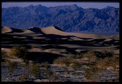
- Description:
- 100 f 6.3 tl
- Subject:
- Rocks, Valleys, Grapevine Mountains (Calif. and Nev.), Dunes, Mountains, Shrubs, and Death Valley (Calif. and Nev.)
- Series:
- 8-55
- Creator:
- Cushman, Charles W., 1896-1972
- Date Created:
- 1955-03-21
- Genre:
- Landscape photographs
- Frame Number:
- 6
- County:
- Inyo
- Abstract:
- S Sand dunes and Grapevine Mtns. north of road a mile or 2 e. of S.P.W. SD
- Call Number:
- P07766
- City:
- Stovepipe Wells
- Country:
- United States
- State/Province:
- California
- Physical Description:
- Image was originally mounted in a glass enclosure. Before digitization, the image was removed and placed in a Wess Plastic, Inc. brand, 2" x 2", pl...
- Alternate Identifier:
- 855.6
- Persistent URL:
- http://purl.dlib.indiana.edu/iudl/archives/cushman/P07766
- Holding Location:
- Bloomington - University Archives
Wells Library E460
1320 E 10th St.
Bloomington, IN 47405
Contact at archives@indiana.edu, 812-855-1127
-
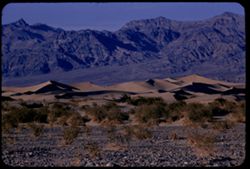
- Description:
- 100 f 8 tl
- Subject:
- Valleys, Hills, Grapevine Mountains (Calif. and Nev.), Death Valley (Calif. and Nev.), Mountains, Shrubs, Rocks, and Dunes
- Series:
- 8-55
- Creator:
- Cushman, Charles W., 1896-1972
- Date Created:
- 1955-03-21
- Genre:
- Landscape photographs
- Frame Number:
- 5
- County:
- Inyo
- Abstract:
- S Sand dunes and Grapevine Mtns. north of road a mile or 2 e. of S.P.W. SD
- Call Number:
- P07765
- City:
- Stovepipe Wells
- Country:
- United States
- State/Province:
- California
- Alternate Identifier:
- 855.5
- Persistent URL:
- http://purl.dlib.indiana.edu/iudl/archives/cushman/P07765
- Holding Location:
- Bloomington - University Archives
Wells Library E460
1320 E 10th St.
Bloomington, IN 47405
Contact at archives@indiana.edu, 812-855-1127
-
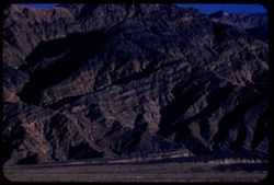
- Description:
- 100 f 6.3 tl
- Subject:
- Valleys, Death Valley (Calif. and Nev.), Mountains, and Tucki Mountain (Calif.)
- Series:
- 8-55
- Creator:
- Cushman, Charles W., 1896-1972
- Date Created:
- 1955-03-21
- Genre:
- Landscape photographs
- Frame Number:
- 3
- Street Address:
- California State Highway 190
- County:
- Inyo
- Abstract:
- South toward Tucki Mtn from near Stovepipe Wells
- Call Number:
- P07764
- City:
- Stovepipe Wells
- Country:
- United States
- State/Province:
- California
- Alternate Identifier:
- 855.3
- Persistent URL:
- http://purl.dlib.indiana.edu/iudl/archives/cushman/P07764
- Holding Location:
- Bloomington - University Archives
Wells Library E460
1320 E 10th St.
Bloomington, IN 47405
Contact at archives@indiana.edu, 812-855-1127
-
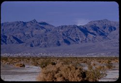
- Description:
- 100 f 6.3
- Subject:
- Valleys, Grapevine Mountains (Calif. and Nev.), Mountains, Shrubs, Clouds, Death Valley (Calif. and Nev.), and Amargosa Range (Nev. and Calif.)
- Series:
- 8-55
- Creator:
- Cushman, Charles W., 1896-1972
- Date Created:
- 1955-03-21
- Genre:
- Landscape photographs
- Frame Number:
- 2
- Street Address:
- California State Highway 190
- County:
- Inyo
- Abstract:
- NE toward Grapevine Mtns of Amargosa Range from near Stovepipe Wells
- Call Number:
- P07763
- City:
- Stovepipe Wells
- Country:
- United States
- State/Province:
- California
- Alternate Identifier:
- 855.2
- Persistent URL:
- http://purl.dlib.indiana.edu/iudl/archives/cushman/P07763
- Holding Location:
- Bloomington - University Archives
Wells Library E460
1320 E 10th St.
Bloomington, IN 47405
Contact at archives@indiana.edu, 812-855-1127
-
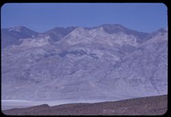
- Description:
- 100 f 6.3 tl
- Subject:
- Valleys, Panamint Range (Calif.), Fog, Emigrant Pass (Inyo County, Calif.), Mountains, Panamint Valley (Calif.), and Telescope Peak (Inyo County, Calif.)
- Series:
- 7-55
- Creator:
- Cushman, Charles W., 1896-1972
- Date Created:
- 1955-03-21
- Genre:
- Landscape photographs
- Frame Number:
- 36
- County:
- Inyo
- Abstract:
- Panamints south of Telescope
- Call Number:
- P07760
- Country:
- United States
- State/Province:
- California
- Alternate Identifier:
- 755.36
- Persistent URL:
- http://purl.dlib.indiana.edu/iudl/archives/cushman/P07760
- Holding Location:
- Bloomington - University Archives
Wells Library E460
1320 E 10th St.
Bloomington, IN 47405
Contact at archives@indiana.edu, 812-855-1127
-
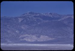
- Description:
- 100 f 6.3 tl
- Subject:
- Valleys, Fog, Emigrant Pass (Inyo County, Calif.), Mountains, Panamint Valley (Calif.), and Telescope Peak (Inyo County, Calif.)
- Series:
- 7-55
- Creator:
- Cushman, Charles W., 1896-1972
- Date Created:
- 1955-03-21
- Genre:
- Landscape photographs
- Frame Number:
- 35
- County:
- Inyo
- Abstract:
- Telescope Pk.
- Call Number:
- P07759
- Country:
- United States
- State/Province:
- California
- Alternate Identifier:
- 755.35
- Persistent URL:
- http://purl.dlib.indiana.edu/iudl/archives/cushman/P07759
- Holding Location:
- Bloomington - University Archives
Wells Library E460
1320 E 10th St.
Bloomington, IN 47405
Contact at archives@indiana.edu, 812-855-1127
-
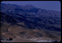
- Description:
- 100 f 8 tl
- Subject:
- Rocks, Valleys, Roads, Argus Range (Calif.), Emigrant Pass (Inyo County, Calif.), Mountains, Shrubs, and Panamint Valley (Calif.)
- Series:
- 7-55
- Creator:
- Cushman, Charles W., 1896-1972
- Date Created:
- 1955-03-21
- Genre:
- Landscape photographs
- Frame Number:
- 34
- County:
- Inyo
- Abstract:
- NW along Argus mtns at west side of Panamint Valley from Emigrant pass.
- Call Number:
- P07758
- Country:
- United States
- State/Province:
- California
- Alternate Identifier:
- 755.34
- Persistent URL:
- http://purl.dlib.indiana.edu/iudl/archives/cushman/P07758
- Holding Location:
- Bloomington - University Archives
Wells Library E460
1320 E 10th St.
Bloomington, IN 47405
Contact at archives@indiana.edu, 812-855-1127
-
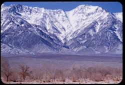
- Description:
- 100 f 5.6
- Subject:
- Snow, Valleys, Trees, Mountains, Williamson, Mount (Inyo County, Calif.), Shrubs, and Sierra Nevada (Calif. and Nev.)
- Series:
- 4-55
- Creator:
- Cushman, Charles W., 1896-1972
- Date Created:
- 1955-02-28
- Genre:
- Landscape photographs
- Frame Number:
- 13
- Street Address:
- United States Highway 6
- County:
- Inyo
- Abstract:
- Mtns north of Williamson
- Call Number:
- P07640
- Country:
- United States
- State/Province:
- California
- Alternate Identifier:
- 455.13
- Persistent URL:
- http://purl.dlib.indiana.edu/iudl/archives/cushman/P07640
- Holding Location:
- Bloomington - University Archives
Wells Library E460
1320 E 10th St.
Bloomington, IN 47405
Contact at archives@indiana.edu, 812-855-1127
-
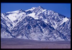
- Description:
- 100 f 6.3.tl
- Subject:
- Valleys, Williamson, Mount (Inyo County, Calif.), Mountains, and Snow
- Series:
- 4-55
- Creator:
- Cushman, Charles W., 1896-1972
- Date Created:
- 1955-02-28
- Genre:
- Landscape photographs
- Frame Number:
- 12
- Street Address:
- United States Highway 6
- County:
- Inyo
- Abstract:
- S Mt Williamson (14,384')
- Call Number:
- P07639
- Country:
- United States
- State/Province:
- California
- Physical Description:
- Image was originally mounted in a glass enclosure. Before digitization, the image was removed and placed in a Wess Plastic, Inc. brand, 2" x 2", pl...
- Alternate Identifier:
- 455.12
- Persistent URL:
- http://purl.dlib.indiana.edu/iudl/archives/cushman/P07639
- Holding Location:
- Bloomington - University Archives
Wells Library E460
1320 E 10th St.
Bloomington, IN 47405
Contact at archives@indiana.edu, 812-855-1127
-
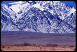
- Description:
- 100 f 6.3 tl
- Subject:
- Snow, Valleys, Trees, Mountains, Williamson, Mount (Inyo County, Calif.), Shrubs, and Whitney, Mount (Calif.)
- Series:
- 4-55
- Creator:
- Cushman, Charles W., 1896-1972
- Date Created:
- 1955-02-28
- Genre:
- Landscape photographs
- Frame Number:
- 10
- County:
- Inyo
- Abstract:
- High peak Mt. Williamson of Independence 14,384 ft.
- Call Number:
- P07638
- City:
- Independence
- Country:
- United States
- State/Province:
- California
- Alternate Identifier:
- 455.10
- Persistent URL:
- http://purl.dlib.indiana.edu/iudl/archives/cushman/P07638
- Holding Location:
- Bloomington - University Archives
Wells Library E460
1320 E 10th St.
Bloomington, IN 47405
Contact at archives@indiana.edu, 812-855-1127
-
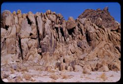
- Description:
- 100 f 8 tl
- Subject:
- Rocks, Boulders, Shrubs, Hills, Alabama Hills (Calif.), and Rock formations
- Series:
- 4-55
- Creator:
- Cushman, Charles W., 1896-1972
- Date Created:
- 1955-02-28
- Genre:
- Landscape photographs
- Frame Number:
- 9
- County:
- Inyo
- Abstract:
- Another odd formation in Alabama Hills
- Call Number:
- P07637
- City:
- Lone Pine
- Country:
- United States
- State/Province:
- California
- Alternate Identifier:
- 455.9
- Persistent URL:
- http://purl.dlib.indiana.edu/iudl/archives/cushman/P07637
- Holding Location:
- Bloomington - University Archives
Wells Library E460
1320 E 10th St.
Bloomington, IN 47405
Contact at archives@indiana.edu, 812-855-1127
-
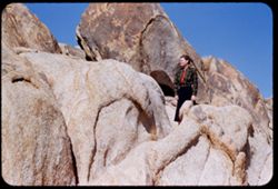
- Description:
- 100 f 6.3 tl
- Subject:
- Spouses, Women, Alabama Hills (Calif.), Hills, Shrubs, and Rock formations
- Series:
- 4-55
- Creator:
- Cushman, Charles W., 1896-1972
- Date Created:
- 1955-02-28
- Genre:
- Portraits
- Frame Number:
- 8
- County:
- Inyo
- Persons Pictured:
- Cushman, Jean
- Abstract:
- Inside the Alabama Hills
- Call Number:
- P07636
- City:
- Lone Pine
- Country:
- United States
- State/Province:
- California
- Alternate Identifier:
- 455.8
- Persistent URL:
- http://purl.dlib.indiana.edu/iudl/archives/cushman/P07636
- Holding Location:
- Bloomington - University Archives
Wells Library E460
1320 E 10th St.
Bloomington, IN 47405
Contact at archives@indiana.edu, 812-855-1127
-
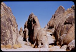
- Description:
- 100 f 6.3 tl
- Subject:
- Shrubs, Hills, Alabama Hills (Calif.), and Rock formations
- Series:
- 4-55
- Creator:
- Cushman, Charles W., 1896-1972
- Date Created:
- 1955-02-28
- Genre:
- Landscape photographs
- Frame Number:
- 7
- County:
- Inyo
- Abstract:
- Inside the Alabama Hills
- Call Number:
- P07635
- Country:
- United States
- State/Province:
- California
- Alternate Identifier:
- 455.7
- Persistent URL:
- http://purl.dlib.indiana.edu/iudl/archives/cushman/P07635
- Holding Location:
- Bloomington - University Archives
Wells Library E460
1320 E 10th St.
Bloomington, IN 47405
Contact at archives@indiana.edu, 812-855-1127
-
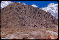
- Description:
- 100 f 8 tl
- Subject:
- Hills, Mountains, Shrubs, Snow, Boulders, Rocks, Fences, Sierra Nevada (Calif. and Nev.), and Alabama Hills (Calif.)
- Series:
- 4-55
- Creator:
- Cushman, Charles W., 1896-1972
- Date Created:
- 1955-02-28
- Genre:
- Landscape photographs
- Frame Number:
- 5
- County:
- Inyo
- Abstract:
- Ala Hills & back of roof of Sierra
- Call Number:
- P07633
- Country:
- United States
- State/Province:
- California
- Alternate Identifier:
- 455.5
- Persistent URL:
- http://purl.dlib.indiana.edu/iudl/archives/cushman/P07633
- Holding Location:
- Bloomington - University Archives
Wells Library E460
1320 E 10th St.
Bloomington, IN 47405
Contact at archives@indiana.edu, 812-855-1127
-
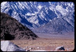
- Description:
- 100 f 5.6
- Subject:
- Snow, Valleys, Trees, Lone Pine Peak (Calif.), Mountains, Shrubs, Sierra Nevada (Calif. and Nev.), Hills, and Rocks
- Series:
- 4-55
- Creator:
- Cushman, Charles W., 1896-1972
- Date Created:
- 1955-02-28
- Genre:
- Landscape photographs
- Frame Number:
- 6
- County:
- Inyo
- Abstract:
- Sierra south of Lone Pine Pk
- Call Number:
- P07634
- Country:
- United States
- State/Province:
- California
- Alternate Identifier:
- 455.6
- Persistent URL:
- http://purl.dlib.indiana.edu/iudl/archives/cushman/P07634
- Holding Location:
- Bloomington - University Archives
Wells Library E460
1320 E 10th St.
Bloomington, IN 47405
Contact at archives@indiana.edu, 812-855-1127
-
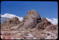
- Description:
- 100 f 5.6 tl
- Subject:
- Hills, Mountains, Sierra Nevada (Calif. and Nev.), Alabama Hills (Calif.), Rock formations, and Snow
- Series:
- 4-55
- Creator:
- Cushman, Charles W., 1896-1972
- Date Created:
- 1955-02-28
- Genre:
- Landscape photographs
- Frame Number:
- 4
- County:
- Inyo
- Abstract:
- In alabama Hills
- Call Number:
- P07632
- City:
- Lone Pine
- Country:
- United States
- State/Province:
- California
- Alternate Identifier:
- 455.4
- Persistent URL:
- http://purl.dlib.indiana.edu/iudl/archives/cushman/P07632
- Holding Location:
- Bloomington - University Archives
Wells Library E460
1320 E 10th St.
Bloomington, IN 47405
Contact at archives@indiana.edu, 812-855-1127
-
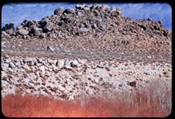
- Description:
- 100 f 5.6 tl
- Subject:
- Hills, Mounds (Landforms), Mountains, Shrubs, Trees, Alabama Hills (Calif.), Boulders, and Rocks
- Series:
- 4-55
- Creator:
- Cushman, Charles W., 1896-1972
- Date Created:
- 1955-02-28
- Genre:
- Landscape photographs
- Frame Number:
- 2
- County:
- Inyo
- Abstract:
- Mound of boulders = Alabama Hills
- Call Number:
- P07631
- City:
- Lone Pine
- Country:
- United States
- State/Province:
- California
- Alternate Identifier:
- 455.2
- Persistent URL:
- http://purl.dlib.indiana.edu/iudl/archives/cushman/P07631
- Holding Location:
- Bloomington - University Archives
Wells Library E460
1320 E 10th St.
Bloomington, IN 47405
Contact at archives@indiana.edu, 812-855-1127
-
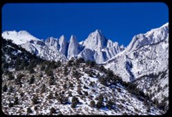
- Description:
- 100 f 9 tl
- Subject:
- Valleys, Whitney, Mount (Calif.), Mountains, Shrubs, Snow, Trees, Rocks, and Rock formations
- Series:
- 3-55
- Creator:
- Cushman, Charles W., 1896-1972
- Date Created:
- 1955-02-28
- Genre:
- Landscape photographs
- Frame Number:
- 38
- County:
- Inyo
- Abstract:
- Mt. Whitney
- Call Number:
- P07629
- Country:
- United States
- State/Province:
- California
- Alternate Identifier:
- 355.38
- Persistent URL:
- http://purl.dlib.indiana.edu/iudl/archives/cushman/P07629
- Holding Location:
- Bloomington - University Archives
Wells Library E460
1320 E 10th St.
Bloomington, IN 47405
Contact at archives@indiana.edu, 812-855-1127
- « Previous
- Next »
- 1
- 2
- 3
- 4