
Search Constraints
You searched for:
Campus
IUB
Remove constraint Campus: IUB
County
Inyo
Remove constraint County: Inyo
« Previous |
1 - 100 of 345
|
Next »
Search Results
-
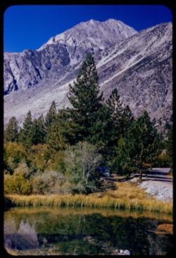
- Description:
- 50 f 9
- Subject:
- Bodies of water, Mountains, Trees, Shrubs, Lakes & ponds, Reflections, and Sierra Nevada (Calif. and Nev.)
- Series:
- 12-54
- Creator:
- Cushman, Charles W., 1896-1972
- Date Created:
- 1954-09-18
- Genre:
- Landscape photographs
- Frame Number:
- 9
- Street Address:
- Glacier Lodge Road
- County:
- Inyo
- Abstract:
- Same peak - with pool + pine.
- Call Number:
- P07399
- City:
- Big Pine
- Country:
- United States
- State/Province:
- California
- Alternate Identifier:
- 1254.9
- Persistent URL:
- http://purl.dlib.indiana.edu/iudl/archives/cushman/P07399
- Holding Location:
- Bloomington - University Archives
Wells Library E460
1320 E 10th St.
Bloomington, IN 47405
Contact at archives@indiana.edu, 812-855-1127
-
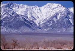
- Description:
- 100 f 5.6
- Subject:
- Snow, Valleys, Trees, Mountains, Williamson, Mount (Inyo County, Calif.), Shrubs, and Sierra Nevada (Calif. and Nev.)
- Series:
- 4-55
- Creator:
- Cushman, Charles W., 1896-1972
- Date Created:
- 1955-02-28
- Genre:
- Landscape photographs
- Frame Number:
- 13
- Street Address:
- United States Highway 6
- County:
- Inyo
- Abstract:
- Mtns north of Williamson
- Call Number:
- P07640
- Country:
- United States
- State/Province:
- California
- Alternate Identifier:
- 455.13
- Persistent URL:
- http://purl.dlib.indiana.edu/iudl/archives/cushman/P07640
- Holding Location:
- Bloomington - University Archives
Wells Library E460
1320 E 10th St.
Bloomington, IN 47405
Contact at archives@indiana.edu, 812-855-1127
-
- Description:
- 100 f 8 tl
- Subject:
- Furnace Creek Inn (Death Valley Junction, Calif.), Death Valley (Calif. and Nev.), Shrubs, Rocks, and Mesquite
- Series:
- 9-55
- Creator:
- Cushman, Charles W., 1896-1972
- Date Created:
- 1955-03-22
- Genre:
- Identification photographs
- Frame Number:
- 24
- County:
- Inyo
- Abstract:
- Mesquite nr. Furnace Creek Inn
- Call Number:
- P07815
- City:
- Death Valley Junction
- Country:
- United States
- State/Province:
- California
- Physical Description:
- masked.
- Alternate Identifier:
- 955.24
- Persistent URL:
- http://purl.dlib.indiana.edu/iudl/archives/cushman/P07815
- Holding Location:
- Bloomington - University Archives
Wells Library E460
1320 E 10th St.
Bloomington, IN 47405
Contact at archives@indiana.edu, 812-855-1127
-
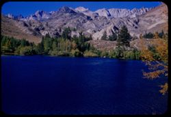
- Description:
- 50 f 11
- Subject:
- Sabrina, Lake (Calif.), Lakes & ponds, Bodies of water, Mountains, Shrubs, and Trees
- Series:
- 11-54
- Creator:
- Cushman, Charles W., 1896-1972
- Date Created:
- 1954-09-17
- Genre:
- Landscape photographs
- Frame Number:
- 7
- County:
- Inyo
- Abstract:
- Across little lake to high Sierra.
- Call Number:
- P07376
- City:
- Bishop
- Country:
- United States
- State/Province:
- California
- Alternate Identifier:
- 1154.7
- Persistent URL:
- http://purl.dlib.indiana.edu/iudl/archives/cushman/P07376
- Holding Location:
- Bloomington - University Archives
Wells Library E460
1320 E 10th St.
Bloomington, IN 47405
Contact at archives@indiana.edu, 812-855-1127
-
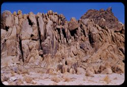
- Description:
- 100 f 8 tl
- Subject:
- Rocks, Boulders, Shrubs, Hills, Alabama Hills (Calif.), and Rock formations
- Series:
- 4-55
- Creator:
- Cushman, Charles W., 1896-1972
- Date Created:
- 1955-02-28
- Genre:
- Landscape photographs
- Frame Number:
- 9
- County:
- Inyo
- Abstract:
- Another odd formation in Alabama Hills
- Call Number:
- P07637
- City:
- Lone Pine
- Country:
- United States
- State/Province:
- California
- Alternate Identifier:
- 455.9
- Persistent URL:
- http://purl.dlib.indiana.edu/iudl/archives/cushman/P07637
- Holding Location:
- Bloomington - University Archives
Wells Library E460
1320 E 10th St.
Bloomington, IN 47405
Contact at archives@indiana.edu, 812-855-1127
-
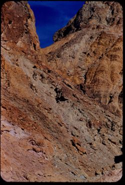
- Description:
- 100 F 8 tl
- Subject:
- Rocks, Twenty Mule Team Canyon (Calif.), Canyons, Mountains, Rock formations, and Death Valley National Park (Calif. and Nev.)
- Series:
- 10-55
- Creator:
- Cushman, Charles W., 1896-1972
- Date Created:
- 1955-03-23
- Genre:
- Landscape photographs
- Frame Number:
- 37
- County:
- Inyo
- Abstract:
- In 20 Mule Team canyon
- Call Number:
- P07861
- Country:
- United States
- State/Province:
- California
- Alternate Identifier:
- 1055.37
- Persistent URL:
- http://purl.dlib.indiana.edu/iudl/archives/cushman/P07861
- Holding Location:
- Bloomington - University Archives
Wells Library E460
1320 E 10th St.
Bloomington, IN 47405
Contact at archives@indiana.edu, 812-855-1127
-
- Description:
- 100 f 8+ tl
- Subject:
- Rocks, Valleys, Mountains, and Death Valley National Park (Calif. and Nev.)
- Series:
- 10-55
- Creator:
- Cushman, Charles W., 1896-1972
- Date Created:
- 1955-03-22
- Frame Number:
- 1
- Street Address:
- Artist's View Drive
- County:
- Inyo
- Abstract:
- From top of Artists Drive
- Call Number:
- P07829
- Country:
- United States
- State/Province:
- California
- Alternate Identifier:
- 1055.1
- Persistent URL:
- http://purl.dlib.indiana.edu/iudl/archives/cushman/P07829
- Holding Location:
- Bloomington - University Archives
Wells Library E460
1320 E 10th St.
Bloomington, IN 47405
Contact at archives@indiana.edu, 812-855-1127
-
- Description:
- 100 f 8+ tl
- Subject:
- Rocks, Mountains, Clouds, and Death Valley National Park (Calif. and Nev.)
- Series:
- 10-55
- Creator:
- Cushman, Charles W., 1896-1972
- Date Created:
- 1955-03-22
- Frame Number:
- 2
- Street Address:
- Artist's View Drive
- County:
- Inyo
- Abstract:
- From top of Artists Drive
- Call Number:
- P07830
- Country:
- United States
- State/Province:
- California
- Alternate Identifier:
- 1055.2
- Persistent URL:
- http://purl.dlib.indiana.edu/iudl/archives/cushman/P07830
- Holding Location:
- Bloomington - University Archives
Wells Library E460
1320 E 10th St.
Bloomington, IN 47405
Contact at archives@indiana.edu, 812-855-1127
-
- Description:
- 100 f 6.3 tl
- Subject:
- Zabriskie Point (Calif.), Telescope Peak (Inyo County, Calif.), Mountains, and Snow
- Series:
- 10-55
- Creator:
- Cushman, Charles W., 1896-1972
- Date Created:
- 1955-03-23
- Genre:
- Landscape photographs
- Frame Number:
- 29
- County:
- Inyo
- Abstract:
- South from Zab. Pt
- Call Number:
- P07854
- Country:
- United States
- State/Province:
- California
- Alternate Identifier:
- 1055.29
- Persistent URL:
- http://purl.dlib.indiana.edu/iudl/archives/cushman/P07854
- Holding Location:
- Bloomington - University Archives
Wells Library E460
1320 E 10th St.
Bloomington, IN 47405
Contact at archives@indiana.edu, 812-855-1127
-
- Description:
- 100 f 8 SL
- Subject:
- Houses, Plains, Owens Valley (Calif.), Mountains, Sierra Nevada (Calif. and Nev.), Hills, and Plants
- Series:
- 25-55
- Creator:
- Cushman, Charles W., 1896-1972
- Date Created:
- 1955-09-25
- Genre:
- Landscape photographs
- Frame Number:
- 35
- County:
- Inyo
- Abstract:
- And looking west
- Call Number:
- P08380
- City:
- Big Pine
- Country:
- United States
- State/Province:
- California
- Alternate Identifier:
- 2555.35
- Persistent URL:
- http://purl.dlib.indiana.edu/iudl/archives/cushman/P08380
- Holding Location:
- Bloomington - University Archives
Wells Library E460
1320 E 10th St.
Bloomington, IN 47405
Contact at archives@indiana.edu, 812-855-1127
-
- Description:
- 100 f 6.3 SL
- Subject:
- Plains, Owens Valley (Calif.), Mounds (Landforms), Mountains, Sierra Nevada (Calif. and Nev.), and Grasses
- Series:
- 25-55
- Creator:
- Cushman, Charles W., 1896-1972
- Date Created:
- 1955-09-25
- Genre:
- Landscape photographs
- Frame Number:
- 34
- County:
- Inyo
- Abstract:
- The whole view looking SW -
- Call Number:
- P08379
- City:
- Big Pine
- Country:
- United States
- State/Province:
- California
- Alternate Identifier:
- 2555.34
- Persistent URL:
- http://purl.dlib.indiana.edu/iudl/archives/cushman/P08379
- Holding Location:
- Bloomington - University Archives
Wells Library E460
1320 E 10th St.
Bloomington, IN 47405
Contact at archives@indiana.edu, 812-855-1127
-
- Description:
- 100 f 8 SL
- Subject:
- Grasses, Plains, Owens Valley (Calif.), Mountains, and Sierra Nevada (Calif. and Nev.)
- Series:
- 25-55
- Creator:
- Cushman, Charles W., 1896-1972
- Date Created:
- 1955-09-25
- Genre:
- Landscape photographs
- Frame Number:
- 36
- County:
- Inyo
- Abstract:
- The mtn with horizontal stripes - from 13 mi. so. Of Big Pine
- Call Number:
- P08381
- City:
- Big Pine
- Country:
- United States
- State/Province:
- California
- Alternate Identifier:
- 2555.36
- Persistent URL:
- http://purl.dlib.indiana.edu/iudl/archives/cushman/P08381
- Holding Location:
- Bloomington - University Archives
Wells Library E460
1320 E 10th St.
Bloomington, IN 47405
Contact at archives@indiana.edu, 812-855-1127
-
- Description:
- 100 f 6.3 TL
- Subject:
- Rocks, Owens Valley (Calif.), Mountains, Land, and Sierra Nevada (Calif. and Nev.)
- Series:
- 25-55
- Creator:
- Cushman, Charles W., 1896-1972
- Date Created:
- 1955-09-25
- Genre:
- Landscape photographs
- Frame Number:
- 33
- County:
- Inyo
- Abstract:
- Like a huge chocolate drop
- Call Number:
- P08378
- City:
- Big Pine
- Country:
- United States
- State/Province:
- California
- Alternate Identifier:
- 2555.33
- Persistent URL:
- http://purl.dlib.indiana.edu/iudl/archives/cushman/P08378
- Holding Location:
- Bloomington - University Archives
Wells Library E460
1320 E 10th St.
Bloomington, IN 47405
Contact at archives@indiana.edu, 812-855-1127
-
- Description:
- 100 f 8 tl
- Subject:
- Hills, Mountains, Death Valley National Park (Calif. and Nev.), Rocks, and Black Mountains (Inyo County, Calif.)
- Series:
- 9-55
- Creator:
- Cushman, Charles W., 1896-1972
- Date Created:
- 1955-03-22
- Frame Number:
- 35
- Street Address:
- Artist's View Drive
- County:
- Inyo
- Abstract:
- Above Artists Drive [P]
- Call Number:
- P07825
- Country:
- United States
- State/Province:
- California
- Alternate Identifier:
- 955.35
- Persistent URL:
- http://purl.dlib.indiana.edu/iudl/archives/cushman/P07825
- Holding Location:
- Bloomington - University Archives
Wells Library E460
1320 E 10th St.
Bloomington, IN 47405
Contact at archives@indiana.edu, 812-855-1127
-
- Description:
- 100 f 8 tl
- Subject:
- Rocks, Valleys, Mountains, Death Valley National Park (Calif. and Nev.), and Black Mountains (Inyo County, Calif.)
- Series:
- 9-55
- Creator:
- Cushman, Charles W., 1896-1972
- Date Created:
- 1955-03-22
- Frame Number:
- 36
- Street Address:
- Artist's View Drive
- County:
- Inyo
- Abstract:
- Aboave Artists Drive [P]
- Call Number:
- P07826
- Country:
- United States
- State/Province:
- California
- Alternate Identifier:
- 955.36
- Persistent URL:
- http://purl.dlib.indiana.edu/iudl/archives/cushman/P07826
- Holding Location:
- Bloomington - University Archives
Wells Library E460
1320 E 10th St.
Bloomington, IN 47405
Contact at archives@indiana.edu, 812-855-1127
-
- Description:
- 100 f 6.3 tl
- Subject:
- Rocks, Twenty Mule Team Canyon (Calif.), Canyons, Mountains, Rock formations, Death Valley National Park (Calif. and Nev.), and Valleys
- Series:
- 10-55
- Creator:
- Cushman, Charles W., 1896-1972
- Date Created:
- 1955-03-23
- Genre:
- Landscape photographs
- Frame Number:
- 34
- County:
- Inyo
- Abstract:
- Same canyon
- Call Number:
- P07859
- Country:
- United States
- State/Province:
- California
- Alternate Identifier:
- 1055.34
- Persistent URL:
- http://purl.dlib.indiana.edu/iudl/archives/cushman/P07859
- Holding Location:
- Bloomington - University Archives
Wells Library E460
1320 E 10th St.
Bloomington, IN 47405
Contact at archives@indiana.edu, 812-855-1127
-
- Description:
- 100 f 8 tl
- Subject:
- Mountains, Zabriskie Point (Calif.), and Hills
- Series:
- 10-55
- Creator:
- Cushman, Charles W., 1896-1972
- Date Created:
- 1955-03-23
- Genre:
- Landscape photographs
- Frame Number:
- 27
- County:
- Inyo
- Abstract:
- Down from below Zabriskie Pt
- Call Number:
- P07852
- Country:
- United States
- State/Province:
- California
- Alternate Identifier:
- 1055.27
- Persistent URL:
- http://purl.dlib.indiana.edu/iudl/archives/cushman/P07852
- Holding Location:
- Bloomington - University Archives
Wells Library E460
1320 E 10th St.
Bloomington, IN 47405
Contact at archives@indiana.edu, 812-855-1127
-
- Description:
- 100 f 8 tl
- Subject:
- Mountains, Zabriskie Point (Calif.), and Hills
- Series:
- 10-55
- Creator:
- Cushman, Charles W., 1896-1972
- Date Created:
- 1955-03-23
- Genre:
- Landscape photographs
- Frame Number:
- 26
- County:
- Inyo
- Abstract:
- Striped rock from Zabriskie Pt.
- Call Number:
- P07851
- Country:
- United States
- State/Province:
- California
- Alternate Identifier:
- 1055.26
- Persistent URL:
- http://purl.dlib.indiana.edu/iudl/archives/cushman/P07851
- Holding Location:
- Bloomington - University Archives
Wells Library E460
1320 E 10th St.
Bloomington, IN 47405
Contact at archives@indiana.edu, 812-855-1127
-
- Description:
- 100 f 8 tl
- Subject:
- Volcanic rock, Zabriskie Point (Calif.), and Hills
- Series:
- 10-55
- Creator:
- Cushman, Charles W., 1896-1972
- Date Created:
- 1955-03-23
- Frame Number:
- 28
- County:
- Inyo
- Abstract:
- Down from below Zabriskie Pt
- Call Number:
- P07853
- Country:
- United States
- State/Province:
- California
- Alternate Identifier:
- 1055.28
- Persistent URL:
- http://purl.dlib.indiana.edu/iudl/archives/cushman/P07853
- Holding Location:
- Bloomington - University Archives
Wells Library E460
1320 E 10th St.
Bloomington, IN 47405
Contact at archives@indiana.edu, 812-855-1127
-
- Description:
- 100 f 8 tl
- Subject:
- Sightseers, Castles & palaces, Death Valley (Calif. and Nev.), Scotty's Castle (Calif.), Roofs, Masonry, Windows, Arches, Flowerpots, and Shrubs
- Series:
- 11-55
- Creator:
- Cushman, Charles W., 1896-1972
- Date Created:
- 1955-03-23
- Genre:
- Architectural photographs
- Frame Number:
- 29
- County:
- Inyo
- Abstract:
- the Castle
- Call Number:
- P07888
- Country:
- United States
- State/Province:
- California
- Alternate Identifier:
- 1155.29
- Persistent URL:
- http://purl.dlib.indiana.edu/iudl/archives/cushman/P07888
- Holding Location:
- Bloomington - University Archives
Wells Library E460
1320 E 10th St.
Bloomington, IN 47405
Contact at archives@indiana.edu, 812-855-1127
-
- Description:
- 100 f 6.3 tl
- Subject:
- Rocks, Roads, Trails & paths, Mountains, Shrubs, Alabama Hills (Calif.), and Rock formations
- Series:
- 4-55
- Creator:
- Cushman, Charles W., 1896-1972
- Date Created:
- 1955-02-28
- Genre:
- Landscape photographs
- Frame Number:
- 1
- Street Address:
- Mount Whitney Road
- County:
- Inyo
- Abstract:
- Alabama Hills from Mt Whitney road
- Call Number:
- P07630
- Country:
- United States
- State/Province:
- California
- Alternate Identifier:
- 455.1
- Persistent URL:
- http://purl.dlib.indiana.edu/iudl/archives/cushman/P07630
- Holding Location:
- Bloomington - University Archives
Wells Library E460
1320 E 10th St.
Bloomington, IN 47405
Contact at archives@indiana.edu, 812-855-1127
-
- Description:
- 100 f 8
- Subject:
- Mountains, Rock formations, Clouds, Death Valley National Park (Calif. and Nev.), and Black Mountains (Inyo County, Calif.)
- Series:
- 9-55
- Creator:
- Cushman, Charles W., 1896-1972
- Date Created:
- 1955-03-22
- Genre:
- Landscape photographs
- Frame Number:
- 38
- Street Address:
- Artist's View Drive
- County:
- Inyo
- Abstract:
- From top of Artists Drive Death Valley Nat'l Mon
- Call Number:
- P07828
- Country:
- United States
- State/Province:
- California
- Alternate Identifier:
- 955.38
- Persistent URL:
- http://purl.dlib.indiana.edu/iudl/archives/cushman/P07828
- Holding Location:
- Bloomington - University Archives
Wells Library E460
1320 E 10th St.
Bloomington, IN 47405
Contact at archives@indiana.edu, 812-855-1127
-
- Description:
- 100 f 8 tl
- Subject:
- Mountains, Death Valley National Park (Calif. and Nev.), and Rock formations
- Series:
- 9-55
- Creator:
- Cushman, Charles W., 1896-1972
- Date Created:
- 1955-03-22
- Genre:
- Landscape photographs
- Frame Number:
- 37
- Street Address:
- Artist's View Drive
- County:
- Inyo
- Abstract:
- From top of Artists Drive
- Call Number:
- P07827
- Country:
- United States
- State/Province:
- California
- Alternate Identifier:
- 955.37
- Persistent URL:
- http://purl.dlib.indiana.edu/iudl/archives/cushman/P07827
- Holding Location:
- Bloomington - University Archives
Wells Library E460
1320 E 10th St.
Bloomington, IN 47405
Contact at archives@indiana.edu, 812-855-1127
-
- Description:
- 100 f 8 tl
- Subject:
- Twenty Mule Team Canyon (Calif.), Canyons, Mountains, Death Valley National Park (Calif. and Nev.), and Valleys
- Series:
- 10-55
- Creator:
- Cushman, Charles W., 1896-1972
- Date Created:
- 1955-03-23
- Genre:
- Landscape photographs
- Frame Number:
- 32
- County:
- Inyo
- Abstract:
- In 20 mule team canyon
- Call Number:
- P07857
- Country:
- United States
- State/Province:
- California
- Alternate Identifier:
- 1055.32
- Persistent URL:
- http://purl.dlib.indiana.edu/iudl/archives/cushman/P07857
- Holding Location:
- Bloomington - University Archives
Wells Library E460
1320 E 10th St.
Bloomington, IN 47405
Contact at archives@indiana.edu, 812-855-1127
-
- Description:
- 25 f 9
- Subject:
- Panamint Mountains (Calif.), Deserts, Panamint Range (Calif.), Rocks, Rock formations, Mountains, and Clouds
- Series:
- 14-52
- Creator:
- Cushman, Charles W., 1896-1972
- Date Created:
- 1952-04-07
- Genre:
- Landscape photographs
- Frame Number:
- 14
- County:
- Inyo and San Bernardino
- Abstract:
- White cloud + distant Panamint Mtns. from few miles south of Trona.
- Call Number:
- P05998
- City:
- Trona
- Country:
- United States
- State/Province:
- California
- Physical Description:
- Image was originally mounted in a glass enclosure. Before digitization, the image was removed and placed in a Wess Plastic, Inc. brand, 2" x 2", pl...
- Alternate Identifier:
- 1452.14
- Persistent URL:
- http://purl.dlib.indiana.edu/iudl/archives/cushman/P05998
- Holding Location:
- Bloomington - University Archives
Wells Library E460
1320 E 10th St.
Bloomington, IN 47405
Contact at archives@indiana.edu, 812-855-1127
-
- Description:
- 50 f 11
- Subject:
- Deserts, Valleys, White Mountains (Calif. and Nev.), Dirt roads, Sand, Owens Valley (Calif.), Mountains, Shrubs, Dwellings, and Farms
- Series:
- 11-54
- Creator:
- Cushman, Charles W., 1896-1972
- Date Created:
- 1954-09-17
- Genre:
- Landscape photographs
- Frame Number:
- 22
- County:
- Inyo
- Abstract:
- White Mtns. have color. In center should be White Mtn. (14,242 ft.)
- Call Number:
- P07391
- Country:
- United States
- State/Province:
- California
- Physical Description:
- Image was originally mounted in a glass enclosure. Before digitization, the image was removed and placed in a Wess Plastic, Inc. brand, 2" x 2", pl...
- Alternate Identifier:
- 1154.22
- Persistent URL:
- http://purl.dlib.indiana.edu/iudl/archives/cushman/P07391
- Holding Location:
- Bloomington - University Archives
Wells Library E460
1320 E 10th St.
Bloomington, IN 47405
Contact at archives@indiana.edu, 812-855-1127
-
- Description:
- 50 f 11 HF
- Subject:
- Valleys, Grasses, White Mountains (Calif. and Nev.), Trees, Owens Valley (Calif.), Mountains, and Shrubs
- Series:
- 11-54
- Creator:
- Cushman, Charles W., 1896-1972
- Date Created:
- 1954-09-17
- Genre:
- Landscape photographs
- Frame Number:
- 20
- County:
- Inyo
- Abstract:
- White Mtns east wall of Owens Valley with 2 bare trees.
- Call Number:
- P07389
- Country:
- United States
- State/Province:
- California and Nevada
- Alternate Identifier:
- 1154.20
- Persistent URL:
- http://purl.dlib.indiana.edu/iudl/archives/cushman/P07389
- Holding Location:
- Bloomington - University Archives
Wells Library E460
1320 E 10th St.
Bloomington, IN 47405
Contact at archives@indiana.edu, 812-855-1127
-
- Description:
- 100 f 4 tl
- Subject:
- Snow, Shadows, Mountains, Clouds, and White Mountain Peak (Inyo County, Calif.)
- Series:
- 26-55
- Creator:
- Cushman, Charles W., 1896-1972
- Date Created:
- 1955-09-25
- Genre:
- Landscape photographs
- Frame Number:
- 25
- County:
- Inyo
- Abstract:
- From US 6 NE of Bishop: White Mtn. Pk under heavy clouds with a little more light
- Call Number:
- P08407
- City:
- Bishop
- Country:
- United States
- State/Province:
- California
- Physical Description:
- Image was originally mounted in a glass enclosure. Before digitization, the image was removed and placed in a Wess Plastic, Inc. brand, 2" x 2", pl...
- Alternate Identifier:
- 2655.25
- Persistent URL:
- http://purl.dlib.indiana.edu/iudl/archives/cushman/P08407
- Holding Location:
- Bloomington - University Archives
Wells Library E460
1320 E 10th St.
Bloomington, IN 47405
Contact at archives@indiana.edu, 812-855-1127
-
- Description:
- 100 f 6.3 TL tel lens
- Subject:
- Mountains, White Mountain Peak (Inyo County, Calif.), and Plants
- Series:
- 25-55
- Creator:
- Cushman, Charles W., 1896-1972
- Date Created:
- 1955-09-25
- Genre:
- Landscape photographs
- Frame Number:
- 25
- County:
- Inyo
- Abstract:
- Toward White Mtn. Peak (14,246 ft.) from same pt. 9:15 am
- Call Number:
- P08372
- City:
- Bishop
- Country:
- United States
- State/Province:
- California
- Alternate Identifier:
- 2555.25
- Persistent URL:
- http://purl.dlib.indiana.edu/iudl/archives/cushman/P08372
- Holding Location:
- Bloomington - University Archives
Wells Library E460
1320 E 10th St.
Bloomington, IN 47405
Contact at archives@indiana.edu, 812-855-1127
-
- Description:
- 25 f 4 tl
- Subject:
- Mountains, Clouds, White Mountain Peak (Inyo County, Calif.), and Mists
- Series:
- 26-55
- Creator:
- Cushman, Charles W., 1896-1972
- Date Created:
- 1955-09-25
- Genre:
- Landscape photographs
- Frame Number:
- 24
- Street Address:
- United States Highway 6
- County:
- Inyo
- Abstract:
- From US 6 NE of Bishop: White Mtn. Pk under heavy clouds
- Call Number:
- P08406
- City:
- Bishop
- Country:
- United States
- State/Province:
- California
- Alternate Identifier:
- 2655.24
- Persistent URL:
- http://purl.dlib.indiana.edu/iudl/archives/cushman/P08406
- Holding Location:
- Bloomington - University Archives
Wells Library E460
1320 E 10th St.
Bloomington, IN 47405
Contact at archives@indiana.edu, 812-855-1127
-
- Description:
- tl
- Subject:
- Valleys, Panamint Range (Calif.), Dantes View (Calif.), Mountains, Clouds, and Death Valley (Calif. and Nev.)
- Series:
- 2-55
- Creator:
- Cushman, Charles W., 1896-1972
- Date Created:
- 1955-02-27
- Genre:
- Landscape photographs
- Frame Number:
- 35
- County:
- Inyo
- Abstract:
- West by north across valley toward Panamints
- Call Number:
- P07592
- Country:
- United States
- State/Province:
- California
- Alternate Identifier:
- 255.35
- Persistent URL:
- http://purl.dlib.indiana.edu/iudl/archives/cushman/P07592
- Holding Location:
- Bloomington - University Archives
Wells Library E460
1320 E 10th St.
Bloomington, IN 47405
Contact at archives@indiana.edu, 812-855-1127
-
- Description:
- 100 f 4 tl
- Subject:
- Furnace Creek Inn (Death Valley Junction, Calif.), Death Valley (Calif. and Nev.), Funeral Mountains (Calif.), Mountains, Shrubs, Rock formations, and Clouds
- Series:
- 2-55
- Creator:
- Cushman, Charles W., 1896-1972
- Date Created:
- 1955-02-27
- Genre:
- Landscape photographs
- Frame Number:
- 25
- County:
- Inyo
- Abstract:
- Funeral Mtn in overcast between D.V. Juctn and Furnace Ck. Inn
- Call Number:
- P07583
- City:
- Death Valley Junction
- Country:
- United States
- State/Province:
- California
- Alternate Identifier:
- 255.25
- Persistent URL:
- http://purl.dlib.indiana.edu/iudl/archives/cushman/P07583
- Holding Location:
- Bloomington - University Archives
Wells Library E460
1320 E 10th St.
Bloomington, IN 47405
Contact at archives@indiana.edu, 812-855-1127
-
- Description:
- 100 f 8 tl
- Subject:
- Rocks, Roads, Dantes View (Calif.), Mountains, and Black Mountains (Inyo County, Calif.)
- Series:
- 8-55
- Creator:
- Cushman, Charles W., 1896-1972
- Date Created:
- 1955-03-22
- Genre:
- Landscape photographs
- Frame Number:
- 25
- County:
- Inyo
- Abstract:
- Marbled ridge down to NW
- Call Number:
- P07783
- Country:
- United States
- State/Province:
- California
- Alternate Identifier:
- 855.25
- Persistent URL:
- http://purl.dlib.indiana.edu/iudl/archives/cushman/P07783
- Holding Location:
- Bloomington - University Archives
Wells Library E460
1320 E 10th St.
Bloomington, IN 47405
Contact at archives@indiana.edu, 812-855-1127
-
- Description:
- 100 f 6.3 tl
- Subject:
- Valleys, Mountains, and Black Mountains (Inyo County, Calif.)
- Series:
- 3-55
- Creator:
- Cushman, Charles W., 1896-1972
- Date Created:
- 1955-02-27
- Genre:
- Landscape photographs
- Frame Number:
- 16
- Street Address:
- Bad Water Road
- County:
- Inyo
- Abstract:
- W slope of Black Mtns from Bad Water Rd.
- Call Number:
- P07608
- Country:
- United States
- State/Province:
- California
- Alternate Identifier:
- 355.16
- Persistent URL:
- http://purl.dlib.indiana.edu/iudl/archives/cushman/P07608
- Holding Location:
- Bloomington - University Archives
Wells Library E460
1320 E 10th St.
Bloomington, IN 47405
Contact at archives@indiana.edu, 812-855-1127
-
- Description:
- 50 mm lens
- Subject:
- Deserts, Craters, Valleys, Dantes View (Calif.), Mountains, Clouds, Death Valley (Calif. and Nev.), and Black Mountains (Inyo County, Calif.)
- Series:
- 3-55
- Creator:
- Cushman, Charles W., 1896-1972
- Date Created:
- 1955-02-27
- Genre:
- Landscape photographs
- Frame Number:
- 4
- County:
- Inyo
- Abstract:
- West across floor of Death Valley
- Call Number:
- P07597
- Country:
- United States
- State/Province:
- California
- Alternate Identifier:
- 355.4
- Persistent URL:
- http://purl.dlib.indiana.edu/iudl/archives/cushman/P07597
- Holding Location:
- Bloomington - University Archives
Wells Library E460
1320 E 10th St.
Bloomington, IN 47405
Contact at archives@indiana.edu, 812-855-1127
-
- Description:
- 50 f 11
- Subject:
- Deserts, White Mountains (Calif. and Nev.), Owens Valley (Calif.), Mountains, and Shrubs
- Series:
- 12-54
- Creator:
- Cushman, Charles W., 1896-1972
- Date Created:
- 1954-09-17
- Genre:
- Landscape photographs
- Frame Number:
- 1
- Street Address:
- United States Highway 6
- County:
- Inyo
- Abstract:
- White Mtns Colorful mountain wall east side Owen Valley from US 6 about 20 mi. north of Bishop.
- Call Number:
- P07392
- City:
- Bishop
- Country:
- United States
- State/Province:
- California
- Alternate Identifier:
- 1254.1
- Persistent URL:
- http://purl.dlib.indiana.edu/iudl/archives/cushman/P07392
- Holding Location:
- Bloomington - University Archives
Wells Library E460
1320 E 10th St.
Bloomington, IN 47405
Contact at archives@indiana.edu, 812-855-1127
-
- Description:
- ?
- Subject:
- Hills, Automobiles, Whitney, Mount (Calif.), Mountains, Shrubs, Trees, Buildings, Dwellings, and Rocks
- Series:
- 12-54
- Creator:
- Cushman, Charles W., 1896-1972
- Date Created:
- 1954-09-18
- Genre:
- Landscape photographs
- Frame Number:
- 21
- Street Address:
- Mt. Whitney Road
- County:
- Inyo
- Abstract:
- Mt. Whitney revisited.
- Call Number:
- P07411
- City:
- Lone Pine
- Country:
- United States
- State/Province:
- California
- Alternate Identifier:
- 1254.21
- Persistent URL:
- http://purl.dlib.indiana.edu/iudl/archives/cushman/P07411
- Holding Location:
- Bloomington - University Archives
Wells Library E460
1320 E 10th St.
Bloomington, IN 47405
Contact at archives@indiana.edu, 812-855-1127
-
- Description:
- 25 f 9 Pola
- Subject:
- Deserts, Valleys, Cliffs, Mountains, Zabriskie Point (Calif.), Death Valley (Calif. and Nev.), Streams, and Hills
- Series:
- 15-52
- Creator:
- Cushman, Charles W., 1896-1972
- Date Created:
- 1952-04-09
- Genre:
- Landscape photographs
- Frame Number:
- 16
- County:
- Inyo
- Abstract:
- West from Zabriskie Pt.
- Call Number:
- P06036
- City:
- Furnace Creek
- Country:
- United States
- State/Province:
- California
- Physical Description:
- Image was originally mounted in a glass enclosure. Before digitization, the image was removed and placed in a Wess Plastic, Inc. brand, 2" x 2", pl...
- Alternate Identifier:
- 1552.16
- Persistent URL:
- http://purl.dlib.indiana.edu/iudl/archives/cushman/P06036
- Holding Location:
- Bloomington - University Archives
Wells Library E460
1320 E 10th St.
Bloomington, IN 47405
Contact at archives@indiana.edu, 812-855-1127
-
- Description:
- 25 f 9 Pola
- Subject:
- Deserts, Valleys, Mountains, Rock formations, Zabriskie Point (Calif.), and Death Valley (Calif. and Nev.)
- Series:
- 15-52
- Creator:
- Cushman, Charles W., 1896-1972
- Date Created:
- 1952-04-09
- Genre:
- Landscape photographs
- Frame Number:
- 18
- County:
- Inyo
- Abstract:
- NW from out on shoulder.
- Call Number:
- P06038
- City:
- Furnace Creek
- Country:
- United States
- State/Province:
- California
- Alternate Identifier:
- 1552.18
- Persistent URL:
- http://purl.dlib.indiana.edu/iudl/archives/cushman/P06038
- Holding Location:
- Bloomington - University Archives
Wells Library E460
1320 E 10th St.
Bloomington, IN 47405
Contact at archives@indiana.edu, 812-855-1127
-
- Description:
- 50 f 11 HF
- Subject:
- Deserts, Striped Mountain (Inyo County, Calif.), Mountains, and Shrubs
- Series:
- 12-54
- Creator:
- Cushman, Charles W., 1896-1972
- Date Created:
- 1954-09-18
- Genre:
- Landscape photographs
- Frame Number:
- 15
- Street Address:
- United States Highway 395 and United States Highway 6
- County:
- Inyo
- Abstract:
- High Sierra wall including Striped Mtn. - 13,160 ft. seen from US 6 - 395 about 10 mi. south of Big Pine.
- Call Number:
- P07405
- City:
- Big Pine
- Country:
- United States
- State/Province:
- California
- Alternate Identifier:
- 1254.15
- Persistent URL:
- http://purl.dlib.indiana.edu/iudl/archives/cushman/P07405
- Holding Location:
- Bloomington - University Archives
Wells Library E460
1320 E 10th St.
Bloomington, IN 47405
Contact at archives@indiana.edu, 812-855-1127
-
- Description:
- 100 f 8 tl
- Subject:
- Valleys, Mountains, Clouds, Death Valley (Calif. and Nev.), and Black Mountains (Inyo County, Calif.)
- Series:
- 9-55
- Creator:
- Cushman, Charles W., 1896-1972
- Date Created:
- 1955-03-22
- Genre:
- Landscape photographs
- Frame Number:
- 34
- Street Address:
- Artist's View Drive
- County:
- Inyo
- Abstract:
- Up from Artists (View) Drive
- Call Number:
- P07824
- Country:
- United States
- State/Province:
- California
- Alternate Identifier:
- 955.34
- Persistent URL:
- http://purl.dlib.indiana.edu/iudl/archives/cushman/P07824
- Holding Location:
- Bloomington - University Archives
Wells Library E460
1320 E 10th St.
Bloomington, IN 47405
Contact at archives@indiana.edu, 812-855-1127
-
- Description:
- 50 f 10
- Subject:
- Sabrina, Lake (Calif.), Canyons, Valleys, Mountains, Shrubs, Sierra Nevada (Calif. and Nev.), Trees, Rocks, and Dwellings
- Series:
- 11-54
- Creator:
- Cushman, Charles W., 1896-1972
- Date Created:
- 1954-09-17
- Genre:
- Landscape photographs
- Frame Number:
- 8
- County:
- Inyo
- Abstract:
- Up canyon of yellow trees.
- Call Number:
- P07377
- Country:
- United States
- State/Province:
- California
- Alternate Identifier:
- 1154.8
- Persistent URL:
- http://purl.dlib.indiana.edu/iudl/archives/cushman/P07377
- Holding Location:
- Bloomington - University Archives
Wells Library E460
1320 E 10th St.
Bloomington, IN 47405
Contact at archives@indiana.edu, 812-855-1127
-
- Description:
- 100 f 6.3 tl
- Subject:
- Valleys, Mountains, Shrubs, Snow, Trees, and Rocks
- Series:
- 3-55
- Creator:
- Cushman, Charles W., 1896-1972
- Date Created:
- 1955-02-28
- Genre:
- Landscape photographs
- Frame Number:
- 33
- Street Address:
- Mount Whitney Road and Whitney Portal Road
- County:
- Inyo
- Abstract:
- view of Whitney Road from 9 mi. up the Whitney Portal rd.
- Call Number:
- P07624
- City:
- Lone Pine
- Country:
- United States
- State/Province:
- California
- Alternate Identifier:
- 355.33
- Persistent URL:
- http://purl.dlib.indiana.edu/iudl/archives/cushman/P07624
- Holding Location:
- Bloomington - University Archives
Wells Library E460
1320 E 10th St.
Bloomington, IN 47405
Contact at archives@indiana.edu, 812-855-1127
-
- Description:
- tl
- Subject:
- Valleys, Roads, Dantes View (Calif.), Black Mountain (Inyo County, Calif.), Clouds, Death Valley (Calif. and Nev.), and Mountains
- Series:
- 2-55
- Creator:
- Cushman, Charles W., 1896-1972
- Date Created:
- 1955-02-27
- Genre:
- Landscape photographs
- Frame Number:
- 37
- County:
- Inyo
- Abstract:
- Up valley - NNW.
- Call Number:
- P07594
- Country:
- United States
- State/Province:
- California
- Alternate Identifier:
- 255.37
- Persistent URL:
- http://purl.dlib.indiana.edu/iudl/archives/cushman/P07594
- Holding Location:
- Bloomington - University Archives
Wells Library E460
1320 E 10th St.
Bloomington, IN 47405
Contact at archives@indiana.edu, 812-855-1127
-
- Description:
- 50 f 9
- Subject:
- Sabrina, Lake (Calif.), Canyons, Roads, Settlements, Mountains, Shrubs, Sierra Nevada (Calif. and Nev.), Trees, Rocks, Bishop Creek Canyon (Calif.), and Dwel...
- Series:
- 11-54
- Creator:
- Cushman, Charles W., 1896-1972
- Date Created:
- 1954-09-17
- Genre:
- Landscape photographs
- Frame Number:
- 17
- County:
- Inyo
- Abstract:
- Back up Bishop Creek canyon in fall color.
- Call Number:
- P07386
- Country:
- United States
- State/Province:
- California
- Alternate Identifier:
- 1154.17
- Persistent URL:
- http://purl.dlib.indiana.edu/iudl/archives/cushman/P07386
- Holding Location:
- Bloomington - University Archives
Wells Library E460
1320 E 10th St.
Bloomington, IN 47405
Contact at archives@indiana.edu, 812-855-1127
-
- Description:
- 50 f 9
- Subject:
- Rocks, Canyons, Trees, Mountains, Shrubs, Sierra Nevada (Calif. and Nev.), Sabrina, Lake (Calif.), and Bishop Creek Canyon (Calif.)
- Series:
- 11-54
- Creator:
- Cushman, Charles W., 1896-1972
- Date Created:
- 1954-09-17
- Genre:
- Landscape photographs
- Frame Number:
- 14
- County:
- Inyo
- Abstract:
- View back up canyon toward high mtns.
- Call Number:
- P07383
- Country:
- United States
- State/Province:
- California
- Alternate Identifier:
- 1154.14
- Persistent URL:
- http://purl.dlib.indiana.edu/iudl/archives/cushman/P07383
- Holding Location:
- Bloomington - University Archives
Wells Library E460
1320 E 10th St.
Bloomington, IN 47405
Contact at archives@indiana.edu, 812-855-1127
-
- Description:
- 100 f 8 tl
- Subject:
- Zabriskie Point (Calif.), Hills, Mountains, Shrubs, Furnace Creek Wash (Calif.), and Rocks
- Series:
- 10-55
- Creator:
- Cushman, Charles W., 1896-1972
- Date Created:
- 1955-03-23
- Genre:
- Landscape photographs
- Frame Number:
- 24
- County:
- Inyo
- Abstract:
- Toward Zabriskie from 8 mi SE of Furnace Creek
- Call Number:
- P07849
- Country:
- United States
- State/Province:
- California
- Alternate Identifier:
- 1055.24
- Persistent URL:
- http://purl.dlib.indiana.edu/iudl/archives/cushman/P07849
- Holding Location:
- Bloomington - University Archives
Wells Library E460
1320 E 10th St.
Bloomington, IN 47405
Contact at archives@indiana.edu, 812-855-1127
-
- Description:
- 50 f 8 Haze F
- Subject:
- Valleys, Rocks, Bishop Peak (Calif.), Mountains, Trees, Owens Valley (Calif.), Shadows, Shrubs, and Roads
- Series:
- 11-54
- Creator:
- Cushman, Charles W., 1896-1972
- Date Created:
- 1954-09-16
- Genre:
- Landscape photographs
- Frame Number:
- 4
- Street Address:
- United States Highway 395, United States Highway 6/395, and California State Highway 14
- County:
- Inyo
- Abstract:
- View south toward Owens valley where Bishop lies.
- Call Number:
- P07373
- Country:
- United States
- State/Province:
- California
- Alternate Identifier:
- 1154.4
- Persistent URL:
- http://purl.dlib.indiana.edu/iudl/archives/cushman/P07373
- Holding Location:
- Bloomington - University Archives
Wells Library E460
1320 E 10th St.
Bloomington, IN 47405
Contact at archives@indiana.edu, 812-855-1127
-
- Description:
- 100 f 9 error 50 mm
- Subject:
- Valleys, Trees, Mountains, Fences, Shrubs, Scotty's Castle (Calif.), Death Valley (Calif. and Nev.), Castles & palaces, and Hills
- Series:
- 11-55
- Creator:
- Cushman, Charles W., 1896-1972
- Date Created:
- 1955-03-23
- Genre:
- Landscape photographs
- Frame Number:
- 34
- County:
- Inyo
- Abstract:
- South from verandah of Scotty's castle
- Call Number:
- P07893
- Country:
- United States
- State/Province:
- California
- Alternate Identifier:
- 1155.34
- Persistent URL:
- http://purl.dlib.indiana.edu/iudl/archives/cushman/P07893
- Holding Location:
- Bloomington - University Archives
Wells Library E460
1320 E 10th St.
Bloomington, IN 47405
Contact at archives@indiana.edu, 812-855-1127
-
- Description:
- 50 f 11
- Subject:
- Rocks, Middle Palisade Glacier (Calif.), Trees, Mountains, Shrubs, and Sierra Nevada (Calif. and Nev.)
- Series:
- 12-54
- Creator:
- Cushman, Charles W., 1896-1972
- Date Created:
- 1954-09-18
- Genre:
- Landscape photographs
- Frame Number:
- 7
- Street Address:
- Glacier Lodge Road
- County:
- Inyo
- Abstract:
- High ridge SSW from Glacier Lodge. [Middle Palisades]
- Call Number:
- P07397
- City:
- Big Pine
- Country:
- United States
- State/Province:
- California
- Alternate Identifier:
- 1254.7
- Persistent URL:
- http://purl.dlib.indiana.edu/iudl/archives/cushman/P07397
- Holding Location:
- Bloomington - University Archives
Wells Library E460
1320 E 10th St.
Bloomington, IN 47405
Contact at archives@indiana.edu, 812-855-1127
-
- Description:
- 100 f 8 tl
- Subject:
- Canyons, Valleys, Twenty Mule Team Canyon (Calif.), Mountains, and Furnace Creek (Calif.)
- Series:
- 10-55
- Creator:
- Cushman, Charles W., 1896-1972
- Date Created:
- 1955-03-23
- Genre:
- Landscape photographs
- Frame Number:
- 30
- County:
- Inyo
- Abstract:
- In 20 mule team canyon
- Call Number:
- P07855
- Country:
- United States
- State/Province:
- California
- Alternate Identifier:
- 1055.30
- Persistent URL:
- http://purl.dlib.indiana.edu/iudl/archives/cushman/P07855
- Holding Location:
- Bloomington - University Archives
Wells Library E460
1320 E 10th St.
Bloomington, IN 47405
Contact at archives@indiana.edu, 812-855-1127
-
- Description:
- 100 f 8 - tel.
- Subject:
- Valleys, Mountains, Zabriskie Point (Calif.), Death Valley (Calif. and Nev.), and Rock formations
- Series:
- 9-55
- Creator:
- Cushman, Charles W., 1896-1972
- Date Created:
- 1955-03-22
- Genre:
- Landscape photographs
- Frame Number:
- 7
- County:
- Inyo
- Abstract:
- NW from Zabriskie Pt.
- Call Number:
- P07799
- Country:
- United States
- State/Province:
- California
- Physical Description:
- Image was originally mounted in a glass enclosure. Before digitization, the image was removed and placed in a Wess Plastic, Inc. brand, 2" x 2", pl...
- Alternate Identifier:
- 955.7
- Persistent URL:
- http://purl.dlib.indiana.edu/iudl/archives/cushman/P07799
- Holding Location:
- Bloomington - University Archives
Wells Library E460
1320 E 10th St.
Bloomington, IN 47405
Contact at archives@indiana.edu, 812-855-1127
-
- Description:
- 100 f 8+ tel l
- Subject:
- Mountains, Death Valley National Park (Calif. and Nev.), and Artists Palette (Calif.)
- Series:
- 10-55
- Creator:
- Cushman, Charles W., 1896-1972
- Date Created:
- 1955-03-22
- Genre:
- Landscape photographs
- Frame Number:
- 9
- Street Address:
- Artist's View Drive
- County:
- Inyo
- Abstract:
- From observation pt of Artists Palette
- Call Number:
- P07834
- Country:
- United States
- State/Province:
- California
- Physical Description:
- Image was originally mounted in a glass enclosure. Before digitization, the image was removed and placed in a Wess Plastic, Inc. brand, 2" x 2", pl...
- Alternate Identifier:
- 1055.9
- Persistent URL:
- http://purl.dlib.indiana.edu/iudl/archives/cushman/P07834
- Holding Location:
- Bloomington - University Archives
Wells Library E460
1320 E 10th St.
Bloomington, IN 47405
Contact at archives@indiana.edu, 812-855-1127
-
- Description:
- 25 f 8 Pola
- Subject:
- Deserts, Valleys, Panamint Range (Calif.), Panamint Mountains (Calif.), Argus Range (Calif.), Mountains, Shrubs, Panamint Valley (Calif.), Death Valley (Cali...
- Series:
- 15-52
- Creator:
- Cushman, Charles W., 1896-1972
- Date Created:
- 1952-04-08
- Genre:
- Landscape photographs
- Frame Number:
- 4
- County:
- Inyo
- Abstract:
- Same [P]
- Call Number:
- P06025
- Country:
- United States
- State/Province:
- California
- Alternate Identifier:
- 1552.4
- Persistent URL:
- http://purl.dlib.indiana.edu/iudl/archives/cushman/P06025
- Holding Location:
- Bloomington - University Archives
Wells Library E460
1320 E 10th St.
Bloomington, IN 47405
Contact at archives@indiana.edu, 812-855-1127
-
- Description:
- 100 f 9 50 mm OR 125 f 9
- Subject:
- Courtyards, Trees, Roofs, Arches, Mountains, Shrubs, Scotty's Castle (Calif.), Death Valley (Calif. and Nev.), Castles & palaces, Gates, and Bell towers
- Series:
- 11-55
- Creator:
- Cushman, Charles W., 1896-1972
- Date Created:
- 1955-03-23
- Genre:
- Architectural photographs
- Frame Number:
- 35
- County:
- Inyo
- Abstract:
- View east Wrong setting
- Call Number:
- P07894
- Country:
- United States
- State/Province:
- California
- Alternate Identifier:
- 1155.35
- Persistent URL:
- http://purl.dlib.indiana.edu/iudl/archives/cushman/P07894
- Holding Location:
- Bloomington - University Archives
Wells Library E460
1320 E 10th St.
Bloomington, IN 47405
Contact at archives@indiana.edu, 812-855-1127
-
- Description:
- 50 f 9 50 mm
- Subject:
- Bell towers, Valleys, Trees, Roofs, Arches, Mountains, Flowerpots, Shrubs, Scotty's Castle (Calif.), Lamps, Castles & palaces, Gates, Courtyards, and...
- Series:
- 11-55
- Creator:
- Cushman, Charles W., 1896-1972
- Date Created:
- 1955-03-23
- Genre:
- Architectural photographs
- Frame Number:
- 36
- County:
- Inyo
- Abstract:
- View east
- Call Number:
- P07895
- Country:
- United States
- State/Province:
- California
- Alternate Identifier:
- 1155.36
- Persistent URL:
- http://purl.dlib.indiana.edu/iudl/archives/cushman/P07895
- Holding Location:
- Bloomington - University Archives
Wells Library E460
1320 E 10th St.
Bloomington, IN 47405
Contact at archives@indiana.edu, 812-855-1127
-
- Description:
- 100 f 6.3 tl
- Subject:
- Valleys, Mountains, Snow, Clouds, and Panamint Range (Calif.)
- Series:
- 2-55
- Creator:
- Cushman, Charles W., 1896-1972
- Date Created:
- 1955-02-26
- Genre:
- Landscape photographs
- Frame Number:
- 22
- Street Address:
- Trona Road
- County:
- Inyo
- Abstract:
- Panamint Mtns east of rd north from Trona
- Call Number:
- P07580
- Country:
- United States
- State/Province:
- California
- Alternate Identifier:
- 255.22
- Persistent URL:
- http://purl.dlib.indiana.edu/iudl/archives/cushman/P07580
- Holding Location:
- Bloomington - University Archives
Wells Library E460
1320 E 10th St.
Bloomington, IN 47405
Contact at archives@indiana.edu, 812-855-1127
-
- Description:
- 25 f 8 Pola
- Subject:
- Snow, Valleys, Inyo Mountains (Calif.), Boulders, Owens Valley (Calif.), Mountains, Shrubs, Hills, Rocks, Alabama Hills (Calif.), and Rock formations
- Series:
- 14-52
- Creator:
- Cushman, Charles W., 1896-1972
- Date Created:
- 1952-04-08
- Genre:
- Landscape photographs
- Frame Number:
- 36
- Street Address:
- Mount Whitney Road
- County:
- Inyo
- Abstract:
- View across valley weird rock at it.
- Call Number:
- P06019
- Country:
- United States
- State/Province:
- California
- Alternate Identifier:
- 1452.36
- Persistent URL:
- http://purl.dlib.indiana.edu/iudl/archives/cushman/P06019
- Holding Location:
- Bloomington - University Archives
Wells Library E460
1320 E 10th St.
Bloomington, IN 47405
Contact at archives@indiana.edu, 812-855-1127
-
- Description:
- 25 f 13
- Subject:
- Rocks, Valleys, Panamint Range (Calif.), Panamint Mountains (Calif.), Argus Range (Calif.), Boulders, Mountains, Rock Candy Mountain (Calif.), Shrubs, Panami...
- Series:
- 15-52
- Creator:
- Cushman, Charles W., 1896-1972
- Date Created:
- 1952-04-08
- Genre:
- Landscape photographs
- Frame Number:
- 7
- Street Address:
- California State Highway 190
- County:
- Inyo
- Abstract:
- Red earth at Rock Candy mtn. (Panamint).
- Call Number:
- P06028
- City:
- Panamint
- Country:
- United States
- State/Province:
- California
- Alternate Identifier:
- 1552.7
- Persistent URL:
- http://purl.dlib.indiana.edu/iudl/archives/cushman/P06028
- Holding Location:
- Bloomington - University Archives
Wells Library E460
1320 E 10th St.
Bloomington, IN 47405
Contact at archives@indiana.edu, 812-855-1127
-
- Description:
- 50 f 11
- Subject:
- Canyons, Moon, Mountains, Shrubs, Sierra Nevada (Calif. and Nev.), Trees, Rocks, and Bishop Creek Canyon (Calif.)
- Series:
- 11-54
- Creator:
- Cushman, Charles W., 1896-1972
- Date Created:
- 1954-09-17
- Genre:
- Landscape photographs
- Frame Number:
- 15
- County:
- Inyo
- Abstract:
- View [L] across Bishop Creek canyon with moon above brown mtn.
- Call Number:
- P07384
- Country:
- United States
- State/Province:
- California
- Physical Description:
- Image was originally mounted in a glass enclosure. Before digitization, the image was removed and placed in a Wess Plastic, Inc. brand, 2" x 2", pl...
- Alternate Identifier:
- 1154.15
- Persistent URL:
- http://purl.dlib.indiana.edu/iudl/archives/cushman/P07384
- Holding Location:
- Bloomington - University Archives
Wells Library E460
1320 E 10th St.
Bloomington, IN 47405
Contact at archives@indiana.edu, 812-855-1127
-
- Description:
- 50 f 9
- Subject:
- Bishop Creek (Inyo County, Calif.), Lakes & ponds, Bodies of water, Mountains, Shrubs, Sierra Nevada (Calif. and Nev.), Reservoirs, Rocks, and Trees
- Series:
- 11-54
- Creator:
- Cushman, Charles W., 1896-1972
- Date Created:
- 1954-09-17
- Genre:
- Landscape photographs
- Frame Number:
- 6
- County:
- Inyo
- Abstract:
- Across little lake to high Sierra.
- Call Number:
- P07375
- Country:
- United States
- State/Province:
- California
- Physical Description:
- Image was originally mounted in a glass enclosure. Before digitization, the image was removed and placed in a Wess Plastic, Inc. brand, 2" x 2", pl...
- Alternate Identifier:
- 1154.6
- Persistent URL:
- http://purl.dlib.indiana.edu/iudl/archives/cushman/P07375
- Holding Location:
- Bloomington - University Archives
Wells Library E460
1320 E 10th St.
Bloomington, IN 47405
Contact at archives@indiana.edu, 812-855-1127
-
- Description:
- 50 f 10
- Subject:
- Rocks, Bodies of water, Trees, Mountains, Shrubs, Lakes & ponds, Rowboats, Islands, Sabrina, Lake (Calif.), Boats, Sierra Nevada (Calif. and Nev.), and P...
- Series:
- 11-54
- Creator:
- Cushman, Charles W., 1896-1972
- Date Created:
- 1954-09-17
- Genre:
- Landscape photographs
- Frame Number:
- 12
- County:
- Inyo
- Abstract:
- SSW across Sabrina Lake to high mtn.
- Call Number:
- P07381
- City:
- Bishop
- Country:
- United States
- State/Province:
- California
- Alternate Identifier:
- 1154.12
- Persistent URL:
- http://purl.dlib.indiana.edu/iudl/archives/cushman/P07381
- Holding Location:
- Bloomington - University Archives
Wells Library E460
1320 E 10th St.
Bloomington, IN 47405
Contact at archives@indiana.edu, 812-855-1127
-
- Description:
- 100 f 6.3 tl
- Subject:
- Valleys, Mountains, Shrubs, Death Valley (Calif. and Nev.), Black Mountains (Inyo County, Calif.), and Salt flats
- Series:
- 8-55
- Creator:
- Cushman, Charles W., 1896-1972
- Date Created:
- 1955-03-21
- Genre:
- Landscape photographs
- Frame Number:
- 12
- Street Address:
- Sand Dune Junction, Bealty Road, California State Highway 190, and Scotty Castle Road
- County:
- Inyo
- Abstract:
- View southeast in late afternoon toward Black Mtns from near Sand Dune junction of 190 & [Bealty] road & Scotty Castle road
- Call Number:
- P07770
- Country:
- United States
- State/Province:
- California
- Alternate Identifier:
- 855.12
- Persistent URL:
- http://purl.dlib.indiana.edu/iudl/archives/cushman/P07770
- Holding Location:
- Bloomington - University Archives
Wells Library E460
1320 E 10th St.
Bloomington, IN 47405
Contact at archives@indiana.edu, 812-855-1127
-
- Description:
- 100 f 6.3
- Subject:
- Valleys, Fog, Dantes View (Calif.), Mountains, and Death Valley (Calif. and Nev.)
- Series:
- 8-55
- Creator:
- Cushman, Charles W., 1896-1972
- Date Created:
- 1955-03-22
- Genre:
- Landscape photographs
- Frame Number:
- 32
- County:
- Inyo
- Abstract:
- Down to NW
- Call Number:
- P07788
- Country:
- United States
- State/Province:
- California
- Alternate Identifier:
- 855.32
- Persistent URL:
- http://purl.dlib.indiana.edu/iudl/archives/cushman/P07788
- Holding Location:
- Bloomington - University Archives
Wells Library E460
1320 E 10th St.
Bloomington, IN 47405
Contact at archives@indiana.edu, 812-855-1127
-
- Description:
- 100 f 8 tl
- Subject:
- Lakes & ponds, Deserts, Reflections, Valleys, Black Mountains (Inyo County, Calif.), Death Valley (Calif. and Nev.), Mountains, and Shrubs
- Series:
- 12-55
- Creator:
- Cushman, Charles W., 1896-1972
- Date Created:
- 1955-03-24
- Genre:
- Landscape photographs
- Frame Number:
- 7
- County:
- Inyo
- Abstract:
- Desert lake near Tecopa - view N.W.
- Call Number:
- P07903
- City:
- Tecopa
- Country:
- United States
- State/Province:
- California
- Alternate Identifier:
- 1255.7
- Persistent URL:
- http://purl.dlib.indiana.edu/iudl/archives/cushman/P07903
- Holding Location:
- Bloomington - University Archives
Wells Library E460
1320 E 10th St.
Bloomington, IN 47405
Contact at archives@indiana.edu, 812-855-1127
-
- Description:
- 100 f 8 tl
- Subject:
- Rocks, Valleys, Roads, Argus Range (Calif.), Emigrant Pass (Inyo County, Calif.), Mountains, Shrubs, and Panamint Valley (Calif.)
- Series:
- 7-55
- Creator:
- Cushman, Charles W., 1896-1972
- Date Created:
- 1955-03-21
- Genre:
- Landscape photographs
- Frame Number:
- 34
- County:
- Inyo
- Abstract:
- NW along Argus mtns at west side of Panamint Valley from Emigrant pass.
- Call Number:
- P07758
- Country:
- United States
- State/Province:
- California
- Alternate Identifier:
- 755.34
- Persistent URL:
- http://purl.dlib.indiana.edu/iudl/archives/cushman/P07758
- Holding Location:
- Bloomington - University Archives
Wells Library E460
1320 E 10th St.
Bloomington, IN 47405
Contact at archives@indiana.edu, 812-855-1127
-
- Description:
- 50 f 9
- Subject:
- Rocks, Canyons, Crown Mountain, Trees, Moon Mountain, Moon, Mountains, Shrubs, Sierra Nevada (Calif. and Nev.), Sabrina, Lake (Calif.), and Bishop Creek Cany...
- Series:
- 11-54
- Creator:
- Cushman, Charles W., 1896-1972
- Date Created:
- 1954-09-17
- Genre:
- Landscape photographs
- Frame Number:
- 13
- County:
- Inyo
- Abstract:
- View NW across Bishop Creek Canyon to Moon + Crown mtn [ ] [P] Mt. Emerson?
- Call Number:
- P07382
- Country:
- United States
- State/Province:
- California
- Physical Description:
- masked.
- Alternate Identifier:
- 1154.13
- Persistent URL:
- http://purl.dlib.indiana.edu/iudl/archives/cushman/P07382
- Holding Location:
- Bloomington - University Archives
Wells Library E460
1320 E 10th St.
Bloomington, IN 47405
Contact at archives@indiana.edu, 812-855-1127
-
- Description:
- 100 f 8 tl
- Subject:
- Canyons, Valleys, Twenty Mule Team Canyon (Calif.), Mountains, Death Valley National Park (Calif. and Nev.), and Furnace Creek (Calif.)
- Series:
- 10-55
- Creator:
- Cushman, Charles W., 1896-1972
- Date Created:
- 1955-03-23
- Genre:
- Landscape photographs
- Frame Number:
- 31
- County:
- Inyo
- Abstract:
- In 20 mule team canyon
- Call Number:
- P07856
- Country:
- United States
- State/Province:
- California
- Alternate Identifier:
- 1055.31
- Persistent URL:
- http://purl.dlib.indiana.edu/iudl/archives/cushman/P07856
- Holding Location:
- Bloomington - University Archives
Wells Library E460
1320 E 10th St.
Bloomington, IN 47405
Contact at archives@indiana.edu, 812-855-1127
-
- Description:
- 100 f 8+ tl
- Subject:
- Golden Canyon (Inyo County, Calif.), Canyons, Valleys, Roads, Death Valley National Park (Calif. and Nev.), and Rock formations
- Series:
- 9-55
- Creator:
- Cushman, Charles W., 1896-1972
- Date Created:
- 1955-03-22
- Genre:
- Landscape photographs
- Frame Number:
- 16
- County:
- Inyo
- Abstract:
- made inside Golden Canyon
- Call Number:
- P07808
- Country:
- United States
- State/Province:
- California
- Alternate Identifier:
- 955.16
- Persistent URL:
- http://purl.dlib.indiana.edu/iudl/archives/cushman/P07808
- Holding Location:
- Bloomington - University Archives
Wells Library E460
1320 E 10th St.
Bloomington, IN 47405
Contact at archives@indiana.edu, 812-855-1127
-
- Description:
- 100 f 8+ tl
- Subject:
- Canyons, Rock formations, Clouds, Death Valley (Calif. and Nev.), Golden Canyon (Inyo County, Calif.), and Valleys
- Series:
- 9-55
- Creator:
- Cushman, Charles W., 1896-1972
- Date Created:
- 1955-03-22
- Genre:
- Landscape photographs
- Frame Number:
- 19
- County:
- Inyo
- Abstract:
- made inside Golden Canyon
- Call Number:
- P07811
- Country:
- United States
- State/Province:
- California
- Alternate Identifier:
- 955.19
- Persistent URL:
- http://purl.dlib.indiana.edu/iudl/archives/cushman/P07811
- Holding Location:
- Bloomington - University Archives
Wells Library E460
1320 E 10th St.
Bloomington, IN 47405
Contact at archives@indiana.edu, 812-855-1127
-
- Description:
- 100 f 8 tl
- Subject:
- Mountains, Clouds, and Death Valley (Calif. and Nev.)
- Series:
- 10-55
- Creator:
- Cushman, Charles W., 1896-1972
- Date Created:
- 1955-03-22
- Genre:
- Landscape photographs
- Frame Number:
- 13
- Street Address:
- Artist's View Drive
- County:
- Inyo
- Abstract:
- Green land at top
- Call Number:
- P07838
- Country:
- United States
- State/Province:
- California
- Alternate Identifier:
- 1055.13
- Persistent URL:
- http://purl.dlib.indiana.edu/iudl/archives/cushman/P07838
- Holding Location:
- Bloomington - University Archives
Wells Library E460
1320 E 10th St.
Bloomington, IN 47405
Contact at archives@indiana.edu, 812-855-1127
-
- Description:
- 100 f 6.3 tl
- Subject:
- Rocks, Twenty Mule Team Canyon (Calif.), Valleys, Mountains, Death Valley National Park (Calif. and Nev.), and Canyons
- Series:
- 10-55
- Creator:
- Cushman, Charles W., 1896-1972
- Date Created:
- 1955-03-23
- Genre:
- Landscape photographs
- Frame Number:
- 33
- County:
- Inyo
- Abstract:
- Same canyon
- Call Number:
- P07858
- Country:
- United States
- State/Province:
- California
- Alternate Identifier:
- 1055.33
- Persistent URL:
- http://purl.dlib.indiana.edu/iudl/archives/cushman/P07858
- Holding Location:
- Bloomington - University Archives
Wells Library E460
1320 E 10th St.
Bloomington, IN 47405
Contact at archives@indiana.edu, 812-855-1127
-
- Description:
- 100 f 8 TL
- Subject:
- Mountains and Sierra Nevada (Calif. and Nev.)
- Series:
- 25-55
- Creator:
- Cushman, Charles W., 1896-1972
- Date Created:
- 1955-09-25
- Genre:
- Landscape photographs
- Frame Number:
- 37
- County:
- Inyo
- Abstract:
- The mtn with horizontal stripes - from 13 mi. so. Of Big Pine
- Call Number:
- P08382
- City:
- Big Pine and Independence
- Country:
- United States
- State/Province:
- California
- Physical Description:
- Image was originally mounted in a glass enclosure. Before digitization, the image was removed and placed in a Wess Plastic, Inc. brand, 2" x 2", pl...
- Alternate Identifier:
- 2555.37
- Persistent URL:
- http://purl.dlib.indiana.edu/iudl/archives/cushman/P08382
- Holding Location:
- Bloomington - University Archives
Wells Library E460
1320 E 10th St.
Bloomington, IN 47405
Contact at archives@indiana.edu, 812-855-1127
-
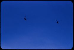
- Description:
- 100 f 8 tl
- Subject:
- H-bomb helicopter and Helicopters
- Series:
- 10-55
- Creator:
- Cushman, Charles W., 1896-1972
- Date Created:
- 1955-03-23
- Frame Number:
- 20
- County:
- Inyo
- Abstract:
- From Death Valley Junction Helicopter flock from north
- Call Number:
- P07845
- City:
- Death Valley Junction
- Country:
- United States
- State/Province:
- California
- Alternate Identifier:
- 1055.20
- Persistent URL:
- http://purl.dlib.indiana.edu/iudl/archives/cushman/P07845
- Holding Location:
- Bloomington - University Archives
Wells Library E460
1320 E 10th St.
Bloomington, IN 47405
Contact at archives@indiana.edu, 812-855-1127
-
- Description:
- 50 f 9
- Subject:
- Deserts, Glacier Lodge (Calif.), Shrubs, Trees, and Rocks
- Series:
- 12-54
- Creator:
- Cushman, Charles W., 1896-1972
- Date Created:
- 1954-09-18
- Genre:
- Landscape photographs
- Frame Number:
- 14
- County:
- Inyo
- Abstract:
- Tumbled rocks in dry river bed.
- Call Number:
- P07404
- City:
- Big Pine
- Country:
- United States
- State/Province:
- California
- Alternate Identifier:
- 1254.14
- Persistent URL:
- http://purl.dlib.indiana.edu/iudl/archives/cushman/P07404
- Holding Location:
- Bloomington - University Archives
Wells Library E460
1320 E 10th St.
Bloomington, IN 47405
Contact at archives@indiana.edu, 812-855-1127
-
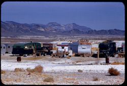
- Description:
- 100 f 8 + tl
- Subject:
- Minerals, Trucks, Valleys, Mountains, Shrubs, Tecopa Hot Springs (Calif.), and Trailers
- Series:
- 12-55
- Creator:
- Cushman, Charles W., 1896-1972
- Date Created:
- 1955-03-24
- Genre:
- Views
- Frame Number:
- 6
- County:
- Inyo
- Abstract:
- Trailer colony near Tecopa Hot Springs
- Call Number:
- P07902
- Country:
- United States
- State/Province:
- California
- Alternate Identifier:
- 1255.6
- Persistent URL:
- http://purl.dlib.indiana.edu/iudl/archives/cushman/P07902
- Holding Location:
- Bloomington - University Archives
Wells Library E460
1320 E 10th St.
Bloomington, IN 47405
Contact at archives@indiana.edu, 812-855-1127
-
- Description:
- 100 f 5.6
- Subject:
- Canyons, Mountains, Death Valley (Calif. and Nev.), and Desolation Canyon (Calif.)
- Series:
- 3-55
- Creator:
- Cushman, Charles W., 1896-1972
- Date Created:
- 1955-02-27
- Genre:
- Landscape photographs
- Frame Number:
- 19
- Street Address:
- Bad Water Road
- County:
- Inyo
- Abstract:
- Toward Desolation canyon
- Call Number:
- P07611
- Country:
- United States
- State/Province:
- California
- Alternate Identifier:
- 355.19
- Persistent URL:
- http://purl.dlib.indiana.edu/iudl/archives/cushman/P07611
- Holding Location:
- Bloomington - University Archives
Wells Library E460
1320 E 10th St.
Bloomington, IN 47405
Contact at archives@indiana.edu, 812-855-1127
-
- Description:
- 100 f 8 tl
- Subject:
- Death Valley (Calif. and Nev.), Craters, Mountains, Ubehebe Crater (Calif.), and Rock formations
- Series:
- 11-55
- Creator:
- Cushman, Charles W., 1896-1972
- Date Created:
- 1955-03-23
- Genre:
- Landscape photographs
- Frame Number:
- 19
- County:
- Inyo
- Abstract:
- Mtns from top of Ubehebe Crater A little crooked
- Call Number:
- P07879
- Country:
- United States
- State/Province:
- California
- Alternate Identifier:
- 1155.19
- Persistent URL:
- http://purl.dlib.indiana.edu/iudl/archives/cushman/P07879
- Holding Location:
- Bloomington - University Archives
Wells Library E460
1320 E 10th St.
Bloomington, IN 47405
Contact at archives@indiana.edu, 812-855-1127
-

- Description:
- 100 f 4 tl
- Subject:
- White Mountains (Calif. and Nev.) and Night
- Series:
- 26-55
- Creator:
- Cushman, Charles W., 1896-1972
- Date Created:
- 1955-09-25
- Genre:
- Night photographs
- Frame Number:
- 29
- County:
- Inyo
- Abstract:
- Top ridge of White Mtns at sunset
- Call Number:
- P08411
- City:
- Bishop
- Country:
- United States
- State/Province:
- California
- Physical Description:
- extremely dense.
- Alternate Identifier:
- 2655.29
- Persistent URL:
- http://purl.dlib.indiana.edu/iudl/archives/cushman/P08411
- Holding Location:
- Bloomington - University Archives
Wells Library E460
1320 E 10th St.
Bloomington, IN 47405
Contact at archives@indiana.edu, 812-855-1127
-
- Description:
- 100 f 8 tl
- Subject:
- Deserts, Valleys, Black Mountains (Inyo County, Calif.), Death Valley (Calif. and Nev.), Mountains, Shrubs, and Furnace Creek (Calif.)
- Series:
- 9-55
- Creator:
- Cushman, Charles W., 1896-1972
- Date Created:
- 1955-03-22
- Genre:
- Landscape photographs
- Frame Number:
- 26
- Street Address:
- Furnace Creek-Bad Water Road
- County:
- Mono and Inyo
- Abstract:
- From Bad Water road near exit to Golden Canyon
- Call Number:
- P07817
- City:
- Badwater
- Country:
- United States
- State/Province:
- California
- Alternate Identifier:
- 955.26
- Persistent URL:
- http://purl.dlib.indiana.edu/iudl/archives/cushman/P07817
- Holding Location:
- Bloomington - University Archives
Wells Library E460
1320 E 10th St.
Bloomington, IN 47405
Contact at archives@indiana.edu, 812-855-1127
-
- Description:
- 100 f 6.3 tl
- Subject:
- Mountains, Clouds, and Sierra Nevada (Calif. and Nev.)
- Series:
- 26-55
- Creator:
- Cushman, Charles W., 1896-1972
- Date Created:
- 1955-09-25
- Genre:
- Landscape photographs
- Frame Number:
- 13
- Street Address:
- United States Highway 395
- County:
- Inyo
- Abstract:
- After lunch = Tp of Sierra ridge from Hwy so. of Independence back lighted
- Call Number:
- P08396
- City:
- Independence
- Country:
- United States
- State/Province:
- California
- Alternate Identifier:
- 2655.13
- Persistent URL:
- http://purl.dlib.indiana.edu/iudl/archives/cushman/P08396
- Holding Location:
- Bloomington - University Archives
Wells Library E460
1320 E 10th St.
Bloomington, IN 47405
Contact at archives@indiana.edu, 812-855-1127
-
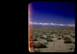
- Description:
- 25 f 8 Pola
- Subject:
- Snow, Mountains, Shrubs, Sierra Nevada (Calif. and Nev.), and Hills
- Series:
- 15-52
- Creator:
- Cushman, Charles W., 1896-1972
- Date Created:
- 1952-04-08
- Genre:
- Landscape photographs
- Frame Number:
- 1
- Street Address:
- California State Highway 190
- County:
- Inyo
- Abstract:
- The very high Sierras from Hwy 190 twenty five miles east of Lone Pine.
- Call Number:
- P06022
- City:
- Lone Pine
- Country:
- United States
- State/Province:
- California
- Physical Description:
- masked.
- Alternate Identifier:
- 1552.1
- Persistent URL:
- http://purl.dlib.indiana.edu/iudl/archives/cushman/P06022
- Holding Location:
- Bloomington - University Archives
Wells Library E460
1320 E 10th St.
Bloomington, IN 47405
Contact at archives@indiana.edu, 812-855-1127
-
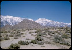
- Description:
- 50 f 10
- Subject:
- Snow, Boulders, Mountains, Shrubs, Whitney, Mount (Calif.), Sierra Nevada (Calif. and Nev.), and Hills
- Series:
- 14-52
- Creator:
- Cushman, Charles W., 1896-1972
- Date Created:
- 1952-04-08
- Genre:
- Landscape photographs
- Frame Number:
- 22
- Street Address:
- Mount Whitney Road
- County:
- Inyo
- Abstract:
- And those to north.
- Call Number:
- P06006
- City:
- Lone Pine
- Country:
- United States
- State/Province:
- California
- Alternate Identifier:
- 1452.22
- Persistent URL:
- http://purl.dlib.indiana.edu/iudl/archives/cushman/P06006
- Holding Location:
- Bloomington - University Archives
Wells Library E460
1320 E 10th St.
Bloomington, IN 47405
Contact at archives@indiana.edu, 812-855-1127
-
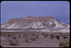
- Description:
- 100 f 8 tl
- Subject:
- Valleys, Furnace Creek Wash (Calif.), Boulders, Buttes, Mountains, Shrubs, Clouds, and Death Valley National Park (Calif. and Nev.)
- Series:
- 9-55
- Creator:
- Cushman, Charles W., 1896-1972
- Date Created:
- 1955-03-22
- Genre:
- Landscape photographs
- Frame Number:
- 4
- County:
- Inyo
- Abstract:
- The butte like a brown-crusted biscuit
- Call Number:
- P07796
- Country:
- United States
- State/Province:
- California
- Alternate Identifier:
- 955.4
- Persistent URL:
- http://purl.dlib.indiana.edu/iudl/archives/cushman/P07796
- Holding Location:
- Bloomington - University Archives
Wells Library E460
1320 E 10th St.
Bloomington, IN 47405
Contact at archives@indiana.edu, 812-855-1127
-
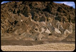
- Description:
- 100 f 8 + tl
- Subject:
- Rocks, Twenty Mule Team Canyon (Calif.), Canyons, Mountains, Rock formations, and Biscuit, The
- Series:
- 11-55
- Creator:
- Cushman, Charles W., 1896-1972
- Date Created:
- 1955-03-23
- Genre:
- Landscape photographs
- Frame Number:
- 2
- County:
- Inyo
- Abstract:
- The Biscuit seen from exit of 20 Mule T. canyon
- Call Number:
- P07864
- Country:
- United States
- State/Province:
- California
- Alternate Identifier:
- 1155.2
- Persistent URL:
- http://purl.dlib.indiana.edu/iudl/archives/cushman/P07864
- Holding Location:
- Bloomington - University Archives
Wells Library E460
1320 E 10th St.
Bloomington, IN 47405
Contact at archives@indiana.edu, 812-855-1127
-

- Description:
- 25 f 9 Pola
- Subject:
- Deserts, Valleys, Hills, Death Valley (Calif. and Nev.), Mountains, Colored mountains, Rocks, Rock formations, and Black Mountains (Inyo County, Calif.)
- Series:
- 15-52
- Creator:
- Cushman, Charles W., 1896-1972
- Date Created:
- 1952-04-09
- Genre:
- Landscape photographs
- Frame Number:
- 23
- County:
- Inyo
- Abstract:
- Colored Mtns. The Black Mtns.
- Call Number:
- P06043
- Country:
- United States
- State/Province:
- California
- Alternate Identifier:
- 1552.23
- Persistent URL:
- http://purl.dlib.indiana.edu/iudl/archives/cushman/P06043
- Holding Location:
- Bloomington - University Archives
Wells Library E460
1320 E 10th St.
Bloomington, IN 47405
Contact at archives@indiana.edu, 812-855-1127
-
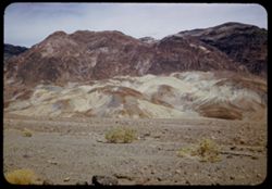
- Description:
- 25 f 9 Pola
- Subject:
- Deserts, Valleys, Salt pools, Mountains, Shrubs, Hills, Black Mountains (Inyo County, Calif.), Rocks, and Death Valley (Calif. and Nev.)
- Series:
- 15-52
- Creator:
- Cushman, Charles W., 1896-1972
- Date Created:
- 1952-04-09
- Genre:
- Landscape photographs
- Frame Number:
- 24
- County:
- Inyo
- Abstract:
- Colored Mtns. The Black Mtns - near Salt Pools this time.
- Call Number:
- P06044
- Country:
- United States
- State/Province:
- California
- Alternate Identifier:
- 1552.24
- Persistent URL:
- http://purl.dlib.indiana.edu/iudl/archives/cushman/P06044
- Holding Location:
- Bloomington - University Archives
Wells Library E460
1320 E 10th St.
Bloomington, IN 47405
Contact at archives@indiana.edu, 812-855-1127
-
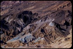
- Description:
- 100 f 6 tl
- Subject:
- Artists Palette (Calif.), Hills, Mountains, Death Valley National Park (Calif. and Nev.), and Rocks
- Series:
- 10-55
- Creator:
- Cushman, Charles W., 1896-1972
- Date Created:
- 1955-03-22
- Genre:
- Landscape photographs
- Frame Number:
- 4
- County:
- Inyo
- Abstract:
- The Artists palette
- Call Number:
- P07832
- Country:
- United States
- State/Province:
- California
- Alternate Identifier:
- 1055.4
- Persistent URL:
- http://purl.dlib.indiana.edu/iudl/archives/cushman/P07832
- Holding Location:
- Bloomington - University Archives
Wells Library E460
1320 E 10th St.
Bloomington, IN 47405
Contact at archives@indiana.edu, 812-855-1127
-
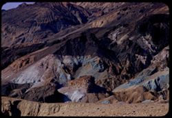
- Description:
- 100 f 6.3 tl
- Subject:
- Valleys, Mountains, Death Valley National Park (Calif. and Nev.), Hills, and Artists Palette (Calif.)
- Series:
- 10-55
- Creator:
- Cushman, Charles W., 1896-1972
- Date Created:
- 1955-03-22
- Genre:
- Landscape photographs
- Frame Number:
- 3
- County:
- Inyo
- Abstract:
- The artists Palette
- Call Number:
- P07831
- Country:
- United States
- State/Province:
- California
- Alternate Identifier:
- 1055.3
- Persistent URL:
- http://purl.dlib.indiana.edu/iudl/archives/cushman/P07831
- Holding Location:
- Bloomington - University Archives
Wells Library E460
1320 E 10th St.
Bloomington, IN 47405
Contact at archives@indiana.edu, 812-855-1127
-
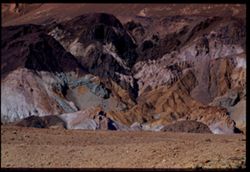
- Description:
- 100 f 8 tl
- Subject:
- Mountains, Death Valley National Park (Calif. and Nev.), and Artists Palette (Calif.)
- Series:
- 10-55
- Creator:
- Cushman, Charles W., 1896-1972
- Date Created:
- 1955-03-22
- Genre:
- Landscape photographs
- Frame Number:
- 6
- County:
- Inyo
- Abstract:
- Twice [move]
- Call Number:
- P07833
- Country:
- United States
- State/Province:
- California
- Physical Description:
- Image was originally mounted in a glass enclosure. Before digitization, the image was removed and placed in a Wess Plastic, Inc. brand, 2" x 2", pl...
- Alternate Identifier:
- 1055.6
- Persistent URL:
- http://purl.dlib.indiana.edu/iudl/archives/cushman/P07833
- Holding Location:
- Bloomington - University Archives
Wells Library E460
1320 E 10th St.
Bloomington, IN 47405
Contact at archives@indiana.edu, 812-855-1127
-
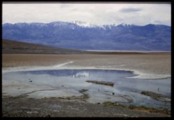
- Description:
- 25 f 8 Pola
- Subject:
- Bodies of water, Telescope Peak (Inyo County, Calif.), Hills, Mountains, Death Valley (Calif. and Nev.), Deserts, Shrubs, Valleys, and Snow
- Series:
- 15-52
- Creator:
- Cushman, Charles W., 1896-1972
- Date Created:
- 1952-04-09
- Genre:
- Landscape photographs
- Frame Number:
- 25
- County:
- Inyo
- Abstract:
- Telescope Pk. from Bad Water. 280 ft. below sea level.
- Call Number:
- P06045
- City:
- Badwater
- Country:
- United States
- State/Province:
- California
- Physical Description:
- Image was originally mounted in a glass enclosure. Before digitization, the image was removed and placed in a Wess Plastic, Inc. brand, 2" x 2", pl...
- Alternate Identifier:
- 1552.25
- Persistent URL:
- http://purl.dlib.indiana.edu/iudl/archives/cushman/P06045
- Holding Location:
- Bloomington - University Archives
Wells Library E460
1320 E 10th St.
Bloomington, IN 47405
Contact at archives@indiana.edu, 812-855-1127
-
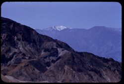
- Description:
- 100 f 6.3 tl
- Subject:
- Snow, Telescope Peak (Inyo County, Calif.), Mountains, and Zabriskie Point (Calif.)
- Series:
- 9-55
- Creator:
- Cushman, Charles W., 1896-1972
- Date Created:
- 1955-03-22
- Genre:
- Landscape photographs
- Frame Number:
- 11
- County:
- Inyo
- Abstract:
- Telescope PK from Zabriskie Pt.
- Call Number:
- P07803
- Country:
- United States
- State/Province:
- California
- Alternate Identifier:
- 955.11
- Persistent URL:
- http://purl.dlib.indiana.edu/iudl/archives/cushman/P07803
- Holding Location:
- Bloomington - University Archives
Wells Library E460
1320 E 10th St.
Bloomington, IN 47405
Contact at archives@indiana.edu, 812-855-1127
-
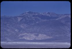
- Description:
- 100 f 6.3 tl
- Subject:
- Valleys, Fog, Emigrant Pass (Inyo County, Calif.), Mountains, Panamint Valley (Calif.), and Telescope Peak (Inyo County, Calif.)
- Series:
- 7-55
- Creator:
- Cushman, Charles W., 1896-1972
- Date Created:
- 1955-03-21
- Genre:
- Landscape photographs
- Frame Number:
- 35
- County:
- Inyo
- Abstract:
- Telescope Pk.
- Call Number:
- P07759
- Country:
- United States
- State/Province:
- California
- Alternate Identifier:
- 755.35
- Persistent URL:
- http://purl.dlib.indiana.edu/iudl/archives/cushman/P07759
- Holding Location:
- Bloomington - University Archives
Wells Library E460
1320 E 10th St.
Bloomington, IN 47405
Contact at archives@indiana.edu, 812-855-1127
-
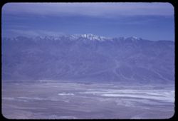
- Description:
- 100 f 5.6 50mm
- Subject:
- Snow, Valleys, Telescope Peak (Inyo County, Calif.), Dantes View (Calif.), Mountains, Death Valley (Calif. and Nev.), and Fog
- Series:
- 8-55
- Creator:
- Cushman, Charles W., 1896-1972
- Date Created:
- 1955-03-22
- Genre:
- Landscape photographs
- Frame Number:
- 36
- County:
- Inyo
- Abstract:
- Tel PK
- Call Number:
- P07791
- Country:
- United States
- State/Province:
- California
- Alternate Identifier:
- 855.36
- Persistent URL:
- http://purl.dlib.indiana.edu/iudl/archives/cushman/P07791
- Holding Location:
- Bloomington - University Archives
Wells Library E460
1320 E 10th St.
Bloomington, IN 47405
Contact at archives@indiana.edu, 812-855-1127
-
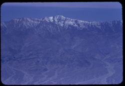
- Description:
- 100 f 8 tl
- Subject:
- Snow, Valleys, Telescope Peak (Inyo County, Calif.), Dantes View (Calif.), and Mountains
- Series:
- 8-55
- Creator:
- Cushman, Charles W., 1896-1972
- Date Created:
- 1955-03-22
- Genre:
- Landscape photographs
- Frame Number:
- 23
- County:
- Inyo
- Abstract:
- Telescope Peak. 11045 ft.
- Call Number:
- P07781
- Country:
- United States
- State/Province:
- California
- Alternate Identifier:
- 855.23
- Persistent URL:
- http://purl.dlib.indiana.edu/iudl/archives/cushman/P07781
- Holding Location:
- Bloomington - University Archives
Wells Library E460
1320 E 10th St.
Bloomington, IN 47405
Contact at archives@indiana.edu, 812-855-1127
-
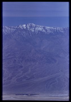
- Description:
- 100 f 8 tl
- Subject:
- Snow, Valleys, Telescope Peak (Inyo County, Calif.), Dantes View (Calif.), Mountains, and Death Valley (Calif. and Nev.)
- Series:
- 8-55
- Creator:
- Cushman, Charles W., 1896-1972
- Date Created:
- 1955-03-22
- Genre:
- Landscape photographs
- Frame Number:
- 26
- County:
- Inyo
- Abstract:
- Tel. Pk [P]
- Call Number:
- P07784
- Country:
- United States
- State/Province:
- California
- Physical Description:
- Image was originally mounted in a glass enclosure. Before digitization, the image was removed and placed in a Wess Plastic, Inc. brand, 2" x 2", pl...
- Alternate Identifier:
- 855.26
- Persistent URL:
- http://purl.dlib.indiana.edu/iudl/archives/cushman/P07784
- Holding Location:
- Bloomington - University Archives
Wells Library E460
1320 E 10th St.
Bloomington, IN 47405
Contact at archives@indiana.edu, 812-855-1127
-
- Description:
- 50 f 13 tl at 7 ft.
- Subject:
- Rocks, Twenty Mule Team Canyon (Calif.), Featherweight Rock, and Death Valley National Park (Calif. and Nev.)
- Series:
- 11-55
- Creator:
- Cushman, Charles W., 1896-1972
- Date Created:
- 1955-03-23
- Genre:
- Identification photographs
- Frame Number:
- 1
- County:
- Inyo
- Abstract:
- Close up ( 7 ft) of feather-weight rock
- Call Number:
- P07863
- Country:
- United States
- State/Province:
- California
- Alternate Identifier:
- 1155.1
- Persistent URL:
- http://purl.dlib.indiana.edu/iudl/archives/cushman/P07863
- Holding Location:
- Bloomington - University Archives
Wells Library E460
1320 E 10th St.
Bloomington, IN 47405
Contact at archives@indiana.edu, 812-855-1127
-
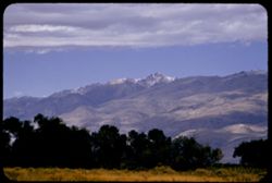
- Description:
- 100 f 5.6 tl
- Subject:
- Grasses, Trees, Mountains, Clouds, and White Mountain Peak (Inyo County, Calif.)
- Series:
- 26-55
- Creator:
- Cushman, Charles W., 1896-1972
- Date Created:
- 1955-09-25
- Genre:
- Landscape photographs
- Frame Number:
- 20
- Street Address:
- East Line Street
- County:
- Inyo
- Abstract:
- White Mtn Pk. from East Line St., Bishop
- Call Number:
- P08403
- City:
- Bishop
- Country:
- United States
- State/Province:
- California
- Alternate Identifier:
- 2655.20
- Persistent URL:
- http://purl.dlib.indiana.edu/iudl/archives/cushman/P08403
- Holding Location:
- Bloomington - University Archives
Wells Library E460
1320 E 10th St.
Bloomington, IN 47405
Contact at archives@indiana.edu, 812-855-1127
-
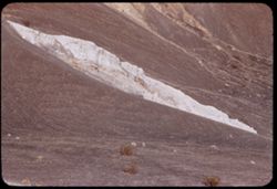
- Description:
- 100 f 6.3 tl
- Subject:
- Rocks, Craters, Mountains, Shrubs, Hills, Ubehebe Crater (Calif.), and Death Valley (Calif. and Nev.)
- Series:
- 11-55
- Creator:
- Cushman, Charles W., 1896-1972
- Date Created:
- 1955-03-23
- Frame Number:
- 25
- County:
- Inyo
- Abstract:
- Strange white ridge in bowl of Ubehebe Crater
- Call Number:
- P07884
- Country:
- United States
- State/Province:
- California
- Alternate Identifier:
- 1155.25
- Persistent URL:
- http://purl.dlib.indiana.edu/iudl/archives/cushman/P07884
- Holding Location:
- Bloomington - University Archives
Wells Library E460
1320 E 10th St.
Bloomington, IN 47405
Contact at archives@indiana.edu, 812-855-1127
-
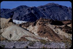
- Description:
- 100 f 6.3 tl
- Subject:
- Rocks, Mountains, Death Valley (Calif. and Nev.), and Black Mountains (Inyo County, Calif.)
- Series:
- 8-55
- Creator:
- Cushman, Charles W., 1896-1972
- Date Created:
- 1955-03-22
- Genre:
- Landscape photographs
- Frame Number:
- 21
- Street Address:
- Dante's View Road
- County:
- Inyo
- Abstract:
- colored rock in valley from closer (along Dante's V. rd.
- Call Number:
- P07779
- Country:
- United States
- State/Province:
- California
- Alternate Identifier:
- 855.21
- Persistent URL:
- http://purl.dlib.indiana.edu/iudl/archives/cushman/P07779
- Holding Location:
- Bloomington - University Archives
Wells Library E460
1320 E 10th St.
Bloomington, IN 47405
Contact at archives@indiana.edu, 812-855-1127
- « Previous
- Next »
- 1
- 2
- 3
- 4