
Search Constraints
You searched for:
Campus
IUB
Remove constraint Campus: IUB
Frame Number
3
Remove constraint Frame Number: 3
Subject
Mountains
Remove constraint Subject: Mountains
State/Province
California
Remove constraint State/Province: California
1 - 49 of 49
Search Results
-
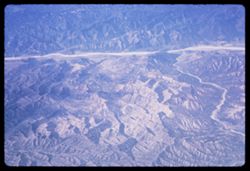
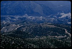
- Description:
- 200 f 5.6
- Subject:
- Pan American World Airways, inc., Channels, Air travel, Mountains, and Rivers
- Series:
- 1-65
- Creator:
- Cushman, Charles W., 1896-1972
- Date Created:
- 1965-03-30
- Genre:
- Aerial photographs and Landscape photographs
- Frame Number:
- 3
- County:
- Los Angeles
- Abstract:
- Over mountains and fields on way to L.A. and California Fields north of Los Angeles
- Call Number:
- P13867
- City:
- Los Angeles
- Country:
- United States
- State/Province:
- California
- Alternate Identifier:
- 165.3
- Persistent URL:
- http://purl.dlib.indiana.edu/iudl/archives/cushman/P13867
- Holding Location:
- Bloomington - University Archives
Wells Library E460
1320 E 10th St.
Bloomington, IN 47405
Contact at archives@indiana.edu, 812-855-1127
-
- Description:
- 100 f 11 SL
- Subject:
- Santa Ynez Mountains (Calif.), Tree limbs, Mountains, Disasters, and Fires
- Series:
- 26-64
- Creator:
- Cushman, Charles W., 1896-1972
- Date Created:
- 1964-12-02
- Genre:
- Landscape photographs
- Frame Number:
- 3
- County:
- Santa Barbara
- Abstract:
- After the big fire
- Call Number:
- P13802
- City:
- Santa Barbara
- Country:
- United States
- State/Province:
- California
- Alternate Identifier:
- 2664.3
- Persistent URL:
- http://purl.dlib.indiana.edu/iudl/archives/cushman/P13802
- Holding Location:
- Bloomington - University Archives
Wells Library E460
1320 E 10th St.
Bloomington, IN 47405
Contact at archives@indiana.edu, 812-855-1127
-

- Description:
- 50 f 5.6 SL
- Subject:
- Echo Summit (El Dorado County, Calif.), Trees, Mountains, Sierra Nevada (Calif. and Nev.), Forests, and Hills
- Series:
- 3-62
- Creator:
- Cushman, Charles W., 1896-1972
- Date Created:
- 1962-09-28
- Genre:
- Landscape photographs
- Frame Number:
- 3
- Abstract:
- Down from Echo Sum.
- Call Number:
- P12701
- Country:
- United States
- State/Province:
- California
- Alternate Identifier:
- 362.3
- Persistent URL:
- http://purl.dlib.indiana.edu/iudl/archives/cushman/P12701
- Holding Location:
- Bloomington - University Archives
Wells Library E460
1320 E 10th St.
Bloomington, IN 47405
Contact at archives@indiana.edu, 812-855-1127
-
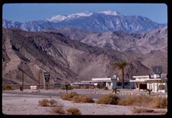
- Description:
- 100 f 6.3 TL
- Subject:
- Stores & shops, Roads, Markets, San Jacinto Peak (Calif.), Signs (Notices), Mountains, Shrubs, Utility poles, and Palms
- Series:
- 24-61
- Creator:
- Cushman, Charles W., 1896-1972
- Date Created:
- 1961-12-25
- Genre:
- Landscape photographs
- Frame Number:
- 3
- County:
- Riverside
- Abstract:
- San Jacinto
- Call Number:
- P12569
- Country:
- United States
- State/Province:
- California
- Alternate Identifier:
- 2461.3
- Persistent URL:
- http://purl.dlib.indiana.edu/iudl/archives/cushman/P12569
- Holding Location:
- Bloomington - University Archives
Wells Library E460
1320 E 10th St.
Bloomington, IN 47405
Contact at archives@indiana.edu, 812-855-1127
-
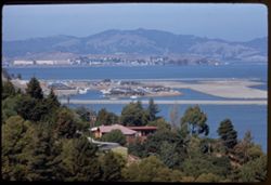
- Description:
- 100 f 6.3 TL
- Subject:
- Paradise Bay (Marin County, Calif.), Hills, Mountains, Trees, Piers & wharves, Houses, Bays (Bodies of water), and Buildings
- Series:
- 22-61
- Creator:
- Cushman, Charles W., 1896-1972
- Date Created:
- 1961-10-06
- Genre:
- Marine photographs and Cityscape photographs
- Frame Number:
- 3
- County:
- Marin
- Abstract:
- Paradise Cay
- Call Number:
- P12494
- Country:
- United States
- State/Province:
- California
- Alternate Identifier:
- 2261.3
- Persistent URL:
- http://purl.dlib.indiana.edu/iudl/archives/cushman/P12494
- Holding Location:
- Bloomington - University Archives
Wells Library E460
1320 E 10th St.
Bloomington, IN 47405
Contact at archives@indiana.edu, 812-855-1127
-
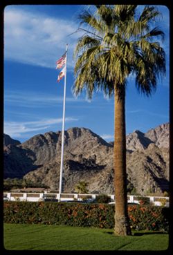
- Description:
- 50 f 8
- Subject:
- Walls, Hedges (Plants), State flags, Flags, Mountains, Lawns, Flagpoles, and Palms
- Series:
- 27-60
- Creator:
- Cushman, Charles W., 1896-1972
- Date Created:
- 1960-12-26
- Genre:
- Landscape photographs
- Frame Number:
- 3
- County:
- Riverside
- Abstract:
- La Quinta- flagstaff and palm
- Call Number:
- P11745
- City:
- La Quinta
- Country:
- United States
- State/Province:
- California
- Alternate Identifier:
- 2760.3
- Persistent URL:
- http://purl.dlib.indiana.edu/iudl/archives/cushman/P11745
- Holding Location:
- Bloomington - University Archives
Wells Library E460
1320 E 10th St.
Bloomington, IN 47405
Contact at archives@indiana.edu, 812-855-1127
-
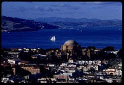
- Description:
- 100 f 8 tl
- Subject:
- Domes, San Francisco Bay Area (Calif.), Palace of Fine Arts (San Francisco), Sailboats, Columns, Mountains, Buildings, Rotundas, Hills, Bays (Bodies of water...
- Series:
- 1-60
- Creator:
- Cushman, Charles W., 1896-1972
- Date Created:
- 1960-01-16
- Genre:
- Marine photographs, Cityscape photographs, and Views
- Frame Number:
- 3
- Street Address:
- Broderick Street and Broadway Street
- County:
- San Francisco
- Abstract:
- North Bay from Broadway + Broderick
- Call Number:
- P10897
- City:
- San Francisco
- Country:
- United States
- State/Province:
- California
- Alternate Identifier:
- 160.3
- Persistent URL:
- http://purl.dlib.indiana.edu/iudl/archives/cushman/P10897
- Holding Location:
- Bloomington - University Archives
Wells Library E460
1320 E 10th St.
Bloomington, IN 47405
Contact at archives@indiana.edu, 812-855-1127
-
- Description:
- 100 f 6.3 tl
- Subject:
- Emigrant Gap (Calif. : Gap), Trees, Mountains, Lakes & ponds, Sierra Nevada (Calif. and Nev.), and Plants
- Series:
- 15-58
- Creator:
- Cushman, Charles W., 1896-1972
- Date Created:
- 1958-08-22
- Genre:
- Landscape photographs
- Frame Number:
- 3
- Abstract:
- Toward mtns east of Emigrant Gap
- Call Number:
- P10109
- Country:
- United States
- State/Province:
- California and Nevada
- Alternate Identifier:
- 1558.3
- Persistent URL:
- http://purl.dlib.indiana.edu/iudl/archives/cushman/P10109
- Holding Location:
- Bloomington - University Archives
Wells Library E460
1320 E 10th St.
Bloomington, IN 47405
Contact at archives@indiana.edu, 812-855-1127
-
- Description:
- 100 f 6.3 tl
- Subject:
- Meadows, Lorenz Lumber Company Mill (Burney, Calif.), Mountains, Clouds, Firs, Haynes Ranch (Burney, Calif.), Lumber industry, and Forests
- Series:
- 10-58
- Creator:
- Cushman, Charles W., 1896-1972
- Date Created:
- 1958-06-12
- Genre:
- Landscape photographs
- Frame Number:
- 3
- County:
- Shasta
- Abstract:
- Mill and meadow Haynes Ranch
- Call Number:
- P09941
- City:
- Burney
- Country:
- United States
- State/Province:
- California
- Alternate Identifier:
- 1058.3
- Persistent URL:
- http://purl.dlib.indiana.edu/iudl/archives/cushman/P09941
- Holding Location:
- Bloomington - University Archives
Wells Library E460
1320 E 10th St.
Bloomington, IN 47405
Contact at archives@indiana.edu, 812-855-1127
-
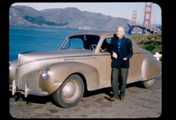
- Description:
- 50 f 8 sl
- Subject:
- Channels, Men, Automobiles, San Francisco Bay (Calif.), Mountains, Golden Gate Bridge (San Francisco, Calif.), Suspension bridges, and Zephyr automobile
- Series:
- 1-58
- Creator:
- Cushman, Charles W., 1896-1972
- Date Created:
- 1958-01-13
- Genre:
- Portraits and Snapshots
- Frame Number:
- 3
- County:
- San Francisco
- Persons Pictured:
- Cushman, Charles W. (Charles Weever), 1896-1972
- Abstract:
- Charles
- Call Number:
- P09663
- City:
- San Francisco
- Country:
- United States
- State/Province:
- California
- Alternate Identifier:
- 158.3
- Persistent URL:
- http://purl.dlib.indiana.edu/iudl/archives/cushman/P09663
- Holding Location:
- Bloomington - University Archives
Wells Library E460
1320 E 10th St.
Bloomington, IN 47405
Contact at archives@indiana.edu, 812-855-1127
-

- Description:
- 100 f 6.3 tl
- Subject:
- Gabilan Range (Calif.), Trees, Croplands, Salinas River Valley (Calif.), and Mountains
- Series:
- 18-57
- Creator:
- Cushman, Charles W., 1896-1972
- Date Created:
- 1957-11-30
- Genre:
- Landscape photographs
- Frame Number:
- 3
- County:
- Monterey
- Abstract:
- Camel-shaped mountain of Gabilan Range SE of Soledad
- Call Number:
- P09626
- City:
- Soledad
- Country:
- United States
- State/Province:
- California
- Alternate Identifier:
- 1857.3
- Persistent URL:
- http://purl.dlib.indiana.edu/iudl/archives/cushman/P09626
- Holding Location:
- Bloomington - University Archives
Wells Library E460
1320 E 10th St.
Bloomington, IN 47405
Contact at archives@indiana.edu, 812-855-1127
-
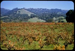
- Description:
- 50 f 6.3 sl
- Subject:
- Grapevines, Trees, Meadows, Mountains, Grapes, Hills, and Alexander Valley (Calif.)
- Series:
- 16-57
- Creator:
- Cushman, Charles W., 1896-1972
- Date Created:
- 1957-11-05
- Genre:
- Landscape photographs
- Frame Number:
- 3
- Street Address:
- California State Highway 128
- County:
- Sonoma
- Call Number:
- P09569
- Country:
- United States
- State/Province:
- California
- Alternate Identifier:
- 1657.3
- Persistent URL:
- http://purl.dlib.indiana.edu/iudl/archives/cushman/P09569
- Holding Location:
- Bloomington - University Archives
Wells Library E460
1320 E 10th St.
Bloomington, IN 47405
Contact at archives@indiana.edu, 812-855-1127
-
- Description:
- 100 f 6.3 tl
- Subject:
- Santa Ynez River Valley (Calif.), Meadows, Bradbury Dam (Calif.), Mountains, Shrubs, and Cachuma, Lake (Calif.)
- Series:
- 15-57
- Creator:
- Cushman, Charles W., 1896-1972
- Date Created:
- 1957-09-20
- Genre:
- Landscape photographs
- Frame Number:
- 3
- County:
- Santa Barbara
- Abstract:
- From height above Cachuma Dam - views north & eastward
- Call Number:
- P09538
- Country:
- United States
- State/Province:
- California
- Alternate Identifier:
- 1557.3
- Persistent URL:
- http://purl.dlib.indiana.edu/iudl/archives/cushman/P09538
- Holding Location:
- Bloomington - University Archives
Wells Library E460
1320 E 10th St.
Bloomington, IN 47405
Contact at archives@indiana.edu, 812-855-1127
-
- Description:
- 100 f 4.5 tl
- Subject:
- Canyons, Grasses, Cuesta Pass (Calif.), Southern Pacific Railroad Company, Mountains, Shrubs, Railroad passenger cars, Passes (Landforms), Embankments, Railr...
- Series:
- 14-57
- Creator:
- Cushman, Charles W., 1896-1972
- Date Created:
- 1957-09-19
- Genre:
- Landscape photographs and Snapshots
- Frame Number:
- 3
- County:
- San Luis Obispo
- Abstract:
- Sou. Pac. passenger train north bound
- Call Number:
- P09502
- Country:
- United States
- State/Province:
- California
- Alternate Identifier:
- 1457.3
- Persistent URL:
- http://purl.dlib.indiana.edu/iudl/archives/cushman/P09502
- Holding Location:
- Bloomington - University Archives
Wells Library E460
1320 E 10th St.
Bloomington, IN 47405
Contact at archives@indiana.edu, 812-855-1127
-
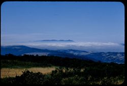
- Description:
- 100 f 8 tl
- Subject:
- Fog, Mountains, Shrubs, Tamalpais, Mount (Calif.), and Hills
- Series:
- 13-57
- Creator:
- Cushman, Charles W., 1896-1972
- Date Created:
- 1957-08-17
- Genre:
- Landscape photographs
- Frame Number:
- 3
- Street Address:
- 12180 Skyline Drive
- County:
- San Mateo
- Persons Pictured:
- Lolla
- Abstract:
- Fog bank at Tamalpais from Skyline Dr. at Mr. Lolla's, 12180.
- Call Number:
- P09482
- Country:
- United States
- State/Province:
- California
- Alternate Identifier:
- 1357.3
- Persistent URL:
- http://purl.dlib.indiana.edu/iudl/archives/cushman/P09482
- Holding Location:
- Bloomington - University Archives
Wells Library E460
1320 E 10th St.
Bloomington, IN 47405
Contact at archives@indiana.edu, 812-855-1127
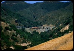
-
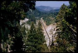
- Description:
- 100 f 5.6 sl
- Subject:
- Feather River Canyon (Calif.), Canyons, Forests, Railroad tracks, Mountains, Electric lines, Trees, Feather River (Calif.), Rivers, and Tree limbs
- Series:
- 12-57
- Creator:
- Cushman, Charles W., 1896-1972
- Date Created:
- 1957-07-25
- Genre:
- Landscape photographs
- Frame Number:
- 3
- County:
- Plumas
- Abstract:
- View down canyon
- Call Number:
- P09448
- City:
- Cromberg
- Country:
- United States
- State/Province:
- California
- Alternate Identifier:
- 1257.3
- Persistent URL:
- http://purl.dlib.indiana.edu/iudl/archives/cushman/P09448
- Holding Location:
- Bloomington - University Archives
Wells Library E460
1320 E 10th St.
Bloomington, IN 47405
Contact at archives@indiana.edu, 812-855-1127
-
- Description:
- 100 f 6.3 tl
- Subject:
- Meadows, Mountains, Trees, Buttes, and Sutter Buttes (Calif.)
- Series:
- 11-57
- Creator:
- Cushman, Charles W., 1896-1972
- Date Created:
- 1957-07-22
- Genre:
- Landscape photographs
- Frame Number:
- 3
- Abstract:
- Sutter Buttes Hazy
- Call Number:
- P09412
- Country:
- United States
- State/Province:
- California
- Alternate Identifier:
- 1157.3
- Persistent URL:
- http://purl.dlib.indiana.edu/iudl/archives/cushman/P09412
- Holding Location:
- Bloomington - University Archives
Wells Library E460
1320 E 10th St.
Bloomington, IN 47405
Contact at archives@indiana.edu, 812-855-1127
-
- Description:
- 100 f 8 tl
- Subject:
- Trees, Mountains, Lakes & ponds, Islands, Hills, and Clear Lake (Lake County, Calif.)
- Series:
- 10-57
- Creator:
- Cushman, Charles W., 1896-1972
- Date Created:
- 1957-06-30
- Genre:
- Landscape photographs
- Frame Number:
- 3
- County:
- Lake
- Abstract:
- East across waist of Cl. Lk from Buckingham Pk
- Call Number:
- P09377
- City:
- Buckingham Park
- Country:
- United States
- State/Province:
- California
- Alternate Identifier:
- 1057.3
- Persistent URL:
- http://purl.dlib.indiana.edu/iudl/archives/cushman/P09377
- Holding Location:
- Bloomington - University Archives
Wells Library E460
1320 E 10th St.
Bloomington, IN 47405
Contact at archives@indiana.edu, 812-855-1127
-
- Description:
- 100 f 8 tl
- Subject:
- Canyons, Cajon Canyon (Calif.), Roads, Mountains, Hills, and Cajon Pass (Calif.)
- Series:
- 7-57
- Creator:
- Cushman, Charles W., 1896-1972
- Date Created:
- 1957-05-14
- Genre:
- Landscape photographs
- Frame Number:
- 3
- Street Address:
- United States Highway 66
- County:
- San Bernardino
- Abstract:
- View SW & W from high point on US 66 through Cajon Pass (4255') Down into Cajon canyon
- Call Number:
- P09282
- Country:
- United States
- State/Province:
- California
- Alternate Identifier:
- 957.3
- Persistent URL:
- http://purl.dlib.indiana.edu/iudl/archives/cushman/P09282
- Holding Location:
- Bloomington - University Archives
Wells Library E460
1320 E 10th St.
Bloomington, IN 47405
Contact at archives@indiana.edu, 812-855-1127
-
- Description:
- 100 f 6.3 tl
- Subject:
- Shasta Lake (Calif.), Trees, Coastlines, Mountains, and Lakes & ponds
- Series:
- 11-56
- Creator:
- Cushman, Charles W., 1896-1972
- Date Created:
- 1956-07-14
- Genre:
- Landscape photographs
- Frame Number:
- 3
- County:
- Shasta
- Abstract:
- Shasta Lake near O'Brien
- Call Number:
- P08901
- City:
- O'Brien
- Country:
- United States
- State/Province:
- California
- Alternate Identifier:
- 1156.3
- Persistent URL:
- http://purl.dlib.indiana.edu/iudl/archives/cushman/P08901
- Holding Location:
- Bloomington - University Archives
Wells Library E460
1320 E 10th St.
Bloomington, IN 47405
Contact at archives@indiana.edu, 812-855-1127
-
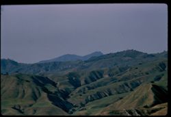
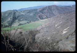
- Description:
- 100 f 8 TL
- Subject:
- Valleys, Mustang Ridge (Monterey County, Calif.), Mountains, Hills, Peachtree Valley (Calif.), and Canyons
- Series:
- 6-56
- Creator:
- Cushman, Charles W., 1896-1972
- Date Created:
- 1956-04-21
- Genre:
- Landscape photographs
- Frame Number:
- 3
- Street Address:
- California State Highway 198
- County:
- Monterey
- Abstract:
- View northward across deep (peach tree Valley) from 198 - 13 mi. east of San Lucas toward Mustang Ridge
- Call Number:
- P08713
- City:
- San Lucas
- Country:
- United States
- State/Province:
- California
- Alternate Identifier:
- 656.3
- Persistent URL:
- http://purl.dlib.indiana.edu/iudl/archives/cushman/P08713
- Holding Location:
- Bloomington - University Archives
Wells Library E460
1320 E 10th St.
Bloomington, IN 47405
Contact at archives@indiana.edu, 812-855-1127
-
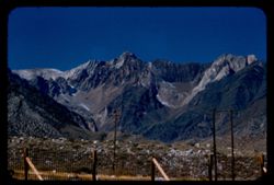
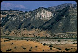
- Description:
- 100 f 8 tl
- Subject:
- Rocks, Mountains, Fences, Lake Crowley (Calif.), Sierra Nevada (Calif. and Nev.), and Utility poles
- Series:
- 27-55
- Creator:
- Cushman, Charles W., 1896-1972
- Date Created:
- 1955-09-26
- Genre:
- Landscape photographs
- Frame Number:
- 3
- County:
- Mono
- Abstract:
- Red & gray [jagged] peak west of Crowley Lake
- Call Number:
- P08423
- Country:
- United States
- State/Province:
- California
- Alternate Identifier:
- 2755.3
- Persistent URL:
- http://purl.dlib.indiana.edu/iudl/archives/cushman/P08423
- Holding Location:
- Bloomington - University Archives
Wells Library E460
1320 E 10th St.
Bloomington, IN 47405
Contact at archives@indiana.edu, 812-855-1127
-
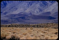
- Description:
- 100 f 6.3
- Subject:
- Rocks, Grasses, Mountains, Sierra Nevada (Calif. and Nev.), and Hills
- Series:
- 26-55
- Creator:
- Cushman, Charles W., 1896-1972
- Date Created:
- 1955-09-25
- Genre:
- Landscape photographs
- Frame Number:
- 3
- County:
- Inyo
- Abstract:
- Looking at base of range to SSW
- Call Number:
- P08386
- City:
- Big Pine and Independence
- Country:
- United States
- State/Province:
- California
- Alternate Identifier:
- 2655.3
- Persistent URL:
- http://purl.dlib.indiana.edu/iudl/archives/cushman/P08386
- Holding Location:
- Bloomington - University Archives
Wells Library E460
1320 E 10th St.
Bloomington, IN 47405
Contact at archives@indiana.edu, 812-855-1127
-
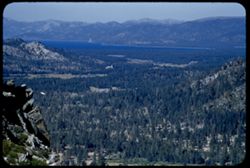
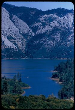
- Description:
- 100 f 5.6 TL
- Subject:
- Echo Summit (El Dorado County, Calif.), Trees, Mountains, Tahoe, Lake (Calif. and Nev.), and Lakes & ponds
- Series:
- 25-55
- Creator:
- Cushman, Charles W., 1896-1972
- Date Created:
- 1955-09-24
- Genre:
- Landscape photographs
- Frame Number:
- 3
- Street Address:
- United States Highway 50
- County:
- Placer
- Abstract:
- North from just below (NE) of Echo Summit toward L. Tahoe
- Call Number:
- P08351
- Country:
- United States
- State/Province:
- California
- Alternate Identifier:
- 2555.3
- Persistent URL:
- http://purl.dlib.indiana.edu/iudl/archives/cushman/P08351
- Holding Location:
- Bloomington - University Archives
Wells Library E460
1320 E 10th St.
Bloomington, IN 47405
Contact at archives@indiana.edu, 812-855-1127
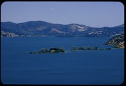
-
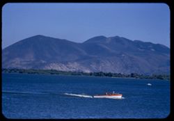
- Description:
- 100 f 5.6 TL
- Subject:
- Trees, Konocti, Mount (Calif.), Mountains, Lakes & ponds, Clear Lake (Lake County, Calif.), and Boats
- Series:
- 24-55
- Creator:
- Cushman, Charles W., 1896-1972
- Date Created:
- 1955-08-10
- Genre:
- Landscape photographs
- Frame Number:
- 3
- County:
- Lake
- Abstract:
- Mt. Konocti across Clear Lake from Lake port
- Call Number:
- P08312
- City:
- Lakeport
- Country:
- United States
- State/Province:
- California
- Alternate Identifier:
- 2455.3
- Persistent URL:
- http://purl.dlib.indiana.edu/iudl/archives/cushman/P08312
- Holding Location:
- Bloomington - University Archives
Wells Library E460
1320 E 10th St.
Bloomington, IN 47405
Contact at archives@indiana.edu, 812-855-1127
-
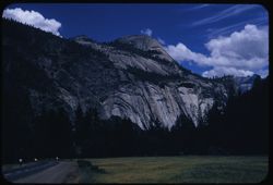
- Description:
- 100 f 8 sl
- Subject:
- North Dome (Mariposa County, Calif.), Yosemite Valley (Calif.), Valleys, Roads, Yosemite National Park (Calif.), Trees, Mountains, National parks & reser...
- Series:
- 22-55
- Creator:
- Cushman, Charles W., 1896-1972
- Date Created:
- 1955-07-09
- Genre:
- Landscape photographs
- Frame Number:
- 3
- County:
- Mariposa
- Abstract:
- North Dome & Royal Arches from valley floor
- Call Number:
- P08256
- Country:
- United States
- State/Province:
- California
- Alternate Identifier:
- 2255.3
- Persistent URL:
- http://purl.dlib.indiana.edu/iudl/archives/cushman/P08256
- Holding Location:
- Bloomington - University Archives
Wells Library E460
1320 E 10th St.
Bloomington, IN 47405
Contact at archives@indiana.edu, 812-855-1127
-
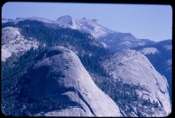
- Description:
- 100 f 5.6 tl (error)
- Subject:
- Yosemite Valley (Calif.), Scenic overlooks, Yosemite National Park (Calif.), Trees, Half Dome (Calif.), Hoffman, Mount (Calif.), Basket Dome (Calif.), Mounta...
- Series:
- 21-55
- Creator:
- Cushman, Charles W., 1896-1972
- Date Created:
- 1955-07-08
- Genre:
- Landscape photographs
- Frame Number:
- 3
- County:
- Mariposa
- Abstract:
- Toward Mt. Hoffman and North Dome & Basket Dome
- Call Number:
- P08222
- Country:
- United States
- State/Province:
- California
- Alternate Identifier:
- 2155.3
- Persistent URL:
- http://purl.dlib.indiana.edu/iudl/archives/cushman/P08222
- Holding Location:
- Bloomington - University Archives
Wells Library E460
1320 E 10th St.
Bloomington, IN 47405
Contact at archives@indiana.edu, 812-855-1127
-
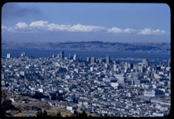
- Description:
- 100 f 6.3 tl
- Subject:
- Bodies of water, Trees, Streets, Telegraph Hill (San Francisco, Calif.), Buildings, Clouds, Dwellings, Hills, Mountains, and Domes
- Series:
- 19-55
- Creator:
- Cushman, Charles W., 1896-1972
- Date Created:
- 1955-07-02
- Genre:
- Cityscape photographs
- Frame Number:
- 3
- County:
- San Francisco
- Abstract:
- Toward Telegraph Hill
- Call Number:
- P08156
- City:
- San Francisco
- Country:
- United States
- State/Province:
- California
- Alternate Identifier:
- 1955.3
- Persistent URL:
- http://purl.dlib.indiana.edu/iudl/archives/cushman/P08156
- Holding Location:
- Bloomington - University Archives
Wells Library E460
1320 E 10th St.
Bloomington, IN 47405
Contact at archives@indiana.edu, 812-855-1127
-
- Description:
- 100 f 5.6 tl
- Subject:
- Mountains, Trees, and Shrubs
- Series:
- 17-55
- Creator:
- Cushman, Charles W., 1896-1972
- Date Created:
- 1955-06-16
- Frame Number:
- 3
- County:
- Trinity and Shasta
- Abstract:
- Tree dotted mtn slope in Shasta County [65568 mi]
- Call Number:
- P08085
- City:
- Weaverville
- Country:
- United States
- State/Province:
- California
- Alternate Identifier:
- 1755.3
- Persistent URL:
- http://purl.dlib.indiana.edu/iudl/archives/cushman/P08085
- Holding Location:
- Bloomington - University Archives
Wells Library E460
1320 E 10th St.
Bloomington, IN 47405
Contact at archives@indiana.edu, 812-855-1127
-
- Description:
- 100 f 8 tl
- Subject:
- Greenwater Range (Calif.), Valleys, Mountains, Shrubs, and Rock formations
- Series:
- 12-55
- Creator:
- Cushman, Charles W., 1896-1972
- Date Created:
- 1955-03-24
- Genre:
- Landscape photographs
- Frame Number:
- 3
- County:
- Inyo
- Abstract:
- Greenwater Mtns west of Shoshone
- Call Number:
- P07899
- City:
- Shoshone
- Country:
- United States
- State/Province:
- California
- Alternate Identifier:
- 1255.3
- Persistent URL:
- http://purl.dlib.indiana.edu/iudl/archives/cushman/P07899
- Holding Location:
- Bloomington - University Archives
Wells Library E460
1320 E 10th St.
Bloomington, IN 47405
Contact at archives@indiana.edu, 812-855-1127
-
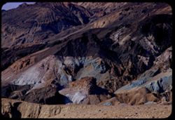
- Description:
- 100 f 6.3 tl
- Subject:
- Valleys, Mountains, Death Valley National Park (Calif. and Nev.), Hills, and Artists Palette (Calif.)
- Series:
- 10-55
- Creator:
- Cushman, Charles W., 1896-1972
- Date Created:
- 1955-03-22
- Genre:
- Landscape photographs
- Frame Number:
- 3
- County:
- Inyo
- Abstract:
- The artists Palette
- Call Number:
- P07831
- Country:
- United States
- State/Province:
- California
- Alternate Identifier:
- 1055.3
- Persistent URL:
- http://purl.dlib.indiana.edu/iudl/archives/cushman/P07831
- Holding Location:
- Bloomington - University Archives
Wells Library E460
1320 E 10th St.
Bloomington, IN 47405
Contact at archives@indiana.edu, 812-855-1127
-
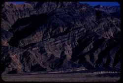
- Description:
- 100 f 8 tl
- Subject:
- Valleys, Buttes, Mountains, Shrubs, Death Valley National Park (Calif. and Nev.), and Black Mountains (Inyo County, Calif.)
- Series:
- 9-55
- Creator:
- Cushman, Charles W., 1896-1972
- Date Created:
- 1955-03-22
- Genre:
- Landscape photographs
- Frame Number:
- 3
- County:
- Inyo
- Abstract:
- Green & brown butte below east side of Black Mtns
- Call Number:
- P07795
- Country:
- United States
- State/Province:
- California
- Alternate Identifier:
- 955.3
- Persistent URL:
- http://purl.dlib.indiana.edu/iudl/archives/cushman/P07795
- Holding Location:
- Bloomington - University Archives
Wells Library E460
1320 E 10th St.
Bloomington, IN 47405
Contact at archives@indiana.edu, 812-855-1127
-
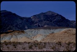
- Description:
- 100 f 6.3 tl
- Subject:
- Valleys, Death Valley (Calif. and Nev.), Mountains, and Tucki Mountain (Calif.)
- Series:
- 8-55
- Creator:
- Cushman, Charles W., 1896-1972
- Date Created:
- 1955-03-21
- Genre:
- Landscape photographs
- Frame Number:
- 3
- Street Address:
- California State Highway 190
- County:
- Inyo
- Abstract:
- South toward Tucki Mtn from near Stovepipe Wells
- Call Number:
- P07764
- City:
- Stovepipe Wells
- Country:
- United States
- State/Province:
- California
- Alternate Identifier:
- 855.3
- Persistent URL:
- http://purl.dlib.indiana.edu/iudl/archives/cushman/P07764
- Holding Location:
- Bloomington - University Archives
Wells Library E460
1320 E 10th St.
Bloomington, IN 47405
Contact at archives@indiana.edu, 812-855-1127
-
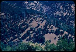
![Mountains of Gabilau Range on east side of Salinas Valley from US 101 [zuni] south of Greenfield, Monterey County](https://iiif.uits.iu.edu/iiif/2/f4752h29j%2Ffiles%2F3fdde8f0-e7ec-432e-891b-88663a382edf/full/250,/0/default.jpg)
- Description:
- 100 f 6.3 tl
- Subject:
- Valleys, Hills, Salinas Valley (Calif.), Gabilan Range (Calif.), Mountains, Dwellings, Trees, Plants, Farms, and Agricultural facilities
- Series:
- 7-55
- Creator:
- Cushman, Charles W., 1896-1972
- Date Created:
- 1955-03-20
- Genre:
- Landscape photographs
- Frame Number:
- 3
- Street Address:
- United States Highway 101
- County:
- Monterey
- Abstract:
- Mtns part of Gabilau range on east side of Salinas Valley from zuni south of Greenfield on US 101
- Call Number:
- P07727
- City:
- Greenfield
- Country:
- United States
- State/Province:
- California
- Alternate Identifier:
- 755.3
- Persistent URL:
- http://purl.dlib.indiana.edu/iudl/archives/cushman/P07727
- Holding Location:
- Bloomington - University Archives
Wells Library E460
1320 E 10th St.
Bloomington, IN 47405
Contact at archives@indiana.edu, 812-855-1127
-
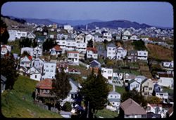
- Description:
- 200 f 4 tl
- Subject:
- Valleys, Trees, Diamond Heights (San Francisco, Calif.), Streets, Mountains, Fences, Dwellings, Hills, Utility poles, Buildings, and Lawns
- Series:
- 6-55
- Creator:
- Cushman, Charles W., 1896-1972
- Date Created:
- 1955-03-14
- Genre:
- Cityscape photographs
- Frame Number:
- 3
- Street Address:
- Farnum Street
- County:
- San Francisco
- Abstract:
- View north from top of Farnum St. on Diamond Heights Three in one views from Diamond Hts - near top of Farnum St. all in high wind
- Call Number:
- P07705
- City:
- San Francisco
- Country:
- United States
- State/Province:
- California
- Alternate Identifier:
- 655.3
- Persistent URL:
- http://purl.dlib.indiana.edu/iudl/archives/cushman/P07705
- Holding Location:
- Bloomington - University Archives
Wells Library E460
1320 E 10th St.
Bloomington, IN 47405
Contact at archives@indiana.edu, 812-855-1127
-
- Description:
- 100 f 6 tl
- Subject:
- Valleys, Roads, Trees, Mountains, Buildings, Clouds, Tamalpais, Mount (Calif.), Hills, Utility poles, Fences, and Dwellings
- Series:
- 5-55
- Creator:
- Cushman, Charles W., 1896-1972
- Date Created:
- 1955-03-10
- Genre:
- Landscape photographs
- Frame Number:
- 3
- County:
- Marin
- Abstract:
- Cloud mass above Mt. Tamalpais from top of Sausalito
- Call Number:
- P07668
- City:
- Sausalito
- Country:
- United States
- State/Province:
- California
- Alternate Identifier:
- 555.3
- Persistent URL:
- http://purl.dlib.indiana.edu/iudl/archives/cushman/P07668
- Holding Location:
- Bloomington - University Archives
Wells Library E460
1320 E 10th St.
Bloomington, IN 47405
Contact at archives@indiana.edu, 812-855-1127
-
- Description:
- 50 mm lens
- Subject:
- Valleys, Dantes View (Calif.), Mountains, Death Valley (Calif. and Nev.), Black Mountains (Inyo County, Calif.), and Clouds
- Series:
- 3-55
- Creator:
- Cushman, Charles W., 1896-1972
- Date Created:
- 1955-02-27
- Genre:
- Landscape photographs
- Frame Number:
- 3
- County:
- Inyo
- Abstract:
- View north along ridge of Black Mtns
- Call Number:
- P07596
- Country:
- United States
- State/Province:
- California
- Alternate Identifier:
- 355.3
- Persistent URL:
- http://purl.dlib.indiana.edu/iudl/archives/cushman/P07596
- Holding Location:
- Bloomington - University Archives
Wells Library E460
1320 E 10th St.
Bloomington, IN 47405
Contact at archives@indiana.edu, 812-855-1127
-
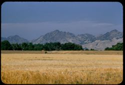
- Description:
- 100 f 5 tl
- Subject:
- Hills, Roads, Mountains, Trees, Buildings, Clouds, and Greenhorn Mountains (Calif.)
- Series:
- 2-55
- Creator:
- Cushman, Charles W., 1896-1972
- Date Created:
- 1955-02-26
- Genre:
- Landscape photographs
- Frame Number:
- 3
- Street Address:
- California State Highway 178
- County:
- Kern
- Abstract:
- From pt. 12 mi E of Bakersfield view east toward Greenhorn Mtns
- Call Number:
- P07561
- City:
- Bakersfield
- Country:
- United States
- State/Province:
- California
- Alternate Identifier:
- 255.3
- Persistent URL:
- http://purl.dlib.indiana.edu/iudl/archives/cushman/P07561
- Holding Location:
- Bloomington - University Archives
Wells Library E460
1320 E 10th St.
Bloomington, IN 47405
Contact at archives@indiana.edu, 812-855-1127
-
- Description:
- 50 f 9
- Subject:
- San Quentin Bridge (Calif.), Bodies of water, Trees, Cities & towns, Buildings, Shrubs, Tamalpais, Mount (Calif.), Hills, and Mountains
- Series:
- 16-54
- Creator:
- Cushman, Charles W., 1896-1972
- Date Created:
- 1954-10-23
- Genre:
- Landscape photographs
- Frame Number:
- 3
- County:
- Marin
- Abstract:
- View east from Tamalpais down toward San Quentin + [?] bridge.
- Call Number:
- P07502
- Country:
- United States
- State/Province:
- California
- Physical Description:
- Anscochrome film.
- Alternate Identifier:
- 1654.3
- Persistent URL:
- http://purl.dlib.indiana.edu/iudl/archives/cushman/P07502
- Holding Location:
- Bloomington - University Archives
Wells Library E460
1320 E 10th St.
Bloomington, IN 47405
Contact at archives@indiana.edu, 812-855-1127
-
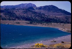
- Description:
- 50 f 6.3
- Subject:
- Bodies of water, Trees, Coastlines, June Lake (Calif.), Shrubs, Lakes & ponds, Flowers, and Mountains
- Series:
- 11-54
- Creator:
- Cushman, Charles W., 1896-1972
- Date Created:
- 1954-09-16
- Genre:
- Landscape photographs
- Frame Number:
- 3
- County:
- Mono
- Abstract:
- June Lake from east side in mid afternoon.
- Call Number:
- P07372
- Country:
- United States
- State/Province:
- California
- Alternate Identifier:
- 1154.3
- Persistent URL:
- http://purl.dlib.indiana.edu/iudl/archives/cushman/P07372
- Holding Location:
- Bloomington - University Archives
Wells Library E460
1320 E 10th St.
Bloomington, IN 47405
Contact at archives@indiana.edu, 812-855-1127
-
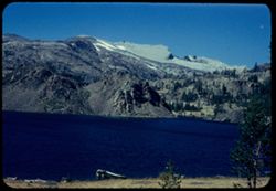
- Description:
- 50 f 9
- Subject:
- Bodies of water, Yosemite National Park (Calif.), Boats, Tioga Pass (Calif.), Mountains, Shrubs, Lakes & ponds, Passes (Landforms), Ellery Lake (Calif.),...
- Series:
- 10-54
- Creator:
- Cushman, Charles W., 1896-1972
- Date Created:
- 1954-09-16
- Genre:
- Landscape photographs
- Frame Number:
- 3
- County:
- Mono
- Abstract:
- Ellory [sic] Lake.
- Call Number:
- P07350
- Country:
- United States
- State/Province:
- California
- Physical Description:
- Anscochrome film.
- Alternate Identifier:
- 1054.3
- Persistent URL:
- http://purl.dlib.indiana.edu/iudl/archives/cushman/P07350
- Holding Location:
- Bloomington - University Archives
Wells Library E460
1320 E 10th St.
Bloomington, IN 47405
Contact at archives@indiana.edu, 812-855-1127
-
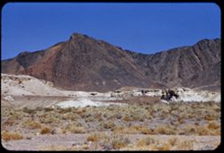
Dardanelles Cone above Stanislaus river canyon a few miles west of Dardanelle - from Calif. Hwy 108.
- Description:
- 50 f 8
- Subject:
- Dardanelles Butte (Calif.), Canyons, Lava flows, Mountains, Trees, Stanislaus River (Calif.), Buttes, Volcanoes, and Dardanelles Cone (Calif.)
- Series:
- 9-54
- Creator:
- Cushman, Charles W., 1896-1972
- Date Created:
- 1954-09-15
- Genre:
- Landscape photographs
- Frame Number:
- 3
- Street Address:
- California State Highway 108
- County:
- Tuolumne
- Abstract:
- Dardanelles Cone. Looking north across canyon from Hwy 108 about 8 or 9 miles w. of Dardanelle.
- Call Number:
- P07314
- City:
- Dardanelle
- Country:
- United States
- State/Province:
- California
- Alternate Identifier:
- 954.3
- Persistent URL:
- http://purl.dlib.indiana.edu/iudl/archives/cushman/P07314
- Holding Location:
- Bloomington - University Archives
Wells Library E460
1320 E 10th St.
Bloomington, IN 47405
Contact at archives@indiana.edu, 812-855-1127
-
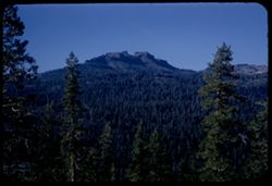
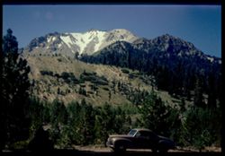
- Description:
- 50 f 8
- Subject:
- Cascade Range, Roads, Trees, Pines, Volcanoes, Volcanic domes, Lassen Volcanic National Park (Calif.), Lava domes, Clouds, Mountains, and Lassen Peak (Calif.)
- Series:
- 6-54
- Creator:
- Cushman, Charles W., 1896-1972
- Date Created:
- 1954-08-19
- Genre:
- Landscape photographs
- Frame Number:
- 3
- County:
- Shasta
- Abstract:
- Mt. Lassen
- Call Number:
- P07222
- Country:
- United States
- State/Province:
- California
- Alternate Identifier:
- 654.3
- Persistent URL:
- http://purl.dlib.indiana.edu/iudl/archives/cushman/P07222
- Holding Location:
- Bloomington - University Archives
Wells Library E460
1320 E 10th St.
Bloomington, IN 47405
Contact at archives@indiana.edu, 812-855-1127
-
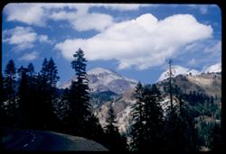
- Description:
- 50 f 9
- Subject:
- Snow, Automobiles, Trees, Volcanoes, Volcanic domes, Lassen Volcanic National Park (Calif.), Lava domes, Shrubs, Lassen Peak (Calif.), and Mountains
- Series:
- 5-54
- Creator:
- Cushman, Charles W., 1896-1972
- Date Created:
- 1954-08-19
- Genre:
- Landscape photographs
- Frame Number:
- 3
- County:
- Shasta
- Abstract:
- East face of Lassen Pk with snow valleys (car in foreground) Cushman
- Call Number:
- P07199
- Country:
- United States
- State/Province:
- California
- Physical Description:
- Image was originally mounted in a glass enclosure. Before digitization, the image was removed and placed in a Wess Plastic, Inc. brand, 2" x 2", pl...
- Alternate Identifier:
- 554.3
- Persistent URL:
- http://purl.dlib.indiana.edu/iudl/archives/cushman/P07199
- Holding Location:
- Bloomington - University Archives
Wells Library E460
1320 E 10th St.
Bloomington, IN 47405
Contact at archives@indiana.edu, 812-855-1127
-
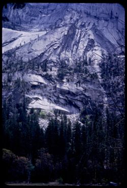
- Description:
- 50 f 6.3
- Subject:
- Yosemite Valley (Calif.), Valleys, Yosemite National Park (Calif.), Mirror Lake (Mariposa County, Calif.), Half Dome (Calif.), Mountains, National parks &...
- Series:
- 6-53
- Creator:
- Cushman, Charles W., 1896-1972
- Date Created:
- 1953-05-14
- Genre:
- Landscape photographs
- Frame Number:
- 3
- County:
- Mariposa
- Abstract:
- Rock face below Half Dome from Mirror Lake
- Call Number:
- P06691
- Country:
- United States
- State/Province:
- California
- Alternate Identifier:
- 653.3
- Persistent URL:
- http://purl.dlib.indiana.edu/iudl/archives/cushman/P06691
- Holding Location:
- Bloomington - University Archives
Wells Library E460
1320 E 10th St.
Bloomington, IN 47405
Contact at archives@indiana.edu, 812-855-1127
-
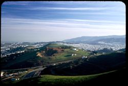
- Description:
- 25 f 4.5 Pola
- Subject:
- San Bruno Mountain (Calif.), Twin Peaks (San Francisco County, Calif.), Automobiles, Trees, Shadows, Mountains, Buildings, Clouds, Dwellings, Hills, and Roads
- Series:
- 2-53
- Creator:
- Cushman, Charles W., 1896-1972
- Date Created:
- 1953-01-22
- Genre:
- Cityscape photographs
- Frame Number:
- 3
- County:
- San Francisco
- Abstract:
- South from Twin Peaks at 3:45.
- Call Number:
- P06537
- City:
- San Francisco
- Country:
- United States
- State/Province:
- California
- Alternate Identifier:
- 253.3
- Persistent URL:
- http://purl.dlib.indiana.edu/iudl/archives/cushman/P06537
- Holding Location:
- Bloomington - University Archives
Wells Library E460
1320 E 10th St.
Bloomington, IN 47405
Contact at archives@indiana.edu, 812-855-1127
-
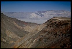
- Description:
- 25 f 9
- Subject:
- Panamint Mountains (Calif.), Deserts, Canyons, Valleys, Death Valley (Calif. and Nev.), Panamint Valley (Calif.), Mountains, Cliffs, and Panamint Range (Calif.)
- Series:
- 15-52
- Creator:
- Cushman, Charles W., 1896-1972
- Date Created:
- 1952-04-01
- Genre:
- Landscape photographs
- Frame Number:
- 3
- County:
- Inyo
- Abstract:
- Mouth of Canyon into Panamint Valley - Panamint Mtns in distance.
- Call Number:
- P06024
- Country:
- United States
- State/Province:
- California
- Physical Description:
- Image was originally mounted in a glass enclosure. Before digitization, the image was removed and placed in a Wess Plastic, Inc. brand, 2" x 2", pl...
- Alternate Identifier:
- 1552.3
- Persistent URL:
- http://purl.dlib.indiana.edu/iudl/archives/cushman/P06024
- Holding Location:
- Bloomington - University Archives
Wells Library E460
1320 E 10th St.
Bloomington, IN 47405
Contact at archives@indiana.edu, 812-855-1127
-
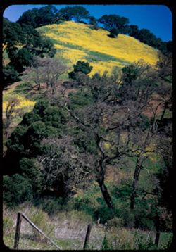
- Description:
- 25 f 9
- Subject:
- Wildflowers, Trees, Flowers, Mountains, Fences, Hills, and Mustard (Plant)
- Series:
- 10-52
- Creator:
- Cushman, Charles W., 1896-1972
- Date Created:
- 1952-03-09
- Genre:
- Landscape photographs
- Frame Number:
- 3
- Street Address:
- California State Highway 24
- County:
- Alameda and Contra Costa
- Abstract:
- Mustard covered mtn. Side nr. Lafayette on Cal 24
- Call Number:
- P05839
- City:
- Oakland and Lafayette
- Country:
- United States
- State/Province:
- California
- Alternate Identifier:
- 1052.3
- Persistent URL:
- http://purl.dlib.indiana.edu/iudl/archives/cushman/P05839
- Holding Location:
- Bloomington - University Archives
Wells Library E460
1320 E 10th St.
Bloomington, IN 47405
Contact at archives@indiana.edu, 812-855-1127
-
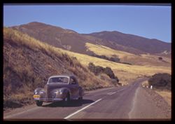
- Subject:
- Roads, Automobiles, Trees, Mountains, Fences, and Shrubs
- Series:
- 7-40
- Creator:
- Cushman, Charles W., 1896-1972
- Date Created:
- 1940-06-20
- Genre:
- Landscape photographs
- Frame Number:
- 3
- Street Address:
- Atascadero Road
- County:
- San Luis Obispo
- Abstract:
- The Morro Bay- Atascadero road.
- Call Number:
- P01859
- City:
- Morro Bay
- Country:
- United States
- State/Province:
- California
- Physical Description:
- Image was originally mounted in a glass enclosure. Before digitization, the image was removed and placed in a Wess Plastic, Inc. brand, 2" x 2", pl...
- Alternate Identifier:
- 740.3
- Persistent URL:
- http://purl.dlib.indiana.edu/iudl/archives/cushman/P01859
- Holding Location:
- Bloomington - University Archives
Wells Library E460
1320 E 10th St.
Bloomington, IN 47405
Contact at archives@indiana.edu, 812-855-1127