
Search Constraints
You searched for:
Campus
IUB
Remove constraint Campus: IUB
Frame Number
8
Remove constraint Frame Number: 8
Subject
Hills
Remove constraint Subject: Hills
1 - 71 of 71
Search Results
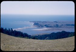
-
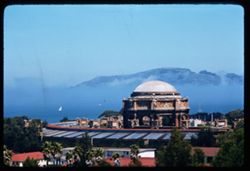
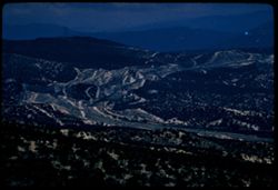
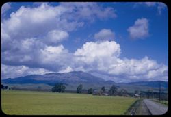
- Description:
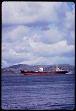
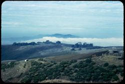
- 100 f TL
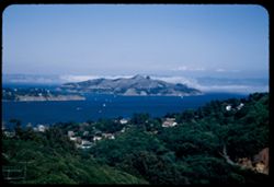
- Subject:
- Hills, San Francisco Bay (Calif.), Bays (Bodies of water), Cargo ships, and Clouds
- Series:
- 1-69
- Creator:
- Cushman, Charles W., 1896-1972
- Date Created:
- 1969-02-01
- Genre:
- Marine photographs
- Frame Number:
- 8
- County:
- San Francisco
- Call Number:
- P15703
- City:
- San Francisco
- Country:
- United States
- State/Province:
- California
- Alternate Identifier:
- 169.8
- Persistent URL:
- http://purl.dlib.indiana.edu/iudl/archives/cushman/P15703
- Holding Location:
- Bloomington - University Archives
Wells Library E460
1320 E 10th St.
Bloomington, IN 47405
Contact at archives@indiana.edu, 812-855-1127
-
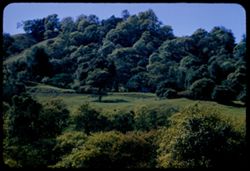
- Description:
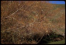
- 100 f 8
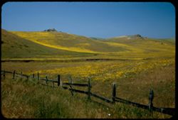
- Subject:
- Willows, Tree limbs, and Hills
- Series:
- 4-68
- Creator:
- Cushman, Charles W., 1896-1972
- Date Created:
- 1968-12-04
- Genre:
- Identification photographs
- Frame Number:
- 8
- Street Address:
- Petaluma-Point Reyes Station Road
- County:
- Marin
- Call Number:
- P15681
- Country:
- United States
- State/Province:
- California
- Alternate Identifier:
- 468.8
- Persistent URL:
- http://purl.dlib.indiana.edu/iudl/archives/cushman/P15681
- Holding Location:
- Bloomington - University Archives
Wells Library E460
1320 E 10th St.
Bloomington, IN 47405
Contact at archives@indiana.edu, 812-855-1127
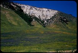
-
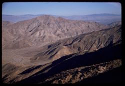
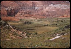
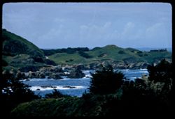
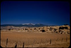
- Description:
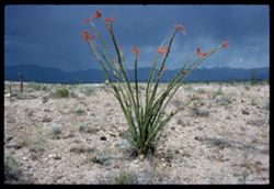
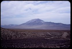
- 100 f 12?
- Subject:
- Rocks, Hills, Mountains, Grasses, Ocotillo, Deserts, Storms, Flowers, and Plants
- Series:
- 1-66
- Creator:
- Cushman, Charles W., 1896-1972
- Date Created:
- 1966-04-22
- Genre:
- Identification photographs and Landscape photographs
- Frame Number:
- 8
- Street Address:
- United States Highway 66
- County:
- Mohave
- Abstract:
- Ocotillo along U.S. 66- Mojave county
- Call Number:
- P15249
- Country:
- United States
- State/Province:
- Arizona
- Alternate Identifier:
- 166.8
- Persistent URL:
- http://purl.dlib.indiana.edu/iudl/archives/cushman/P15249
- Holding Location:
- Bloomington - University Archives
Wells Library E460
1320 E 10th St.
Bloomington, IN 47405
Contact at archives@indiana.edu, 812-855-1127
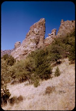
-
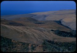
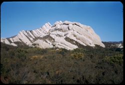
- Description:
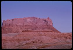
- 100 f 11 or 13 TL
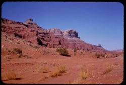
- Subject:
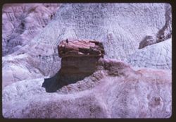
- Valleys, Erosion, Cliffs, Buttes, Rock formations, and Hills
- Series:
- 39-65
- Creator:
- Cushman, Charles W., 1896-1972
- Date Created:
- 1965-10-12
- Genre:
- Landscape photographs
- Frame Number:
- 8
- County:
- Apache
- Abstract:
- Butte west of Round Rock
- Call Number:
- P15189
- City:
- Round Rock
- Country:
- United States
- State/Province:
- Arizona
- Alternate Identifier:
- 3965.8
- Persistent URL:
- http://purl.dlib.indiana.edu/iudl/archives/cushman/P15189
- Holding Location:
- Bloomington - University Archives
Wells Library E460
1320 E 10th St.
Bloomington, IN 47405
Contact at archives@indiana.edu, 812-855-1127
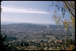
-
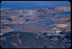
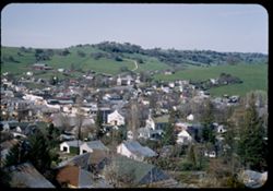
- Description:
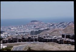
- 100 f 11 tl
- Subject:
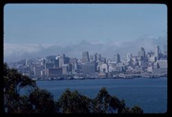
- Twin Peaks (San Francisco County, Calif.), Cities & towns, Hills, Broadcasting, Roads, Bays (Bodies of water), Dwellings, Towers, and Bay View Hill (Calif.)
- Series:
- 27-65
- Creator:
- Cushman, Charles W., 1896-1972
- Date Created:
- 1965-07-27
- Genre:
- Cityscape photographs
- Frame Number:
- 8
- County:
- San Francisco
- Abstract:
- So. & East from south shoulder of Twin Peaks
- Call Number:
- P14807
- Country:
- United States
- State/Province:
- California
- Alternate Identifier:
- 2765.8
- Persistent URL:
- http://purl.dlib.indiana.edu/iudl/archives/cushman/P14807
- Holding Location:
- Bloomington - University Archives
Wells Library E460
1320 E 10th St.
Bloomington, IN 47405
Contact at archives@indiana.edu, 812-855-1127
-
- Description:
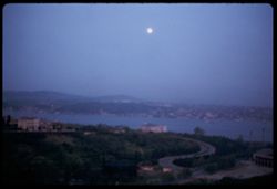
- 50 f 1.5
- Subject:
- Channels, Roads, Coastlines, Moon, Sunrises & sunsets, Bosporus (Turkey), and Hills
- Series:
- 22-65
- Creator:
- Cushman, Charles W., 1896-1972
- Date Created:
- 1965-05-14
- Genre:
- Snapshots
- Frame Number:
- 8
- County:
- Istanbul
- Abstract:
- Full moon - Bosphorus
- Call Number:
- P14623
- City:
- Istanbul
- Country:
- Turkey
- State/Province:
- Marmara
- Alternate Identifier:
- 2265.8
- Persistent URL:
- http://purl.dlib.indiana.edu/iudl/archives/cushman/P14623
- Holding Location:
- Bloomington - University Archives
Wells Library E460
1320 E 10th St.
Bloomington, IN 47405
Contact at archives@indiana.edu, 812-855-1127
-
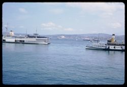
- Subject:
- Bays (Bodies of water), Haliç (Turkey), Life preservers, Coastlines, Ferries, Clouds, and Hills
- Series:
- 21-65
- Creator:
- Cushman, Charles W., 1896-1972
- Date Created:
- 1965-05-13
- Genre:
- Marine photographs
- Frame Number:
- 8
- Street Address:
- Galata
- County:
- Istanbul
- Abstract:
- Golden Horn east of Galata bridge
- Call Number:
- P14586
- City:
- Istanbul
- Country:
- Turkey
- State/Province:
- Marmara
- Alternate Identifier:
- 2165.8
- Persistent URL:
- http://purl.dlib.indiana.edu/iudl/archives/cushman/P14586
- Holding Location:
- Bloomington - University Archives
Wells Library E460
1320 E 10th St.
Bloomington, IN 47405
Contact at archives@indiana.edu, 812-855-1127
-
- Description:
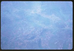
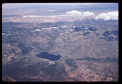
- 200 f ?
- Subject:
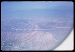
- Valleys, Pan American World Airways, inc., Air travel, Hills, and Rivers
- Series:
- 20-65
- Creator:
- Cushman, Charles W., 1896-1972
- Date Created:
- 1965-05-11
- Genre:
- Aerial photographs and Landscape photographs
- Frame Number:
- 8
- Call Number:
- P14549
- Country:
- Turkey
- Alternate Identifier:
- 2065.8
- Persistent URL:
- http://purl.dlib.indiana.edu/iudl/archives/cushman/P14549
- Holding Location:
- Bloomington - University Archives
Wells Library E460
1320 E 10th St.
Bloomington, IN 47405
Contact at archives@indiana.edu, 812-855-1127
-
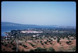
- Description:
- 200 f 8
- Subject:
- Orchards, Bays (Bodies of water), Trees, Coastlines, Buildings, Saronic Gulf (Greece), and Hills
- Series:
- 14-65
- Creator:
- Cushman, Charles W., 1896-1972
- Date Created:
- 1965-04-28
- Genre:
- Landscape photographs and Seascapes
- Frame Number:
- 8
- Abstract:
- Saronic Gulf
- Call Number:
- P14322
- Country:
- Greece
- Alternate Identifier:
- 1465.8
- Persistent URL:
- http://purl.dlib.indiana.edu/iudl/archives/cushman/P14322
- Holding Location:
- Bloomington - University Archives
Wells Library E460
1320 E 10th St.
Bloomington, IN 47405
Contact at archives@indiana.edu, 812-855-1127
-
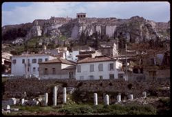
- Description:
- 100 f 11
- Subject:
- Buildings, Fences, Columns, Grasses, Dwellings, Colonnades, Greek temples, Agora (Athens, Greece), Walls, Acropolis (Athens, Greece), Hills, Markets, and Arc...
- Series:
- 11-65
- Creator:
- Cushman, Charles W., 1896-1972
- Date Created:
- 1965-04-20
- Genre:
- Cityscape photographs
- Frame Number:
- 8
- County:
- Attica
- Abstract:
- Acropolis from Roman Agora
- Call Number:
- P14209
- City:
- Athens
- Country:
- Greece
- State/Province:
- Central Greece and Euboea
- Alternate Identifier:
- 1165.8
- Persistent URL:
- http://purl.dlib.indiana.edu/iudl/archives/cushman/P14209
- Holding Location:
- Bloomington - University Archives
Wells Library E460
1320 E 10th St.
Bloomington, IN 47405
Contact at archives@indiana.edu, 812-855-1127
-
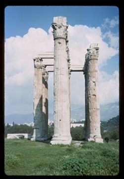
- Description:
- 100 f 11
- Subject:
- Capitals (Columns), Meadows, Archaeological sites, Hills, Columns, Colonnades, Temple of Zeus (Athens, Greece), Clouds, and Greek temples
- Series:
- 10-65
- Creator:
- Cushman, Charles W., 1896-1972
- Date Created:
- 1965-04-15
- Genre:
- Architectural photographs
- Frame Number:
- 8
- County:
- Attica
- Abstract:
- Temple of Zeus and Temple of Zeus with billowy cloud
- Call Number:
- P14173
- City:
- Athens
- Country:
- Greece
- State/Province:
- Central Greece and Euboea
- Alternate Identifier:
- 1065.8
- Persistent URL:
- http://purl.dlib.indiana.edu/iudl/archives/cushman/P14173
- Holding Location:
- Bloomington - University Archives
Wells Library E460
1320 E 10th St.
Bloomington, IN 47405
Contact at archives@indiana.edu, 812-855-1127
-
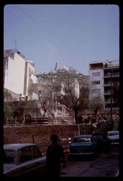
- Description:
- 100 f 11
- Subject:
- Likavittós (Greece), Streets, Hills, Automobiles, People, Dwellings, Trees, Buildings, and Fences
- Series:
- 8-65
- Creator:
- Cushman, Charles W., 1896-1972
- Date Created:
- 1965-04-10
- Genre:
- Cityscape photographs
- Frame Number:
- 8
- County:
- Attica
- Abstract:
- Likavitos and Toward Acropolis from Likavitos
- Call Number:
- P14098
- City:
- Athens
- Country:
- Greece
- State/Province:
- Central Greece and Euboea
- Alternate Identifier:
- 865.8
- Persistent URL:
- http://purl.dlib.indiana.edu/iudl/archives/cushman/P14098
- Holding Location:
- Bloomington - University Archives
Wells Library E460
1320 E 10th St.
Bloomington, IN 47405
Contact at archives@indiana.edu, 812-855-1127
-
- Subject:
- Valleys, Mountains, Air travel, and Hills
- Series:
- 1-65
- Creator:
- Cushman, Charles W., 1896-1972
- Date Created:
- 1965-03-30
- Genre:
- Aerial photographs and Landscape photographs
- Frame Number:
- 8
- Call Number:
- P13872
- Country:
- United States
- State/Province:
- California
- Alternate Identifier:
- 165.8
- Persistent URL:
- http://purl.dlib.indiana.edu/iudl/archives/cushman/P13872
- Holding Location:
- Bloomington - University Archives
Wells Library E460
1320 E 10th St.
Bloomington, IN 47405
Contact at archives@indiana.edu, 812-855-1127
-
- Description:
- 100 f 11 TL
- Subject:
- Deserts, Blue Mesa (Ariz.), Petrified forests, Petrified Forest National Park (Ariz.), National parks & reserves, Logs, Hills, Erosion, Shadows, and Rock...
- Series:
- 6-63
- Creator:
- Cushman, Charles W., 1896-1972
- Date Created:
- 1963-06-27
- Genre:
- Landscape photographs and Identification photographs
- Frame Number:
- 8
- County:
- Apache and Navajo
- Abstract:
- Distantly Down from Blue Mesa
- Call Number:
- P12961
- City:
- Holbrook
- Country:
- United States
- State/Province:
- Arizona
- Alternate Identifier:
- 663.8
- Persistent URL:
- http://purl.dlib.indiana.edu/iudl/archives/cushman/P12961
- Holding Location:
- Bloomington - University Archives
Wells Library E460
1320 E 10th St.
Bloomington, IN 47405
Contact at archives@indiana.edu, 812-855-1127
-
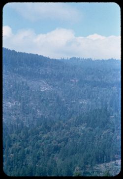
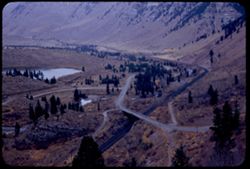
- Description:
- 100 f 5.6 SL
- Subject:
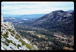
- Rocks, Valleys, Echo Summit (El Dorado County, Calif.), Trees, Mountains, Tahoe, Lake (Calif. and Nev.), Lakes & ponds, Sierra Nevada (Calif. and Nev.), ...
- Series:
- 3-62
- Creator:
- Cushman, Charles W., 1896-1972
- Date Created:
- 1962-09-28
- Genre:
- Landscape photographs
- Frame Number:
- 8
- Abstract:
- Toward right.
- Call Number:
- P12706
- Country:
- United States
- State/Province:
- California
- Alternate Identifier:
- 362.8
- Persistent URL:
- http://purl.dlib.indiana.edu/iudl/archives/cushman/P12706
- Holding Location:
- Bloomington - University Archives
Wells Library E460
1320 E 10th St.
Bloomington, IN 47405
Contact at archives@indiana.edu, 812-855-1127
-
- Description:
- 100 f 8 TL
- Subject:
- Bays (Bodies of water), Piers & wharves, Skyscrapers, Yerba Buena Island (Calif.), Tree limbs, Buildings, Dwellings, Hills, and San Francisco Bay (Calif.)
- Series:
- 2-62
- Creator:
- Cushman, Charles W., 1896-1972
- Date Created:
- 1962-08-21
- Genre:
- Marine photographs and Cityscape photographs
- Frame Number:
- 8
- County:
- San Francisco
- Call Number:
- P12668
- City:
- San Francisco
- Country:
- United States
- State/Province:
- California
- Alternate Identifier:
- 262.8
- Persistent URL:
- http://purl.dlib.indiana.edu/iudl/archives/cushman/P12668
- Holding Location:
- Bloomington - University Archives
Wells Library E460
1320 E 10th St.
Bloomington, IN 47405
Contact at archives@indiana.edu, 812-855-1127
-
- Description:
- 100 f 6.3 TL
- Subject:
- Bays (Bodies of water), Palace of Fine Arts (San Francisco), Presidio of San Francisco (Calif.), Fog, Trees, Roofs, Friezes (Ornamental bands), Entablatures,...
- Series:
- 1-62
- Creator:
- Cushman, Charles W., 1896-1972
- Date Created:
- 1962-04-22
- Genre:
- Landscape photographs and Cityscape photographs
- Frame Number:
- 8
- County:
- San Francisco
- Abstract:
- From Presidio - views of Golden Gate and Bay with fog setting in
- Call Number:
- P12632
- City:
- San Francisco
- Country:
- United States
- State/Province:
- California
- Alternate Identifier:
- 162.8
- Persistent URL:
- http://purl.dlib.indiana.edu/iudl/archives/cushman/P12632
- Holding Location:
- Bloomington - University Archives
Wells Library E460
1320 E 10th St.
Bloomington, IN 47405
Contact at archives@indiana.edu, 812-855-1127
-
- Description:
- 50 f 11 haze filter
- Subject:
- Valleys, San Jacinto Mountains (Calif.), Hills, Coachella Valley (Calif.), and Mountains
- Series:
- 24-61
- Creator:
- Cushman, Charles W., 1896-1972
- Date Created:
- 1961-12-27
- Genre:
- Landscape photographs
- Frame Number:
- 8
- Street Address:
- California State Highway 74
- County:
- Riverside
- Abstract:
- Looking down into Coachella Valley from ht of rd. 74
- Call Number:
- P12574
- Country:
- United States
- State/Province:
- California
- Alternate Identifier:
- 2461.8
- Persistent URL:
- http://purl.dlib.indiana.edu/iudl/archives/cushman/P12574
- Holding Location:
- Bloomington - University Archives
Wells Library E460
1320 E 10th St.
Bloomington, IN 47405
Contact at archives@indiana.edu, 812-855-1127
-
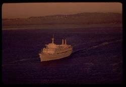
- Description:
- 100 f 4.5 TL
- Subject:
- Bays (Bodies of water), Canberra (Ship), P & O Cruises (Firm), Ocean liners, Hills, San Francisco Bay (Calif.), and Golden Gate Bridge (San Francisco, Ca...
- Series:
- 23-61
- Creator:
- Cushman, Charles W., 1896-1972
- Date Created:
- 1961-11-06
- Genre:
- Marine photographs
- Frame Number:
- 8
- County:
- San Francisco
- Abstract:
- outward bound
- Call Number:
- P12537
- City:
- San Francisco
- Country:
- United States
- State/Province:
- California
- Alternate Identifier:
- 2361.8
- Persistent URL:
- http://purl.dlib.indiana.edu/iudl/archives/cushman/P12537
- Holding Location:
- Bloomington - University Archives
Wells Library E460
1320 E 10th St.
Bloomington, IN 47405
Contact at archives@indiana.edu, 812-855-1127
-
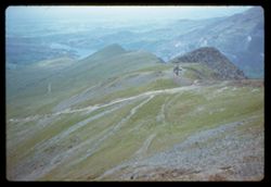
- Description:
- 250 f 2
- Subject:
- Bodies of water, Valleys, Trails & paths, Hills, Mountains, Snowdon (Wales), Railroad travel, and Mountain railroads
- Series:
- 12-61
- Creator:
- Cushman, Charles W., 1896-1972
- Date Created:
- 1961-05-25
- Genre:
- Landscape photographs
- Frame Number:
- 8
- Call Number:
- P12130
- Country:
- United Kingdom
- State/Province:
- Wales
- Alternate Identifier:
- 1261.8
- Persistent URL:
- http://purl.dlib.indiana.edu/iudl/archives/cushman/P12130
- Holding Location:
- Bloomington - University Archives
Wells Library E460
1320 E 10th St.
Bloomington, IN 47405
Contact at archives@indiana.edu, 812-855-1127
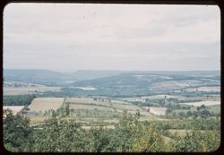
-
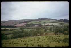
- Description:
- 500 f 2
- Subject:
- Houses, Trees, Meadows, Croplands, and Hills
- Series:
- 11-61
- Creator:
- Cushman, Charles W., 1896-1972
- Date Created:
- 1961-05-24
- Genre:
- Landscape photographs
- Frame Number:
- 8
- Street Address:
- Highway A 44
- County:
- Montgomery
- Abstract:
- Montgomery shire
- Call Number:
- P12094
- Country:
- United Kingdom
- State/Province:
- Wales
- Alternate Identifier:
- 1161.8
- Persistent URL:
- http://purl.dlib.indiana.edu/iudl/archives/cushman/P12094
- Holding Location:
- Bloomington - University Archives
Wells Library E460
1320 E 10th St.
Bloomington, IN 47405
Contact at archives@indiana.edu, 812-855-1127
-
- Description:
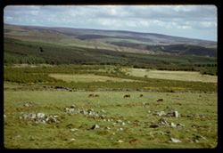
- 200 f 2.5
- Subject:
- Rocks, Moors (Wetlands), Grasses, Dartmoor (England), Grazing, Horses, Shadows, Shrubs, Clouds, Hills, and Stone walls
- Series:
- 6-61
- Creator:
- Cushman, Charles W., 1896-1972
- Date Created:
- 1961-05-08
- Genre:
- Landscape photographs
- Frame Number:
- 8
- County:
- Devon
- Abstract:
- Dartmoor
- Call Number:
- P11907
- Country:
- United Kingdom
- State/Province:
- England
- Alternate Identifier:
- 661.8
- Persistent URL:
- http://purl.dlib.indiana.edu/iudl/archives/cushman/P11907
- Holding Location:
- Bloomington - University Archives
Wells Library E460
1320 E 10th St.
Bloomington, IN 47405
Contact at archives@indiana.edu, 812-855-1127
-
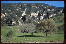
- Description:
- 50 f 8
- Subject:
- Grazing, Trees, Meadows, Livestock, Mountains, Hills, and Cattle
- Series:
- 27-60
- Creator:
- Cushman, Charles W., 1896-1972
- Date Created:
- 1960-12-29
- Genre:
- Landscape photographs
- Frame Number:
- 8
- Street Address:
- United States Highway 101
- County:
- Santa Barbara
- Abstract:
- Hills north of Gaviota
- Call Number:
- P11750
- City:
- Gaviota
- Country:
- United States
- State/Province:
- California
- Alternate Identifier:
- 2760.8
- Persistent URL:
- http://purl.dlib.indiana.edu/iudl/archives/cushman/P11750
- Holding Location:
- Bloomington - University Archives
Wells Library E460
1320 E 10th St.
Bloomington, IN 47405
Contact at archives@indiana.edu, 812-855-1127
-
- Description:
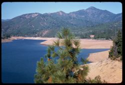
- 50 f 8
- Subject:
- Lakes & ponds, Tree limbs, Sacramento River (Calif.), Hills, Mountains, Shasta Lake (Calif.), Trees, and Rivers
- Series:
- 23-60
- Creator:
- Cushman, Charles W., 1896-1972
- Date Created:
- 1960-09-15
- Genre:
- Landscape photographs
- Frame Number:
- 8
- County:
- Shasta
- Abstract:
- Sacramento river north of Shasta Lake
- Call Number:
- P11630
- Country:
- United States
- State/Province:
- California
- Alternate Identifier:
- 2360.8
- Persistent URL:
- http://purl.dlib.indiana.edu/iudl/archives/cushman/P11630
- Holding Location:
- Bloomington - University Archives
Wells Library E460
1320 E 10th St.
Bloomington, IN 47405
Contact at archives@indiana.edu, 812-855-1127
-
- Description:
- 100 f 5
- Subject:
- Lakes & ponds, Air France, Air travel, Mountains, Snow, Shadows, Clouds, and Hills
- Series:
- 3-60
- Creator:
- Cushman, Charles W., 1896-1972
- Date Created:
- 1960-05-07
- Genre:
- Aerial photographs and Landscape photographs
- Frame Number:
- 8
- Abstract:
- Snow spotted mtns
- Call Number:
- P10968
- Country:
- United States
- Alternate Identifier:
- 360.8
- Persistent URL:
- http://purl.dlib.indiana.edu/iudl/archives/cushman/P10968
- Holding Location:
- Bloomington - University Archives
Wells Library E460
1320 E 10th St.
Bloomington, IN 47405
Contact at archives@indiana.edu, 812-855-1127
-
- Description:
- 100 f 5.6 TL
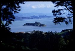
- Subject:
- Piers & wharves, Channels, Trees, San Pablo Strait (Calif.), Tree limbs, Mountains, Buildings, Bridges, Islands, and Hills
- Series:
- 2-60
- Creator:
- Cushman, Charles W., 1896-1972
- Date Created:
- 1960-03-08
- Genre:
- Landscape photographs
- Frame Number:
- 8
- County:
- Marin
- Abstract:
- From ht. East of S. Rafael - Marin Islands in San Pablo str.
- Call Number:
- P10939
- City:
- San Rafael
- Country:
- United States
- State/Province:
- California
- Alternate Identifier:
- 260.8
- Persistent URL:
- http://purl.dlib.indiana.edu/iudl/archives/cushman/P10939
- Holding Location:
- Bloomington - University Archives
Wells Library E460
1320 E 10th St.
Bloomington, IN 47405
Contact at archives@indiana.edu, 812-855-1127
-
- Description:
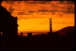
- f 4 tl
- Subject:
- Domes, Palace of Fine Arts (San Francisco), Hills, Bridges, Golden Gate Bridge (San Francisco, Calif.), Suspension bridges, Clouds, Sunrises & sunsets, C...
- Series:
- 15-59
- Creator:
- Cushman, Charles W., 1896-1972
- Date Created:
- 1959-08-23
- Genre:
- Views
- Frame Number:
- 8
- County:
- San Francisco
- Call Number:
- P10847
- City:
- San Francisco
- Country:
- United States
- State/Province:
- California
- Physical Description:
- Anscochrome film.
- Alternate Identifier:
- 1559.8
- Persistent URL:
- http://purl.dlib.indiana.edu/iudl/archives/cushman/P10847
- Holding Location:
- Bloomington - University Archives
Wells Library E460
1320 E 10th St.
Bloomington, IN 47405
Contact at archives@indiana.edu, 812-855-1127
-

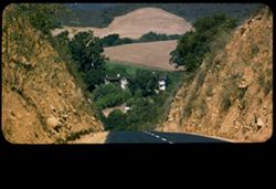
- Description:
- 100 f 6.3 SL
- Subject:
- Grasses, Roads, Farms, Fences, Hay, Hills, and Cliffs
- Series:
- 11-58
- Creator:
- Cushman, Charles W., 1896-1972
- Date Created:
- 1958-06-14
- Genre:
- Landscape photographs
- Frame Number:
- 8
- Street Address:
- United States Highway 20
- County:
- Malheur and Harney
- Abstract:
- Green & dark red cliff
- Call Number:
- P09983
- City:
- Burns
- Country:
- United States
- State/Province:
- Oregon
- Alternate Identifier:
- 1158.8
- Persistent URL:
- http://purl.dlib.indiana.edu/iudl/archives/cushman/P09983
- Holding Location:
- Bloomington - University Archives
Wells Library E460
1320 E 10th St.
Bloomington, IN 47405
Contact at archives@indiana.edu, 812-855-1127
-
- Description:
- 100 f 5.6 sl
- Subject:
- Canyons, Valleys, Hills, Snow Canyon (Washington County, Utah), Plants, and Rock formations
- Series:
- 8-58
- Creator:
- Cushman, Charles W., 1896-1972
- Date Created:
- 1958-04-29
- Genre:
- Landscape photographs
- Frame Number:
- 8
- Street Address:
- Utah State Highway 18
- County:
- Washington
- Abstract:
- Looking down into Snow's Valley
- Call Number:
- P09896
- City:
- Saint George
- Country:
- United States
- State/Province:
- Utah
- Alternate Identifier:
- 858.8
- Persistent URL:
- http://purl.dlib.indiana.edu/iudl/archives/cushman/P09896
- Holding Location:
- Bloomington - University Archives
Wells Library E460
1320 E 10th St.
Bloomington, IN 47405
Contact at archives@indiana.edu, 812-855-1127
-
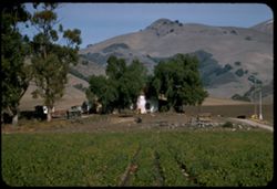
- Description:
- 100 f 6.3 tl
- Subject:
- Farmhouses, Outbuildings, Farms, Trees, Croplands, Hills, Truck farming, Farming, and Mountains
- Series:
- 18-57
- Creator:
- Cushman, Charles W., 1896-1972
- Date Created:
- 1957-12-01
- Genre:
- Views
- Frame Number:
- 8
- County:
- San Luis Obispo
- Abstract:
- Farm along Arroyo Grande
- Call Number:
- P09631
- City:
- Arroyo Grande
- Country:
- United States
- State/Province:
- California
- Alternate Identifier:
- 1857.8
- Persistent URL:
- http://purl.dlib.indiana.edu/iudl/archives/cushman/P09631
- Holding Location:
- Bloomington - University Archives
Wells Library E460
1320 E 10th St.
Bloomington, IN 47405
Contact at archives@indiana.edu, 812-855-1127
-
- Description:
- 100 f 5.6 tl
- Subject:
- Meadows, Hills, Roads, Cliffs, Dwellings, and San Marcos Pass (Calif.)
- Series:
- 15-57
- Creator:
- Cushman, Charles W., 1896-1972
- Date Created:
- 1957-09-20
- Genre:
- Landscape photographs and Views
- Frame Number:
- 8
- Street Address:
- California State Highway 150
- County:
- Santa Barbara
- Abstract:
- North on Cal 150 north of Santa Barbara
- Call Number:
- P09543
- Country:
- United States
- State/Province:
- California
- Physical Description:
- masked.
- Alternate Identifier:
- 1557.8
- Persistent URL:
- http://purl.dlib.indiana.edu/iudl/archives/cushman/P09543
- Holding Location:
- Bloomington - University Archives
Wells Library E460
1320 E 10th St.
Bloomington, IN 47405
Contact at archives@indiana.edu, 812-855-1127
-
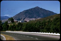
- Description:
- 100 f 6.3 tl
- Subject:
- Railings, Roads, Trees, San Luis Obispo, Cerro (Calif.), Mountains, Buildings, and Hills
- Series:
- 14-57
- Creator:
- Cushman, Charles W., 1896-1972
- Date Created:
- 1957-09-19
- Genre:
- Landscape photographs
- Frame Number:
- 8
- Street Address:
- United States Highway 101
- County:
- San Luis Obispo
- Abstract:
- San Luis O. Mtn from US 101 NE of San Luis O.
- Call Number:
- P09507
- Country:
- United States
- State/Province:
- California
- Alternate Identifier:
- 1457.8
- Persistent URL:
- http://purl.dlib.indiana.edu/iudl/archives/cushman/P09507
- Holding Location:
- Bloomington - University Archives
Wells Library E460
1320 E 10th St.
Bloomington, IN 47405
Contact at archives@indiana.edu, 812-855-1127
-
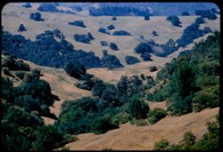
- Description:
- 100 f 5.6 tl
- Subject:
- Meadows, Valleys, Hills, and Trees
- Series:
- 9-57
- Creator:
- Cushman, Charles W., 1896-1972
- Date Created:
- 1957-06-18
- Genre:
- Landscape photographs
- Frame Number:
- 8
- Street Address:
- Ukiah-Boonville Road
- County:
- Mendocino
- Abstract:
- Folded hills near Boonville
- Call Number:
- P09345
- City:
- Ukiah and Boonville
- Country:
- United States
- State/Province:
- California
- Alternate Identifier:
- 957.8
- Persistent URL:
- http://purl.dlib.indiana.edu/iudl/archives/cushman/P09345
- Holding Location:
- Bloomington - University Archives
Wells Library E460
1320 E 10th St.
Bloomington, IN 47405
Contact at archives@indiana.edu, 812-855-1127
-
- Description:
- 100 f 8 tl
- Subject:
- Canyons, Cajon Canyon (Calif.), Mountains, Hills, and Cajon Pass (Calif.)
- Series:
- 7-57
- Creator:
- Cushman, Charles W., 1896-1972
- Date Created:
- 1957-05-14
- Genre:
- Landscape photographs
- Frame Number:
- 8
- County:
- San Bernardino
- Abstract:
- View down SE from Cajon summit of 4255' after lunch
- Call Number:
- P09287
- Country:
- United States
- State/Province:
- California
- Alternate Identifier:
- 757.8
- Persistent URL:
- http://purl.dlib.indiana.edu/iudl/archives/cushman/P09287
- Holding Location:
- Bloomington - University Archives
Wells Library E460
1320 E 10th St.
Bloomington, IN 47405
Contact at archives@indiana.edu, 812-855-1127
-
- Description:
- 100 f 6.3
- Subject:
- Rocks, Bays (Bodies of water), Oceans, Seas, Cliffs, Highlands Inn (Carmel, Calif.), Pacific Ocean, Pacific Coast (Calif.), Hills, and Carmel Highlands (Calif.)
- Series:
- 5-57
- Creator:
- Cushman, Charles W., 1896-1972
- Date Created:
- 1957-05-09
- Genre:
- Landscape photographs
- Frame Number:
- 8
- County:
- Monterey
- Abstract:
- Cove southwest of Highlands Inn
- Call Number:
- P09213
- City:
- Carmel
- Country:
- United States
- State/Province:
- California
- Alternate Identifier:
- 557.8
- Persistent URL:
- http://purl.dlib.indiana.edu/iudl/archives/cushman/P09213
- Holding Location:
- Bloomington - University Archives
Wells Library E460
1320 E 10th St.
Bloomington, IN 47405
Contact at archives@indiana.edu, 812-855-1127
-
- Description:
- 100 f 5.6 tl
- Subject:
- Trees, Meadows, and Hills
- Series:
- 3-57
- Creator:
- Cushman, Charles W., 1896-1972
- Date Created:
- 1957-04-09
- Genre:
- Landscape photographs
- Frame Number:
- 8
- Street Address:
- California State Highway 128
- County:
- Sonoma
- Abstract:
- Another upland scene a few miles nw
- Call Number:
- P09172
- City:
- Cloverdale
- Country:
- United States
- State/Province:
- California
- Alternate Identifier:
- 357.8
- Persistent URL:
- http://purl.dlib.indiana.edu/iudl/archives/cushman/P09172
- Holding Location:
- Bloomington - University Archives
Wells Library E460
1320 E 10th St.
Bloomington, IN 47405
Contact at archives@indiana.edu, 812-855-1127
-
- Description:
- 100 f8 tl
- Subject:
- Grasses, Meadows, Croplands, Shrubs, and Hills
- Series:
- 13-56
- Creator:
- Cushman, Charles W., 1896-1972
- Date Created:
- 1956-10-22
- Genre:
- Landscape photographs
- Frame Number:
- 8
- County:
- San Mateo
- Abstract:
- Toward the hills & the sea
- Call Number:
- P08981
- City:
- Pescadero and San Gregorio
- Country:
- United States
- State/Province:
- California
- Alternate Identifier:
- 1356.8
- Persistent URL:
- http://purl.dlib.indiana.edu/iudl/archives/cushman/P08981
- Holding Location:
- Bloomington - University Archives
Wells Library E460
1320 E 10th St.
Bloomington, IN 47405
Contact at archives@indiana.edu, 812-855-1127
-
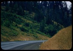
- Description:
- 100 f 4.5 tl
- Subject:
- Roads, Trees, and Hills
- Series:
- 10-56
- Creator:
- Cushman, Charles W., 1896-1972
- Date Created:
- 1956-07-13
- Genre:
- Landscape photographs
- Frame Number:
- 8
- Street Address:
- United States Highway 99
- County:
- Douglas
- Abstract:
- Along US 99 south of Anlauf
- Call Number:
- P08868
- City:
- Anlauf
- Country:
- United States
- State/Province:
- Oregon
- Alternate Identifier:
- 1056.8
- Persistent URL:
- http://purl.dlib.indiana.edu/iudl/archives/cushman/P08868
- Holding Location:
- Bloomington - University Archives
Wells Library E460
1320 E 10th St.
Bloomington, IN 47405
Contact at archives@indiana.edu, 812-855-1127
-
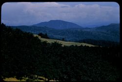
- Description:
- 100 f 8 tl
- Subject:
- Trees, Meadows, Mountains, Clouds, Forests, and Hills
- Series:
- 9-56
- Creator:
- Cushman, Charles W., 1896-1972
- Date Created:
- 1956-07-10
- Genre:
- Landscape photographs
- Frame Number:
- 8
- Street Address:
- United States Highway 101
- County:
- Curry
- Abstract:
- north of Crescent City on US 101- near Carpenterville, Curry co., Oregon view se - toward large mtn
- Call Number:
- P08830
- City:
- Carpenterville
- Country:
- United States
- State/Province:
- Oregon
- Alternate Identifier:
- 956.8
- Persistent URL:
- http://purl.dlib.indiana.edu/iudl/archives/cushman/P08830
- Holding Location:
- Bloomington - University Archives
Wells Library E460
1320 E 10th St.
Bloomington, IN 47405
Contact at archives@indiana.edu, 812-855-1127
-
- Description:
- 100 f 5.6 SL
- Subject:
- Becker Valley (Calif.), Meadows, Flowers, Valleys, Hills, Poppies, and Grasses
- Series:
- 6-56
- Creator:
- Cushman, Charles W., 1896-1972
- Date Created:
- 1956-04-22
- Genre:
- Landscape photographs
- Frame Number:
- 8
- County:
- San Benito
- Abstract:
- Field of lupine & poppies Becker Valley
- Call Number:
- P08718
- Country:
- United States
- State/Province:
- California
- Alternate Identifier:
- 656.8
- Persistent URL:
- http://purl.dlib.indiana.edu/iudl/archives/cushman/P08718
- Holding Location:
- Bloomington - University Archives
Wells Library E460
1320 E 10th St.
Bloomington, IN 47405
Contact at archives@indiana.edu, 812-855-1127
-
- Description:
- 50mm f 8 sl
- Subject:
- Bays (Bodies of water), Seas, Bolinas Lagoon (Calif.), Trees, Coastlines, Bolinas Bay (Calif.), Peninsulas, Hills, and Sandbars
- Series:
- 2-56
- Creator:
- Cushman, Charles W., 1896-1972
- Date Created:
- 1956-03-14
- Genre:
- Landscape photographs
- Frame Number:
- 8
- County:
- Marin
- Abstract:
- Bolinas lagoon - noon
- Call Number:
- P08574
- City:
- Bolinas
- Country:
- United States
- State/Province:
- California
- Alternate Identifier:
- 256.8
- Persistent URL:
- http://purl.dlib.indiana.edu/iudl/archives/cushman/P08574
- Holding Location:
- Bloomington - University Archives
Wells Library E460
1320 E 10th St.
Bloomington, IN 47405
Contact at archives@indiana.edu, 812-855-1127
-
- Description:
- 50 mm 1/100 short lens
- Subject:
- Meadows, Diablo, Mount (Calif.), Hills, Mountains, Trees, Utility poles, Roads, and Clouds
- Series:
- 1-56
- Creator:
- Cushman, Charles W., 1896-1972
- Date Created:
- 1956-02-23
- Genre:
- Landscape photographs
- Frame Number:
- 8
- Street Address:
- Norris Canyon Road
- County:
- Contra Costa
- Abstract:
- Mt. Diablo
- Call Number:
- P08537
- Country:
- United States
- State/Province:
- California
- Alternate Identifier:
- 156.8
- Persistent URL:
- http://purl.dlib.indiana.edu/iudl/archives/cushman/P08537
- Holding Location:
- Bloomington - University Archives
Wells Library E460
1320 E 10th St.
Bloomington, IN 47405
Contact at archives@indiana.edu, 812-855-1127
-
- Description:
- 100 f 6.3 tl
- Subject:
- Bays (Bodies of water), Trees, Cities & towns, Islands, Tamalpais, Mount (Calif.), Hills, Streams, Canals, and Corte Madera Creek (Marin County, Calif.)
- Series:
- 29-55
- Creator:
- Cushman, Charles W., 1896-1972
- Date Created:
- 1955-10-31
- Genre:
- Landscape photographs and Cityscape photographs
- Frame Number:
- 8
- County:
- Marin
- Abstract:
- Canals (?)
- Call Number:
- P08499
- Country:
- United States
- State/Province:
- California
- Alternate Identifier:
- 2955.8
- Persistent URL:
- http://purl.dlib.indiana.edu/iudl/archives/cushman/P08499
- Holding Location:
- Bloomington - University Archives
Wells Library E460
1320 E 10th St.
Bloomington, IN 47405
Contact at archives@indiana.edu, 812-855-1127
-
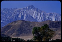
- Description:
- 100 f 8 tl
- Subject:
- Initials, Trees, Lone Pine Peak (Calif.), Mountains, Alabama Hills (Calif.), and Hills
- Series:
- 26-55
- Creator:
- Cushman, Charles W., 1896-1972
- Date Created:
- 1955-09-25
- Genre:
- Landscape photographs
- Frame Number:
- 8
- County:
- Inyo
- Abstract:
- Lone Pine Mt beyond Alabama Hills
- Call Number:
- P08391
- Country:
- United States
- State/Province:
- California
- Alternate Identifier:
- 2655.8
- Persistent URL:
- http://purl.dlib.indiana.edu/iudl/archives/cushman/P08391
- Holding Location:
- Bloomington - University Archives
Wells Library E460
1320 E 10th St.
Bloomington, IN 47405
Contact at archives@indiana.edu, 812-855-1127
-
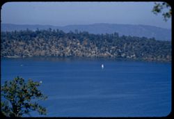
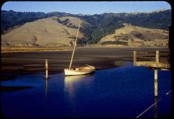
- Description:
- 100 f 5.6 TL
- Subject:
- Bays (Bodies of water), Boats, Lakes & ponds, Waterfronts, Hills, Clear Lake (Lake County, Calif.), Trees, and Soda Bay (Calif.)
- Series:
- 24-55
- Creator:
- Cushman, Charles W., 1896-1972
- Date Created:
- 1955-08-11
- Genre:
- Seascapes
- Frame Number:
- 8
- County:
- Lake
- Abstract:
- Sail boat in Soda Bay
- Call Number:
- P08317
- Country:
- United States
- State/Province:
- California
- Alternate Identifier:
- 2455.8
- Persistent URL:
- http://purl.dlib.indiana.edu/iudl/archives/cushman/P08317
- Holding Location:
- Bloomington - University Archives
Wells Library E460
1320 E 10th St.
Bloomington, IN 47405
Contact at archives@indiana.edu, 812-855-1127
-
- Description:
- 100 f 4.5 tl
- Subject:
- Redwood Creek (Humboldt County, Calif.), Hills, Roads, Mountains, Trees, Clouds, and Berry Summit (Calif.)
- Series:
- 16-55
- Creator:
- Cushman, Charles W., 1896-1972
- Date Created:
- 1955-06-15
- Genre:
- Landscape photographs
- Frame Number:
- 8
- Street Address:
- United States Highway 299
- County:
- Humboldt
- Abstract:
- 65423 mi. Looking across Redwood Creek Valley from up road toward Berry Summit
- Call Number:
- P08053
- Country:
- United States
- State/Province:
- California
- Alternate Identifier:
- 1655.8
- Persistent URL:
- http://purl.dlib.indiana.edu/iudl/archives/cushman/P08053
- Holding Location:
- Bloomington - University Archives
Wells Library E460
1320 E 10th St.
Bloomington, IN 47405
Contact at archives@indiana.edu, 812-855-1127
-
- Description:
- 100 f 5.6 tl
- Subject:
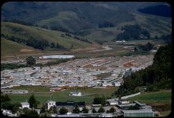
- Valleys, Houses, Automobiles, Trees, San Pedro, Point (San Mateo County, Calif.), Streets, Street lights, Shrubs, Facilities, Hills, Utility poles, and Fences
- Series:
- 14-55
- Creator:
- Cushman, Charles W., 1896-1972
- Date Created:
- 1955-04-22
- Genre:
- Cityscape photographs
- Frame Number:
- 8
- County:
- San Mateo
- Abstract:
- New town of Linda Mar (part of it) near Pedro Pt., San Mateo co.
- Call Number:
- P07980
- City:
- Linda Mar
- Country:
- United States
- State/Province:
- California
- Alternate Identifier:
- 1455.8
- Persistent URL:
- http://purl.dlib.indiana.edu/iudl/archives/cushman/P07980
- Holding Location:
- Bloomington - University Archives
Wells Library E460
1320 E 10th St.
Bloomington, IN 47405
Contact at archives@indiana.edu, 812-855-1127
-
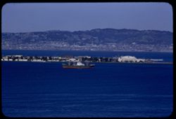
- Description:
- 100 f 6.3 tl
- Subject:
- Naval yards & naval stations, Bodies of water, Trees, Coastlines, Telegraph Hill (San Francisco, Calif.), Buildings, Ships, Treasure Island (San Francisc...
- Series:
- 6-55
- Creator:
- Cushman, Charles W., 1896-1972
- Date Created:
- 1955-03-14
- Genre:
- Marine photographs
- Frame Number:
- 8
- County:
- Alameda and San Francisco
- Abstract:
- Freighter at Treasure Isl. from Telegraph Hill
- Call Number:
- P07710
- City:
- Berkeley and San Francisco
- Country:
- United States
- State/Province:
- California
- Alternate Identifier:
- 655.8
- Persistent URL:
- http://purl.dlib.indiana.edu/iudl/archives/cushman/P07710
- Holding Location:
- Bloomington - University Archives
Wells Library E460
1320 E 10th St.
Bloomington, IN 47405
Contact at archives@indiana.edu, 812-855-1127
-
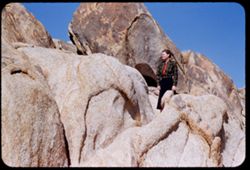
- Description:
- 100 f 6.3 tl
- Subject:
- Spouses, Women, Alabama Hills (Calif.), Hills, Shrubs, and Rock formations
- Series:
- 4-55
- Creator:
- Cushman, Charles W., 1896-1972
- Date Created:
- 1955-02-28
- Genre:
- Portraits
- Frame Number:
- 8
- County:
- Inyo
- Persons Pictured:
- Cushman, Jean
- Abstract:
- Inside the Alabama Hills
- Call Number:
- P07636
- City:
- Lone Pine
- Country:
- United States
- State/Province:
- California
- Alternate Identifier:
- 455.8
- Persistent URL:
- http://purl.dlib.indiana.edu/iudl/archives/cushman/P07636
- Holding Location:
- Bloomington - University Archives
Wells Library E460
1320 E 10th St.
Bloomington, IN 47405
Contact at archives@indiana.edu, 812-855-1127
-
- Description:
- 50 f 8
- Subject:
- Croplands, San Francisco Bay Area (Calif.), Hills, Roads, Fog, Dwellings, Trees, Machinery, Facilities, Farms, Fences, and Shrubs
- Series:
- 17-54
- Creator:
- Cushman, Charles W., 1896-1972
- Date Created:
- 1954-11-19
- Genre:
- Landscape photographs
- Frame Number:
- 8
- Street Address:
- Skyline Drive
- County:
- San Francisco and San Mateo
- Abstract:
- Fog crossing Skyline Drive - San Mateo county
- Call Number:
- P07528
- City:
- San Francisco
- Country:
- United States
- State/Province:
- California
- Physical Description:
- Anscochrome film.
- Alternate Identifier:
- 1754.8
- Persistent URL:
- http://purl.dlib.indiana.edu/iudl/archives/cushman/P07528
- Holding Location:
- Bloomington - University Archives
Wells Library E460
1320 E 10th St.
Bloomington, IN 47405
Contact at archives@indiana.edu, 812-855-1127
-
- Description:
- 50 f 8
- Subject:
- Sailboats, Bolinas Lagoon (Calif.), Decks (Rooms & spaces), Boats, Buildings, Shrubs, Lakes & ponds, Hills, and Trees
- Series:
- 16-54
- Creator:
- Cushman, Charles W., 1896-1972
- Date Created:
- 1954-10-23
- Genre:
- Landscape photographs
- Frame Number:
- 8
- County:
- Marin
- Abstract:
- Little boat with fore mast in Bolinas Lagoon at low tide.
- Call Number:
- P07507
- Country:
- United States
- State/Province:
- California
- Physical Description:
- Anscochrome film.
- Alternate Identifier:
- 1654.8
- Persistent URL:
- http://purl.dlib.indiana.edu/iudl/archives/cushman/P07507
- Holding Location:
- Bloomington - University Archives
Wells Library E460
1320 E 10th St.
Bloomington, IN 47405
Contact at archives@indiana.edu, 812-855-1127
-
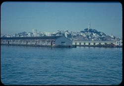
- Description:
- 100 f 5.6
- Subject:
- Telegraph Hill (San Francisco, Calif.), Cities & towns, Hills, Bodies of water, San Francisco Bay (Calif.), Coit Memorial Tower (San Francisco, Calif.), ...
- Series:
- 8-54
- Creator:
- Cushman, Charles W., 1896-1972
- Date Created:
- 1954-08-31
- Genre:
- Cityscape photographs
- Frame Number:
- 8
- County:
- San Francisco
- Abstract:
- Telegraph Hill from Bay.
- Call Number:
- P07301
- City:
- San Francisco
- Country:
- United States
- State/Province:
- California
- Physical Description:
- Anscochrome film.
- Alternate Identifier:
- 854.8
- Persistent URL:
- http://purl.dlib.indiana.edu/iudl/archives/cushman/P07301
- Holding Location:
- Bloomington - University Archives
Wells Library E460
1320 E 10th St.
Bloomington, IN 47405
Contact at archives@indiana.edu, 812-855-1127
-
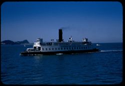
- Description:
- 125 f 5.6
- Subject:
- Bays (Bodies of water), Bodies of water, Boats, Signs (Notices), Ferries, Vehicles, Klamath (Ferry), Russian River (Ferry), Smokestacks, San Francisco Bay (C...
- Series:
- 2-54
- Creator:
- Cushman, Charles W., 1896-1972
- Date Created:
- 1954-05-21
- Genre:
- Marine photographs
- Frame Number:
- 8
- County:
- Marin and Contra Costa
- Abstract:
- Aboard Ferry Boat Russian River from San Rafael to Richmond W bound ferry on port side
- Call Number:
- P07138
- City:
- Richmond and San Rafael
- Country:
- United States
- State/Province:
- California
- Alternate Identifier:
- 254.8
- Persistent URL:
- http://purl.dlib.indiana.edu/iudl/archives/cushman/P07138
- Holding Location:
- Bloomington - University Archives
Wells Library E460
1320 E 10th St.
Bloomington, IN 47405
Contact at archives@indiana.edu, 812-855-1127
-
- Description:
- 50 f 8
- Subject:
- Rocks, Trees, Cajon Pass (Calif.), Rock formations, Passes (Landforms), Mountains, and Hills
- Series:
- 16-53
- Creator:
- Cushman, Charles W., 1896-1972
- Date Created:
- 1953-11-23
- Genre:
- Landscape photographs
- Frame Number:
- 8
- Street Address:
- California State Highway 138
- County:
- San Bernardino
- Abstract:
- Tilted rocks along Cal 138 nr. Cajon
- Call Number:
- P07080
- Country:
- United States
- State/Province:
- California
- Alternate Identifier:
- 1653.8
- Persistent URL:
- http://purl.dlib.indiana.edu/iudl/archives/cushman/P07080
- Holding Location:
- Bloomington - University Archives
Wells Library E460
1320 E 10th St.
Bloomington, IN 47405
Contact at archives@indiana.edu, 812-855-1127
-
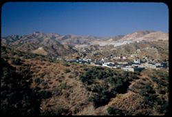
- Description:
- 50 f 5.6 POLA
- Subject:
- Grasses, Factories, Copper industry, Mountains, Buildings, Business districts, and Hills
- Series:
- 14-53
- Creator:
- Cushman, Charles W., 1896-1972
- Date Created:
- 1953-11-19
- Genre:
- Cityscape photographs
- Frame Number:
- 8
- County:
- Gila
- Abstract:
- View s.w. across Miami
- Call Number:
- P07004
- City:
- Miami
- Country:
- United States
- State/Province:
- Arizona
- Alternate Identifier:
- 1453.8
- Persistent URL:
- http://purl.dlib.indiana.edu/iudl/archives/cushman/P07004
- Holding Location:
- Bloomington - University Archives
Wells Library E460
1320 E 10th St.
Bloomington, IN 47405
Contact at archives@indiana.edu, 812-855-1127
-
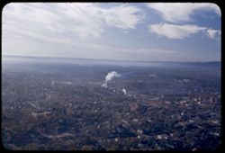
- Description:
- 25 f 5.6 POLA
- Subject:
- Hot Springs Mountain (Ark.), Hot Springs National Park (Ark.), Trees, Smoke, Streets, Mountains, Buildings, National parks & reserves, Clouds, Hills, and...
- Series:
- 12-53
- Creator:
- Cushman, Charles W., 1896-1972
- Date Created:
- 1953-11-12
- Genre:
- Cityscape photographs
- Frame Number:
- 8
- County:
- Garland
- Abstract:
- South over town
- Call Number:
- P06926
- City:
- Hot Springs
- Country:
- United States
- State/Province:
- Arkansas
- Alternate Identifier:
- 1253.8
- Persistent URL:
- http://purl.dlib.indiana.edu/iudl/archives/cushman/P06926
- Holding Location:
- Bloomington - University Archives
Wells Library E460
1320 E 10th St.
Bloomington, IN 47405
Contact at archives@indiana.edu, 812-855-1127
-
- Description:
- 50 f 4.5
- Subject:
- Valleys, Grasses, Roads, Trees, Mountains, Bridges, Hills, Utility poles, Railroads, Rivers, Bodies of water, and Eagle River (Colo.)
- Series:
- 10-53
- Creator:
- Cushman, Charles W., 1896-1972
- Date Created:
- 1953-10-13
- Genre:
- Landscape photographs
- Frame Number:
- 8
- Street Address:
- United States Highway 6
- County:
- Eagle
- Abstract:
- Mtns along Eagle river below Minturn & Gilman(overcast), from higher
- Call Number:
- P06848
- City:
- Minturn and Gilman
- Country:
- United States
- State/Province:
- Colorado
- Alternate Identifier:
- 1053.8
- Persistent URL:
- http://purl.dlib.indiana.edu/iudl/archives/cushman/P06848
- Holding Location:
- Bloomington - University Archives
Wells Library E460
1320 E 10th St.
Bloomington, IN 47405
Contact at archives@indiana.edu, 812-855-1127
-
- Description:
- 50 f 9
- Subject:
- Silver Zone Pass (Nev.), Grasses, Dirt roads, Mountains, Clouds, Silver Zone (Nev.), Hills, and Pilot Peak (Elko County, Nev.)
- Series:
- 9-53
- Creator:
- Cushman, Charles W., 1896-1972
- Date Created:
- 1953-10-10
- Genre:
- Landscape photographs
- Frame Number:
- 8
- Street Address:
- United States Highway 40
- County:
- Elko
- Abstract:
- Pilot Pk. 10704 fromUS 40 below Silver Zone Pass. Overcast.
- Call Number:
- P06809
- Country:
- United States
- State/Province:
- Nevada
- Alternate Identifier:
- 953.8
- Persistent URL:
- http://purl.dlib.indiana.edu/iudl/archives/cushman/P06809
- Holding Location:
- Bloomington - University Archives
Wells Library E460
1320 E 10th St.
Bloomington, IN 47405
Contact at archives@indiana.edu, 812-855-1127
-
- Description:
- 25 f 6.3 Pola
- Subject:
- Bays (Bodies of water), Roads, Angel Island (Calif.), Fog, Trees, Mountains, Islands, Hills, North Bay (Humboldt County, Calif.), San Francisco Bay (Calif.),...
- Series:
- 8-53
- Creator:
- Cushman, Charles W., 1896-1972
- Date Created:
- 1953-08-30
- Genre:
- Landscape photographs
- Frame Number:
- 8
- County:
- Marin
- Abstract:
- Looking down on Angel Island from heights above Sausalito with fog over North Bay.
- Call Number:
- P06770
- City:
- Sausalito
- Country:
- United States
- State/Province:
- California
- Alternate Identifier:
- 853.8
- Persistent URL:
- http://purl.dlib.indiana.edu/iudl/archives/cushman/P06770
- Holding Location:
- Bloomington - University Archives
Wells Library E460
1320 E 10th St.
Bloomington, IN 47405
Contact at archives@indiana.edu, 812-855-1127
-
- Description:
- 50 f 5.6 Pola
- Subject:
- Wildflowers, Grasses, Barbed wire, Meadows, Fences, and Hills
- Series:
- 7-53
- Creator:
- Cushman, Charles W., 1896-1972
- Date Created:
- 1953-06-17
- Genre:
- Landscape photographs
- Frame Number:
- 8
- County:
- Marin
- Abstract:
- Marin hills and fields 4 or 5 miles east of Point Reyes Station.
- Call Number:
- P06733
- City:
- Point Reyes Station
- Country:
- United States
- State/Province:
- California
- Alternate Identifier:
- 753.8
- Persistent URL:
- http://purl.dlib.indiana.edu/iudl/archives/cushman/P06733
- Holding Location:
- Bloomington - University Archives
Wells Library E460
1320 E 10th St.
Bloomington, IN 47405
Contact at archives@indiana.edu, 812-855-1127
-
- Description:
- 25 f 11
- Subject:
- Rocks, Cliffs, Trees, Mountains, Rock formations, Arches National Park (Utah), Hills, and Shrubs
- Series:
- 27-52
- Creator:
- Cushman, Charles W., 1896-1972
- Date Created:
- 1952-11-04
- Genre:
- Landscape photographs
- Frame Number:
- 8
- County:
- Grand
- Abstract:
- Along Hwy from Moab to Arches.
- Call Number:
- P06453
- City:
- Moab
- Country:
- United States
- State/Province:
- Utah
- Alternate Identifier:
- 2752.8
- Persistent URL:
- http://purl.dlib.indiana.edu/iudl/archives/cushman/P06453
- Holding Location:
- Bloomington - University Archives
Wells Library E460
1320 E 10th St.
Bloomington, IN 47405
Contact at archives@indiana.edu, 812-855-1127
-
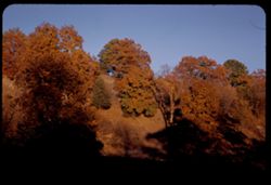
- Description:
- 50 f 6
- Subject:
- Hills, Autumn, Trees, and Shadows
- Series:
- 20-52
- Creator:
- Cushman, Charles W., 1896-1972
- Date Created:
- 1952-10-20
- Genre:
- Landscape photographs
- Frame Number:
- 8
- County:
- Greene
- Abstract:
- Autumn tress on hillside 10 mi NE of Springfield, Mo.
- Call Number:
- P06200
- City:
- Springfield
- Country:
- United States
- State/Province:
- Missouri
- Alternate Identifier:
- 2052.8
- Persistent URL:
- http://purl.dlib.indiana.edu/iudl/archives/cushman/P06200
- Holding Location:
- Bloomington - University Archives
Wells Library E460
1320 E 10th St.
Bloomington, IN 47405
Contact at archives@indiana.edu, 812-855-1127
-
- Description:
- 25 f 9 Pola
- Subject:
- Barbed wire, Boulders, Croplands, Fences, Rock formations, Taylor, Mount (N.M.), Hills, and Mountains
- Series:
- 18-52
- Creator:
- Cushman, Charles W., 1896-1972
- Date Created:
- 1952-04-14
- Genre:
- Landscape photographs
- Frame Number:
- 8
- Street Address:
- United States Highway 66
- County:
- Cibola
- Abstract:
- Mt. Taylor at distance from 66 east of San Fidel.
- Call Number:
- P06139
- City:
- San Fidel
- Country:
- United States
- State/Province:
- New Mexico
- Alternate Identifier:
- 1852.8
- Persistent URL:
- http://purl.dlib.indiana.edu/iudl/archives/cushman/P06139
- Holding Location:
- Bloomington - University Archives
Wells Library E460
1320 E 10th St.
Bloomington, IN 47405
Contact at archives@indiana.edu, 812-855-1127
-
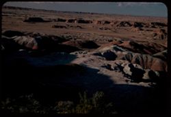
- Description:
- 50 f 5.6 Pola
- Subject:
- Deserts, Valleys, Hills, Painted Desert (Ariz.), Shrubs, Mesas, and Harvey Inn (Holbrook, Ariz.)
- Series:
- 17-52
- Creator:
- Cushman, Charles W., 1896-1972
- Date Created:
- 1952-04-12
- Genre:
- Landscape photographs
- Frame Number:
- 8
- County:
- Navajo and Coconimo
- Abstract:
- View north from near Fred Harvey Inn
- Call Number:
- P06101
- City:
- Holbrook
- Country:
- United States
- State/Province:
- Arizona
- Alternate Identifier:
- 1752.8
- Persistent URL:
- http://purl.dlib.indiana.edu/iudl/archives/cushman/P06101
- Holding Location:
- Bloomington - University Archives
Wells Library E460
1320 E 10th St.
Bloomington, IN 47405
Contact at archives@indiana.edu, 812-855-1127
-
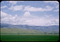
- Description:
- 25 f 11
- Subject:
- Grasses, Tehachapi Mountains (Calif.), Trees, Meadows, Croplands, Clouds, Hills, and Mountains
- Series:
- 14-52
- Creator:
- Cushman, Charles W., 1896-1972
- Date Created:
- 1952-04-07
- Genre:
- Landscape photographs
- Frame Number:
- 8
- Street Address:
- United States Highway 466
- County:
- Kern
- Abstract:
- Along Hwy 466 between Bakersfield and Tehachapi.
- Call Number:
- P05992
- City:
- Tehachapi and Bakersfield
- Country:
- United States
- State/Province:
- California
- Alternate Identifier:
- 1452.8
- Persistent URL:
- http://purl.dlib.indiana.edu/iudl/archives/cushman/P05992
- Holding Location:
- Bloomington - University Archives
Wells Library E460
1320 E 10th St.
Bloomington, IN 47405
Contact at archives@indiana.edu, 812-855-1127
-
- Description:
- 25 f 9
- Subject:
- Hills, Trees, and Buildings
- Series:
- 13-52
- Creator:
- Cushman, Charles W., 1896-1972
- Date Created:
- 1952-04-04
- Genre:
- Cityscape photographs
- Frame Number:
- 8
- Street Address:
- California State Highway 49
- County:
- Amador
- Abstract:
- Looking down on town of Sutter Creek from SW on Cal 49.
- Call Number:
- P05953
- City:
- Sutter Creek
- Country:
- United States
- State/Province:
- California
- Alternate Identifier:
- 1352.8
- Persistent URL:
- http://purl.dlib.indiana.edu/iudl/archives/cushman/P05953
- Holding Location:
- Bloomington - University Archives
Wells Library E460
1320 E 10th St.
Bloomington, IN 47405
Contact at archives@indiana.edu, 812-855-1127
-
- Description:
- 25 f 4.5 Pola
- Subject:
- Trees, Streets, Buildings, Franceschi Park (Calif.), and Hills
- Series:
- 8-52
- Creator:
- Cushman, Charles W., 1896-1972
- Date Created:
- 1952-02-28
- Genre:
- Cityscape photographs
- Frame Number:
- 8
- County:
- Santa Barbara
- Abstract:
- SW over city from Franceschi PK.
- Call Number:
- P05767
- City:
- Santa Barbara
- Country:
- United States
- State/Province:
- California
- Alternate Identifier:
- 852.8
- Persistent URL:
- http://purl.dlib.indiana.edu/iudl/archives/cushman/P05767
- Holding Location:
- Bloomington - University Archives
Wells Library E460
1320 E 10th St.
Bloomington, IN 47405
Contact at archives@indiana.edu, 812-855-1127
-
- Description:
- 50 f 8
- Subject:
- National parks & reserves, Hills, Cliffs, Big Bend National Park (Tex.), Shrubs, Trees, Grasses, and Rock formations
- Series:
- 16-51
- Creator:
- Cushman, Charles W., 1896-1972
- Date Created:
- 1951-12-27
- Genre:
- Landscape photographs
- Frame Number:
- 8
- County:
- Brewster
- Abstract:
- Up at jagged crevice
- Call Number:
- P05427
- Country:
- United States
- State/Province:
- Texas
- Alternate Identifier:
- 1651.8
- Persistent URL:
- http://purl.dlib.indiana.edu/iudl/archives/cushman/P05427
- Holding Location:
- Bloomington - University Archives
Wells Library E460
1320 E 10th St.
Bloomington, IN 47405
Contact at archives@indiana.edu, 812-855-1127
-
- Subject:
- Croplands, Tree limbs, Meadows, Hedges (Plants), Hills, Mountains, Buildings, Farms, Nescopeck Mountain (Pa.), and Boundaries
- Series:
- 21-41
- Creator:
- Cushman, Charles W., 1896-1972
- Date Created:
- 1941-09-29
- Genre:
- Landscape photographs
- Frame Number:
- 8
- County:
- Luzerne and Columbia
- Abstract:
- Pennsylvania farms in Nescopeck mountain area east of Berwick, Pa.
- Call Number:
- P02530
- City:
- Berwick and Nanticoke
- Country:
- United States
- State/Province:
- Pennsylvania
- Alternate Identifier:
- 2141.8
- Persistent URL:
- http://purl.dlib.indiana.edu/iudl/archives/cushman/P02530
- Holding Location:
- Bloomington - University Archives
Wells Library E460
1320 E 10th St.
Bloomington, IN 47405
Contact at archives@indiana.edu, 812-855-1127
-
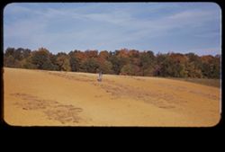
- Subject:
- Farmers, Farms, Trees, Croplands, and Hills
- Series:
- 19-40
- Creator:
- Cushman, Charles W., 1896-1972
- Date Created:
- 1940-10-14
- Genre:
- Landscape photographs
- Frame Number:
- 8
- County:
- Posey
- Abstract:
- A Posey Co. farmer works his hillside acres.
- Call Number:
- P02114
- Country:
- United States
- State/Province:
- Indiana
- Physical Description:
- masked.
- Alternate Identifier:
- 1940.8
- Persistent URL:
- http://purl.dlib.indiana.edu/iudl/archives/cushman/P02114
- Holding Location:
- Bloomington - University Archives
Wells Library E460
1320 E 10th St.
Bloomington, IN 47405
Contact at archives@indiana.edu, 812-855-1127
-
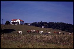
- Subject:
- Cotton, Houses, Grazing, Croplands, Cows, Hills, and Shenandoah River Valley (Va. and W. Va.)
- Series:
- 16-40
- Creator:
- Cushman, Charles W., 1896-1972
- Date Created:
- 1940-09-16/1940-09-23
- Genre:
- Landscape photographs
- Frame Number:
- 8
- County:
- Jefferson
- Abstract:
- Cows trail across a green hillside. Shenandoah Valley, W. Va.
- Call Number:
- P02057
- City:
- Charles Town
- Country:
- United States
- State/Province:
- West Virginia
- Physical Description:
- Image was originally mounted in a glass enclosure. Before digitization, the image was removed and placed in a Wess Plastic, Inc. brand, 2" x 2", pl...
- Alternate Identifier:
- 1640.8
- Persistent URL:
- http://purl.dlib.indiana.edu/iudl/archives/cushman/P02057
- Holding Location:
- Bloomington - University Archives
Wells Library E460
1320 E 10th St.
Bloomington, IN 47405
Contact at archives@indiana.edu, 812-855-1127