
Search Constraints
You searched for:
Campus
IUB
Remove constraint Campus: IUB
Pages
0-99 pages
Remove constraint Pages: 0-99 pages
Subject
Clouds
Remove constraint Subject: Clouds
State/Province
California
Remove constraint State/Province: California
« Previous |
1 - 100 of 624
|
Next »
Search Results
-
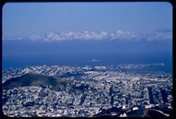
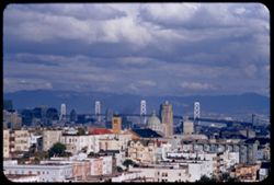
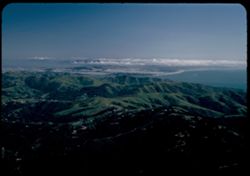
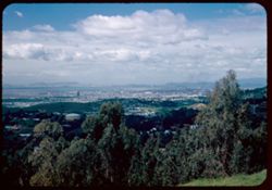
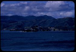
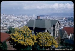
- Description:
- 200 f 5 tl
- Subject:
- Seas, Houses, Hunters Point (San Francisco, Calif.), Streets, Cities & towns, Clouds, Hills, and Twin Peaks (San Francisco County, Calif.)
- Series:
- 29-55
- Creator:
- Cushman, Charles W., 1896-1972
- Date Created:
- 1955-12-01
- Genre:
- Cityscape photographs
- Frame Number:
- 27
- County:
- San Francisco
- Abstract:
- Hunters Point from Twin Peaks
- Call Number:
- P08518
- City:
- San Francisco
- Country:
- United States
- State/Province:
- California
- Alternate Identifier:
- 2955.27
- Persistent URL:
- http://purl.dlib.indiana.edu/iudl/archives/cushman/P08518
- Holding Location:
- Bloomington - University Archives
Wells Library E460
1320 E 10th St.
Bloomington, IN 47405
Contact at archives@indiana.edu, 812-855-1127
-

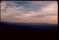
- Description:
- 100 f 11 TL
- Subject:
- Clouds
- Series:
- 2-67
- Creator:
- Cushman, Charles W., 1896-1972
- Date Created:
- 1967-03-23
- Genre:
- Snapshots
- Frame Number:
- 8
- County:
- San Francisco
- Abstract:
- spring sky after rains
- Call Number:
- P15505
- City:
- San Francisco
- Country:
- United States
- State/Province:
- California
- Alternate Identifier:
- 267.8
- Persistent URL:
- http://purl.dlib.indiana.edu/iudl/archives/cushman/P15505
- Holding Location:
- Bloomington - University Archives
Wells Library E460
1320 E 10th St.
Bloomington, IN 47405
Contact at archives@indiana.edu, 812-855-1127
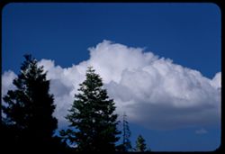
-
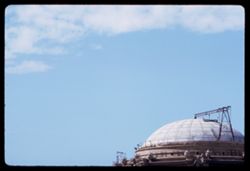
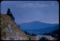
- Description:
- 100 f 11 TL
- Subject:
- Domes, Building construction, Palace of Fine Arts (San Francisco), Scaffolding, Clouds, and Architectural decorations & ornaments
- Series:
- 2-67
- Creator:
- Cushman, Charles W., 1896-1972
- Date Created:
- 1967-03-23
- Genre:
- Snapshots
- Frame Number:
- 9
- County:
- San Francisco
- Abstract:
- spring sky after rains
- Call Number:
- P15506
- City:
- San Francisco
- Country:
- United States
- State/Province:
- California
- Alternate Identifier:
- 267.9
- Persistent URL:
- http://purl.dlib.indiana.edu/iudl/archives/cushman/P15506
- Holding Location:
- Bloomington - University Archives
Wells Library E460
1320 E 10th St.
Bloomington, IN 47405
Contact at archives@indiana.edu, 812-855-1127
-
- Description:
- 100 f 11 TL
- Subject:
- Willows, Flowers, Hills, Trees, and Clouds
- Series:
- 1-67
- Creator:
- Cushman, Charles W., 1896-1972
- Date Created:
- 1967-03-14
- Genre:
- Identification photographs and Landscape photographs
- Frame Number:
- 21
- County:
- Sonoma
- Abstract:
- Willows in spring sonoma
- Call Number:
- P15496
- Country:
- United States
- State/Province:
- California
- Alternate Identifier:
- 167.21
- Persistent URL:
- http://purl.dlib.indiana.edu/iudl/archives/cushman/P15496
- Holding Location:
- Bloomington - University Archives
Wells Library E460
1320 E 10th St.
Bloomington, IN 47405
Contact at archives@indiana.edu, 812-855-1127
-
- Description:
- 100 f 11 tl
- Subject:
- Trees and Clouds
- Series:
- 3-56
- Creator:
- Cushman, Charles W., 1896-1972
- Date Created:
- 1956-04-01
- Genre:
- Views
- Frame Number:
- 26
- County:
- Amador
- Abstract:
- Clouds above amador Co. hills - south of lone 2 or 3 mi
- Call Number:
- P08627
- City:
- Ione
- Country:
- United States
- State/Province:
- California
- Alternate Identifier:
- 356.26
- Persistent URL:
- http://purl.dlib.indiana.edu/iudl/archives/cushman/P08627
- Holding Location:
- Bloomington - University Archives
Wells Library E460
1320 E 10th St.
Bloomington, IN 47405
Contact at archives@indiana.edu, 812-855-1127
-
- Description:
- 100 f 11
- Subject:
- Rocks, Grasses, Coastlines, Mountains, Lakes & ponds, Clouds, Black Mountain (Marin County, Calif.), and Hills
- Series:
- 27-65
- Creator:
- Cushman, Charles W., 1896-1972
- Date Created:
- 1965-07-26
- Genre:
- Landscape photographs
- Frame Number:
- 2
- County:
- Marin
- Abstract:
- Hopi Pt. and Black Mtn. Western Marin
- Call Number:
- P14801
- City:
- Nicasio
- Country:
- United States
- State/Province:
- California
- Alternate Identifier:
- 2765.2
- Persistent URL:
- http://purl.dlib.indiana.edu/iudl/archives/cushman/P14801
- Holding Location:
- Bloomington - University Archives
Wells Library E460
1320 E 10th St.
Bloomington, IN 47405
Contact at archives@indiana.edu, 812-855-1127
-
- Description:
- 100 f 8 TL
- Subject:
- Hills and Clouds
- Series:
- 3-69
- Creator:
- Cushman, Charles W., 1896-1972
- Date Created:
- 1969-03-21
- Genre:
- Landscape photographs
- Frame Number:
- 24
- County:
- San Luis Obispo
- Abstract:
- Faded green hills near Cholame
- Call Number:
- P15776
- City:
- Cholame
- Country:
- United States
- State/Province:
- California
- Alternate Identifier:
- 369.24
- Persistent URL:
- http://purl.dlib.indiana.edu/iudl/archives/cushman/P15776
- Holding Location:
- Bloomington - University Archives
Wells Library E460
1320 E 10th St.
Bloomington, IN 47405
Contact at archives@indiana.edu, 812-855-1127
-
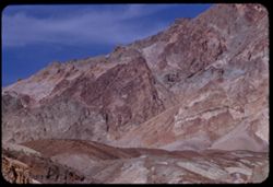
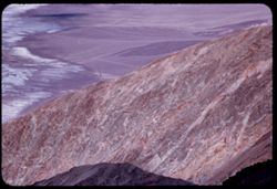
- Description:
- 100 f 8+ tl
- Subject:
- Rocks, Mountains, Clouds, and Death Valley National Park (Calif. and Nev.)
- Series:
- 10-55
- Creator:
- Cushman, Charles W., 1896-1972
- Date Created:
- 1955-03-22
- Frame Number:
- 2
- Street Address:
- Artist's View Drive
- County:
- Inyo
- Abstract:
- From top of Artists Drive
- Call Number:
- P07830
- Country:
- United States
- State/Province:
- California
- Alternate Identifier:
- 1055.2
- Persistent URL:
- http://purl.dlib.indiana.edu/iudl/archives/cushman/P07830
- Holding Location:
- Bloomington - University Archives
Wells Library E460
1320 E 10th St.
Bloomington, IN 47405
Contact at archives@indiana.edu, 812-855-1127
-
- Description:
- 100 f 6.3 or f 8 tl
- Subject:
- Hills and Clouds
- Series:
- 29-55
- Creator:
- Cushman, Charles W., 1896-1972
- Date Created:
- 1955-12-03
- Genre:
- Views
- Frame Number:
- 35
- Street Address:
- 100 Broderick Street
- County:
- San Francisco
- Abstract:
- 32-39 incl. (Dec. 3) 2:30 PM clouds in eastern sky from top of 100 Broderick
- Call Number:
- P08526
- City:
- San Francisco
- Country:
- United States
- State/Province:
- California
- Alternate Identifier:
- 2955.35
- Persistent URL:
- http://purl.dlib.indiana.edu/iudl/archives/cushman/P08526
- Holding Location:
- Bloomington - University Archives
Wells Library E460
1320 E 10th St.
Bloomington, IN 47405
Contact at archives@indiana.edu, 812-855-1127
-
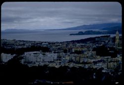
- Description:
- 100 f 8 tl
- Subject:
- Domes, Cities & towns, Hills, San Francisco-Oakland Bay Bridge (Oakland and San Francisco, Calif.), Bays (Bodies of water), Buildings, Suspension bridges...
- Series:
- 29-55
- Creator:
- Cushman, Charles W., 1896-1972
- Date Created:
- 1955-12-03
- Genre:
- Cityscape photographs
- Frame Number:
- 32
- Street Address:
- 100 Broderick Street
- County:
- San Francisco
- Abstract:
- 32-39 incl. (Dec. 3) 2:30 PM clouds in eastern sky from top of 100 Broderick
- Call Number:
- P08523
- City:
- San Francisco
- Country:
- United States
- State/Province:
- California
- Alternate Identifier:
- 2955.32
- Persistent URL:
- http://purl.dlib.indiana.edu/iudl/archives/cushman/P08523
- Holding Location:
- Bloomington - University Archives
Wells Library E460
1320 E 10th St.
Bloomington, IN 47405
Contact at archives@indiana.edu, 812-855-1127
-

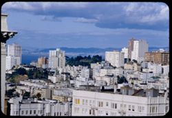
- Description:
- 100 f 8 tl
- Subject:
- Bays (Bodies of water), Houses, Cities & towns, Buildings, Clouds, and Hills
- Series:
- 29-55
- Creator:
- Cushman, Charles W., 1896-1972
- Date Created:
- 1955-12-03
- Genre:
- Cityscape photographs
- Frame Number:
- 33
- Street Address:
- 100 Broderick Street
- County:
- San Francisco
- Abstract:
- 32-39 incl. (Dec. 3) 2:3 PM clouds in eastern sky from top of 100 Broderick
- Call Number:
- P08524
- City:
- San Francisco
- Country:
- United States
- State/Province:
- California
- Alternate Identifier:
- 2955.33
- Persistent URL:
- http://purl.dlib.indiana.edu/iudl/archives/cushman/P08524
- Holding Location:
- Bloomington - University Archives
Wells Library E460
1320 E 10th St.
Bloomington, IN 47405
Contact at archives@indiana.edu, 812-855-1127
-

- Description:
- 100 f 6.3 tl
- Subject:
- Clouds
- Series:
- 29-55
- Creator:
- Cushman, Charles W., 1896-1972
- Date Created:
- 1955-12-03
- Genre:
- Views
- Frame Number:
- 37
- Street Address:
- 100 Broderick Street
- County:
- San Francisco
- Abstract:
- 32-39 incl. (Dec. 3) 2:30 PM clouds in eastern sky from top of 100 Broderick
- Call Number:
- P08528
- City:
- San Francisco
- Country:
- United States
- State/Province:
- California
- Alternate Identifier:
- 2599.37
- Persistent URL:
- http://purl.dlib.indiana.edu/iudl/archives/cushman/P08528
- Holding Location:
- Bloomington - University Archives
Wells Library E460
1320 E 10th St.
Bloomington, IN 47405
Contact at archives@indiana.edu, 812-855-1127
-
- Description:
- 100 f 8 or 6.3 tl
- Subject:
- Clouds
- Series:
- 29-55
- Creator:
- Cushman, Charles W., 1896-1972
- Date Created:
- 1955-12-03
- Genre:
- Views
- Frame Number:
- 36
- Street Address:
- 100 Broderick Street
- County:
- San Francisco
- Abstract:
- 32-39 incl. (Dec. 3) 2:30 PM clouds in eastern sky from top of 100 Broderick
- Call Number:
- P08527
- City:
- San Francisco
- Country:
- United States
- State/Province:
- California
- Alternate Identifier:
- 2955.36
- Persistent URL:
- http://purl.dlib.indiana.edu/iudl/archives/cushman/P08527
- Holding Location:
- Bloomington - University Archives
Wells Library E460
1320 E 10th St.
Bloomington, IN 47405
Contact at archives@indiana.edu, 812-855-1127
-
- Description:
- 100 f 6.3 tl
- Subject:
- Roofs and Clouds
- Series:
- 29-55
- Creator:
- Cushman, Charles W., 1896-1972
- Date Created:
- 1955-12-03
- Genre:
- Views
- Frame Number:
- 38
- Street Address:
- 100 Broderick Street
- County:
- San Francisco
- Abstract:
- 32-39 incl. (Dec. 3) 2:30 PM clouds in eastern sky from top of 100 Broderick
- Call Number:
- P08529
- City:
- San Francisco
- Country:
- United States
- State/Province:
- California
- Alternate Identifier:
- 2955.38
- Persistent URL:
- http://purl.dlib.indiana.edu/iudl/archives/cushman/P08529
- Holding Location:
- Bloomington - University Archives
Wells Library E460
1320 E 10th St.
Bloomington, IN 47405
Contact at archives@indiana.edu, 812-855-1127
-
- Description:
- 100 f 8 tl
- Subject:
- Sky, Trees, Clouds, Clear Creek (Plumas County, Calif.), and Pines
- Series:
- 11-57
- Creator:
- Cushman, Charles W., 1896-1972
- Date Created:
- 1957-07-24
- Frame Number:
- 29
- County:
- Plumas
- Abstract:
- From road near Clear Creek - Cloud above pine trees
- Call Number:
- P09438
- Country:
- United States
- State/Province:
- California
- Alternate Identifier:
- 1157.29
- Persistent URL:
- http://purl.dlib.indiana.edu/iudl/archives/cushman/P09438
- Holding Location:
- Bloomington - University Archives
Wells Library E460
1320 E 10th St.
Bloomington, IN 47405
Contact at archives@indiana.edu, 812-855-1127
-
- Description:
- 100 f 5.6 TL
- Subject:
- Orange trees, San Gorgonio Mountain (Calif.), Mountains, Buildings, Shrubs, Clouds, and Indio Hacienda (Indio, Calif.)
- Series:
- 24-61
- Creator:
- Cushman, Charles W., 1896-1972
- Date Created:
- 1961-01-01
- Genre:
- Landscape photographs
- Frame Number:
- 37
- County:
- Riverside and San Bernardino
- Abstract:
- Mt. San Gorgonio- from Indio
- Call Number:
- P12603
- City:
- Indio
- Country:
- United States
- State/Province:
- California
- Alternate Identifier:
- 2461.37
- Persistent URL:
- http://purl.dlib.indiana.edu/iudl/archives/cushman/P12603
- Holding Location:
- Bloomington - University Archives
Wells Library E460
1320 E 10th St.
Bloomington, IN 47405
Contact at archives@indiana.edu, 812-855-1127
-
- Description:
- 100 f 6.3 TL
- Subject:
- Indio Hacienda (Indio, Calif.), San Jacinto Peak (Calif.), Balconies, Automobiles, Parking lots, Orange trees, Mountains, Public accommodation facilities, Sh...
- Series:
- 24-61
- Creator:
- Cushman, Charles W., 1896-1972
- Date Created:
- 1961-01-01
- Genre:
- Landscape photographs and Views
- Frame Number:
- 34
- County:
- Riverside
- Abstract:
- San Jacinto
- Call Number:
- P12600
- City:
- Indio
- Country:
- United States
- State/Province:
- California
- Alternate Identifier:
- 2461.34
- Persistent URL:
- http://purl.dlib.indiana.edu/iudl/archives/cushman/P12600
- Holding Location:
- Bloomington - University Archives
Wells Library E460
1320 E 10th St.
Bloomington, IN 47405
Contact at archives@indiana.edu, 812-855-1127
-
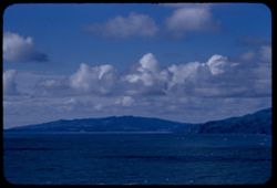
- Description:
- 25 f 5.6 pola
- Subject:
- Bays (Bodies of water), Mountains, Clouds, Islands, San Francisco Bay (Calif.), and Cities & towns
- Series:
- 10-52
- Creator:
- Cushman, Charles W., 1896-1972
- Date Created:
- 1952-03-11
- Genre:
- Cityscape photographs
- Frame Number:
- 5
- Street Address:
- Grizzly Peak Drive
- County:
- Alameda and San Francisco
- Abstract:
- SF to Bay from Grizzly Pk Drive
- Call Number:
- P05841
- City:
- Oakland and San Francisco
- Country:
- United States
- State/Province:
- California
- Physical Description:
- physical matter on slide.
- Alternate Identifier:
- 1052.5
- Persistent URL:
- http://purl.dlib.indiana.edu/iudl/archives/cushman/P05841
- Holding Location:
- Bloomington - University Archives
Wells Library E460
1320 E 10th St.
Bloomington, IN 47405
Contact at archives@indiana.edu, 812-855-1127
-
- Description:
- 25 f 11
- Subject:
- Crosses, Mountains, Shrubs, Boulders, Rocks, Clouds, San Marcos Pass (Calif.), and Rock formations
- Series:
- 8-52
- Creator:
- Cushman, Charles W., 1896-1972
- Date Created:
- 1952-03-01
- Genre:
- Landscape photographs
- Frame Number:
- 31
- Street Address:
- California State Highway 150
- County:
- Santa Barbara
- Abstract:
- From Cal 150 2 or 3 mi. north of San Marcos Pass
- Call Number:
- P05790
- City:
- Santa Barbara
- Country:
- United States
- State/Province:
- California
- Alternate Identifier:
- 852.31
- Persistent URL:
- http://purl.dlib.indiana.edu/iudl/archives/cushman/P05790
- Holding Location:
- Bloomington - University Archives
Wells Library E460
1320 E 10th St.
Bloomington, IN 47405
Contact at archives@indiana.edu, 812-855-1127
-
- Description:
- sl 100 f 8
- Subject:
- Bodies of water, Trees, Quarrying, Lakes & ponds, Clouds, and Clay mining
- Series:
- 3-56
- Creator:
- Cushman, Charles W., 1896-1972
- Date Created:
- 1956-04-01
- Genre:
- Landscape photographs
- Frame Number:
- 22
- Street Address:
- California State Highway 104
- County:
- Amador
- Abstract:
- Clay quarry 3 mi [N] of loke on Cal 104
- Call Number:
- P08623
- City:
- Ione
- Country:
- United States
- State/Province:
- California
- Alternate Identifier:
- 356.22
- Persistent URL:
- http://purl.dlib.indiana.edu/iudl/archives/cushman/P08623
- Holding Location:
- Bloomington - University Archives
Wells Library E460
1320 E 10th St.
Bloomington, IN 47405
Contact at archives@indiana.edu, 812-855-1127
-
- Subject:
- Rocks, Trees, Mountains, Rock formations, Pacific Coast Highway, Hills, and Clouds
- Series:
- 3-68
- Creator:
- Cushman, Charles W., 1896-1972
- Date Created:
- 1968-10-01
- Genre:
- Landscape photographs
- Frame Number:
- 21
- Street Address:
- California State Highway 1
- County:
- San Luis Obispo
- Call Number:
- P15673
- City:
- San Luis Obispo
- Country:
- United States
- State/Province:
- California
- Alternate Identifier:
- 368.21
- Persistent URL:
- http://purl.dlib.indiana.edu/iudl/archives/cushman/P15673
- Holding Location:
- Bloomington - University Archives
Wells Library E460
1320 E 10th St.
Bloomington, IN 47405
Contact at archives@indiana.edu, 812-855-1127
-
- Description:
- tl 1/100
- Subject:
- Sandbars, Michigan Bar (Calif.), Trees, Rock formations, Clouds, and Hills
- Series:
- 3-56
- Creator:
- Cushman, Charles W., 1896-1972
- Date Created:
- 1956-04-01
- Genre:
- Landscape photographs
- Frame Number:
- 19
- Street Address:
- California State Highway 16
- County:
- Sacramento
- Abstract:
- near Michigan Bar
- Call Number:
- P08620
- Country:
- United States
- State/Province:
- California
- Alternate Identifier:
- 356.19
- Persistent URL:
- http://purl.dlib.indiana.edu/iudl/archives/cushman/P08620
- Holding Location:
- Bloomington - University Archives
Wells Library E460
1320 E 10th St.
Bloomington, IN 47405
Contact at archives@indiana.edu, 812-855-1127
-
- Description:
- tl 1/100
- Subject:
- Sandbars, Michigan Bar (Calif.), Trees, Rock formations, Clouds, and Hills
- Series:
- 3-56
- Creator:
- Cushman, Charles W., 1896-1972
- Date Created:
- 1956-04-01
- Genre:
- Landscape photographs
- Frame Number:
- 21
- Street Address:
- California State Highway 16
- County:
- Sacramento
- Abstract:
- near Michigan Bar
- Call Number:
- P08622
- Country:
- United States
- State/Province:
- California
- Alternate Identifier:
- 356.21
- Persistent URL:
- http://purl.dlib.indiana.edu/iudl/archives/cushman/P08622
- Holding Location:
- Bloomington - University Archives
Wells Library E460
1320 E 10th St.
Bloomington, IN 47405
Contact at archives@indiana.edu, 812-855-1127
-
- Description:
- sl
- Subject:
- Sandbars, Hills, Michigan Bar (Calif.), Utility poles, Trees, and Clouds
- Series:
- 3-56
- Creator:
- Cushman, Charles W., 1896-1972
- Date Created:
- 1956-04-01
- Genre:
- Landscape photographs
- Frame Number:
- 20
- Street Address:
- California State Highway 16
- County:
- Sacramento
- Abstract:
- near Michigan Bar
- Call Number:
- P08621
- Country:
- United States
- State/Province:
- California
- Alternate Identifier:
- 356.20
- Persistent URL:
- http://purl.dlib.indiana.edu/iudl/archives/cushman/P08621
- Holding Location:
- Bloomington - University Archives
Wells Library E460
1320 E 10th St.
Bloomington, IN 47405
Contact at archives@indiana.edu, 812-855-1127
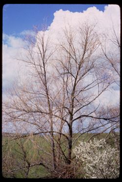
-
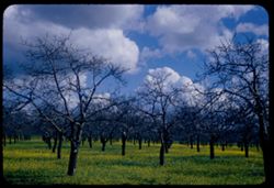
- Description:
- 50 f 8 sl
- Subject:
- Trees, Meadows, Tree limbs, and Clouds
- Series:
- 3-58
- Creator:
- Cushman, Charles W., 1896-1972
- Date Created:
- 1958-04-07
- Genre:
- Landscape photographs
- Frame Number:
- 2
- Street Address:
- Brown's Valley Road
- County:
- Napa
- Abstract:
- Skeleton trees against beautiful sky
- Call Number:
- P09718
- Country:
- United States
- State/Province:
- California
- Alternate Identifier:
- 358.2
- Persistent URL:
- http://purl.dlib.indiana.edu/iudl/archives/cushman/P09718
- Holding Location:
- Bloomington - University Archives
Wells Library E460
1320 E 10th St.
Bloomington, IN 47405
Contact at archives@indiana.edu, 812-855-1127
-
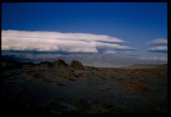
- Description:
- 100 f 8
- Subject:
- Mountains, Rock formations, Clouds, Death Valley National Park (Calif. and Nev.), and Black Mountains (Inyo County, Calif.)
- Series:
- 9-55
- Creator:
- Cushman, Charles W., 1896-1972
- Date Created:
- 1955-03-22
- Genre:
- Landscape photographs
- Frame Number:
- 38
- Street Address:
- Artist's View Drive
- County:
- Inyo
- Abstract:
- From top of Artists Drive Death Valley Nat'l Mon
- Call Number:
- P07828
- Country:
- United States
- State/Province:
- California
- Alternate Identifier:
- 955.38
- Persistent URL:
- http://purl.dlib.indiana.edu/iudl/archives/cushman/P07828
- Holding Location:
- Bloomington - University Archives
Wells Library E460
1320 E 10th St.
Bloomington, IN 47405
Contact at archives@indiana.edu, 812-855-1127
-
![[No Description]](https://iiif.uits.iu.edu/iiif/2/1z40kt54k%2Ffiles%2F057d1acc-6070-47f4-999c-05bc2dd67864/full/250,/0/default.jpg)
- Description:
- 100 f 4
- Subject:
- Golden Gate Bridge (San Francisco, Calif.), Suspension bridges, Tree limbs, Mountains, Buildings, Bridges, Sunrises & sunsets, Hills, and Clouds
- Series:
- 13-59
- Creator:
- Cushman, Charles W., 1896-1972
- Date Created:
- 1959-07-09
- Genre:
- Architectural photographs
- Frame Number:
- 22
- County:
- San Francisco
- Abstract:
- Sunset - Golden Gate Half frame
- Call Number:
- P10818
- City:
- San Francisco
- Country:
- United States
- State/Province:
- California
- Physical Description:
- masked.
- Alternate Identifier:
- 1359.22
- Persistent URL:
- http://purl.dlib.indiana.edu/iudl/archives/cushman/P10818
- Holding Location:
- Bloomington - University Archives
Wells Library E460
1320 E 10th St.
Bloomington, IN 47405
Contact at archives@indiana.edu, 812-855-1127
-
- Description:
- 100 f 5.6 tl
- Subject:
- Trees, Streets, Mountains, Buildings, Shrubs, Clouds, Dwellings, Utility poles, and Fences
- Series:
- 17-55
- Creator:
- Cushman, Charles W., 1896-1972
- Date Created:
- 1955-06-16
- Genre:
- Cityscape photographs
- Frame Number:
- 38
- County:
- Siskiyou
- Abstract:
- Looking down on Yreka from east or NE
- Call Number:
- P08117
- City:
- Yreka
- Country:
- United States
- State/Province:
- California
- Alternate Identifier:
- 1755.38
- Persistent URL:
- http://purl.dlib.indiana.edu/iudl/archives/cushman/P08117
- Holding Location:
- Bloomington - University Archives
Wells Library E460
1320 E 10th St.
Bloomington, IN 47405
Contact at archives@indiana.edu, 812-855-1127
-
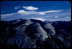
- Description:
- 50 f 7 Pola
- Subject:
- Snow, Yosemite National Park (Calif.), Mountains, Glacier Point (Calif.), Clouds, and National parks & reserves
- Series:
- 5-53
- Creator:
- Cushman, Charles W., 1896-1972
- Date Created:
- 1953-05-13
- Genre:
- Landscape photographs
- Frame Number:
- 9
- County:
- Mariposa
- Abstract:
- NE from GP.
- Call Number:
- P06659
- Country:
- United States
- State/Province:
- California
- Alternate Identifier:
- 553.9
- Persistent URL:
- http://purl.dlib.indiana.edu/iudl/archives/cushman/P06659
- Holding Location:
- Bloomington - University Archives
Wells Library E460
1320 E 10th St.
Bloomington, IN 47405
Contact at archives@indiana.edu, 812-855-1127
-
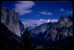
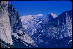
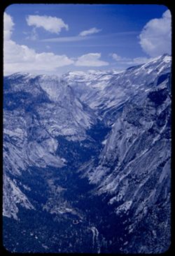
- Description:
- 100 F 8 TL
- Subject:
- Yosemite Valley (Calif.), Valleys, Cliffs, Yosemite National Park (Calif.), Waterfalls, Trees, Mountains, National parks & reserves, Clouds, Discovery Vi...
- Series:
- 22-55
- Creator:
- Cushman, Charles W., 1896-1972
- Date Created:
- 1955-07-09
- Genre:
- Landscape photographs
- Frame Number:
- 27
- County:
- Mariposa
- Abstract:
- Coventional View
- Call Number:
- P08280
- Country:
- United States
- State/Province:
- California
- Alternate Identifier:
- 2255.27
- Persistent URL:
- http://purl.dlib.indiana.edu/iudl/archives/cushman/P08280
- Holding Location:
- Bloomington - University Archives
Wells Library E460
1320 E 10th St.
Bloomington, IN 47405
Contact at archives@indiana.edu, 812-855-1127
-
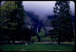
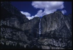
- Description:
- 25 f 3.5 Pola
- Subject:
- Yosemite Valley (Calif.), Valleys, Yosemite Falls (Calif.), Yosemite National Park (Calif.), Waterfalls, Trees, Mountains, National parks & reserves, Clo...
- Series:
- 6-53
- Creator:
- Cushman, Charles W., 1896-1972
- Date Created:
- 1953-05-15
- Genre:
- Landscape photographs
- Frame Number:
- 23
- County:
- Mariposa
- Abstract:
- Yosemite falls = 2 and 3 under cloud cover.
- Call Number:
- P06711
- Country:
- United States
- State/Province:
- California
- Alternate Identifier:
- 653.23
- Persistent URL:
- http://purl.dlib.indiana.edu/iudl/archives/cushman/P06711
- Holding Location:
- Bloomington - University Archives
Wells Library E460
1320 E 10th St.
Bloomington, IN 47405
Contact at archives@indiana.edu, 812-855-1127
-
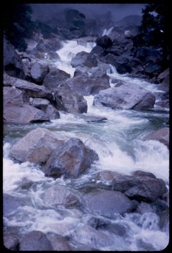
- Description:
- 50 f 2.5
- Subject:
- Yosemite Creek (Calif.), Yosemite National Park (Calif.), Waterfalls, Boulders, National parks & reserves, Rapids, Streams, and Clouds
- Series:
- 6-53
- Creator:
- Cushman, Charles W., 1896-1972
- Date Created:
- 1953-05-14
- Genre:
- Landscape photographs
- Frame Number:
- 14
- County:
- Mariposa
- Abstract:
- Yosemite below fall
- Call Number:
- P06701
- Country:
- United States
- State/Province:
- California
- Alternate Identifier:
- 653.14
- Persistent URL:
- http://purl.dlib.indiana.edu/iudl/archives/cushman/P06701
- Holding Location:
- Bloomington - University Archives
Wells Library E460
1320 E 10th St.
Bloomington, IN 47405
Contact at archives@indiana.edu, 812-855-1127
-
- Description:
- 100 f 8 tl
- Subject:
- Yosemite Valley (Calif.), Valleys, Trees, Half Dome (Calif.), Mountains, Shrubs, and Clouds
- Series:
- 20-55
- Creator:
- Cushman, Charles W., 1896-1972
- Date Created:
- 1955-07-07
- Genre:
- Landscape photographs
- Frame Number:
- 6
- County:
- Mariposa
- Abstract:
- Toward Half Dome
- Call Number:
- P08190
- Country:
- United States
- State/Province:
- California
- Alternate Identifier:
- 2055.6
- Persistent URL:
- http://purl.dlib.indiana.edu/iudl/archives/cushman/P08190
- Holding Location:
- Bloomington - University Archives
Wells Library E460
1320 E 10th St.
Bloomington, IN 47405
Contact at archives@indiana.edu, 812-855-1127
-
- Description:
- 50 f 6.3 Pola
- Subject:
- Snow, Yosemite National Park (Calif.), Trees, Pines, Mountains, National parks & reserves, Clouds, and Sentinel Dome (Calif.)
- Series:
- 5-53
- Creator:
- Cushman, Charles W., 1896-1972
- Date Created:
- 1953-05-13
- Genre:
- Landscape photographs
- Frame Number:
- 19
- County:
- Mariposa
- Abstract:
- NE from Sent Dome.
- Call Number:
- P06669
- Country:
- United States
- State/Province:
- California
- Physical Description:
- Image was originally mounted in a glass enclosure. Before digitization, the image was removed and placed in a Wess Plastic, Inc. brand, 2" x 2", pl...
- Alternate Identifier:
- 553.19
- Persistent URL:
- http://purl.dlib.indiana.edu/iudl/archives/cushman/P06669
- Holding Location:
- Bloomington - University Archives
Wells Library E460
1320 E 10th St.
Bloomington, IN 47405
Contact at archives@indiana.edu, 812-855-1127
-
- Description:
- 100 f 8 50mm lens
- Subject:
- Cliffs, Yosemite Falls (Calif.), Yosemite National Park (Calif.), Waterfalls, Trees, Mountains, National parks & reserves, and Clouds
- Series:
- 22-55
- Creator:
- Cushman, Charles W., 1896-1972
- Date Created:
- 1955-07-09
- Genre:
- Landscape photographs
- Frame Number:
- 2
- County:
- Mariposa
- Abstract:
- 0 Yosemite Fall
- Call Number:
- P08255
- Country:
- United States
- State/Province:
- California
- Physical Description:
- Image was originally mounted in a glass enclosure. Before digitization, the image was removed and placed in a Wess Plastic, Inc. brand, 2" x 2", pl...
- Alternate Identifier:
- 2255.2
- Persistent URL:
- http://purl.dlib.indiana.edu/iudl/archives/cushman/P08255
- Holding Location:
- Bloomington - University Archives
Wells Library E460
1320 E 10th St.
Bloomington, IN 47405
Contact at archives@indiana.edu, 812-855-1127
-
- Description:
- 100 f 8 tl
- Subject:
- National parks & reserves, Mountains, Yosemite National Park (Calif.), Trees, Rock formations, Cathedral Rocks (Calif.), and Clouds
- Series:
- 22-55
- Creator:
- Cushman, Charles W., 1896-1972
- Date Created:
- 1955-07-09
- Genre:
- Landscape photographs
- Frame Number:
- 24
- County:
- Mariposa
- Abstract:
- 0 Cathedral Rocks
- Call Number:
- P08277
- Country:
- United States
- State/Province:
- California
- Physical Description:
- Image was originally mounted in a glass enclosure. Before digitization, the image was removed and placed in a Wess Plastic, Inc. brand, 2" x 2", pl...
- Alternate Identifier:
- 2255.24
- Persistent URL:
- http://purl.dlib.indiana.edu/iudl/archives/cushman/P08277
- Holding Location:
- Bloomington - University Archives
Wells Library E460
1320 E 10th St.
Bloomington, IN 47405
Contact at archives@indiana.edu, 812-855-1127
-
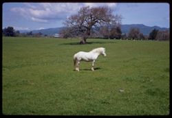
- Description:
- 100 f 8
- Subject:
- Ponies, Houses, Trees, Meadows, Clouds, and Hills
- Series:
- 3-69
- Creator:
- Cushman, Charles W., 1896-1972
- Date Created:
- 1969-04-07
- Genre:
- Landscape photographs and Identification photographs
- Frame Number:
- 32
- County:
- Sonoma
- Abstract:
- Pony near Sonoma
- Call Number:
- P15784
- City:
- Sonoma
- Country:
- United States
- State/Province:
- California
- Alternate Identifier:
- 369.32
- Persistent URL:
- http://purl.dlib.indiana.edu/iudl/archives/cushman/P15784
- Holding Location:
- Bloomington - University Archives
Wells Library E460
1320 E 10th St.
Bloomington, IN 47405
Contact at archives@indiana.edu, 812-855-1127
-
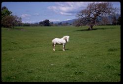
- Description:
- 100 f 8
- Subject:
- Ponies, Trees, Meadows, Clouds, and Hills
- Series:
- 3-69
- Creator:
- Cushman, Charles W., 1896-1972
- Date Created:
- 1969-04-07
- Genre:
- Landscape photographs and Identification photographs
- Frame Number:
- 33
- County:
- Sonoma
- Abstract:
- Pony near Sonoma
- Call Number:
- P15785
- City:
- Sonoma
- Country:
- United States
- State/Province:
- California
- Alternate Identifier:
- 369.33
- Persistent URL:
- http://purl.dlib.indiana.edu/iudl/archives/cushman/P15785
- Holding Location:
- Bloomington - University Archives
Wells Library E460
1320 E 10th St.
Bloomington, IN 47405
Contact at archives@indiana.edu, 812-855-1127
-
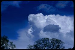
- Description:
- 100 f 8 tl
- Subject:
- Sky, Trees, Clouds, Bear Valley (Sierra County, Calif.), and Pines
- Series:
- 11-57
- Creator:
- Cushman, Charles W., 1896-1972
- Date Created:
- 1957-07-23
- Genre:
- Identification photographs
- Frame Number:
- 19
- County:
- Sierra
- Abstract:
- White clouds above Bear Valley
- Call Number:
- P09428
- Country:
- United States
- State/Province:
- California
- Alternate Identifier:
- 1157.19
- Persistent URL:
- http://purl.dlib.indiana.edu/iudl/archives/cushman/P09428
- Holding Location:
- Bloomington - University Archives
Wells Library E460
1320 E 10th St.
Bloomington, IN 47405
Contact at archives@indiana.edu, 812-855-1127
-
- Description:
- 25 f 9
- Subject:
- Panamint Mountains (Calif.), Deserts, Panamint Range (Calif.), Rocks, Rock formations, Mountains, and Clouds
- Series:
- 14-52
- Creator:
- Cushman, Charles W., 1896-1972
- Date Created:
- 1952-04-07
- Genre:
- Landscape photographs
- Frame Number:
- 14
- County:
- Inyo and San Bernardino
- Abstract:
- White cloud + distant Panamint Mtns. from few miles south of Trona.
- Call Number:
- P05998
- City:
- Trona
- Country:
- United States
- State/Province:
- California
- Physical Description:
- Image was originally mounted in a glass enclosure. Before digitization, the image was removed and placed in a Wess Plastic, Inc. brand, 2" x 2", pl...
- Alternate Identifier:
- 1452.14
- Persistent URL:
- http://purl.dlib.indiana.edu/iudl/archives/cushman/P05998
- Holding Location:
- Bloomington - University Archives
Wells Library E460
1320 E 10th St.
Bloomington, IN 47405
Contact at archives@indiana.edu, 812-855-1127
-
- Description:
- 100 f 4 tl
- Subject:
- Snow, Shadows, Mountains, Clouds, and White Mountain Peak (Inyo County, Calif.)
- Series:
- 26-55
- Creator:
- Cushman, Charles W., 1896-1972
- Date Created:
- 1955-09-25
- Genre:
- Landscape photographs
- Frame Number:
- 25
- County:
- Inyo
- Abstract:
- From US 6 NE of Bishop: White Mtn. Pk under heavy clouds with a little more light
- Call Number:
- P08407
- City:
- Bishop
- Country:
- United States
- State/Province:
- California
- Physical Description:
- Image was originally mounted in a glass enclosure. Before digitization, the image was removed and placed in a Wess Plastic, Inc. brand, 2" x 2", pl...
- Alternate Identifier:
- 2655.25
- Persistent URL:
- http://purl.dlib.indiana.edu/iudl/archives/cushman/P08407
- Holding Location:
- Bloomington - University Archives
Wells Library E460
1320 E 10th St.
Bloomington, IN 47405
Contact at archives@indiana.edu, 812-855-1127
-
- Description:
- 25 f 4 tl
- Subject:
- Mountains, Clouds, White Mountain Peak (Inyo County, Calif.), and Mists
- Series:
- 26-55
- Creator:
- Cushman, Charles W., 1896-1972
- Date Created:
- 1955-09-25
- Genre:
- Landscape photographs
- Frame Number:
- 24
- Street Address:
- United States Highway 6
- County:
- Inyo
- Abstract:
- From US 6 NE of Bishop: White Mtn. Pk under heavy clouds
- Call Number:
- P08406
- City:
- Bishop
- Country:
- United States
- State/Province:
- California
- Alternate Identifier:
- 2655.24
- Persistent URL:
- http://purl.dlib.indiana.edu/iudl/archives/cushman/P08406
- Holding Location:
- Bloomington - University Archives
Wells Library E460
1320 E 10th St.
Bloomington, IN 47405
Contact at archives@indiana.edu, 812-855-1127
-
- Description:
- 50 f 5.6 POLA
- Subject:
- Grasses, Tehachapi Mountains (Calif.), Smoke, Mountains, Clouds, Hills, and Smokestacks
- Series:
- 16-53
- Creator:
- Cushman, Charles W., 1896-1972
- Date Created:
- 1953-11-23
- Genre:
- Landscape photographs
- Frame Number:
- 16
- Street Address:
- United States Highway 466
- County:
- Kern
- Abstract:
- Western sky - Tehachapi Mtns, near Monolith
- Call Number:
- P07088
- City:
- Monolith
- Country:
- United States
- State/Province:
- California
- Alternate Identifier:
- 1653.16
- Persistent URL:
- http://purl.dlib.indiana.edu/iudl/archives/cushman/P07088
- Holding Location:
- Bloomington - University Archives
Wells Library E460
1320 E 10th St.
Bloomington, IN 47405
Contact at archives@indiana.edu, 812-855-1127
-
- Description:
- tl
- Subject:
- Valleys, Panamint Range (Calif.), Dantes View (Calif.), Mountains, Clouds, and Death Valley (Calif. and Nev.)
- Series:
- 2-55
- Creator:
- Cushman, Charles W., 1896-1972
- Date Created:
- 1955-02-27
- Genre:
- Landscape photographs
- Frame Number:
- 35
- County:
- Inyo
- Abstract:
- West by north across valley toward Panamints
- Call Number:
- P07592
- Country:
- United States
- State/Province:
- California
- Alternate Identifier:
- 255.35
- Persistent URL:
- http://purl.dlib.indiana.edu/iudl/archives/cushman/P07592
- Holding Location:
- Bloomington - University Archives
Wells Library E460
1320 E 10th St.
Bloomington, IN 47405
Contact at archives@indiana.edu, 812-855-1127
-
- Description:
- 100 f 4 tl
- Subject:
- Furnace Creek Inn (Death Valley Junction, Calif.), Death Valley (Calif. and Nev.), Funeral Mountains (Calif.), Mountains, Shrubs, Rock formations, and Clouds
- Series:
- 2-55
- Creator:
- Cushman, Charles W., 1896-1972
- Date Created:
- 1955-02-27
- Genre:
- Landscape photographs
- Frame Number:
- 25
- County:
- Inyo
- Abstract:
- Funeral Mtn in overcast between D.V. Juctn and Furnace Ck. Inn
- Call Number:
- P07583
- City:
- Death Valley Junction
- Country:
- United States
- State/Province:
- California
- Alternate Identifier:
- 255.25
- Persistent URL:
- http://purl.dlib.indiana.edu/iudl/archives/cushman/P07583
- Holding Location:
- Bloomington - University Archives
Wells Library E460
1320 E 10th St.
Bloomington, IN 47405
Contact at archives@indiana.edu, 812-855-1127
-
- Subject:
- Mountains, Rock formations, Clouds, Hills, and Pacific Coast Highway
- Series:
- 3-68
- Creator:
- Cushman, Charles W., 1896-1972
- Date Created:
- 1968-10-01
- Genre:
- Landscape photographs
- Frame Number:
- 18
- Street Address:
- California State Highway 1
- County:
- San Luis Obispo
- Call Number:
- P15670
- City:
- San Luis Obispo
- Country:
- United States
- State/Province:
- California
- Alternate Identifier:
- 368.18
- Persistent URL:
- http://purl.dlib.indiana.edu/iudl/archives/cushman/P15670
- Holding Location:
- Bloomington - University Archives
Wells Library E460
1320 E 10th St.
Bloomington, IN 47405
Contact at archives@indiana.edu, 812-855-1127
-
- Description:
- 50 f 9
- Subject:
- Cascade Range, Valleys, Trees, Volcanoes, Volcanic domes, Lassen Volcanic National Park (Calif.), Mountains, Shrubs, Clouds, Bumpass Mountain (Calif.), Shado...
- Series:
- 6-54
- Creator:
- Cushman, Charles W., 1896-1972
- Date Created:
- 1954-08-19
- Genre:
- Landscape photographs
- Frame Number:
- 8
- County:
- Shasta
- Abstract:
- Mass of Bumpass.
- Call Number:
- P07226
- Country:
- United States
- State/Province:
- California
- Alternate Identifier:
- 654.8
- Persistent URL:
- http://purl.dlib.indiana.edu/iudl/archives/cushman/P07226
- Holding Location:
- Bloomington - University Archives
Wells Library E460
1320 E 10th St.
Bloomington, IN 47405
Contact at archives@indiana.edu, 812-855-1127
-
- Description:
- 50 mm lens
- Subject:
- Deserts, Craters, Valleys, Dantes View (Calif.), Mountains, Clouds, Death Valley (Calif. and Nev.), and Black Mountains (Inyo County, Calif.)
- Series:
- 3-55
- Creator:
- Cushman, Charles W., 1896-1972
- Date Created:
- 1955-02-27
- Genre:
- Landscape photographs
- Frame Number:
- 4
- County:
- Inyo
- Abstract:
- West across floor of Death Valley
- Call Number:
- P07597
- Country:
- United States
- State/Province:
- California
- Alternate Identifier:
- 355.4
- Persistent URL:
- http://purl.dlib.indiana.edu/iudl/archives/cushman/P07597
- Holding Location:
- Bloomington - University Archives
Wells Library E460
1320 E 10th St.
Bloomington, IN 47405
Contact at archives@indiana.edu, 812-855-1127
-
- Description:
- 1/100
- Subject:
- Flowers, Dandelions, Trees, Clouds, and Grasses
- Series:
- 1-56
- Creator:
- Cushman, Charles W., 1896-1972
- Date Created:
- 1956-02-23
- Genre:
- Landscape photographs
- Frame Number:
- 13
- Street Address:
- Norris Canyon Road
- County:
- Contra Costa
- Abstract:
- Leafless walnut grove, new dandelions in grass - & clouds
- Call Number:
- P08542
- Country:
- United States
- State/Province:
- California
- Alternate Identifier:
- 156.13
- Persistent URL:
- http://purl.dlib.indiana.edu/iudl/archives/cushman/P08542
- Holding Location:
- Bloomington - University Archives
Wells Library E460
1320 E 10th St.
Bloomington, IN 47405
Contact at archives@indiana.edu, 812-855-1127
-
- Description:
- 100 f 4.5 tl
- Subject:
- Valleys, Santa Rosa Valley (Calif.), Meadows, Mountains, Clouds, and Hills
- Series:
- 6-57
- Creator:
- Cushman, Charles W., 1896-1972
- Date Created:
- 1957-05-11
- Genre:
- Landscape photographs
- Frame Number:
- 23
- Street Address:
- United States Highway 101
- County:
- Ventura
- Abstract:
- View westward over Santa Rosa valley from US 101 Ventura county
- Call Number:
- P09265
- Country:
- United States
- State/Province:
- California
- Alternate Identifier:
- 657.23
- Persistent URL:
- http://purl.dlib.indiana.edu/iudl/archives/cushman/P09265
- Holding Location:
- Bloomington - University Archives
Wells Library E460
1320 E 10th St.
Bloomington, IN 47405
Contact at archives@indiana.edu, 812-855-1127
-
- Description:
- 25 f 8 Pola
- Subject:
- Wildflowers, Barbed wire, Trees, Croplands, Fences, Shrubs, Sonoma Mountain (Calif.), Clouds, and Hills
- Series:
- 8-53
- Creator:
- Cushman, Charles W., 1896-1972
- Date Created:
- 1953-08-30
- Genre:
- Landscape photographs
- Frame Number:
- 3
- Street Address:
- Roberts Road
- County:
- Sonoma
- Abstract:
- View west from higher up on Roberts Rd.
- Call Number:
- P06766
- Country:
- United States
- State/Province:
- California
- Alternate Identifier:
- 853.3
- Persistent URL:
- http://purl.dlib.indiana.edu/iudl/archives/cushman/P06766
- Holding Location:
- Bloomington - University Archives
Wells Library E460
1320 E 10th St.
Bloomington, IN 47405
Contact at archives@indiana.edu, 812-855-1127
-
- Description:
- 50 f 5.6 Pola
- Subject:
- Snow, Yosemite National Park (Calif.), Trees, Mountains, National parks & reserves, Sentinel Dome (Calif.), and Clouds
- Series:
- 5-53
- Creator:
- Cushman, Charles W., 1896-1972
- Date Created:
- 1953-05-13
- Genre:
- Landscape photographs
- Frame Number:
- 22
- County:
- Mariposa
- Abstract:
- West from shoulder of Sent Dome.
- Call Number:
- P06672
- Country:
- United States
- State/Province:
- California
- Alternate Identifier:
- 553.22
- Persistent URL:
- http://purl.dlib.indiana.edu/iudl/archives/cushman/P06672
- Holding Location:
- Bloomington - University Archives
Wells Library E460
1320 E 10th St.
Bloomington, IN 47405
Contact at archives@indiana.edu, 812-855-1127
-
- Description:
- 100 f 8 tl
- Subject:
- Valleys, Mountains, Clouds, Death Valley (Calif. and Nev.), and Black Mountains (Inyo County, Calif.)
- Series:
- 9-55
- Creator:
- Cushman, Charles W., 1896-1972
- Date Created:
- 1955-03-22
- Genre:
- Landscape photographs
- Frame Number:
- 34
- Street Address:
- Artist's View Drive
- County:
- Inyo
- Abstract:
- Up from Artists (View) Drive
- Call Number:
- P07824
- Country:
- United States
- State/Province:
- California
- Alternate Identifier:
- 955.34
- Persistent URL:
- http://purl.dlib.indiana.edu/iudl/archives/cushman/P07824
- Holding Location:
- Bloomington - University Archives
Wells Library E460
1320 E 10th St.
Bloomington, IN 47405
Contact at archives@indiana.edu, 812-855-1127
-
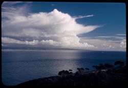
- Description:
- 100 f 8 tl
- Subject:
- Oceans, Lands End (Calif.), Coastlines, Pacific Ocean, Mountains, Pacific Coast (Calif.), Waterfronts, and Clouds
- Series:
- 1-57
- Creator:
- Cushman, Charles W., 1896-1972
- Date Created:
- 1957-03-16
- Genre:
- Seascapes
- Frame Number:
- 13
- County:
- Marin and San Francisco
- Abstract:
- Toward Bolinas
- Call Number:
- P09119
- City:
- Bolinas and San Francisco
- Country:
- United States
- State/Province:
- California
- Alternate Identifier:
- 157.13
- Persistent URL:
- http://purl.dlib.indiana.edu/iudl/archives/cushman/P09119
- Holding Location:
- Bloomington - University Archives
Wells Library E460
1320 E 10th St.
Bloomington, IN 47405
Contact at archives@indiana.edu, 812-855-1127
-
- Description:
- 50 f 11
- Subject:
- Yosemite National Park (Calif.), Mountains, Tenaya Canyon (Calif.), Canyons, National parks & reserves, Snow, Mirror Lake (Mariposa County, Calif.), Lake...
- Series:
- 5-53
- Creator:
- Cushman, Charles W., 1896-1972
- Date Created:
- 1953-05-13
- Genre:
- Landscape photographs
- Frame Number:
- 31
- County:
- Mariposa
- Abstract:
- View up Tenaya Canyon - NE from Glacier Point (Mirror Lake at bottom).
- Call Number:
- P06681
- Country:
- United States
- State/Province:
- California
- Alternate Identifier:
- 553.31
- Persistent URL:
- http://purl.dlib.indiana.edu/iudl/archives/cushman/P06681
- Holding Location:
- Bloomington - University Archives
Wells Library E460
1320 E 10th St.
Bloomington, IN 47405
Contact at archives@indiana.edu, 812-855-1127
-
- Description:
- 100 f 4.5 tl
- Subject:
- Canyons, Hills, Roads, Rocks, Clouds, and Kern River Valley (Calif.)
- Series:
- 2-55
- Creator:
- Cushman, Charles W., 1896-1972
- Date Created:
- 1955-02-26
- Genre:
- Landscape photographs
- Frame Number:
- 5
- Street Address:
- California State Highway 178
- County:
- Kern
- Abstract:
- View up canyon
- Call Number:
- P07563
- City:
- Bakersfield
- Country:
- United States
- State/Province:
- California
- Alternate Identifier:
- 255.5
- Persistent URL:
- http://purl.dlib.indiana.edu/iudl/archives/cushman/P07563
- Holding Location:
- Bloomington - University Archives
Wells Library E460
1320 E 10th St.
Bloomington, IN 47405
Contact at archives@indiana.edu, 812-855-1127
-
- Description:
- tl
- Subject:
- Valleys, Roads, Dantes View (Calif.), Black Mountain (Inyo County, Calif.), Clouds, Death Valley (Calif. and Nev.), and Mountains
- Series:
- 2-55
- Creator:
- Cushman, Charles W., 1896-1972
- Date Created:
- 1955-02-27
- Genre:
- Landscape photographs
- Frame Number:
- 37
- County:
- Inyo
- Abstract:
- Up valley - NNW.
- Call Number:
- P07594
- Country:
- United States
- State/Province:
- California
- Alternate Identifier:
- 255.37
- Persistent URL:
- http://purl.dlib.indiana.edu/iudl/archives/cushman/P07594
- Holding Location:
- Bloomington - University Archives
Wells Library E460
1320 E 10th St.
Bloomington, IN 47405
Contact at archives@indiana.edu, 812-855-1127
-
- Description:
- 100 f 5 tl wrong focus error at 300 ft.
- Subject:
- Domes, Cities & towns, Streets, Hills, Bodies of water, Mountains, Dwellings, Buena Vista Park (San Francisco, Calif.), Buildings, Coastlines, Clouds, Tr...
- Series:
- 5-55
- Creator:
- Cushman, Charles W., 1896-1972
- Date Created:
- 1955-03-12
- Genre:
- Cityscape photographs
- Frame Number:
- 20
- County:
- Marin and San Francisco
- Abstract:
- Toward Pt. Reyes under clouds were out too far to left and had to be remounted
- Call Number:
- P07685
- City:
- San Francisco and Point Reyes Station
- Country:
- United States
- State/Province:
- California
- Alternate Identifier:
- 555.20
- Persistent URL:
- http://purl.dlib.indiana.edu/iudl/archives/cushman/P07685
- Holding Location:
- Bloomington - University Archives
Wells Library E460
1320 E 10th St.
Bloomington, IN 47405
Contact at archives@indiana.edu, 812-855-1127
-
- Description:
- 100 f 7 tl
- Subject:
- Bays (Bodies of water), Trees, Cities & towns, Buildings, Clouds, and Hills
- Series:
- 1-56
- Creator:
- Cushman, Charles W., 1896-1972
- Date Created:
- 1956-02-26
- Genre:
- Cityscape photographs
- Frame Number:
- 23
- Street Address:
- Washington Street, Octavia Street, and Russian Hill
- County:
- San Francisco
- Abstract:
- Clouds above north crown of Russian Hill - from Washington at Octavia
- Call Number:
- P08552
- City:
- San Francisco
- Country:
- United States
- State/Province:
- California
- Alternate Identifier:
- 156.23
- Persistent URL:
- http://purl.dlib.indiana.edu/iudl/archives/cushman/P08552
- Holding Location:
- Bloomington - University Archives
Wells Library E460
1320 E 10th St.
Bloomington, IN 47405
Contact at archives@indiana.edu, 812-855-1127
-
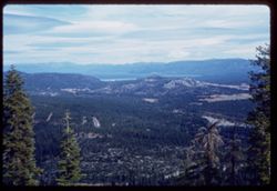
- Description:
- 50 f 8
- Subject:
- Echo Summit (El Dorado County, Calif.), Trees, Mountains, Tahoe, Lake (Calif. and Nev.), Lakes & ponds, Clouds, Sierra Nevada (Calif. and Nev.), Forests,...
- Series:
- 3-62
- Creator:
- Cushman, Charles W., 1896-1972
- Date Created:
- 1962-09-28
- Genre:
- Landscape photographs
- Frame Number:
- 5
- Abstract:
- Toward Tahoe.
- Call Number:
- P12703
- Country:
- United States
- State/Province:
- California
- Alternate Identifier:
- 362.5
- Persistent URL:
- http://purl.dlib.indiana.edu/iudl/archives/cushman/P12703
- Holding Location:
- Bloomington - University Archives
Wells Library E460
1320 E 10th St.
Bloomington, IN 47405
Contact at archives@indiana.edu, 812-855-1127
-
- Description:
- 25 f 6.3 Pola
- Subject:
- Bays (Bodies of water), Oceans, Fog, Trees, Coastlines, Pacific Ocean, Pacific Coast (Calif.), Tamalpais, Mount (Calif.), Hills, San Francisco Bay (Calif.), ...
- Series:
- 12-52
- Creator:
- Cushman, Charles W., 1896-1972
- Date Created:
- 1952-03-30
- Genre:
- Landscape photographs and Cityscape photographs
- Frame Number:
- 18
- County:
- Marin and San Francisco
- Abstract:
- Fog bank over SF.
- Call Number:
- P05925
- City:
- San Francisco
- Country:
- United States
- State/Province:
- California
- Alternate Identifier:
- 1252.18
- Persistent URL:
- http://purl.dlib.indiana.edu/iudl/archives/cushman/P05925
- Holding Location:
- Bloomington - University Archives
Wells Library E460
1320 E 10th St.
Bloomington, IN 47405
Contact at archives@indiana.edu, 812-855-1127
-
- Description:
- 25 f 4.5 Pola
- Subject:
- San Bernardino Mountains (Calif.), Mountains, Clouds, and Sunrises & sunsets
- Series:
- 8-52
- Creator:
- Cushman, Charles W., 1896-1972
- Date Created:
- 1952-02-25
- Genre:
- Landscape photographs
- Frame Number:
- 2
- Street Address:
- Rim-of-World Drive
- County:
- San Bernardino
- Abstract:
- View south from Rim Drive 3 mi west of Running Springs
- Call Number:
- P05761
- City:
- Running Springs
- Country:
- United States
- State/Province:
- California
- Alternate Identifier:
- 852.2
- Persistent URL:
- http://purl.dlib.indiana.edu/iudl/archives/cushman/P05761
- Holding Location:
- Bloomington - University Archives
Wells Library E460
1320 E 10th St.
Bloomington, IN 47405
Contact at archives@indiana.edu, 812-855-1127
-
- Description:
- 100 f 5.6 tl
- Subject:
- Rocks, Trees, Mountains, Clouds, and Bridges
- Series:
- 10-56
- Creator:
- Cushman, Charles W., 1896-1972
- Date Created:
- 1956-07-13
- Frame Number:
- 20
- Street Address:
- United States Highway 99
- County:
- Siskiyou
- Abstract:
- View south (silhouette) from US 99 so. of Cal. Oregon line
- Call Number:
- P08880
- Country:
- United States
- State/Province:
- California
- Alternate Identifier:
- 1056.20
- Persistent URL:
- http://purl.dlib.indiana.edu/iudl/archives/cushman/P08880
- Holding Location:
- Bloomington - University Archives
Wells Library E460
1320 E 10th St.
Bloomington, IN 47405
Contact at archives@indiana.edu, 812-855-1127
-
- Description:
- 25 f 8 pola
- Subject:
- Loma, Point (Calif.), Eucalyptus trees, San Diego Bay (Calif.), Coastlines, Pacific Ocean, Shrubs, Pacific Coast (Calif.), Bays (Bodies of water), Trees, Cab...
- Series:
- 6-52
- Creator:
- Cushman, Charles W., 1896-1972
- Date Created:
- 1952-02-09
- Genre:
- Seascapes
- Frame Number:
- 3
- Street Address:
- Point Loma
- County:
- San Diego
- Abstract:
- Bright cloud mass South from Cabrillo Mon at Point Loma San Diego
- Call Number:
- P05686
- City:
- San Diego
- Country:
- United States
- State/Province:
- California
- Alternate Identifier:
- 652.3
- Persistent URL:
- http://purl.dlib.indiana.edu/iudl/archives/cushman/P05686
- Holding Location:
- Bloomington - University Archives
Wells Library E460
1320 E 10th St.
Bloomington, IN 47405
Contact at archives@indiana.edu, 812-855-1127
-
- Description:
- 50 f 9 HF
- Subject:
- Almanor, Lake (Calif.), Reservoirs, Trees, Pines, Lassen Volcanic National Park (Calif.), Mountains, Clouds, and Reading Peak (Calif.)
- Series:
- 7-54
- Creator:
- Cushman, Charles W., 1896-1972
- Date Created:
- 1954-08-21
- Genre:
- Landscape photographs
- Frame Number:
- 6
- County:
- Shasta
- Abstract:
- View SE from side of Reading Pk. in Lassen Pk toward Lake Almanor.
- Call Number:
- P07261
- Country:
- United States
- State/Province:
- California
- Alternate Identifier:
- 754.6
- Persistent URL:
- http://purl.dlib.indiana.edu/iudl/archives/cushman/P07261
- Holding Location:
- Bloomington - University Archives
Wells Library E460
1320 E 10th St.
Bloomington, IN 47405
Contact at archives@indiana.edu, 812-855-1127
-
- Description:
- 100 f tl
- Subject:
- Bays (Bodies of water), Naval yards & naval stations, Telegraph Hill (San Francisco, Calif.), Clouds, Treasure Island (San Francisco, Calif.), Islands, S...
- Series:
- 8-58
- Creator:
- Cushman, Charles W., 1896-1972
- Date Created:
- 1958-05-18
- Genre:
- Views
- Frame Number:
- 34
- County:
- Alameda and San Francisco
- Abstract:
- Telegraph Hill Cloud bank over Berkeley
- Call Number:
- P09919
- City:
- Berkeley and San Francisco
- Country:
- United States
- State/Province:
- California
- Alternate Identifier:
- 858.34
- Persistent URL:
- http://purl.dlib.indiana.edu/iudl/archives/cushman/P09919
- Holding Location:
- Bloomington - University Archives
Wells Library E460
1320 E 10th St.
Bloomington, IN 47405
Contact at archives@indiana.edu, 812-855-1127
-
- Description:
- 100 f 5.6 tl
- Subject:
- Electric lines, Angel Island (Calif.), Buses, Trees, Streets, Buildings, Clouds, Islands, Dwellings, Hills, Utility poles, Aircraft, and Automobiles
- Series:
- 14-55
- Creator:
- Cushman, Charles W., 1896-1972
- Date Created:
- 1955-04-29
- Genre:
- Cityscape photographs
- Frame Number:
- 24
- Street Address:
- 100 Broderick Street
- County:
- San Francisco
- Abstract:
- Big Navy plane flying above S.F. Bay
- Call Number:
- P07994
- City:
- San Francisco
- Country:
- United States
- State/Province:
- California
- Alternate Identifier:
- 1455.24
- Persistent URL:
- http://purl.dlib.indiana.edu/iudl/archives/cushman/P07994
- Holding Location:
- Bloomington - University Archives
Wells Library E460
1320 E 10th St.
Bloomington, IN 47405
Contact at archives@indiana.edu, 812-855-1127
-
- Subject:
- Trees, Walkways, Roofs, Cities & towns, Buildings, Shrubs, Clouds, Railroad tracks, Domes, Mission Park (San Francisco County, Calif.), and Bridges
- Series:
- 1-54
- Creator:
- Cushman, Charles W., 1896-1972
- Date Created:
- 1954-05-10
- Genre:
- Cityscape photographs
- Frame Number:
- 21
- Street Address:
- Church Street and Cumberland Street
- County:
- San Francisco
- Abstract:
- Looking toward the city from Church St at Cumberland alongside Mission Park.
- Call Number:
- P07131
- City:
- San Francisco
- Country:
- United States
- State/Province:
- California
- Alternate Identifier:
- 154.21
- Persistent URL:
- http://purl.dlib.indiana.edu/iudl/archives/cushman/P07131
- Holding Location:
- Bloomington - University Archives
Wells Library E460
1320 E 10th St.
Bloomington, IN 47405
Contact at archives@indiana.edu, 812-855-1127
-
- Description:
- 25 f 6.3 pola
- Subject:
- Trees, Cities & towns, and Clouds
- Series:
- 10-52
- Creator:
- Cushman, Charles W., 1896-1972
- Date Created:
- 1952-03-11
- Genre:
- Cityscape photographs
- Frame Number:
- 4
- Street Address:
- Grass Valley Road
- County:
- Alameda
- Abstract:
- View NW from Grass Valley Rd back of Oakland
- Call Number:
- P05840
- City:
- Oakland
- Country:
- United States
- State/Province:
- California
- Alternate Identifier:
- 1052.4
- Persistent URL:
- http://purl.dlib.indiana.edu/iudl/archives/cushman/P05840
- Holding Location:
- Bloomington - University Archives
Wells Library E460
1320 E 10th St.
Bloomington, IN 47405
Contact at archives@indiana.edu, 812-855-1127
-
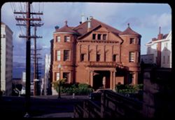
- Description:
- 25 f 9
- Subject:
- Bodies of water, Automobiles, Streets, Sidewalks, Shrubs, Stone houses, Clouds, Masonry, Brownstone buildings, Whittier Mansion (San Francisco, Calif.), Colu...
- Series:
- 1-53
- Creator:
- Cushman, Charles W., 1896-1972
- Date Created:
- 1953-01-20
- Genre:
- Cityscape photographs
- Frame Number:
- 14
- Street Address:
- Jackson Street and Laguna Street
- County:
- San Francisco
- Abstract:
- Whittier Mansion (built 1896) Classic brownstone - NE corner Jackson + Laguna. Wm. Frank Whittier, capitalist.
- Call Number:
- P06527
- City:
- San Francisco
- Country:
- United States
- State/Province:
- California
- Alternate Identifier:
- 153.14
- Persistent URL:
- http://purl.dlib.indiana.edu/iudl/archives/cushman/P06527
- Holding Location:
- Bloomington - University Archives
Wells Library E460
1320 E 10th St.
Bloomington, IN 47405
Contact at archives@indiana.edu, 812-855-1127
-
- Description:
- 25 f 7 Pola
- Subject:
- Grasses, Farms, Trees, Meadows, Tree limbs, Croplands, Fences, Sonoma Mountain (Calif.), Clouds, Hills, and Mountains
- Series:
- 8-53
- Creator:
- Cushman, Charles W., 1896-1972
- Date Created:
- 1953-08-30
- Genre:
- Landscape photographs
- Frame Number:
- 5
- County:
- Sonoma
- Abstract:
- View north from Sonoma Mtn road.
- Call Number:
- P06768
- Country:
- United States
- State/Province:
- California
- Alternate Identifier:
- 853.5
- Persistent URL:
- http://purl.dlib.indiana.edu/iudl/archives/cushman/P06768
- Holding Location:
- Bloomington - University Archives
Wells Library E460
1320 E 10th St.
Bloomington, IN 47405
Contact at archives@indiana.edu, 812-855-1127
-
- Description:
- 25 f 7 Pola
- Subject:
- Grasses, Trees, Meadows, Mountains, Fences, Shrubs, Sonoma Mountain (Calif.), Clouds, and Hills
- Series:
- 8-53
- Creator:
- Cushman, Charles W., 1896-1972
- Date Created:
- 1953-08-30
- Genre:
- Landscape photographs
- Frame Number:
- 6
- County:
- Sonoma
- Abstract:
- From Sonoma Mtn road. a mile or so to the east.
- Call Number:
- P06769
- Country:
- United States
- State/Province:
- California
- Alternate Identifier:
- 853.6
- Persistent URL:
- http://purl.dlib.indiana.edu/iudl/archives/cushman/P06769
- Holding Location:
- Bloomington - University Archives
Wells Library E460
1320 E 10th St.
Bloomington, IN 47405
Contact at archives@indiana.edu, 812-855-1127
-
- Description:
- 100 f 8 tl
- Subject:
- Bays (Bodies of water), Fort Barry Military Reservation (Calif.), Cliffs, Lands End (Calif.), Bonita, Point (Calif.), Capes (Coasts), Mountains, Clouds, Wate...
- Series:
- 1-57
- Creator:
- Cushman, Charles W., 1896-1972
- Date Created:
- 1957-03-16
- Genre:
- Landscape photographs
- Frame Number:
- 10
- County:
- San Francisco
- Abstract:
- Point Bonita and Fort Barry with Mt. Tamalpais beyond
- Call Number:
- P09116
- City:
- San Francisco
- Country:
- United States
- State/Province:
- California
- Alternate Identifier:
- 157.10
- Persistent URL:
- http://purl.dlib.indiana.edu/iudl/archives/cushman/P09116
- Holding Location:
- Bloomington - University Archives
Wells Library E460
1320 E 10th St.
Bloomington, IN 47405
Contact at archives@indiana.edu, 812-855-1127
-
- Description:
- 25 f 8 pola
- Subject:
- Pines, Mount Wilson (Calif.), Mountains, Clouds, San Gabriel Mountains (Calif.), and Echo Rock (Calif.)
- Series:
- 6-52
- Creator:
- Cushman, Charles W., 1896-1972
- Date Created:
- 1952-02-18
- Genre:
- Landscape photographs
- Frame Number:
- 16
- County:
- Los Angeles
- Abstract:
- North by East from Echo Rock of Mt. Wilson
- Call Number:
- P05699
- Country:
- United States
- State/Province:
- California
- Alternate Identifier:
- 652.16
- Persistent URL:
- http://purl.dlib.indiana.edu/iudl/archives/cushman/P05699
- Holding Location:
- Bloomington - University Archives
Wells Library E460
1320 E 10th St.
Bloomington, IN 47405
Contact at archives@indiana.edu, 812-855-1127
-
- Description:
- 25 f 11
- Subject:
- Mount Wilson (Calif.), San Gabriel Mountains (Calif.), Shadows, Clouds, and Mountains
- Series:
- 6-52
- Creator:
- Cushman, Charles W., 1896-1972
- Date Created:
- 1952-02-18
- Genre:
- Landscape photographs
- Frame Number:
- 13
- County:
- Los Angeles
- Abstract:
- North from Mt. Wilson
- Call Number:
- P05696
- Country:
- United States
- State/Province:
- California
- Alternate Identifier:
- 652.13
- Persistent URL:
- http://purl.dlib.indiana.edu/iudl/archives/cushman/P05696
- Holding Location:
- Bloomington - University Archives
Wells Library E460
1320 E 10th St.
Bloomington, IN 47405
Contact at archives@indiana.edu, 812-855-1127
-
- Description:
- 25 f 9 Pola
- Subject:
- Yosemite Valley (Calif.), Yosemite National Park (Calif.), Trees, Shadows, Mountains, National parks & reserves, Clouds, and Glacier Point (Calif.)
- Series:
- 5-53
- Creator:
- Cushman, Charles W., 1896-1972
- Date Created:
- 1953-05-13
- Genre:
- Landscape photographs
- Frame Number:
- 1
- County:
- Mariposa
- Abstract:
- View north from Glacier Point. [L]
- Call Number:
- P06651
- Country:
- United States
- State/Province:
- California
- Alternate Identifier:
- 553.1
- Persistent URL:
- http://purl.dlib.indiana.edu/iudl/archives/cushman/P06651
- Holding Location:
- Bloomington - University Archives
Wells Library E460
1320 E 10th St.
Bloomington, IN 47405
Contact at archives@indiana.edu, 812-855-1127
-
- Description:
- 50 f 8
- Subject:
- Chimneys, Flowers, Houses, Skyscrapers, Bays (Bodies of water), Trees, Bay windows, Garden walls, Clouds, Roofs, Hills, and Buildings
- Series:
- 16-53
- Creator:
- Cushman, Charles W., 1896-1972
- Date Created:
- 1953-01-17
- Genre:
- Cityscape photographs
- Frame Number:
- 36
- Street Address:
- Twenty-first Street and Sanchez Street
- County:
- San Francisco
- Abstract:
- Toward city from same pt.
- Call Number:
- P07108
- City:
- San Francisco
- Country:
- United States
- State/Province:
- California
- Alternate Identifier:
- 1653.36
- Persistent URL:
- http://purl.dlib.indiana.edu/iudl/archives/cushman/P07108
- Holding Location:
- Bloomington - University Archives
Wells Library E460
1320 E 10th St.
Bloomington, IN 47405
Contact at archives@indiana.edu, 812-855-1127
-
- Description:
- 50 f 5.6 Pola
- Subject:
- National parks & reserves, Sentinel Dome (Calif.), Half Dome (Calif.), Mountains, Yosemite National Park (Calif.), Snow, Trees, and Clouds
- Series:
- 5-53
- Creator:
- Cushman, Charles W., 1896-1972
- Date Created:
- 1953-05-13
- Genre:
- Landscape photographs
- Frame Number:
- 17
- County:
- Mariposa
- Abstract:
- East from Sentinel Dome.
- Call Number:
- P06667
- Country:
- United States
- State/Province:
- California
- Alternate Identifier:
- 553.17
- Persistent URL:
- http://purl.dlib.indiana.edu/iudl/archives/cushman/P06667
- Holding Location:
- Bloomington - University Archives
Wells Library E460
1320 E 10th St.
Bloomington, IN 47405
Contact at archives@indiana.edu, 812-855-1127
-

- Description:
- 25 f 6.3 Pola
- Subject:
- Rocks, San Marcos Pass (Calif.), Boulders, Shadows, Mountains, Shrubs, and Clouds
- Series:
- 8-52
- Creator:
- Cushman, Charles W., 1896-1972
- Date Created:
- 1952-03-01
- Genre:
- Landscape photographs
- Frame Number:
- 32
- Street Address:
- California State Highway 150
- County:
- Santa Barbara
- Abstract:
- From a few miles farther down
- Call Number:
- P05791
- City:
- Santa Barbara
- Country:
- United States
- State/Province:
- California
- Alternate Identifier:
- 852.32
- Persistent URL:
- http://purl.dlib.indiana.edu/iudl/archives/cushman/P05791
- Holding Location:
- Bloomington - University Archives
Wells Library E460
1320 E 10th St.
Bloomington, IN 47405
Contact at archives@indiana.edu, 812-855-1127
-
- Description:
- 100 f 9 tl
- Subject:
- Trees, Half Dome (Calif.), Lyell, Mount (Calif.), Mountains, Shrubs, Clouds, and Maclure, Mount (Calif.)
- Series:
- 20-55
- Creator:
- Cushman, Charles W., 1896-1972
- Date Created:
- 1955-07-07
- Genre:
- Landscape photographs
- Frame Number:
- 25
- County:
- Mariposa
- Abstract:
- Toward Mts. McClure & Lyell
- Call Number:
- P08208
- Country:
- United States
- State/Province:
- California
- Alternate Identifier:
- 2055.25
- Persistent URL:
- http://purl.dlib.indiana.edu/iudl/archives/cushman/P08208
- Holding Location:
- Bloomington - University Archives
Wells Library E460
1320 E 10th St.
Bloomington, IN 47405
Contact at archives@indiana.edu, 812-855-1127
-
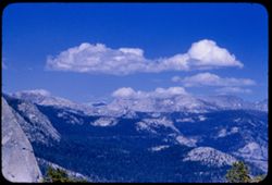
- Description:
- 100 f 8 tl
- Subject:
- Valleys, Trees, Half Dome (Calif.), Mountains, and Clouds
- Series:
- 20-55
- Creator:
- Cushman, Charles W., 1896-1972
- Date Created:
- 1955-07-07
- Genre:
- Landscape photographs
- Frame Number:
- 17
- County:
- Mariposa
- Abstract:
- View east (to right of Half Dome)
- Call Number:
- P08200
- Country:
- United States
- State/Province:
- California
- Alternate Identifier:
- 2055.17
- Persistent URL:
- http://purl.dlib.indiana.edu/iudl/archives/cushman/P08200
- Holding Location:
- Bloomington - University Archives
Wells Library E460
1320 E 10th St.
Bloomington, IN 47405
Contact at archives@indiana.edu, 812-855-1127
-
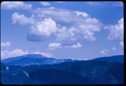
- Description:
- 100 f 6.3 tl
- Subject:
- Roads, Trinity Mountains (Calif.), Trees, Mountains, Clouds, and Hills
- Series:
- 16-55
- Creator:
- Cushman, Charles W., 1896-1972
- Date Created:
- 1955-06-15
- Genre:
- Landscape photographs
- Frame Number:
- 33
- County:
- Trinity
- Abstract:
- Same
- Call Number:
- P08077
- City:
- Weaverville
- Country:
- United States
- State/Province:
- California
- Alternate Identifier:
- 1655.33
- Persistent URL:
- http://purl.dlib.indiana.edu/iudl/archives/cushman/P08077
- Holding Location:
- Bloomington - University Archives
Wells Library E460
1320 E 10th St.
Bloomington, IN 47405
Contact at archives@indiana.edu, 812-855-1127
-
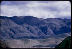
- Description:
- 100 f 5 tl
- Subject:
- Hills, Roads, Mountains, Trees, Buildings, Clouds, and Greenhorn Mountains (Calif.)
- Series:
- 2-55
- Creator:
- Cushman, Charles W., 1896-1972
- Date Created:
- 1955-02-26
- Genre:
- Landscape photographs
- Frame Number:
- 3
- Street Address:
- California State Highway 178
- County:
- Kern
- Abstract:
- From pt. 12 mi E of Bakersfield view east toward Greenhorn Mtns
- Call Number:
- P07561
- City:
- Bakersfield
- Country:
- United States
- State/Province:
- California
- Alternate Identifier:
- 255.3
- Persistent URL:
- http://purl.dlib.indiana.edu/iudl/archives/cushman/P07561
- Holding Location:
- Bloomington - University Archives
Wells Library E460
1320 E 10th St.
Bloomington, IN 47405
Contact at archives@indiana.edu, 812-855-1127
-
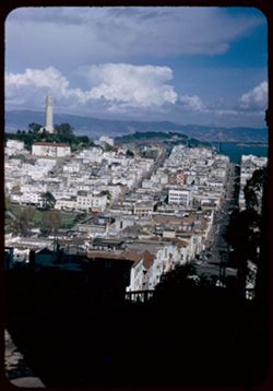
- Description:
- 50 f 8
- Subject:
- Lyon (San Francisco, Calif.), Apartment houses, Cities & towns, Streets, Hills, San Francisco Bay (Calif.), Coit Memorial Tower (San Francisco, Calif.), ...
- Series:
- 10-52
- Creator:
- Cushman, Charles W., 1896-1972
- Date Created:
- 1952-03-12
- Genre:
- Cityscape photographs
- Frame Number:
- 24
- Street Address:
- Jones Street, 973 Green Street, and Leavenworth Street
- County:
- San Francisco
- Abstract:
- Views east over Bay from 973 Green - between Leavenworth & Jones
- Call Number:
- P05855
- City:
- San Francisco
- Country:
- United States
- State/Province:
- California
- Alternate Identifier:
- 1052.24
- Persistent URL:
- http://purl.dlib.indiana.edu/iudl/archives/cushman/P05855
- Holding Location:
- Bloomington - University Archives
Wells Library E460
1320 E 10th St.
Bloomington, IN 47405
Contact at archives@indiana.edu, 812-855-1127
-
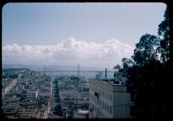
- Description:
- 25 f 5.6 pola
- Subject:
- Bays (Bodies of water), Electric lines, Suspension bridges, San Francisco-Oakland Bay Bridge (Oakland and San Francisco, Calif.), Signs (Notices), Streets, T...
- Series:
- 10-52
- Creator:
- Cushman, Charles W., 1896-1972
- Date Created:
- 1952-03-12
- Genre:
- Cityscape photographs
- Frame Number:
- 10
- Street Address:
- Taylor Street, Green Street, and Jones Street
- County:
- San Francisco
- Abstract:
- from Green at Jones - and [lamb] Island & Bridge
- Call Number:
- P05845
- City:
- San Francisco
- Country:
- United States
- State/Province:
- California
- Alternate Identifier:
- 1052.10
- Persistent URL:
- http://purl.dlib.indiana.edu/iudl/archives/cushman/P05845
- Holding Location:
- Bloomington - University Archives
Wells Library E460
1320 E 10th St.
Bloomington, IN 47405
Contact at archives@indiana.edu, 812-855-1127
-
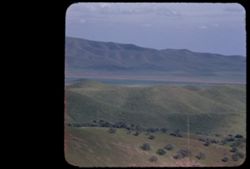
- Description:
- 100 f 5.6 tl
- Subject:
- Pacheco Pass (Calif.), Hills, Mountains, Trees, and Clouds
- Series:
- 2-55
- Creator:
- Cushman, Charles W., 1896-1972
- Date Created:
- 1955-02-25
- Genre:
- Landscape photographs
- Frame Number:
- 1
- County:
- Santa Clara
- Abstract:
- View east from summit of Pacheco Pass
- Call Number:
- P07559
- Country:
- United States
- State/Province:
- California
- Physical Description:
- masked.
- Alternate Identifier:
- 255.1
- Persistent URL:
- http://purl.dlib.indiana.edu/iudl/archives/cushman/P07559
- Holding Location:
- Bloomington - University Archives
Wells Library E460
1320 E 10th St.
Bloomington, IN 47405
Contact at archives@indiana.edu, 812-855-1127
-
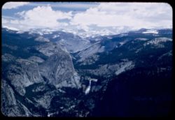
- Description:
- 50 f 5.6 Pola
- Subject:
- Snow, Washburn Point (Calif.), Yosemite National Park (Calif.), Waterfalls, Mountains, National parks & reserves, Clouds, and Nevada Fall (Calif.)
- Series:
- 5-53
- Creator:
- Cushman, Charles W., 1896-1972
- Date Created:
- 1953-05-13
- Genre:
- Landscape photographs
- Frame Number:
- 29
- County:
- Mariposa
- Abstract:
- East from Washburn Pt.
- Call Number:
- P06679
- Country:
- United States
- State/Province:
- California
- Alternate Identifier:
- 553.29
- Persistent URL:
- http://purl.dlib.indiana.edu/iudl/archives/cushman/P06679
- Holding Location:
- Bloomington - University Archives
Wells Library E460
1320 E 10th St.
Bloomington, IN 47405
Contact at archives@indiana.edu, 812-855-1127
-
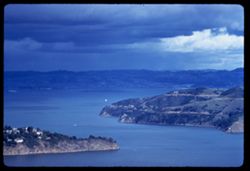
- Description:
- 100 f 6.3 TL
- Subject:
- Bays (Bodies of water), Channels, Waldo Height, Waldo Point Harbor (Calif.), Richardson Bay (Calif.), Clouds, Islands, Hills, and Raccoon Strait (Calif.)
- Series:
- 1-60
- Creator:
- Cushman, Charles W., 1896-1972
- Date Created:
- 1960-02-18
- Genre:
- Seascapes
- Frame Number:
- 30
- County:
- Marin
- Abstract:
- [Raccoon] Str.
- Call Number:
- P10923
- City:
- Sausalito
- Country:
- United States
- State/Province:
- California
- Alternate Identifier:
- 160.30
- Persistent URL:
- http://purl.dlib.indiana.edu/iudl/archives/cushman/P10923
- Holding Location:
- Bloomington - University Archives
Wells Library E460
1320 E 10th St.
Bloomington, IN 47405
Contact at archives@indiana.edu, 812-855-1127
-
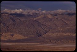
- Description:
- 100 f 6.3 tl
- Subject:
- Valleys, Mountains, Snow, Clouds, and Panamint Range (Calif.)
- Series:
- 2-55
- Creator:
- Cushman, Charles W., 1896-1972
- Date Created:
- 1955-02-26
- Genre:
- Landscape photographs
- Frame Number:
- 22
- Street Address:
- Trona Road
- County:
- Inyo
- Abstract:
- Panamint Mtns east of rd north from Trona
- Call Number:
- P07580
- Country:
- United States
- State/Province:
- California
- Alternate Identifier:
- 255.22
- Persistent URL:
- http://purl.dlib.indiana.edu/iudl/archives/cushman/P07580
- Holding Location:
- Bloomington - University Archives
Wells Library E460
1320 E 10th St.
Bloomington, IN 47405
Contact at archives@indiana.edu, 812-855-1127
-
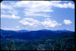
- Description:
- 50 f 8 sl
- Subject:
- Trees, Mountains, Clouds, and Oregon Mountain Summit (Calif.)
- Series:
- 16-55
- Creator:
- Cushman, Charles W., 1896-1972
- Date Created:
- 1955-06-15
- Genre:
- Landscape photographs
- Frame Number:
- 31
- Street Address:
- United States Highway 299
- County:
- Trinity
- Abstract:
- View east from Oregon Mtn. Summit 65510 mi
- Call Number:
- P08075
- City:
- Weaverville
- Country:
- United States
- State/Province:
- California
- Alternate Identifier:
- 1655.31
- Persistent URL:
- http://purl.dlib.indiana.edu/iudl/archives/cushman/P08075
- Holding Location:
- Bloomington - University Archives
Wells Library E460
1320 E 10th St.
Bloomington, IN 47405
Contact at archives@indiana.edu, 812-855-1127
-

- Description:
- 100 f 6.3 tl
- Subject:
- Bays (Bodies of water), Suspension bridges, San Francisco-Oakland Bay Bridge (Oakland and San Francisco, Calif.), Buildings, Clouds, and Hills
- Series:
- 1-58
- Creator:
- Cushman, Charles W., 1896-1972
- Date Created:
- 1958-02-04
- Genre:
- Landscape photographs and Cityscape photographs
- Frame Number:
- 15
- Street Address:
- Taylor Street and Green Street
- County:
- San Francisco
- Abstract:
- East from Green above Taylor
- Call Number:
- P09675
- City:
- San Francisco
- Country:
- United States
- State/Province:
- California
- Alternate Identifier:
- 158.15
- Persistent URL:
- http://purl.dlib.indiana.edu/iudl/archives/cushman/P09675
- Holding Location:
- Bloomington - University Archives
Wells Library E460
1320 E 10th St.
Bloomington, IN 47405
Contact at archives@indiana.edu, 812-855-1127
-
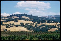
- Description:
- 100 f 8 tl
- Subject:
- Grapevines, Trees, Meadows, Grapes, Hills, and Clouds
- Series:
- 10-57
- Creator:
- Cushman, Charles W., 1896-1972
- Date Created:
- 1957-07-06
- Genre:
- Landscape photographs
- Frame Number:
- 13
- County:
- Sonoma
- Abstract:
- ridge & sky east of Asti
- Call Number:
- P09387
- City:
- Asti
- Country:
- United States
- State/Province:
- California
- Alternate Identifier:
- 1057.13
- Persistent URL:
- http://purl.dlib.indiana.edu/iudl/archives/cushman/P09387
- Holding Location:
- Bloomington - University Archives
Wells Library E460
1320 E 10th St.
Bloomington, IN 47405
Contact at archives@indiana.edu, 812-855-1127
-
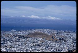
- Description:
- 100 f 6.3 tl
- Subject:
- Piers & wharves, Vessels, Bodies of water, Twin Peaks (San Francisco County, Calif.), Trees, Streets, Cities & towns, Buildings, Shrubs, Clouds, and ...
- Series:
- 19-55
- Creator:
- Cushman, Charles W., 1896-1972
- Date Created:
- 1955-07-02
- Genre:
- Cityscape photographs
- Frame Number:
- 2
- Street Address:
- Bernal Heights
- County:
- San Francisco
- Abstract:
- Past Bernal Hts.
- Call Number:
- P08155
- City:
- San Francisco
- Country:
- United States
- State/Province:
- California
- Alternate Identifier:
- 1955.2
- Persistent URL:
- http://purl.dlib.indiana.edu/iudl/archives/cushman/P08155
- Holding Location:
- Bloomington - University Archives
Wells Library E460
1320 E 10th St.
Bloomington, IN 47405
Contact at archives@indiana.edu, 812-855-1127
-
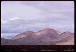
- Description:
- 100 f 9 TL
- Subject:
- Deserts, Mojave Desert (Calif.), Tehachapi Mountains (Calif.), Mountains, Shrubs, and Clouds
- Series:
- 3-69
- Creator:
- Cushman, Charles W., 1896-1972
- Date Created:
- 1969-03-21
- Genre:
- Landscape photographs
- Frame Number:
- 18
- Street Address:
- California State Highway 14
- County:
- Kern
- Abstract:
- Toward Tehachapi Mtns from Hwy 14
- Call Number:
- P15770
- City:
- Mojave
- Country:
- United States
- State/Province:
- California
- Alternate Identifier:
- 369.18
- Persistent URL:
- http://purl.dlib.indiana.edu/iudl/archives/cushman/P15770
- Holding Location:
- Bloomington - University Archives
Wells Library E460
1320 E 10th St.
Bloomington, IN 47405
Contact at archives@indiana.edu, 812-855-1127
-
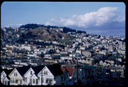
- Description:
- 50 f 8
- Subject:
- Row houses, Electric lines, Trees, Streets, Buildings, Clouds, Bay windows, Hills, Utility poles, Buena Vista Park (San Francisco, Calif.), and Corona Height...
- Series:
- 16-53
- Creator:
- Cushman, Charles W., 1896-1972
- Date Created:
- 1953-01-17
- Genre:
- Cityscape photographs
- Frame Number:
- 38
- Street Address:
- Noe Street and Twentieth Street
- County:
- San Francisco
- Abstract:
- View toward Corona Heights from Noe St. near 20th St.
- Call Number:
- P07110
- City:
- San Francisco
- Country:
- United States
- State/Province:
- California
- Alternate Identifier:
- 1653.38
- Persistent URL:
- http://purl.dlib.indiana.edu/iudl/archives/cushman/P07110
- Holding Location:
- Bloomington - University Archives
Wells Library E460
1320 E 10th St.
Bloomington, IN 47405
Contact at archives@indiana.edu, 812-855-1127
-
- Description:
- 100 f 8 TL
- Subject:
- Roads, Orange trees, San Gorgonio Mountain (Calif.), Trees, Flowers, Mountains, Buildings, Shrubs, Clouds, and Indio Hacienda (Indio, Calif.)
- Series:
- 24-61
- Creator:
- Cushman, Charles W., 1896-1972
- Date Created:
- 1961-01-01
- Genre:
- Landscape photographs and Views
- Frame Number:
- 33
- County:
- Riverside and San Bernardino
- Abstract:
- San Gorgonio and San Gorgonio from Indio Hacienda
- Call Number:
- P12599
- City:
- Indio
- Country:
- United States
- State/Province:
- California
- Alternate Identifier:
- 2461.33
- Persistent URL:
- http://purl.dlib.indiana.edu/iudl/archives/cushman/P12599
- Holding Location:
- Bloomington - University Archives
Wells Library E460
1320 E 10th St.
Bloomington, IN 47405
Contact at archives@indiana.edu, 812-855-1127
-
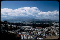
- Description:
- 25 f 6.3 Pola
- Subject:
- Twin Peaks (San Francisco County, Calif.), Kezar Stadium (San Francisco, Calif.), Roofs, Streets, Bodies of water, Stadiums, Bridges, Mountains, Tamalpais, M...
- Series:
- 4-53
- Creator:
- Cushman, Charles W., 1896-1972
- Date Created:
- 1953-04-10
- Genre:
- Cityscape photographs
- Frame Number:
- 15
- Street Address:
- Clavenden Avenue and Twin Peaks Boulevard
- County:
- San Francisco
- Abstract:
- From Clavenden + Twin Pks. Ave. - view NNW across Kezar Stadium + GG Park toward Tamalpais.
- Call Number:
- P06626
- City:
- San Francisco
- Country:
- United States
- State/Province:
- California
- Alternate Identifier:
- 453.15
- Persistent URL:
- http://purl.dlib.indiana.edu/iudl/archives/cushman/P06626
- Holding Location:
- Bloomington - University Archives
Wells Library E460
1320 E 10th St.
Bloomington, IN 47405
Contact at archives@indiana.edu, 812-855-1127
-
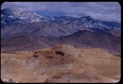
- Description:
- 100 f 7
- Subject:
- Snow, Roads, Isabella Lake (Calif. : Lake), Mountains, Clouds, Sierra Nevada (Calif. and Nev.), and Hills
- Series:
- 2-55
- Creator:
- Cushman, Charles W., 1896-1972
- Date Created:
- 1955-02-26
- Genre:
- Landscape photographs
- Frame Number:
- 14
- County:
- Kern
- Abstract:
- View NNE
- Call Number:
- P07572
- Country:
- United States
- State/Province:
- California
- Alternate Identifier:
- 255.14
- Persistent URL:
- http://purl.dlib.indiana.edu/iudl/archives/cushman/P07572
- Holding Location:
- Bloomington - University Archives
Wells Library E460
1320 E 10th St.
Bloomington, IN 47405
Contact at archives@indiana.edu, 812-855-1127
-
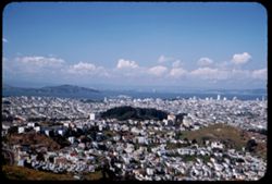
- Description:
- 50 f 4.5 Pola
- Subject:
- Twin Peaks (San Francisco County, Calif.), Streets, Hills, Bodies of water, Dwellings, Trees, Buildings, Islands, and Clouds
- Series:
- 4-53
- Creator:
- Cushman, Charles W., 1896-1972
- Date Created:
- 1953-04-10
- Genre:
- Cityscape photographs
- Frame Number:
- 16
- County:
- San Francisco and Contra Costa
- Abstract:
- NNE from Twin Peaks toward Richmond.
- Call Number:
- P06627
- City:
- San Francisco and Richmond
- Country:
- United States
- State/Province:
- California
- Alternate Identifier:
- 453.16
- Persistent URL:
- http://purl.dlib.indiana.edu/iudl/archives/cushman/P06627
- Holding Location:
- Bloomington - University Archives
Wells Library E460
1320 E 10th St.
Bloomington, IN 47405
Contact at archives@indiana.edu, 812-855-1127
-
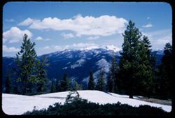
- Description:
- 50 f 9
- Subject:
- Snow, Yosemite National Park (Calif.), Trees, Mountains, National parks & reserves, Clouds, Shrubs, and Sentinel Dome (Calif.)
- Series:
- 5-53
- Creator:
- Cushman, Charles W., 1896-1972
- Date Created:
- 1953-05-13
- Genre:
- Landscape photographs
- Frame Number:
- 13
- County:
- Mariposa
- Abstract:
- NE from Sentinel Dome, 11:30am DST.
- Call Number:
- P06663
- Country:
- United States
- State/Province:
- California
- Alternate Identifier:
- 553.13
- Persistent URL:
- http://purl.dlib.indiana.edu/iudl/archives/cushman/P06663
- Holding Location:
- Bloomington - University Archives
Wells Library E460
1320 E 10th St.
Bloomington, IN 47405
Contact at archives@indiana.edu, 812-855-1127