
Search Constraints
You searched for:
Campus
IUB
Remove constraint Campus: IUB
Pages
0-99 pages
Remove constraint Pages: 0-99 pages
Subject
Mountains
Remove constraint Subject: Mountains
State/Province
California
Remove constraint State/Province: California
« Previous |
1 - 100 of 1,519
|
Next »
Search Results
-
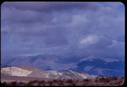
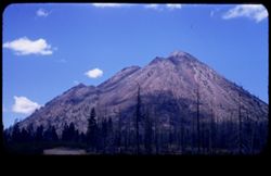
- Description:
- 100 f 8 tl
- Subject:
- Hills, Funeral Mountains (Calif.), Funeral Mountains Wilderness (Calif.), Mountains, Shrubs, Furnace Creek (Calif.), Rocks, and Clouds
- Series:
- 2-55
- Creator:
- Cushman, Charles W., 1896-1972
- Date Created:
- 1955-02-27
- Genre:
- Landscape photographs
- Frame Number:
- 29
- Street Address:
- Furance Creek-Death Valley Junction Road
- County:
- Mono and Inyo
- Abstract:
- North toward Funeral Mtns
- Call Number:
- P07586
- City:
- Death Valley Junction
- Country:
- United States
- State/Province:
- California
- Alternate Identifier:
- 255.29
- Persistent URL:
- http://purl.dlib.indiana.edu/iudl/archives/cushman/P07586
- Holding Location:
- Bloomington - University Archives
Wells Library E460
1320 E 10th St.
Bloomington, IN 47405
Contact at archives@indiana.edu, 812-855-1127
-
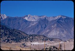
- Description:
- 100 f 8 tl
- Subject:
- Hills, Tom's Place, Mountains, Utility poles, Sierra Nevada (Calif. and Nev.), and Plants
- Series:
- 26-55
- Creator:
- Cushman, Charles W., 1896-1972
- Date Created:
- 1955-09-26
- Genre:
- Landscape photographs
- Frame Number:
- 35
- Street Address:
- United States Highway 395
- Abstract:
- Dark-colored mtns west from Tom's Place
- Call Number:
- P08417
- Country:
- United States
- State/Province:
- California
- Alternate Identifier:
- 2655.35
- Persistent URL:
- http://purl.dlib.indiana.edu/iudl/archives/cushman/P08417
- Holding Location:
- Bloomington - University Archives
Wells Library E460
1320 E 10th St.
Bloomington, IN 47405
Contact at archives@indiana.edu, 812-855-1127
-
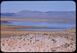
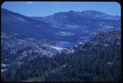
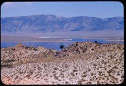
- Description:
- 100 f 8 tl
- Subject:
- Lakes & ponds, Mountains, Waterfronts, and Lake Crowley (Calif.)
- Series:
- 27-55
- Creator:
- Cushman, Charles W., 1896-1972
- Date Created:
- 1955-09-26
- Genre:
- Landscape photographs
- Frame Number:
- 1
- Street Address:
- United States Highway 395
- County:
- Mono
- Abstract:
- Crowley Lake from US 395 above
- Call Number:
- P08421
- Country:
- United States
- State/Province:
- California
- Alternate Identifier:
- 2755.1
- Persistent URL:
- http://purl.dlib.indiana.edu/iudl/archives/cushman/P08421
- Holding Location:
- Bloomington - University Archives
Wells Library E460
1320 E 10th St.
Bloomington, IN 47405
Contact at archives@indiana.edu, 812-855-1127
-
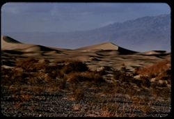
- Description:
- 100 f 7 tl
- Subject:
- Valleys, Death Valley (Calif. and Nev.), Mountains, Shrubs, and Dunes
- Series:
- 3-55
- Creator:
- Cushman, Charles W., 1896-1972
- Date Created:
- 1955-02-27
- Genre:
- Landscape photographs
- Frame Number:
- 25
- County:
- Inyo
- Abstract:
- Sand Dunes near Stove Pipe Wells
- Call Number:
- P07616
- City:
- Stovepipe Wells
- Country:
- United States
- State/Province:
- California
- Alternate Identifier:
- 355.25
- Persistent URL:
- http://purl.dlib.indiana.edu/iudl/archives/cushman/P07616
- Holding Location:
- Bloomington - University Archives
Wells Library E460
1320 E 10th St.
Bloomington, IN 47405
Contact at archives@indiana.edu, 812-855-1127
-
- Description:
- 50 f 8
- Subject:
- Black Butte (Siskiyou County, Calif.), Lava domes, Lassen Volcanic National Park (Calif.), Volcanic domes, Mountains, Shrubs, Trees, Cascade Range, Buttes, C...
- Series:
- 6-54
- Creator:
- Cushman, Charles W., 1896-1972
- Date Created:
- 1954-08-20
- Genre:
- Landscape photographs
- Frame Number:
- 26
- County:
- Siskiyou
- Abstract:
- That same triple cone (Black Butte) west of Mt Shasta.
- Call Number:
- P07243
- Country:
- United States
- State/Province:
- California
- Physical Description:
- masked.
- Alternate Identifier:
- 654.26
- Persistent URL:
- http://purl.dlib.indiana.edu/iudl/archives/cushman/P07243
- Holding Location:
- Bloomington - University Archives
Wells Library E460
1320 E 10th St.
Bloomington, IN 47405
Contact at archives@indiana.edu, 812-855-1127
-
- Description:
- 100 f 5.6 tl
- Subject:
- Lakes & ponds, Mountains, Sierra Nevada (Calif. and Nev.), Trees, Emigrant Gap (Calif. : Gap), and Reservoirs
- Series:
- 15-58
- Creator:
- Cushman, Charles W., 1896-1972
- Date Created:
- 1958-08-22
- Genre:
- Landscape photographs
- Frame Number:
- 4
- Abstract:
- Lake
- Call Number:
- P10110
- Country:
- United States
- State/Province:
- Nevada and California
- Alternate Identifier:
- 1558.4
- Persistent URL:
- http://purl.dlib.indiana.edu/iudl/archives/cushman/P10110
- Holding Location:
- Bloomington - University Archives
Wells Library E460
1320 E 10th St.
Bloomington, IN 47405
Contact at archives@indiana.edu, 812-855-1127
-
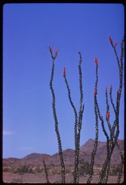
- Description:
- 100 f 8 tl
- Subject:
- Deserts, Flowers, Ocotillo, Mountains, Shrubs, and Clouds
- Series:
- 11-59
- Creator:
- Cushman, Charles W., 1896-1972
- Date Created:
- 1959-03-24
- Genre:
- Identification photographs
- Frame Number:
- 11
- County:
- Yuma and Riverside
- Abstract:
- Our finest ocotillo - 15-20 mi east of Blythe
- Call Number:
- P10736
- City:
- Blythe and Quartzsite
- Country:
- United States
- State/Province:
- Arizona and California
- Alternate Identifier:
- 1159.11
- Persistent URL:
- http://purl.dlib.indiana.edu/iudl/archives/cushman/P10736
- Holding Location:
- Bloomington - University Archives
Wells Library E460
1320 E 10th St.
Bloomington, IN 47405
Contact at archives@indiana.edu, 812-855-1127
-
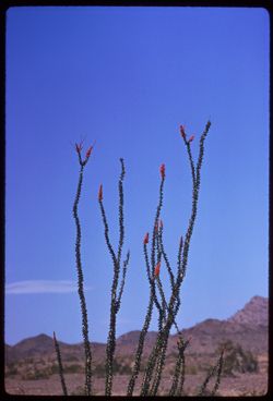
- Description:
- 250 f 5.6
- Subject:
- Deserts, Flowers, Ocotillo, Mountains, Shrubs, and Clouds
- Series:
- 11-59
- Creator:
- Cushman, Charles W., 1896-1972
- Date Created:
- 1959-03-24
- Genre:
- Identification photographs
- Frame Number:
- 12
- County:
- Yuma and Riverside
- Abstract:
- Our finest ocotillo - 15-20 mi east of Blythe
- Call Number:
- P10737
- City:
- Blythe and Quartzsite
- Country:
- United States
- State/Province:
- Arizona and California
- Alternate Identifier:
- 1159.12
- Persistent URL:
- http://purl.dlib.indiana.edu/iudl/archives/cushman/P10737
- Holding Location:
- Bloomington - University Archives
Wells Library E460
1320 E 10th St.
Bloomington, IN 47405
Contact at archives@indiana.edu, 812-855-1127
-
- Description:
- 100 f 8 TL
- Subject:
- Lakes & ponds, Shasta, Mount (Calif. : Mountain), Mountains, Trees, and Clouds
- Series:
- 10-58
- Creator:
- Cushman, Charles W., 1896-1972
- Date Created:
- 1958-06-13
- Genre:
- Landscape photographs
- Frame Number:
- 25
- County:
- Shasta
- Abstract:
- Mt Shasta from SE
- Call Number:
- P09964
- Country:
- United States
- State/Province:
- California
- Alternate Identifier:
- 1058.25
- Persistent URL:
- http://purl.dlib.indiana.edu/iudl/archives/cushman/P09964
- Holding Location:
- Bloomington - University Archives
Wells Library E460
1320 E 10th St.
Bloomington, IN 47405
Contact at archives@indiana.edu, 812-855-1127
-
- Description:
- 100 f 6.3 tl
- Subject:
- Hills, Mountains, Tamalpais, Mount (Calif.), and Trees
- Series:
- 2-56
- Creator:
- Cushman, Charles W., 1896-1972
- Date Created:
- 1956-03-14
- Genre:
- Landscape photographs
- Frame Number:
- 2
- County:
- Marin
- Abstract:
- From road on West shoulder of Mt. Tamalpais: Folded hills to north
- Call Number:
- P08568
- Country:
- United States
- State/Province:
- California
- Alternate Identifier:
- 256.2
- Persistent URL:
- http://purl.dlib.indiana.edu/iudl/archives/cushman/P08568
- Holding Location:
- Bloomington - University Archives
Wells Library E460
1320 E 10th St.
Bloomington, IN 47405
Contact at archives@indiana.edu, 812-855-1127
-
- Description:
- 50 f 8
- Subject:
- Lakes & ponds, Almanor, Lake (Calif.), Bodies of water, Mountains, Shrubs, Trees, Cascade Range, Reservoirs, and Pines
- Series:
- 7-54
- Creator:
- Cushman, Charles W., 1896-1972
- Date Created:
- 1954-08-21
- Genre:
- Landscape photographs
- Frame Number:
- 10
- Street Address:
- California State Highway 36
- County:
- Plumas
- Abstract:
- Lake Almanor from Cal 36.
- Call Number:
- P07265
- Country:
- United States
- State/Province:
- California
- Alternate Identifier:
- 754.10
- Persistent URL:
- http://purl.dlib.indiana.edu/iudl/archives/cushman/P07265
- Holding Location:
- Bloomington - University Archives
Wells Library E460
1320 E 10th St.
Bloomington, IN 47405
Contact at archives@indiana.edu, 812-855-1127
-
- Description:
- 50 f 8 sl
- Subject:
- Lakes & ponds, Roads, June Lake (Calif.), Mountains, and Trees
- Series:
- 27-55
- Creator:
- Cushman, Charles W., 1896-1972
- Date Created:
- 1955-09-26
- Genre:
- Landscape photographs
- Frame Number:
- 7
- County:
- Mono
- Abstract:
- June Lake
- Call Number:
- P08427
- Country:
- United States
- State/Province:
- California
- Alternate Identifier:
- 2755.7
- Persistent URL:
- http://purl.dlib.indiana.edu/iudl/archives/cushman/P08427
- Holding Location:
- Bloomington - University Archives
Wells Library E460
1320 E 10th St.
Bloomington, IN 47405
Contact at archives@indiana.edu, 812-855-1127
-
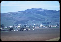
- Description:
- 100 f 4.5 TL
- Subject:
- Croplands, Streets, Hills, Agricultural machinery & implements, Mountains, Trees, Farms, Farming, and Houses
- Series:
- 2-60
- Creator:
- Cushman, Charles W., 1896-1972
- Date Created:
- 1960-03-10
- Genre:
- Cityscape photographs
- Frame Number:
- 16
- County:
- San Mateo
- Abstract:
- From ht wsw of tower
- Call Number:
- P10947
- City:
- Pescadero
- Country:
- United States
- State/Province:
- California
- Alternate Identifier:
- 260.16
- Persistent URL:
- http://purl.dlib.indiana.edu/iudl/archives/cushman/P10947
- Holding Location:
- Bloomington - University Archives
Wells Library E460
1320 E 10th St.
Bloomington, IN 47405
Contact at archives@indiana.edu, 812-855-1127
-
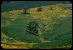
- Description:
- 100 f 8 TL
- Subject:
- Diablo, Mount (Calif.), Meadows, Flowers, Hills, Mustard (Plant), Mountains, Trees, Grasses, and Fences
- Series:
- 2-60
- Creator:
- Cushman, Charles W., 1896-1972
- Date Created:
- 1960-03-25
- Genre:
- Landscape photographs
- Frame Number:
- 28
- County:
- Contra Costa
- Abstract:
- Mustard & grass SE of Clayton
- Call Number:
- P10959
- City:
- Clayton
- Country:
- United States
- State/Province:
- California
- Alternate Identifier:
- 260.28
- Persistent URL:
- http://purl.dlib.indiana.edu/iudl/archives/cushman/P10959
- Holding Location:
- Bloomington - University Archives
Wells Library E460
1320 E 10th St.
Bloomington, IN 47405
Contact at archives@indiana.edu, 812-855-1127
-
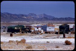
- Description:
- 100 f 8 + tl
- Subject:
- Minerals, Trucks, Valleys, Mountains, Shrubs, Tecopa Hot Springs (Calif.), and Trailers
- Series:
- 12-55
- Creator:
- Cushman, Charles W., 1896-1972
- Date Created:
- 1955-03-24
- Genre:
- Views
- Frame Number:
- 6
- County:
- Inyo
- Abstract:
- Trailer colony near Tecopa Hot Springs
- Call Number:
- P07902
- Country:
- United States
- State/Province:
- California
- Alternate Identifier:
- 1255.6
- Persistent URL:
- http://purl.dlib.indiana.edu/iudl/archives/cushman/P07902
- Holding Location:
- Bloomington - University Archives
Wells Library E460
1320 E 10th St.
Bloomington, IN 47405
Contact at archives@indiana.edu, 812-855-1127
-
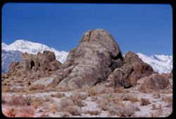
- Description:
- 100 f 5.6 tl
- Subject:
- Hills, Mountains, Sierra Nevada (Calif. and Nev.), Alabama Hills (Calif.), Rock formations, and Snow
- Series:
- 4-55
- Creator:
- Cushman, Charles W., 1896-1972
- Date Created:
- 1955-02-28
- Genre:
- Landscape photographs
- Frame Number:
- 4
- County:
- Inyo
- Abstract:
- In alabama Hills
- Call Number:
- P07632
- City:
- Lone Pine
- Country:
- United States
- State/Province:
- California
- Alternate Identifier:
- 455.4
- Persistent URL:
- http://purl.dlib.indiana.edu/iudl/archives/cushman/P07632
- Holding Location:
- Bloomington - University Archives
Wells Library E460
1320 E 10th St.
Bloomington, IN 47405
Contact at archives@indiana.edu, 812-855-1127
-
- Description:
- 25 f 8 Pola
- Subject:
- Lakes & ponds, Houses, Bodies of water, Sand, Mountains, Waterfronts, Trees, Beaches, Grasses, and Hills
- Series:
- 7-53
- Creator:
- Cushman, Charles W., 1896-1972
- Date Created:
- 1953-07-08
- Genre:
- Landscape photographs
- Frame Number:
- 29
- County:
- Marin
- Abstract:
- Across Bolinas lagoon from Bolinas.
- Call Number:
- P06753
- City:
- Bolinas
- Country:
- United States
- State/Province:
- California
- Alternate Identifier:
- 753.29
- Persistent URL:
- http://purl.dlib.indiana.edu/iudl/archives/cushman/P06753
- Holding Location:
- Bloomington - University Archives
Wells Library E460
1320 E 10th St.
Bloomington, IN 47405
Contact at archives@indiana.edu, 812-855-1127
-
- Description:
- 100 f 5.6 tl
- Subject:
- Valleys, Hills, Bodies of water, Roads, Mountains, Tamalpais, Mount (Calif.), Trees, Buildings, Clouds, Dwellings, and Utility poles
- Series:
- 5-55
- Creator:
- Cushman, Charles W., 1896-1972
- Date Created:
- 1955-03-10
- Genre:
- Landscape photographs
- Frame Number:
- 4
- County:
- Marin
- Abstract:
- Cloud mass above Mt. Tamalpais from top of Sausalito All of frame will next to 3
- Call Number:
- P07669
- City:
- Sausalito
- Country:
- United States
- State/Province:
- California
- Alternate Identifier:
- 555.4
- Persistent URL:
- http://purl.dlib.indiana.edu/iudl/archives/cushman/P07669
- Holding Location:
- Bloomington - University Archives
Wells Library E460
1320 E 10th St.
Bloomington, IN 47405
Contact at archives@indiana.edu, 812-855-1127
-
- Description:
- 25 f 8 pola
- Subject:
- San Bernardino Mountains (Calif.), Mountains, Snow, and Trees
- Series:
- 7-52
- Creator:
- Cushman, Charles W., 1896-1972
- Date Created:
- 1952-02-25
- Genre:
- Landscape photographs
- Frame Number:
- 29
- Street Address:
- Rim-of-World Drive
- Abstract:
- Snow clad mtns - from rim of World Drive
- Call Number:
- P05750
- Country:
- United States
- State/Province:
- California
- Alternate Identifier:
- 752.29
- Persistent URL:
- http://purl.dlib.indiana.edu/iudl/archives/cushman/P05750
- Holding Location:
- Bloomington - University Archives
Wells Library E460
1320 E 10th St.
Bloomington, IN 47405
Contact at archives@indiana.edu, 812-855-1127
-
- Description:
- 25 f 5.6 pola
- Subject:
- Mount Wilson (Calif.), Mountains, Pines, Clouds, and San Gabriel Mountains (Calif.)
- Series:
- 6-52
- Creator:
- Cushman, Charles W., 1896-1972
- Date Created:
- 1952-02-18
- Genre:
- Landscape photographs
- Frame Number:
- 15
- County:
- Los Angeles
- Abstract:
- NE from Mt. Wilson
- Call Number:
- P05698
- Country:
- United States
- State/Province:
- California
- Alternate Identifier:
- 652.15
- Persistent URL:
- http://purl.dlib.indiana.edu/iudl/archives/cushman/P05698
- Holding Location:
- Bloomington - University Archives
Wells Library E460
1320 E 10th St.
Bloomington, IN 47405
Contact at archives@indiana.edu, 812-855-1127
-
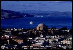
- Description:
- 100 f 8 tl
- Subject:
- Domes, San Francisco Bay Area (Calif.), Palace of Fine Arts (San Francisco), Sailboats, Columns, Mountains, Buildings, Rotundas, Hills, Bays (Bodies of water...
- Series:
- 1-60
- Creator:
- Cushman, Charles W., 1896-1972
- Date Created:
- 1960-01-16
- Genre:
- Marine photographs, Cityscape photographs, and Views
- Frame Number:
- 3
- Street Address:
- Broderick Street and Broadway Street
- County:
- San Francisco
- Abstract:
- North Bay from Broadway + Broderick
- Call Number:
- P10897
- City:
- San Francisco
- Country:
- United States
- State/Province:
- California
- Alternate Identifier:
- 160.3
- Persistent URL:
- http://purl.dlib.indiana.edu/iudl/archives/cushman/P10897
- Holding Location:
- Bloomington - University Archives
Wells Library E460
1320 E 10th St.
Bloomington, IN 47405
Contact at archives@indiana.edu, 812-855-1127
-
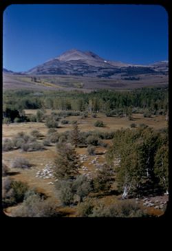
- Description:
- 50 f 9
- Subject:
- Sheep, Hills, Mountains, Shrubs, Sierra Nevada (Calif. and Nev.), Trees, Grazing, Grasses, and Dunderberg Peak (Calif.)
- Series:
- 9-54
- Creator:
- Cushman, Charles W., 1896-1972
- Date Created:
- 1954-09-16
- Genre:
- Landscape photographs
- Frame Number:
- 20
- Street Address:
- United States Highway 395
- County:
- Mono
- Abstract:
- Sheep below - looking toward Dunderberg Pk. (19-20-21 were taken less than mile north of Conway Summit)
- Call Number:
- P07331
- City:
- Bridgeport
- Country:
- United States
- State/Province:
- California
- Physical Description:
- masked.
- Alternate Identifier:
- 954.20
- Persistent URL:
- http://purl.dlib.indiana.edu/iudl/archives/cushman/P07331
- Holding Location:
- Bloomington - University Archives
Wells Library E460
1320 E 10th St.
Bloomington, IN 47405
Contact at archives@indiana.edu, 812-855-1127
-
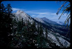
- Description:
- 50 f 11
- Subject:
- Tree limbs, Forests, Mountains, Sierra Nevada (Calif. and Nev.), Trees, Rock slopes, Rock formations, and Clouds
- Series:
- 8-53
- Creator:
- Cushman, Charles W., 1896-1972
- Date Created:
- 1953-10-09
- Genre:
- Landscape photographs
- Frame Number:
- 26
- County:
- El Dorado
- Abstract:
- Mtn ridge NW from Echo Lake. (Echo Summit is 7365)
- Call Number:
- P06788
- City:
- Echo Lake
- Country:
- United States
- State/Province:
- California
- Alternate Identifier:
- 853.26
- Persistent URL:
- http://purl.dlib.indiana.edu/iudl/archives/cushman/P06788
- Holding Location:
- Bloomington - University Archives
Wells Library E460
1320 E 10th St.
Bloomington, IN 47405
Contact at archives@indiana.edu, 812-855-1127
-
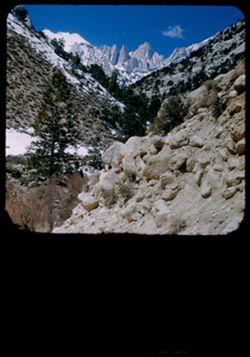
- Description:
- 25 f 9 Pola
- Subject:
- Whitney, Mount (Calif.), Mountains, Shrubs, Snow, Trees, Rocks, Portal station, Rock formations, and Boulders
- Series:
- 14-52
- Creator:
- Cushman, Charles W., 1896-1972
- Date Created:
- 1952-04-08
- Genre:
- Landscape photographs
- Frame Number:
- 29
- County:
- Inyo
- Abstract:
- Whitney from Portal Station.
- Call Number:
- P06013
- Country:
- United States
- State/Province:
- California
- Physical Description:
- masked.
- Alternate Identifier:
- 1452.29
- Persistent URL:
- http://purl.dlib.indiana.edu/iudl/archives/cushman/P06013
- Holding Location:
- Bloomington - University Archives
Wells Library E460
1320 E 10th St.
Bloomington, IN 47405
Contact at archives@indiana.edu, 812-855-1127
-
- Description:
- 100 f 6.3 tl
- Subject:
- Valleys, Black Mountains (Inyo County, Calif.), Death Valley (Calif. and Nev.), Mountains, Shrubs, and Hills
- Series:
- 8-55
- Creator:
- Cushman, Charles W., 1896-1972
- Date Created:
- 1955-03-22
- Genre:
- Landscape photographs
- Frame Number:
- 20
- Street Address:
- California State Highway 190
- County:
- Inyo
- Abstract:
- From 18 mi out - west toward Black Mtns - colored rock in valley
- Call Number:
- P07778
- Country:
- United States
- State/Province:
- California
- Alternate Identifier:
- 855.20
- Persistent URL:
- http://purl.dlib.indiana.edu/iudl/archives/cushman/P07778
- Holding Location:
- Bloomington - University Archives
Wells Library E460
1320 E 10th St.
Bloomington, IN 47405
Contact at archives@indiana.edu, 812-855-1127
-
- Description:
- 100 f 5 tl wrong focus error at 300 ft.
- Subject:
- Domes, Cities & towns, Streets, Hills, Bodies of water, Mountains, Dwellings, Buena Vista Park (San Francisco, Calif.), Buildings, Coastlines, Clouds, Tr...
- Series:
- 5-55
- Creator:
- Cushman, Charles W., 1896-1972
- Date Created:
- 1955-03-12
- Genre:
- Cityscape photographs
- Frame Number:
- 20
- County:
- Marin and San Francisco
- Abstract:
- Toward Pt. Reyes under clouds were out too far to left and had to be remounted
- Call Number:
- P07685
- City:
- San Francisco and Point Reyes Station
- Country:
- United States
- State/Province:
- California
- Alternate Identifier:
- 555.20
- Persistent URL:
- http://purl.dlib.indiana.edu/iudl/archives/cushman/P07685
- Holding Location:
- Bloomington - University Archives
Wells Library E460
1320 E 10th St.
Bloomington, IN 47405
Contact at archives@indiana.edu, 812-855-1127
-
- Description:
- 100 f 6.3 tl
- Subject:
- Twin Peaks (San Francisco County, Calif.), Vessels, Streets, Bodies of water, Sidewalks, Utility poles, Trees, Piers & wharves, Diablo, Mount (Calif.), M...
- Series:
- 19-55
- Creator:
- Cushman, Charles W., 1896-1972
- Date Created:
- 1955-07-02
- Genre:
- Cityscape photographs
- Frame Number:
- 4
- County:
- San Francisco
- Abstract:
- Diablo again
- Call Number:
- P08157
- City:
- San Francisco
- Country:
- United States
- State/Province:
- California
- Alternate Identifier:
- 1955.4
- Persistent URL:
- http://purl.dlib.indiana.edu/iudl/archives/cushman/P08157
- Holding Location:
- Bloomington - University Archives
Wells Library E460
1320 E 10th St.
Bloomington, IN 47405
Contact at archives@indiana.edu, 812-855-1127
-
- Description:
- 200 f 5 tl
- Subject:
- Valleys, Panamint Valley (Calif.), Panamint Range (Calif.), Shrubs, Trails & paths, Clouds, and Mountains
- Series:
- 3-55
- Creator:
- Cushman, Charles W., 1896-1972
- Date Created:
- 1955-02-27
- Genre:
- Landscape photographs
- Frame Number:
- 27
- Street Address:
- California State Highway 190
- Abstract:
- E across Panamint Valley from floor (Cal 190)
- Call Number:
- P07618
- Country:
- United States
- State/Province:
- California
- Alternate Identifier:
- 355.27
- Persistent URL:
- http://purl.dlib.indiana.edu/iudl/archives/cushman/P07618
- Holding Location:
- Bloomington - University Archives
Wells Library E460
1320 E 10th St.
Bloomington, IN 47405
Contact at archives@indiana.edu, 812-855-1127
-
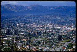
- Description:
- 100 f 4.5 SL
- Subject:
- Cities & towns, Streets, Houses, Mountains, Trees, and Buildings
- Series:
- 5-56
- Creator:
- Cushman, Charles W., 1896-1972
- Date Created:
- 1956-04-20
- Genre:
- Cityscape photographs
- Frame Number:
- 12
- County:
- Santa Barbara
- Abstract:
- Looking down on center of Sta Barbara (cpr 9)
- Call Number:
- P08686
- City:
- Santa Barbara
- Country:
- United States
- State/Province:
- California
- Alternate Identifier:
- 556.12
- Persistent URL:
- http://purl.dlib.indiana.edu/iudl/archives/cushman/P08686
- Holding Location:
- Bloomington - University Archives
Wells Library E460
1320 E 10th St.
Bloomington, IN 47405
Contact at archives@indiana.edu, 812-855-1127
-
- Description:
- 100 f 6.3 tl
- Subject:
- Valleys, Roads, San Lorenzo Creek (Calif.), Mountains, Agricultural facilities, Trees, Vehicles, Storage tanks, Dwellings, and Utility poles
- Series:
- 7-55
- Creator:
- Cushman, Charles W., 1896-1972
- Date Created:
- 1955-03-20
- Genre:
- Landscape photographs
- Frame Number:
- 7
- Street Address:
- California State Highway 198
- County:
- Monterey
- Abstract:
- Lovely Valley of San Lorenzo Creek (and views across it Peachtree Valley) from top of Cal 198 12 or 13 mi. east of San Louas. (no. 9 was turned up and back)
- Call Number:
- P07731
- City:
- San Lucas
- Country:
- United States
- State/Province:
- California
- Alternate Identifier:
- 755.7
- Persistent URL:
- http://purl.dlib.indiana.edu/iudl/archives/cushman/P07731
- Holding Location:
- Bloomington - University Archives
Wells Library E460
1320 E 10th St.
Bloomington, IN 47405
Contact at archives@indiana.edu, 812-855-1127
-
- Description:
- 100 f 8 TL
- Subject:
- Meadows, Valleys, Hills, Mountains, Trees, and Little Rabbit Valley (Calif.)
- Series:
- 6-56
- Creator:
- Cushman, Charles W., 1896-1972
- Date Created:
- 1956-04-22
- Genre:
- Landscape photographs
- Frame Number:
- 16
- County:
- San Benito
- Abstract:
- San Benito county valley (Little Rabbit) near Bitterwater
- Call Number:
- P08725
- City:
- Bitterwater
- Country:
- United States
- State/Province:
- California
- Alternate Identifier:
- 656.16
- Persistent URL:
- http://purl.dlib.indiana.edu/iudl/archives/cushman/P08725
- Holding Location:
- Bloomington - University Archives
Wells Library E460
1320 E 10th St.
Bloomington, IN 47405
Contact at archives@indiana.edu, 812-855-1127
-
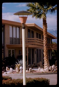
- Description:
- 100 f 6.3
- Subject:
- Indio Hacienda (Indio, Calif.), Balconies, Lampposts, Windows, Mountains, Public accommodation facilities, Shrubs, Rocks, Palms, and Doors & doorways
- Series:
- 24-61
- Creator:
- Cushman, Charles W., 1896-1972
- Date Created:
- 1961-01-01
- Genre:
- Architectural photographs
- Frame Number:
- 36
- County:
- Riverside
- Abstract:
- Indio Hacienda
- Call Number:
- P12602
- City:
- Indio
- Country:
- United States
- State/Province:
- California
- Alternate Identifier:
- 2461.36
- Persistent URL:
- http://purl.dlib.indiana.edu/iudl/archives/cushman/P12602
- Holding Location:
- Bloomington - University Archives
Wells Library E460
1320 E 10th St.
Bloomington, IN 47405
Contact at archives@indiana.edu, 812-855-1127
-
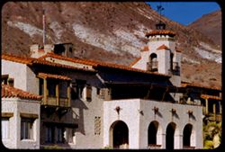
- Description:
- 100 f 8 tl
- Subject:
- Shutters, Balconies, Roofs, Flowers, Flowerpots, Death Valley (Calif. and Nev.), Windows, Scotty's Castle (Calif.), Mountains, Shrubs, Castles & pala...
- Series:
- 11-55
- Creator:
- Cushman, Charles W., 1896-1972
- Date Created:
- 1955-03-23
- Genre:
- Architectural photographs
- Frame Number:
- 31
- County:
- Inyo
- Abstract:
- the Castle
- Call Number:
- P07890
- Country:
- United States
- State/Province:
- California
- Alternate Identifier:
- 1155.31
- Persistent URL:
- http://purl.dlib.indiana.edu/iudl/archives/cushman/P07890
- Holding Location:
- Bloomington - University Archives
Wells Library E460
1320 E 10th St.
Bloomington, IN 47405
Contact at archives@indiana.edu, 812-855-1127
-
- Description:
- 100 f 5.6 sl
- Subject:
- Channels, Tree limbs, Cities & towns, San Francisco Bay (Calif.), Olympus, Mount (San Francisco County, Calif.), Mountains, Buildings, Suspension bridges...
- Series:
- 15-57
- Creator:
- Cushman, Charles W., 1896-1972
- Date Created:
- 1957-10-06
- Genre:
- Cityscape photographs
- Frame Number:
- 34
- County:
- San Francisco
- Abstract:
- Clouds above Golden Gate seen from Mt. Olympus
- Call Number:
- P09564
- City:
- San Francisco
- Country:
- United States
- State/Province:
- California
- Alternate Identifier:
- 1557.34
- Persistent URL:
- http://purl.dlib.indiana.edu/iudl/archives/cushman/P09564
- Holding Location:
- Bloomington - University Archives
Wells Library E460
1320 E 10th St.
Bloomington, IN 47405
Contact at archives@indiana.edu, 812-855-1127
-

- Description:
- 25 f 11
- Subject:
- Hills, Mountains, Shrubs, Boulders, Rocks, Rock formations, and Crazy rocks
- Series:
- 14-52
- Creator:
- Cushman, Charles W., 1896-1972
- Date Created:
- 1952-04-08
- Genre:
- Landscape photographs
- Frame Number:
- 33
- Street Address:
- Mount Whitney Road
- County:
- Inyo
- Abstract:
- Crazy rocks along lower Mt. Whitney rd.
- Call Number:
- P06016
- City:
- Lone Pine
- Country:
- United States
- State/Province:
- California
- Alternate Identifier:
- 1452.33
- Persistent URL:
- http://purl.dlib.indiana.edu/iudl/archives/cushman/P06016
- Holding Location:
- Bloomington - University Archives
Wells Library E460
1320 E 10th St.
Bloomington, IN 47405
Contact at archives@indiana.edu, 812-855-1127
-
- Description:
- 100 f 5.6 sl 50 mm lens
- Subject:
- Lakes & ponds, Mountains, Dirt roads, Shrubs, Trees, and Shasta Lake (Calif.)
- Series:
- 17-55
- Creator:
- Cushman, Charles W., 1896-1972
- Date Created:
- 1955-06-16
- Genre:
- Landscape photographs
- Frame Number:
- 20
- Street Address:
- United States Highway 99
- County:
- Shasta
- Abstract:
- From same point
- Call Number:
- P08100
- City:
- Redding
- Country:
- United States
- State/Province:
- California
- Alternate Identifier:
- 1755.20
- Persistent URL:
- http://purl.dlib.indiana.edu/iudl/archives/cushman/P08100
- Holding Location:
- Bloomington - University Archives
Wells Library E460
1320 E 10th St.
Bloomington, IN 47405
Contact at archives@indiana.edu, 812-855-1127
-
- Description:
- 50 f 8
- Subject:
- Lakes & ponds, Bodies of water, Mountains, Shrubs, Trees, Coastlines, and Grant Lake (Calif.)
- Series:
- 11-54
- Creator:
- Cushman, Charles W., 1896-1972
- Date Created:
- 1954-09-16
- Genre:
- Landscape photographs
- Frame Number:
- 2
- County:
- Mono
- Abstract:
- Grant Lake.
- Call Number:
- P07371
- Country:
- United States
- State/Province:
- California
- Alternate Identifier:
- 1154.2
- Persistent URL:
- http://purl.dlib.indiana.edu/iudl/archives/cushman/P07371
- Holding Location:
- Bloomington - University Archives
Wells Library E460
1320 E 10th St.
Bloomington, IN 47405
Contact at archives@indiana.edu, 812-855-1127
-
- Description:
- 100 f 9 tl tel lens
- Subject:
- Tioga Peak (Calif.), Mountains, Pines, and Rock formations
- Series:
- 27-55
- Creator:
- Cushman, Charles W., 1896-1972
- Date Created:
- 1955-09-26
- Genre:
- Landscape photographs
- Frame Number:
- 22
- County:
- Mono
- Abstract:
- Tioga Pk [P]
- Call Number:
- P08441
- Country:
- United States
- State/Province:
- California
- Physical Description:
- Image was originally mounted in a glass enclosure. Before digitization, the image was removed and placed in a Wess Plastic, Inc. brand, 2" x 2", pl...
- Alternate Identifier:
- 2755.22
- Persistent URL:
- http://purl.dlib.indiana.edu/iudl/archives/cushman/P08441
- Holding Location:
- Bloomington - University Archives
Wells Library E460
1320 E 10th St.
Bloomington, IN 47405
Contact at archives@indiana.edu, 812-855-1127
-
- Description:
- 50 f 8
- Subject:
- Sailboats, Bodies of water, Mountains, Shrubs, Electric lines, Trees, Golden Gate Bridge (San Francisco, Calif.), Suspension bridges, Utility poles, and Buil...
- Series:
- 2-53
- Creator:
- Cushman, Charles W., 1896-1972
- Date Created:
- 1953-02-08
- Genre:
- Architectural photographs
- Frame Number:
- 20
- County:
- San Francisco
- Abstract:
- GG bridge.
- Call Number:
- P06554
- City:
- San Francisco
- Country:
- United States
- State/Province:
- California
- Alternate Identifier:
- 253.20
- Persistent URL:
- http://purl.dlib.indiana.edu/iudl/archives/cushman/P06554
- Holding Location:
- Bloomington - University Archives
Wells Library E460
1320 E 10th St.
Bloomington, IN 47405
Contact at archives@indiana.edu, 812-855-1127
-
- Description:
- 100 f 6.3
- Subject:
- Novato Creek Dam (Calif.), Little Mountain (Marin County, Calif.), Hills, Mountains, Reservoirs, and Meadows
- Series:
- 4-57
- Creator:
- Cushman, Charles W., 1896-1972
- Date Created:
- 1957-04-25
- Genre:
- Landscape photographs
- Frame Number:
- 17
- County:
- Marin
- Abstract:
- Green Hill above Novato Dam (Little Mtn.)
- Call Number:
- P09201
- Country:
- United States
- State/Province:
- California
- Alternate Identifier:
- 457.17
- Persistent URL:
- http://purl.dlib.indiana.edu/iudl/archives/cushman/P09201
- Holding Location:
- Bloomington - University Archives
Wells Library E460
1320 E 10th St.
Bloomington, IN 47405
Contact at archives@indiana.edu, 812-855-1127
-
- Description:
- 100 f 5.5 sl
- Subject:
- Lakes & ponds, Croplands, Clear Lake (Lake County, Calif.), Konocti, Mount (Calif.), Mountains, Park Haven, Fruit trees, and Citrus trees
- Series:
- 9-57
- Creator:
- Cushman, Charles W., 1896-1972
- Date Created:
- 1957-06-20
- Genre:
- Landscape photographs
- Frame Number:
- 35
- County:
- Lake
- Abstract:
- Mt. Konocti from pt above Park Haven
- Call Number:
- P09372
- Country:
- United States
- State/Province:
- California
- Alternate Identifier:
- 957.35
- Persistent URL:
- http://purl.dlib.indiana.edu/iudl/archives/cushman/P09372
- Holding Location:
- Bloomington - University Archives
Wells Library E460
1320 E 10th St.
Bloomington, IN 47405
Contact at archives@indiana.edu, 812-855-1127
-
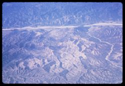
- Description:
- 200 f 5.6
- Subject:
- Pan American World Airways, inc., Channels, Air travel, Mountains, and Rivers
- Series:
- 1-65
- Creator:
- Cushman, Charles W., 1896-1972
- Date Created:
- 1965-03-30
- Genre:
- Aerial photographs and Landscape photographs
- Frame Number:
- 3
- County:
- Los Angeles
- Abstract:
- Over mountains and fields on way to L.A. and California Fields north of Los Angeles
- Call Number:
- P13867
- City:
- Los Angeles
- Country:
- United States
- State/Province:
- California
- Alternate Identifier:
- 165.3
- Persistent URL:
- http://purl.dlib.indiana.edu/iudl/archives/cushman/P13867
- Holding Location:
- Bloomington - University Archives
Wells Library E460
1320 E 10th St.
Bloomington, IN 47405
Contact at archives@indiana.edu, 812-855-1127
-
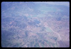
- Description:
- 200 f 5.6
- Subject:
- Valleys, Hills, Mountains, Air travel, and Lakes & ponds
- Series:
- 1-65
- Creator:
- Cushman, Charles W., 1896-1972
- Date Created:
- 1965-03-30
- Genre:
- Aerial photographs and Landscape photographs
- Frame Number:
- 5
- County:
- Los Angeles
- Abstract:
- California Fields north of Los Angeles and Over mountains and fields on way to L.A.
- Call Number:
- P13869
- City:
- Los Angeles
- Country:
- United States
- State/Province:
- California
- Alternate Identifier:
- 165.5
- Persistent URL:
- http://purl.dlib.indiana.edu/iudl/archives/cushman/P13869
- Holding Location:
- Bloomington - University Archives
Wells Library E460
1320 E 10th St.
Bloomington, IN 47405
Contact at archives@indiana.edu, 812-855-1127
-
- Description:
- 100 f 6.3 sl
- Subject:
- Roads, Mountains, Shrubs, Trees, and Shasta Dam (Calif.)
- Series:
- 17-55
- Creator:
- Cushman, Charles W., 1896-1972
- Date Created:
- 1955-06-16
- Genre:
- Landscape photographs
- Frame Number:
- 13
- County:
- Shasta
- Abstract:
- Mtns NW of dam
- Call Number:
- P08093
- Country:
- United States
- State/Province:
- California
- Alternate Identifier:
- 1755.13
- Persistent URL:
- http://purl.dlib.indiana.edu/iudl/archives/cushman/P08093
- Holding Location:
- Bloomington - University Archives
Wells Library E460
1320 E 10th St.
Bloomington, IN 47405
Contact at archives@indiana.edu, 812-855-1127
-
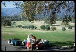
- Description:
- 100 f 9
- Subject:
- Mountains, Golfers, Trees, Caddies, Women, Golf, and Tree limbs
- Series:
- 26-64
- Creator:
- Cushman, Charles W., 1896-1972
- Date Created:
- 1964-12-03
- Genre:
- Ethnographic photographs and Landscape photographs
- Frame Number:
- 6
- County:
- Ventura
- Abstract:
- Ojai Golf course
- Call Number:
- P13805
- City:
- Ojai
- Country:
- United States
- State/Province:
- California
- Alternate Identifier:
- 2664.6
- Persistent URL:
- http://purl.dlib.indiana.edu/iudl/archives/cushman/P13805
- Holding Location:
- Bloomington - University Archives
Wells Library E460
1320 E 10th St.
Bloomington, IN 47405
Contact at archives@indiana.edu, 812-855-1127
-
- Description:
- 50 f 8 Haze F
- Subject:
- Valleys, Rocks, Bishop Peak (Calif.), Mountains, Trees, Owens Valley (Calif.), Shadows, Shrubs, and Roads
- Series:
- 11-54
- Creator:
- Cushman, Charles W., 1896-1972
- Date Created:
- 1954-09-16
- Genre:
- Landscape photographs
- Frame Number:
- 4
- Street Address:
- United States Highway 395, United States Highway 6/395, and California State Highway 14
- County:
- Inyo
- Abstract:
- View south toward Owens valley where Bishop lies.
- Call Number:
- P07373
- Country:
- United States
- State/Province:
- California
- Alternate Identifier:
- 1154.4
- Persistent URL:
- http://purl.dlib.indiana.edu/iudl/archives/cushman/P07373
- Holding Location:
- Bloomington - University Archives
Wells Library E460
1320 E 10th St.
Bloomington, IN 47405
Contact at archives@indiana.edu, 812-855-1127
-
- Description:
- 50 f 8
- Subject:
- Mountains, Cascade Range, Lassen Volcanic National Park (Calif.), Lava domes, Bumpass Mountain (Calif.), Volcanoes, Shrubs, Clouds, Volcanic domes, and Trees
- Series:
- 6-54
- Creator:
- Cushman, Charles W., 1896-1972
- Date Created:
- 1954-08-19
- Genre:
- Landscape photographs
- Frame Number:
- 4
- County:
- Shasta
- Abstract:
- Bumpass
- Call Number:
- P07223
- Country:
- United States
- State/Province:
- California
- Alternate Identifier:
- 654.4
- Persistent URL:
- http://purl.dlib.indiana.edu/iudl/archives/cushman/P07223
- Holding Location:
- Bloomington - University Archives
Wells Library E460
1320 E 10th St.
Bloomington, IN 47405
Contact at archives@indiana.edu, 812-855-1127
-
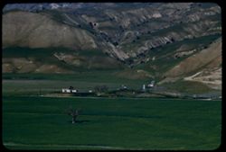
- Description:
- 50 f 9
- Subject:
- Agricultural facilities, Fences, Mountains, Horses, Barns, Grazing, and Sierra Nevada (Calif. and Nev.)
- Series:
- 9-54
- Creator:
- Cushman, Charles W., 1896-1972
- Date Created:
- 1954-09-16
- Genre:
- Landscape photographs
- Frame Number:
- 15
- County:
- Mono
- Abstract:
- View SW from Bridgeport in early am (7:30).
- Call Number:
- P07326
- City:
- Bridgeport
- Country:
- United States
- State/Province:
- California
- Alternate Identifier:
- 954.15
- Persistent URL:
- http://purl.dlib.indiana.edu/iudl/archives/cushman/P07326
- Holding Location:
- Bloomington - University Archives
Wells Library E460
1320 E 10th St.
Bloomington, IN 47405
Contact at archives@indiana.edu, 812-855-1127
-
- Description:
- 100 f 5.6 TL
- Subject:
- Hills, Mountains, Trees, Clear Lake (Lake County, Calif.), and Lakes & ponds
- Series:
- 24-55
- Creator:
- Cushman, Charles W., 1896-1972
- Date Created:
- 1955-08-11
- Genre:
- Landscape photographs
- Frame Number:
- 11
- County:
- Lake
- Abstract:
- Lower lake (view north)
- Call Number:
- P08320
- City:
- Lower Lake
- Country:
- United States
- State/Province:
- California
- Alternate Identifier:
- 2455.11
- Persistent URL:
- http://purl.dlib.indiana.edu/iudl/archives/cushman/P08320
- Holding Location:
- Bloomington - University Archives
Wells Library E460
1320 E 10th St.
Bloomington, IN 47405
Contact at archives@indiana.edu, 812-855-1127
-
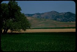
- Description:
- 100 f 5.6 tl
- Subject:
- Mountains, Trees, and Shrubs
- Series:
- 17-55
- Creator:
- Cushman, Charles W., 1896-1972
- Date Created:
- 1955-06-16
- Frame Number:
- 3
- County:
- Trinity and Shasta
- Abstract:
- Tree dotted mtn slope in Shasta County [65568 mi]
- Call Number:
- P08085
- City:
- Weaverville
- Country:
- United States
- State/Province:
- California
- Alternate Identifier:
- 1755.3
- Persistent URL:
- http://purl.dlib.indiana.edu/iudl/archives/cushman/P08085
- Holding Location:
- Bloomington - University Archives
Wells Library E460
1320 E 10th St.
Bloomington, IN 47405
Contact at archives@indiana.edu, 812-855-1127
-
- Description:
- 50 mm lens
- Subject:
- Valleys, Dantes View (Calif.), Mountains, Death Valley (Calif. and Nev.), Black Mountains (Inyo County, Calif.), and Clouds
- Series:
- 3-55
- Creator:
- Cushman, Charles W., 1896-1972
- Date Created:
- 1955-02-27
- Genre:
- Landscape photographs
- Frame Number:
- 3
- County:
- Inyo
- Abstract:
- View north along ridge of Black Mtns
- Call Number:
- P07596
- Country:
- United States
- State/Province:
- California
- Alternate Identifier:
- 355.3
- Persistent URL:
- http://purl.dlib.indiana.edu/iudl/archives/cushman/P07596
- Holding Location:
- Bloomington - University Archives
Wells Library E460
1320 E 10th St.
Bloomington, IN 47405
Contact at archives@indiana.edu, 812-855-1127
-
- Description:
- 50 mm 1/100 short lens
- Subject:
- Meadows, Diablo, Mount (Calif.), Hills, Mountains, Trees, Utility poles, Roads, and Clouds
- Series:
- 1-56
- Creator:
- Cushman, Charles W., 1896-1972
- Date Created:
- 1956-02-23
- Genre:
- Landscape photographs
- Frame Number:
- 8
- Street Address:
- Norris Canyon Road
- County:
- Contra Costa
- Abstract:
- Mt. Diablo
- Call Number:
- P08537
- Country:
- United States
- State/Province:
- California
- Alternate Identifier:
- 156.8
- Persistent URL:
- http://purl.dlib.indiana.edu/iudl/archives/cushman/P08537
- Holding Location:
- Bloomington - University Archives
Wells Library E460
1320 E 10th St.
Bloomington, IN 47405
Contact at archives@indiana.edu, 812-855-1127
-

- Description:
- 100 f 5.6 tl
- Subject:
- Konocti, Mount (Calif.), Mountains, Clear Lake (Lake County, Calif.), Lakes & ponds, and Croplands
- Series:
- 9-57
- Creator:
- Cushman, Charles W., 1896-1972
- Date Created:
- 1957-06-20
- Genre:
- Landscape photographs
- Frame Number:
- 33
- County:
- Lake
- Abstract:
- Cultivated area-base of Mt. Konocti
- Call Number:
- P09370
- Country:
- United States
- State/Province:
- California
- Alternate Identifier:
- 957.33
- Persistent URL:
- http://purl.dlib.indiana.edu/iudl/archives/cushman/P09370
- Holding Location:
- Bloomington - University Archives
Wells Library E460
1320 E 10th St.
Bloomington, IN 47405
Contact at archives@indiana.edu, 812-855-1127
-
- Description:
- 100 f 6.3 tl
- Subject:
- Mountains, Sierra Nevada (Calif. and Nev.), and Clouds
- Series:
- 26-55
- Creator:
- Cushman, Charles W., 1896-1972
- Date Created:
- 1955-09-25
- Genre:
- Landscape photographs
- Frame Number:
- 16
- Street Address:
- United States Highway 395 and United States Highway 6
- County:
- Inyo
- Abstract:
- From US 6/395 between Independence & Big Pine - toward a [push?] in the high Sierra
- Call Number:
- P08399
- City:
- Independence and Big Pine
- Country:
- United States
- State/Province:
- California
- Alternate Identifier:
- 2655.16
- Persistent URL:
- http://purl.dlib.indiana.edu/iudl/archives/cushman/P08399
- Holding Location:
- Bloomington - University Archives
Wells Library E460
1320 E 10th St.
Bloomington, IN 47405
Contact at archives@indiana.edu, 812-855-1127
-
- Description:
- 100 f 6.3 tel. Lens
- Subject:
- Diablo, Mount (Calif.), Vessels, Streets, Hills, Bodies of water, Mountains, Dwellings, Trees, Buildings, Twin Peaks (San Francisco County, Calif.), Automobi...
- Series:
- 19-55
- Creator:
- Cushman, Charles W., 1896-1972
- Date Created:
- 1955-07-02
- Genre:
- Cityscape photographs
- Frame Number:
- 1
- County:
- San Francisco
- Abstract:
- Mt. Diablo from Twin Peaks
- Call Number:
- P08154
- City:
- San Francisco
- Country:
- United States
- State/Province:
- California
- Physical Description:
- Image was originally mounted in a glass enclosure. Before digitization, the image was removed and placed in a Wess Plastic, Inc. brand, 2" x 2", pl...
- Alternate Identifier:
- 1955.1
- Persistent URL:
- http://purl.dlib.indiana.edu/iudl/archives/cushman/P08154
- Holding Location:
- Bloomington - University Archives
Wells Library E460
1320 E 10th St.
Bloomington, IN 47405
Contact at archives@indiana.edu, 812-855-1127
-
- Description:
- 50 f 8
- Subject:
- Bishop Creek (Inyo County, Calif.), Flowers, Donkeys, Animals, Mountains, Shrubs, Trees, Sagebrush, and Rocks
- Series:
- 11-54
- Creator:
- Cushman, Charles W., 1896-1972
- Date Created:
- 1954-09-17
- Genre:
- Identification photographs
- Frame Number:
- 18
- County:
- Inyo
- Abstract:
- Jennie in the sage brush.
- Call Number:
- P07387
- City:
- Bishop
- Country:
- United States
- State/Province:
- California
- Alternate Identifier:
- 1154.18
- Persistent URL:
- http://purl.dlib.indiana.edu/iudl/archives/cushman/P07387
- Holding Location:
- Bloomington - University Archives
Wells Library E460
1320 E 10th St.
Bloomington, IN 47405
Contact at archives@indiana.edu, 812-855-1127
-
- Description:
- 100 f 6 tl
- Subject:
- Rocks, Mountains, Trees, Canyons, Feather River (Calif.), Shrubs, and Utility poles
- Series:
- 18-55
- Creator:
- Cushman, Charles W., 1896-1972
- Date Created:
- 1955-06-19
- Genre:
- Landscape photographs
- Frame Number:
- 21
- County:
- Plumas
- Abstract:
- View downstream
- Call Number:
- P08137
- Country:
- United States
- State/Province:
- California
- Alternate Identifier:
- 1855.21
- Persistent URL:
- http://purl.dlib.indiana.edu/iudl/archives/cushman/P08137
- Holding Location:
- Bloomington - University Archives
Wells Library E460
1320 E 10th St.
Bloomington, IN 47405
Contact at archives@indiana.edu, 812-855-1127
-
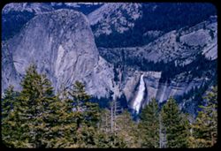
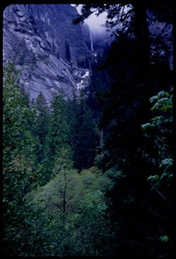
- Description:
- 100 f 8 tl
- Subject:
- Waterfalls, Yosemite National Park (Calif.), Mountains, Trees, Half Dome (Calif.), Nevada Fall (Calif.), and Shrubs
- Series:
- 20-55
- Creator:
- Cushman, Charles W., 1896-1972
- Date Created:
- 1955-07-07
- Genre:
- Landscape photographs
- Frame Number:
- 24
- County:
- Mariposa
- Abstract:
- Nevada Fall
- Call Number:
- P08207
- Country:
- United States
- State/Province:
- California
- Alternate Identifier:
- 2055.24
- Persistent URL:
- http://purl.dlib.indiana.edu/iudl/archives/cushman/P08207
- Holding Location:
- Bloomington - University Archives
Wells Library E460
1320 E 10th St.
Bloomington, IN 47405
Contact at archives@indiana.edu, 812-855-1127
-
- Description:
- 50 f 9
- Subject:
- Passes (Landforms), Rocks, Mountains, Tioga Pass (Calif.), Yosemite Creek (Calif.), Dana Plateau (Calif.), Volcanoes, Shrubs, and Flowers
- Series:
- 9-54
- Creator:
- Cushman, Charles W., 1896-1972
- Date Created:
- 1954-09-16
- Genre:
- Landscape photographs
- Frame Number:
- 36
- County:
- Mono
- Abstract:
- Combs above south wall of Tioga Pass from N.
- Call Number:
- P07345
- Country:
- United States
- State/Province:
- California
- Alternate Identifier:
- 954.36
- Persistent URL:
- http://purl.dlib.indiana.edu/iudl/archives/cushman/P07345
- Holding Location:
- Bloomington - University Archives
Wells Library E460
1320 E 10th St.
Bloomington, IN 47405
Contact at archives@indiana.edu, 812-855-1127
-
- Description:
- 50 f 11
- Subject:
- Yosemite National Park (Calif.), Mountains, Tenaya Canyon (Calif.), Canyons, National parks & reserves, Snow, Mirror Lake (Mariposa County, Calif.), Lake...
- Series:
- 5-53
- Creator:
- Cushman, Charles W., 1896-1972
- Date Created:
- 1953-05-13
- Genre:
- Landscape photographs
- Frame Number:
- 31
- County:
- Mariposa
- Abstract:
- View up Tenaya Canyon - NE from Glacier Point (Mirror Lake at bottom).
- Call Number:
- P06681
- Country:
- United States
- State/Province:
- California
- Alternate Identifier:
- 553.31
- Persistent URL:
- http://purl.dlib.indiana.edu/iudl/archives/cushman/P06681
- Holding Location:
- Bloomington - University Archives
Wells Library E460
1320 E 10th St.
Bloomington, IN 47405
Contact at archives@indiana.edu, 812-855-1127
-
- Description:
- 25 f 9
- Subject:
- Buildings, Cities & towns, Mountains, Telegraph Hill (San Francisco, Calif.), Suspension bridges, Bays (Bodies of water), Golden Gate Bridge (San Francis...
- Series:
- 10-52
- Creator:
- Cushman, Charles W., 1896-1972
- Date Created:
- 1952-03-12
- Genre:
- Views and Cityscape photographs
- Frame Number:
- 11
- County:
- San Francisco
- Abstract:
- Golden Gate from Telegraph Hill
- Call Number:
- P05846
- City:
- San Francisco
- Country:
- United States
- State/Province:
- California
- Alternate Identifier:
- 1052.11
- Persistent URL:
- http://purl.dlib.indiana.edu/iudl/archives/cushman/P05846
- Holding Location:
- Bloomington - University Archives
Wells Library E460
1320 E 10th St.
Bloomington, IN 47405
Contact at archives@indiana.edu, 812-855-1127
-
- Description:
- 100 f 6.3 TL
- Subject:
- Sweetwater Mountains (Calif. and Nev.), Mountains, Antelope Valley (Calif.), Land, and Monitor Pass (Calif.)
- Series:
- 25-55
- Creator:
- Cushman, Charles W., 1896-1972
- Date Created:
- 1955-09-24
- Genre:
- Landscape photographs
- Frame Number:
- 16
- Street Address:
- California State Highway 89
- County:
- Alpine and Mono
- Abstract:
- From same pt. SE
- Call Number:
- P08364
- Country:
- United States
- State/Province:
- California
- Alternate Identifier:
- 2555.16
- Persistent URL:
- http://purl.dlib.indiana.edu/iudl/archives/cushman/P08364
- Holding Location:
- Bloomington - University Archives
Wells Library E460
1320 E 10th St.
Bloomington, IN 47405
Contact at archives@indiana.edu, 812-855-1127
-
- Description:
- 100 f 5.6 tl
- Subject:
- Valleys, Facilities, Hills, Mountains, Storage tanks, Oil wells, Temblor Range (Calif.), Electric lines, Shrubs, Roads, and Utility poles
- Series:
- 4-55
- Creator:
- Cushman, Charles W., 1896-1972
- Date Created:
- 1955-03-01
- Genre:
- Views
- Frame Number:
- 23
- County:
- Kern
- Abstract:
- View west from Fellows
- Call Number:
- P07650
- City:
- Fellows
- Country:
- United States
- State/Province:
- California
- Alternate Identifier:
- 455.23
- Persistent URL:
- http://purl.dlib.indiana.edu/iudl/archives/cushman/P07650
- Holding Location:
- Bloomington - University Archives
Wells Library E460
1320 E 10th St.
Bloomington, IN 47405
Contact at archives@indiana.edu, 812-855-1127
-
- Description:
- 50 f 9
- Subject:
- Tree limbs, Passes (Landforms), Cajon Pass (Calif.), Rocks, Rock formations, and Mountains
- Series:
- 16-53
- Creator:
- Cushman, Charles W., 1896-1972
- Date Created:
- 1953-11-23
- Genre:
- Identification photographs and Landscape photographs
- Frame Number:
- 11
- Street Address:
- United States Highway 66 and California State Highway 138
- County:
- San Bernardino
- Abstract:
- Old snub nose
- Call Number:
- P07083
- Country:
- United States
- State/Province:
- California
- Alternate Identifier:
- 1653.11
- Persistent URL:
- http://purl.dlib.indiana.edu/iudl/archives/cushman/P07083
- Holding Location:
- Bloomington - University Archives
Wells Library E460
1320 E 10th St.
Bloomington, IN 47405
Contact at archives@indiana.edu, 812-855-1127
-
- Description:
- 100 f 6.3 tl
- Subject:
- Tree limbs, Plains, Valleys, Yuba Pass (Sierra County, Calif.), Mountains, Trees, and Bear Valley (Sierra County, Calif.)
- Series:
- 11-57
- Creator:
- Cushman, Charles W., 1896-1972
- Date Created:
- 1957-07-23
- Genre:
- Landscape photographs
- Frame Number:
- 16
- County:
- Sierra
- Abstract:
- Down into the Bear Valley from Yuba Pass
- Call Number:
- P09425
- Country:
- United States
- State/Province:
- California
- Alternate Identifier:
- 1157.16
- Persistent URL:
- http://purl.dlib.indiana.edu/iudl/archives/cushman/P09425
- Holding Location:
- Bloomington - University Archives
Wells Library E460
1320 E 10th St.
Bloomington, IN 47405
Contact at archives@indiana.edu, 812-855-1127
-
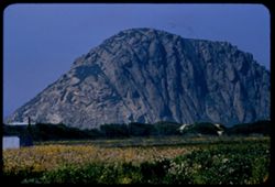
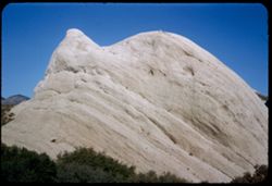
- Description:
- 100 f 8 tl
- Subject:
- Rock formations, Mountains, Plants, Morro Rock (Calif.), and Flowers
- Series:
- 4-56
- Creator:
- Cushman, Charles W., 1896-1972
- Date Created:
- 1956-04-19
- Genre:
- Landscape photographs
- Frame Number:
- 15
- County:
- San Luis Obispo
- Abstract:
- Morro Rock
- Call Number:
- P08654
- Country:
- United States
- State/Province:
- California
- Alternate Identifier:
- 456.15
- Persistent URL:
- http://purl.dlib.indiana.edu/iudl/archives/cushman/P08654
- Holding Location:
- Bloomington - University Archives
Wells Library E460
1320 E 10th St.
Bloomington, IN 47405
Contact at archives@indiana.edu, 812-855-1127
-
- Description:
- 50 f 8
- Subject:
- Fire escapes, Bodies of water, Mountains, Marine terminals, Telegraph Hill (San Francisco, Calif.), Dwellings, Shadows, Streets, Sidewalks, Shrubs, and Piers...
- Series:
- 2-53
- Creator:
- Cushman, Charles W., 1896-1972
- Date Created:
- 1953-02-09
- Genre:
- Cityscape photographs
- Frame Number:
- 25
- Street Address:
- Union Street and Montgomery Street
- County:
- San Francisco
- Abstract:
- Union St. - east of Montgomery.
- Call Number:
- P06559
- City:
- San Francisco
- Country:
- United States
- State/Province:
- California
- Alternate Identifier:
- 253.25
- Persistent URL:
- http://purl.dlib.indiana.edu/iudl/archives/cushman/P06559
- Holding Location:
- Bloomington - University Archives
Wells Library E460
1320 E 10th St.
Bloomington, IN 47405
Contact at archives@indiana.edu, 812-855-1127
-
- Description:
- 50 f 5.6
- Subject:
- Buildings, Hills, Mountains, Grasses, Trees, Utility poles, Acacia, Houses, Flowers, Roads, Automobiles, Electric lines, and Shrubs
- Series:
- 8-52
- Creator:
- Cushman, Charles W., 1896-1972
- Date Created:
- 1952-03-02
- Genre:
- Landscape photographs
- Frame Number:
- 37
- County:
- San Luis Obispo
- Abstract:
- San Luis mtn with acacia below
- Call Number:
- P05796
- City:
- San Luis Obispo
- Country:
- United States
- State/Province:
- California
- Alternate Identifier:
- 852.37
- Persistent URL:
- http://purl.dlib.indiana.edu/iudl/archives/cushman/P05796
- Holding Location:
- Bloomington - University Archives
Wells Library E460
1320 E 10th St.
Bloomington, IN 47405
Contact at archives@indiana.edu, 812-855-1127
-
- Description:
- 100 f 7 tel
- Subject:
- Valleys, Mountains, Panamint Valley (Calif.), Panamint Range (Calif.), and Clouds
- Series:
- 3-55
- Creator:
- Cushman, Charles W., 1896-1972
- Date Created:
- 1955-02-27
- Genre:
- Landscape photographs
- Frame Number:
- 26
- Street Address:
- California State Highway 190
- Abstract:
- NE across Panamint Valley from floor (Cal 190)
- Call Number:
- P07617
- Country:
- United States
- State/Province:
- California
- Physical Description:
- Image was originally mounted in a glass enclosure. Before digitization, the image was removed and placed in a Wess Plastic, Inc. brand, 2" x 2", pl...
- Alternate Identifier:
- 355.26
- Persistent URL:
- http://purl.dlib.indiana.edu/iudl/archives/cushman/P07617
- Holding Location:
- Bloomington - University Archives
Wells Library E460
1320 E 10th St.
Bloomington, IN 47405
Contact at archives@indiana.edu, 812-855-1127
-
- Description:
- 50 f 8.8
- Subject:
- Yosemite National Park (Calif.), Tioga Peak (Calif.), Mountains, Trees, Streams, Shrubs, Roads, Rocks, and Tioga Pass (Calif.)
- Series:
- 10-54
- Creator:
- Cushman, Charles W., 1896-1972
- Date Created:
- 1954-09-16
- Genre:
- Landscape photographs
- Frame Number:
- 9
- County:
- Mono
- Abstract:
- Great red brown mtn next to Tioga Pk.
- Call Number:
- P07356
- Country:
- United States
- State/Province:
- California
- Physical Description:
- Anscochrome film.
- Alternate Identifier:
- 1054.9
- Persistent URL:
- http://purl.dlib.indiana.edu/iudl/archives/cushman/P07356
- Holding Location:
- Bloomington - University Archives
Wells Library E460
1320 E 10th St.
Bloomington, IN 47405
Contact at archives@indiana.edu, 812-855-1127
-
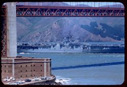
- Description:
- 100 f 6.3 tl
- Subject:
- Buildings, Mountains, Aircraft carriers, Suspension bridges, Bays (Bodies of water), San Francisco Bay (Calif.), USS Boxer, Automobiles, Golden Gate Bridge (...
- Series:
- 7-56
- Creator:
- Cushman, Charles W., 1896-1972
- Date Created:
- 1956-06-08
- Genre:
- Marine photographs
- Frame Number:
- 18
- County:
- San Francisco
- Abstract:
- Carrier 21 Boxer
- Call Number:
- P08765
- City:
- San Francisco
- Country:
- United States
- State/Province:
- California
- Alternate Identifier:
- 756.18
- Persistent URL:
- http://purl.dlib.indiana.edu/iudl/archives/cushman/P08765
- Holding Location:
- Bloomington - University Archives
Wells Library E460
1320 E 10th St.
Bloomington, IN 47405
Contact at archives@indiana.edu, 812-855-1127
-
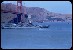
- Description:
- 100 f 6.3
- Subject:
- USS Bremerton, San Francisco Bay (Calif.), Bays (Bodies of water), Boats, Golden Gate Bridge (San Francisco, Calif.), Coastlines, Suspension bridges, Aircraf...
- Series:
- 7-56
- Creator:
- Cushman, Charles W., 1896-1972
- Date Created:
- 1956-06-08
- Genre:
- Marine photographs
- Frame Number:
- 19
- County:
- San Francisco
- Abstract:
- Carrier 130
- Call Number:
- P08766
- City:
- San Francisco
- Country:
- United States
- State/Province:
- California
- Alternate Identifier:
- 756.19
- Persistent URL:
- http://purl.dlib.indiana.edu/iudl/archives/cushman/P08766
- Holding Location:
- Bloomington - University Archives
Wells Library E460
1320 E 10th St.
Bloomington, IN 47405
Contact at archives@indiana.edu, 812-855-1127
-
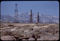
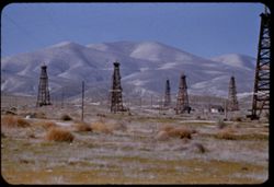
- Description:
- 100 f 5.6 tl
- Subject:
- Oil wells, Storage tanks, Hills, Mountains, Dirt roads, Shrubs, Oil well drilling rigs, and Facilities
- Series:
- 4-55
- Creator:
- Cushman, Charles W., 1896-1972
- Date Created:
- 1955-03-01
- Genre:
- Views
- Frame Number:
- 22
- County:
- Kern
- Abstract:
- 3 derricks with folded hills in background (Hazy)
- Call Number:
- P07649
- City:
- Taft
- Country:
- United States
- State/Province:
- California
- Alternate Identifier:
- 455.22
- Persistent URL:
- http://purl.dlib.indiana.edu/iudl/archives/cushman/P07649
- Holding Location:
- Bloomington - University Archives
Wells Library E460
1320 E 10th St.
Bloomington, IN 47405
Contact at archives@indiana.edu, 812-855-1127
-
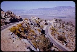
- Description:
- 50 f 11 HF
- Subject:
- Valleys, Inyo Mountains (Calif.), Mountains, Owens Valley (Calif.), Deserts, Shrubs, Roads, and Rocks
- Series:
- 12-54
- Creator:
- Cushman, Charles W., 1896-1972
- Date Created:
- 1954-09-18
- Genre:
- Landscape photographs
- Frame Number:
- 27
- Street Address:
- Mt. Whitney Road
- County:
- Inyo
- Abstract:
- Switch-back coming down Mt Whitney rd.
- Call Number:
- P07417
- Country:
- United States
- State/Province:
- California
- Alternate Identifier:
- 1254.27
- Persistent URL:
- http://purl.dlib.indiana.edu/iudl/archives/cushman/P07417
- Holding Location:
- Bloomington - University Archives
Wells Library E460
1320 E 10th St.
Bloomington, IN 47405
Contact at archives@indiana.edu, 812-855-1127
-
- Description:
- 25 f 8 Pola
- Subject:
- Scenic overlooks, Trees, National parks & reserves, Snow, Cliffs, Roads, Sequoia National Park (Calif.), Sierra Nevada (Calif. and Nev.), Mountains, and ...
- Series:
- 14-52
- Creator:
- Cushman, Charles W., 1896-1972
- Date Created:
- 1952-04-06
- Genre:
- Landscape photographs
- Frame Number:
- 1
- Street Address:
- California State Highway 198
- County:
- Tulare
- Abstract:
- High ridge from turnout on road down.
- Call Number:
- P05985
- Country:
- United States
- State/Province:
- California
- Alternate Identifier:
- 1452.1
- Persistent URL:
- http://purl.dlib.indiana.edu/iudl/archives/cushman/P05985
- Holding Location:
- Bloomington - University Archives
Wells Library E460
1320 E 10th St.
Bloomington, IN 47405
Contact at archives@indiana.edu, 812-855-1127
-
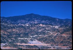
- Description:
- 100 f 6.3 TL
- Subject:
- Coachella Valley (Calif.), Mountains, Trees, Palms, and San Jacinto Peak (Calif.)
- Series:
- 24-61
- Creator:
- Cushman, Charles W., 1896-1972
- Date Created:
- 1961-12-25
- Genre:
- Landscape photographs
- Frame Number:
- 1
- County:
- Riverside
- Abstract:
- Mt. San Jacinto and Mr San jac.
- Call Number:
- P12567
- City:
- Palm Desert
- Country:
- United States
- State/Province:
- California
- Alternate Identifier:
- 2461.1
- Persistent URL:
- http://purl.dlib.indiana.edu/iudl/archives/cushman/P12567
- Holding Location:
- Bloomington - University Archives
Wells Library E460
1320 E 10th St.
Bloomington, IN 47405
Contact at archives@indiana.edu, 812-855-1127
-
- Description:
- 100 f 8 SL H.F
- Subject:
- San Jacinto Mountains (Calif.) and Mountains
- Series:
- 24-61
- Creator:
- Cushman, Charles W., 1896-1972
- Date Created:
- 1961-12-27
- Genre:
- Landscape photographs
- Frame Number:
- 10
- Street Address:
- California State Highway 74
- County:
- Riverside
- Abstract:
- Looking down into Coachella Valley from ht of rd. 74
- Call Number:
- P12576
- Country:
- United States
- State/Province:
- California
- Alternate Identifier:
- 2461.10
- Persistent URL:
- http://purl.dlib.indiana.edu/iudl/archives/cushman/P12576
- Holding Location:
- Bloomington - University Archives
Wells Library E460
1320 E 10th St.
Bloomington, IN 47405
Contact at archives@indiana.edu, 812-855-1127
-
- Description:
- 100 f 6.3 TL
- Subject:
- San Gorgonio Mountain (Calif.), Mountains, Utility poles, Palms, Shrubs, Roads, and Dwellings
- Series:
- 24-61
- Creator:
- Cushman, Charles W., 1896-1972
- Date Created:
- 1961-12-25
- Genre:
- Landscape photographs
- Frame Number:
- 2
- County:
- San Bernardino
- Abstract:
- Mr San Gorgonio and Mt. San Gorgonio
- Call Number:
- P12568
- City:
- Palm Desert
- Country:
- United States
- State/Province:
- California
- Alternate Identifier:
- 2461.2
- Persistent URL:
- http://purl.dlib.indiana.edu/iudl/archives/cushman/P12568
- Holding Location:
- Bloomington - University Archives
Wells Library E460
1320 E 10th St.
Bloomington, IN 47405
Contact at archives@indiana.edu, 812-855-1127
-
- Description:
- 50 f 4
- Subject:
- Illilouette Fall (Calif.), National parks & reserves, Mountains, Yosemite National Park (Calif.), Waterfalls, Trees, Yosemite Valley (Calif.), Vernal Fal...
- Series:
- 6-53
- Creator:
- Cushman, Charles W., 1896-1972
- Date Created:
- 1953-05-15
- Genre:
- Landscape photographs
- Frame Number:
- 18
- County:
- Mariposa
- Abstract:
- Illilouette Fall from Vernal fall trail
- Call Number:
- P06705
- Country:
- United States
- State/Province:
- California
- Alternate Identifier:
- 653.18
- Persistent URL:
- http://purl.dlib.indiana.edu/iudl/archives/cushman/P06705
- Holding Location:
- Bloomington - University Archives
Wells Library E460
1320 E 10th St.
Bloomington, IN 47405
Contact at archives@indiana.edu, 812-855-1127
-
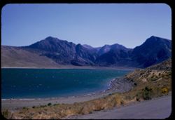
- Description:
- 100 f 7 tl
- Subject:
- Mountains, Plants, Waterfronts, Lake Crowley (Calif.), and Lakes & ponds
- Series:
- 27-55
- Creator:
- Cushman, Charles W., 1896-1972
- Date Created:
- 1955-09-26
- Genre:
- Landscape photographs
- Frame Number:
- 0
- Street Address:
- United States Highway 395
- County:
- Mono
- Abstract:
- Crowley Lake from US 395 above
- Call Number:
- P08420
- Country:
- United States
- State/Province:
- California
- Alternate Identifier:
- 2755.0
- Persistent URL:
- http://purl.dlib.indiana.edu/iudl/archives/cushman/P08420
- Holding Location:
- Bloomington - University Archives
Wells Library E460
1320 E 10th St.
Bloomington, IN 47405
Contact at archives@indiana.edu, 812-855-1127
-
- Description:
- 50 f 9
- Subject:
- Passes (Landforms), Mountains, Shrubs, Trees, Buttes, and Sonora Pass (Calif.)
- Series:
- 9-54
- Creator:
- Cushman, Charles W., 1896-1972
- Date Created:
- 1954-09-15
- Genre:
- Landscape photographs
- Frame Number:
- 10
- County:
- Tuolumne
- Abstract:
- Cone above Sonora Pass - to south.
- Call Number:
- P07321
- Country:
- United States
- State/Province:
- California
- Alternate Identifier:
- 954.10
- Persistent URL:
- http://purl.dlib.indiana.edu/iudl/archives/cushman/P07321
- Holding Location:
- Bloomington - University Archives
Wells Library E460
1320 E 10th St.
Bloomington, IN 47405
Contact at archives@indiana.edu, 812-855-1127
-
- Description:
- 100 f 6.3 tl telescope lens
- Subject:
- Meadows, Moffett Field (Calif.), Mountains, Universities & colleges, Stanford University, Clouds, and Skeggs Point (Calif.)
- Series:
- 3-57
- Creator:
- Cushman, Charles W., 1896-1972
- Date Created:
- 1957-04-12
- Genre:
- Landscape photographs and Views
- Frame Number:
- 14
- Street Address:
- Skyline Drive
- County:
- San Mateo
- Abstract:
- Towards Stanford & Moffett Field from Skeggs Pt.
- Call Number:
- P09178
- Country:
- United States
- State/Province:
- California
- Alternate Identifier:
- 357.14
- Persistent URL:
- http://purl.dlib.indiana.edu/iudl/archives/cushman/P09178
- Holding Location:
- Bloomington - University Archives
Wells Library E460
1320 E 10th St.
Bloomington, IN 47405
Contact at archives@indiana.edu, 812-855-1127
-
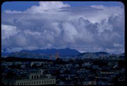
- Description:
- 100 f 8 TL
- Subject:
- Cities & towns, Houses, Mountains, Tamalpais, Mount (Calif.), Golden Gate Bridge (San Francisco, Calif.), Suspension bridges, Clouds, and Buildings
- Series:
- 6-56
- Creator:
- Cushman, Charles W., 1896-1972
- Date Created:
- 1956-05-07
- Genre:
- Cityscape photographs
- Frame Number:
- 33
- Street Address:
- 100 Broderick Street
- County:
- San Francisco
- Abstract:
- Clouds in northern sky, seen from top of 100 Broderick Mt. Tamalpais and Golden Gate Bridge and dark clouds
- Call Number:
- P08742
- City:
- San Francisco
- Country:
- United States
- State/Province:
- California
- Alternate Identifier:
- 656.33
- Persistent URL:
- http://purl.dlib.indiana.edu/iudl/archives/cushman/P08742
- Holding Location:
- Bloomington - University Archives
Wells Library E460
1320 E 10th St.
Bloomington, IN 47405
Contact at archives@indiana.edu, 812-855-1127
-
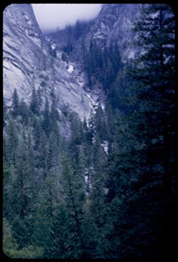
- Description:
- 25 f 3.5
- Subject:
- Illilouette Fall (Calif.), National parks & reserves, Valleys, Mountains, Yosemite National Park (Calif.), Waterfalls, Trees, and Vernal Fall trail (Calif.)
- Series:
- 6-53
- Creator:
- Cushman, Charles W., 1896-1972
- Date Created:
- 1953-05-15
- Genre:
- Landscape photographs
- Frame Number:
- 22
- County:
- Mariposa
- Abstract:
- Cascade of Illiloulette from VF trail.
- Call Number:
- P06710
- Country:
- United States
- State/Province:
- California
- Alternate Identifier:
- 653.22
- Persistent URL:
- http://purl.dlib.indiana.edu/iudl/archives/cushman/P06710
- Holding Location:
- Bloomington - University Archives
Wells Library E460
1320 E 10th St.
Bloomington, IN 47405
Contact at archives@indiana.edu, 812-855-1127
-
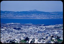
- Description:
- 200 f 4.5 tl
- Subject:
- Twin Peaks (San Francisco County, Calif.), Cities & towns, Streets, Hills, Bays (Bodies of water), Trees, Buildings, Diablo, Mount (Calif.), Houses, and ...
- Series:
- 1-56
- Creator:
- Cushman, Charles W., 1896-1972
- Date Created:
- 1956-03-06
- Genre:
- Cityscape photographs
- Frame Number:
- 28
- County:
- San Francisco
- Call Number:
- P08557
- City:
- San Francisco
- Country:
- United States
- State/Province:
- California
- Alternate Identifier:
- 156.28
- Persistent URL:
- http://purl.dlib.indiana.edu/iudl/archives/cushman/P08557
- Holding Location:
- Bloomington - University Archives
Wells Library E460
1320 E 10th St.
Bloomington, IN 47405
Contact at archives@indiana.edu, 812-855-1127
-
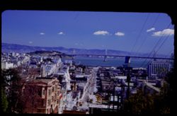
- Description:
- 25 f 6.3 pola
- Subject:
- Diablo, Mount (Calif.), Tree limbs, Apartment houses, Streets, Goat Island (Calif.), Automobiles, San Francisco Bay (Calif.) Calif.), San Francisco-Oakland ...
- Series:
- 11-52
- Creator:
- Cushman, Charles W., 1896-1972
- Date Created:
- 1952-03-20
- Genre:
- Cityscape photographs
- Frame Number:
- 4
- Street Address:
- Broadway Street
- County:
- San Francisco
- Persons Pictured:
- Cushman, Charles W. (Charles Weever), 1896-1972
- Abstract:
- Toward Goat Island, Mt. Diablo & Bay Bridge from Broadway on Russian Hill
- Call Number:
- P05873
- City:
- San Francisco
- Country:
- United States
- State/Province:
- California
- Physical Description:
- masked.
- Alternate Identifier:
- 1152.4
- Persistent URL:
- http://purl.dlib.indiana.edu/iudl/archives/cushman/P05873
- Holding Location:
- Bloomington - University Archives
Wells Library E460
1320 E 10th St.
Bloomington, IN 47405
Contact at archives@indiana.edu, 812-855-1127
-
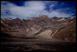
- Description:
- 25 f 11 Pola
- Subject:
- Deserts, Amargosa Range (Nev. and Calif.), Valleys, Death Valley (Calif. and Nev.), Mountains, and Rocks
- Series:
- 15-52
- Creator:
- Cushman, Charles W., 1896-1972
- Date Created:
- 1952-04-09
- Genre:
- Landscape photographs
- Frame Number:
- 27
- County:
- Inyo
- Abstract:
- Amargosa Mtns near Bad Water.
- Call Number:
- P06047
- City:
- Badwater
- Country:
- United States
- State/Province:
- California
- Physical Description:
- Image was originally mounted in a glass enclosure. Before digitization, the image was removed and placed in a Wess Plastic, Inc. brand, 2" x 2", pl...
- Alternate Identifier:
- 1552.27
- Persistent URL:
- http://purl.dlib.indiana.edu/iudl/archives/cushman/P06047
- Holding Location:
- Bloomington - University Archives
Wells Library E460
1320 E 10th St.
Bloomington, IN 47405
Contact at archives@indiana.edu, 812-855-1127
-
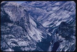
- Description:
- 100 f 8 tl
- Subject:
- National parks & reserves, Tenaya Canyon (Calif.), Half Dome (Calif.), Watkins, Mount (Calif.), Mountains, Yosemite National Park (Calif.), and Rock form...
- Series:
- 21-55
- Creator:
- Cushman, Charles W., 1896-1972
- Date Created:
- 1955-07-08
- Genre:
- Landscape photographs
- Frame Number:
- 22
- County:
- Mariposa
- Abstract:
- Tenaya canyon
- Call Number:
- P08239
- Country:
- United States
- State/Province:
- California
- Alternate Identifier:
- 2155.22
- Persistent URL:
- http://purl.dlib.indiana.edu/iudl/archives/cushman/P08239
- Holding Location:
- Bloomington - University Archives
Wells Library E460
1320 E 10th St.
Bloomington, IN 47405
Contact at archives@indiana.edu, 812-855-1127
-
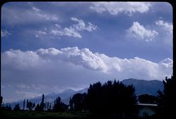
- Description:
- 100 f 6.3 sl with 50mm
- Subject:
- Mountains, Sierra Nevada (Calif. and Nev.), Trees, and Clouds
- Series:
- 26-55
- Creator:
- Cushman, Charles W., 1896-1972
- Date Created:
- 1955-09-25
- Genre:
- Landscape photographs
- Frame Number:
- 23
- County:
- Inyo
- Abstract:
- Cloud mass over Sierra - from Bishop
- Call Number:
- P08405
- City:
- Bishop
- Country:
- United States
- State/Province:
- California
- Alternate Identifier:
- 2655.23
- Persistent URL:
- http://purl.dlib.indiana.edu/iudl/archives/cushman/P08405
- Holding Location:
- Bloomington - University Archives
Wells Library E460
1320 E 10th St.
Bloomington, IN 47405
Contact at archives@indiana.edu, 812-855-1127
-
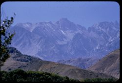
- Description:
- 100 f 6.3
- Subject:
- Hills, Whitney, Mount (Calif.), Mountains, Sierra Nevada (Calif. and Nev.), Trees, Corcoran, Mount (Calif.), and Le Conte, Mount (Calif.)
- Series:
- 26-55
- Creator:
- Cushman, Charles W., 1896-1972
- Date Created:
- 1955-09-25
- Genre:
- Landscape photographs
- Frame Number:
- 11
- County:
- Inyo
- Abstract:
- And a little further to south (perhaps Mt. Corcoran)
- Call Number:
- P08394
- Country:
- United States
- State/Province:
- California
- Alternate Identifier:
- 2655.11
- Persistent URL:
- http://purl.dlib.indiana.edu/iudl/archives/cushman/P08394
- Holding Location:
- Bloomington - University Archives
Wells Library E460
1320 E 10th St.
Bloomington, IN 47405
Contact at archives@indiana.edu, 812-855-1127
-
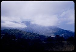
- Description:
- 50 f 6.3
- Subject:
- Hills, Mountains, Trees, Tehachapi Mountains (Calif.), Clouds, and Grasses
- Series:
- 16-53
- Creator:
- Cushman, Charles W., 1896-1972
- Date Created:
- 1953-11-23
- Genre:
- Landscape photographs
- Frame Number:
- 22
- County:
- Kern
- Abstract:
- Clouds through Tehachapi Mtns
- Call Number:
- P07094
- City:
- Tehachapi and Bakersfield
- Country:
- United States
- State/Province:
- California
- Alternate Identifier:
- 1653.22
- Persistent URL:
- http://purl.dlib.indiana.edu/iudl/archives/cushman/P07094
- Holding Location:
- Bloomington - University Archives
Wells Library E460
1320 E 10th St.
Bloomington, IN 47405
Contact at archives@indiana.edu, 812-855-1127
-
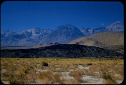
- Description:
- 100 f 6.3 SL
- Subject:
- Plains, Owens Valley (Calif.), Mounds (Landforms), Mountains, Sierra Nevada (Calif. and Nev.), and Grasses
- Series:
- 25-55
- Creator:
- Cushman, Charles W., 1896-1972
- Date Created:
- 1955-09-25
- Genre:
- Landscape photographs
- Frame Number:
- 34
- County:
- Inyo
- Abstract:
- The whole view looking SW -
- Call Number:
- P08379
- City:
- Big Pine
- Country:
- United States
- State/Province:
- California
- Alternate Identifier:
- 2555.34
- Persistent URL:
- http://purl.dlib.indiana.edu/iudl/archives/cushman/P08379
- Holding Location:
- Bloomington - University Archives
Wells Library E460
1320 E 10th St.
Bloomington, IN 47405
Contact at archives@indiana.edu, 812-855-1127
-
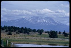
- Description:
- 100 f 6.3 tl
- Subject:
- Hills, Bodies of water, Mountains, Shrubs, Snow, Trees, Clouds, Fences, Shasta, Mount (Calif. : Mountain), and Grasses
- Series:
- 18-55
- Creator:
- Cushman, Charles W., 1896-1972
- Date Created:
- 1955-06-17
- Genre:
- Landscape photographs
- Frame Number:
- 2
- County:
- Siskiyou
- Abstract:
- Mt. Shasta at 2:35 from road east of Grenada
- Call Number:
- P08119
- City:
- Grenada
- Country:
- United States
- State/Province:
- California
- Alternate Identifier:
- 1855.2
- Persistent URL:
- http://purl.dlib.indiana.edu/iudl/archives/cushman/P08119
- Holding Location:
- Bloomington - University Archives
Wells Library E460
1320 E 10th St.
Bloomington, IN 47405
Contact at archives@indiana.edu, 812-855-1127
-
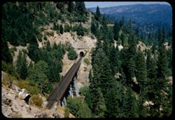
- Description:
- 50 f 6.3 sl
- Subject:
- Western Pacific Railroad Company, Railroad bridges, Mountains, Tunnels, Trees, and Trestles
- Series:
- 11-57
- Creator:
- Cushman, Charles W., 1896-1972
- Date Created:
- 1957-07-24
- Genre:
- Landscape photographs
- Frame Number:
- 25
- County:
- Plumas
- Abstract:
- Trestle and tunnel mouth of W P RR at Keddie Wye
- Call Number:
- P09434
- City:
- Keddie
- Country:
- United States
- State/Province:
- California
- Alternate Identifier:
- 1157.25
- Persistent URL:
- http://purl.dlib.indiana.edu/iudl/archives/cushman/P09434
- Holding Location:
- Bloomington - University Archives
Wells Library E460
1320 E 10th St.
Bloomington, IN 47405
Contact at archives@indiana.edu, 812-855-1127
-
- Description:
- 25 f 11
- Subject:
- California poppies, Flowers, Streets, Mountains, Shrubs, Trees, Rocks, La Cumbre Peak (Calif.), Buildings, and Figurines
- Series:
- 8-52
- Creator:
- Cushman, Charles W., 1896-1972
- Date Created:
- 1952-02-28
- Genre:
- Cityscape photographs
- Frame Number:
- 14
- Street Address:
- Kenwood Road
- County:
- Santa Barbara
- Abstract:
- View across Sta Barbara to LaCumbre, Montecito, & other mtns from top of Kenwood Rd.
- Call Number:
- P05773
- City:
- Santa Barbara and Montecito
- Country:
- United States
- State/Province:
- California
- Alternate Identifier:
- 852.14
- Persistent URL:
- http://purl.dlib.indiana.edu/iudl/archives/cushman/P05773
- Holding Location:
- Bloomington - University Archives
Wells Library E460
1320 E 10th St.
Bloomington, IN 47405
Contact at archives@indiana.edu, 812-855-1127
-
- Description:
- 100 f 6.3 tl
- Subject:
- Meadows, Santa Ynez Valley (Calif.), Flowers, Valleys, Mountains, Trees, and Wildflowers
- Series:
- 15-57
- Creator:
- Cushman, Charles W., 1896-1972
- Date Created:
- 1957-09-21
- Genre:
- Landscape photographs
- Frame Number:
- 12
- Street Address:
- California State Highway 150
- County:
- Santa Barbara
- Abstract:
- Flowers on 150 w. of Solvang
- Call Number:
- P09545
- City:
- Solvang
- Country:
- United States
- State/Province:
- California
- Alternate Identifier:
- 1557.12
- Persistent URL:
- http://purl.dlib.indiana.edu/iudl/archives/cushman/P09545
- Holding Location:
- Bloomington - University Archives
Wells Library E460
1320 E 10th St.
Bloomington, IN 47405
Contact at archives@indiana.edu, 812-855-1127
-
- Description:
- 100 f 9 TL
- Subject:
- Deserts, Mojave Desert (Calif.), Hills, Mountains, and Tehachapi Mountains (Calif.)
- Series:
- 3-69
- Creator:
- Cushman, Charles W., 1896-1972
- Date Created:
- 1969-03-21
- Genre:
- Landscape photographs
- Frame Number:
- 16
- Street Address:
- California State Highway 14
- County:
- Los Angeles and Kern
- Abstract:
- Toward Tehachapi Mtns from Hwy 14
- Call Number:
- P15768
- City:
- Mojave and Lancaster
- Country:
- United States
- State/Province:
- California
- Alternate Identifier:
- 369.16
- Persistent URL:
- http://purl.dlib.indiana.edu/iudl/archives/cushman/P15768
- Holding Location:
- Bloomington - University Archives
Wells Library E460
1320 E 10th St.
Bloomington, IN 47405
Contact at archives@indiana.edu, 812-855-1127
-
- Description:
- 100 f 9 TL
- Subject:
- Passes (Landforms), Cajon Pass (Calif.), Shrubs, Rock formations, Mountains, and Grasses
- Series:
- 3-69
- Creator:
- Cushman, Charles W., 1896-1972
- Date Created:
- 1969-03-20
- Genre:
- Landscape photographs
- Frame Number:
- 15
- County:
- San Bernardino
- Abstract:
- In Cajon Pass
- Call Number:
- P15767
- Country:
- United States
- State/Province:
- California
- Alternate Identifier:
- 369.15
- Persistent URL:
- http://purl.dlib.indiana.edu/iudl/archives/cushman/P15767
- Holding Location:
- Bloomington - University Archives
Wells Library E460
1320 E 10th St.
Bloomington, IN 47405
Contact at archives@indiana.edu, 812-855-1127
-
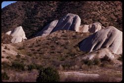
- Description:
- 100 f 9 TL
- Subject:
- Passes (Landforms), Hills, Cajon Pass (Calif.), Shrubs, Trees, Rock formations, Mountains, and Grasses
- Series:
- 2-69
- Creator:
- Cushman, Charles W., 1896-1972
- Date Created:
- 1969-03-14
- Genre:
- Landscape photographs
- Frame Number:
- 17
- County:
- San Bernardino
- Abstract:
- Cajon Pass
- Call Number:
- P15734
- Country:
- United States
- State/Province:
- California
- Alternate Identifier:
- 269.17
- Persistent URL:
- http://purl.dlib.indiana.edu/iudl/archives/cushman/P15734
- Holding Location:
- Bloomington - University Archives
Wells Library E460
1320 E 10th St.
Bloomington, IN 47405
Contact at archives@indiana.edu, 812-855-1127
-
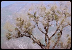
- Description:
- 100 f 9 TL
- Subject:
- Tree limbs, Mountains, and Trees
- Series:
- 2-69
- Creator:
- Cushman, Charles W., 1896-1972
- Date Created:
- 1969-03-17
- Genre:
- Landscape photographs
- Frame Number:
- 31
- County:
- Riverside
- Abstract:
- near Hemet
- Call Number:
- P15748
- City:
- Hemet
- Country:
- United States
- State/Province:
- California
- Alternate Identifier:
- 269.31
- Persistent URL:
- http://purl.dlib.indiana.edu/iudl/archives/cushman/P15748
- Holding Location:
- Bloomington - University Archives
Wells Library E460
1320 E 10th St.
Bloomington, IN 47405
Contact at archives@indiana.edu, 812-855-1127