
Search Constraints
You searched for:
Campus
IUB
Remove constraint Campus: IUB
Subject
Grasses
Remove constraint Subject: Grasses
State/Province
Colorado
Remove constraint State/Province: Colorado
1 - 96 of 96
Search Results
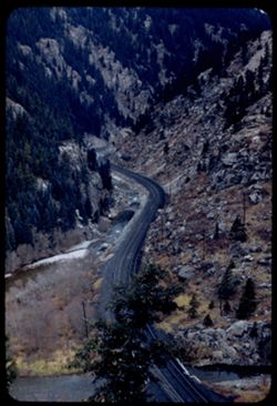
-
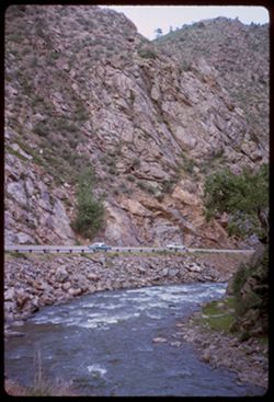
- Description:
- 100 f 4
- Subject:
- Canyons, Automobiles, Roads, Cliffs, Trees, Rocks, Clear Creek (Clear Creek County, Colo.), Grasses, Clear Creek Canyon (Colo.), and Rivers
- Series:
- 9-66
- Creator:
- Cushman, Charles W., 1896-1972
- Date Created:
- 1966-06-13
- Genre:
- Landscape photographs
- Frame Number:
- 13
- County:
- Clear Creek
- Call Number:
- P15416
- Country:
- United States
- State/Province:
- Colorado
- Alternate Identifier:
- 966.13
- Persistent URL:
- http://purl.dlib.indiana.edu/iudl/archives/cushman/P15416
- Holding Location:
- Bloomington - University Archives
Wells Library E460
1320 E 10th St.
Bloomington, IN 47405
Contact at archives@indiana.edu, 812-855-1127
-
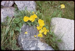
- Description:
- 50 f 6.3
- Subject:
- Rocks, Grasses, and Wildflowers
- Series:
- 9-66
- Creator:
- Cushman, Charles W., 1896-1972
- Date Created:
- 1966-06-13
- Genre:
- Identification photographs
- Frame Number:
- 12
- County:
- Clear Creek
- Call Number:
- P15415
- City:
- Georgetown
- Country:
- United States
- State/Province:
- Colorado
- Alternate Identifier:
- 966.12
- Persistent URL:
- http://purl.dlib.indiana.edu/iudl/archives/cushman/P15415
- Holding Location:
- Bloomington - University Archives
Wells Library E460
1320 E 10th St.
Bloomington, IN 47405
Contact at archives@indiana.edu, 812-855-1127
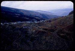
-
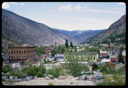
- Description:
- 100 f 5.6
- Subject:
- Rocks, Grasses, Houses, Trees, Roofs, Mountains, and Buildings
- Series:
- 9-66
- Creator:
- Cushman, Charles W., 1896-1972
- Date Created:
- 1966-06-13
- Genre:
- Landscape photographs and Cityscape photographs
- Frame Number:
- 11
- County:
- Clear Creek
- Call Number:
- P15414
- City:
- Georgetown
- Country:
- United States
- State/Province:
- Colorado
- Alternate Identifier:
- 966.11
- Persistent URL:
- http://purl.dlib.indiana.edu/iudl/archives/cushman/P15414
- Holding Location:
- Bloomington - University Archives
Wells Library E460
1320 E 10th St.
Bloomington, IN 47405
Contact at archives@indiana.edu, 812-855-1127
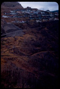
-
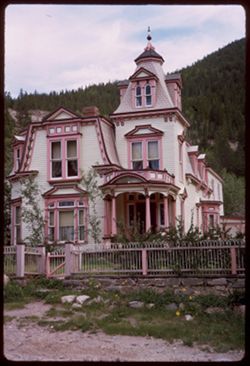
- Description:
- 100 f 6.3
- Subject:
- Spires, Houses, Pediments, Dormers, Shrubs, Bay windows, Cornices, Grasses, Fences, Rocks, Porticoes (Porches), and Architectural decorations & ornaments
- Series:
- 9-66
- Creator:
- Cushman, Charles W., 1896-1972
- Date Created:
- 1966-06-13
- Genre:
- Architectural photographs
- Frame Number:
- 8
- County:
- Clear Creek
- Call Number:
- P15411
- City:
- Georgetown
- Country:
- United States
- State/Province:
- Colorado
- Alternate Identifier:
- 966.8
- Persistent URL:
- http://purl.dlib.indiana.edu/iudl/archives/cushman/P15411
- Holding Location:
- Bloomington - University Archives
Wells Library E460
1320 E 10th St.
Bloomington, IN 47405
Contact at archives@indiana.edu, 812-855-1127
-
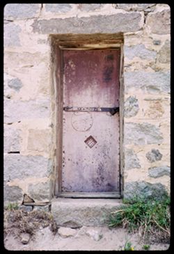
- Description:
- 50 f 5.6
- Subject:
- Rocks, Stone buildings, Grasses, Locks (Hardware), Jails, and Doors & doorways
- Series:
- 9-66
- Creator:
- Cushman, Charles W., 1896-1972
- Date Created:
- 1966-06-13
- Genre:
- Architectural photographs
- Frame Number:
- 2
- County:
- Clear Creek
- Call Number:
- P15405
- City:
- Georgetown
- Country:
- United States
- State/Province:
- Colorado
- Alternate Identifier:
- 966.2
- Persistent URL:
- http://purl.dlib.indiana.edu/iudl/archives/cushman/P15405
- Holding Location:
- Bloomington - University Archives
Wells Library E460
1320 E 10th St.
Bloomington, IN 47405
Contact at archives@indiana.edu, 812-855-1127
-
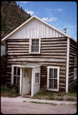
- Description:
- 100 f 11
- Subject:
- Chimneys, Sash windows, Sidewalks, Dirt roads, Log buildings, Grasses, Doors & doorways, Mountains, and Clouds
- Series:
- 9-66
- Creator:
- Cushman, Charles W., 1896-1972
- Date Created:
- 1966-06-13
- Genre:
- Architectural photographs
- Frame Number:
- 1
- County:
- Clear Creek
- Call Number:
- P15404
- City:
- Georgetown
- Country:
- United States
- State/Province:
- Colorado
- Alternate Identifier:
- 966.1
- Persistent URL:
- http://purl.dlib.indiana.edu/iudl/archives/cushman/P15404
- Holding Location:
- Bloomington - University Archives
Wells Library E460
1320 E 10th St.
Bloomington, IN 47405
Contact at archives@indiana.edu, 812-855-1127
-
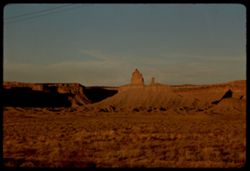
- Description:
- 100 f 16 TL
- Subject:
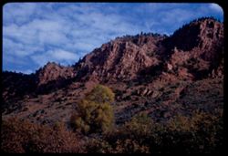
- Erosion, Plains, Canyons, Grasses, Mesas, and Rock formations
- Series:
- 36-65
- Creator:
- Cushman, Charles W., 1896-1972
- Date Created:
- 1965-10-07
- Genre:
- Landscape photographs
- Frame Number:
- 22
- Street Address:
- United States Highway 666
- County:
- Montezuma
- Abstract:
- Squaw + papoose along Hwy 666.
- Call Number:
- P15090
- City:
- Cortez
- Country:
- United States
- State/Province:
- Colorado
- Alternate Identifier:
- 3665.22
- Persistent URL:
- http://purl.dlib.indiana.edu/iudl/archives/cushman/P15090
- Holding Location:
- Bloomington - University Archives
Wells Library E460
1320 E 10th St.
Bloomington, IN 47405
Contact at archives@indiana.edu, 812-855-1127
-
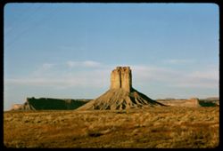
- Description:
- 100 f 16 TL
- Subject:
- Plains, Cliffs, Buttes, Rock formations, Mesas, and Grasses
- Series:
- 36-65
- Creator:
- Cushman, Charles W., 1896-1972
- Date Created:
- 1965-10-07
- Genre:
- Landscape photographs
- Frame Number:
- 19
- Street Address:
- United States Highway 666
- County:
- Montezuma
- Abstract:
- Sad rock.
- Call Number:
- P15087
- City:
- Cortez
- Country:
- United States
- State/Province:
- Colorado
- Alternate Identifier:
- 3665.19
- Persistent URL:
- http://purl.dlib.indiana.edu/iudl/archives/cushman/P15087
- Holding Location:
- Bloomington - University Archives
Wells Library E460
1320 E 10th St.
Bloomington, IN 47405
Contact at archives@indiana.edu, 812-855-1127
-
- Description:
- 100 f 11
- Subject:
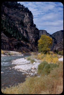
- Rocks, Canyons, Grasses, Mountains, Rapids, Rivers, Uncompahgre River (Colo.), and Erosion
- Series:
- 34-65
- Creator:
- Cushman, Charles W., 1896-1972
- Date Created:
- 1965-10-04
- Genre:
- Landscape photographs
- Frame Number:
- 24
- Street Address:
- United States Highway 550
- County:
- Ouray
- Abstract:
- Canyon.
- Call Number:
- P15016
- City:
- Ouray
- Country:
- United States
- State/Province:
- Colorado
- Alternate Identifier:
- 3465.24
- Persistent URL:
- http://purl.dlib.indiana.edu/iudl/archives/cushman/P15016
- Holding Location:
- Bloomington - University Archives
Wells Library E460
1320 E 10th St.
Bloomington, IN 47405
Contact at archives@indiana.edu, 812-855-1127
-
- Description:
- 100 f 11
- Subject:
- Rocks, Uncompahgre River (Colo.), Grasses, Roads, Trees, Mountains, Rapids, Rivers, Canyons, Erosion, and Ouray (Colo.)
- Series:
- 34-65
- Creator:
- Cushman, Charles W., 1896-1972
- Date Created:
- 1965-10-04
- Genre:
- Landscape photographs
- Frame Number:
- 22
- Street Address:
- United States Highway 550
- County:
- San Juan and Ouray
- Abstract:
- Canyon
- Call Number:
- P15014
- City:
- Silverton and Ouray
- Country:
- United States
- State/Province:
- Colorado
- Alternate Identifier:
- 3465.22
- Persistent URL:
- http://purl.dlib.indiana.edu/iudl/archives/cushman/P15014
- Holding Location:
- Bloomington - University Archives
Wells Library E460
1320 E 10th St.
Bloomington, IN 47405
Contact at archives@indiana.edu, 812-855-1127
-
- Description:
- 100 f 11
- Subject:
- Erosion, Trees, Mountains, Forests, and Grasses
- Series:
- 34-65
- Creator:
- Cushman, Charles W., 1896-1972
- Date Created:
- 1965-10-04
- Genre:
- Landscape photographs
- Frame Number:
- 20
- County:
- San Juan
- Abstract:
- Nearby mtnside
- Call Number:
- P15012
- City:
- Silverton
- Country:
- United States
- State/Province:
- Colorado
- Alternate Identifier:
- 3465.20
- Persistent URL:
- http://purl.dlib.indiana.edu/iudl/archives/cushman/P15012
- Holding Location:
- Bloomington - University Archives
Wells Library E460
1320 E 10th St.
Bloomington, IN 47405
Contact at archives@indiana.edu, 812-855-1127
-
- Description:
- 100 f 13 sl
- Subject:
- Grasses, Trees, Mountains, Fences, Shrubs, and Rock formations
- Series:
- 34-65
- Creator:
- Cushman, Charles W., 1896-1972
- Date Created:
- 1965-10-03
- Genre:
- Landscape photographs
- Frame Number:
- 14
- County:
- La Plata
- Abstract:
- 2 truncated pyramids w. of Durango
- Call Number:
- P15006
- City:
- Durango
- Country:
- United States
- State/Province:
- Colorado
- Alternate Identifier:
- 3465.14
- Persistent URL:
- http://purl.dlib.indiana.edu/iudl/archives/cushman/P15006
- Holding Location:
- Bloomington - University Archives
Wells Library E460
1320 E 10th St.
Bloomington, IN 47405
Contact at archives@indiana.edu, 812-855-1127
-

- Description:
- 100 f 13
- Subject:
- Rocks, Grasses, Roads, Mountains, Shrubs, Bridges, Animas River (Colo. and N.M.), and Rivers
- Series:
- 34-65
- Creator:
- Cushman, Charles W., 1896-1972
- Date Created:
- 1965-10-03
- Genre:
- Landscape photographs
- Frame Number:
- 12
- County:
- La Plata
- Abstract:
- Animas river below Durango
- Call Number:
- P15004
- City:
- Durango
- Country:
- United States
- State/Province:
- Colorado
- Alternate Identifier:
- 3465.12
- Persistent URL:
- http://purl.dlib.indiana.edu/iudl/archives/cushman/P15004
- Holding Location:
- Bloomington - University Archives
Wells Library E460
1320 E 10th St.
Bloomington, IN 47405
Contact at archives@indiana.edu, 812-855-1127
-
- Description:
- 100 f 16 sl
- Subject:
- Snow, Grasses, Roads, Trails & paths, Trees, Mountains, Forests, and Passes (Landforms)
- Series:
- 33-65
- Creator:
- Cushman, Charles W., 1896-1972
- Date Created:
- 1965-10-02
- Genre:
- Landscape photographs
- Frame Number:
- 24
- Street Address:
- United States Highway 550 and Red Mountain Pass
- County:
- San Juan
- Abstract:
- View east
- Call Number:
- P14979
- City:
- Silverton
- Country:
- United States
- State/Province:
- Colorado
- Alternate Identifier:
- 3365.24
- Persistent URL:
- http://purl.dlib.indiana.edu/iudl/archives/cushman/P14979
- Holding Location:
- Bloomington - University Archives
Wells Library E460
1320 E 10th St.
Bloomington, IN 47405
Contact at archives@indiana.edu, 812-855-1127
-
- Description:
- 200 f 11
- Subject:
- Uncompahgre National Forest (Colo.), Forests, Roads, Mountains, Utility poles, Snow, Trees, Grasses, and Fences
- Series:
- 33-65
- Creator:
- Cushman, Charles W., 1896-1972
- Date Created:
- 1965-10-02
- Genre:
- Landscape photographs
- Frame Number:
- 4
- Street Address:
- United States Highway 550
- County:
- San Juan
- Abstract:
- Snow covered Mtn
- Call Number:
- P14959
- Country:
- United States
- State/Province:
- Colorado
- Alternate Identifier:
- 3365.4
- Persistent URL:
- http://purl.dlib.indiana.edu/iudl/archives/cushman/P14959
- Holding Location:
- Bloomington - University Archives
Wells Library E460
1320 E 10th St.
Bloomington, IN 47405
Contact at archives@indiana.edu, 812-855-1127
-
- Description:
- 100 f 16
- Subject:
- Forests, Roads, Mountains, Snow, Trees, Grasses, and Fences
- Series:
- 33-65
- Creator:
- Cushman, Charles W., 1896-1972
- Date Created:
- 1965-10-02
- Genre:
- Landscape photographs
- Frame Number:
- 3
- Street Address:
- United States Highway 550
- County:
- La Plata and San Juan
- Abstract:
- Snow covered Mtn
- Call Number:
- P14958
- City:
- Silverton and Durango
- Country:
- United States
- State/Province:
- Colorado
- Alternate Identifier:
- 3365.3
- Persistent URL:
- http://purl.dlib.indiana.edu/iudl/archives/cushman/P14958
- Holding Location:
- Bloomington - University Archives
Wells Library E460
1320 E 10th St.
Bloomington, IN 47405
Contact at archives@indiana.edu, 812-855-1127
-
- Description:
- 100 f 16 sl
- Subject:
- Forests, Cliffs, Mountains, Trees, Rocks, and Grasses
- Series:
- 32-65
- Creator:
- Cushman, Charles W., 1896-1972
- Date Created:
- 1965-10-02
- Genre:
- Landscape photographs
- Frame Number:
- 33
- Street Address:
- United States Highway 550
- County:
- La Plata and San Juan
- Abstract:
- Cliffs and fall colors
- Call Number:
- P14951
- City:
- Silverton and Durango
- Country:
- United States
- State/Province:
- Colorado
- Alternate Identifier:
- 3265.33
- Persistent URL:
- http://purl.dlib.indiana.edu/iudl/archives/cushman/P14951
- Holding Location:
- Bloomington - University Archives
Wells Library E460
1320 E 10th St.
Bloomington, IN 47405
Contact at archives@indiana.edu, 812-855-1127
-
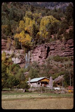
- Description:
- 100 f 13 tl
- Subject:
- Grasses, Houses, Waterfalls, Trees, Meadows, Mountains, Fences, Rock formations, Trucks, and Cliffs
- Series:
- 32-65
- Creator:
- Cushman, Charles W., 1896-1972
- Date Created:
- 1965-10-02
- Genre:
- Landscape photographs
- Frame Number:
- 26
- Street Address:
- United States Highway 550
- County:
- La Plata
- Abstract:
- Waterfall nearby
- Call Number:
- P14944
- City:
- Durango
- Country:
- United States
- State/Province:
- Colorado
- Alternate Identifier:
- 3265.26
- Persistent URL:
- http://purl.dlib.indiana.edu/iudl/archives/cushman/P14944
- Holding Location:
- Bloomington - University Archives
Wells Library E460
1320 E 10th St.
Bloomington, IN 47405
Contact at archives@indiana.edu, 812-855-1127
-
- Description:
- 100 f 13
- Subject:
- Grasses, Cliffs, Trees, Meadows, Mountains, Rock formations, and Houses
- Series:
- 32-65
- Creator:
- Cushman, Charles W., 1896-1972
- Date Created:
- 1965-10-02
- Genre:
- Landscape photographs
- Frame Number:
- 25
- Street Address:
- United States Highway 550
- County:
- La Plata
- Abstract:
- Horses below mtn side
- Call Number:
- P14943
- City:
- Durango
- Country:
- United States
- State/Province:
- Colorado
- Alternate Identifier:
- 3265.25
- Persistent URL:
- http://purl.dlib.indiana.edu/iudl/archives/cushman/P14943
- Holding Location:
- Bloomington - University Archives
Wells Library E460
1320 E 10th St.
Bloomington, IN 47405
Contact at archives@indiana.edu, 812-855-1127
-
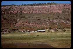
- Description:
- 100 f 16
- Subject:
- Grasses, Cliffs, Horses, Trees, Mountains, Fences, and Gates
- Series:
- 32-65
- Creator:
- Cushman, Charles W., 1896-1972
- Date Created:
- 1965-10-02
- Genre:
- Landscape photographs
- Frame Number:
- 24
- Street Address:
- United States Highway 550
- County:
- La Plata
- Abstract:
- Horses below mtn side
- Call Number:
- P14942
- City:
- Durango
- Country:
- United States
- State/Province:
- Colorado
- Alternate Identifier:
- 3265.24
- Persistent URL:
- http://purl.dlib.indiana.edu/iudl/archives/cushman/P14942
- Holding Location:
- Bloomington - University Archives
Wells Library E460
1320 E 10th St.
Bloomington, IN 47405
Contact at archives@indiana.edu, 812-855-1127
-
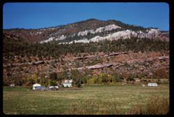
- Description:
- 100 f 16
- Subject:
- Grasses, Houses, Horses, Trees, Meadows, Mountains, Fences, Lakes & ponds, and Cliffs
- Series:
- 32-65
- Creator:
- Cushman, Charles W., 1896-1972
- Date Created:
- 1965-10-02
- Genre:
- Landscape photographs
- Frame Number:
- 23
- Street Address:
- United States Highway 550
- County:
- La Plata
- Abstract:
- Horses below mtn side
- Call Number:
- P14941
- City:
- Durango
- Country:
- United States
- State/Province:
- Colorado
- Alternate Identifier:
- 3265.23
- Persistent URL:
- http://purl.dlib.indiana.edu/iudl/archives/cushman/P14941
- Holding Location:
- Bloomington - University Archives
Wells Library E460
1320 E 10th St.
Bloomington, IN 47405
Contact at archives@indiana.edu, 812-855-1127
-
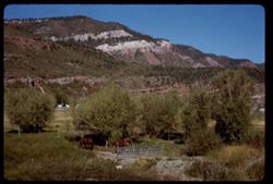
- Description:
- 100 f 16
- Subject:
- Horses, Cliffs, Mountains, Trees, Gates, Grasses, and Fences
- Series:
- 32-65
- Creator:
- Cushman, Charles W., 1896-1972
- Date Created:
- 1965-10-02
- Genre:
- Landscape photographs
- Frame Number:
- 22
- Street Address:
- United States Highway 550
- County:
- La Plata
- Abstract:
- Horses below mtn side
- Call Number:
- P14940
- City:
- Durango
- Country:
- United States
- State/Province:
- Colorado
- Alternate Identifier:
- 3265.22
- Persistent URL:
- http://purl.dlib.indiana.edu/iudl/archives/cushman/P14940
- Holding Location:
- Bloomington - University Archives
Wells Library E460
1320 E 10th St.
Bloomington, IN 47405
Contact at archives@indiana.edu, 812-855-1127
-
- Description:
- 100 f 11
- Subject:
- Grasses, Houses, Trees, Mountains, Lakes & ponds, and Croplands
- Series:
- 32-65
- Creator:
- Cushman, Charles W., 1896-1972
- Date Created:
- 1965-10-02
- Genre:
- Landscape photographs
- Frame Number:
- 19
- Street Address:
- United States Highway 550
- County:
- La Plata
- Abstract:
- Mtn side
- Call Number:
- P14937
- City:
- Durango
- Country:
- United States
- State/Province:
- Colorado
- Alternate Identifier:
- 3265.19
- Persistent URL:
- http://purl.dlib.indiana.edu/iudl/archives/cushman/P14937
- Holding Location:
- Bloomington - University Archives
Wells Library E460
1320 E 10th St.
Bloomington, IN 47405
Contact at archives@indiana.edu, 812-855-1127
-
- Description:
- 100 f 11
- Subject:
- Rocks, Grasses, Houses, Trees, Mountains, and Hills
- Series:
- 32-65
- Creator:
- Cushman, Charles W., 1896-1972
- Date Created:
- 1965-10-02
- Genre:
- Landscape photographs
- Frame Number:
- 20
- Street Address:
- United States Highway 550
- County:
- La Plata
- Abstract:
- few miles north of Durango
- Call Number:
- P14938
- City:
- Durango
- Country:
- United States
- State/Province:
- Colorado
- Alternate Identifier:
- 3265.20
- Persistent URL:
- http://purl.dlib.indiana.edu/iudl/archives/cushman/P14938
- Holding Location:
- Bloomington - University Archives
Wells Library E460
1320 E 10th St.
Bloomington, IN 47405
Contact at archives@indiana.edu, 812-855-1127
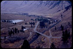
-
- Description:
- 50 f 11
- Subject:
- Reservoirs, Houses, Trees, Mountains, Shrubs, Lakes & ponds, Clouds, Twin Lakes Reservoir (Lake County, Colo.), Hills, Grasses, and Waterfronts
- Series:
- 11-53
- Creator:
- Cushman, Charles W., 1896-1972
- Date Created:
- 1953-10-15
- Genre:
- Landscape photographs
- Frame Number:
- 16
- County:
- Lake
- Abstract:
- The bigger Twin Lakes
- Call Number:
- P06895
- City:
- Leadville
- Country:
- United States
- State/Province:
- Colorado
- Alternate Identifier:
- 1153.16
- Persistent URL:
- http://purl.dlib.indiana.edu/iudl/archives/cushman/P06895
- Holding Location:
- Bloomington - University Archives
Wells Library E460
1320 E 10th St.
Bloomington, IN 47405
Contact at archives@indiana.edu, 812-855-1127
-
- Description:
- 50 f 9
- Subject:
- Grasses, Houses, Dirt roads, Fuelwood, Mountains, Massive, Mount (Colo.), Clotheslines, Huts, Suburbs, Hills, Suburban life, Clouds, and Laundry
- Series:
- 11-53
- Creator:
- Cushman, Charles W., 1896-1972
- Date Created:
- 1953-10-15
- Genre:
- Views and Cityscape photographs
- Frame Number:
- 11
- County:
- Lake
- Abstract:
- Mt. Massive above suburb of Stringtown
- Call Number:
- P06890
- City:
- Stringtown and Leadville
- Country:
- United States
- State/Province:
- Colorado
- Alternate Identifier:
- 1153.11
- Persistent URL:
- http://purl.dlib.indiana.edu/iudl/archives/cushman/P06890
- Holding Location:
- Bloomington - University Archives
Wells Library E460
1320 E 10th St.
Bloomington, IN 47405
Contact at archives@indiana.edu, 812-855-1127
-
- Description:
- 50 f 6.3 Pola
- Subject:
- Rocks, Grasses, Roads, Trees, Mountains, Massive, Mount (Colo.), Clouds, Suburbs, and Hills
- Series:
- 11-53
- Creator:
- Cushman, Charles W., 1896-1972
- Date Created:
- 1953-10-15
- Genre:
- Landscape photographs
- Frame Number:
- 10
- County:
- Lake
- Abstract:
- Mt Massive form Stringtown
- Call Number:
- P06889
- City:
- Stringtown and Leadville
- Country:
- United States
- State/Province:
- Colorado
- Alternate Identifier:
- 1153.10
- Persistent URL:
- http://purl.dlib.indiana.edu/iudl/archives/cushman/P06889
- Holding Location:
- Bloomington - University Archives
Wells Library E460
1320 E 10th St.
Bloomington, IN 47405
Contact at archives@indiana.edu, 812-855-1127
-
- Description:
- 50 f 11
- Subject:
- Rocks, Grasses, Houses, Dirt, Mountains, Clotheslines, Clouds, Suburbs, Wooden buildings, Suburban life, and Laundry
- Series:
- 11-53
- Creator:
- Cushman, Charles W., 1896-1972
- Date Created:
- 1953-10-15
- Genre:
- Cityscape photographs
- Frame Number:
- 8
- County:
- Lake
- Abstract:
- Stringtown nr Leadville
- Call Number:
- P06887
- City:
- Stringtown and Leadville
- Country:
- United States
- State/Province:
- Colorado
- Alternate Identifier:
- 1153.8
- Persistent URL:
- http://purl.dlib.indiana.edu/iudl/archives/cushman/P06887
- Holding Location:
- Bloomington - University Archives
Wells Library E460
1320 E 10th St.
Bloomington, IN 47405
Contact at archives@indiana.edu, 812-855-1127
-
- Description:
- 50 f 11
- Subject:
- Grasses, Houses, Dirt, Meadows, Mountains, Massive, Mount (Colo.), Shrubs, Clouds, Hills, and Fences
- Series:
- 11-53
- Creator:
- Cushman, Charles W., 1896-1972
- Date Created:
- 1953-10-15
- Genre:
- Landscape photographs
- Frame Number:
- 7
- Street Address:
- United States Highway 24
- County:
- Lake
- Abstract:
- Mt. Massive 14, 418 from US 24 just South of Leadville, Colorado
- Call Number:
- P06886
- City:
- Leadville
- Country:
- United States
- State/Province:
- Colorado
- Alternate Identifier:
- 1153.7
- Persistent URL:
- http://purl.dlib.indiana.edu/iudl/archives/cushman/P06886
- Holding Location:
- Bloomington - University Archives
Wells Library E460
1320 E 10th St.
Bloomington, IN 47405
Contact at archives@indiana.edu, 812-855-1127
-
- Description:
- 59 f 8 Pola
- Subject:
- Grasses, Grazing, Meadows, Cattle, Mountains, Massive, Mount (Colo.), Clouds, and Hills
- Series:
- 11-53
- Creator:
- Cushman, Charles W., 1896-1972
- Date Created:
- 1953-10-15
- Genre:
- Landscape photographs
- Frame Number:
- 6
- County:
- Lake
- Abstract:
- Mt Massive from east
- Call Number:
- P06885
- City:
- Leadville
- Country:
- United States
- State/Province:
- Colorado
- Physical Description:
- Image was originally mounted in a glass enclosure. Before digitization, the image was removed and placed in a Wess Plastic, Inc. brand, 2" x 2", pl...
- Alternate Identifier:
- 1153.6
- Persistent URL:
- http://purl.dlib.indiana.edu/iudl/archives/cushman/P06885
- Holding Location:
- Bloomington - University Archives
Wells Library E460
1320 E 10th St.
Bloomington, IN 47405
Contact at archives@indiana.edu, 812-855-1127
-
- Description:
- 50 f 9 Pola
- Subject:
- Snow, Grasses, Grazing, Meadows, Cattle, Mountains, Fences, Shrubs, Clouds, Hills, and Elbert, Mount (Colo.)
- Series:
- 11-53
- Creator:
- Cushman, Charles W., 1896-1972
- Date Created:
- 1953-10-15
- Genre:
- Landscape photographs
- Frame Number:
- 5
- County:
- Lake
- Abstract:
- Mt. Elbert from east
- Call Number:
- P06884
- City:
- Leadville
- Country:
- United States
- State/Province:
- Colorado
- Physical Description:
- Image was originally mounted in a glass enclosure. Before digitization, the image was removed and placed in a Wess Plastic, Inc. brand, 2" x 2", pl...
- Alternate Identifier:
- 1153.5
- Persistent URL:
- http://purl.dlib.indiana.edu/iudl/archives/cushman/P06884
- Holding Location:
- Bloomington - University Archives
Wells Library E460
1320 E 10th St.
Bloomington, IN 47405
Contact at archives@indiana.edu, 812-855-1127
-
- Description:
- 50 f 11
- Subject:
- Meadows, Hills, Mountains, Shrubs, Grazing, Barns, Clouds, Fences, Cattle, Massive, Mount (Colo.), and Grasses
- Series:
- 11-53
- Creator:
- Cushman, Charles W., 1896-1972
- Date Created:
- 1953-10-15
- Genre:
- Views
- Frame Number:
- 4
- County:
- Lake
- Abstract:
- Mt. Massive from SE
- Call Number:
- P06883
- City:
- Leadville
- Country:
- United States
- State/Province:
- Colorado
- Alternate Identifier:
- 1153.4
- Persistent URL:
- http://purl.dlib.indiana.edu/iudl/archives/cushman/P06883
- Holding Location:
- Bloomington - University Archives
Wells Library E460
1320 E 10th St.
Bloomington, IN 47405
Contact at archives@indiana.edu, 812-855-1127
-
- Description:
- 50 f 6.3 Pola
- Subject:
- La Plata Mountains (Colo.), Reservoirs, Shadows, Mountains, Beaches, Lakes & ponds, Clouds, Waterfronts, Elbert, Mount (Colo.), Grasses, Grizzly Peak (Co...
- Series:
- 11-53
- Creator:
- Cushman, Charles W., 1896-1972
- Date Created:
- 1953-10-15
- Genre:
- Landscape photographs
- Frame Number:
- 3
- County:
- Elbert and Lake
- Abstract:
- Mountain south of Elbert
- Call Number:
- P06882
- City:
- Elbert and Leadville
- Country:
- United States
- State/Province:
- Colorado
- Alternate Identifier:
- 1153.3
- Persistent URL:
- http://purl.dlib.indiana.edu/iudl/archives/cushman/P06882
- Holding Location:
- Bloomington - University Archives
Wells Library E460
1320 E 10th St.
Bloomington, IN 47405
Contact at archives@indiana.edu, 812-855-1127
-
- Description:
- 50 f 8 Pola
- Subject:
- Snow, Grasses, Roads, Meadows, Mountains, Lakes & ponds, Twin Lakes Reservoir (Lake County, Colo.), Hills, and Elbert, Mount (Colo.)
- Series:
- 11-53
- Creator:
- Cushman, Charles W., 1896-1972
- Date Created:
- 1953-10-15
- Genre:
- Landscape photographs
- Frame Number:
- 2
- County:
- Lake
- Abstract:
- Mt. Elbert form Twin Lakes Res.
- Call Number:
- P06881
- City:
- Leadville
- Country:
- United States
- State/Province:
- Colorado
- Physical Description:
- Image was originally mounted in a glass enclosure. Before digitization, the image was removed and placed in a Wess Plastic, Inc. brand, 2" x 2", pl...
- Alternate Identifier:
- 1153.2
- Persistent URL:
- http://purl.dlib.indiana.edu/iudl/archives/cushman/P06881
- Holding Location:
- Bloomington - University Archives
Wells Library E460
1320 E 10th St.
Bloomington, IN 47405
Contact at archives@indiana.edu, 812-855-1127
-
- Description:
- 50 f 6.3 Pola
- Subject:
- Snow, La Plata Mountains (Colo.), Grasses, Trees, Shadows, Mountains, Lakes & ponds, Clouds, Twin Lakes Reservoir (Lake County, Colo.), Hills, Rocks, and...
- Series:
- 11-53
- Creator:
- Cushman, Charles W., 1896-1972
- Date Created:
- 1953-10-15
- Genre:
- Landscape photographs
- Frame Number:
- 1
- County:
- Lake
- Abstract:
- Mt La Plata across Twi Lakes Reservoir
- Call Number:
- P06880
- City:
- Leadville
- Country:
- United States
- State/Province:
- Colorado
- Alternate Identifier:
- 1153.1
- Persistent URL:
- http://purl.dlib.indiana.edu/iudl/archives/cushman/P06880
- Holding Location:
- Bloomington - University Archives
Wells Library E460
1320 E 10th St.
Bloomington, IN 47405
Contact at archives@indiana.edu, 812-855-1127
-
- Description:
- 50 f 7 Pola
- Subject:
- Harvard, Mount (Colo.), Meadows, Hills, Mountains, Shrubs, Snow, Trees, Shadows, Trails & paths, Clouds, Utility poles, and Grasses
- Series:
- 10-53
- Creator:
- Cushman, Charles W., 1896-1972
- Date Created:
- 1953-10-15
- Genre:
- Landscape photographs
- Frame Number:
- 38
- Street Address:
- United States Highway 24
- County:
- Pitkin
- Abstract:
- Snow crowned Mount Harvard from the Aspen road
- Call Number:
- P06878
- City:
- Aspen
- Country:
- United States
- State/Province:
- Colorado
- Alternate Identifier:
- 1053.38
- Persistent URL:
- http://purl.dlib.indiana.edu/iudl/archives/cushman/P06878
- Holding Location:
- Bloomington - University Archives
Wells Library E460
1320 E 10th St.
Bloomington, IN 47405
Contact at archives@indiana.edu, 812-855-1127
-
- Description:
- 50 f 8 Pola
- Subject:
- Rocks, Grasses, Mountains, Shrubs, Clouds, Elbert, Mount (Colo.), and Hills
- Series:
- 10-53
- Creator:
- Cushman, Charles W., 1896-1972
- Date Created:
- 1953-10-15
- Genre:
- Landscape photographs
- Frame Number:
- 37
- Street Address:
- United States Highway 24
- County:
- Chaffee
- Abstract:
- Mt. Elbert from US 24 north of Granite
- Call Number:
- P06877
- City:
- Granite
- Country:
- United States
- State/Province:
- Colorado
- Alternate Identifier:
- 1053.37
- Persistent URL:
- http://purl.dlib.indiana.edu/iudl/archives/cushman/P06877
- Holding Location:
- Bloomington - University Archives
Wells Library E460
1320 E 10th St.
Bloomington, IN 47405
Contact at archives@indiana.edu, 812-855-1127
-
- Subject:
- Antero, Mount (Colo.), Grasses, Trees, Meadows, Mountains, Shrubs, Clouds, Passes (Landforms), and Trout Creek Pass (Colo.)
- Series:
- 10-53
- Creator:
- Cushman, Charles W., 1896-1972
- Date Created:
- 1953-10-15
- Genre:
- Landscape photographs
- Frame Number:
- 35
- Street Address:
- United States Highway 24
- County:
- Chaffee
- Abstract:
- Also Mt. Antero (same)
- Call Number:
- P06875
- Country:
- United States
- State/Province:
- Colorado
- Physical Description:
- Image was originally mounted in a glass enclosure. Before digitization, the image was removed and placed in a Wess Plastic, Inc. brand, 2" x 2", pl...
- Alternate Identifier:
- 1053.35
- Persistent URL:
- http://purl.dlib.indiana.edu/iudl/archives/cushman/P06875
- Holding Location:
- Bloomington - University Archives
Wells Library E460
1320 E 10th St.
Bloomington, IN 47405
Contact at archives@indiana.edu, 812-855-1127
-
- Description:
- 50 f 7 Pola
- Subject:
- Grasses, Trees, Meadows, Mountains, Shrubs, Clouds, Hills, and Yale, Mount (Colo.)
- Series:
- 10-53
- Creator:
- Cushman, Charles W., 1896-1972
- Date Created:
- 1953-10-15
- Genre:
- Landscape photographs
- Frame Number:
- 36
- Street Address:
- United States Highway 24
- County:
- Chaffee
- Abstract:
- Mt Yale form US 24 north of Buena Vista
- Call Number:
- P06876
- City:
- Buena Vista
- Country:
- United States
- State/Province:
- Colorado
- Alternate Identifier:
- 1053.36
- Persistent URL:
- http://purl.dlib.indiana.edu/iudl/archives/cushman/P06876
- Holding Location:
- Bloomington - University Archives
Wells Library E460
1320 E 10th St.
Bloomington, IN 47405
Contact at archives@indiana.edu, 812-855-1127
-
- Description:
- 50 f 8 Pola
- Subject:
- Grasses, Trees, Meadows, Mountains, Shrubs, Clouds, Hills, and Yale, Mount (Colo.)
- Series:
- 10-53
- Creator:
- Cushman, Charles W., 1896-1972
- Date Created:
- 1953-10-15
- Genre:
- Landscape photographs
- Frame Number:
- 33
- Street Address:
- United States Highway 24
- County:
- Chaffee
- Abstract:
- Mt. Yale
- Call Number:
- P06873
- Country:
- United States
- State/Province:
- Colorado
- Alternate Identifier:
- 1053.33
- Persistent URL:
- http://purl.dlib.indiana.edu/iudl/archives/cushman/P06873
- Holding Location:
- Bloomington - University Archives
Wells Library E460
1320 E 10th St.
Bloomington, IN 47405
Contact at archives@indiana.edu, 812-855-1127
-
- Description:
- 50 f 6.3 Pola
- Subject:
- Snow, Antero, Mount (Colo.), Grasses, Trees, Meadows, Mountains, Passes (Landforms), Trout Creek Pass (Colo.), Rocks, and Hills
- Series:
- 10-53
- Creator:
- Cushman, Charles W., 1896-1972
- Date Created:
- 1953-10-15
- Genre:
- Landscape photographs
- Frame Number:
- 31
- County:
- Chaffee
- Abstract:
- Mt. Antero from Trout Creek Pass
- Call Number:
- P06871
- Country:
- United States
- State/Province:
- Colorado
- Alternate Identifier:
- 1053.31
- Persistent URL:
- http://purl.dlib.indiana.edu/iudl/archives/cushman/P06871
- Holding Location:
- Bloomington - University Archives
Wells Library E460
1320 E 10th St.
Bloomington, IN 47405
Contact at archives@indiana.edu, 812-855-1127
-
- Description:
- 50 f 8 Pola
- Subject:
- Railings, Grasses, Roads, Trees, Meadows, Mountains, Shrubs, Clouds, Passes (Landforms), Trout Creek Pass (Colo.), Princeton, Mount (Colo.), and Hills
- Series:
- 10-53
- Creator:
- Cushman, Charles W., 1896-1972
- Date Created:
- 1953-10-15
- Genre:
- Landscape photographs
- Frame Number:
- 32
- Street Address:
- United States Highway 24
- County:
- Chaffee
- Abstract:
- Mt. Princeton
- Call Number:
- P06872
- Country:
- United States
- State/Province:
- Colorado
- Physical Description:
- Image was originally mounted in a glass enclosure. Before digitization, the image was removed and placed in a Wess Plastic, Inc. brand, 2" x 2", pl...
- Alternate Identifier:
- 1053.32
- Persistent URL:
- http://purl.dlib.indiana.edu/iudl/archives/cushman/P06872
- Holding Location:
- Bloomington - University Archives
Wells Library E460
1320 E 10th St.
Bloomington, IN 47405
Contact at archives@indiana.edu, 812-855-1127
-
- Description:
- 50 f 7 Pola
- Subject:
- Rocks, Grasses, Roads, Trees, Shadows, Mountains, Princeton, Mount (Colo.), Clouds, Passes (Landforms), Trout Creek Pass (Colo.), and Hills
- Series:
- 10-53
- Creator:
- Cushman, Charles W., 1896-1972
- Date Created:
- 1953-10-15
- Genre:
- Landscape photographs
- Frame Number:
- 30
- County:
- Chaffee
- Abstract:
- Mt. Princeton from Trout Creek Pass but nearer
- Call Number:
- P06870
- Country:
- United States
- State/Province:
- Colorado
- Alternate Identifier:
- 1053.30
- Persistent URL:
- http://purl.dlib.indiana.edu/iudl/archives/cushman/P06870
- Holding Location:
- Bloomington - University Archives
Wells Library E460
1320 E 10th St.
Bloomington, IN 47405
Contact at archives@indiana.edu, 812-855-1127
-
- Description:
- 50 f 8 Pola
- Subject:
- Rocks, Grasses, Roads, Trees, Mountains, Princeton, Mount (Colo.), Clouds, Hills, Trout Creek Pass (Colo.), and Passes (Landforms)
- Series:
- 10-53
- Creator:
- Cushman, Charles W., 1896-1972
- Date Created:
- 1953-10-15
- Genre:
- Landscape photographs
- Frame Number:
- 29
- County:
- Chaffee
- Abstract:
- Mt. Princeton from Trout Creek Pass
- Call Number:
- P06869
- Country:
- United States
- State/Province:
- Colorado
- Alternate Identifier:
- 1053.29
- Persistent URL:
- http://purl.dlib.indiana.edu/iudl/archives/cushman/P06869
- Holding Location:
- Bloomington - University Archives
Wells Library E460
1320 E 10th St.
Bloomington, IN 47405
Contact at archives@indiana.edu, 812-855-1127
-
- Description:
- 50 6.3 Pola
- Subject:
- Railings, Grasses, Roads, Trees, Mountains, Pikes Peak (Colo.), and Clouds
- Series:
- 10-53
- Creator:
- Cushman, Charles W., 1896-1972
- Date Created:
- 1953-10-15
- Genre:
- Landscape photographs
- Frame Number:
- 28
- Street Address:
- United States Highway 24
- County:
- Teller
- Abstract:
- Pikes Peak in morning from near Woodland Pk
- Call Number:
- P06868
- City:
- Woodland Park
- Country:
- United States
- State/Province:
- Colorado
- Alternate Identifier:
- 1053.28
- Persistent URL:
- http://purl.dlib.indiana.edu/iudl/archives/cushman/P06868
- Holding Location:
- Bloomington - University Archives
Wells Library E460
1320 E 10th St.
Bloomington, IN 47405
Contact at archives@indiana.edu, 812-855-1127
-
- Description:
- 50 f 8 Pola
- Subject:
- Snow, Valleys, Grasses, Grazing, Horses, Meadows, Kenosha Mountains (Colo.), Kenosha Pass (Colo.), Mountains, Fences, Clouds, and Hills
- Series:
- 10-53
- Creator:
- Cushman, Charles W., 1896-1972
- Date Created:
- 1953-10-14
- Genre:
- Landscape photographs
- Frame Number:
- 25
- County:
- Park
- Abstract:
- NW from valley below Kenosha Pass
- Call Number:
- P06865
- Country:
- United States
- State/Province:
- Colorado
- Alternate Identifier:
- 1053.25
- Persistent URL:
- http://purl.dlib.indiana.edu/iudl/archives/cushman/P06865
- Holding Location:
- Bloomington - University Archives
Wells Library E460
1320 E 10th St.
Bloomington, IN 47405
Contact at archives@indiana.edu, 812-855-1127
-
- Description:
- 50 f 8 Pola
- Subject:
- Snow, Railings, Valleys, Grasses, Roads, Trees, Shadows, Meadows, Kenosha Mountains (Colo.), Kenosha Pass (Colo.), Mountains, Clouds, and Hills
- Series:
- 10-53
- Creator:
- Cushman, Charles W., 1896-1972
- Date Created:
- 1953-10-14
- Genre:
- Landscape photographs
- Frame Number:
- 24
- County:
- Park
- Abstract:
- West from Kenosha Pass-SW slope
- Call Number:
- P06864
- Country:
- United States
- State/Province:
- Colorado
- Alternate Identifier:
- 1053.24
- Persistent URL:
- http://purl.dlib.indiana.edu/iudl/archives/cushman/P06864
- Holding Location:
- Bloomington - University Archives
Wells Library E460
1320 E 10th St.
Bloomington, IN 47405
Contact at archives@indiana.edu, 812-855-1127
-
- Description:
- 50 f 6.3 Pola
- Subject:
- Grasses, Ranches, Trees, Shadows, Meadows, Mountains, Fences, Long Meadow Ranch, Clouds, and Hills
- Series:
- 10-53
- Creator:
- Cushman, Charles W., 1896-1972
- Date Created:
- 1953-10-14
- Genre:
- Landscape photographs
- Frame Number:
- 20
- Street Address:
- Colorado State Highway 285
- County:
- Park
- Abstract:
- Long Meadow ranch few miles west of Bailey, Colo on Hwy 285-Santa Maria
- Call Number:
- P06860
- City:
- Bailey
- Country:
- United States
- State/Province:
- Colorado
- Alternate Identifier:
- 1053.20
- Persistent URL:
- http://purl.dlib.indiana.edu/iudl/archives/cushman/P06860
- Holding Location:
- Bloomington - University Archives
Wells Library E460
1320 E 10th St.
Bloomington, IN 47405
Contact at archives@indiana.edu, 812-855-1127
-
- Description:
- 50 f 6.3
- Subject:
- Grasses, Houses, Dirt roads, Gables, Chimneys, Roofs, Sidewalks, Windows, Dormers, Porches, and Fences
- Series:
- 10-53
- Creator:
- Cushman, Charles W., 1896-1972
- Date Created:
- 1953-10-13
- Genre:
- Architectural photographs
- Frame Number:
- 15
- County:
- Lake
- Abstract:
- Leadville houses
- Call Number:
- P06855
- City:
- Leadville
- Country:
- United States
- State/Province:
- Colorado
- Alternate Identifier:
- 1053.15
- Persistent URL:
- http://purl.dlib.indiana.edu/iudl/archives/cushman/P06855
- Holding Location:
- Bloomington - University Archives
Wells Library E460
1320 E 10th St.
Bloomington, IN 47405
Contact at archives@indiana.edu, 812-855-1127
-
- Description:
- 50 f 3.5
- Subject:
- Rocks, Valleys, Grasses, Trees, Tree limbs, Mountains, Bridges, Eagle River (Colo.), Utility poles, Railroads, Rivers, and Canyons
- Series:
- 10-53
- Creator:
- Cushman, Charles W., 1896-1972
- Date Created:
- 1953-10-13
- Genre:
- Landscape photographs
- Frame Number:
- 11
- County:
- Eagle
- Abstract:
- Gorge of Eagle river form high arch bridge near Redcliff
- Call Number:
- P06851
- City:
- Red Cliff
- Country:
- United States
- State/Province:
- Colorado
- Alternate Identifier:
- 1053.11
- Persistent URL:
- http://purl.dlib.indiana.edu/iudl/archives/cushman/P06851
- Holding Location:
- Bloomington - University Archives
Wells Library E460
1320 E 10th St.
Bloomington, IN 47405
Contact at archives@indiana.edu, 812-855-1127
-
- Description:
- 50 f 5.6
- Subject:
- Grasses, Houses, Trees, Tree limbs, Mountains, Utility poles, and Roads
- Series:
- 10-53
- Creator:
- Cushman, Charles W., 1896-1972
- Date Created:
- 1953-10-13
- Genre:
- Cityscape photographs
- Frame Number:
- 10
- Street Address:
- United States Highway 6
- County:
- Eagle
- Abstract:
- Gilman from above
- Call Number:
- P06850
- City:
- Gilman
- Country:
- United States
- State/Province:
- Colorado
- Alternate Identifier:
- 1053.10
- Persistent URL:
- http://purl.dlib.indiana.edu/iudl/archives/cushman/P06850
- Holding Location:
- Bloomington - University Archives
Wells Library E460
1320 E 10th St.
Bloomington, IN 47405
Contact at archives@indiana.edu, 812-855-1127
-
- Description:
- 50 f 5.6
- Subject:
- Rocks, Grasses, Roads, Dirt, Mountains, Eagle River (Colo.), Rivers, and Houses
- Series:
- 10-53
- Creator:
- Cushman, Charles W., 1896-1972
- Date Created:
- 1953-10-13
- Genre:
- Cityscape photographs
- Frame Number:
- 9
- County:
- Eagle
- Abstract:
- Gilman
- Call Number:
- P06849
- City:
- Gilman
- Country:
- United States
- State/Province:
- Colorado
- Alternate Identifier:
- 1053.9
- Persistent URL:
- http://purl.dlib.indiana.edu/iudl/archives/cushman/P06849
- Holding Location:
- Bloomington - University Archives
Wells Library E460
1320 E 10th St.
Bloomington, IN 47405
Contact at archives@indiana.edu, 812-855-1127
-
- Description:
- 50 f 4.5
- Subject:
- Valleys, Grasses, Roads, Trees, Mountains, Bridges, Hills, Utility poles, Railroads, Rivers, Bodies of water, and Eagle River (Colo.)
- Series:
- 10-53
- Creator:
- Cushman, Charles W., 1896-1972
- Date Created:
- 1953-10-13
- Genre:
- Landscape photographs
- Frame Number:
- 8
- Street Address:
- United States Highway 6
- County:
- Eagle
- Abstract:
- Mtns along Eagle river below Minturn & Gilman(overcast), from higher
- Call Number:
- P06848
- City:
- Minturn and Gilman
- Country:
- United States
- State/Province:
- Colorado
- Alternate Identifier:
- 1053.8
- Persistent URL:
- http://purl.dlib.indiana.edu/iudl/archives/cushman/P06848
- Holding Location:
- Bloomington - University Archives
Wells Library E460
1320 E 10th St.
Bloomington, IN 47405
Contact at archives@indiana.edu, 812-855-1127
-
- Description:
- 50 f 5.6
- Subject:
- Valleys, Grasses, Trees, Mountains, Eagle River (Colo.), and Rivers
- Series:
- 10-53
- Creator:
- Cushman, Charles W., 1896-1972
- Date Created:
- 1953-10-13
- Genre:
- Landscape photographs
- Frame Number:
- 7
- Street Address:
- United States Highway 6
- County:
- Eagle
- Abstract:
- Mtns along Eagle river below Minturn & Gilman(overcast)
- Call Number:
- P06847
- City:
- Minturn and Gilman
- Country:
- United States
- State/Province:
- Colorado
- Alternate Identifier:
- 1053.7
- Persistent URL:
- http://purl.dlib.indiana.edu/iudl/archives/cushman/P06847
- Holding Location:
- Bloomington - University Archives
Wells Library E460
1320 E 10th St.
Bloomington, IN 47405
Contact at archives@indiana.edu, 812-855-1127
-
- Description:
- 50 f 4.5
- Subject:
- Grasses, Trees, Mountains, Shrubs, Autumn, and Erosion
- Series:
- 10-53
- Creator:
- Cushman, Charles W., 1896-1972
- Date Created:
- 1953-10-13
- Genre:
- Landscape photographs
- Frame Number:
- 6
- Street Address:
- United States Highway 6
- County:
- Eagle
- Abstract:
- Yellow trees & red Mountain from US 6 east of Eagle [P]
- Call Number:
- P06846
- City:
- Eagle
- Country:
- United States
- State/Province:
- Colorado
- Alternate Identifier:
- 1053.6
- Persistent URL:
- http://purl.dlib.indiana.edu/iudl/archives/cushman/P06846
- Holding Location:
- Bloomington - University Archives
Wells Library E460
1320 E 10th St.
Bloomington, IN 47405
Contact at archives@indiana.edu, 812-855-1127
-
- Description:
- 50 f 8
- Subject:
- Houses, Dirt, Mountains, Shrubs, Trees, Rocks, Colorado River (Colo.-Mexico), Rivers, Fences, Hills, and Grasses
- Series:
- 10-53
- Creator:
- Cushman, Charles W., 1896-1972
- Date Created:
- 1953-10-13
- Genre:
- Landscape photographs
- Frame Number:
- 4
- County:
- Eagle
- Abstract:
- Colorado river near Dotsero
- Call Number:
- P06844
- City:
- Dotsero
- Country:
- United States
- State/Province:
- Colorado
- Alternate Identifier:
- 1053.4
- Persistent URL:
- http://purl.dlib.indiana.edu/iudl/archives/cushman/P06844
- Holding Location:
- Bloomington - University Archives
Wells Library E460
1320 E 10th St.
Bloomington, IN 47405
Contact at archives@indiana.edu, 812-855-1127
-
- Description:
- 50 6.3
- Subject:
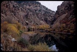
- Canyons, Glenwood Canyon (Colo.), Cliffs, Utility poles, Trees, Rocks, Colorado River (Colo.-Mexico), Grasses, Reflections, Shrubs, Railroads, and Rivers
- Series:
- 10-53
- Creator:
- Cushman, Charles W., 1896-1972
- Date Created:
- 1953-10-13
- Genre:
- Landscape photographs
- Frame Number:
- 3
- County:
- Garfield
- Abstract:
- Glenwood Canyon above Shoshone
- Call Number:
- P06843
- City:
- Shoshone
- Country:
- United States
- State/Province:
- Colorado
- Alternate Identifier:
- 1053.3
- Persistent URL:
- http://purl.dlib.indiana.edu/iudl/archives/cushman/P06843
- Holding Location:
- Bloomington - University Archives
Wells Library E460
1320 E 10th St.
Bloomington, IN 47405
Contact at archives@indiana.edu, 812-855-1127
-
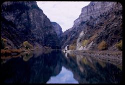
- Description:
- 50 f 6.3
- Subject:
- Rocks, Canyons, Grasses, Cliffs, Trees, Colorado River (Colo.-Mexico), Shrubs, Utility poles, Reflections, Railroads, Rivers, and Glenwood Canyon (Colo.)
- Series:
- 10-53
- Creator:
- Cushman, Charles W., 1896-1972
- Date Created:
- 1953-10-13
- Genre:
- Landscape photographs
- Frame Number:
- 2
- County:
- Garfield
- Abstract:
- Glenwood Canyon above Shoshone
- Call Number:
- P06842
- City:
- Shoshone
- Country:
- United States
- State/Province:
- Colorado
- Alternate Identifier:
- 1053.2
- Persistent URL:
- http://purl.dlib.indiana.edu/iudl/archives/cushman/P06842
- Holding Location:
- Bloomington - University Archives
Wells Library E460
1320 E 10th St.
Bloomington, IN 47405
Contact at archives@indiana.edu, 812-855-1127
-
- Description:
- 50 5.6
- Subject:
- Glenwood Canyon (Colo.), Railings, Canyons, Grasses, Roads, Shoshone Lake (Colo.), Trees, Colorado River (Colo.-Mexico), Buildings, Lakes & ponds, Utilit...
- Series:
- 10-53
- Creator:
- Cushman, Charles W., 1896-1972
- Date Created:
- 1953-10-13
- Genre:
- Landscape photographs
- Frame Number:
- 1
- County:
- Garfield
- Abstract:
- Shoshone lake in Glenwood canyon
- Call Number:
- P06841
- City:
- Shoshone
- Country:
- United States
- State/Province:
- Colorado
- Alternate Identifier:
- 1053.1
- Persistent URL:
- http://purl.dlib.indiana.edu/iudl/archives/cushman/P06841
- Holding Location:
- Bloomington - University Archives
Wells Library E460
1320 E 10th St.
Bloomington, IN 47405
Contact at archives@indiana.edu, 812-855-1127
-
- Description:
- 50 f 8
- Subject:
- Rocks, Valleys, Grasses, Cliffs, Trees, Pines, Mountains, Shrubs, Rivers, Glenwood Canyon (Colo.), Canyons, and Colorado River (Colo.-Mexico)
- Series:
- 9-53
- Creator:
- Cushman, Charles W., 1896-1972
- Date Created:
- 1953-10-13
- Frame Number:
- 39
- County:
- Garfield
- Abstract:
- Glenwood canyon
- Call Number:
- P06840
- City:
- Glenwood Springs
- Country:
- United States
- State/Province:
- Colorado
- Alternate Identifier:
- 953.39
- Persistent URL:
- http://purl.dlib.indiana.edu/iudl/archives/cushman/P06840
- Holding Location:
- Bloomington - University Archives
Wells Library E460
1320 E 10th St.
Bloomington, IN 47405
Contact at archives@indiana.edu, 812-855-1127
-
- Description:
- 50 f 8
- Subject:
- Canyons, Grasses, Cliffs, Trees, Red Canyon (Garfield County, Colo.), Tree limbs, Mountains, Rock formations, Clouds, and Hills
- Series:
- 9-53
- Creator:
- Cushman, Charles W., 1896-1972
- Date Created:
- 1953-10-13
- Genre:
- Landscape photographs
- Frame Number:
- 38
- County:
- Garfield
- Abstract:
- Red Canyon, south of Glenwood Spgs.
- Call Number:
- P06839
- City:
- Glenwood Springs
- Country:
- United States
- State/Province:
- Colorado
- Alternate Identifier:
- 953.38
- Persistent URL:
- http://purl.dlib.indiana.edu/iudl/archives/cushman/P06839
- Holding Location:
- Bloomington - University Archives
Wells Library E460
1320 E 10th St.
Bloomington, IN 47405
Contact at archives@indiana.edu, 812-855-1127
-
- Description:
- 50 f 6.3 Pola
- Subject:
- Valleys, Hills, Mountains, Shrubs, Grasses, and Clouds
- Series:
- 9-53
- Creator:
- Cushman, Charles W., 1896-1972
- Date Created:
- 1953-10-12
- Genre:
- Landscape photographs
- Frame Number:
- 36
- County:
- Garfield
- Abstract:
- Looking south across Grand Valley at 2:10
- Call Number:
- P06837
- City:
- Parachute
- Country:
- United States
- State/Province:
- Colorado
- Alternate Identifier:
- 953.36
- Persistent URL:
- http://purl.dlib.indiana.edu/iudl/archives/cushman/P06837
- Holding Location:
- Bloomington - University Archives
Wells Library E460
1320 E 10th St.
Bloomington, IN 47405
Contact at archives@indiana.edu, 812-855-1127
-
- Description:
- 50 f 11
- Subject:
- Grasses, Roads, Trees, Mountains, Fences, Shrubs, Clouds, Hills, Cliffs, and Bridges
- Series:
- 9-53
- Creator:
- Cushman, Charles W., 1896-1972
- Date Created:
- 1953-10-12
- Genre:
- Landscape photographs
- Frame Number:
- 35
- County:
- Mesa
- Abstract:
- Mtns near De Beque
- Call Number:
- P06836
- City:
- De Beque
- Country:
- United States
- State/Province:
- Colorado
- Alternate Identifier:
- 953.35
- Persistent URL:
- http://purl.dlib.indiana.edu/iudl/archives/cushman/P06836
- Holding Location:
- Bloomington - University Archives
Wells Library E460
1320 E 10th St.
Bloomington, IN 47405
Contact at archives@indiana.edu, 812-855-1127
-
- Description:
- 50 f 8 Pola
- Subject:
- Rocks, Canyons, Grasses, Roads, Automobiles, Mesas, Colorado River (Colo.-Mexico), Mountains, Shrubs, Clouds, Hills, Rivers, and Trees
- Series:
- 9-53
- Creator:
- Cushman, Charles W., 1896-1972
- Date Created:
- 1953-10-12
- Genre:
- Landscape photographs
- Frame Number:
- 34
- County:
- Mesa
- Abstract:
- View north up river around bend
- Call Number:
- P06835
- City:
- Grand Junction
- Country:
- United States
- State/Province:
- Colorado
- Alternate Identifier:
- 953.34
- Persistent URL:
- http://purl.dlib.indiana.edu/iudl/archives/cushman/P06835
- Holding Location:
- Bloomington - University Archives
Wells Library E460
1320 E 10th St.
Bloomington, IN 47405
Contact at archives@indiana.edu, 812-855-1127
-
- Description:
- 50 f 11
- Subject:
- Canyons, Hills, Roads, Mountains, Shrubs, Rocks, Colorado River (Colo.-Mexico), Grasses, Mesas, Horseshoe Canyon (Colo.), Clouds, and Rivers
- Series:
- 9-53
- Creator:
- Cushman, Charles W., 1896-1972
- Date Created:
- 1953-10-12
- Genre:
- Landscape photographs
- Frame Number:
- 33
- County:
- Mesa
- Abstract:
- Colorado river in Horseshoe Canyon
- Call Number:
- P06834
- City:
- Grand Junction
- Country:
- United States
- State/Province:
- Colorado
- Alternate Identifier:
- 953.33
- Persistent URL:
- http://purl.dlib.indiana.edu/iudl/archives/cushman/P06834
- Holding Location:
- Bloomington - University Archives
Wells Library E460
1320 E 10th St.
Bloomington, IN 47405
Contact at archives@indiana.edu, 812-855-1127
-
- Description:
- 50 f 11
- Subject:
- Erosion, Canyons, Valleys, Denver and Rio Grande Western Railway Company, Roads, Cliffs, Rocks, Colorado River (Colo.-Mexico), Rivers, Horseshoe Canyon (Colo...
- Series:
- 9-53
- Creator:
- Cushman, Charles W., 1896-1972
- Date Created:
- 1953-10-12
- Genre:
- Snapshots
- Frame Number:
- 32
- County:
- Mesa
- Abstract:
- Freight train in curve
- Call Number:
- P06833
- City:
- Grand Junction
- Country:
- United States
- State/Province:
- Colorado
- Alternate Identifier:
- 953.32
- Persistent URL:
- http://purl.dlib.indiana.edu/iudl/archives/cushman/P06833
- Holding Location:
- Bloomington - University Archives
Wells Library E460
1320 E 10th St.
Bloomington, IN 47405
Contact at archives@indiana.edu, 812-855-1127
-
- Description:
- 50 f 11
- Subject:
- Rocks, Canyons, Grasses, Cliffs, Colorado River (Colo.-Mexico), Horseshoe Canyon (Colo.), Clouds, Reflections, Railroads, Rivers, and Valleys
- Series:
- 9-53
- Creator:
- Cushman, Charles W., 1896-1972
- Date Created:
- 1953-10-12
- Genre:
- Landscape photographs
- Frame Number:
- 31
- County:
- Mesa
- Abstract:
- Up and [?]on the Colorado river from top of horseshoe canyon on curve 28 miles east of Grand Junction
- Call Number:
- P06832
- City:
- Grand Junction
- Country:
- United States
- State/Province:
- Colorado
- Alternate Identifier:
- 953.31
- Persistent URL:
- http://purl.dlib.indiana.edu/iudl/archives/cushman/P06832
- Holding Location:
- Bloomington - University Archives
Wells Library E460
1320 E 10th St.
Bloomington, IN 47405
Contact at archives@indiana.edu, 812-855-1127
-
- Description:
- 50 f 11
- Subject:
- Rocks, Canyons, Grasses, Roads, Colorado River (Colo.-Mexico), Horseshoe Canyon (Colo.), Clouds, Railroads, Rivers, Valleys, and Cliffs
- Series:
- 9-53
- Creator:
- Cushman, Charles W., 1896-1972
- Date Created:
- 1953-10-12
- Genre:
- Landscape photographs
- Frame Number:
- 30
- County:
- Mesa
- Abstract:
- Up and [?]on the Colorado river from top of horseshoe canyon on curve 28 miles east of Grand Junction
- Call Number:
- P06831
- City:
- Grand Junction
- Country:
- United States
- State/Province:
- Colorado
- Alternate Identifier:
- 953.30
- Persistent URL:
- http://purl.dlib.indiana.edu/iudl/archives/cushman/P06831
- Holding Location:
- Bloomington - University Archives
Wells Library E460
1320 E 10th St.
Bloomington, IN 47405
Contact at archives@indiana.edu, 812-855-1127
-
- Description:
- 50 f 11
- Subject:
- Rocks, Canyons, Grasses, Colorado River (Colo.-Mexico), Horseshoe Canyon (Colo.), Mountains, Shrubs, Clouds, Hills, and Rivers
- Series:
- 9-53
- Creator:
- Cushman, Charles W., 1896-1972
- Date Created:
- 1953-10-12
- Genre:
- Landscape photographs
- Frame Number:
- 29
- County:
- Mesa
- Abstract:
- Up and [?]on the Colorado river from top of horseshoe canyon on curve 28 miles east of Grand Junction
- Call Number:
- P06830
- City:
- Grand Junction
- Country:
- United States
- State/Province:
- Colorado
- Alternate Identifier:
- 953.29
- Persistent URL:
- http://purl.dlib.indiana.edu/iudl/archives/cushman/P06830
- Holding Location:
- Bloomington - University Archives
Wells Library E460
1320 E 10th St.
Bloomington, IN 47405
Contact at archives@indiana.edu, 812-855-1127
-
- Description:
- 50 f 11
- Subject:
- Erosion, Canyons, Cliffs, Mountains, Dirt roads, Trees, Rocks, California Zephyr (Express train), Colorado River (Colo.-Mexico), Grasses, Railroads, Clouds, ...
- Series:
- 9-53
- Creator:
- Cushman, Charles W., 1896-1972
- Date Created:
- 1953-10-12
- Genre:
- Snapshots
- Frame Number:
- 27
- County:
- Mesa
- Abstract:
- California Zephyr along Colorado river.
- Call Number:
- P06828
- City:
- Grand Junction
- Country:
- United States
- State/Province:
- Colorado
- Alternate Identifier:
- 953.27
- Persistent URL:
- http://purl.dlib.indiana.edu/iudl/archives/cushman/P06828
- Holding Location:
- Bloomington - University Archives
Wells Library E460
1320 E 10th St.
Bloomington, IN 47405
Contact at archives@indiana.edu, 812-855-1127
-
- Description:
- 50 f 7 Pola
- Subject:
- Pyramidal mountain, Grasses, Trees, Mountains, Rock formations, Clouds, Rivers, Erosion, Mesas, and Formations (Geology)
- Series:
- 9-53
- Creator:
- Cushman, Charles W., 1896-1972
- Date Created:
- 1953-10-12
- Genre:
- Landscape photographs
- Frame Number:
- 28
- Street Address:
- United States Highway 6
- County:
- Mesa
- Abstract:
- Pyramid above Co[?] Colorado river.
- Call Number:
- P06829
- City:
- Grand Junction
- Country:
- United States
- State/Province:
- Colorado
- Physical Description:
- Image was originally mounted in a glass enclosure. Before digitization, the image was removed and placed in a Wess Plastic, Inc. brand, 2" x 2", pl...
- Alternate Identifier:
- 953.28
- Persistent URL:
- http://purl.dlib.indiana.edu/iudl/archives/cushman/P06829
- Holding Location:
- Bloomington - University Archives
Wells Library E460
1320 E 10th St.
Bloomington, IN 47405
Contact at archives@indiana.edu, 812-855-1127
-
- Description:
- 50 f 8 Pola
- Subject:
- Grasses, Cliffs, Mesas, Plains, Mountains, Clouds, Erosion, Trees, and Sandstone
- Series:
- 9-53
- Creator:
- Cushman, Charles W., 1896-1972
- Date Created:
- 1953-10-12
- Genre:
- Landscape photographs
- Frame Number:
- 26
- County:
- Mesa
- Abstract:
- Great sandstone promontory 10 mi east of Grnd Jnctn.
- Call Number:
- P06827
- City:
- Grand Junction
- Country:
- United States
- State/Province:
- Colorado
- Physical Description:
- Image was originally mounted in a glass enclosure. Before digitization, the image was removed and placed in a Wess Plastic, Inc. brand, 2" x 2", pl...
- Alternate Identifier:
- 953.26
- Persistent URL:
- http://purl.dlib.indiana.edu/iudl/archives/cushman/P06827
- Holding Location:
- Bloomington - University Archives
Wells Library E460
1320 E 10th St.
Bloomington, IN 47405
Contact at archives@indiana.edu, 812-855-1127
-
- Description:
- 50 f 6.3 Pola
- Subject:
- Grasses, Mesas, Mountains, Fences, Clouds, Hills, Erosion, and Trees
- Series:
- 9-53
- Creator:
- Cushman, Charles W., 1896-1972
- Date Created:
- 1953-10-12
- Genre:
- Landscape photographs
- Frame Number:
- 25
- Street Address:
- United States Highway 6
- County:
- Mesa
- Abstract:
- Mountain wall east of Grand Jnctn from US 6.
- Call Number:
- P06826
- City:
- Grand Junction
- Country:
- United States
- State/Province:
- Colorado
- Alternate Identifier:
- 953.25
- Persistent URL:
- http://purl.dlib.indiana.edu/iudl/archives/cushman/P06826
- Holding Location:
- Bloomington - University Archives
Wells Library E460
1320 E 10th St.
Bloomington, IN 47405
Contact at archives@indiana.edu, 812-855-1127
-
- Description:
- 50 f 8 Pola
- Subject:
- Erosion, Colorado National Monument (Colo.), Buttes, Plains, Mountains, Shrubs, Clouds, Hills, and Grasses
- Series:
- 9-53
- Creator:
- Cushman, Charles W., 1896-1972
- Date Created:
- 1953-10-12
- Genre:
- Landscape photographs
- Frame Number:
- 24
- County:
- Mesa
- Abstract:
- Buttes near Colo National Mon.
- Call Number:
- P06825
- City:
- Grand Junction
- Country:
- United States
- State/Province:
- Colorado
- Physical Description:
- Image was originally mounted in a glass enclosure. Before digitization, the image was removed and placed in a Wess Plastic, Inc. brand, 2" x 2", pl...
- Alternate Identifier:
- 953.24
- Persistent URL:
- http://purl.dlib.indiana.edu/iudl/archives/cushman/P06825
- Holding Location:
- Bloomington - University Archives
Wells Library E460
1320 E 10th St.
Bloomington, IN 47405
Contact at archives@indiana.edu, 812-855-1127
-
- Description:
- 50 f 6.3 Pola
- Subject:
- Grasses, Roads, Colorado National Monument (Colo.), Automobiles, Trees, Plains, Mountains, Shrubs, Traffic signs & signals, Clouds, Hills, and Mesas
- Series:
- 9-53
- Creator:
- Cushman, Charles W., 1896-1972
- Date Created:
- 1953-10-12
- Genre:
- Landscape photographs
- Frame Number:
- 23
- Street Address:
- United States Highway 50
- County:
- Mesa
- Abstract:
- View west from Grand Junction toward Colo Nat'l Mon.
- Call Number:
- P06824
- City:
- Grand Junction
- Country:
- United States
- State/Province:
- Colorado
- Physical Description:
- Image was originally mounted in a glass enclosure. Before digitization, the image was removed and placed in a Wess Plastic, Inc. brand, 2" x 2", pl...
- Alternate Identifier:
- 953.23
- Persistent URL:
- http://purl.dlib.indiana.edu/iudl/archives/cushman/P06824
- Holding Location:
- Bloomington - University Archives
Wells Library E460
1320 E 10th St.
Bloomington, IN 47405
Contact at archives@indiana.edu, 812-855-1127
-
- Description:
- 25 f 8
- Subject:
- Mills, Puddles, Houses, Dirt roads, Mountains, Massive, Mount (Colo.), Huts, Utility poles, Rocks, Electric lines, and Grasses
- Series:
- 25-52
- Creator:
- Cushman, Charles W., 1896-1972
- Date Created:
- 1952-11-02
- Genre:
- Views
- Frame Number:
- 21
- Street Address:
- Stringtown
- County:
- Lake
- Abstract:
- Shacks near Mill - Massive in bkgrd.
- Call Number:
- P06390
- City:
- Leadville
- Country:
- United States
- State/Province:
- Colorado
- Alternate Identifier:
- 2552.21
- Persistent URL:
- http://purl.dlib.indiana.edu/iudl/archives/cushman/P06390
- Holding Location:
- Bloomington - University Archives
Wells Library E460
1320 E 10th St.
Bloomington, IN 47405
Contact at archives@indiana.edu, 812-855-1127
-
- Description:
- 25 f 6.3
- Subject:
- Rocks, Grasses, Abandoned buildings, Mountains, Hills, Building deterioration, and Ruins
- Series:
- 25-52
- Creator:
- Cushman, Charles W., 1896-1972
- Date Created:
- 1952-11-02
- Genre:
- Snapshots
- Frame Number:
- 18
- County:
- Lake
- Abstract:
- Ruins atop hill at east of Leadville.
- Call Number:
- P06387
- City:
- Leadville
- Country:
- United States
- State/Province:
- Colorado
- Alternate Identifier:
- 2552.18
- Persistent URL:
- http://purl.dlib.indiana.edu/iudl/archives/cushman/P06387
- Holding Location:
- Bloomington - University Archives
Wells Library E460
1320 E 10th St.
Bloomington, IN 47405
Contact at archives@indiana.edu, 812-855-1127
-
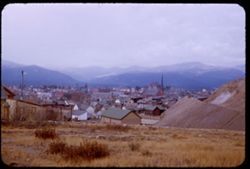
- Description:
- 25 f 6.3
- Subject:
- Rocks, Grasses, Houses, Streets, Mountains, Churches, Shrubs, Hotels, Hills, Cities & towns, and Buildings
- Series:
- 25-52
- Creator:
- Cushman, Charles W., 1896-1972
- Date Created:
- 1952-11-02
- Genre:
- Cityscape photographs
- Frame Number:
- 19
- County:
- Lake
- Abstract:
- Leadville from [?] SE.
- Call Number:
- P06388
- City:
- Leadville
- Country:
- United States
- State/Province:
- Colorado
- Alternate Identifier:
- 2552.19
- Persistent URL:
- http://purl.dlib.indiana.edu/iudl/archives/cushman/P06388
- Holding Location:
- Bloomington - University Archives
Wells Library E460
1320 E 10th St.
Bloomington, IN 47405
Contact at archives@indiana.edu, 812-855-1127
-
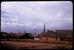
- Description:
- 25 f 5.6 Pola
- Subject:
- Rocky Mountains, Crosses, Grasses, Houses, Mountains, Churches, Clotheslines, Clouds, Railroad tracks, Elbert, Mount (Colo.), Buildings, Massive, Mount (Colo...
- Series:
- 25-52
- Creator:
- Cushman, Charles W., 1896-1972
- Date Created:
- 1952-11-02
- Genre:
- Views
- Frame Number:
- 15
- County:
- Lake
- Abstract:
- Mt Elbert from Leadville.
- Call Number:
- P06384
- City:
- Leadville
- Country:
- United States
- State/Province:
- Colorado
- Alternate Identifier:
- 2552.15
- Persistent URL:
- http://purl.dlib.indiana.edu/iudl/archives/cushman/P06384
- Holding Location:
- Bloomington - University Archives
Wells Library E460
1320 E 10th St.
Bloomington, IN 47405
Contact at archives@indiana.edu, 812-855-1127
-
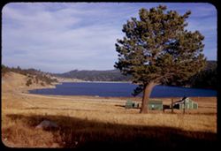
- Description:
- 25 f 9
- Subject:
- Lakes & ponds, Meadows, Hills, Roads, Outbuildings, Mountains, Trees, Shadows, Grasses, Fences, and Houses
- Series:
- 24-52
- Creator:
- Cushman, Charles W., 1896-1972
- Date Created:
- 1952-10-31
- Genre:
- Landscape photographs
- Frame Number:
- 32
- County:
- Boulder
- Abstract:
- Little mountain lake at Nederland.
- Call Number:
- P06363
- City:
- Nederland
- Country:
- United States
- State/Province:
- Colorado
- Alternate Identifier:
- 2452.32
- Persistent URL:
- http://purl.dlib.indiana.edu/iudl/archives/cushman/P06363
- Holding Location:
- Bloomington - University Archives
Wells Library E460
1320 E 10th St.
Bloomington, IN 47405
Contact at archives@indiana.edu, 812-855-1127
-
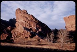
- Description:
- 25 f 8
- Subject:
- Grasses, Cliffs, Parks, Trees, Boulders, Shadows, Buttes, Shrubs, Red Rocks Park (Jefferson County, Colo.), and Rock formations
- Series:
- 24-52
- Creator:
- Cushman, Charles W., 1896-1972
- Date Created:
- 1952-10-30
- Genre:
- Landscape photographs
- Frame Number:
- 12
- County:
- Jefferson
- Abstract:
- Tilted rock on road down
- Call Number:
- P06343
- City:
- Morrison
- Country:
- United States
- State/Province:
- Colorado
- Alternate Identifier:
- 2452.12
- Persistent URL:
- http://purl.dlib.indiana.edu/iudl/archives/cushman/P06343
- Holding Location:
- Bloomington - University Archives
Wells Library E460
1320 E 10th St.
Bloomington, IN 47405
Contact at archives@indiana.edu, 812-855-1127
-
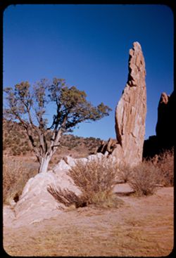
- Description:
- 25 f 11
- Subject:
- Grasses, Cliffs, Trees, Pines, Buttes, Rock formations, Hills, Garden of the Gods (Colorado Springs, Colo.), and Shrubs
- Series:
- 23-52
- Creator:
- Cushman, Charles W., 1896-1972
- Date Created:
- 1952-10-29
- Genre:
- Identification photographs
- Frame Number:
- 30
- County:
- El Paso
- Abstract:
- Pine & Chip
- Call Number:
- P06322
- City:
- Colorado Springs
- Country:
- United States
- State/Province:
- Colorado
- Alternate Identifier:
- 2352.30
- Persistent URL:
- http://purl.dlib.indiana.edu/iudl/archives/cushman/P06322
- Holding Location:
- Bloomington - University Archives
Wells Library E460
1320 E 10th St.
Bloomington, IN 47405
Contact at archives@indiana.edu, 812-855-1127
-
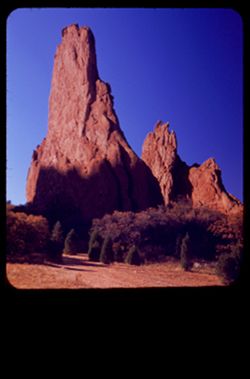
- Description:
- 25 f 6 Pola
- Subject:
- Cliffs, Garden of the Gods (Colorado Springs, Colo.), Dirt roads, Shrubs, Tall splinters, Shadows, Buttes, Grasses, Trees, and Rock formations
- Series:
- 23-52
- Creator:
- Cushman, Charles W., 1896-1972
- Date Created:
- 1952-10-29
- Genre:
- Landscape photographs
- Frame Number:
- 29
- County:
- El Paso
- Persons Pictured:
- Cushman, Charles W. (Charles Weever), 1896-1972
- Abstract:
- Two tall splinters
- Call Number:
- P06321
- City:
- Colorado Springs
- Country:
- United States
- State/Province:
- Colorado
- Physical Description:
- masked.
- Alternate Identifier:
- 2352.29
- Persistent URL:
- http://purl.dlib.indiana.edu/iudl/archives/cushman/P06321
- Holding Location:
- Bloomington - University Archives
Wells Library E460
1320 E 10th St.
Bloomington, IN 47405
Contact at archives@indiana.edu, 812-855-1127
-
- Description:
- 25 f 11
- Subject:
- Grasses, Cliffs, Trees, Mountains, Buildings, Rock formations, Hills, Garden of the Gods (Colorado Springs, Colo.), Houses, and Shrubs
- Series:
- 23-52
- Creator:
- Cushman, Charles W., 1896-1972
- Date Created:
- 1952-10-29
- Genre:
- Landscape photographs
- Frame Number:
- 23
- County:
- El Paso
- Abstract:
- Rocks north of Garden of the Gods
- Call Number:
- P06315
- City:
- Colorado Springs
- Country:
- United States
- State/Province:
- Colorado
- Alternate Identifier:
- 2352.23
- Persistent URL:
- http://purl.dlib.indiana.edu/iudl/archives/cushman/P06315
- Holding Location:
- Bloomington - University Archives
Wells Library E460
1320 E 10th St.
Bloomington, IN 47405
Contact at archives@indiana.edu, 812-855-1127
-
- Description:
- 25 f 5.2 Pola
- Subject:
- Grasses, Trees, Broadmoor (Hotel : Colorado Springs, Colo.), Buildings, Shrubs, Lakes & ponds, Hotels, and Lawns
- Series:
- 22-52
- Creator:
- Cushman, Charles W., 1896-1972
- Date Created:
- 1952-10-28
- Genre:
- Views and Cityscape photographs
- Frame Number:
- 32
- County:
- El Paso
- Abstract:
- Broadmoor Hotel & Colo Spgs in haze beyond
- Call Number:
- P06286
- City:
- Colorado Springs
- Country:
- United States
- State/Province:
- Colorado
- Alternate Identifier:
- 2252.32
- Persistent URL:
- http://purl.dlib.indiana.edu/iudl/archives/cushman/P06286
- Holding Location:
- Bloomington - University Archives
Wells Library E460
1320 E 10th St.
Bloomington, IN 47405
Contact at archives@indiana.edu, 812-855-1127
-
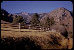
- Description:
- 25 f 9
- Subject:
- Rocky Mountains, Grasses, Trails & paths, Trees, Meadows, Mountains, Fences, Shrubs, and Hills
- Series:
- 22-52
- Creator:
- Cushman, Charles W., 1896-1972
- Date Created:
- 1952-10-28
- Genre:
- Landscape photographs
- Frame Number:
- 31
- County:
- El Paso
- Abstract:
- Mtns above & west of Broadmoor
- Call Number:
- P06285
- City:
- Broadmoor
- Country:
- United States
- State/Province:
- Colorado
- Alternate Identifier:
- 2252.31
- Persistent URL:
- http://purl.dlib.indiana.edu/iudl/archives/cushman/P06285
- Holding Location:
- Bloomington - University Archives
Wells Library E460
1320 E 10th St.
Bloomington, IN 47405
Contact at archives@indiana.edu, 812-855-1127
-
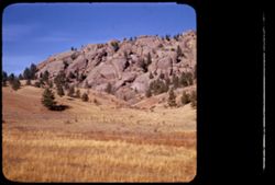
- Description:
- 25 f 11
- Subject:
- Rocky Mountains, Hills, Barbed wire, Mountains, Boulders, Rock formations, Fences, Trees, and Grasses
- Series:
- 22-52
- Creator:
- Cushman, Charles W., 1896-1972
- Date Created:
- 1952-10-27
- Genre:
- Landscape photographs
- Frame Number:
- 23
- Street Address:
- Colorado State Highway 143
- County:
- Teller
- Abstract:
- And to the left, this scene-the Rock is truly overlapped
- Call Number:
- P06277
- City:
- Cripple Creek and Florissant
- Country:
- United States
- State/Province:
- Colorado
- Physical Description:
- masked.
- Alternate Identifier:
- 2252.23
- Persistent URL:
- http://purl.dlib.indiana.edu/iudl/archives/cushman/P06277
- Holding Location:
- Bloomington - University Archives
Wells Library E460
1320 E 10th St.
Bloomington, IN 47405
Contact at archives@indiana.edu, 812-855-1127
-
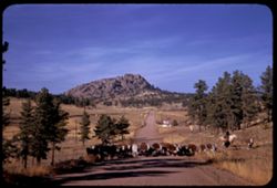
- Description:
- 25 f 11
- Subject:
- Grasses, Roads, Cowboys, Trees, Signs (Notices), Mountains, Rock formations, Cows, and Hills
- Series:
- 22-52
- Creator:
- Cushman, Charles W., 1896-1972
- Date Created:
- 1952-10-27
- Genre:
- Landscape photographs
- Frame Number:
- 21
- Street Address:
- Colorado State Highway 143
- County:
- Teller
- Abstract:
- Cows-lots of them-on Colo. 143
- Call Number:
- P06275
- City:
- Florissant and Cripple Creek
- Country:
- United States
- State/Province:
- Colorado
- Alternate Identifier:
- 2252.21
- Persistent URL:
- http://purl.dlib.indiana.edu/iudl/archives/cushman/P06275
- Holding Location:
- Bloomington - University Archives
Wells Library E460
1320 E 10th St.
Bloomington, IN 47405
Contact at archives@indiana.edu, 812-855-1127
-
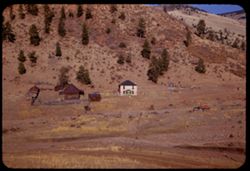
- Description:
- 25 f 11
- Subject:
- Houses, Ranches, Outbuildings, Mountains, Shrubs, Trees, and Grasses
- Series:
- 22-52
- Creator:
- Cushman, Charles W., 1896-1972
- Date Created:
- 1952-10-27
- Genre:
- Views
- Frame Number:
- 20
- County:
- Teller
- Abstract:
- Pink house 2 mi west of Cripple Creek
- Call Number:
- P06274
- City:
- Cripple Creek
- Country:
- United States
- State/Province:
- Colorado
- Alternate Identifier:
- 2252.20
- Persistent URL:
- http://purl.dlib.indiana.edu/iudl/archives/cushman/P06274
- Holding Location:
- Bloomington - University Archives
Wells Library E460
1320 E 10th St.
Bloomington, IN 47405
Contact at archives@indiana.edu, 812-855-1127
-
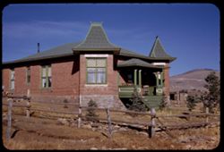
- Description:
- 25 f 11
- Subject:
- Rocks, Grasses, Houses, Trees, Brick houses, Stairways, Fences, Chairs, Windows, Hills, Columns, Porches, and Utility poles
- Series:
- 22-52
- Creator:
- Cushman, Charles W., 1896-1972
- Date Created:
- 1952-10-27
- Genre:
- Architectural photographs
- Frame Number:
- 18
- County:
- Teller
- Abstract:
- Brick house on west edge of Crip Crk (Elev. 9800)
- Call Number:
- P06272
- City:
- Cripple Creek
- Country:
- United States
- State/Province:
- Colorado
- Alternate Identifier:
- 2252.18
- Persistent URL:
- http://purl.dlib.indiana.edu/iudl/archives/cushman/P06272
- Holding Location:
- Bloomington - University Archives
Wells Library E460
1320 E 10th St.
Bloomington, IN 47405
Contact at archives@indiana.edu, 812-855-1127
-
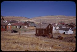
- Description:
- 25 f 11
- Subject:
- Rocks, Electric lines, Houses, Automobiles, Trees, Streets, Cities & towns, Fences, Shrubs, Hills, Utility poles, and Grasses
- Series:
- 22-52
- Creator:
- Cushman, Charles W., 1896-1972
- Date Created:
- 1952-10-27
- Genre:
- Views
- Frame Number:
- 17
- County:
- Teller
- Abstract:
- Cripple Creek=NE sec.
- Call Number:
- P06271
- City:
- Cripple Creek
- Country:
- United States
- State/Province:
- Colorado
- Alternate Identifier:
- 2252.17
- Persistent URL:
- http://purl.dlib.indiana.edu/iudl/archives/cushman/P06271
- Holding Location:
- Bloomington - University Archives
Wells Library E460
1320 E 10th St.
Bloomington, IN 47405
Contact at archives@indiana.edu, 812-855-1127
-
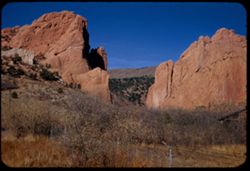
- Description:
- 25 f 11+
- Subject:
- Rock formations, Fences, Garden of the Gods (Colorado Springs, Colo.), Mountains, Grasses, Trees, Barbed wire, Shrubs, and Buttes
- Series:
- 21-52
- Creator:
- Cushman, Charles W., 1896-1972
- Date Created:
- 1952-10-27
- Genre:
- Landscape photographs
- Frame Number:
- 16
- County:
- El Paso
- Abstract:
- Gateway Garden to Gods
- Call Number:
- P06247
- City:
- Colorado Springs
- Country:
- United States
- State/Province:
- Colorado
- Alternate Identifier:
- 2152.16
- Persistent URL:
- http://purl.dlib.indiana.edu/iudl/archives/cushman/P06247
- Holding Location:
- Bloomington - University Archives
Wells Library E460
1320 E 10th St.
Bloomington, IN 47405
Contact at archives@indiana.edu, 812-855-1127
-
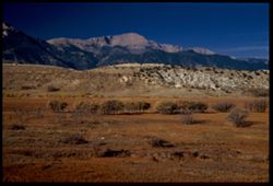
- Description:
- 25 f 7 Pola
- Subject:
- Grasses, Trees, Mountains, Shrubs, White House Ranch (Colorado Springs, Colo.), Pikes Peak (Colo.), and Hills
- Series:
- 21-52
- Creator:
- Cushman, Charles W., 1896-1972
- Date Created:
- 1952-10-27
- Genre:
- Landscape photographs
- Frame Number:
- 15
- County:
- El Paso
- Persons Pictured:
- Cushman, Charles W. (Charles Weever), 1896-1972
- Abstract:
- The majesty of Pike's Peak-view from White House ranch
- Call Number:
- P06246
- City:
- Colorado Springs
- Country:
- United States
- State/Province:
- Colorado
- Physical Description:
- Image was originally mounted in a glass enclosure. Before digitization, the image was removed and placed in a Wess Plastic, Inc. brand, 2" x 2", pl...
- Alternate Identifier:
- 2152.15
- Persistent URL:
- http://purl.dlib.indiana.edu/iudl/archives/cushman/P06246
- Holding Location:
- Bloomington - University Archives
Wells Library E460
1320 E 10th St.
Bloomington, IN 47405
Contact at archives@indiana.edu, 812-855-1127
-
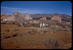
- Description:
- 25 f 12
- Subject:
- Meadows, Hills, Ranches, Roads, Bridges, Mountains, Utility poles, Trees, Buttes, Grasses, White House Ranch (Colorado Springs, Colo.), Houses, Garden of the...
- Series:
- 21-52
- Creator:
- Cushman, Charles W., 1896-1972
- Date Created:
- 1952-10-27
- Genre:
- Landscape photographs
- Frame Number:
- 14
- County:
- El Paso
- Abstract:
- Across White House Ranch to Garden of Gods
- Call Number:
- P06245
- City:
- Colorado Springs
- Country:
- United States
- State/Province:
- Colorado
- Alternate Identifier:
- 2152.14
- Persistent URL:
- http://purl.dlib.indiana.edu/iudl/archives/cushman/P06245
- Holding Location:
- Bloomington - University Archives
Wells Library E460
1320 E 10th St.
Bloomington, IN 47405
Contact at archives@indiana.edu, 812-855-1127
-
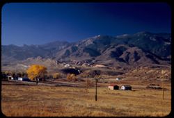
- Description:
- 25 f 6.3 Pola
- Subject:
- Grasses, Roads, Trees, Meadows, Mountains, Pikes Peak (Colo.), Hills, Utility poles, Garden of the Gods (Colorado Springs, Colo.), and Houses
- Series:
- 21-52
- Creator:
- Cushman, Charles W., 1896-1972
- Date Created:
- 1952-10-27
- Genre:
- Landscape photographs
- Frame Number:
- 13
- County:
- El Paso
- Abstract:
- Low Mtns east of Pikes Pk. In early morning light
- Call Number:
- P06244
- City:
- Colorado Springs
- Country:
- United States
- State/Province:
- Colorado
- Alternate Identifier:
- 2152.13
- Persistent URL:
- http://purl.dlib.indiana.edu/iudl/archives/cushman/P06244
- Holding Location:
- Bloomington - University Archives
Wells Library E460
1320 E 10th St.
Bloomington, IN 47405
Contact at archives@indiana.edu, 812-855-1127
-
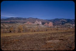
- Description:
- 25 f 13
- Subject:
- Grasses, Trees, Meadows, Mountains, Rock formations, Utility poles, Garden of the Gods (Colorado Springs, Colo.), and Buttes
- Series:
- 21-52
- Creator:
- Cushman, Charles W., 1896-1972
- Date Created:
- 1952-10-27
- Genre:
- Landscape photographs
- Frame Number:
- 12
- County:
- El Paso
- Abstract:
- Garden of the Gods in distance
- Call Number:
- P06243
- City:
- Colorado Springs
- Country:
- United States
- State/Province:
- Colorado
- Alternate Identifier:
- 2152.12
- Persistent URL:
- http://purl.dlib.indiana.edu/iudl/archives/cushman/P06243
- Holding Location:
- Bloomington - University Archives
Wells Library E460
1320 E 10th St.
Bloomington, IN 47405
Contact at archives@indiana.edu, 812-855-1127