
Search Constraints
You searched for:
Campus
IUB
Remove constraint Campus: IUB
Subject
Mountains
Remove constraint Subject: Mountains
Subject
Shrubs
Remove constraint Subject: Shrubs
« Previous |
1 - 100 of 1,198
|
Next »
Search Results
-
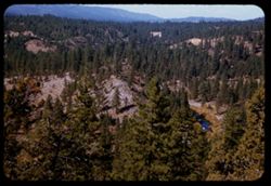
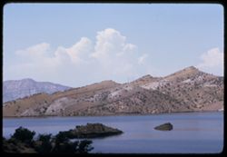
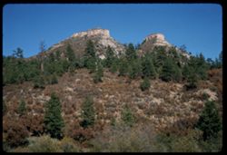
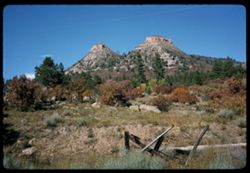
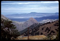
- Description:
- 50 f 8
- Subject:
- Trestles, Feather River (Calif.), Trees, Mountains, Shrubs, Bridges, and Rivers
- Series:
- 14-54
- Creator:
- Cushman, Charles W., 1896-1972
- Date Created:
- 1954-10-10
- Genre:
- Landscape photographs
- Frame Number:
- 24
- County:
- Plumas
- Abstract:
- View north from rd above Feather river 6 mi SW of Portola.
- Call Number:
- P15806
- City:
- Portola
- Country:
- United States
- State/Province:
- California
- Alternate Identifier:
- 1454.24
- Persistent URL:
- http://purl.dlib.indiana.edu/iudl/archives/cushman/P15806
- Holding Location:
- Bloomington - University Archives
Wells Library E460
1320 E 10th St.
Bloomington, IN 47405
Contact at archives@indiana.edu, 812-855-1127
-
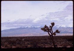
- Description:
- 100 f 9
- Subject:
- Deserts, Mojave Desert (Calif.), Mountains, Shrubs, Cactus, Tehachapi Mountains (Calif.), Clouds, Plains, and Snow
- Series:
- 3-69
- Creator:
- Cushman, Charles W., 1896-1972
- Date Created:
- 1969-03-21
- Genre:
- Landscape photographs
- Frame Number:
- 19
- Street Address:
- California State Highway 58
- County:
- Kern
- Abstract:
- Yellow fields Green hills Hwy 58
- Call Number:
- P15771
- Country:
- United States
- State/Province:
- California
- Alternate Identifier:
- 369.19
- Persistent URL:
- http://purl.dlib.indiana.edu/iudl/archives/cushman/P15771
- Holding Location:
- Bloomington - University Archives
Wells Library E460
1320 E 10th St.
Bloomington, IN 47405
Contact at archives@indiana.edu, 812-855-1127
-
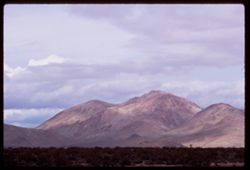
- Description:
- 100 f 9 TL
- Subject:
- Deserts, Mojave Desert (Calif.), Tehachapi Mountains (Calif.), Mountains, Shrubs, and Clouds
- Series:
- 3-69
- Creator:
- Cushman, Charles W., 1896-1972
- Date Created:
- 1969-03-21
- Genre:
- Landscape photographs
- Frame Number:
- 18
- Street Address:
- California State Highway 14
- County:
- Kern
- Abstract:
- Toward Tehachapi Mtns from Hwy 14
- Call Number:
- P15770
- City:
- Mojave
- Country:
- United States
- State/Province:
- California
- Alternate Identifier:
- 369.18
- Persistent URL:
- http://purl.dlib.indiana.edu/iudl/archives/cushman/P15770
- Holding Location:
- Bloomington - University Archives
Wells Library E460
1320 E 10th St.
Bloomington, IN 47405
Contact at archives@indiana.edu, 812-855-1127
-
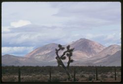
- Description:
- 100 f 9 TL
- Subject:
- Deserts, Mojave Desert (Calif.), Tehachapi Mountains (Calif.), Cactus, Mountains, Fences, Shrubs, and Clouds
- Series:
- 3-69
- Creator:
- Cushman, Charles W., 1896-1972
- Date Created:
- 1969-03-21
- Genre:
- Landscape photographs
- Frame Number:
- 17
- Street Address:
- California State Highway 14
- County:
- Kern
- Abstract:
- Toward Tehachapi Mtns from Hwy 14
- Call Number:
- P15769
- City:
- Mojave
- Country:
- United States
- State/Province:
- California
- Alternate Identifier:
- 369.17
- Persistent URL:
- http://purl.dlib.indiana.edu/iudl/archives/cushman/P15769
- Holding Location:
- Bloomington - University Archives
Wells Library E460
1320 E 10th St.
Bloomington, IN 47405
Contact at archives@indiana.edu, 812-855-1127
-
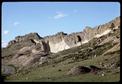
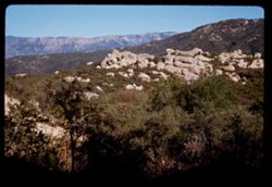
- Description:
- 100 f 9 TL
- Subject:
- Passes (Landforms), Cajon Pass (Calif.), Shrubs, Rock formations, Mountains, and Grasses
- Series:
- 3-69
- Creator:
- Cushman, Charles W., 1896-1972
- Date Created:
- 1969-03-20
- Genre:
- Landscape photographs
- Frame Number:
- 15
- County:
- San Bernardino
- Abstract:
- In Cajon Pass
- Call Number:
- P15767
- Country:
- United States
- State/Province:
- California
- Alternate Identifier:
- 369.15
- Persistent URL:
- http://purl.dlib.indiana.edu/iudl/archives/cushman/P15767
- Holding Location:
- Bloomington - University Archives
Wells Library E460
1320 E 10th St.
Bloomington, IN 47405
Contact at archives@indiana.edu, 812-855-1127
-
- Description:
- 100 f 11 TL
- Subject:
- Rocks, Families, Children, Valleys, Electric lines, Roads, Trees, Bicycles & tricycles, Palm Canyon (Calif.), Shrubs, and Mountains
- Series:
- 2-69
- Creator:
- Cushman, Charles W., 1896-1972
- Date Created:
- 1969-03-16
- Genre:
- Snapshots
- Frame Number:
- 29
- County:
- Riverside
- Call Number:
- P15746
- Country:
- United States
- State/Province:
- California
- Alternate Identifier:
- 269.29
- Persistent URL:
- http://purl.dlib.indiana.edu/iudl/archives/cushman/P15746
- Holding Location:
- Bloomington - University Archives
Wells Library E460
1320 E 10th St.
Bloomington, IN 47405
Contact at archives@indiana.edu, 812-855-1127
-
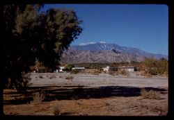
- Description:
- 100 f 9 TL
- Subject:
- San Jacinto Peak (Calif.), Mountains, Shrubs, Electric lines, Buildings, Palms, Grasses, and Snow
- Series:
- 2-69
- Creator:
- Cushman, Charles W., 1896-1972
- Date Created:
- 1969-03-16
- Genre:
- Landscape photographs and Views
- Frame Number:
- 25
- County:
- Riverside
- Abstract:
- China berry Mt. San Jacinto near Palm springs
- Call Number:
- P15742
- City:
- Palm Springs
- Country:
- United States
- State/Province:
- California
- Alternate Identifier:
- 269.25
- Persistent URL:
- http://purl.dlib.indiana.edu/iudl/archives/cushman/P15742
- Holding Location:
- Bloomington - University Archives
Wells Library E460
1320 E 10th St.
Bloomington, IN 47405
Contact at archives@indiana.edu, 812-855-1127
-
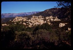
- Description:
- 100 f 9 TL
- Subject:
- Passes (Landforms), Hills, Cajon Pass (Calif.), Shrubs, Trees, Rock formations, Mountains, and Grasses
- Series:
- 2-69
- Creator:
- Cushman, Charles W., 1896-1972
- Date Created:
- 1969-03-14
- Genre:
- Landscape photographs
- Frame Number:
- 17
- County:
- San Bernardino
- Abstract:
- Cajon Pass
- Call Number:
- P15734
- Country:
- United States
- State/Province:
- California
- Alternate Identifier:
- 269.17
- Persistent URL:
- http://purl.dlib.indiana.edu/iudl/archives/cushman/P15734
- Holding Location:
- Bloomington - University Archives
Wells Library E460
1320 E 10th St.
Bloomington, IN 47405
Contact at archives@indiana.edu, 812-855-1127
-
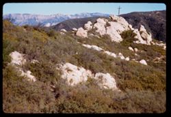
- Description:
- 100 f 9 TL
- Subject:
- Passes (Landforms), Mountains, Shrubs, Snow, Rock formations, Cajon Pass (Calif.), and Grasses
- Series:
- 2-69
- Creator:
- Cushman, Charles W., 1896-1972
- Date Created:
- 1969-03-14
- Genre:
- Landscape photographs
- Frame Number:
- 16
- County:
- San Bernardino
- Abstract:
- Cajon Pass
- Call Number:
- P15733
- Country:
- United States
- State/Province:
- California
- Alternate Identifier:
- 269.16
- Persistent URL:
- http://purl.dlib.indiana.edu/iudl/archives/cushman/P15733
- Holding Location:
- Bloomington - University Archives
Wells Library E460
1320 E 10th St.
Bloomington, IN 47405
Contact at archives@indiana.edu, 812-855-1127
-
- Description:
- 100 f 9 TL
- Subject:
- Trees, Mountains, Shrubs, and Hills
- Series:
- 2-69
- Creator:
- Cushman, Charles W., 1896-1972
- Date Created:
- 1969-03-14
- Genre:
- Landscape photographs
- Frame Number:
- 15
- Street Address:
- California State Highway 14
- County:
- Kern
- Abstract:
- Views NW from Hwy 14 south of Mojave
- Call Number:
- P15732
- City:
- Mojave
- Country:
- United States
- State/Province:
- California
- Alternate Identifier:
- 269.15
- Persistent URL:
- http://purl.dlib.indiana.edu/iudl/archives/cushman/P15732
- Holding Location:
- Bloomington - University Archives
Wells Library E460
1320 E 10th St.
Bloomington, IN 47405
Contact at archives@indiana.edu, 812-855-1127
-
- Description:
- 100 f 9 TL
- Subject:
- Snow, Trees, Plains, Mountains, Shrubs, and Hills
- Series:
- 2-69
- Creator:
- Cushman, Charles W., 1896-1972
- Date Created:
- 1969-03-14
- Genre:
- Landscape photographs
- Frame Number:
- 14
- County:
- Kern
- Abstract:
- Views NW from Hwy 14 south of Mojave
- Call Number:
- P15731
- City:
- Mojave
- Country:
- United States
- State/Province:
- California
- Alternate Identifier:
- 269.14
- Persistent URL:
- http://purl.dlib.indiana.edu/iudl/archives/cushman/P15731
- Holding Location:
- Bloomington - University Archives
Wells Library E460
1320 E 10th St.
Bloomington, IN 47405
Contact at archives@indiana.edu, 812-855-1127
-
- Description:
- 100 f 8
- Subject:
- Bays (Bodies of water), Grasses, Cliffs, Trees, Coastlines, Bolinas Bay (Calif.), Mountains, Beaches, Shrubs, and Hills
- Series:
- 1-68
- Creator:
- Cushman, Charles W., 1896-1972
- Date Created:
- 1968-03-20
- Genre:
- Landscape photographs and Seascapes
- Frame Number:
- 29
- County:
- Marin
- Abstract:
- Across Bolinas Bay
- Call Number:
- P15623
- City:
- Bolinas
- Country:
- United States
- State/Province:
- California
- Alternate Identifier:
- 168.29
- Persistent URL:
- http://purl.dlib.indiana.edu/iudl/archives/cushman/P15623
- Holding Location:
- Bloomington - University Archives
Wells Library E460
1320 E 10th St.
Bloomington, IN 47405
Contact at archives@indiana.edu, 812-855-1127
-
- Description:
- 100 f 14 TL
- Subject:
- Rocks, Steinaker Reservoir (Utah), Steinaker State Park (Utah), Mountains, State parks & reserves, Shrubs, Lakes & ponds, and Clouds
- Series:
- 10-66
- Creator:
- Cushman, Charles W., 1896-1972
- Date Created:
- 1966-06-18
- Genre:
- Landscape photographs
- Frame Number:
- 10
- County:
- Uintah
- Abstract:
- Steinaker Lake
- Call Number:
- P15450
- City:
- Vernal
- Country:
- United States
- State/Province:
- Utah
- Alternate Identifier:
- 1066.10
- Persistent URL:
- http://purl.dlib.indiana.edu/iudl/archives/cushman/P15450
- Holding Location:
- Bloomington - University Archives
Wells Library E460
1320 E 10th St.
Bloomington, IN 47405
Contact at archives@indiana.edu, 812-855-1127
-
- Description:
- 100 f 11 tl
- Subject:
- Rocks, Cliffs, Grazing, Mining, Cattle, Mountains, Rock formations, Utility poles, Roads, and Shrubs
- Series:
- 9-66
- Creator:
- Cushman, Charles W., 1896-1972
- Date Created:
- 1966-06-14
- Genre:
- Landscape photographs
- Frame Number:
- 22
- Street Address:
- Colorado State Highway 93
- County:
- Jefferson and Boulder
- Call Number:
- P15425
- City:
- Golden and Boulder
- Country:
- United States
- State/Province:
- Colorado
- Alternate Identifier:
- 966.22
- Persistent URL:
- http://purl.dlib.indiana.edu/iudl/archives/cushman/P15425
- Holding Location:
- Bloomington - University Archives
Wells Library E460
1320 E 10th St.
Bloomington, IN 47405
Contact at archives@indiana.edu, 812-855-1127
-
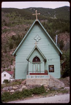
- Description:
- 100 f 8
- Subject:
- Rocks, Crosses, Houses, Gables, Signs (Notices), Grace Episcopal Church (Georgetown, Colo.), Mountains, Shrubs, Windows, Architectural decorations & orna...
- Series:
- 9-66
- Creator:
- Cushman, Charles W., 1896-1972
- Date Created:
- 1966-06-13
- Genre:
- Architectural photographs
- Frame Number:
- 7
- County:
- Clear Creek
- Call Number:
- P15410
- City:
- Georgetown
- Country:
- United States
- State/Province:
- Colorado
- Alternate Identifier:
- 966.7
- Persistent URL:
- http://purl.dlib.indiana.edu/iudl/archives/cushman/P15410
- Holding Location:
- Bloomington - University Archives
Wells Library E460
1320 E 10th St.
Bloomington, IN 47405
Contact at archives@indiana.edu, 812-855-1127
-
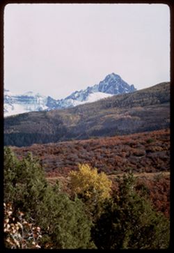
- Description:
- 100 f 11 TL
- Subject:
- Snow, Sneffels, Mount (Colo.), Trees, Mountains, Shrubs, Forests, San Juan Mountains (Colo. and N.M.), and Uncompahgre National Forest (Colo.)
- Series:
- 36-65
- Creator:
- Cushman, Charles W., 1896-1972
- Date Created:
- 1965-10-05
- Genre:
- Landscape photographs
- Frame Number:
- 1
- Street Address:
- Colorado State Highway 62
- County:
- San Miguel
- Abstract:
- Nr. Mt Sneffels (14150') from Colo. Hwy 62, San Miguel county.
- Call Number:
- P15069
- Country:
- United States
- State/Province:
- Colorado
- Alternate Identifier:
- 3665.1
- Persistent URL:
- http://purl.dlib.indiana.edu/iudl/archives/cushman/P15069
- Holding Location:
- Bloomington - University Archives
Wells Library E460
1320 E 10th St.
Bloomington, IN 47405
Contact at archives@indiana.edu, 812-855-1127
-
- Description:
- 100 f 13 sl
- Subject:
- Trees, Mountains, Rock formations, and Shrubs
- Series:
- 34-65
- Creator:
- Cushman, Charles W., 1896-1972
- Date Created:
- 1965-10-03
- Genre:
- Landscape photographs
- Frame Number:
- 15
- County:
- La Plata
- Abstract:
- 2 truncated pyramids w. of Durango
- Call Number:
- P15007
- City:
- Durango
- Country:
- United States
- State/Province:
- Colorado
- Alternate Identifier:
- 3465.15
- Persistent URL:
- http://purl.dlib.indiana.edu/iudl/archives/cushman/P15007
- Holding Location:
- Bloomington - University Archives
Wells Library E460
1320 E 10th St.
Bloomington, IN 47405
Contact at archives@indiana.edu, 812-855-1127
-
- Description:
- 100 f 13 sl
- Subject:
- Grasses, Trees, Mountains, Fences, Shrubs, and Rock formations
- Series:
- 34-65
- Creator:
- Cushman, Charles W., 1896-1972
- Date Created:
- 1965-10-03
- Genre:
- Landscape photographs
- Frame Number:
- 14
- County:
- La Plata
- Abstract:
- 2 truncated pyramids w. of Durango
- Call Number:
- P15006
- City:
- Durango
- Country:
- United States
- State/Province:
- Colorado
- Alternate Identifier:
- 3465.14
- Persistent URL:
- http://purl.dlib.indiana.edu/iudl/archives/cushman/P15006
- Holding Location:
- Bloomington - University Archives
Wells Library E460
1320 E 10th St.
Bloomington, IN 47405
Contact at archives@indiana.edu, 812-855-1127
-

- Description:
- 100 f 13
- Subject:
- Rocks, Grasses, Roads, Mountains, Shrubs, Bridges, Animas River (Colo. and N.M.), and Rivers
- Series:
- 34-65
- Creator:
- Cushman, Charles W., 1896-1972
- Date Created:
- 1965-10-03
- Genre:
- Landscape photographs
- Frame Number:
- 12
- County:
- La Plata
- Abstract:
- Animas river below Durango
- Call Number:
- P15004
- City:
- Durango
- Country:
- United States
- State/Province:
- Colorado
- Alternate Identifier:
- 3465.12
- Persistent URL:
- http://purl.dlib.indiana.edu/iudl/archives/cushman/P15004
- Holding Location:
- Bloomington - University Archives
Wells Library E460
1320 E 10th St.
Bloomington, IN 47405
Contact at archives@indiana.edu, 812-855-1127
-
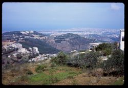
- Description:
- 100 f 13
- Subject:
- Trees, Cities & towns, Buildings, Shrubs, Hills, and Mountains
- Series:
- 16-65
- Creator:
- Cushman, Charles W., 1896-1972
- Date Created:
- 1965-05-03
- Genre:
- Cityscape photographs
- Frame Number:
- 31
- Abstract:
- Beirut from height at S.E.
- Call Number:
- P14420
- City:
- Beirut
- Country:
- Lebanon
- State/Province:
- Beirut
- Alternate Identifier:
- 1665.31
- Persistent URL:
- http://purl.dlib.indiana.edu/iudl/archives/cushman/P14420
- Holding Location:
- Bloomington - University Archives
Wells Library E460
1320 E 10th St.
Bloomington, IN 47405
Contact at archives@indiana.edu, 812-855-1127
-
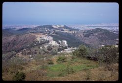
- Subject:
- Trees, Mountains, Buildings, Shrubs, Hills, and Cities & towns
- Series:
- 16-65
- Creator:
- Cushman, Charles W., 1896-1972
- Date Created:
- 1965-05-03
- Genre:
- Cityscape photographs
- Frame Number:
- 30
- Abstract:
- Beirut from height at S.E.
- Call Number:
- P14419
- City:
- Beirut
- Country:
- Lebanon
- State/Province:
- Beirut
- Alternate Identifier:
- 1665.30
- Persistent URL:
- http://purl.dlib.indiana.edu/iudl/archives/cushman/P14419
- Holding Location:
- Bloomington - University Archives
Wells Library E460
1320 E 10th St.
Bloomington, IN 47405
Contact at archives@indiana.edu, 812-855-1127
-
- Description:
- 100 f 16
- Subject:
- Walls, Lampposts, Forts & fortifications, Mountains, Dwellings, Trees, Buildings, Towers, Railings, and Shrubs
- Series:
- 14-65
- Creator:
- Cushman, Charles W., 1896-1972
- Date Created:
- 1965-04-28
- Genre:
- Cityscape photographs
- Frame Number:
- 31
- County:
- Argolis
- Abstract:
- Fortress above Nauplion
- Call Number:
- P14345
- City:
- Nauplion
- Country:
- Greece
- State/Province:
- Peloponnese
- Alternate Identifier:
- 1465.31
- Persistent URL:
- http://purl.dlib.indiana.edu/iudl/archives/cushman/P14345
- Holding Location:
- Bloomington - University Archives
Wells Library E460
1320 E 10th St.
Bloomington, IN 47405
Contact at archives@indiana.edu, 812-855-1127
-
- Description:
- 100 f 11
- Subject:
- Agora (Athens, Greece), Archaeological sites, Stoa of Attalos (Athens, Greece), Conservation & restoration, Cities & towns, Buildings, Shrubs, Clouds...
- Series:
- 9-65
- Creator:
- Cushman, Charles W., 1896-1972
- Date Created:
- 1965-04-13
- Genre:
- Cityscape photographs
- Frame Number:
- 26
- County:
- Attica
- Abstract:
- Across Agora toward Likavitos
- Call Number:
- P14154
- City:
- Athens
- Country:
- Greece
- State/Province:
- Central Greece and Euboea
- Alternate Identifier:
- 965.26
- Persistent URL:
- http://purl.dlib.indiana.edu/iudl/archives/cushman/P14154
- Holding Location:
- Bloomington - University Archives
Wells Library E460
1320 E 10th St.
Bloomington, IN 47405
Contact at archives@indiana.edu, 812-855-1127
-
- Description:
- 100 f 11
- Subject:
- Pedestrians, Balconies, Archaeological sites, Women, Trees, Likavittós (Greece), Refuse, Mountains, Sidewalks, Shrubs, Dwellings, Hills, and Acropolis (Athen...
- Series:
- 8-65
- Creator:
- Cushman, Charles W., 1896-1972
- Date Created:
- 1965-04-10
- Genre:
- Cityscape photographs
- Frame Number:
- 9
- County:
- Attica
- Abstract:
- Toward Acropolis from Likavitos and St. Georges Church
- Call Number:
- P14099
- City:
- Athens
- Country:
- Greece
- State/Province:
- Central Greece and Euboea
- Alternate Identifier:
- 865.9
- Persistent URL:
- http://purl.dlib.indiana.edu/iudl/archives/cushman/P14099
- Holding Location:
- Bloomington - University Archives
Wells Library E460
1320 E 10th St.
Bloomington, IN 47405
Contact at archives@indiana.edu, 812-855-1127
-
- Description:
- 100 f 11
- Subject:
- Valleys, Rocks, Trails & paths, Fences, Hills, Mountains, Trees, Alps, Austrian (Austria), Shrubs, Forests, and Stubay Valley (Austria)
- Series:
- 17-64
- Creator:
- Cushman, Charles W., 1896-1972
- Date Created:
- 1964-06-09
- Genre:
- Landscape photographs
- Frame Number:
- 26
- Abstract:
- from height to height
- Call Number:
- P13567
- City:
- Neustift
- Country:
- Austria
- State/Province:
- Tyrol
- Alternate Identifier:
- 1764.26
- Persistent URL:
- http://purl.dlib.indiana.edu/iudl/archives/cushman/P13567
- Holding Location:
- Bloomington - University Archives
Wells Library E460
1320 E 10th St.
Bloomington, IN 47405
Contact at archives@indiana.edu, 812-855-1127
-
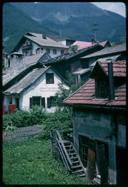
- Description:
- 100 f 11
- Subject:
- Valleys, Roofs, Stairways, Mountains, Buildings, Shrubs, Stubay Valley (Austria), Dormers, Dwellings, Utility poles, and Doors & doorways
- Series:
- 17-64
- Creator:
- Cushman, Charles W., 1896-1972
- Date Created:
- 1964-06-09
- Genre:
- Cityscape photographs
- Frame Number:
- 17
- Abstract:
- Fulpmes- view up
- Call Number:
- P13558
- City:
- Fulpmes
- Country:
- Austria
- State/Province:
- Tyrol
- Alternate Identifier:
- 1764.17
- Persistent URL:
- http://purl.dlib.indiana.edu/iudl/archives/cushman/P13558
- Holding Location:
- Bloomington - University Archives
Wells Library E460
1320 E 10th St.
Bloomington, IN 47405
Contact at archives@indiana.edu, 812-855-1127
-
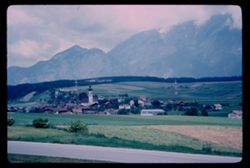
- Description:
- 100 f 5.6
- Subject:
- Towers, Spires, Valleys, Roads, Cities & towns, Churches, Shrubs, Stubay Valley (Austria), Dwellings, Hills, Mountains, and Croplands
- Series:
- 17-64
- Creator:
- Cushman, Charles W., 1896-1972
- Date Created:
- 1964-06-09
- Genre:
- Landscape photographs and Cityscape photographs
- Frame Number:
- 4
- Abstract:
- Mutters
- Call Number:
- P13545
- City:
- Innsbruck and Mutters
- Country:
- Austria
- State/Province:
- Tyrol
- Alternate Identifier:
- 1764.4
- Persistent URL:
- http://purl.dlib.indiana.edu/iudl/archives/cushman/P13545
- Holding Location:
- Bloomington - University Archives
Wells Library E460
1320 E 10th St.
Bloomington, IN 47405
Contact at archives@indiana.edu, 812-855-1127
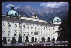
-
- Description:
- ?
- Subject:
- Pedestrians, Crosses, Benches, Automobiles, Hofburg (Innsbruck, Austria), Streets, Mountains, Shrubs, Architectural decorations & ornaments, Domes, Castl...
- Series:
- 16-64
- Creator:
- Cushman, Charles W., 1896-1972
- Date Created:
- 1964-06-07
- Genre:
- Architectural photographs
- Frame Number:
- 35
- Abstract:
- Hofburg
- Call Number:
- P13538
- City:
- Innsbruck
- Country:
- Austria
- State/Province:
- Tyrol
- Alternate Identifier:
- 1664.35
- Persistent URL:
- http://purl.dlib.indiana.edu/iudl/archives/cushman/P13538
- Holding Location:
- Bloomington - University Archives
Wells Library E460
1320 E 10th St.
Bloomington, IN 47405
Contact at archives@indiana.edu, 812-855-1127
-
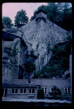
- Description:
- 100 f 5.6
- Subject:
- Stone walls, Vines, Windows, Mountains, Shrubs, Trees, Buildings, Watch towers, Monasteries, and Kapuzinerberg (Salzburg, Austria)
- Series:
- 11-64
- Creator:
- Cushman, Charles W., 1896-1972
- Date Created:
- 1964-05-27
- Genre:
- Architectural photographs
- Frame Number:
- 5
- Abstract:
- View up Kapuzinerberg
- Call Number:
- P13320
- City:
- Salzburg
- Country:
- Austria
- State/Province:
- Salzburg
- Alternate Identifier:
- 1164.5
- Persistent URL:
- http://purl.dlib.indiana.edu/iudl/archives/cushman/P13320
- Holding Location:
- Bloomington - University Archives
Wells Library E460
1320 E 10th St.
Bloomington, IN 47405
Contact at archives@indiana.edu, 812-855-1127
-
- Description:
- 100 f 11
- Subject:
- Cliffs, Automobiles, Trees, Streets, Monchsberg (Salzburg, Austria), Street lights, Rock formations, Utility poles, Mountains, Buildings, Sidewalks, and Shrubs
- Series:
- 10-64
- Creator:
- Cushman, Charles W., 1896-1972
- Date Created:
- 1964-05-27
- Genre:
- Cityscape photographs
- Frame Number:
- 38
- Street Address:
- Josefs-Kai
- Abstract:
- Josefs Kai below Monchsberg
- Call Number:
- P13315
- City:
- Salzburg
- Country:
- Austria
- State/Province:
- Salzburg
- Alternate Identifier:
- 1064.38
- Persistent URL:
- http://purl.dlib.indiana.edu/iudl/archives/cushman/P13315
- Holding Location:
- Bloomington - University Archives
Wells Library E460
1320 E 10th St.
Bloomington, IN 47405
Contact at archives@indiana.edu, 812-855-1127
-
- Description:
- 100 f 8
- Subject:
- Rock formations, Hills, Mountains, Untersberg (Austria), Shrubs, Roads, Airports, and Cliffs
- Series:
- 9-64
- Creator:
- Cushman, Charles W., 1896-1972
- Date Created:
- 1964-05-24
- Genre:
- Landscape photographs
- Frame Number:
- 17
- Abstract:
- On Untersberg Toward Salzburg
- Call Number:
- P13257
- City:
- Salzburg
- Country:
- Austria
- State/Province:
- Salzburg
- Alternate Identifier:
- 964.17
- Persistent URL:
- http://purl.dlib.indiana.edu/iudl/archives/cushman/P13257
- Holding Location:
- Bloomington - University Archives
Wells Library E460
1320 E 10th St.
Bloomington, IN 47405
Contact at archives@indiana.edu, 812-855-1127
-
- Description:
- 100 f 8
- Subject:
- Snow, Untersberg (Austria), Salzach River (Austria and Germany), Cliffs, Cable railroads, Mountains, Shrubs, Forests, Rivers, and Rock formations
- Series:
- 9-64
- Creator:
- Cushman, Charles W., 1896-1972
- Date Created:
- 1964-05-24
- Genre:
- Landscape photographs, Views, and Cityscape photographs
- Frame Number:
- 15
- Abstract:
- On Untersberg Looking down to right of cables
- Call Number:
- P13255
- City:
- Salzburg
- Country:
- Austria
- State/Province:
- Salzburg
- Alternate Identifier:
- 964.15
- Persistent URL:
- http://purl.dlib.indiana.edu/iudl/archives/cushman/P13255
- Holding Location:
- Bloomington - University Archives
Wells Library E460
1320 E 10th St.
Bloomington, IN 47405
Contact at archives@indiana.edu, 812-855-1127
-
- Description:
- 100 f 8
- Subject:
- Airports, Forests, Roads, Untersberg (Austria), Mountains, Shrubs, and Rock formations
- Series:
- 9-64
- Creator:
- Cushman, Charles W., 1896-1972
- Date Created:
- 1964-05-24
- Genre:
- Cityscape photographs and Views
- Frame Number:
- 14
- Abstract:
- On Untersberg Airport
- Call Number:
- P13254
- City:
- Salzburg
- Country:
- Austria
- State/Province:
- Salzburg
- Alternate Identifier:
- 964.14
- Persistent URL:
- http://purl.dlib.indiana.edu/iudl/archives/cushman/P13254
- Holding Location:
- Bloomington - University Archives
Wells Library E460
1320 E 10th St.
Bloomington, IN 47405
Contact at archives@indiana.edu, 812-855-1127
-
- Description:
- 100 f 6.3
- Subject:
- Untersberg (Austria), Mountains, Shrubs, Snow, Rocks, and Trails & paths
- Series:
- 9-64
- Creator:
- Cushman, Charles W., 1896-1972
- Date Created:
- 1964-05-24
- Genre:
- Landscape photographs and Ethnographic photographs
- Frame Number:
- 7
- Abstract:
- On top of Untersberg Snow & rock and from highest point
- Call Number:
- P13247
- City:
- Salzburg
- Country:
- Austria
- State/Province:
- Salzburg
- Alternate Identifier:
- 964.7
- Persistent URL:
- http://purl.dlib.indiana.edu/iudl/archives/cushman/P13247
- Holding Location:
- Bloomington - University Archives
Wells Library E460
1320 E 10th St.
Bloomington, IN 47405
Contact at archives@indiana.edu, 812-855-1127
-
- Description:
- 100 f 6.3
- Subject:
- Untersberg (Austria), Mountains, Shrubs, Trees, Rocks, Trails & paths, and Lodges
- Series:
- 9-64
- Creator:
- Cushman, Charles W., 1896-1972
- Date Created:
- 1964-05-24
- Genre:
- Landscape photographs
- Frame Number:
- 6
- Abstract:
- top of Untersberg looking down
- Call Number:
- P13246
- City:
- Salzburg
- Country:
- Austria
- State/Province:
- Salzburg
- Alternate Identifier:
- 964.6
- Persistent URL:
- http://purl.dlib.indiana.edu/iudl/archives/cushman/P13246
- Holding Location:
- Bloomington - University Archives
Wells Library E460
1320 E 10th St.
Bloomington, IN 47405
Contact at archives@indiana.edu, 812-855-1127
-
- Description:
- 100 f 5.6
- Subject:
- Steeples, Cathedrals, Mirabellgarten (Salzburg, Austria), Pedestrians, Forts & fortifications, Mountains, Shrubs, Fountains, Trees, Gates, Festung Hohens...
- Series:
- 8-64
- Creator:
- Cushman, Charles W., 1896-1972
- Date Created:
- 1964-05-21
- Genre:
- Cityscape photographs and Views
- Frame Number:
- 4
- Abstract:
- Hohensalzberg Fortress from Mirabell Garden
- Call Number:
- P13206
- City:
- Salzburg
- Country:
- Austria
- State/Province:
- Salzburg
- Alternate Identifier:
- 864.4
- Persistent URL:
- http://purl.dlib.indiana.edu/iudl/archives/cushman/P13206
- Holding Location:
- Bloomington - University Archives
Wells Library E460
1320 E 10th St.
Bloomington, IN 47405
Contact at archives@indiana.edu, 812-855-1127
-
- Description:
- 100 f 6.3
- Subject:
- Pedestrians, Kapuzinerberg (Salzburg, Austria), Trees, Flowers, Walkways, Gardens, Mountains, Fences, Shrubs, Mirabellgarten (Salzburg, Austria), Buildings, ...
- Series:
- 8-64
- Creator:
- Cushman, Charles W., 1896-1972
- Date Created:
- 1964-05-21
- Genre:
- Views and Cityscape photographs
- Frame Number:
- 5
- Abstract:
- Kapuzinerberg from Mirabell Garden
- Call Number:
- P13207
- City:
- Salzburg
- Country:
- Austria
- State/Province:
- Salzburg
- Alternate Identifier:
- 864.5
- Persistent URL:
- http://purl.dlib.indiana.edu/iudl/archives/cushman/P13207
- Holding Location:
- Bloomington - University Archives
Wells Library E460
1320 E 10th St.
Bloomington, IN 47405
Contact at archives@indiana.edu, 812-855-1127
-
- Description:
- 100 f 5.6
- Subject:
- Pedestrians, Fountains, Forts & fortifications, Trees, Gardens, Mountains, Festung Hohensalzburg (Salzburg, Austria), Shrubs, Garden walls, Steeples, Cat...
- Series:
- 8-64
- Creator:
- Cushman, Charles W., 1896-1972
- Date Created:
- 1964-05-21
- Genre:
- Views and Cityscape photographs
- Frame Number:
- 3
- Abstract:
- Hohensalzberg Fortress from Mirabell Garden
- Call Number:
- P13205
- City:
- Salzburg
- Country:
- Austria
- State/Province:
- Salzburg
- Alternate Identifier:
- 864.3
- Persistent URL:
- http://purl.dlib.indiana.edu/iudl/archives/cushman/P13205
- Holding Location:
- Bloomington - University Archives
Wells Library E460
1320 E 10th St.
Bloomington, IN 47405
Contact at archives@indiana.edu, 812-855-1127
-
- Description:
- 50 f 5.6
- Subject:
- Cafes, Musicians, Flowers, Pedestals, Mountains, Flutes, Shrubs, Trees, Buildings, Towers, Winkler Café (Salzburg, Austria), Sculpture, and Monchsberg (Salzb...
- Series:
- 7-64
- Creator:
- Cushman, Charles W., 1896-1972
- Date Created:
- 1964-05-21
- Genre:
- Views
- Frame Number:
- 30
- Abstract:
- Flute player and Winkler on high
- Call Number:
- P13195
- City:
- Salzburg
- Country:
- Austria
- State/Province:
- Salzburg
- Alternate Identifier:
- 764.30
- Persistent URL:
- http://purl.dlib.indiana.edu/iudl/archives/cushman/P13195
- Holding Location:
- Bloomington - University Archives
Wells Library E460
1320 E 10th St.
Bloomington, IN 47405
Contact at archives@indiana.edu, 812-855-1127
-
- Description:
- 50 f 5.6
- Subject:
- Towers, Benches, Pigeons, Parks, Automobiles, Trees, Mountains, Buildings, Shrubs, Flying, Plazas, and Hedges (Plants)
- Series:
- 7-64
- Creator:
- Cushman, Charles W., 1896-1972
- Date Created:
- 1964-05-21
- Genre:
- Cityscape photographs
- Frame Number:
- 29
- Street Address:
- Markartplatz
- Abstract:
- Pigeons in market Mozart? Makart? Pltz
- Call Number:
- P13194
- City:
- Salzburg
- Country:
- Austria
- State/Province:
- Salzburg
- Alternate Identifier:
- 764.29
- Persistent URL:
- http://purl.dlib.indiana.edu/iudl/archives/cushman/P13194
- Holding Location:
- Bloomington - University Archives
Wells Library E460
1320 E 10th St.
Bloomington, IN 47405
Contact at archives@indiana.edu, 812-855-1127
-
- Description:
- 100 f 11 TL
- Subject:
- Deserts, Mojave Desert (Calif.), Grasses, Cady Mountains (Calif.), Mountains, and Shrubs
- Series:
- 5-62
- Creator:
- Cushman, Charles W., 1896-1972
- Date Created:
- 1962-10-08
- Genre:
- Landscape photographs
- Frame Number:
- 26
- Street Address:
- United States Highway 66
- County:
- San Bernardino
- Abstract:
- Cady Mtns
- Call Number:
- P12793
- City:
- Barstow
- Country:
- United States
- State/Province:
- California
- Alternate Identifier:
- 562.26
- Persistent URL:
- http://purl.dlib.indiana.edu/iudl/archives/cushman/P12793
- Holding Location:
- Bloomington - University Archives
Wells Library E460
1320 E 10th St.
Bloomington, IN 47405
Contact at archives@indiana.edu, 812-855-1127
-
- Description:
- 100 f 11 SL
- Subject:
- Erosion, Cliffs, Mesas, Mountains, Rock formations, Utility poles, Roads, and Shrubs
- Series:
- 5-62
- Creator:
- Cushman, Charles W., 1896-1972
- Date Created:
- 1962-10-07
- Genre:
- Landscape photographs
- Frame Number:
- 22
- Street Address:
- Sitgreaves Pass
- County:
- Mohave
- Abstract:
- West side of Sitgreaves Pass
- Call Number:
- P12789
- Country:
- United States
- State/Province:
- Arizona
- Alternate Identifier:
- 562.22
- Persistent URL:
- http://purl.dlib.indiana.edu/iudl/archives/cushman/P12789
- Holding Location:
- Bloomington - University Archives
Wells Library E460
1320 E 10th St.
Bloomington, IN 47405
Contact at archives@indiana.edu, 812-855-1127
-
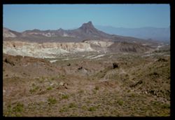
- Description:
- 100 f 11 SL
- Subject:
- Rocks, Erosion, Cliffs, Buttes, Mountains, Rock formations, Hills, and Shrubs
- Series:
- 5-62
- Creator:
- Cushman, Charles W., 1896-1972
- Date Created:
- 1962-10-07
- Genre:
- Landscape photographs
- Frame Number:
- 21
- Street Address:
- Sitgreaves Pass
- County:
- Mohave
- Abstract:
- Expanse
- Call Number:
- P12788
- Country:
- United States
- State/Province:
- Arizona
- Alternate Identifier:
- 562.21
- Persistent URL:
- http://purl.dlib.indiana.edu/iudl/archives/cushman/P12788
- Holding Location:
- Bloomington - University Archives
Wells Library E460
1320 E 10th St.
Bloomington, IN 47405
Contact at archives@indiana.edu, 812-855-1127
-
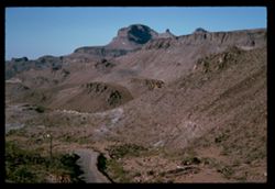
- Description:
- 100 f 11 SL
- Subject:
- Rocks, Erosion, Cliffs, Buttes, Mountains, Shrubs, Hills, Roads, and Rock formations
- Series:
- 5-62
- Creator:
- Cushman, Charles W., 1896-1972
- Date Created:
- 1962-10-07
- Genre:
- Landscape photographs
- Frame Number:
- 20
- Street Address:
- Sitgreaves Pass
- County:
- Mohave
- Abstract:
- Light + dark rock
- Call Number:
- P12787
- Country:
- United States
- State/Province:
- Arizona
- Alternate Identifier:
- 562.20
- Persistent URL:
- http://purl.dlib.indiana.edu/iudl/archives/cushman/P12787
- Holding Location:
- Bloomington - University Archives
Wells Library E460
1320 E 10th St.
Bloomington, IN 47405
Contact at archives@indiana.edu, 812-855-1127
-
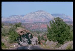
- Description:
- 100 f 9
- Subject:
- Hills, Roads, Cliffs, Mountains, Shrubs, Trees, and Grasses
- Series:
- 5-62
- Creator:
- Cushman, Charles W., 1896-1972
- Date Created:
- 1962-10-05
- Genre:
- Landscape photographs
- Frame Number:
- 17
- County:
- Coconino
- Abstract:
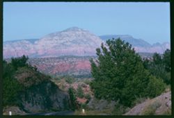
- East from 6 or 7 mi. west of Sedona
- Call Number:
- P12784
- City:
- Sedona
- Country:
- United States
- State/Province:
- Arizona
- Alternate Identifier:
- 562.17
- Persistent URL:
- http://purl.dlib.indiana.edu/iudl/archives/cushman/P12784
- Holding Location:
- Bloomington - University Archives
Wells Library E460
1320 E 10th St.
Bloomington, IN 47405
Contact at archives@indiana.edu, 812-855-1127
-
- Description:
- 100 f 11
- Subject:
- Hills, Roads, Cliffs, Mountains, Shrubs, Trees, and Grasses
- Series:
- 5-62
- Creator:
- Cushman, Charles W., 1896-1972
- Date Created:
- 1962-10-05
- Genre:
- Landscape photographs
- Frame Number:
- 16
- County:
- Coconino
- Abstract:
- East from 6 or 7 mi. west of Sedona
- Call Number:
- P12783
- City:
- Sedona
- Country:
- United States
- State/Province:
- Arizona
- Alternate Identifier:
- 562.16
- Persistent URL:
- http://purl.dlib.indiana.edu/iudl/archives/cushman/P12783
- Holding Location:
- Bloomington - University Archives
Wells Library E460
1320 E 10th St.
Bloomington, IN 47405
Contact at archives@indiana.edu, 812-855-1127
-
- Description:
- 100 f 13 ?
- Subject:
- Cliffs, Cactus, Trees, Mountains, Shrubs, and Hills
- Series:
- 5-62
- Creator:
- Cushman, Charles W., 1896-1972
- Date Created:
- 1962-10-05
- Genre:
- Landscape photographs
- Frame Number:
- 15
- County:
- Coconino
- Abstract:
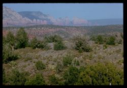
- East from 6 or 7 mi west of Sedona
- Call Number:
- P12782
- City:
- Sedona
- Country:
- United States
- State/Province:
- Arizona
- Alternate Identifier:
- 562.15
- Persistent URL:
- http://purl.dlib.indiana.edu/iudl/archives/cushman/P12782
- Holding Location:
- Bloomington - University Archives
Wells Library E460
1320 E 10th St.
Bloomington, IN 47405
Contact at archives@indiana.edu, 812-855-1127
-
- Description:
- 100 f 13 ?
- Subject:
- Cliffs, Cactus, Trees, Mountains, Shrubs, and Hills
- Series:
- 5-62
- Creator:
- Cushman, Charles W., 1896-1972
- Date Created:
- 1962-10-05
- Genre:
- Landscape photographs
- Frame Number:
- 14
- County:
- Coconino
- Abstract:
- East from 6 or 7 mi west of Sedona
- Call Number:
- P12781
- City:
- Sedona
- Country:
- United States
- State/Province:
- Arizona
- Alternate Identifier:
- 562.14
- Persistent URL:
- http://purl.dlib.indiana.edu/iudl/archives/cushman/P12781
- Holding Location:
- Bloomington - University Archives
Wells Library E460
1320 E 10th St.
Bloomington, IN 47405
Contact at archives@indiana.edu, 812-855-1127
-
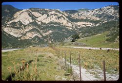
- Description:
- 100 f 11 TL
- Subject:
- Erosion, Cliffs, Buttes, Mountains, Rock formations, Grasses, and Shrubs
- Series:
- 5-62
- Creator:
- Cushman, Charles W., 1896-1972
- Date Created:
- 1962-10-05
- Genre:
- Landscape photographs
- Frame Number:
- 10
- County:
- Coconino
- Abstract:
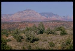
- Little peaks so. of Sedona from west
- Call Number:
- P12777
- City:
- Sedona
- Country:
- United States
- State/Province:
- Arizona
- Alternate Identifier:
- 562.10
- Persistent URL:
- http://purl.dlib.indiana.edu/iudl/archives/cushman/P12777
- Holding Location:
- Bloomington - University Archives
Wells Library E460
1320 E 10th St.
Bloomington, IN 47405
Contact at archives@indiana.edu, 812-855-1127
-
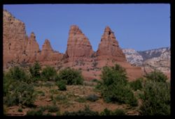
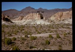
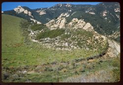
- Description:
- 100 f 13 TL
- Subject:
- Erosion, Hills, Cliffs, Mountains, Shrubs, Trees, Buttes, and Rock formations
- Series:
- 5-62
- Creator:
- Cushman, Charles W., 1896-1972
- Date Created:
- 1962-10-15
- Genre:
- Landscape photographs
- Frame Number:
- 9
- County:
- Coconino
- Abstract:
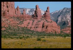
- Little peaks so. of Sedona
- Call Number:
- P12776
- City:
- Sedona
- Country:
- United States
- State/Province:
- Arizona
- Alternate Identifier:
- 562.9
- Persistent URL:
- http://purl.dlib.indiana.edu/iudl/archives/cushman/P12776
- Holding Location:
- Bloomington - University Archives
Wells Library E460
1320 E 10th St.
Bloomington, IN 47405
Contact at archives@indiana.edu, 812-855-1127
-
- Description:
- 100 f 8 TL
- Subject:
- Rocks, Grasses, Mountains, Shrubs, and Hills
- Series:
- 3-62
- Creator:
- Cushman, Charles W., 1896-1972
- Date Created:
- 1962-09-29
- Genre:
- Landscape photographs
- Frame Number:
- 30
- County:
- Storey
- Abstract:
- View east from [dome]
- Call Number:
- P12727
- City:
- Virginia City
- Country:
- United States
- State/Province:
- Nevada
- Alternate Identifier:
- 362.30
- Persistent URL:
- http://purl.dlib.indiana.edu/iudl/archives/cushman/P12727
- Holding Location:
- Bloomington - University Archives
Wells Library E460
1320 E 10th St.
Bloomington, IN 47405
Contact at archives@indiana.edu, 812-855-1127
-
- Description:
- 100 f 8 TL
- Subject:
- Hills, Mountains, Shrubs, and Clouds
- Series:
- 3-62
- Creator:
- Cushman, Charles W., 1896-1972
- Date Created:
- 1962-09-28
- Genre:
- Landscape photographs
- Frame Number:
- 20
- County:
- Storey
- Abstract:
- View east from Va. Cy.
- Call Number:
- P12718
- City:
- Virginia City
- Country:
- United States
- State/Province:
- Nevada
- Alternate Identifier:
- 362.20
- Persistent URL:
- http://purl.dlib.indiana.edu/iudl/archives/cushman/P12718
- Holding Location:
- Bloomington - University Archives
Wells Library E460
1320 E 10th St.
Bloomington, IN 47405
Contact at archives@indiana.edu, 812-855-1127
-
- Description:
- 100 f 6.3 TL
- Subject:
- Roads, Mountains, Shrubs, Clouds, Hills, and Utility poles
- Series:
- 3-62
- Creator:
- Cushman, Charles W., 1896-1972
- Date Created:
- 1962-09-28
- Genre:
- Landscape photographs
- Frame Number:
- 19
- County:
- Storey
- Abstract:
- View east from Va. Cy.
- Call Number:
- P12717
- City:
- Virginia City
- Country:
- United States
- State/Province:
- Nevada
- Alternate Identifier:
- 362.19
- Persistent URL:
- http://purl.dlib.indiana.edu/iudl/archives/cushman/P12717
- Holding Location:
- Bloomington - University Archives
Wells Library E460
1320 E 10th St.
Bloomington, IN 47405
Contact at archives@indiana.edu, 812-855-1127
-
- Description:
- 100 f 4? TL
- Subject:
- Trees, Mountains, Shrubs, Clouds, and Utility poles
- Series:
- 3-62
- Creator:
- Cushman, Charles W., 1896-1972
- Date Created:
- 1962-09-28
- Genre:
- Landscape photographs
- Frame Number:
- 18
- County:
- Storey
- Abstract:
- View east from Va. Cy.
- Call Number:
- P12716
- City:
- Virginia City
- Country:
- United States
- State/Province:
- Nevada
- Alternate Identifier:
- 362.18
- Persistent URL:
- http://purl.dlib.indiana.edu/iudl/archives/cushman/P12716
- Holding Location:
- Bloomington - University Archives
Wells Library E460
1320 E 10th St.
Bloomington, IN 47405
Contact at archives@indiana.edu, 812-855-1127
-
- Description:
- 100 f 6.3 TL
- Subject:
- Rocks, Roads, Trees, Mountains, Shrubs, Lakes & ponds, Clouds, Sierra Nevada (Calif. and Nev.), Forests, Hills, Echo Summit (El Dorado County, Calif.), a...
- Series:
- 3-62
- Creator:
- Cushman, Charles W., 1896-1972
- Date Created:
- 1962-09-28
- Genre:
- Landscape photographs
- Frame Number:
- 11
- Street Address:
- United States Highway 50
- Abstract:
- Toward Lake Tahoe.
- Call Number:
- P12709
- Country:
- United States
- State/Province:
- California
- Alternate Identifier:
- 362.11
- Persistent URL:
- http://purl.dlib.indiana.edu/iudl/archives/cushman/P12709
- Holding Location:
- Bloomington - University Archives
Wells Library E460
1320 E 10th St.
Bloomington, IN 47405
Contact at archives@indiana.edu, 812-855-1127
-
- Description:
- 100 f 5.6 SL
- Subject:
- Rocks, Valleys, Echo Summit (El Dorado County, Calif.), Trees, Mountains, Tahoe, Lake (Calif. and Nev.), Lakes & ponds, Sierra Nevada (Calif. and Nev.), ...
- Series:
- 3-62
- Creator:
- Cushman, Charles W., 1896-1972
- Date Created:
- 1962-09-28
- Genre:
- Landscape photographs
- Frame Number:
- 8
- Abstract:
- Toward right.
- Call Number:
- P12706
- Country:
- United States
- State/Province:
- California
- Alternate Identifier:
- 362.8
- Persistent URL:
- http://purl.dlib.indiana.edu/iudl/archives/cushman/P12706
- Holding Location:
- Bloomington - University Archives
Wells Library E460
1320 E 10th St.
Bloomington, IN 47405
Contact at archives@indiana.edu, 812-855-1127
-
- Description:
- 100 f 6.3 SL
- Subject:
- Walls, Railings, Roads, Automobiles, Trees, Mountains, Shrubs, Sierra Nevada (Calif. and Nev.), Stone walls, Rocks, Houses, and Echo Summit (El Dorado County...
- Series:
- 3-62
- Creator:
- Cushman, Charles W., 1896-1972
- Date Created:
- 1962-09-28
- Genre:
- Landscape photographs
- Frame Number:
- 7
- Street Address:
- United States Highway 50
- Abstract:
- Wall above US 50.
- Call Number:
- P12705
- Country:
- United States
- State/Province:
- California
- Alternate Identifier:
- 362.7
- Persistent URL:
- http://purl.dlib.indiana.edu/iudl/archives/cushman/P12705
- Holding Location:
- Bloomington - University Archives
Wells Library E460
1320 E 10th St.
Bloomington, IN 47405
Contact at archives@indiana.edu, 812-855-1127
-
- Description:
- 100 f 6.3
- Subject:
- Indio Hacienda (Indio, Calif.), Balconies, Lampposts, Windows, Mountains, Public accommodation facilities, Shrubs, Rocks, Palms, and Doors & doorways
- Series:
- 24-61
- Creator:
- Cushman, Charles W., 1896-1972
- Date Created:
- 1961-01-01
- Genre:
- Architectural photographs
- Frame Number:
- 36
- County:
- Riverside
- Abstract:
- Indio Hacienda
- Call Number:
- P12602
- City:
- Indio
- Country:
- United States
- State/Province:
- California
- Alternate Identifier:
- 2461.36
- Persistent URL:
- http://purl.dlib.indiana.edu/iudl/archives/cushman/P12602
- Holding Location:
- Bloomington - University Archives
Wells Library E460
1320 E 10th St.
Bloomington, IN 47405
Contact at archives@indiana.edu, 812-855-1127
-
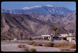
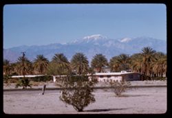
- Description:
- 100 f 5.6 TL
- Subject:
- Orange trees, San Gorgonio Mountain (Calif.), Mountains, Buildings, Shrubs, Clouds, and Indio Hacienda (Indio, Calif.)
- Series:
- 24-61
- Creator:
- Cushman, Charles W., 1896-1972
- Date Created:
- 1961-01-01
- Genre:
- Landscape photographs
- Frame Number:
- 37
- County:
- Riverside and San Bernardino
- Abstract:
- Mt. San Gorgonio- from Indio
- Call Number:
- P12603
- City:
- Indio
- Country:
- United States
- State/Province:
- California
- Alternate Identifier:
- 2461.37
- Persistent URL:
- http://purl.dlib.indiana.edu/iudl/archives/cushman/P12603
- Holding Location:
- Bloomington - University Archives
Wells Library E460
1320 E 10th St.
Bloomington, IN 47405
Contact at archives@indiana.edu, 812-855-1127
-
- Description:
- 100 f 5.6 TL
- Subject:
- Snow, Balconies, Orange trees, Automobiles, San Jacinto Peak (Calif.), Mountains, Shrubs, Clouds, Public accommodation facilities, Indio Hacienda (Indio, Cal...
- Series:
- 24-61
- Creator:
- Cushman, Charles W., 1896-1972
- Date Created:
- 1961-01-01
- Genre:
- Landscape photographs and Views
- Frame Number:
- 35
- County:
- Riverside
- Abstract:
- San Jacinto
- Call Number:
- P12601
- City:
- Indio
- Country:
- United States
- State/Province:
- California
- Alternate Identifier:
- 2461.35
- Persistent URL:
- http://purl.dlib.indiana.edu/iudl/archives/cushman/P12601
- Holding Location:
- Bloomington - University Archives
Wells Library E460
1320 E 10th St.
Bloomington, IN 47405
Contact at archives@indiana.edu, 812-855-1127
-
- Description:
- 100 f 6.3 TL
- Subject:
- Indio Hacienda (Indio, Calif.), San Jacinto Peak (Calif.), Balconies, Automobiles, Parking lots, Orange trees, Mountains, Public accommodation facilities, Sh...
- Series:
- 24-61
- Creator:
- Cushman, Charles W., 1896-1972
- Date Created:
- 1961-01-01
- Genre:
- Landscape photographs and Views
- Frame Number:
- 34
- County:
- Riverside
- Abstract:
- San Jacinto
- Call Number:
- P12600
- City:
- Indio
- Country:
- United States
- State/Province:
- California
- Alternate Identifier:
- 2461.34
- Persistent URL:
- http://purl.dlib.indiana.edu/iudl/archives/cushman/P12600
- Holding Location:
- Bloomington - University Archives
Wells Library E460
1320 E 10th St.
Bloomington, IN 47405
Contact at archives@indiana.edu, 812-855-1127
-
- Description:
- 100 f 8 TL
- Subject:
- Roads, Orange trees, San Gorgonio Mountain (Calif.), Trees, Flowers, Mountains, Buildings, Shrubs, Clouds, and Indio Hacienda (Indio, Calif.)
- Series:
- 24-61
- Creator:
- Cushman, Charles W., 1896-1972
- Date Created:
- 1961-01-01
- Genre:
- Landscape photographs and Views
- Frame Number:
- 33
- County:
- Riverside and San Bernardino
- Abstract:
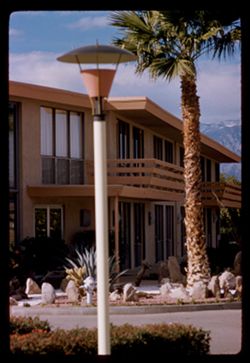
- San Gorgonio and San Gorgonio from Indio Hacienda
- Call Number:
- P12599
- City:
- Indio
- Country:
- United States
- State/Province:
- California
- Alternate Identifier:
- 2461.33
- Persistent URL:
- http://purl.dlib.indiana.edu/iudl/archives/cushman/P12599
- Holding Location:
- Bloomington - University Archives
Wells Library E460
1320 E 10th St.
Bloomington, IN 47405
Contact at archives@indiana.edu, 812-855-1127
-
- Description:
- 100 f 8 TL
- Subject:
- Deserts, Grasses, San Bernardino Desert (Calif.), Mountains, and Shrubs
- Series:
- 24-61
- Creator:
- Cushman, Charles W., 1896-1972
- Date Created:
- 1961-12-29
- Genre:
- Landscape photographs
- Frame Number:
- 27
- County:
- San Bernardino
- Abstract:
- Panorama north from 12 mi. w. of 29 Palms and Panorama north of 29 Palm S Hwy 7 miles west of 29 Palms San Bernardino Desert
- Call Number:
- P12593
- City:
- Twentynine Palms
- Country:
- United States
- State/Province:
- California
- Alternate Identifier:
- 2461.27
- Persistent URL:
- http://purl.dlib.indiana.edu/iudl/archives/cushman/P12593
- Holding Location:
- Bloomington - University Archives
Wells Library E460
1320 E 10th St.
Bloomington, IN 47405
Contact at archives@indiana.edu, 812-855-1127
-
- Description:
- 100 f 9 TL
- Subject:
- Deserts, Hills, Mountains, Shrubs, Palms, and San Bernardino Desert (Calif.)
- Series:
- 24-61
- Creator:
- Cushman, Charles W., 1896-1972
- Date Created:
- 1961-12-29
- Genre:
- Landscape photographs
- Frame Number:
- 26
- County:
- San Bernardino
- Abstract:
- Panorama north from 12 mi. w. of 29 Palms and Panorama north at 29 Palm S Hwy 7 miles west of 29 Palms San Bernardino Desert
- Call Number:
- P12592
- City:
- Twentynine Palms
- Country:
- United States
- State/Province:
- California
- Alternate Identifier:
- 2461.26
- Persistent URL:
- http://purl.dlib.indiana.edu/iudl/archives/cushman/P12592
- Holding Location:
- Bloomington - University Archives
Wells Library E460
1320 E 10th St.
Bloomington, IN 47405
Contact at archives@indiana.edu, 812-855-1127
-
- Description:
- 100 f 8 TL
- Subject:
- San Gorgonio Mountain (Calif.), Trees, Mountains, Shrubs, and Hills
- Series:
- 24-61
- Creator:
- Cushman, Charles W., 1896-1972
- Date Created:
- 1961-12-29
- Genre:
- Landscape photographs
- Frame Number:
- 25
- County:
- San Bernardino
- Abstract:
- Mt. San Gorgonio from east and Gorgonio from east
- Call Number:
- P12591
- Country:
- United States
- State/Province:
- California
- Alternate Identifier:
- 2461.25
- Persistent URL:
- http://purl.dlib.indiana.edu/iudl/archives/cushman/P12591
- Holding Location:
- Bloomington - University Archives
Wells Library E460
1320 E 10th St.
Bloomington, IN 47405
Contact at archives@indiana.edu, 812-855-1127
-
- Description:
- 100 f 6.3 TL
- Subject:
- Rocks, Roads, Trees, San Jacinto Mountains (Calif.), San Bernardino National Forest (Calif.), Mountains, Rock formations, and Shrubs
- Series:
- 24-61
- Creator:
- Cushman, Charles W., 1896-1972
- Date Created:
- 1961-12-27
- Genre:
- Landscape photographs
- Frame Number:
- 20
- Street Address:
- California State Highway 74
- County:
- Riverside
- Abstract:
- San Jacinto Mountains in San Bernardino Nat'l Forest and Mtns in San Bernardino Natl Forest - from Cal 74
- Call Number:
- P12586
- Country:
- United States
- State/Province:
- California
- Alternate Identifier:
- 2461.20
- Persistent URL:
- http://purl.dlib.indiana.edu/iudl/archives/cushman/P12586
- Holding Location:
- Bloomington - University Archives
Wells Library E460
1320 E 10th St.
Bloomington, IN 47405
Contact at archives@indiana.edu, 812-855-1127
-
- Description:
- 100 f 5.6 TL
- Subject:
- National parks & reserves, San Bernardino National Forest (Calif.), San Jacinto Mountains (Calif.), Forests, Mountains, Shrubs, Trees, and Rocks
- Series:
- 24-61
- Creator:
- Cushman, Charles W., 1896-1972
- Date Created:
- 1961-12-27
- Genre:
- Landscape photographs
- Frame Number:
- 19
- County:
- Riverside
- Abstract:
- Mtns in San Bernardino Natl Forest - from Cal 74 and San Jacinto Mountains in San Bernardino Nat'l Forest
- Call Number:
- P12585
- Country:
- United States
- State/Province:
- California
- Alternate Identifier:
- 2461.19
- Persistent URL:
- http://purl.dlib.indiana.edu/iudl/archives/cushman/P12585
- Holding Location:
- Bloomington - University Archives
Wells Library E460
1320 E 10th St.
Bloomington, IN 47405
Contact at archives@indiana.edu, 812-855-1127
-
- Description:
- 100 f 5.6 TL
- Subject:
- Rocks, Trees, San Jacinto Mountains (Calif.), San Bernardino National Forest (Calif.), Mountains, Shrubs, Forests, Hills, and National parks & reserves
- Series:
- 24-61
- Creator:
- Cushman, Charles W., 1896-1972
- Date Created:
- 1961-12-27
- Genre:
- Landscape photographs
- Frame Number:
- 18
- County:
- Riverside
- Abstract:
- San Jacinto Mountains in San Bernardino Nat'l Forest and Mtns in San Bernardino Natl Forest - from Cal 74
- Call Number:
- P12584
- Country:
- United States
- State/Province:
- California
- Alternate Identifier:
- 2461.18
- Persistent URL:
- http://purl.dlib.indiana.edu/iudl/archives/cushman/P12584
- Holding Location:
- Bloomington - University Archives
Wells Library E460
1320 E 10th St.
Bloomington, IN 47405
Contact at archives@indiana.edu, 812-855-1127
-
- Description:
- 100 f 5.6 TL HF
- Subject:
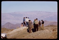
- Sightseers, Children, Valleys, Ethnic groups, San Jacinto Mountains (Calif.), Mountains, Shrubs, Families, Men, and Coachella Valley (Calif.)
- Series:
- 24-61
- Creator:
- Cushman, Charles W., 1896-1972
- Date Created:
- 1961-12-27
- Genre:
- Landscape photographs and Ethnographic photographs
- Frame Number:
- 16
- County:
- Riverside
- Abstract:
- Mexicans - Elisabeta, Tacho et al and Group of Mexicans- Elisabeta, Tacho, [etal]
- Call Number:
- P12582
- Country:
- United States
- State/Province:
- California
- Alternate Identifier:
- 2461.16
- Persistent URL:
- http://purl.dlib.indiana.edu/iudl/archives/cushman/P12582
- Holding Location:
- Bloomington - University Archives
Wells Library E460
1320 E 10th St.
Bloomington, IN 47405
Contact at archives@indiana.edu, 812-855-1127
-
- Description:
- 100 f 5.6 TL HF
- Subject:
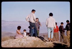
- Sightseers, Valleys, Ethnic groups, Automobiles, Binoculars, Mountains, Coachella Valley (Calif.), People, Families, San Jacinto Mountains (Calif.), and Shrubs
- Series:
- 24-61
- Creator:
- Cushman, Charles W., 1896-1972
- Date Created:
- 1961-12-27
- Genre:
- Landscape photographs and Ethnographic photographs
- Frame Number:
- 15
- County:
- Riverside
- Abstract:
- Mexicans - Elisabeta, Tacho et al and Group of Mexicans- Elisabeta, Tacho, [etal]
- Call Number:
- P12581
- Country:
- United States
- State/Province:
- California
- Alternate Identifier:
- 2461.15
- Persistent URL:
- http://purl.dlib.indiana.edu/iudl/archives/cushman/P12581
- Holding Location:
- Bloomington - University Archives
Wells Library E460
1320 E 10th St.
Bloomington, IN 47405
Contact at archives@indiana.edu, 812-855-1127
-
- Description:
- 100 f ? TL HF
- Subject:
- Families, Children, Clothing & dress, Ethnic groups, San Jacinto Mountains (Calif.), Mountains, Shrubs, People, and Sightseers
- Series:
- 24-61
- Creator:
- Cushman, Charles W., 1896-1972
- Date Created:
- 1961-12-27
- Genre:
- Snapshots and Ethnographic photographs
- Frame Number:
- 14
- Street Address:
- California State Highway 74
- County:
- Riverside
- Abstract:
- Mexicans - Elisabeta, Tacho et al and Group of Mexicans- Elisabeta, Tacho, [etal]
- Call Number:
- P12580
- Country:
- United States
- State/Province:
- California
- Alternate Identifier:
- 2461.14
- Persistent URL:
- http://purl.dlib.indiana.edu/iudl/archives/cushman/P12580
- Holding Location:
- Bloomington - University Archives
Wells Library E460
1320 E 10th St.
Bloomington, IN 47405
Contact at archives@indiana.edu, 812-855-1127
-
- Description:
- 100 f 6.3 TL
- Subject:
- Stores & shops, Roads, Markets, San Jacinto Peak (Calif.), Signs (Notices), Mountains, Shrubs, Utility poles, and Palms
- Series:
- 24-61
- Creator:
- Cushman, Charles W., 1896-1972
- Date Created:
- 1961-12-25
- Genre:
- Landscape photographs
- Frame Number:
- 3
- County:
- Riverside
- Abstract:
- San Jacinto
- Call Number:
- P12569
- Country:
- United States
- State/Province:
- California
- Alternate Identifier:
- 2461.3
- Persistent URL:
- http://purl.dlib.indiana.edu/iudl/archives/cushman/P12569
- Holding Location:
- Bloomington - University Archives
Wells Library E460
1320 E 10th St.
Bloomington, IN 47405
Contact at archives@indiana.edu, 812-855-1127
-
- Description:
- 100 f 6.3 TL
- Subject:
- San Gorgonio Mountain (Calif.), Mountains, Utility poles, Palms, Shrubs, Roads, and Dwellings
- Series:
- 24-61
- Creator:
- Cushman, Charles W., 1896-1972
- Date Created:
- 1961-12-25
- Genre:
- Landscape photographs
- Frame Number:
- 2
- County:
- San Bernardino
- Abstract:
- Mr San Gorgonio and Mt. San Gorgonio
- Call Number:
- P12568
- City:
- Palm Desert
- Country:
- United States
- State/Province:
- California
- Alternate Identifier:
- 2461.2
- Persistent URL:
- http://purl.dlib.indiana.edu/iudl/archives/cushman/P12568
- Holding Location:
- Bloomington - University Archives
Wells Library E460
1320 E 10th St.
Bloomington, IN 47405
Contact at archives@indiana.edu, 812-855-1127
-
- Description:
- 100 f 6..3 TL
- Subject:
- Grasses, Houses, Trees, San Jacinto Peak (Calif.), Shadows, Mountains, and Shrubs
- Series:
- 23-61
- Creator:
- Cushman, Charles W., 1896-1972
- Date Created:
- 1961-12-25
- Genre:
- Landscape photographs
- Frame Number:
- 37
- County:
- Riverside
- Abstract:
- Mr. San Jacinto from Palm Desert and Mt. San Jacinto from Palm Desert
- Call Number:
- P12566
- City:
- Palm Desert
- Country:
- United States
- State/Province:
- California
- Alternate Identifier:
- 2361.37
- Persistent URL:
- http://purl.dlib.indiana.edu/iudl/archives/cushman/P12566
- Holding Location:
- Bloomington - University Archives
Wells Library E460
1320 E 10th St.
Bloomington, IN 47405
Contact at archives@indiana.edu, 812-855-1127
-
- Description:
- 50 f 8 SL
- Subject:
- Rocks, San Marcos Pass (Calif.), Trees, Mountains, Rock formations, Passes (Landforms), and Shrubs
- Series:
- 23-61
- Creator:
- Cushman, Charles W., 1896-1972
- Date Created:
- 1961-11-22
- Genre:
- Landscape photographs
- Frame Number:
- 28
- County:
- Santa Barbara
- Abstract:
- Rocks near summit
- Call Number:
- P12557
- Country:
- United States
- State/Province:
- California
- Alternate Identifier:
- 2361.28
- Persistent URL:
- http://purl.dlib.indiana.edu/iudl/archives/cushman/P12557
- Holding Location:
- Bloomington - University Archives
Wells Library E460
1320 E 10th St.
Bloomington, IN 47405
Contact at archives@indiana.edu, 812-855-1127
-
- Description:
- 100 f 8 TL
- Subject:
- Passes (Landforms), Mountains, Shrubs, Trees, Rocks, Rock formations, and San Marcos Pass (Calif.)
- Series:
- 23-61
- Creator:
- Cushman, Charles W., 1896-1972
- Date Created:
- 1961-11-22
- Genre:
- Landscape photographs
- Frame Number:
- 27
- County:
- Santa Barbara
- Abstract:
- Rocks near summit
- Call Number:
- P12556
- Country:
- United States
- State/Province:
- California
- Alternate Identifier:
- 2361.27
- Persistent URL:
- http://purl.dlib.indiana.edu/iudl/archives/cushman/P12556
- Holding Location:
- Bloomington - University Archives
Wells Library E460
1320 E 10th St.
Bloomington, IN 47405
Contact at archives@indiana.edu, 812-855-1127
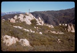
-
- Description:
- 50 f 6.3
- Subject:
- Crosses, Passes (Landforms), Hills, Mountains, Shrubs, Rocks, and San Marcos Pass (Calif.)
- Series:
- 23-61
- Creator:
- Cushman, Charles W., 1896-1972
- Date Created:
- 1961-11-22
- Genre:
- Landscape photographs
- Frame Number:
- 26
- County:
- Santa Barbara
- Abstract:
- San Marcos Pass north side
- Call Number:
- P12555
- Country:
- United States
- State/Province:
- California
- Alternate Identifier:
- 2361.26
- Persistent URL:
- http://purl.dlib.indiana.edu/iudl/archives/cushman/P12555
- Holding Location:
- Bloomington - University Archives
Wells Library E460
1320 E 10th St.
Bloomington, IN 47405
Contact at archives@indiana.edu, 812-855-1127
-
- Description:
- 50 f 6.3
- Subject:
- Rocks, Crosses, San Marcos Pass (Calif.), Mountains, Shrubs, and Passes (Landforms)
- Series:
- 23-61
- Creator:
- Cushman, Charles W., 1896-1972
- Date Created:
- 1961-11-22
- Genre:
- Landscape photographs
- Frame Number:
- 25
- County:
- Santa Barbara
- Abstract:
- San Marcos Pass north side
- Call Number:
- P12554
- Country:
- United States
- State/Province:
- California
- Alternate Identifier:
- 2361.25
- Persistent URL:
- http://purl.dlib.indiana.edu/iudl/archives/cushman/P12554
- Holding Location:
- Bloomington - University Archives
Wells Library E460
1320 E 10th St.
Bloomington, IN 47405
Contact at archives@indiana.edu, 812-855-1127
-
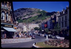
- Description:
- 100 f 6.3
- Subject:
- Pedestrians, Awnings, Automobiles, Streets, Mountains, Sidewalks, Shrubs, Hotels, Jewelry stores, Architectural decorations & ornaments, Stone walls, and...
- Series:
- 12-61
- Creator:
- Cushman, Charles W., 1896-1972
- Date Created:
- 1961-05-26
- Genre:
- Cityscape photographs
- Frame Number:
- 28
- Street Address:
- Mostyn Street
- County:
- Conwy
- Abstract:
- Mostyn street
- Call Number:
- P12149
- City:
- Llandudno
- Country:
- United Kingdom
- State/Province:
- Wales
- Alternate Identifier:
- 1261.28
- Persistent URL:
- http://purl.dlib.indiana.edu/iudl/archives/cushman/P12149
- Holding Location:
- Bloomington - University Archives
Wells Library E460
1320 E 10th St.
Bloomington, IN 47405
Contact at archives@indiana.edu, 812-855-1127
-
- Description:
- 50 f 8
- Subject:
- Grasses, Barbed wire, Mountains, Fences, Shrubs, and Hills
- Series:
- 27-60
- Creator:
- Cushman, Charles W., 1896-1972
- Date Created:
- 1960-12-29
- Genre:
- Landscape photographs
- Frame Number:
- 7
- Street Address:
- United States Highway 101
- County:
- Santa Barbara
- Abstract:
- Hills north of Gaviota
- Call Number:
- P11749
- City:
- Gaviota
- Country:
- United States
- State/Province:
- California
- Alternate Identifier:
- 2760.7
- Persistent URL:
- http://purl.dlib.indiana.edu/iudl/archives/cushman/P11749
- Holding Location:
- Bloomington - University Archives
Wells Library E460
1320 E 10th St.
Bloomington, IN 47405
Contact at archives@indiana.edu, 812-855-1127
-
- Description:
- 50 f 8
- Subject:
- Grasses, Roads, Grazing, Barbed wire, Livestock, Mountains, Fences, Shrubs, Hills, and Utility poles
- Series:
- 27-60
- Creator:
- Cushman, Charles W., 1896-1972
- Date Created:
- 1960-12-29
- Genre:
- Landscape photographs
- Frame Number:
- 6
- County:
- Santa Barbara
- Abstract:
- Hills north of Gaviota
- Call Number:
- P11748
- City:
- Gaviota
- Country:
- United States
- State/Province:
- California
- Alternate Identifier:
- 2760.6
- Persistent URL:
- http://purl.dlib.indiana.edu/iudl/archives/cushman/P11748
- Holding Location:
- Bloomington - University Archives
Wells Library E460
1320 E 10th St.
Bloomington, IN 47405
Contact at archives@indiana.edu, 812-855-1127
-
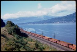
- Description:
- 50 f 6.3
- Subject:
- Railroad freight cars, Union Pacific Railroad Company, Columbia River, Railroad cars, Railroad tracks, Mountains, Utility poles, Electric lines, Trees, Cloud...
- Series:
- 25-60
- Creator:
- Cushman, Charles W., 1896-1972
- Date Created:
- 1960-09-25
- Genre:
- Landscape photographs
- Frame Number:
- 10
- County:
- Hood River
- Abstract:
- Cloud mass above Columbia 16 mi w. of H.R.
- Call Number:
- P11698
- City:
- Hood River
- Country:
- United States
- State/Province:
- Oregon
- Alternate Identifier:
- 2560.10
- Persistent URL:
- http://purl.dlib.indiana.edu/iudl/archives/cushman/P11698
- Holding Location:
- Bloomington - University Archives
Wells Library E460
1320 E 10th St.
Bloomington, IN 47405
Contact at archives@indiana.edu, 812-855-1127
-
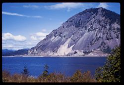
- Description:
- 50 f 8 sl
- Subject:
- Columbia River, Trees, Tree limbs, Mountains, Shrubs, Clouds, and Rivers
- Series:
- 25-60
- Creator:
- Cushman, Charles W., 1896-1972
- Date Created:
- 1960-09-25
- Genre:
- Landscape photographs
- Frame Number:
- 9
- County:
- Hood River
- Abstract:
- Columbia, 12 mi west of Hood River
- Call Number:
- P11697
- City:
- Hood River
- Country:
- United States
- State/Province:
- Oregon
- Alternate Identifier:
- 2560.9
- Persistent URL:
- http://purl.dlib.indiana.edu/iudl/archives/cushman/P11697
- Holding Location:
- Bloomington - University Archives
Wells Library E460
1320 E 10th St.
Bloomington, IN 47405
Contact at archives@indiana.edu, 812-855-1127
-
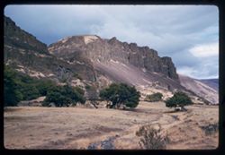
- Description:
- 50 f 8 sl
- Subject:
- Rocks, Columbia River, Cliffs, Trees, Plains, Mountains, Shrubs, Hills, and Grasses
- Series:
- 24-60
- Creator:
- Cushman, Charles W., 1896-1972
- Date Created:
- 1960-09-19
- Genre:
- Landscape photographs
- Frame Number:
- 16
- County:
- Wasco
- Abstract:
- Washington side of Columbia 10m: from The Dalles
- Call Number:
- P11670
- City:
- Dalles
- Country:
- United States
- State/Province:
- Washington
- Alternate Identifier:
- 2460.16
- Persistent URL:
- http://purl.dlib.indiana.edu/iudl/archives/cushman/P11670
- Holding Location:
- Bloomington - University Archives
Wells Library E460
1320 E 10th St.
Bloomington, IN 47405
Contact at archives@indiana.edu, 812-855-1127
-
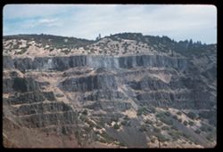
- Description:
- 100 f 6.3 tl
- Subject:
- Columbia River, Cliffs, Columbia River Palisades, Mountains, Shrubs, Columbia Palisades, and Rock formations
- Series:
- 24-60
- Creator:
- Cushman, Charles W., 1896-1972
- Date Created:
- 1960-09-19
- Genre:
- Landscape photographs
- Frame Number:
- 12
- County:
- Wasco
- Abstract:
- Palisades on right bank
- Call Number:
- P11666
- City:
- Rowena
- Country:
- United States
- State/Province:
- Oregon
- Alternate Identifier:
- 2460.12
- Persistent URL:
- http://purl.dlib.indiana.edu/iudl/archives/cushman/P11666
- Holding Location:
- Bloomington - University Archives
Wells Library E460
1320 E 10th St.
Bloomington, IN 47405
Contact at archives@indiana.edu, 812-855-1127
-
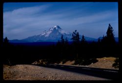
- Description:
- 100 f 11 tl
- Subject:
- Forests, Roads, Dirt, Mountains, Shrubs, Snow, Trees, and Hood, Mount (Or.)
- Series:
- 24-60
- Creator:
- Cushman, Charles W., 1896-1972
- Date Created:
- 1960-09-17
- Genre:
- Landscape photographs
- Frame Number:
- 4
- County:
- Clackamas
- Abstract:
- Mt. Hood from south
- Call Number:
- P11659
- Country:
- United States
- State/Province:
- Oregon
- Alternate Identifier:
- 2460.4
- Persistent URL:
- http://purl.dlib.indiana.edu/iudl/archives/cushman/P11659
- Holding Location:
- Bloomington - University Archives
Wells Library E460
1320 E 10th St.
Bloomington, IN 47405
Contact at archives@indiana.edu, 812-855-1127
-
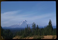
- Description:
- 100 f 9 tl
- Subject:
- Snow, Cascade Range, Trees, Mountains, Hood, Mount (Or.), Shrubs, Forests, and Hills
- Series:
- 24-60
- Creator:
- Cushman, Charles W., 1896-1972
- Date Created:
- 1960-09-17
- Genre:
- Landscape photographs
- Frame Number:
- 3
- County:
- Clackamas
- Abstract:
- Mt. Hood from south
- Call Number:
- P11658
- Country:
- United States
- State/Province:
- Oregon
- Alternate Identifier:
- 2460.3
- Persistent URL:
- http://purl.dlib.indiana.edu/iudl/archives/cushman/P11658
- Holding Location:
- Bloomington - University Archives
Wells Library E460
1320 E 10th St.
Bloomington, IN 47405
Contact at archives@indiana.edu, 812-855-1127
-
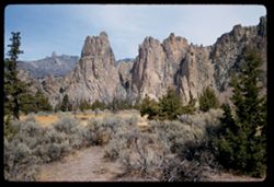
- Description:
- 50 f 9
- Subject:
- Cliffs, Trees, Buttes, Mountains, Rock formations, Smith Rock (Or.), and Shrubs
- Series:
- 23-60
- Creator:
- Cushman, Charles W., 1896-1972
- Date Created:
- 1960-09-17
- Genre:
- Landscape photographs
- Frame Number:
- 33
- County:
- Deschutes
- Abstract:
- Broad view of 29 + 30
- Call Number:
- P11652
- Country:
- United States
- State/Province:
- Oregon
- Alternate Identifier:
- 2360.33
- Persistent URL:
- http://purl.dlib.indiana.edu/iudl/archives/cushman/P11652
- Holding Location:
- Bloomington - University Archives
Wells Library E460
1320 E 10th St.
Bloomington, IN 47405
Contact at archives@indiana.edu, 812-855-1127
-
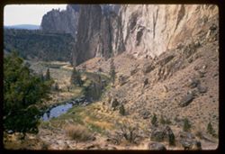
- Description:
- 50 f 6.3 sl
- Subject:
- Cliffs, Trees, Boulders, Buttes, Mountains, Shrubs, Smith Rock (Or.), Streams, and Rock formations
- Series:
- 23-60
- Creator:
- Cushman, Charles W., 1896-1972
- Date Created:
- 1960-09-17
- Genre:
- Landscape photographs
- Frame Number:
- 32
- County:
- Deschutes
- Abstract:
- Looking down into creek
- Call Number:
- P11651
- Country:
- United States
- State/Province:
- Oregon
- Alternate Identifier:
- 2360.32
- Persistent URL:
- http://purl.dlib.indiana.edu/iudl/archives/cushman/P11651
- Holding Location:
- Bloomington - University Archives
Wells Library E460
1320 E 10th St.
Bloomington, IN 47405
Contact at archives@indiana.edu, 812-855-1127
-
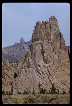
- Description:
- 100 f 8 tl
- Subject:
- Cliffs, Buttes, Mountains, Rock formations, Smith Rock (Or.), and Shrubs
- Series:
- 23-60
- Creator:
- Cushman, Charles W., 1896-1972
- Date Created:
- 1960-09-17
- Genre:
- Landscape photographs and Identification photographs
- Frame Number:
- 29
- County:
- Deschutes
- Call Number:
- P11649
- City:
- Terrebonne
- Country:
- United States
- State/Province:
- Oregon
- Alternate Identifier:
- 2360.29
- Persistent URL:
- http://purl.dlib.indiana.edu/iudl/archives/cushman/P11649
- Holding Location:
- Bloomington - University Archives
Wells Library E460
1320 E 10th St.
Bloomington, IN 47405
Contact at archives@indiana.edu, 812-855-1127
-
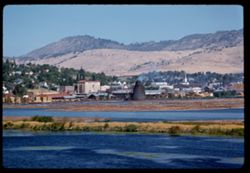
- Description:
- 100 f 5.6 tl
- Subject:
- Sandbars, Industrial facilities, Hills, Bodies of water, Mountains, Shrubs, Buildings, Islands, and Houses
- Series:
- 23-60
- Creator:
- Cushman, Charles W., 1896-1972
- Date Created:
- 1960-09-16
- Genre:
- Landscape photographs, Cityscape photographs, and Views
- Frame Number:
- 10
- County:
- Klamath
- Abstract:
- Klamath Falls from south
- Call Number:
- P11632
- City:
- Klamath Falls
- Country:
- United States
- State/Province:
- Oregon
- Alternate Identifier:
- 2360.10
- Persistent URL:
- http://purl.dlib.indiana.edu/iudl/archives/cushman/P11632
- Holding Location:
- Bloomington - University Archives
Wells Library E460
1320 E 10th St.
Bloomington, IN 47405
Contact at archives@indiana.edu, 812-855-1127
-
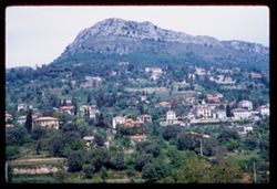
- Subject:
- Houses, Trees, Croplands, Buildings, Shrubs, Hills, and Mountains
- Series:
- 8-60
- Creator:
- Cushman, Charles W., 1896-1972
- Date Created:
- 1960-05-16
- Genre:
- Landscape photographs and Cityscape photographs
- Frame Number:
- 5
- County:
- Alpes-Maritimes
- Call Number:
- P11105
- City:
- Vence
- Country:
- France
- State/Province:
- Provence-Alpes-Côte d'Azur
- Alternate Identifier:
- 860.5
- Persistent URL:
- http://purl.dlib.indiana.edu/iudl/archives/cushman/P11105
- Holding Location:
- Bloomington - University Archives
Wells Library E460
1320 E 10th St.
Bloomington, IN 47405
Contact at archives@indiana.edu, 812-855-1127
-
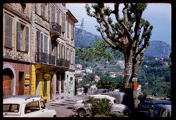
- Subject:
- Balconies, Grilles, Automobiles, Trees, Signs (Notices), Shutters, Mountains, Buildings, Shrubs, Hills, Railings, and Stores & shops
- Series:
- 8-60
- Creator:
- Cushman, Charles W., 1896-1972
- Date Created:
- 1960-05-16
- Genre:
- Cityscape photographs
- Frame Number:
- 4
- County:
- Alpes-Maritimes
- Call Number:
- P11104
- City:
- Vence
- Country:
- France
- State/Province:
- Provence-Alpes-Côte d'Azur
- Alternate Identifier:
- 860.4
- Persistent URL:
- http://purl.dlib.indiana.edu/iudl/archives/cushman/P11104
- Holding Location:
- Bloomington - University Archives
Wells Library E460
1320 E 10th St.
Bloomington, IN 47405
Contact at archives@indiana.edu, 812-855-1127
-
- Subject:
- Hotels, Balconies, Streets, Hills, Automobiles, Windows, Hotel Martinez (Cannes, France), Sidewalks, Shrubs, Trees, Buildings, Palms, and Mountains
- Series:
- 7-60
- Creator:
- Cushman, Charles W., 1896-1972
- Date Created:
- 1960-05-15
- Genre:
- Cityscape photographs
- Frame Number:
- 27
- County:
- Alpes-Maritimes
- Abstract:
- View north alongside hotel Martinez
- Call Number:
- P11091
- City:
- Cannes
- Country:
- France
- State/Province:
- Provence-Alpes-Côte d'Azur
- Alternate Identifier:
- 760.27
- Persistent URL:
- http://purl.dlib.indiana.edu/iudl/archives/cushman/P11091
- Holding Location:
- Bloomington - University Archives
Wells Library E460
1320 E 10th St.
Bloomington, IN 47405
Contact at archives@indiana.edu, 812-855-1127
-
- Description:
- 100 f 11 tl
- Subject:
- Catalpas, Catalpa, Hills, Windows, Mountains, Shrubs, Electric lines, Trees, Fences, and Houses
- Series:
- 16-59
- Creator:
- Cushman, Charles W., 1896-1972
- Date Created:
- 1959-10-03
- Genre:
- Identification photographs
- Frame Number:
- 22
- County:
- Marin
- Abstract:
- Catalpa- Bolinas Bay
- Call Number:
- P10874
- City:
- Bolinas
- Country:
- United States
- State/Province:
- California
- Physical Description:
- Anscochrome film.
- Alternate Identifier:
- 1659.22
- Persistent URL:
- http://purl.dlib.indiana.edu/iudl/archives/cushman/P10874
- Holding Location:
- Bloomington - University Archives
Wells Library E460
1320 E 10th St.
Bloomington, IN 47405
Contact at archives@indiana.edu, 812-855-1127
-
- Description:
- 100 f 8 TL
- Subject:
- Domes, Streets, Hills, Skyscrapers, Roads, Mountains, Shrubs, Buildings, Grasses, Houses, and Dwellings
- Series:
- 12-59
- Creator:
- Cushman, Charles W., 1896-1972
- Date Created:
- 1959-05-10
- Genre:
- Cityscape photographs
- Frame Number:
- 36
- Street Address:
- Clipper Street
- County:
- San Francisco
- Abstract:
- From top of Clipper St.
- Call Number:
- P10798
- City:
- San Francisco
- Country:
- United States
- State/Province:
- California
- Alternate Identifier:
- 1259.36
- Persistent URL:
- http://purl.dlib.indiana.edu/iudl/archives/cushman/P10798
- Holding Location:
- Bloomington - University Archives
Wells Library E460
1320 E 10th St.
Bloomington, IN 47405
Contact at archives@indiana.edu, 812-855-1127
-
- Description:
- 100 f 8 TL
- Subject:
- Grasses, Houses, Skyscrapers, Streets, Mountains, Buildings, Shrubs, Dwellings, Domes, Roads, and Hills
- Series:
- 12-59
- Creator:
- Cushman, Charles W., 1896-1972
- Date Created:
- 1959-05-10
- Genre:
- Cityscape photographs
- Frame Number:
- 35
- Street Address:
- Clipper Street
- County:
- San Francisco
- Abstract:
- From top of Clipper St.
- Call Number:
- P10797
- City:
- San Francisco
- Country:
- United States
- State/Province:
- California
- Alternate Identifier:
- 1259.35
- Persistent URL:
- http://purl.dlib.indiana.edu/iudl/archives/cushman/P10797
- Holding Location:
- Bloomington - University Archives
Wells Library E460
1320 E 10th St.
Bloomington, IN 47405
Contact at archives@indiana.edu, 812-855-1127
-
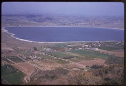
- Description:
- 100 f 6.3 tl
- Subject:
- Lakes & ponds, Cities & towns, Hills, Roads, Mountains, Shrubs, Trees, Buildings, Plants, Houses, and Lake Elsinore (Calif.)
- Series:
- 11-59
- Creator:
- Cushman, Charles W., 1896-1972
- Date Created:
- 1959-03-25
- Genre:
- Aerial photographs
- Frame Number:
- 22
- County:
- Riverside
- Abstract:
- L. Elsinore from above
- Call Number:
- P10747
- City:
- Elsinore
- Country:
- United States
- State/Province:
- California
- Alternate Identifier:
- 1159.22
- Persistent URL:
- http://purl.dlib.indiana.edu/iudl/archives/cushman/P10747
- Holding Location:
- Bloomington - University Archives
Wells Library E460
1320 E 10th St.
Bloomington, IN 47405
Contact at archives@indiana.edu, 812-855-1127
-
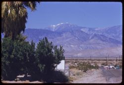
- Description:
- 100 f 8 tl
- Subject:
- Snow, Electric lines, Roads, San Gorgonio Mountain (Calif.), Automobiles, Trees, San Jacinto Peak (Calif.), Mountains, Shrubs, Utility poles, and Palms
- Series:
- 11-59
- Creator:
- Cushman, Charles W., 1896-1972
- Date Created:
- 1959-03-25
- Genre:
- Landscape photographs
- Frame Number:
- 18
- County:
- Riverside
- Abstract:
- Mt. San Gorgonio from road north of Palm Springs
- Call Number:
- P10743
- City:
- Palm Springs
- Country:
- United States
- State/Province:
- California
- Alternate Identifier:
- 1159.18
- Persistent URL:
- http://purl.dlib.indiana.edu/iudl/archives/cushman/P10743
- Holding Location:
- Bloomington - University Archives
Wells Library E460
1320 E 10th St.
Bloomington, IN 47405
Contact at archives@indiana.edu, 812-855-1127
-
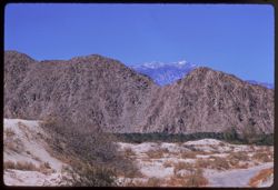
- Description:
- 100 f 9 tl
- Subject:
- San Jacinto Peak (Calif.), Hills, San Gorgonio Mountain (Calif.), Sand, Mountains, Shrubs, and Snow
- Series:
- 11-59
- Creator:
- Cushman, Charles W., 1896-1972
- Date Created:
- 1959-03-25
- Genre:
- Landscape photographs
- Frame Number:
- 16
- County:
- Riverside
- Abstract:
- San Jacinto mtn thru watch in bown foothills
- Call Number:
- P10741
- Country:
- United States
- State/Province:
- California
- Alternate Identifier:
- 1159.16
- Persistent URL:
- http://purl.dlib.indiana.edu/iudl/archives/cushman/P10741
- Holding Location:
- Bloomington - University Archives
Wells Library E460
1320 E 10th St.
Bloomington, IN 47405
Contact at archives@indiana.edu, 812-855-1127