
Search Constraints
You searched for:
Campus
IUB
Remove constraint Campus: IUB
State/Province
Arizona
Remove constraint State/Province: Arizona
« Previous |
1 - 100 of 962
|
Next »
Search Results
-
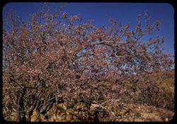
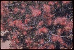
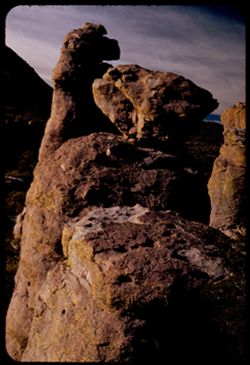
- Subject:
- Hornbeams, Ironwoods, Tucson Mountains (Ariz.), Shrubs, and Trees
- Series:
- 5-40
- Creator:
- Cushman, Charles W., 1896-1972
- Date Created:
- 1940-05-01
- Genre:
- Identification photographs
- Frame Number:
- 7
- County:
- Pima
- Abstract:
- Ironwood in bloom. Tucson Mtns.
- Call Number:
- P01815
- Country:
- United States
- State/Province:
- Arizona
- Alternate Identifier:
- 540.7
- Persistent URL:
- http://purl.dlib.indiana.edu/iudl/archives/cushman/P01815
- Holding Location:
- Bloomington - University Archives
Wells Library E460
1320 E 10th St.
Bloomington, IN 47405
Contact at archives@indiana.edu, 812-855-1127
-
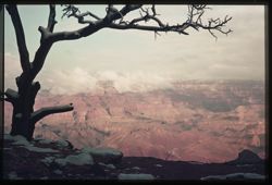
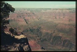
- Subject:
- Desert View Point (Ariz.), Canyons, Grand Canyon (Ariz.), Snow, Clouds, and Tree limbs
- Series:
- 7-39
- Creator:
- Cushman, Charles W., 1896-1972
- Date Created:
- 1939-11-29
- Genre:
- Landscape photographs
- Frame Number:
- 3
- County:
- Coconino
- Abstract:
- Q-3= Yesterday's snow along rim at Desert View.
- Call Number:
- P01667
- City:
- Desert View
- Country:
- United States
- State/Province:
- Arizona
- Physical Description:
- some dye fading. Image was originally mounted in a glass enclosure. Before digitization, the image was removed and placed in a Wess Plastic, Inc. brand, 2&qu...
- Alternate Identifier:
- 739.3
- Persistent URL:
- http://purl.dlib.indiana.edu/iudl/archives/cushman/P01667
- Holding Location:
- Bloomington - University Archives
Wells Library E460
1320 E 10th St.
Bloomington, IN 47405
Contact at archives@indiana.edu, 812-855-1127
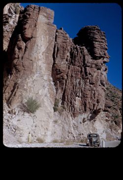
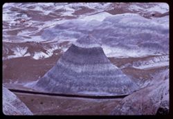
-
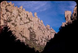
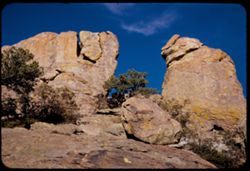
- Description:
- 50 f 9
- Subject:
- National parks & reserves, Cliffs, Shrubs, Trees, Rocks, Chiricahua National Monument (Ariz.), and Rock formations
- Series:
- 4-52
- Creator:
- Cushman, Charles W., 1896-1972
- Date Created:
- 1952-01-22
- Genre:
- Landscape photographs
- Frame Number:
- 2
- County:
- Cochise
- Abstract:
- View up thru gap
- Call Number:
- P05608
- Country:
- United States
- State/Province:
- Arizona
- Alternate Identifier:
- 452.2
- Persistent URL:
- http://purl.dlib.indiana.edu/iudl/archives/cushman/P05608
- Holding Location:
- Bloomington - University Archives
Wells Library E460
1320 E 10th St.
Bloomington, IN 47405
Contact at archives@indiana.edu, 812-855-1127
-
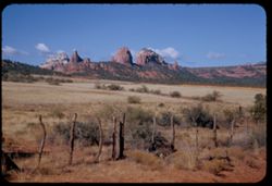
- Description:
- 50 f 11
- Subject:
- Meadows, Hills, Shrubs, Grasses, Fences, Clouds, and Rock formations
- Series:
- 15-53
- Creator:
- Cushman, Charles W., 1896-1972
- Date Created:
- 1953-11-21
- Genre:
- Landscape photographs
- Frame Number:
- 26
- County:
- Coconino
- Abstract:
- Rock forms NW from Sedona
- Call Number:
- P07059
- City:
- Sedona
- Country:
- United States
- State/Province:
- Arizona
- Alternate Identifier:
- 1553.26
- Persistent URL:
- http://purl.dlib.indiana.edu/iudl/archives/cushman/P07059
- Holding Location:
- Bloomington - University Archives
Wells Library E460
1320 E 10th St.
Bloomington, IN 47405
Contact at archives@indiana.edu, 812-855-1127
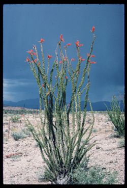
-
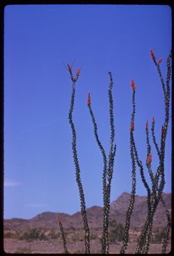
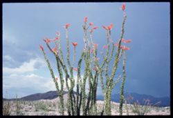
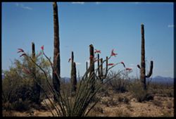
- Description:
- 100 f 8 tl
- Subject:
- Deserts, Flowers, Ocotillo, Mountains, Shrubs, and Clouds
- Series:
- 11-59
- Creator:
- Cushman, Charles W., 1896-1972
- Date Created:
- 1959-03-24
- Genre:
- Identification photographs
- Frame Number:
- 11
- County:
- Yuma and Riverside
- Abstract:
- Our finest ocotillo - 15-20 mi east of Blythe
- Call Number:
- P10736
- City:
- Blythe and Quartzsite
- Country:
- United States
- State/Province:
- Arizona and California
- Alternate Identifier:
- 1159.11
- Persistent URL:
- http://purl.dlib.indiana.edu/iudl/archives/cushman/P10736
- Holding Location:
- Bloomington - University Archives
Wells Library E460
1320 E 10th St.
Bloomington, IN 47405
Contact at archives@indiana.edu, 812-855-1127
-
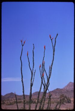
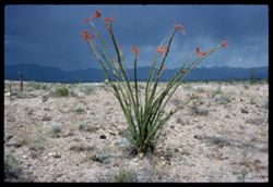
- Description:
- 250 f 5.6
- Subject:
- Deserts, Flowers, Ocotillo, Mountains, Shrubs, and Clouds
- Series:
- 11-59
- Creator:
- Cushman, Charles W., 1896-1972
- Date Created:
- 1959-03-24
- Genre:
- Identification photographs
- Frame Number:
- 12
- County:
- Yuma and Riverside
- Abstract:
- Our finest ocotillo - 15-20 mi east of Blythe
- Call Number:
- P10737
- City:
- Blythe and Quartzsite
- Country:
- United States
- State/Province:
- Arizona and California
- Alternate Identifier:
- 1159.12
- Persistent URL:
- http://purl.dlib.indiana.edu/iudl/archives/cushman/P10737
- Holding Location:
- Bloomington - University Archives
Wells Library E460
1320 E 10th St.
Bloomington, IN 47405
Contact at archives@indiana.edu, 812-855-1127
-
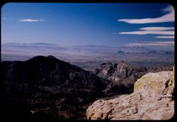
- Description:
- 50 f 6.3 Pola
- Subject:
- Valleys, Mountains, Tucson Mountains (Ariz.), Sierrita Mountains (Ariz.), Rock formations, and Clouds
- Series:
- 4-52
- Creator:
- Cushman, Charles W., 1896-1972
- Date Created:
- 1952-01-25
- Genre:
- Landscape photographs
- Frame Number:
- 17
- Street Address:
- Mount Lemmon Road
- County:
- Pima
- Abstract:
- View over Tucson from same location
- Call Number:
- P05623
- City:
- Tucson
- Country:
- United States
- State/Province:
- Arizona
- Alternate Identifier:
- 452.17
- Persistent URL:
- http://purl.dlib.indiana.edu/iudl/archives/cushman/P05623
- Holding Location:
- Bloomington - University Archives
Wells Library E460
1320 E 10th St.
Bloomington, IN 47405
Contact at archives@indiana.edu, 812-855-1127
-
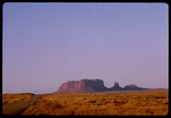
- Description:
- 100 f 11 TL
- Subject:
- Erosion, Plains, Valleys, Cliffs, Monument Valley (Ariz. and Utah), Buttes, Grasses, and Rock formations
- Series:
- 38-65
- Creator:
- Cushman, Charles W., 1896-1972
- Date Created:
- 1965-10-10
- Genre:
- Landscape photographs
- Frame Number:
- 1
- Street Address:
- United States Highway 464
- County:
- Navajo
- Abstract:
- Big Sq. Butte (12 mi. N)
- Call Number:
- P15144
- City:
- Kayenta
- Country:
- United States
- State/Province:
- Arizona
- Alternate Identifier:
- 3865.1
- Persistent URL:
- http://purl.dlib.indiana.edu/iudl/archives/cushman/P15144
- Holding Location:
- Bloomington - University Archives
Wells Library E460
1320 E 10th St.
Bloomington, IN 47405
Contact at archives@indiana.edu, 812-855-1127
-
- Description:
- 100 f 11 TL
- Subject:
- Boundaries, Plains, Valleys, Cliffs, Monument Valley (Ariz. and Utah), Buttes, Rock formations, and Grasses
- Series:
- 38-65
- Creator:
- Cushman, Charles W., 1896-1972
- Date Created:
- 1965-10-10
- Genre:
- Landscape photographs
- Frame Number:
- 2
- County:
- Navajo
- Abstract:
- Temples 24 mi. N of Junction.
- Call Number:
- P15145
- City:
- Kayenta
- Country:
- United States
- State/Province:
- Arizona
- Alternate Identifier:
- 3865.2
- Persistent URL:
- http://purl.dlib.indiana.edu/iudl/archives/cushman/P15145
- Holding Location:
- Bloomington - University Archives
Wells Library E460
1320 E 10th St.
Bloomington, IN 47405
Contact at archives@indiana.edu, 812-855-1127
-
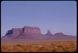
- Description:
- 100 f 11 TL
- Subject:
- Boundaries, Plains, Roads, Cliffs, Monument Valley (Ariz. and Utah), Buttes, Rock formations, Mesas, and Grasses
- Series:
- 37-65
- Creator:
- Cushman, Charles W., 1896-1972
- Date Created:
- 1965-10-09
- Genre:
- Landscape photographs
- Frame Number:
- 24
- Abstract:
- In Monument Valley near Utah-Arizona border.
- Call Number:
- P15130
- Country:
- United States
- State/Province:
- Arizona and Utah
- Alternate Identifier:
- 3765.24
- Persistent URL:
- http://purl.dlib.indiana.edu/iudl/archives/cushman/P15130
- Holding Location:
- Bloomington - University Archives
Wells Library E460
1320 E 10th St.
Bloomington, IN 47405
Contact at archives@indiana.edu, 812-855-1127
-
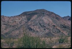
- Description:
- 100 f 8
- Subject:
- Mountains, Tucson Mountains (Ariz.), Shrubs, Cactus, and Clouds
- Series:
- 7-59
- Creator:
- Cushman, Charles W., 1896-1972
- Date Created:
- 1959-02-02
- Genre:
- Landscape photographs
- Frame Number:
- 2
- Street Address:
- Ajo Way
- County:
- Pima
- Abstract:
- a Tucson mtn. from SE
- Call Number:
- P10578
- City:
- Tucson
- Country:
- United States
- State/Province:
- Arizona
- Physical Description:
- masked.
- Alternate Identifier:
- 759.2
- Persistent URL:
- http://purl.dlib.indiana.edu/iudl/archives/cushman/P10578
- Holding Location:
- Bloomington - University Archives
Wells Library E460
1320 E 10th St.
Bloomington, IN 47405
Contact at archives@indiana.edu, 812-855-1127
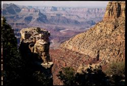
-
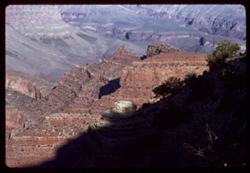
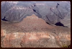
- Subject:
- Granite Gorge (Ariz.), Cheops Pyramid (Ariz.), Shrubs, Yavapai Point (Ariz.), Trees, Rock formations, and Canyons
- Series:
- 13-40
- Creator:
- Cushman, Charles W., 1896-1972
- Date Created:
- 1940-07-15
- Genre:
- Landscape photographs
- Frame Number:
- 6
- Abstract:
- Looking down on Granite Gorge from Yavapai Pt. Monday afternoon.
- Call Number:
- P02005
- Country:
- United States
- State/Province:
- Arizona
- Physical Description:
- Image was originally mounted in a glass enclosure. Before digitization, the image was removed and placed in a Wess Plastic, Inc. brand, 2" x 2", pl...
- Alternate Identifier:
- 1340.6
- Persistent URL:
- http://purl.dlib.indiana.edu/iudl/archives/cushman/P02005
- Holding Location:
- Bloomington - University Archives
Wells Library E460
1320 E 10th St.
Bloomington, IN 47405
Contact at archives@indiana.edu, 812-855-1127
-
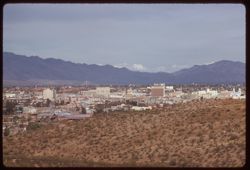
- Description:
- 100 f 6.3 tl
- Subject:
- Domes, Cities & towns, Streets, Automobiles, Mountains, Tucson Mountains (Ariz.), Shrubs, Trees, Buildings, Signs (Notices), Clouds, and Dwellings
- Series:
- 8-59
- Creator:
- Cushman, Charles W., 1896-1972
- Date Created:
- 1959-02-11
- Genre:
- Cityscape photographs
- Frame Number:
- 4
- County:
- Pima
- Abstract:
- Tucson from A Mtn.
- Call Number:
- P10618
- City:
- Tucson
- Country:
- United States
- State/Province:
- Arizona
- Alternate Identifier:
- 859.4
- Persistent URL:
- http://purl.dlib.indiana.edu/iudl/archives/cushman/P10618
- Holding Location:
- Bloomington - University Archives
Wells Library E460
1320 E 10th St.
Bloomington, IN 47405
Contact at archives@indiana.edu, 812-855-1127
-
- Subject:
- Canyons, Pima Point (Ariz.), Powell Plateau (Ariz.), Shrubs, Trees, and Shadows
- Series:
- 9-39
- Creator:
- Cushman, Charles W., 1896-1972
- Date Created:
- 1939-11-30
- Genre:
- Landscape photographs
- Frame Number:
- 10
- County:
- Coconino
- Abstract:
- S-10: Looking past Pima Pt. toward Powell Plateau
- Call Number:
- P01710
- Country:
- United States
- State/Province:
- Arizona
- Physical Description:
- some dye fading. Image was originally mounted in a glass enclosure. Before digitization, the image was removed and placed in a Wess Plastic, Inc. brand, 2&qu...
- Alternate Identifier:
- 939.10
- Persistent URL:
- http://purl.dlib.indiana.edu/iudl/archives/cushman/P01710
- Holding Location:
- Bloomington - University Archives
Wells Library E460
1320 E 10th St.
Bloomington, IN 47405
Contact at archives@indiana.edu, 812-855-1127
-
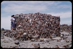
- Description:
- 25 f 9
- Subject:
- Petrified wood, Petrified forests, National parks & reserves, Stone walls, Houses, Agates, Stone houses, Stonework, Rocks, Agate House (Ariz.), Petrified...
- Series:
- 17-52
- Creator:
- Cushman, Charles W., 1896-1972
- Date Created:
- 1952-04-13
- Genre:
- Portraits, Identification photographs, and Architectural photographs
- Frame Number:
- 29
- County:
- Navajo
- Persons Pictured:
- Cushman, Jean
- Abstract:
- Jean at Agate House
- Call Number:
- P06121
- Country:
- United States
- State/Province:
- Arizona
- Alternate Identifier:
- 1752.29
- Persistent URL:
- http://purl.dlib.indiana.edu/iudl/archives/cushman/P06121
- Holding Location:
- Bloomington - University Archives
Wells Library E460
1320 E 10th St.
Bloomington, IN 47405
Contact at archives@indiana.edu, 812-855-1127
-
- Description:
- 100 f 16 SL
- Subject:
- Hills, Navajo Indian Reservation, Cliffs, Indian reservations, Trees, Grasses, and Rock formations
- Series:
- 36-65
- Creator:
- Cushman, Charles W., 1896-1972
- Date Created:
- 1965-10-07
- Frame Number:
- 29
- County:
- Apache
- Abstract:
- Distant view.
- Call Number:
- P15097
- City:
- Window Rock
- Country:
- United States
- State/Province:
- Arizona
- Alternate Identifier:
- 3665.29
- Persistent URL:
- http://purl.dlib.indiana.edu/iudl/archives/cushman/P15097
- Holding Location:
- Bloomington - University Archives
Wells Library E460
1320 E 10th St.
Bloomington, IN 47405
Contact at archives@indiana.edu, 812-855-1127
-
- Description:
- 100 f 8 tl
- Subject:
- Flowers, Mountains, and Shrubs
- Series:
- 11-59
- Creator:
- Cushman, Charles W., 1896-1972
- Date Created:
- 1959-03-24
- Genre:
- Landscape photographs
- Frame Number:
- 6
- County:
- Yuma
- Abstract:
- RM Mtns
- Call Number:
- P10731
- City:
- Quartzsite
- Country:
- United States
- State/Province:
- Arizona
- Alternate Identifier:
- 1159.6
- Persistent URL:
- http://purl.dlib.indiana.edu/iudl/archives/cushman/P10731
- Holding Location:
- Bloomington - University Archives
Wells Library E460
1320 E 10th St.
Bloomington, IN 47405
Contact at archives@indiana.edu, 812-855-1127
-
- Description:
- 100 f 8 tl
- Subject:
- Deserts and Flowers
- Series:
- 11-59
- Creator:
- Cushman, Charles W., 1896-1972
- Date Created:
- 1959-03-24
- Genre:
- Identification photographs
- Frame Number:
- 9
- County:
- Yuma
- Abstract:
- Flowers of
- Call Number:
- P10734
- City:
- Quartzsite
- Country:
- United States
- State/Province:
- Arizona
- Alternate Identifier:
- 1159.9
- Persistent URL:
- http://purl.dlib.indiana.edu/iudl/archives/cushman/P10734
- Holding Location:
- Bloomington - University Archives
Wells Library E460
1320 E 10th St.
Bloomington, IN 47405
Contact at archives@indiana.edu, 812-855-1127
-
- Description:
- 50 f 8
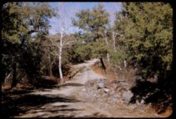
- Subject:
- Canyons, Roads, Trees, Rocks, and Madeira Canyon (Ariz.)
- Series:
- 2-52
- Creator:
- Cushman, Charles W., 1896-1972
- Date Created:
- 1952-01-14
- Genre:
- Landscape photographs
- Frame Number:
- 30
- Street Address:
- Madeira Canyon Road
- Abstract:
- In Madeira Canyon.
- Call Number:
- P05560
- Country:
- United States
- State/Province:
- Arizona
- Alternate Identifier:
- 252.30
- Persistent URL:
- http://purl.dlib.indiana.edu/iudl/archives/cushman/P05560
- Holding Location:
- Bloomington - University Archives
Wells Library E460
1320 E 10th St.
Bloomington, IN 47405
Contact at archives@indiana.edu, 812-855-1127
-
- Description:
- 25 F 9
- Subject:
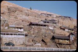
- Sacramento Pit, Cities & towns, Houses, Automobiles, Cliffs, Mountains, Clotheslines, Utility poles, Electric lines, Trees, Rocks, Retaining walls, Porch...
- Series:
- 1-52
- Creator:
- Cushman, Charles W., 1896-1972
- Date Created:
- 1952-01-04
- Genre:
- Cityscape photographs and Views
- Frame Number:
- 36
- County:
- Cochise
- Abstract:
- Bisbee houses on mountainside.
- Call Number:
- P05526
- City:
- Bisbee
- Country:
- United States
- State/Province:
- Arizona
- Alternate Identifier:
- 152.36
- Persistent URL:
- http://purl.dlib.indiana.edu/iudl/archives/cushman/P05526
- Holding Location:
- Bloomington - University Archives
Wells Library E460
1320 E 10th St.
Bloomington, IN 47405
Contact at archives@indiana.edu, 812-855-1127
-
- Subject:
- Boundaries, Plains, Valleys, Cliffs, Monument Valley (Ariz. and Utah), Buttes, Rock formations, and Mesas
- Series:
- 37-65
- Creator:
- Cushman, Charles W., 1896-1972
- Date Created:
- 1965-10-09
- Genre:
- Landscape photographs
- Frame Number:
- 25
- Abstract:
- In Monument Valley near Utah-Arizona border.
- Call Number:
- P15131
- Country:
- United States
- State/Province:
- Arizona and Utah
- Alternate Identifier:
- 3765.25
- Persistent URL:
- http://purl.dlib.indiana.edu/iudl/archives/cushman/P15131
- Holding Location:
- Bloomington - University Archives
Wells Library E460
1320 E 10th St.
Bloomington, IN 47405
Contact at archives@indiana.edu, 812-855-1127
-
- Description:
- 100 f 11 TL
- Subject:
- Erosion, Valleys, Cliffs, Monument Valley (Ariz. and Utah), Buttes, Rock formations, Mesas, and Grasses
- Series:
- 37-65
- Creator:
- Cushman, Charles W., 1896-1972
- Date Created:
- 1965-10-10
- Genre:
- Landscape photographs
- Frame Number:
- 32
- Call Number:
- P15138
- Country:
- United States
- State/Province:
- Arizona
- Alternate Identifier:
- 3765.32
- Persistent URL:
- http://purl.dlib.indiana.edu/iudl/archives/cushman/P15138
- Holding Location:
- Bloomington - University Archives
Wells Library E460
1320 E 10th St.
Bloomington, IN 47405
Contact at archives@indiana.edu, 812-855-1127
-
- Subject:
- Leaves, Desert View Point (Ariz.), Canyons, Grand Canyon (Ariz.), Snow, Clouds, and Tree limbs
- Series:
- 7-39
- Creator:
- Cushman, Charles W., 1896-1972
- Date Created:
- 1939-11-29
- Genre:
- Landscape photographs
- Frame Number:
- 7
- County:
- Coconino
- Abstract:
- Q-7: Cloud caps over Canyon from Desert View pt.
- Call Number:
- P01671
- City:
- Desert View
- Country:
- United States
- State/Province:
- Arizona
- Physical Description:
- some dye fading. Image was originally mounted in a glass enclosure. Before digitization, the image was removed and placed in a Wess Plastic, Inc. brand, 2&qu...
- Alternate Identifier:
- 739.7
- Persistent URL:
- http://purl.dlib.indiana.edu/iudl/archives/cushman/P01671
- Holding Location:
- Bloomington - University Archives
Wells Library E460
1320 E 10th St.
Bloomington, IN 47405
Contact at archives@indiana.edu, 812-855-1127
-
- Description:
- 50 f 6.3 pola
- Subject:
- Cliffs, Mountains, Shrubs, Santa Catalina Mountains (Ariz.), Boulders, Rock formations, and Clouds
- Series:
- 4-52
- Creator:
- Cushman, Charles W., 1896-1972
- Date Created:
- 1952-01-25
- Genre:
- Landscape photographs
- Frame Number:
- 20
- Street Address:
- Mount Lemmon Road
- Abstract:
- View toward Santa Catalina tops westward
- Call Number:
- P05626
- Country:
- United States
- State/Province:
- Arizona
- Alternate Identifier:
- 452.20
- Persistent URL:
- http://purl.dlib.indiana.edu/iudl/archives/cushman/P05626
- Holding Location:
- Bloomington - University Archives
Wells Library E460
1320 E 10th St.
Bloomington, IN 47405
Contact at archives@indiana.edu, 812-855-1127
-
- Description:
- 100 f 9 tl
- Subject:
- Roskruge Mountains (Ariz.), Mountains, and Shrubs
- Series:
- 8-59
- Creator:
- Cushman, Charles W., 1896-1972
- Date Created:
- 1959-02-20
- Genre:
- Landscape photographs
- Frame Number:
- 34
- Street Address:
- Ajo Way
- County:
- Pima
- Abstract:
- A single beauty
- Call Number:
- P10648
- Country:
- United States
- State/Province:
- Arizona
- Alternate Identifier:
- 859.34
- Persistent URL:
- http://purl.dlib.indiana.edu/iudl/archives/cushman/P10648
- Holding Location:
- Bloomington - University Archives
Wells Library E460
1320 E 10th St.
Bloomington, IN 47405
Contact at archives@indiana.edu, 812-855-1127
-
- Description:
- 100 f 8 tl
- Subject:
- Baboquivari Peak (Ariz.), Mountains, Shrubs, Cactus, and Topara
- Series:
- 8-59
- Creator:
- Cushman, Charles W., 1896-1972
- Date Created:
- 1959-02-20
- Genre:
- Landscape photographs
- Frame Number:
- 37
- County:
- Pima
- Abstract:
- Babaoquivari from road south of Topara
- Call Number:
- P10651
- Country:
- United States
- State/Province:
- Arizona
- Alternate Identifier:
- 859.37
- Persistent URL:
- http://purl.dlib.indiana.edu/iudl/archives/cushman/P10651
- Holding Location:
- Bloomington - University Archives
Wells Library E460
1320 E 10th St.
Bloomington, IN 47405
Contact at archives@indiana.edu, 812-855-1127
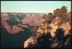
-
- Subject:
- Canyons, Grand Canyon (Ariz.), Shrubs, and Trees
- Series:
- 8-39
- Creator:
- Cushman, Charles W., 1896-1972
- Date Created:
- 1939-11-30
- Genre:
- Landscape photographs
- Frame Number:
- 16
- Street Address:
- Bright Angel Trail
- Abstract:
- R-16: Looking into depths from Bright Angel Trail.
- Call Number:
- P01697
- Country:
- United States
- State/Province:
- Arizona
- Physical Description:
- some dye fading. Image was originally mounted in a glass enclosure. Before digitization, the image was removed and placed in a Wess Plastic, Inc. brand, 2&qu...
- Alternate Identifier:
- 839.16
- Persistent URL:
- http://purl.dlib.indiana.edu/iudl/archives/cushman/P01697
- Holding Location:
- Bloomington - University Archives
Wells Library E460
1320 E 10th St.
Bloomington, IN 47405
Contact at archives@indiana.edu, 812-855-1127
-
- Description:
- 25 f 12
- Subject:
- Oak Creek Canyon (Ariz.), Canyons, Cliffs, Mountains, Trees, and Rock formations
- Series:
- 16-52
- Creator:
- Cushman, Charles W., 1896-1972
- Date Created:
- 1952-04-12
- Genre:
- Landscape photographs
- Frame Number:
- 37
- County:
- Coconino and Coconimo
- Abstract:
- Side of canyon smudge
- Call Number:
- P06095
- City:
- Flagstaff and Sedona
- Country:
- United States
- State/Province:
- Arizona
- Alternate Identifier:
- 1652.37
- Persistent URL:
- http://purl.dlib.indiana.edu/iudl/archives/cushman/P06095
- Holding Location:
- Bloomington - University Archives
Wells Library E460
1320 E 10th St.
Bloomington, IN 47405
Contact at archives@indiana.edu, 812-855-1127
-
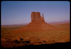
- Description:
- 200 f 8 TL
- Subject:
- Valleys, Parks, Cliffs, Mitten Peak (Ariz.), Monument Valley (Ariz. and Utah), Buttes, and Rock formations
- Series:
- 38-65
- Creator:
- Cushman, Charles W., 1896-1972
- Date Created:
- 1965-10-10
- Genre:
- Landscape photographs
- Frame Number:
- 14
- County:
- Navajo
- Abstract:
- Mitten et al
- Call Number:
- P15157
- Country:
- United States
- State/Province:
- Arizona
- Alternate Identifier:
- 3865.14
- Persistent URL:
- http://purl.dlib.indiana.edu/iudl/archives/cushman/P15157
- Holding Location:
- Bloomington - University Archives
Wells Library E460
1320 E 10th St.
Bloomington, IN 47405
Contact at archives@indiana.edu, 812-855-1127
-
- Description:
- 200 f 8 TL
- Subject:
- Plains, Valleys, Parks, Cliffs, Monument Valley (Ariz. and Utah), Buttes, and Rock formations
- Series:
- 38-65
- Creator:
- Cushman, Charles W., 1896-1972
- Date Created:
- 1965-10-10
- Genre:
- Landscape photographs
- Frame Number:
- 16
- County:
- Navajo
- Abstract:
- Mitten et al
- Call Number:
- P15159
- Country:
- United States
- State/Province:
- Arizona
- Alternate Identifier:
- 3865.16
- Persistent URL:
- http://purl.dlib.indiana.edu/iudl/archives/cushman/P15159
- Holding Location:
- Bloomington - University Archives
Wells Library E460
1320 E 10th St.
Bloomington, IN 47405
Contact at archives@indiana.edu, 812-855-1127
-
- Description:
- 50 f 8
- Subject:
- Valleys, Roads, Cliffs, Mountains, Santa Catalina Mountains (Ariz.), Boulders, Rocks, and Rock formations
- Series:
- 4-52
- Creator:
- Cushman, Charles W., 1896-1972
- Date Created:
- 1952-01-25
- Genre:
- Landscape photographs
- Frame Number:
- 18
- Street Address:
- Mount Lemmon Road
- Abstract:
- Looking down the mtn from same point
- Call Number:
- P05624
- Country:
- United States
- State/Province:
- Arizona
- Alternate Identifier:
- 452.18
- Persistent URL:
- http://purl.dlib.indiana.edu/iudl/archives/cushman/P05624
- Holding Location:
- Bloomington - University Archives
Wells Library E460
1320 E 10th St.
Bloomington, IN 47405
Contact at archives@indiana.edu, 812-855-1127
-
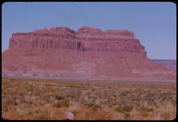
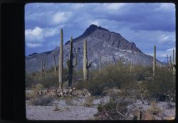
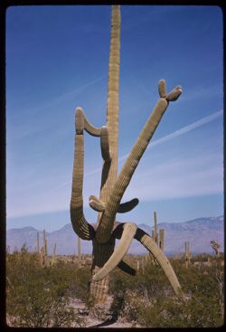
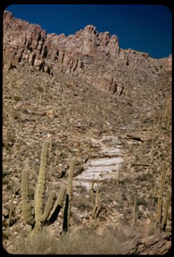
- Description:
- 25 f 12
- Subject:
- National parks & reserves, Deserts, Saguaro, Mountains, Saguaro National Park (Ariz.), Cactus, and Shrubs
- Series:
- 3-52
- Creator:
- Cushman, Charles W., 1896-1972
- Date Created:
- 1952-01-15
- Genre:
- Identification photographs
- Frame Number:
- 4
- County:
- Pima
- Abstract:
- Multi branched Sahuaro showing nobbins.
- Call Number:
- P05573
- City:
- Tucson
- Country:
- United States
- State/Province:
- Arizona
- Alternate Identifier:
- 352.4
- Persistent URL:
- http://purl.dlib.indiana.edu/iudl/archives/cushman/P05573
- Holding Location:
- Bloomington - University Archives
Wells Library E460
1320 E 10th St.
Bloomington, IN 47405
Contact at archives@indiana.edu, 812-855-1127
-
- Description:
- 50 f 11
- Subject:
- Mountains, Shrubs, Rocks, Grasses, Chimney rocks, and Rock formations
- Series:
- 14-53
- Creator:
- Cushman, Charles W., 1896-1972
- Date Created:
- 1953-11-19
- Genre:
- Identification photographs and Landscape photographs
- Frame Number:
- 23
- Street Address:
- United States Highway 70 and United States Highway 60
- County:
- Pinal
- Abstract:
- Row of high chimney rocks above old road
- Call Number:
- P07019
- City:
- Superior
- Country:
- United States
- State/Province:
- Arizona
- Alternate Identifier:
- 1453.23
- Persistent URL:
- http://purl.dlib.indiana.edu/iudl/archives/cushman/P07019
- Holding Location:
- Bloomington - University Archives
Wells Library E460
1320 E 10th St.
Bloomington, IN 47405
Contact at archives@indiana.edu, 812-855-1127
-
- Description:
- 50 f 6.3 POLA
- Subject:
- Smokestacks, Mills, Hills, Smoke, Factories, Roads, Copper mining, Inspiration Copper Co. (Miami, Ariz.), Grasses, Industrial facilities, and Copper industry
- Series:
- 14-53
- Creator:
- Cushman, Charles W., 1896-1972
- Date Created:
- 1953-11-19
- Genre:
- Identification photographs and Architectural photographs
- Frame Number:
- 2
- County:
- Gila
- Abstract:
- Inspiration Copper Co. mill at Miami
- Call Number:
- P06998
- City:
- Miami
- Country:
- United States
- State/Province:
- Arizona
- Alternate Identifier:
- 1453.2
- Persistent URL:
- http://purl.dlib.indiana.edu/iudl/archives/cushman/P06998
- Holding Location:
- Bloomington - University Archives
Wells Library E460
1320 E 10th St.
Bloomington, IN 47405
Contact at archives@indiana.edu, 812-855-1127
-
- Description:
- 100 f 9 tl
- Subject:
- Baboquivari Peak (Ariz.), Mountains, Shrubs, and Grasses
- Series:
- 6-59
- Creator:
- Cushman, Charles W., 1896-1972
- Date Created:
- 1959-01-28
- Genre:
- Landscape photographs
- Frame Number:
- 17
- County:
- Pima
- Abstract:
- Broadside view of Babo. range further north of PK.
- Call Number:
- P10555
- Country:
- United States
- State/Province:
- Arizona
- Alternate Identifier:
- 659.17
- Persistent URL:
- http://purl.dlib.indiana.edu/iudl/archives/cushman/P10555
- Holding Location:
- Bloomington - University Archives
Wells Library E460
1320 E 10th St.
Bloomington, IN 47405
Contact at archives@indiana.edu, 812-855-1127
-
- Description:
- 25 f 8
- Subject:
- Oak Tree Canyon (Ariz.), Cliffs, Mountains, Trees, and Rock formations
- Series:
- 16-52
- Creator:
- Cushman, Charles W., 1896-1972
- Date Created:
- 1952-04-12
- Genre:
- Landscape photographs
- Frame Number:
- 21
- Abstract:
- High red jutting rock 25 f 8 by error
- Call Number:
- P06079
- Country:
- United States
- State/Province:
- Arizona
- Alternate Identifier:
- 1652.21
- Persistent URL:
- http://purl.dlib.indiana.edu/iudl/archives/cushman/P06079
- Holding Location:
- Bloomington - University Archives
Wells Library E460
1320 E 10th St.
Bloomington, IN 47405
Contact at archives@indiana.edu, 812-855-1127
-
- Subject:
- Yaki Point (Ariz.), Trees, Canyons, Shadows, Shrubs, Yavapai Point (Ariz.), and Grand Canyon (Ariz.)
- Series:
- 8-39
- Creator:
- Cushman, Charles W., 1896-1972
- Date Created:
- 1939-11-30
- Genre:
- Landscape photographs
- Frame Number:
- 3
- County:
- Coconino
- Abstract:
- R-3: Downstream from Yavapai point.
- Call Number:
- P01685
- Country:
- United States
- State/Province:
- Arizona
- Physical Description:
- some dye fading. Image was originally mounted in a glass enclosure. Before digitization, the image was removed and placed in a Wess Plastic, Inc. brand, 2&qu...
- Alternate Identifier:
- 839.3
- Persistent URL:
- http://purl.dlib.indiana.edu/iudl/archives/cushman/P01685
- Holding Location:
- Bloomington - University Archives
Wells Library E460
1320 E 10th St.
Bloomington, IN 47405
Contact at archives@indiana.edu, 812-855-1127
-
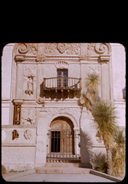
- Description:
- 25 f 11
- Subject:
- Missions, Stonework, Facades, Mission San Xavier del Bac (Tucson, Ariz.), Ironwork, Doors & doorways, Balconies, Windows, Stone walls, Shrubs, Mission ch...
- Series:
- 2-52
- Creator:
- Cushman, Charles W., 1896-1972
- Date Created:
- 1952-01-05
- Genre:
- Architectural photographs
- Frame Number:
- 1
- County:
- Pima
- Abstract:
- Façade of San Xavier Mission.
- Call Number:
- P05531
- City:
- Tucson
- Country:
- United States
- State/Province:
- Arizona
- Physical Description:
- masked.
- Alternate Identifier:
- 252.1
- Persistent URL:
- http://purl.dlib.indiana.edu/iudl/archives/cushman/P05531
- Holding Location:
- Bloomington - University Archives
Wells Library E460
1320 E 10th St.
Bloomington, IN 47405
Contact at archives@indiana.edu, 812-855-1127
-
- Description:
- 100 f 11 SL
- Subject:
- Valleys, Grasses, Monument Valley (Ariz. and Utah), Deserts, Cliffs, Rock formations, and Shrubs
- Series:
- 37-65
- Creator:
- Cushman, Charles W., 1896-1972
- Date Created:
- 1965-10-09
- Genre:
- Landscape photographs
- Frame Number:
- 9
- Street Address:
- Arizona State Highway 64 and Navajo Trail
- County:
- Navajo
- Abstract:
- Red stone.
- Call Number:
- P15115
- City:
- Kayenta
- Country:
- United States
- State/Province:
- Arizona
- Alternate Identifier:
- 3765.9
- Persistent URL:
- http://purl.dlib.indiana.edu/iudl/archives/cushman/P15115
- Holding Location:
- Bloomington - University Archives
Wells Library E460
1320 E 10th St.
Bloomington, IN 47405
Contact at archives@indiana.edu, 812-855-1127
-
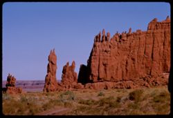
- Description:
- 100 f 11 TL
- Subject:
- Rock formations, Rocks, Grasses, Monument Valley (Ariz. and Utah), Cliffs, and Buttes
- Series:
- 37-65
- Creator:
- Cushman, Charles W., 1896-1972
- Date Created:
- 1965-10-09
- Genre:
- Landscape photographs
- Frame Number:
- 11
- Street Address:
- Arizona State Highway 64 and Navajo Trail
- County:
- Navajo
- Abstract:
- Red stone.
- Call Number:
- P15117
- City:
- Kayenta
- Country:
- United States
- State/Province:
- Arizona
- Alternate Identifier:
- 3765.11
- Persistent URL:
- http://purl.dlib.indiana.edu/iudl/archives/cushman/P15117
- Holding Location:
- Bloomington - University Archives
Wells Library E460
1320 E 10th St.
Bloomington, IN 47405
Contact at archives@indiana.edu, 812-855-1127
-
- Description:
- 100 f 16 SL
- Subject:
- Rock formations, Grasses, Mesas, Boundaries, Indian reservations, Navajo Indian Reservation, Cliffs, Smoke, Trees, and Shrubs
- Series:
- 36-65
- Creator:
- Cushman, Charles W., 1896-1972
- Date Created:
- 1965-10-08
- Genre:
- Landscape photographs
- Frame Number:
- 35
- County:
- Apache
- Abstract:
- Temple.
- Call Number:
- P15103
- City:
- Window Rock
- Country:
- United States
- State/Province:
- Arizona and New Mexico
- Alternate Identifier:
- 3665.35
- Persistent URL:
- http://purl.dlib.indiana.edu/iudl/archives/cushman/P15103
- Holding Location:
- Bloomington - University Archives
Wells Library E460
1320 E 10th St.
Bloomington, IN 47405
Contact at archives@indiana.edu, 812-855-1127
-
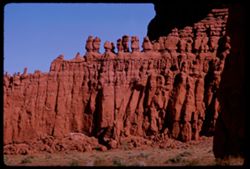
- Description:
- 100 f 11 TL
- Subject:
- Rock formations, Monument Valley (Ariz. and Utah), and Cliffs
- Series:
- 37-65
- Creator:
- Cushman, Charles W., 1896-1972
- Date Created:
- 1965-10-09
- Genre:
- Landscape photographs
- Frame Number:
- 10
- Street Address:
- Arizona State Highway 64 and Navajo Trail
- County:
- Navajo
- Abstract:
- Red stone.
- Call Number:
- P15116
- City:
- Kayenta
- Country:
- United States
- State/Province:
- Arizona
- Alternate Identifier:
- 3765.10
- Persistent URL:
- http://purl.dlib.indiana.edu/iudl/archives/cushman/P15116
- Holding Location:
- Bloomington - University Archives
Wells Library E460
1320 E 10th St.
Bloomington, IN 47405
Contact at archives@indiana.edu, 812-855-1127
-
- Description:
- 100 f 11 SL
- Subject:
- Rock formations, Trails & paths, Grasses, Deserts, Cliffs, and Buttes
- Series:
- 37-65
- Creator:
- Cushman, Charles W., 1896-1972
- Date Created:
- 1965-10-09
- Genre:
- Landscape photographs
- Frame Number:
- 8
- Street Address:
- Arizona State Highway 64 and Navajo Trail
- County:
- Navajo
- Abstract:
- Red stone.
- Call Number:
- P15114
- City:
- Kayenta
- Country:
- United States
- State/Province:
- Arizona
- Alternate Identifier:
- 3765.8
- Persistent URL:
- http://purl.dlib.indiana.edu/iudl/archives/cushman/P15114
- Holding Location:
- Bloomington - University Archives
Wells Library E460
1320 E 10th St.
Bloomington, IN 47405
Contact at archives@indiana.edu, 812-855-1127
-
- Description:
- 25 f 9
- Subject:
- Buildings, Cities & towns, Mountains, Trees, Dwellings, Hotels, Streets, Copper Queen Hotel (Bisbee, Ariz.), Automobiles, Shrubs, Churches, Flagpoles, an...
- Series:
- 1-52
- Creator:
- Cushman, Charles W., 1896-1972
- Date Created:
- 1952-01-04
- Genre:
- Views and Cityscape photographs
- Frame Number:
- 30
- County:
- Cochise
- Abstract:
- from higher up. [Bisbee + Mtn from Main st.]
- Call Number:
- P05520
- City:
- Bisbee
- Country:
- United States
- State/Province:
- Arizona
- Alternate Identifier:
- 152.30
- Persistent URL:
- http://purl.dlib.indiana.edu/iudl/archives/cushman/P05520
- Holding Location:
- Bloomington - University Archives
Wells Library E460
1320 E 10th St.
Bloomington, IN 47405
Contact at archives@indiana.edu, 812-855-1127
-
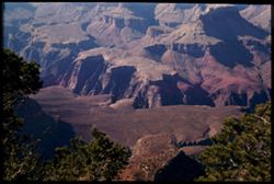
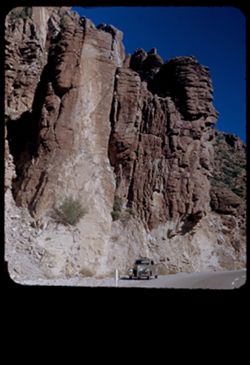
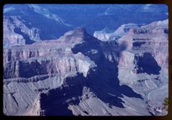
- Description:
- 100 f 8 TL
- Subject:
- Rock formations, Trees, Erosion, Canyons, Grand Canyon National Park (Ariz.), National parks & reserves, Shadows, Cliffs, Buttes, Grand Canyon (Ariz.), Y...
- Series:
- 4-62
- Creator:
- Cushman, Charles W., 1896-1972
- Date Created:
- 1962-10-03
- Genre:
- Landscape photographs
- Frame Number:
- 22
- Abstract:
- NE + down.
- Call Number:
- P12751
- Country:
- United States
- State/Province:
- Arizona
- Alternate Identifier:
- 462.22
- Persistent URL:
- http://purl.dlib.indiana.edu/iudl/archives/cushman/P12751
- Holding Location:
- Bloomington - University Archives
Wells Library E460
1320 E 10th St.
Bloomington, IN 47405
Contact at archives@indiana.edu, 812-855-1127
-
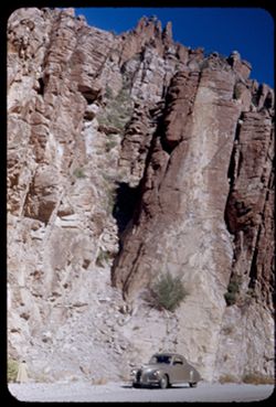
- Description:
- 100 f 8 SL
- Subject:
- Rock formations, Tree limbs, Mesas, Erosion, Canyons, Grand Canyon National Park (Ariz.), Cliffs, Buttes, Grand Canyon (Ariz.), and Bright Angel Lodge (Ariz.)
- Series:
- 4-62
- Creator:
- Cushman, Charles W., 1896-1972
- Date Created:
- 1962-10-03
- Genre:
- Landscape photographs
- Frame Number:
- 14
- Abstract:
- Near Bright Angel Lodge.
- Call Number:
- P12743
- Country:
- United States
- State/Province:
- Arizona
- Alternate Identifier:
- 462.14
- Persistent URL:
- http://purl.dlib.indiana.edu/iudl/archives/cushman/P12743
- Holding Location:
- Bloomington - University Archives
Wells Library E460
1320 E 10th St.
Bloomington, IN 47405
Contact at archives@indiana.edu, 812-855-1127
-
- Description:
- 100 f 8 TL
- Subject:
- Erosion, National parks & reserves, Canyons, Grand Canyon (Ariz.), Yaki Point (Ariz.), Grand Canyon National Park (Ariz.), Buttes, Rock formations, Mesas...
- Series:
- 4-62
- Creator:
- Cushman, Charles W., 1896-1972
- Date Created:
- 1962-10-03
- Genre:
- Landscape photographs
- Frame Number:
- 24
- Abstract:
- Right below.
- Call Number:
- P12753
- Country:
- United States
- State/Province:
- Arizona
- Alternate Identifier:
- 462.24
- Persistent URL:
- http://purl.dlib.indiana.edu/iudl/archives/cushman/P12753
- Holding Location:
- Bloomington - University Archives
Wells Library E460
1320 E 10th St.
Bloomington, IN 47405
Contact at archives@indiana.edu, 812-855-1127
-
- Description:
- 100 f 11 + f 12/13
- Subject:
- Mountains, Plants, Ocotillo, Deserts, Storms, and Flowers
- Series:
- 1-66
- Creator:
- Cushman, Charles W., 1896-1972
- Date Created:
- 1966-04-22
- Genre:
- Identification photographs and Landscape photographs
- Frame Number:
- 6
- Street Address:
- United States Highway 66
- County:
- Mohave
- Abstract:
- Ocotillo along U.S. 66- Mojave county and Little red head and friend at drinking fountain - same in error
- Call Number:
- P15247
- Country:
- United States
- State/Province:
- Arizona
- Alternate Identifier:
- 166.6
- Persistent URL:
- http://purl.dlib.indiana.edu/iudl/archives/cushman/P15247
- Holding Location:
- Bloomington - University Archives
Wells Library E460
1320 E 10th St.
Bloomington, IN 47405
Contact at archives@indiana.edu, 812-855-1127
-
- Description:
- 100 f 13 ?
- Subject:
- Hills, Mountains, Plants, Ocotillo, Deserts, Storms, Flowers, Clouds, and Grasses
- Series:
- 1-66
- Creator:
- Cushman, Charles W., 1896-1972
- Date Created:
- 1966-04-22
- Genre:
- Identification photographs and Landscape photographs
- Frame Number:
- 7
- Street Address:
- United States Highway 66
- County:
- Mohave
- Abstract:
- Ocotillo along U.S. 66- Mojave county
- Call Number:
- P15248
- Country:
- United States
- State/Province:
- Arizona
- Alternate Identifier:
- 166.7
- Persistent URL:
- http://purl.dlib.indiana.edu/iudl/archives/cushman/P15248
- Holding Location:
- Bloomington - University Archives
Wells Library E460
1320 E 10th St.
Bloomington, IN 47405
Contact at archives@indiana.edu, 812-855-1127
-
- Description:
- 100 f 12?
- Subject:
- Rocks, Hills, Mountains, Grasses, Ocotillo, Deserts, Storms, Flowers, and Plants
- Series:
- 1-66
- Creator:
- Cushman, Charles W., 1896-1972
- Date Created:
- 1966-04-22
- Genre:
- Identification photographs and Landscape photographs
- Frame Number:
- 8
- Street Address:
- United States Highway 66
- County:
- Mohave
- Abstract:
- Ocotillo along U.S. 66- Mojave county
- Call Number:
- P15249
- Country:
- United States
- State/Province:
- Arizona
- Alternate Identifier:
- 166.8
- Persistent URL:
- http://purl.dlib.indiana.edu/iudl/archives/cushman/P15249
- Holding Location:
- Bloomington - University Archives
Wells Library E460
1320 E 10th St.
Bloomington, IN 47405
Contact at archives@indiana.edu, 812-855-1127
-
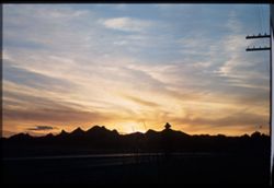
- Subject:
- Tucson Mountains (Ariz.), Mountains, Sunrises & sunsets, Roads, and Clouds
- Series:
- 2-40
- Creator:
- Cushman, Charles W., 1896-1972
- Date Created:
- 1940-02-01
- Genre:
- Landscape photographs
- Frame Number:
- 2
- Street Address:
- Ajo Way
- County:
- Pima
- Abstract:
- Sunday evening , sunset sky, along Ajo road.
- Call Number:
- P01757
- City:
- Tucson
- Country:
- United States
- State/Province:
- Arizona
- Physical Description:
- Image was originally mounted in a glass enclosure. Before digitization, the image was removed and placed in a Wess Plastic, Inc. brand, 2" x 2", pl...
- Alternate Identifier:
- 240.2
- Persistent URL:
- http://purl.dlib.indiana.edu/iudl/archives/cushman/P01757
- Holding Location:
- Bloomington - University Archives
Wells Library E460
1320 E 10th St.
Bloomington, IN 47405
Contact at archives@indiana.edu, 812-855-1127
-
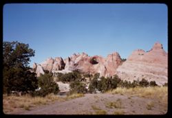
- Description:
- 50 f 9
- Subject:
- Rock formations, Rocks, Grasses, Automobiles, Cliffs, Roads, and Women
- Series:
- 14-53
- Creator:
- Cushman, Charles W., 1896-1972
- Date Created:
- 1953-11-19
- Genre:
- Identification photographs and Landscape photographs
- Frame Number:
- 25
- Street Address:
- United States Highway 70 and United States Highway 60
- County:
- Pinal
- Abstract:
- Giant rock forms rising from north side US 70 on west slope
- Call Number:
- P07021
- City:
- Superior
- Country:
- United States
- State/Province:
- Arizona
- Physical Description:
- masked.
- Alternate Identifier:
- 1453.25
- Persistent URL:
- http://purl.dlib.indiana.edu/iudl/archives/cushman/P07021
- Holding Location:
- Bloomington - University Archives
Wells Library E460
1320 E 10th St.
Bloomington, IN 47405
Contact at archives@indiana.edu, 812-855-1127
-
- Description:
- 100 f 11 SL
- Subject:
- Plains, Valleys, Parks, Cliffs, Mitten Peak (Ariz.), Monument Valley (Ariz. and Utah), Buttes, and Rock formations
- Series:
- 38-65
- Creator:
- Cushman, Charles W., 1896-1972
- Date Created:
- 1965-10-10
- Genre:
- Landscape photographs
- Frame Number:
- 19
- County:
- Navajo
- Abstract:
- Mitten et al
- Call Number:
- P15162
- Country:
- United States
- State/Province:
- Arizona
- Alternate Identifier:
- 3865.19
- Persistent URL:
- http://purl.dlib.indiana.edu/iudl/archives/cushman/P15162
- Holding Location:
- Bloomington - University Archives
Wells Library E460
1320 E 10th St.
Bloomington, IN 47405
Contact at archives@indiana.edu, 812-855-1127
-
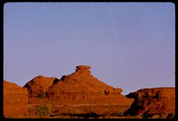
- Description:
- 100 f 8 TL
- Subject:
- Rock formations, Mesas, Monument Valley (Ariz. and Utah), Cliffs, and Buttes
- Series:
- 37-65
- Creator:
- Cushman, Charles W., 1896-1972
- Date Created:
- 1965-10-09
- Genre:
- Landscape photographs
- Frame Number:
- 27
- Abstract:
- Tea Kettle.
- Call Number:
- P15133
- Country:
- United States
- State/Province:
- Arizona
- Alternate Identifier:
- 3765.27
- Persistent URL:
- http://purl.dlib.indiana.edu/iudl/archives/cushman/P15133
- Holding Location:
- Bloomington - University Archives
Wells Library E460
1320 E 10th St.
Bloomington, IN 47405
Contact at archives@indiana.edu, 812-855-1127
-
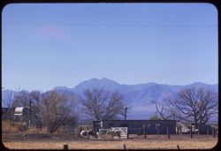
- Description:
- 100 f 6.3 tl
- Subject:
- Fences, Mountains, Trees, Dwellings, Horses, Electric lines, Shrubs, and Cochise Head (Ariz.)
- Series:
- 5-59
- Creator:
- Cushman, Charles W., 1896-1972
- Date Created:
- 1959-01-23
- Genre:
- Landscape photographs
- Frame Number:
- 36
- Street Address:
- Arizona State Highway 86
- County:
- Cochise
- Abstract:
- Cochise Head from Ariz Hwy 86
- Call Number:
- P10537
- Country:
- United States
- State/Province:
- Arizona
- Alternate Identifier:
- 559.36
- Persistent URL:
- http://purl.dlib.indiana.edu/iudl/archives/cushman/P10537
- Holding Location:
- Bloomington - University Archives
Wells Library E460
1320 E 10th St.
Bloomington, IN 47405
Contact at archives@indiana.edu, 812-855-1127
-
- Description:
- 100 f 11 TL
- Subject:
- Logs, Valleys, Rocks, Blue Mesa (Ariz.), Grasses, National parks & reserves, Deserts, Petrified forests, Petrified Forest National Park (Ariz.), and Hills
- Series:
- 6-63
- Creator:
- Cushman, Charles W., 1896-1972
- Date Created:
- 1963-06-27
- Genre:
- Identification photographs and Landscape photographs
- Frame Number:
- 7
- County:
- Navajo and Apache
- Abstract:
- Distantly Down from Blue Mesa
- Call Number:
- P12960
- City:
- Holbrook
- Country:
- United States
- State/Province:
- Arizona
- Alternate Identifier:
- 663.7
- Persistent URL:
- http://purl.dlib.indiana.edu/iudl/archives/cushman/P12960
- Holding Location:
- Bloomington - University Archives
Wells Library E460
1320 E 10th St.
Bloomington, IN 47405
Contact at archives@indiana.edu, 812-855-1127
-
- Description:
- 25 f 13
- Subject:
- Rock formations, Rocks, Trees, National parks & reserves, Boulders, Chiricahua National Monument (Ariz.), and Massai Point (Ariz.)
- Series:
- 4-52
- Creator:
- Cushman, Charles W., 1896-1972
- Date Created:
- 1952-01-22
- Genre:
- Landscape photographs
- Frame Number:
- 9
- County:
- Cochise
- Abstract:
- Again the rocks at the top of the drive
- Call Number:
- P05615
- Country:
- United States
- State/Province:
- Arizona
- Alternate Identifier:
- 452.9
- Persistent URL:
- http://purl.dlib.indiana.edu/iudl/archives/cushman/P05615
- Holding Location:
- Bloomington - University Archives
Wells Library E460
1320 E 10th St.
Bloomington, IN 47405
Contact at archives@indiana.edu, 812-855-1127
-
- Description:
- 50 f 10
- Subject:
- Rock formations, Rocks, Grasses, Automobiles, Cliffs, Roads, and Women
- Series:
- 14-53
- Creator:
- Cushman, Charles W., 1896-1972
- Date Created:
- 1953-11-19
- Genre:
- Identification photographs and Landscape photographs
- Frame Number:
- 24
- Street Address:
- United States Highway 70 and United States Highway 60
- County:
- Pinal
- Abstract:
- Giant rock forms rising from north side US 70 on west slope
- Call Number:
- P07020
- City:
- Superior
- Country:
- United States
- State/Province:
- Arizona
- Physical Description:
- masked.
- Alternate Identifier:
- 1453.24
- Persistent URL:
- http://purl.dlib.indiana.edu/iudl/archives/cushman/P07020
- Holding Location:
- Bloomington - University Archives
Wells Library E460
1320 E 10th St.
Bloomington, IN 47405
Contact at archives@indiana.edu, 812-855-1127
-
- Description:
- 50 f 8
- Subject:
- Rock formations, Rocks, Rock wall, Grasses, Automobiles, Cliffs, Roads, and Women
- Series:
- 14-53
- Creator:
- Cushman, Charles W., 1896-1972
- Date Created:
- 1953-11-19
- Genre:
- Identification photographs and Landscape photographs
- Frame Number:
- 26
- Street Address:
- United States Highway 70 and United States Highway 60
- County:
- Pinal
- Abstract:
- Giant rock forms rising from north side US 70 on west slope
- Call Number:
- P07022
- City:
- Superior
- Country:
- United States
- State/Province:
- Arizona
- Alternate Identifier:
- 1453.26
- Persistent URL:
- http://purl.dlib.indiana.edu/iudl/archives/cushman/P07022
- Holding Location:
- Bloomington - University Archives
Wells Library E460
1320 E 10th St.
Bloomington, IN 47405
Contact at archives@indiana.edu, 812-855-1127
-
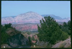
- Description:
- 100 f 11
- Subject:
- Hills, Roads, Cliffs, Mountains, Shrubs, Trees, and Grasses
- Series:
- 5-62
- Creator:
- Cushman, Charles W., 1896-1972
- Date Created:
- 1962-10-05
- Genre:
- Landscape photographs
- Frame Number:
- 16
- County:
- Coconino
- Abstract:
- East from 6 or 7 mi. west of Sedona
- Call Number:
- P12783
- City:
- Sedona
- Country:
- United States
- State/Province:
- Arizona
- Alternate Identifier:
- 562.16
- Persistent URL:
- http://purl.dlib.indiana.edu/iudl/archives/cushman/P12783
- Holding Location:
- Bloomington - University Archives
Wells Library E460
1320 E 10th St.
Bloomington, IN 47405
Contact at archives@indiana.edu, 812-855-1127
-

- Description:
- 25 f 8
- Subject:
- Mission San Xavier del Bac (Tucson, Ariz.), Missions, Mission churches, Stonework, and Sculpture
- Series:
- 2-52
- Creator:
- Cushman, Charles W., 1896-1972
- Date Created:
- 1952-01-05
- Genre:
- Snapshots
- Frame Number:
- 3
- County:
- Pima
- Abstract:
- Sun lit statue in church.
- Call Number:
- P05533
- City:
- Tucson
- Country:
- United States
- State/Province:
- Arizona
- Alternate Identifier:
- 252.3
- Persistent URL:
- http://purl.dlib.indiana.edu/iudl/archives/cushman/P05533
- Holding Location:
- Bloomington - University Archives
Wells Library E460
1320 E 10th St.
Bloomington, IN 47405
Contact at archives@indiana.edu, 812-855-1127
-
- Description:
- 50 f 11 sl
- Subject:
- Deserts, Mountains, Shrubs, Cactus, and Saguaro National Park (Ariz.)
- Series:
- 10-59
- Creator:
- Cushman, Charles W., 1896-1972
- Date Created:
- 1959-03-03
- Genre:
- Identification photographs
- Frame Number:
- 5
- County:
- Pima
- Abstract:
- Multi-branched Giant Sohuaro
- Call Number:
- P10693
- City:
- Tucson
- Country:
- United States
- State/Province:
- Arizona
- Alternate Identifier:
- 1059.5
- Persistent URL:
- http://purl.dlib.indiana.edu/iudl/archives/cushman/P10693
- Holding Location:
- Bloomington - University Archives
Wells Library E460
1320 E 10th St.
Bloomington, IN 47405
Contact at archives@indiana.edu, 812-855-1127
-
- Subject:
- Deserts, Flowers, Saguaro, Ocotillo, Mountains, Shrubs, Cactus, and Clouds
- Series:
- 4-40
- Creator:
- Cushman, Charles W., 1896-1972
- Date Created:
- 1940-04-01
- Genre:
- Identification photographs
- Frame Number:
- 18
- County:
- Pima
- Abstract:
- Desert blooms: Flaming Ocotillo: Giant Sahuaras
- Call Number:
- P01805
- Country:
- United States
- State/Province:
- Arizona
- Physical Description:
- Image was originally mounted in a glass enclosure. Before digitization, the image was removed and placed in a Wess Plastic, Inc. brand, 2" x 2", pl...
- Alternate Identifier:
- 440.18
- Persistent URL:
- http://purl.dlib.indiana.edu/iudl/archives/cushman/P01805
- Holding Location:
- Bloomington - University Archives
Wells Library E460
1320 E 10th St.
Bloomington, IN 47405
Contact at archives@indiana.edu, 812-855-1127
-
- Subject:
- Tree limbs, Palo verde trees, and Shrubs
- Series:
- 5-40
- Creator:
- Cushman, Charles W., 1896-1972
- Date Created:
- 1940-05-01
- Genre:
- Identification photographs
- Frame Number:
- 6
- County:
- Pima
- Abstract:
- Top of a Palo Verde from below. Tucson.
- Call Number:
- P01814
- City:
- Tucson
- Country:
- United States
- State/Province:
- Arizona
- Physical Description:
- Image was originally mounted in a glass enclosure. Before digitization, the image was removed and placed in a Wess Plastic, Inc. brand, 2" x 2", pl...
- Alternate Identifier:
- 540.6
- Persistent URL:
- http://purl.dlib.indiana.edu/iudl/archives/cushman/P01814
- Holding Location:
- Bloomington - University Archives
Wells Library E460
1320 E 10th St.
Bloomington, IN 47405
Contact at archives@indiana.edu, 812-855-1127
-
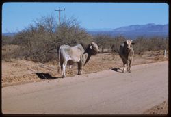
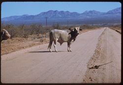
- Description:
- 100 f 6.3 tl
- Subject:
- Channels, Brawley Wash (Ariz.), Roads, Mountains, Shrubs, Electric lines, and Bulls
- Series:
- 6-59
- Creator:
- Cushman, Charles W., 1896-1972
- Date Created:
- 1959-01-28
- Genre:
- Identification photographs
- Frame Number:
- 18
- Street Address:
- Sasabe Road
- County:
- Pima
- Abstract:
- 2 Brahma bulls on Sasabe road
- Call Number:
- P10556
- Country:
- United States
- State/Province:
- Arizona
- Alternate Identifier:
- 659.18
- Persistent URL:
- http://purl.dlib.indiana.edu/iudl/archives/cushman/P10556
- Holding Location:
- Bloomington - University Archives
Wells Library E460
1320 E 10th St.
Bloomington, IN 47405
Contact at archives@indiana.edu, 812-855-1127
-
- Description:
- 100 f 6.3 tl
- Subject:
- Channels, Brawley Wash (Ariz.), Roads, Mountains, Shrubs, Electric lines, and Bulls
- Series:
- 6-59
- Creator:
- Cushman, Charles W., 1896-1972
- Date Created:
- 1959-01-28
- Genre:
- Identification photographs
- Frame Number:
- 19
- Street Address:
- Sasabe Road
- County:
- Pima
- Abstract:
- One B B
- Call Number:
- P10557
- Country:
- United States
- State/Province:
- Arizona
- Alternate Identifier:
- 659.19
- Persistent URL:
- http://purl.dlib.indiana.edu/iudl/archives/cushman/P10557
- Holding Location:
- Bloomington - University Archives
Wells Library E460
1320 E 10th St.
Bloomington, IN 47405
Contact at archives@indiana.edu, 812-855-1127
-
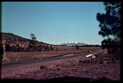
- Subject:
- San Francisco Peaks (Ariz.), Hills, Automobiles, Roads, Bridges, Mountains, Grand Canyon Junction (Ariz.), Shrubs, Snow, Trees, Rocks, Fences, and Masonry
- Series:
- 10-39
- Creator:
- Cushman, Charles W., 1896-1972
- Date Created:
- 1939-12-01
- Genre:
- Landscape photographs
- Frame Number:
- 3
- County:
- Coconino
- Abstract:
- T-3: San Franciscos Pk. from Grand Canyon Junction
- Call Number:
- P01719
- City:
- Flagstaff
- Country:
- United States
- State/Province:
- Arizona
- Physical Description:
- some dye fading. Image was originally mounted in a glass enclosure. Before digitization, the image was removed and placed in a Wess Plastic, Inc. brand, 2&qu...
- Alternate Identifier:
- 1039.3
- Persistent URL:
- http://purl.dlib.indiana.edu/iudl/archives/cushman/P01719
- Holding Location:
- Bloomington - University Archives
Wells Library E460
1320 E 10th St.
Bloomington, IN 47405
Contact at archives@indiana.edu, 812-855-1127
-
- Subject:
- Canyons, Grand Canyon (Ariz.), Shrubs, Trees, Colorado River (Colo.-Mexico), Rock formations, and Rivers
- Series:
- 13-40
- Creator:
- Cushman, Charles W., 1896-1972
- Date Created:
- 1940-07-14
- Genre:
- Landscape photographs
- Frame Number:
- 2
- Abstract:
- Colorado from South Rim. Sunday afternoon
- Call Number:
- P02001
- Country:
- United States
- State/Province:
- Arizona
- Physical Description:
- Image was originally mounted in a glass enclosure. Before digitization, the image was removed and placed in a Wess Plastic, Inc. brand, 2" x 2", pl...
- Alternate Identifier:
- 1340.2
- Persistent URL:
- http://purl.dlib.indiana.edu/iudl/archives/cushman/P02001
- Holding Location:
- Bloomington - University Archives
Wells Library E460
1320 E 10th St.
Bloomington, IN 47405
Contact at archives@indiana.edu, 812-855-1127
-
- Description:
- 25 f 13
- Subject:
- Sabino Canyon (Ariz.), Canyons, Saguaro, Cliffs, Mountains, Shrubs, Cactus, Rocks, Rock formations, and Santa Catalina Mountains (Ariz.)
- Series:
- 5-52
- Creator:
- Cushman, Charles W., 1896-1972
- Date Created:
- 1952-02-05
- Genre:
- Landscape photographs
- Frame Number:
- 26
- County:
- Pima
- Abstract:
- Up wall of Sabino Canyon in morning
- Call Number:
- P05671
- Country:
- United States
- State/Province:
- Arizona
- Alternate Identifier:
- 552.26
- Persistent URL:
- http://purl.dlib.indiana.edu/iudl/archives/cushman/P05671
- Holding Location:
- Bloomington - University Archives
Wells Library E460
1320 E 10th St.
Bloomington, IN 47405
Contact at archives@indiana.edu, 812-855-1127
-
- Subject:
- Deserts, Roskruge Mountains (Ariz.), Mountains, Shrubs, Cactus, and Clouds
- Series:
- 5-40
- Creator:
- Cushman, Charles W., 1896-1972
- Date Created:
- 1940-05-01
- Genre:
- Landscape photographs
- Frame Number:
- 17
- County:
- Pima
- Abstract:
- An Arizona desert . Roskruge Mtns. In distance. View is northeast.
- Call Number:
- P01835
- Country:
- United States
- State/Province:
- Arizona
- Physical Description:
- Image was originally mounted in a glass enclosure. Before digitization, the image was removed and placed in a Wess Plastic, Inc. brand, 2" x 2", pl...
- Alternate Identifier:
- 540.17
- Persistent URL:
- http://purl.dlib.indiana.edu/iudl/archives/cushman/P01835
- Holding Location:
- Bloomington - University Archives
Wells Library E460
1320 E 10th St.
Bloomington, IN 47405
Contact at archives@indiana.edu, 812-855-1127
-
- Description:
- 100 f 13 TL
- Subject:
- Erosion, National parks & reserves, Deserts, Valleys, Hills, Cliffs, Blue Mesa (Ariz.), Rock formations, Mesas, Petrified Forest National Park (Ariz.), a...
- Series:
- 6-63
- Creator:
- Cushman, Charles W., 1896-1972
- Date Created:
- 1963-06-27
- Genre:
- Landscape photographs
- Frame Number:
- 1
- County:
- Navajo and Apache
- Abstract:
- Cliff of Blue Mesa
- Call Number:
- P12954
- City:
- Holbrook
- Country:
- United States
- State/Province:
- Arizona
- Alternate Identifier:
- 663.1
- Persistent URL:
- http://purl.dlib.indiana.edu/iudl/archives/cushman/P12954
- Holding Location:
- Bloomington - University Archives
Wells Library E460
1320 E 10th St.
Bloomington, IN 47405
Contact at archives@indiana.edu, 812-855-1127
-

- Description:
- 100 f 8 tl
- Subject:
- Domes, Crosses, Mission churches, Arches, Shrubs, Masonry, Trees, Towers, Mission San Xavier del Bac (Tucson, Ariz.), and Stone walls
- Series:
- 6-59
- Creator:
- Cushman, Charles W., 1896-1972
- Date Created:
- 1959-01-24
- Genre:
- Architectural photographs
- Frame Number:
- 2
- County:
- Pima
- Abstract:
- West Tower of church
- Call Number:
- P10540
- City:
- Tucson
- Country:
- United States
- State/Province:
- Arizona
- Alternate Identifier:
- 659.2
- Persistent URL:
- http://purl.dlib.indiana.edu/iudl/archives/cushman/P10540
- Holding Location:
- Bloomington - University Archives
Wells Library E460
1320 E 10th St.
Bloomington, IN 47405
Contact at archives@indiana.edu, 812-855-1127
-
- Description:
- 50 f 9
- Subject:
- Pinto Creek (Ariz.), Steel, Arches, Roads, Bridges, Mountains, Rocks, Railings, Streams, and Grasses
- Series:
- 14-53
- Creator:
- Cushman, Charles W., 1896-1972
- Date Created:
- 1953-11-19
- Genre:
- Landscape photographs and Architectural photographs
- Frame Number:
- 12
- Street Address:
- United States Highway 70 and United States Highway 60
- County:
- Pinal and Gila
- Abstract:
- Steel Arch bridge over Pinto Creek - between Miami & Superior US 70
- Call Number:
- P07008
- City:
- Miami and Superior
- Country:
- United States
- State/Province:
- Arizona
- Alternate Identifier:
- 1453.12
- Persistent URL:
- http://purl.dlib.indiana.edu/iudl/archives/cushman/P07008
- Holding Location:
- Bloomington - University Archives
Wells Library E460
1320 E 10th St.
Bloomington, IN 47405
Contact at archives@indiana.edu, 812-855-1127
-
- Subject:
- Canyons, Grand Canyon (Ariz.), Shrubs, Rocks, Bright Angel Lodge, and Shadows
- Series:
- 9-39
- Creator:
- Cushman, Charles W., 1896-1972
- Date Created:
- 1939-11-30/1939-12-01
- Genre:
- Landscape photographs
- Frame Number:
- 18
- Abstract:
- S-18: Early morning sun lights up rocks.
- Call Number:
- P01715
- Country:
- United States
- State/Province:
- Arizona
- Physical Description:
- some dye fading. Image was originally mounted in a glass enclosure. Before digitization, the image was removed and placed in a Wess Plastic, Inc. brand, 2&qu...
- Alternate Identifier:
- 939.18
- Persistent URL:
- http://purl.dlib.indiana.edu/iudl/archives/cushman/P01715
- Holding Location:
- Bloomington - University Archives
Wells Library E460
1320 E 10th St.
Bloomington, IN 47405
Contact at archives@indiana.edu, 812-855-1127
-
- Description:
- 25 f 13
- Subject:
- National parks & reserves, Cliffs, Massai Point (Ariz.), Mountains, Chiricahua National Monument (Ariz.), and Rock formations
- Series:
- 4-52
- Creator:
- Cushman, Charles W., 1896-1972
- Date Created:
- 1952-01-22
- Genre:
- Landscape photographs
- Frame Number:
- 8
- County:
- Cochise
- Abstract:
- View NW from the Lookout Pt.
- Call Number:
- P05614
- Country:
- United States
- State/Province:
- Arizona
- Alternate Identifier:
- 452.8
- Persistent URL:
- http://purl.dlib.indiana.edu/iudl/archives/cushman/P05614
- Holding Location:
- Bloomington - University Archives
Wells Library E460
1320 E 10th St.
Bloomington, IN 47405
Contact at archives@indiana.edu, 812-855-1127
-
- Description:
- 100 f 11 TL
- Subject:
- Petrified Forest National Park (Ariz.), National parks & reserves, Deserts, Valleys, Hills, Blue Mesa (Ariz.), Rivers, Mesas, Petrified forests, Erosion,...
- Series:
- 6-63
- Creator:
- Cushman, Charles W., 1896-1972
- Date Created:
- 1963-06-27
- Genre:
- Landscape photographs
- Frame Number:
- 11
- County:
- Navajo and Apache
- Abstract:
- Distantly Down from Blue Mesa
- Call Number:
- P12964
- City:
- Holbrook
- Country:
- United States
- State/Province:
- Arizona
- Alternate Identifier:
- 663.11
- Persistent URL:
- http://purl.dlib.indiana.edu/iudl/archives/cushman/P12964
- Holding Location:
- Bloomington - University Archives
Wells Library E460
1320 E 10th St.
Bloomington, IN 47405
Contact at archives@indiana.edu, 812-855-1127
-
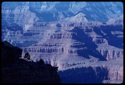
- Description:
- 100 f 9 TL
- Subject:
- Erosion, National parks & reserves, Canyons, Grand Canyon (Ariz.), Grand Canyon National Park (Ariz.), Shadows, Buttes, Rock formations, Mesas, and Cliffs
- Series:
- 4-62
- Creator:
- Cushman, Charles W., 1896-1972
- Date Created:
- 1962-10-04
- Genre:
- Landscape photographs
- Frame Number:
- 35
- County:
- Coconino
- Abstract:
- from Hermit's Rest
- Call Number:
- P12764
- City:
- Hermits Rest
- Country:
- United States
- State/Province:
- Arizona
- Alternate Identifier:
- 462.35
- Persistent URL:
- http://purl.dlib.indiana.edu/iudl/archives/cushman/P12764
- Holding Location:
- Bloomington - University Archives
Wells Library E460
1320 E 10th St.
Bloomington, IN 47405
Contact at archives@indiana.edu, 812-855-1127
-
- Description:
- 100 f 6.3 TL
- Subject:
- Erosion, National parks & reserves, Canyons, Cliffs, Grand Canyon National Park (Ariz.), Trees, Shadows, Buttes, Rock formations, Mesas, Grand Canyon (Ar...
- Series:
- 4-62
- Creator:
- Cushman, Charles W., 1896-1972
- Date Created:
- 1962-10-03
- Genre:
- Landscape photographs
- Frame Number:
- 20
- County:
- Coconino
- Abstract:
- Views across from Powell Memorial.
- Call Number:
- P12749
- Country:
- United States
- State/Province:
- Arizona
- Alternate Identifier:
- 462.20
- Persistent URL:
- http://purl.dlib.indiana.edu/iudl/archives/cushman/P12749
- Holding Location:
- Bloomington - University Archives
Wells Library E460
1320 E 10th St.
Bloomington, IN 47405
Contact at archives@indiana.edu, 812-855-1127
-

- Subject:
- Indians of North America, Mustaches, Earrings, Bicycles & tricycles, Cowboy hats, Windows, and Buildings
- Series:
- 2-40
- Creator:
- Cushman, Charles W., 1896-1972
- Date Created:
- 1940-02-01
- Genre:
- Ethnographic photographs
- Frame Number:
- 11
- County:
- Pima
- Abstract:
- An ear-ringed Indian watches Rodeo parade
- Call Number:
- P01767
- City:
- Tucson
- Country:
- United States
- State/Province:
- Arizona
- Physical Description:
- masked. Image was originally mounted in a glass enclosure. Before digitization, the image was removed and placed in a Wess Plastic, Inc. brand, 2" x 2&q...
- Alternate Identifier:
- 240.11
- Persistent URL:
- http://purl.dlib.indiana.edu/iudl/archives/cushman/P01767
- Holding Location:
- Bloomington - University Archives
Wells Library E460
1320 E 10th St.
Bloomington, IN 47405
Contact at archives@indiana.edu, 812-855-1127
-
- Description:
- 200 f 8
- Subject:
- Boundaries, Plains, Valleys, Houses, Cliffs, Monument Valley (Ariz. and Utah), Buttes, and Rock formations
- Series:
- 38-65
- Creator:
- Cushman, Charles W., 1896-1972
- Date Created:
- 1965-10-10
- Genre:
- Landscape photographs
- Frame Number:
- 5
- Abstract:
- At border.
- Call Number:
- P15148
- Country:
- United States
- State/Province:
- Arizona and Utah
- Alternate Identifier:
- 3865.5
- Persistent URL:
- http://purl.dlib.indiana.edu/iudl/archives/cushman/P15148
- Holding Location:
- Bloomington - University Archives
Wells Library E460
1320 E 10th St.
Bloomington, IN 47405
Contact at archives@indiana.edu, 812-855-1127
-
- Description:
- 50 f 5.6 POLA
- Subject:
- Smokestacks, Houses, Smoke, Factories, Copper industry, Copper mining, Mountains, Smelters, Trees, Inspiration Copper Co. (Miami, Ariz.), Grasses, and Hills
- Series:
- 14-53
- Creator:
- Cushman, Charles W., 1896-1972
- Date Created:
- 1953-11-19
- Genre:
- Cityscape photographs
- Frame Number:
- 7
- County:
- Gila
- Abstract:
- Inspiration smelter from south=
- Call Number:
- P07003
- City:
- Miami
- Country:
- United States
- State/Province:
- Arizona
- Alternate Identifier:
- 1453.7
- Persistent URL:
- http://purl.dlib.indiana.edu/iudl/archives/cushman/P07003
- Holding Location:
- Bloomington - University Archives
Wells Library E460
1320 E 10th St.
Bloomington, IN 47405
Contact at archives@indiana.edu, 812-855-1127
-
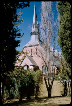
- Description:
- 25 f 9
- Subject:
- Steeples, Churches, Windows, Dormers, Gables, Shrubs, and Trees
- Series:
- 1-52
- Creator:
- Cushman, Charles W., 1896-1972
- Date Created:
- 1952-01-04
- Genre:
- Architectural photographs
- Frame Number:
- 26
- County:
- Cochise
- Abstract:
- Church at Bisbee.
- Call Number:
- P05516
- City:
- Bisbee
- Country:
- United States
- State/Province:
- Arizona
- Alternate Identifier:
- 152.26
- Persistent URL:
- http://purl.dlib.indiana.edu/iudl/archives/cushman/P05516
- Holding Location:
- Bloomington - University Archives
Wells Library E460
1320 E 10th St.
Bloomington, IN 47405
Contact at archives@indiana.edu, 812-855-1127
-
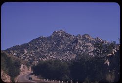
- Description:
- 100 f 8 tl
- Subject:
- Automobiles, Roads, Mountains, and Trees
- Series:
- 9-59
- Creator:
- Cushman, Charles W., 1896-1972
- Date Created:
- 1959-02-27
- Genre:
- Landscape photographs
- Frame Number:
- 23
- Street Address:
- United States Highway 70 and United States Highway 60
- County:
- Pinal and Gila
- Abstract:
- Familiar mountain above the Superior- Miami road (from 1936)
- Call Number:
- P10674
- City:
- Miami and Superior
- Country:
- United States
- State/Province:
- Arizona
- Alternate Identifier:
- 959.23
- Persistent URL:
- http://purl.dlib.indiana.edu/iudl/archives/cushman/P10674
- Holding Location:
- Bloomington - University Archives
Wells Library E460
1320 E 10th St.
Bloomington, IN 47405
Contact at archives@indiana.edu, 812-855-1127
-
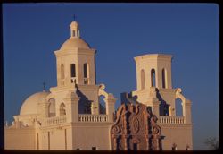
- Description:
- 100 f 8 tl
- Subject:
- Domes, Crosses, Mission churches, Arches, Windows, Stairways, Towers, and Mission San Xavier del Bac (Tucson, Ariz.)
- Series:
- 6-59
- Creator:
- Cushman, Charles W., 1896-1972
- Date Created:
- 1959-01-24
- Genre:
- Architectural photographs
- Frame Number:
- 3
- County:
- Pima
- Abstract:
- Both Towers
- Call Number:
- P10541
- City:
- Tucson
- Country:
- United States
- State/Province:
- Arizona
- Alternate Identifier:
- 659.3
- Persistent URL:
- http://purl.dlib.indiana.edu/iudl/archives/cushman/P10541
- Holding Location:
- Bloomington - University Archives
Wells Library E460
1320 E 10th St.
Bloomington, IN 47405
Contact at archives@indiana.edu, 812-855-1127
-
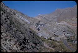
- Description:
- 50 f 11
- Subject:
- Queen Creek (Ariz.), Valleys, Roads, Queen Creek Bridge (Ariz.), Bridges, Mountains, Rocks, Streams, and Grasses
- Series:
- 14-53
- Creator:
- Cushman, Charles W., 1896-1972
- Date Created:
- 1953-11-19
- Genre:
- Landscape photographs
- Frame Number:
- 34
- Street Address:
- United States Highway 70 and United States Highway 60
- County:
- Pinal
- Abstract:
- Two bridges over Queen Creek near Superior
- Call Number:
- P07030
- City:
- Superior
- Country:
- United States
- State/Province:
- Arizona
- Alternate Identifier:
- 1453.34
- Persistent URL:
- http://purl.dlib.indiana.edu/iudl/archives/cushman/P07030
- Holding Location:
- Bloomington - University Archives
Wells Library E460
1320 E 10th St.
Bloomington, IN 47405
Contact at archives@indiana.edu, 812-855-1127
-
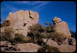
- Description:
- 25 f 13
- Subject:
- National parks & reserves, Massai Point (Ariz.), Shrubs, Trees, Chiricahua National Monument (Ariz.), Rock formations, and Boulders
- Series:
- 4-52
- Creator:
- Cushman, Charles W., 1896-1972
- Date Created:
- 1952-01-22
- Genre:
- Landscape photographs
- Frame Number:
- 6
- County:
- Cochise
- Abstract:
- Rocks at top of drive-from same path down from Lookout Pt.
- Call Number:
- P05612
- Country:
- United States
- State/Province:
- Arizona
- Alternate Identifier:
- 452.6
- Persistent URL:
- http://purl.dlib.indiana.edu/iudl/archives/cushman/P05612
- Holding Location:
- Bloomington - University Archives
Wells Library E460
1320 E 10th St.
Bloomington, IN 47405
Contact at archives@indiana.edu, 812-855-1127
-

- Description:
- 100 f 5.6 sl
- Subject:
- Parades & processions, Rodeos, Streets, Automobiles, Electric lines, Trees, Buildings, Crowds, Costumes, Signs (Notices), and Stores & shops
- Series:
- 8-59
- Creator:
- Cushman, Charles W., 1896-1972
- Date Created:
- 1959-02-19
- Genre:
- Ethnographic photographs
- Frame Number:
- 29
- County:
- Pima
- Abstract:
- Harem girls
- Call Number:
- P10643
- City:
- Tucson
- Country:
- United States
- State/Province:
- Arizona
- Alternate Identifier:
- 859.29
- Persistent URL:
- http://purl.dlib.indiana.edu/iudl/archives/cushman/P10643
- Holding Location:
- Bloomington - University Archives
Wells Library E460
1320 E 10th St.
Bloomington, IN 47405
Contact at archives@indiana.edu, 812-855-1127
-
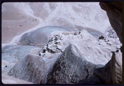
- Description:
- 100 f 11TL
- Subject:
- Petrified Forest National Park (Ariz.), National parks & reserves, Deserts, Cliffs, Blue Mesa (Ariz.), Rock formations, Mesas, and Petrified forests
- Series:
- 6-63
- Creator:
- Cushman, Charles W., 1896-1972
- Date Created:
- 1963-06-27
- Genre:
- Landscape photographs
- Frame Number:
- 5
- County:
- Navajo and Apache
- Abstract:
- Down from Blue Mesa
- Call Number:
- P12958
- City:
- Holbrook
- Country:
- United States
- State/Province:
- Arizona
- Alternate Identifier:
- 663.5
- Persistent URL:
- http://purl.dlib.indiana.edu/iudl/archives/cushman/P12958
- Holding Location:
- Bloomington - University Archives
Wells Library E460
1320 E 10th St.
Bloomington, IN 47405
Contact at archives@indiana.edu, 812-855-1127
-
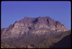
- Description:
- 100 f 8 tl
- Subject:
- Deserts, Hills, Mountains, Picketpost Mountain (Ariz.), and Cactus
- Series:
- 10-59
- Creator:
- Cushman, Charles W., 1896-1972
- Date Created:
- 1959-02-27
- Frame Number:
- 1
- County:
- Pinal
- Abstract:
- Pickett Post Mtn.
- Call Number:
- P10689
- City:
- Superior
- Country:
- United States
- State/Province:
- Arizona
- Alternate Identifier:
- 1059.1
- Persistent URL:
- http://purl.dlib.indiana.edu/iudl/archives/cushman/P10689
- Holding Location:
- Bloomington - University Archives
Wells Library E460
1320 E 10th St.
Bloomington, IN 47405
Contact at archives@indiana.edu, 812-855-1127
-
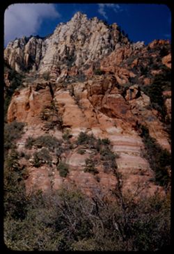
- Description:
- 25 f 13
- Subject:
- Oak Creek Canyon (Ariz.), Tree limbs, Canyons, Cliffs, Mountains, and Shrubs
- Series:
- 16-52
- Creator:
- Cushman, Charles W., 1896-1972
- Date Created:
- 1952-04-12
- Genre:
- Landscape photographs
- Frame Number:
- 25
- County:
- Coconino
- Abstract:
- [P] Spots
- Call Number:
- P06083
- Country:
- United States
- State/Province:
- Arizona
- Alternate Identifier:
- 1652.25
- Persistent URL:
- http://purl.dlib.indiana.edu/iudl/archives/cushman/P06083
- Holding Location:
- Bloomington - University Archives
Wells Library E460
1320 E 10th St.
Bloomington, IN 47405
Contact at archives@indiana.edu, 812-855-1127
-
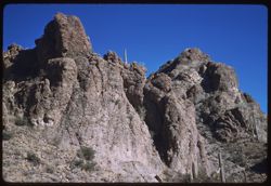
- Description:
- 50 f 8 sl
- Subject:
- Mountains, Tucson Mountains (Ariz.), Shrubs, Cactus, Rocks, and Gates Pass (Ariz.)
- Series:
- 6-59
- Creator:
- Cushman, Charles W., 1896-1972
- Date Created:
- 1959-01-26
- Genre:
- Landscape photographs
- Frame Number:
- 8
- County:
- Pima
- Abstract:
- Tucson Mtns. - up from Gates Pass
- Call Number:
- P10546
- City:
- Tucson
- Country:
- United States
- State/Province:
- Arizona
- Alternate Identifier:
- 659.8
- Persistent URL:
- http://purl.dlib.indiana.edu/iudl/archives/cushman/P10546
- Holding Location:
- Bloomington - University Archives
Wells Library E460
1320 E 10th St.
Bloomington, IN 47405
Contact at archives@indiana.edu, 812-855-1127
-
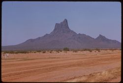
- Description:
- 100 f 8 tl
- Subject:
- Deserts, Mountains, Dirt roads, Shrubs, Picacho Mountains (Ariz.), and Fences
- Series:
- 10-59
- Creator:
- Cushman, Charles W., 1896-1972
- Date Created:
- 1959-03-22
- Genre:
- Landscape photographs
- Frame Number:
- 31
- County:
- Pima and Pinal
- Abstract:
- Picacho, near Red Rock
- Call Number:
- P10719
- City:
- Tucson and Red Rock
- Country:
- United States
- State/Province:
- Arizona
- Alternate Identifier:
- 1059.31
- Persistent URL:
- http://purl.dlib.indiana.edu/iudl/archives/cushman/P10719
- Holding Location:
- Bloomington - University Archives
Wells Library E460
1320 E 10th St.
Bloomington, IN 47405
Contact at archives@indiana.edu, 812-855-1127
-
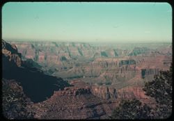
- Subject:
- Canyons, Yavapai Point (Ariz.), Trees, and Shadows
- Series:
- 8-39
- Creator:
- Cushman, Charles W., 1896-1972
- Date Created:
- 1939-11-29
- Genre:
- Landscape photographs
- Frame Number:
- 5
- County:
- Coconino
- Abstract:
- R-5: West from Yavapai Pt.
- Call Number:
- P01687
- Country:
- United States
- State/Province:
- Arizona
- Physical Description:
- some dye fading.
- Alternate Identifier:
- 839.5
- Persistent URL:
- http://purl.dlib.indiana.edu/iudl/archives/cushman/P01687
- Holding Location:
- Bloomington - University Archives
Wells Library E460
1320 E 10th St.
Bloomington, IN 47405
Contact at archives@indiana.edu, 812-855-1127
-
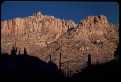
- Description:
- 25 f 13
- Subject:
- Sabino Canyon (Ariz.), Canyons, Saguaro, Cliffs, Mountains, Shrubs, Santa Catalina Mountains (Ariz.), Rock formations, and Cactus
- Series:
- 5-52
- Creator:
- Cushman, Charles W., 1896-1972
- Date Created:
- 1952-02-04
- Genre:
- Landscape photographs
- Frame Number:
- 25
- County:
- Pima
- Abstract:
- Pent house - at left - and the square castle - late
- Call Number:
- P05670
- Country:
- United States
- State/Province:
- Arizona
- Alternate Identifier:
- 552.25
- Persistent URL:
- http://purl.dlib.indiana.edu/iudl/archives/cushman/P05670
- Holding Location:
- Bloomington - University Archives
Wells Library E460
1320 E 10th St.
Bloomington, IN 47405
Contact at archives@indiana.edu, 812-855-1127
-
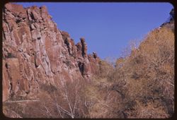
- Description:
- 100 f 8 tl
- Subject:
- Shrubs, Trees, and Rock formations
- Series:
- 9-59
- Creator:
- Cushman, Charles W., 1896-1972
- Date Created:
- 1959-02-27
- Genre:
- Landscape photographs
- Frame Number:
- 30
- Street Address:
- United States Highway 70 and United States Highway 60
- County:
- Gila and Pinal
- Abstract:
- A chimney rock
- Call Number:
- P10681
- City:
- Miami and Superior
- Country:
- United States
- State/Province:
- Arizona
- Alternate Identifier:
- 959.30
- Persistent URL:
- http://purl.dlib.indiana.edu/iudl/archives/cushman/P10681
- Holding Location:
- Bloomington - University Archives
Wells Library E460
1320 E 10th St.
Bloomington, IN 47405
Contact at archives@indiana.edu, 812-855-1127
-
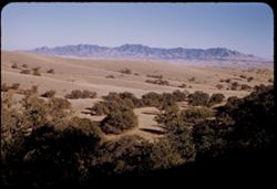
- Description:
- 50 f 9
- Subject:
- Whetstone Mountains (Ariz.), Hills, Oaks, Live oak, Trees, and Mountains
- Series:
- 2-52
- Creator:
- Cushman, Charles W., 1896-1972
- Date Created:
- 1952-01-14
- Genre:
- Landscape photographs
- Frame Number:
- 37
- Street Address:
- Arizona State Highway 83
- Abstract:
- Live oak-tow colored valley and distant mtns from Hwy 83.
- Call Number:
- P05567
- Country:
- United States
- State/Province:
- Arizona
- Alternate Identifier:
- 252.37
- Persistent URL:
- http://purl.dlib.indiana.edu/iudl/archives/cushman/P05567
- Holding Location:
- Bloomington - University Archives
Wells Library E460
1320 E 10th St.
Bloomington, IN 47405
Contact at archives@indiana.edu, 812-855-1127
-
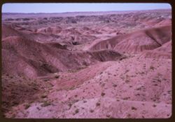
- Description:
- 100 f 8
- Subject:
- Petrified Forest National Park (Ariz.), National parks & reserves, Deserts, Valleys, Hills, Painted Desert (Ariz.), Shrubs, and Mesas
- Series:
- 5-63
- Creator:
- Cushman, Charles W., 1896-1972
- Date Created:
- 1963-06-26
- Genre:
- Landscape photographs
- Frame Number:
- 23
- County:
- Navajo and Apache
- Abstract:
- Painted Desert near Holbrook, Ariz
- Call Number:
- P12939
- City:
- Holbrook
- Country:
- United States
- State/Province:
- Arizona
- Alternate Identifier:
- 563.23
- Persistent URL:
- http://purl.dlib.indiana.edu/iudl/archives/cushman/P12939
- Holding Location:
- Bloomington - University Archives
Wells Library E460
1320 E 10th St.
Bloomington, IN 47405
Contact at archives@indiana.edu, 812-855-1127
-
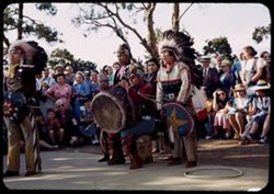
- Subject:
- Shields, Indigenous peoples, Dance, Spectators, Grand Canyon National Park (Ariz.), Trees, Shadows, El Tovar Hotel (Grand Canyon, Ariz.), Drums, and Hopi Ind...
- Series:
- 13-40
- Creator:
- Cushman, Charles W., 1896-1972
- Date Created:
- 1940-07-14
- Frame Number:
- 4
- Abstract:
- Hopi Indian dance - El Tovar.
- Call Number:
- P02003
- Country:
- United States
- State/Province:
- Arizona
- Alternate Identifier:
- 1340.4
- Persistent URL:
- http://purl.dlib.indiana.edu/iudl/archives/cushman/P02003
- Holding Location:
- Bloomington - University Archives
Wells Library E460
1320 E 10th St.
Bloomington, IN 47405
Contact at archives@indiana.edu, 812-855-1127
-
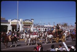
- Description:
- 100 f 5.6 sl
- Subject:
- Parades & processions, Rodeos, Horses, Streets, Automobiles, Electric lines, Trees, Crowds, Carriages & coaches, Signs (Notices), Stores & shops,...
- Series:
- 8-59
- Creator:
- Cushman, Charles W., 1896-1972
- Date Created:
- 1959-02-19
- Genre:
- Ethnographic photographs
- Frame Number:
- 24
- County:
- Pima
- Abstract:
- Stage coach + white horses
- Call Number:
- P10638
- City:
- Tucson
- Country:
- United States
- State/Province:
- Arizona
- Alternate Identifier:
- 859.24
- Persistent URL:
- http://purl.dlib.indiana.edu/iudl/archives/cushman/P10638
- Holding Location:
- Bloomington - University Archives
Wells Library E460
1320 E 10th St.
Bloomington, IN 47405
Contact at archives@indiana.edu, 812-855-1127
-
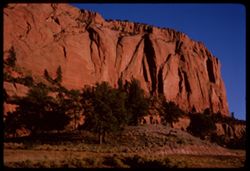
- Description:
- 100 f 16
- Subject:
- Boundaries, Cliffs, Shrubs, Trees, Rock formations, and Mesas
- Series:
- 37-65
- Creator:
- Cushman, Charles W., 1896-1972
- Date Created:
- 1965-10-08
- Genre:
- Landscape photographs
- Frame Number:
- 2
- County:
- Apache
- Abstract:
- N.M. along road to Navajo.
- Call Number:
- P15108
- City:
- Navajo and Fort Defiance
- Country:
- United States
- State/Province:
- Arizona
- Alternate Identifier:
- 3765.2
- Persistent URL:
- http://purl.dlib.indiana.edu/iudl/archives/cushman/P15108
- Holding Location:
- Bloomington - University Archives
Wells Library E460
1320 E 10th St.
Bloomington, IN 47405
Contact at archives@indiana.edu, 812-855-1127