Topical Subject: Land use and Geographic Subject: Gibson County (Ind.)
Creator:
Gibson County (Ind.). Land Use Planning Committee
Publisher:
United States. Bureau of Agricultural Economics
Date Created:
1941
Identifier:
VAC3073-M-00705
Genre:
Thematic maps
Geographic Location:
Coordinates: W0875917 W0871856 N0383200 N0380955
Related URL:
Catalog URL: https://iucat.iu.edu/catalog/5126313
Abstract:
"Color reproduction by Bureau of Agricultural Economics, U.S.D.A." "7-31-41". Includes chart showing type of land use, acreage, and recom...
Call Number:
G4093.G5G4 1941 .G53
Caption:
Imprint: [Washington, D.C.?] : U.S. Bureau of Agricultural Economics, [1941]
Physical Description:
Dimensions: 18 x 26 cm, on sheet 38 x 28 cm and Scale: Scale not given.
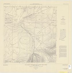
Topical Subject: Coal mines and mining and Geographic Subject: Indiana
Creator:
Hutchison, Harold C. (Harold Christy), 1925-
Publisher:
Indiana. Geological Survey
Date Created:
1975
Identifier:
VAC3073-M-00704
Genre:
Mine maps
Geographic Location:
Coordinates: W0872723 W0862628 N0403749 N0374618
Related URL:
Catalog URL: https://iucat.iu.edu/catalog/5050615
Abstract:
Blue line print. "Base modified from Indiana Department of Conservation, Geological Survey, Base map of portion of western Indiana, 1951." Includes...
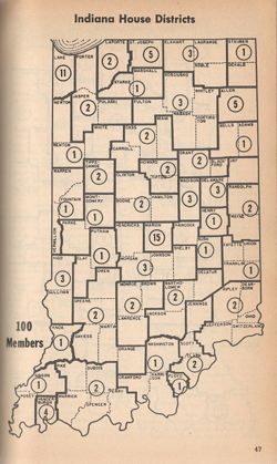
Shows Indiana election districts for the state's House of Representatives with the number of representatives for each district. Appears in Indiana alm...
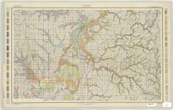
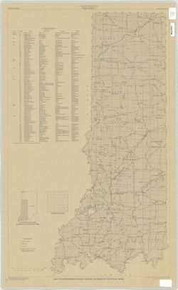
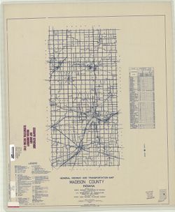
Topical Subject: Roads and Geographic Subject: Madison County (Ind.)
Creator:
Indiana. State Highway Commission (1919-1953)
Publisher:
State Highway Commission of Indiana
Date Created:
1949
Identifier:
VAC3073-M-00703
Genre:
Road maps
Geographic Location:
Coordinates: W0855200 W0853500 N0402300 N0395700
Related URL:
Catalog URL: https://iucat.iu.edu/catalog/5706658
Abstract:
Blueline. "State roads revised to January 1, 1949." "1937." "Data obtained from State-wide Highway Planning Survey." Includes l...
Call Number:
G4093.M2 P2 1949 .I53
Caption:
Imprint: [Indianapolis?] : State Highway Commission of Indiana, 1949.
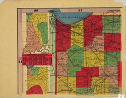
Shows counties, townships, sections and railroads. Prime meridians: Greenwich and Washington. Includes "Geological map of Indiana" , List of territ...
Call Number:
G4090 1894 .B75
Caption:
Imprint: New York : E. C. Bridgman, [1894]
Physical Description:
Dimensions: 181 x 137 cm, on sheets 71 x 92 cm and Scale: 1:264,000

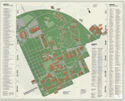
![Gibson County [Indiana] preliminary land use map](https://iiif.uits.iu.edu/iiif/2/f7624g240%2Ffiles%2F91ddcfae-bfc8-40ae-a801-4b23f126742f/full/250,/0/default.jpg)
![Marion County, Indiana [map] : [aerial photographs, 1 inch=100 feet]](https://iiif.uits.iu.edu/iiif/2/8g84np70q%2Ffiles%2F87c92dbf-3c08-4afb-9aa5-654d83642274/full/250,/0/default.jpg)