
Search Constraints
Search Results
-
- Description:
- 1877
- Subject:
- Topical Subject: Soviet Union, Topical Subject: Maps, and Geographic Subject: Strumok
- Publisher:
- Генеральный штаб РККА
- Language:
- Russian
- Date Created:
- 1916
- Identifier:
- VAC9619-001668
- Genre:
- Topographic Maps and Military Maps
- Geographic Location:
- Coordinates: 45.6667, 29, 46, 29.5
- Related URL:
- DataCORE Dataset Download: https://datacore.iu.edu/concern/data_sets/v692t686f
- Abstract:
- Modern area represented: Strumok, Odessa oblast, Ukraine
- Call Number:
- G7000 s100 .S7 sheet L-35-83
- City:
- Чишмеле (Cişmele)
- Copyright Holder:
- No Copyright - United States
- Physical Description:
- Scale: 1:100,000
- Provenance:
- DMA Topographic Center, Army Map Service Library, OMAHA, Atlasblatt, Library of Congress Geography & Map Division
- State/Province:
- Бессарабия (Bessarabia)
- Persistent URL:
- http://purl.dlib.indiana.edu/iudl/images/VAC9619/VAC9619-001668
-
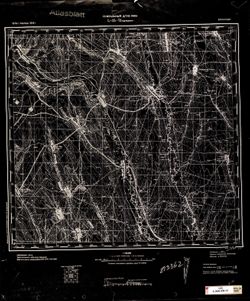
- Description:
- 1875
- Subject:
- Topical Subject: Maps, Geographic Subject: Berezyne, and Topical Subject: Soviet Union
- Publisher:
- Генеральный штаб РККА
- Language:
- Russian
- Date Created:
- 1916
- Identifier:
- VAC9619-001635
- Genre:
- Topographic Maps and Military Maps
- Geographic Location:
- Coordinates: 46, 29, 46.3333, 29.5
- Related URL:
- DataCORE Dataset Download: https://datacore.iu.edu/concern/data_sets/dz010q71s
- Abstract:
- Modern area represented: Berezyne, Odessa oblast, Ukraine.
- Call Number:
- G7000 s100 .S7 sheet L-35-71
- City:
- Березина (Berezyne)
- Copyright Holder:
- No Copyright - United States
- Country:
- СССР (USSR)
- Physical Description:
- Scale: 1:100,000
- Provenance:
- CIA Map Library, Atlasblatt
- State/Province:
- Бессарабия (Bessarabia)
- Persistent URL:
- http://purl.dlib.indiana.edu/iudl/images/VAC9619/VAC9619-001635
-
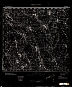
- Description:
- 1875
- Subject:
- Topical Subject: Maps, Topical Subject: Soviet Union, and Geographic Subject: Berezyne
- Publisher:
- Генеральный штаб РККА
- Language:
- Russian
- Date Created:
- 1916
- Identifier:
- VAC9619-001629
- Genre:
- Military Maps and Topographic Maps
- Geographic Location:
- Coordinates: 46, 29, 46.3333, 29.5
- Related URL:
- DataCORE Dataset Download: https://datacore.iu.edu/concern/data_sets/bn999773b
- Abstract:
- Modern area represented: Berezyne, Odessa oblast, Ukraine.
- Call Number:
- G7000 s100 .S7 sheet L-35-71
- City:
- Березина (Berezyne)
- Copyright Holder:
- No Copyright - United States
- Country:
- СССР (USSR)
- Physical Description:
- Scale: 1:100,000
- Provenance:
- CIA Map Library
- State/Province:
- Бессарабия (Bessarabia)
- Persistent URL:
- http://purl.dlib.indiana.edu/iudl/images/VAC9619/VAC9619-001629
-
- Subject:
- Geographic Subject: Wells County (Ind.), Topical Subject: IGS Annual Reports, and Topical Subject: Soils
- Creator:
- United States. Bureau of Soils, Tharp, W. E. (William Edgar), and Wiley, W. E. (William Emmett), 1894-1967
- Publisher:
- Indiana. Department of Geology and Natural Resources
- Date Created:
- 1916
- Identifier:
- VAC3073-M-01537
- Genre:
- Thematic maps
- Geographic Location:
- Coordinates: W0852656 W0850406 N0405504 N0403400
- Related URL:
- Catalog URL: https://iucat.iu.edu/catalog/16138560
- Abstract:
- "Field Operations, Bureau of Soils, 1915." Detached from: Soil survey of Wells County / W. E. Tharp and W. E. Wiley. In Fortieth annual report o...
- Call Number:
- G4093.W7J3 1915 .T49
- Caption:
- Imprint: [Fort Wayne]: [Fort Wayne Printing Company], [1916] and Imprint: [Indianapolis] : State of Indiana, Department of Geology, [1916]
- Physical Description:
- Dimensions: 58 x 48 cm and Scale: 1:63,360. 1 in. = 1 mile
- Alternate Identifier:
- Title Control Number: a16138560 and Alternate ID: 390726IP
- Provenance:
- 40th Annual Report (1915) / Indiana. Department of Geology and Natural Resources.
- Persistent URL:
- https://purl.dlib.indiana.edu/iudl/images/VAC3073/VAC3073-M-01537
-
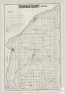
- Subject:
- Topical Subject: Mines and mineral resources, Topical Subject: Geology, Geographic Subject: Fountain County (Ind.), and Topical Subject: IGS Annual Reports
- Creator:
- Indiana. Department of Geology and Natural Resources
- Date Created:
- 1916
- Identifier:
- VAC3073-M-01529
- Genre:
- Thematic maps
- Related URL:
- Catalog URL: https://iucat.iu.edu/catalog/4022273
- Call Number:
- QE109 .A2 1915
- Persistent URL:
- https://purl.dlib.indiana.edu/iudl/images/VAC3073/VAC3073-M-01529
-
- Subject:
- Topical Subject: Soils and Geographic Subject: Starke County (Ind.)
- Creator:
- Grimes, E. J. (Earl Jerome)
- Publisher:
- Indiana. Department of Geology
- Date Created:
- 1916
- Identifier:
- VAC3073-M-01512
- Genre:
- Thematic maps
- Geographic Location:
- Coordinates: W0865548 W0862758 N0412558 N0411016
- Related URL:
- Catalog URL: https://iucat.iu.edu/catalog/16144189
- Abstract:
- Detached from: Soil survey of Starke County, Indiana / E.J. Grimes, Wendell Barrett, and T.M. Bushnell. In 40th Annual report of Department of Geology and Na...
- Call Number:
- G4093.S6J3 1915 .G76
- Caption:
- Imprint: [Indianapolis] : State of Indiana, Department of Geology, [1916]
- Physical Description:
- Scale: 1:63,360
- Provenance:
- 40th Annual Report (1915) / Indiana. Department of Geology and Natural Resources.
- Persistent URL:
- https://purl.dlib.indiana.edu/iudl/images/VAC3073/VAC3073-M-01512
-
- Subject:
- Topical Subject: Soils and Geographic Subject: Grant County (Ind.)
- Creator:
- Hertenstein, Earl, Hurst, Lewis A. (Lewis Alexander), 1874-, Middleton, Philip (Soil surveyor), Watkins, W. I. (William Isaac), 1888-1973, Tharp, W. E. (Will...
- Publisher:
- Indiana. Department of Geology and Natural Resources
- Date Created:
- 1916
- Identifier:
- VAC3073-M-01510
- Genre:
- Thematic maps
- Geographic Location:
- Coordinates: W0855153 W0852639 N0403913 N0402242
- Related URL:
- Catalog URL: https://iucat.iu.edu/catalog/16142796
- Abstract:
- "Field Operations Bureau of Soils, 1915"--Lower margin. Detached from: Soil survey of Grant County, Indiana / L.A. Hurst [and others]. In 40th A...
- Call Number:
- G4093.G6J3 1915 .H88
- Caption:
- Imprint: [Indianapolis] : Indiana Department of Geology, [1916] and Imprint: [Fort Wayne] : [Fort Wayne Printing Company], [1916]
- Physical Description:
- Scale: Approximately 1:63,360. 1 in. = 1 mile and Dimensions: 46 x 53 cm
- Alternate Identifier:
- Title Control Number: a16142796 and Alternate ID: 390726IP
- Provenance:
- 40th Annual Report (1915) / Indiana. Department of Geology and Natural Resources.
- Persistent URL:
- https://purl.dlib.indiana.edu/iudl/images/VAC3073/VAC3073-M-01510
-
![Indiana (Lake County) Toleston quadrangle [sic] [1916 reprint]](https://iiif.uits.iu.edu/iiif/2/jq086p521%2Ffiles%2Ffca34003-c067-4ace-a355-1b209c1a014f/full/250,/0/default.jpg)
- Subject:
- Geographic Subject: Lake County (Ind.)
- Creator:
- U.S. Lake Survey, Geological Survey (U.S.), Renshawe, John H., and McKinney, R. C. (Robert C.)
- Publisher:
- Geological Survey (U.S.)
- Date Created:
- 1916
- Identifier:
- VAC3073-M-01398
- Genre:
- Topographic maps, 15 minute topographic maps, and Quadrangle maps
- Geographic Location:
- Coordinates: W0873000 W0871500 N0414500 N0413000
- Related URL:
- Catalog URL: https://iucat.iu.edu/catalog/18406229
- Abstract:
- United States, Department of the Interior, Geological Survey , Jno. H. Renshawe, geographer in charge , control by U.S. Lake Survey , topography by R. C. McK...
- Call Number:
- G4090 s62 .G4 Toleston 1900 rep1916
- Caption:
- Imprint: Washington, D. C. : United States, Department of the Interior, Geological Survey, 1916.
- Physical Description:
- Dimensions: 45 x 42 cm and Scale: 1:62,500
- Alternate Identifier:
- Title Control Number: a18406229
- Provenance:
- Part of Geological Survey (U.S.). Indiana 1:62,500.
- Persistent URL:
- https://purl.dlib.indiana.edu/iudl/images/VAC3073/VAC3073-M-01398
-
![Kentucky-Indiana Henderson quadrangle [1916 printing]](https://iiif.uits.iu.edu/iiif/2/3t946v40d%2Ffiles%2F831c2385-8d1a-40d7-a1d6-fa14e229fd25/full/250,/0/default.jpg)
- Subject:
- Geographic Subject: Henderson County (Ky.), Geographic Subject: Posey County (Ind.), and Geographic Subject: Vanderburgh County (Ind.)
- Creator:
- U.S. Coast and Geodetic Survey, Herron, W. H. (William Harrison), 1865-, United States. Army, Gehres, W. S. (Wilmer Sherman), 1887-1963, Marshall, R. B. (Rob...
- Publisher:
- Geological Survey (U.S.)
- Date Created:
- 1916
- Identifier:
- VAC3073-M-01343
- Genre:
- Topographic maps, 15 minute topographic maps, and Quadrangle maps
- Geographic Location:
- Coordinates: W0874500 W0873000 N0380000 N0374500
- Related URL:
- Catalog URL: https://iucat.iu.edu/catalog/18408409
- Abstract:
- Filing title: Henderson, Ky.-Ind. Edition of 1916. Relief shown by contours and spot heights. Shows Henderson and Vandergurgh counties in Kentucky and Posey ...
- Call Number:
- G4090 s62 .G4 Henderson 1916
- Caption:
- Imprint: [Washington, D.C.] : Department of the Interior, U.S. Geological Survey, [1916]
- Physical Description:
- Dimensions: 45 x 42 cm or smaller and Scale: 1:62,500
- Alternate Identifier:
- Title Control Number: a18408409
- Provenance:
- Part of Geological Survey (U.S.). Indiana 1:62,500.
- Persistent URL:
- https://purl.dlib.indiana.edu/iudl/images/VAC3073/VAC3073-M-01343
-
![Indiana (Lake County) Toleston quadrangle [sic] [1916 reprint]](https://iiif.uits.iu.edu/iiif/2/rn3024376%2Ffiles%2F849a8877-161b-4be6-9e9a-4918080787df/full/250,/0/default.jpg)
- Subject:
- Geographic Subject: Lake County (Ind.)
- Creator:
- Geological Survey (U.S.), U.S. Lake Survey, McKinney, R. C. (Robert C.), and Renshawe, John H.
- Publisher:
- Geological Survey (U.S.)
- Date Created:
- 1916
- Identifier:
- VAC3073-M-01307
- Genre:
- Quadrangle maps, 15 minute topographic maps, and Topographic maps
- Geographic Location:
- Coordinates: W0873000 W0871500 N0414500 N0413000
- Related URL:
- Catalog URL: https://iucat.iu.edu/catalog/18406229
- Abstract:
- United States, Department of the Interior, Geological Survey , Jno. H. Renshawe, geographer in charge , control by U.S. Lake Survey , topography by R. C. McK...
- Call Number:
- G4090 s62 .G4 Toleston 1900 R1916
- Caption:
- Imprint: Washington, D. C. : United States, Department of the Interior, Geological Survey, 1916
- Physical Description:
- Scale: 1:62,500 and Dimensions: 45 x 42 cm or smaller
- Alternate Identifier:
- Title Control Number: a18406229
- Provenance:
- Part of Geological Survey (U.S.). Indiana 1:62,500.
- Persistent URL:
- https://purl.dlib.indiana.edu/iudl/images/VAC3073/VAC3073-M-01307
