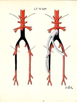
This collection consists of 28 color drawings of vascular surgery procedures such as endarterectomies, bypasses, grafts, aneurysmal repairs, arterial incisio...
出版者:
Ruth Lilly Medical Library, Indiana University School of Medicine
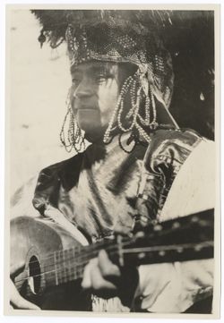
The collection consists of photographs (prints and negatives), loose photo captions, and postcards related to Eisenstein's film Que viva Mexico, released in ...
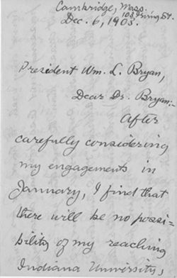
The first President of what was then Indiana College was elected by the Board of Trustees in 1829. William Lowe Bryan served as president of Indiana Universi...
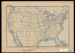
This collection is comprised of 20 maps produced as part of Alfred C. Kinsey’s gall wasp research, which culminated in the volume entitled The gall wasp genus Cynips: a study in the origin of species (https://iucat.iu.edu/catalog/932965). Kinsey’s gall wasp research predates the work on human sexuality for which he is more widely known. The maps were created during a span of twenty years, between approximately 1917 and 1937. Eighteen of the collection items are United States Geological Survey base maps onto which hand-annotated species data was added. Of particular interest to researchers may be the two remaining hand-drawn maps (Untitled I; First Expedition, 1931-32, Indiana University Second Mexican and Biological Expedition, 1935-36) which document Kinsey’s research travel routes. The original, physical copies of this set of 20 maps are housed at the Herman B Wells Library, Indiana University, Bloomington.
The Lilly Library is the rare books, manuscripts, and special collections library of the Indiana University Libraries, Bloomington. Its collections represent...
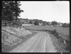
The IUB Map Collections contain digitized public domain maps from the Indiana University Bloomington Libraries print map collections. Maps in the digital collection range from the early nineteenth century to the present and feature: Geologic, topographic, and highway maps of Indiana in the Indiana Historic Maps Collection; Russian military topographic maps produced for defense and economic planning in the Russian Military Topographic Map Collection. The print IUB Map Collections are located on the 2nd floor of the East Tower of the Herman B Wells Library, 1320 East Tenth Street, Bloomington, Indiana 47405. To suggest maps to add to the digital collection or for more information, please contact us at libgimms@indiana.edu.
The bulk of Indiana University’s Russian Military Topographic Map Collection is made up of the Soviet Red Army topographic maps, which were produced for defense and economic planning. This collection came to Indiana University from the duplicate map room of the Library of Congress Map Collection in the early 1990s. These maps cover not only parts of Russia and Eastern Europe, but extend as far north as Scandinavia, as far west as Germany and the Netherlands, and as far south as Iran.
View an interactive index map of the collection (https://iu.maps.arcgis.com/apps/webappviewer/index.html?id=3003eaf8107048aeabd74b74a1481cb4).
This project was supported by a Digitizing Hidden Collections grant from the Council on Library and Information Resources (CLIR). The grant program is made possible by funding from The Andrew W. Mellon Foundation.
The Wylie family members represented in this collection are all family or in-laws of Andrew Wylie, Jr., son of Indiana University’s first president, Andrew W...
The Indiana University Archives is the largest and most comprehensive source of information on the history and culture of IU. This site includes finding aids...

 206Works