
Image
Princeton quadrangle, Indiana-Illinois : 15 minute series (topographic) [1965 printing without vegetation] 公开 Deposited
- Genre
- Quadrangle maps
- 15 minute topographic maps
- Topographic maps
- Location
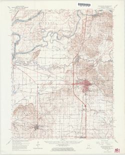
- Coordinates: W0874500 W0873000 N0383000 N0381500
- Related URL
- Abstract
- Mapped, edited and published by the Geological Survey , Illinois area mapped in cooperation with State of Illinois Geological Survey. Filing title: Princeton, Ind.-Ill. Standard map series designation: AMS (Series) V751 3460 I. Polyconic projection. Relief shown by contours and spot heights. Contour interval 10 feet. Includes quadrangle location map. Shows portion of Gibson County, Indiana, as well as small portions of Knox County, Indiana, and Wabash County, Illinois. Some copies show forest areas colored green. "Control by USGS, USC&GS, USCE, and Indiana Flood Control and Water Resources Commission." "Compiled in 1962 from 1:24000-scale maps dated 1959." "This area also covered by 7.5-minute, 1:24,000-scale maps: Patoka 1959, East Mount Carmel 1959, Owensville 1959, and Princeton 1959." Reprinted in 1965. "N3815--W8730/15."
- Call Number
- G4090 s62 .G4 Princeton 1959
- Caption
- Imprint: Washington, D.C. : Interior--U.S. Geological Survey, 1964.
- Filename
- VAC3073-M-01503
- Subject
- Geographic Subject: Knox County (Ind.)
- Geographic Subject: Gibson County (Ind.)
- Geographic Subject: Wabash County (Ill.)
- Title
- Princeton quadrangle, Indiana-Illinois : 15 minute series (topographic) [1965 printing without vegetation]
- Producer
- Illinois State Geological Survey
- United States. Army Map Service
- Geological Survey (U.S.)
- Physical Description
- Dimensions: 45 x 42 cm or smaller
- Scale: 1:62,500
- Item Identifiers
- Title Control Number: a18413928
- Persistent Identifier
- Campus
- IU Bloomington
- Date Created
- 1965
- Provenance
- Part of Geological Survey (U.S.). Indiana 1:62,500.
- Publisher
- Geological Survey (U.S.)
Relationships
关联
- 属于 Collection:
Items
Show Item Images
| 缩略图 | 标题 | 上传日期 | 公开度 | 行动 |
|---|---|---|---|---|
|
VAC3073-M-01503.jp2 | 2023-09-28 | 公开 |
|