
Image
Bloomington, [Indiana] metropolitan map series Public Deposited
- Genre
- Statistical maps
- Thematic maps
- Census data
- Location
- Coordinates: W0863904 W0860450 N0391839 N0390254
- Related URL
- Abstract
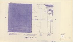
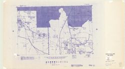
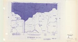
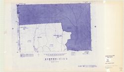
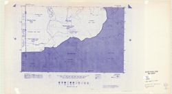
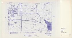
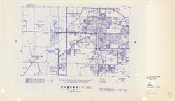
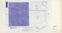
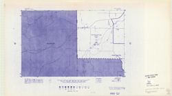
- Blue line print. "1020." "1980 census map." Shows census blocks for portions of Monroe County, Indiana, including Bloomington, Ellettsville, and Stinesville and portions of Washington Township in Brown County.
- Call Number
- G4094.B5 E25 s19 .U5
- Caption
- Imprint: [place of publication not identified : publisher not identified, 198-?]
- Filename
- VAC3073-M-00170
- Subject
- Geographic Subject: Bloomington Metropolitan Area (Ind.)
- Geographic Subject: Ellettsville (Ind.)
- Geographic Subject: Monroe County (Ind.)
- Geographic Subject: Indiana
- Topical Subject: Administrative and political divisions
- Geographic Subject: Washington (Brown County, Ind. : Township)
- Geographic Subject: Bloomington (Ind.)
- Topical Subject: Census districts
- Geographic Subject: Stinesville (Ind.)
- Title
- Bloomington, [Indiana] metropolitan map series
- Producer
- United States. Bureau of the Census. Geography Division
- Physical Description
- Scale: 1:19,000
- Dimensions: 37 x 57 cm
- Item Identifiers
- Title Control Number: a5326785
- Persistent Identifier
- Campus
- IU Bloomington
- Date Created
- 1967
- Publisher
- [publisher not identified]
Relationships
Relationships
- In Collection:
Items
Show Item Images
| Thumbnail | Title | Date Uploaded | Visibility | Actions |
|---|---|---|---|---|
|
VAC3073-M-00170.jp2 | 2023-09-22 | Public |
|
|
VAC3073-00438.jp2 | 2023-09-22 | Public |
|

|
VAC3073-00439.jp2 | 2023-09-22 | Public |
|
|
VAC3073-00440.jp2 | 2023-09-22 | Public |
|
|
VAC3073-00441.jp2 | 2023-09-22 | Public |
|
|
VAC3073-00442.jp2 | 2023-09-22 | Public |
|
|
VAC3073-00443.jp2 | 2023-09-22 | Public |
|
|
VAC3073-00444.jp2 | 2023-09-22 | Public |
|
|
VAC3073-00445.jp2 | 2023-09-22 | Public |
|
|
VAC3073-00446.jp2 | 2023-09-22 | Public |
|