
Image
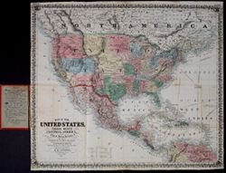
Map of the United States, Canada, Mexico, Central America, and the West India Islands : with a portion of Venezuela & New Granada Public Deposited
showing the routes overland and by the Isthmus to California & Oregon, also the new boundaries of California, Utah, & New Mexico
- Genre
- map
- Call Number
- G3300 1851 .A89
- Filename
- VAC2587-00018
- Subject
- Transportation--North America--Maps
- Title
- Map of the United States, Canada, Mexico, Central America, and the West India Islands : with a portion of Venezuela & New Granada
- showing the routes overland and by the Isthmus to California & Oregon, also the new boundaries of California, Utah, & New Mexico
- Persistent URL
- Source Metadata Identifier
- Holding Location
- Bloomington - Lilly Library
1200 E. Seventh St
Bloomington, IN 47405
Contact at liblilly@iu.edu, 812-855-2452
- Bloomington - Lilly Library
- Campus
- IU Bloomington
Relationships
Relationships
- In Collection:
Items
Show Item Images
| Thumbnail | Title | Date Uploaded | Visibility | Actions |
|---|---|---|---|---|
|
VAC2587-00018.tif | 2024-06-23 | Public |
|