
Image
Map of the city of Indianapolis, Indiana Public Deposited
- Genre
- Maps
- Location
- Coordinates: W0861142 W0860735 N0394758 N0394409
- Related URL
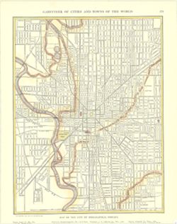
- Abstract
- Shows states and principal cities indexed in margin. Inset maps show Hamburg and Berlin. Shows cities, towns, and railroads. "Copyright, 1911, by P. F. Collier & Son." From: New encyclopedic atlas and gazetteer of the world. New York : P. F. Collier & Son, 1911. At head of map: Gazetteer of cities and towns of the world, 171.
- Call Number
- G4094.I4 1911.C65
- Filename
- VAC3073-M-01582
- Subject
- Geographic Subject: Indianapolis (Ind.)
- Title
- Map of the city of Indianapolis, Indiana
- Physical Description
- Dimensions: 30 x 23 cm
- Persistent Identifier
- Campus
- IU Bloomington
- Publisher
- [New York] : P. F. Collier & Son, 1911.
Relationships
Relationships
- In Collection:
Items
Show Item Images
| Thumbnail | Title | Date Uploaded | Visibility | Actions |
|---|---|---|---|---|
|
VAC3073-M-01582.jp2 | 2023-09-28 | Public |
|