
Image
Indiana, 15 minute series (topographic), New Haven quadrangle [1958 printing with vegetation] 公开 Deposited
- Genre
- Topographic maps
- 15 minute topographic maps
- Quadrangle maps
- Location
- Coordinates: W0881500 W0880000 N0380000 N0374500
- Related URL
- Abstract
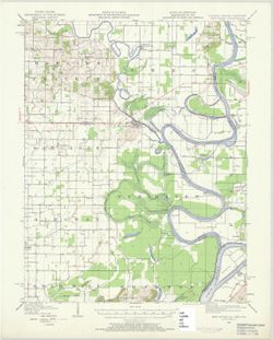
- United States, Department of the Interior, Geological Survey , State of Illinois, Department of Registration and Education, Geological Survey Division , State of Kentucky, represented by the Department of Mines and Minerals , H. M. Wilson, geographer , Chas. E. Cooke, in charge of section , topography by W. J. Lloyd and L. Scott Smith. Filing title: New Haven, Ill.-Ind.-Ky., 1949. Polyconic projection. Relief shown by contours and spot heights. Contour interval 20 feet. Shows portions of Gallatin and White counties, Illinois, Posey County, Indiana, and Union County, Kentucky. Surveyed in 1905. "Culture revised in part, 1938 and 1949." Reprinted 1966. Some copies show forest areas colored green. "W3745--N8800/15."
- Call Number
- G4090 s62 .G4 New Haven 1949 rep 1958 V
- Caption
- Imprint: Washington, D.C. : Interior--Geological Survey, 1958
- Filename
- VAC3073-M-01360
- Subject
- Topical Subject: Vegetation mapping
- Geographic Subject: Posey County (Ind.)
- Geographic Subject: Gallatin County (Ill.)
- Geographic Subject: White County (Ill.)
- Geographic Subject: Union County (Ky.)
- Title
- Indiana, 15 minute series (topographic), New Haven quadrangle [1958 printing with vegetation]
- Producer
- Geological Survey (U.S.)
- Physical Description
- Scale: 1:62,500
- Dimensions: 45 x 42 cm or smaller
- Item Identifiers
- Title Control Number: a18413861
- Persistent Identifier
- Campus
- IU Bloomington
- Date Created
- 1958
- Provenance
- Part of Geological Survey (U.S.). Indiana 1:62,500.
- Publisher
- Geological Survey (U.S.)
Relationships
关联
- 属于 Collection:
Items
Show Item Images
| 缩略图 | 标题 | 上传日期 | 公开度 | 行动 |
|---|---|---|---|---|
|
VAC3073-M-01360.jp2 | 2023-09-28 | 公开 |
|