
Image
Cassopolis quadrangle, Michigan--Indiana : 15-minute series Public Deposited
- Genre
- Quadrangle maps
- Topographic maps
- 15 minute topographic maps
- Location
- Coordinates: W0861500 W0860000 N0420000 N0414500
- Related URL
- Abstract
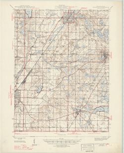
- Filing title: Cassopolis, Mich.--Ind. Edition of 1947. Polyconic projection. Indiana portion not shown, shown on 1:24,000 scale maps of South Bend West and Osceola. Relief shown by contours and spot heights. Contour interval 20 feet. Mapped by the Geological Survey 1944-1945. 10,000-foot grid based on Michigan (Central) rectangular coordinate system , 5000 yard grid based on U.S. zone system, C , 1000-meter Universal Transverse Mercator grid, zone 16. At head of map: "Michigan State Highway Department." "N4145-W8600/15."
- Call Number
- G4090 s62 .G4 Cassopolis 1947
- Caption
- Imprint: Washington, D.C. : U.S. Geological Survey, 1947.
- Filename
- VAC3073-M-01325
- Subject
- Geographic Subject: Cass County (Ind.)
- Geographic Subject: Berrien County (Mich.)
- Title
- Cassopolis quadrangle, Michigan--Indiana : 15-minute series
- Producer
- Geological Survey (U.S.)
- Physical Description
- Dimensions: 45 x 42 cm or smaller
- Scale: 1:62,500
- Item Identifiers
- Title Control Number: a18408371
- Persistent Identifier
- Campus
- IU Bloomington
- Date Created
- 1947
- Provenance
- Part of Geological Survey (U.S.). Indiana 1:62,500.
- Publisher
- Geological Survey (U.S.)
Relationships
Relationships
- In Collection:
Items
Show Item Images
| Thumbnail | Title | Date Uploaded | Visibility | Actions |
|---|---|---|---|---|
|
VAC3073-M-01325.jp2 | 2023-09-28 | Public |
|