
Image
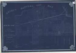
Hefel's natural gas map : map of Muncie Ind. Public Deposited
- Genre
- Cadastral maps
- Location
- Coordinates: W0852716 W0851914 N0401426 N0400856
- Related URL
- Abstract
- Partial cadastral map showing landowners. Blueprint.
- Call Number
- G4094.M9G46 1888 .H44
- Caption
- Imprint: [Muncie, Ind.] : [Toney C. Hefel], [1888]
- Filename
- VAC3073-M-00168
- Subject
- Topical Subject: Real property
- Topical Subject: Natural gas
- Topical Subject: Landowners
- Geographic Subject: Muncie (Ind.)
- Title
- Hefel's natural gas map : map of Muncie Ind.
- Producer
- Hefel, Toney C.
- Physical Description
- Scale: 1:3,960
- Dimensions: 86 x 127 cm
- Persistent Identifier
- Campus
- IU Bloomington
- Date Created
- 1888
- Publisher
- Hefel, Toney C.
Relationships
Relationships
- In Collection:
Items
Show Item Images
| Thumbnail | Title | Date Uploaded | Visibility | Actions |
|---|---|---|---|---|
|
VAC3073-M-00168.jp2 | 2023-09-22 | Public |
|