
Image
Shell highway map Indiana Public Deposited
- Genre
- Road maps
- Location
- Coordinates: W0880500 W0844700 N0414500 N0374600
- Related URL
- Abstract
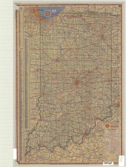
- Includes index to counties, cities and towns. Text and ancillary maps of Hammond, Gary, Michigan City Region, Indianapolis, Indiana, and United States mileage and driving time along main transcontinental highways on verso.
- Call Number
- G4091.P2 1949 .H2
- Caption
- Imprint: Chicago : H.M. Gousha, [1949]
- Filename
- VAC3073-M-00163
- Subject
- Geographic Subject: Indiana
- Topical Subject: Roads
- Title
- Shell highway map Indiana
- Producer
- H.M. Gousha Company
- Physical Description
- Scale: 1:760,000
- Dimensions: 65 x 41 cm
- Item Identifiers
- Title Control Number: a5272396
- Persistent Identifier
- Campus
- IU Bloomington
- Date Created
- 1949
- Publisher
- H.M. Gousha Company
Relationships
Relationships
- In Collection:
Items
Show Item Images
| Thumbnail | Title | Date Uploaded | Visibility | Actions |
|---|---|---|---|---|

|
VAC3073-M-00163.jp2 | 2023-09-22 | Public |
|
|
VAC3073-00436.jp2 | 2023-09-22 | Public |
|