
Image
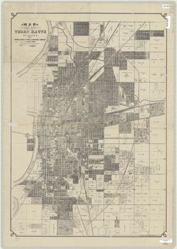
Map of the City of Terre Haute Indiana Public Deposited
- Genre
- Cadastral maps
- Location
- Coordinates: W0872810 W0871636 N0393142 N0392405
- Related URL
- Call Number
- G4094.T4 1927 .M66
- Caption
- Imprint: Terre Haute, Ind.: Moore-Langen Ptg. and Pub. Co., [1927]
- Filename
- VAC3073-M-00379
- Subject
- Topical Subject: Roads
- Topical Subject: Real property
- Geographic Subject: Terre Haute (Ind.)
- Title
- Map of the City of Terre Haute Indiana
- Producer
- Moore-Langen Printing & Publishing Company
- Physical Description
- Dimensions: 79 x 56 cm
- Persistent Identifier
- Campus
- IU Bloomington
- Date Created
- 1927
- Publisher
- Moore-Langen Printing & Publishing Company
Relationships
Relationships
- In Collection:
Items
Show Item Images
| Thumbnail | Title | Date Uploaded | Visibility | Actions |
|---|---|---|---|---|
|
VAC3073-M-00379.jp2 | 2023-09-25 | Public |
|