
Image
Wabash River Logansport to Huntington, Ind. : chart 39 to chart 46 inclusive Public Deposited
- Genre
- Nautical charts
- Location
- Coordinates: W0880700 W0843300 N0405700 N0374700
- Related URL
- Abstract
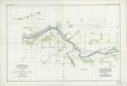
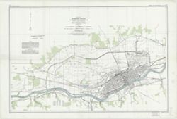
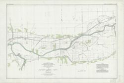
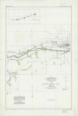
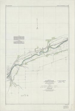
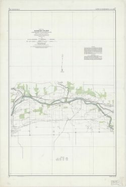
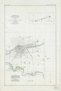
- Surveyed and mapped under the direction of the United States engineer officer, Louisville, Ky. 1930. Relief shown by contours and spot heights. Depths shown by soundings. Includes index map on chart 39. "Aerial photography was begun August 21st and completed October 12th, 1930 ..." "Horizontal control and mapping by W.N. Brown, Inc. ... Vertical control by U.S. Coast and Geodetic Survey, Brock and Weymouth and W.N. Brown, Inc. Aerial photogrpahy by Bowman Park Aero Company, Inc. Soundings by U.S. Engineer Office, Louisville, Ky."
- Call Number
- G4072.W3 1930 .U5
- Caption
- Imprint: Washington, D.C. : Williams & Heintz Co., 1931.
- Filename
- VAC3073-M-01501
- Subject
- Topical Subject: Rivers
- Topical Subject: Valleys
- Geographic Subject: Wabash River
- Geographic Subject: Wabash River Valley
- Title
- Wabash River Logansport to Huntington, Ind. : chart 39 to chart 46 inclusive
- Producer
- Williams & Heintz Co.
- Physical Description
- Scale: 1:24,000
- Dimensions: 64 x 96 cm, on sheets 72 x 107 cm
- Persistent Identifier
- Campus
- IU Bloomington
- Date Created
- 1930
- Publisher
- United States. Army. Corps of Engineers. Louisville District.
Relationships
Relationships
- In Collection:
Items
Show Item Images
| Thumbnail | Title | Date Uploaded | Visibility | Actions |
|---|---|---|---|---|
|
VAC3073-M-01501.jp2 | 2023-09-28 | Public |
|
|
VAC3073-00879.jp2 | 2023-09-28 | Public |
|
|
VAC3073-00880.jp2 | 2023-09-28 | Public |
|
|
VAC3073-00881.jp2 | 2023-09-28 | Public |
|
|
VAC3073-00882.jp2 | 2023-09-28 | Public |
|
|
VAC3073-00883.jp2 | 2023-09-28 | Public |
|
|
VAC3073-00884.jp2 | 2023-09-28 | Public |
|