
Image
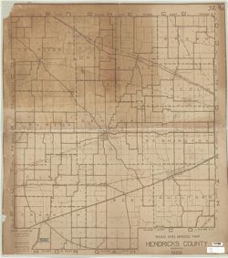
Road and Bridge map Hendricks County Indiana Public Deposited
- Genre
- Road maps
- Location
- Coordinates: W0864143 W0861931 N0395527 N0393602
- Related URL
- Abstract
- Brown line. "1922."
- Call Number
- G4093.H5P2 1922 .R63
- Caption
- Imprint: [Place of publication not identified] : [publisher not identified], 1922.
- Filename
- VAC3073-M-00968
- Subject
- Geographic Subject: Hendricks County (Ind.)
- Topical Subject: Roads
- Topical Subject: Bridges
- Title
- Road and Bridge map Hendricks County Indiana
- Physical Description
- Dimensions: 108 x 98 cm
- Scale: 1:35,000
- Item Identifiers
- Title Control Number: a6946082
- Persistent Identifier
- Campus
- IU Bloomington
- Date Created
- 1922
- Publisher
- [publisher not identified]
Relationships
Relationships
- In Collection:
Items
Show Item Images
| Thumbnail | Title | Date Uploaded | Visibility | Actions |
|---|---|---|---|---|
|
VAC3073-M-00968.jp2 | 2023-09-27 | Public |
|