
Image
Map of Vigo County, Indiana Public Deposited
- Genre
- Maps
- Location
- Coordinates: W0873635 W0871156 N0393629 N0391532
- Related URL
- Abstract
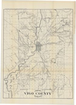
- Relief shown by hachures. Shows roads and railroads. Detached from: Geology of Vigo County, Indiana / J.T. Scovell. In Indiana Department of Geology and Natural Resources twenty-first annual report. Indianapolis, Ind. : Wm. B. Burford, 1897.
- Call Number
- G4093.V5 1896 .I53
- Caption
- Imprint: [Indianapolis] : Department of Geology and Natural Resources of Indiana, [1897]
- Imprint: Indianapolis, Ind. : Wm. B. Burford, [1897]
- Filename
- VAC3073-M-01452
- Subject
- Topical Subject: IGS Annual Reports
- Geographic Subject: Vigo County (Ind.)
- Title
- Map of Vigo County, Indiana
- Physical Description
- Dimensions: 55 x 43 cm
- Item Identifiers
- Title Control Number: a16180108
- Alternate ID: 390726IP
- Persistent Identifier
- Campus
- IU Bloomington
- Date Created
- 1896
- Provenance
- 21st Annual Report (1896) / Indiana. Department of Geology and Natural Resources.
- Publisher
- Indiana. Department of Geology and Natural Resources
Relationships
Relationships
- In Collection:
Items
Show Item Images
| Thumbnail | Title | Date Uploaded | Visibility | Actions |
|---|---|---|---|---|
|
VAC3073-M-01452.jp2 | 2023-09-28 | Public |
|