
Image
Vandalia quadrangle, Michigan-Indiana : 15 minute series (topographic) [1973 reprint with vegetation] Public Deposited
- Genre
- 15 minute topographic maps
- Quadrangle maps
- Topographic maps
- Location
- Coordinates: W0860000 W0854500 N0420000 N0414500
- Related URL
- Abstract
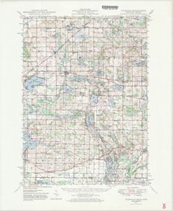
- Mapped, edited, and published by the Geological Survey. Filing title: Vandalia, Mich.-Ind. Standard map series designation: AMS (Series) V762 3867 IV. [Edition of] 1948. Polyconic projection. Relief shown by contours and spot heights, depth shown by isolines and soundings. Contour interval 20 feet. Shows portion of Cass County, Michigan, and small portions of St. Joseph County, Michigan, and Elkhart, Indiana. At head of map: Michigan State Highway Department. Culture and drainage in part compiled from aerial photographs taken 1938. Topography by plane-table surveys 1944-1945 and 1948. Reprinted 1959 and 1973. AMS series information from 1973 reprint. "N4145-W8545/15."
- Call Number
- G4090 s62 .G4 Vandalia 1948 V
- Caption
- Imprint: Washington, D.C. : Interior--U.S. Geological Survey, 1973
- Filename
- VAC3073-M-01507
- Subject
- Topical Subject: Vegetation mapping
- Geographic Subject: Saint Joseph County (Mich.)
- Geographic Subject: Cass County (Mich.)
- Geographic Subject: Elkhart County (Ind.)
- Title
- Vandalia quadrangle, Michigan-Indiana : 15 minute series (topographic) [1973 reprint with vegetation]
- Producer
- Michigan. State Highway Department
- Geological Survey (U.S.)
- Physical Description
- Scale: 1:62,500
- Dimensions: 45 x 42 cm or smaller
- Item Identifiers
- Title Control Number: a18415471
- Persistent Identifier
- Campus
- IU Bloomington
- Date Created
- 1973
- Provenance
- Part of Geological Survey (U.S.). Indiana 1:62,500.
- Publisher
- Geological Survey (U.S.)
Relationships
Relationships
- In Collection:
Items
Show Item Images
| Thumbnail | Title | Date Uploaded | Visibility | Actions |
|---|---|---|---|---|
|
VAC3073-M-01507.jp2 | 2023-09-28 | Public |
|