
Image
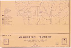
[Monroe County, Indiana, existing use of land.] Sheet 13. Washington Township, Monroe County, Indiana, existing use of land Public Deposited
- Genre
- Thematic maps
- Location
- Coordinates: W0863427 W0862750 N0392022 N0391503
- Related URL
- Abstract
- Prepared for the Monroe County Plan Commission by Kenneth L. Schellie & Associates. "Land use survey taken June 1961". Includes locator and index maps. Sheet 13 of 14.
- Call Number
- G4093.M7G4 1961 .S34 sheet 13
- Caption
- Imprint: [Bloomington, Indiana] : Monroe County Plan Commission, 1961
- Filename
- VAC3073-M-01114
- Subject
- Geographic Subject: Washington (Monroe County, Ind. : Township)
- Topical Subject: Land use
- Title
- [Monroe County, Indiana, existing use of land.] Sheet 13. Washington Township, Monroe County, Indiana, existing use of land
- Producer
- Schellie Associates
- Physical Description
- Scale: Approximately 1:12,152
- Dimensions: 83 x 81 cm, on sheet 144 x 105 cm
- Item Identifiers
- Title Control Number: a18409365
- Persistent Identifier
- Campus
- IU Bloomington
- Provenance
- Schellie Associates. Monroe County Indiana, Existing Use of Land. [Bloomington, Indiana] : Monroe County Plan Commission, 1961.
- Publisher
- Schellie Associates
Relationships
Relationships
- In Collection:
Items
Show Item Images
| Thumbnail | Title | Date Uploaded | Visibility | Actions |
|---|---|---|---|---|
|
VAC3073-M-01114.jp2 | 2023-09-27 | Public |
|
|
VAC3073-00338.jp2 | 2023-09-27 | Public |
|