
Image
Michigan, Wisconsin, Northern Illinois Public Deposited
- Series
- GLOVE - Local and Regional Maps
- Abstract
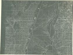
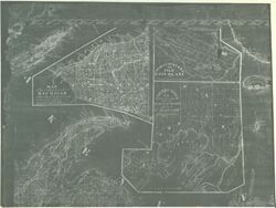
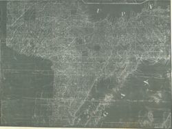
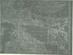
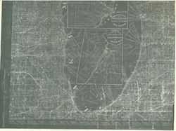
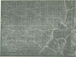
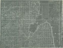
- A geological map of Isle Royale to Lake Superior reduced from the maps made pursuant to Act of Congress approved March 1st 1847. By Charles T. Jackson, J.W. Foster, and J.D. Whitney, U.S. Geologists and from Bayfields Chart.
- Call Number
- GLV171
- Copyright Holder
- Public Domain
- Country
- United States
- Source Identifier
- VAD5944-000060
- Subject
- American Indians
- United States--Maps
- Illinois
- Michigan
- Indians of North America
- Wisconsin
- Holding Location
- Bloomington - Indiana University Museum of Archaeology and Anthropology
416 North Indiana Avenue
Bloomington, IN 47408
Contact at iumaa@iu.edu, 812-855-6873
- Bloomington - Indiana University Museum of Archaeology and Anthropology
- Campus
- IU Bloomington
- Source Metadata Identifier
- Title
- Michigan, Wisconsin, Northern Illinois
- Date Created
- 1847
- Physical Description
- Scale of miles to 9 centimeters
- Persistent URL
Relationships
Relationships
Items
Show Item Images
| Thumbnail | Title | Date Uploaded | Visibility | Actions |
|---|---|---|---|---|
|
VAD5944-000060.tif | 2023-04-18 | Public |
|
|
VAD5944-U-00053.tif | 2023-04-18 | Public |
|
|
VAD5944-U-00054.tif | 2023-04-18 | Public |
|
|
VAD5944-U-00055.tif | 2023-04-18 | Public |
|
|
VAD5944-U-00056.tif | 2023-04-18 | Public |
|
|
VAD5944-U-00057.tif | 2023-04-18 | Public |
|
|
VAD5944-U-00058.tif | 2023-04-18 | Public |
|