
Image
Historical Map of Illinois Showing Early Discoveries Public Deposited
- Series
- GLOVE - Local and Regional Maps
- Abstract
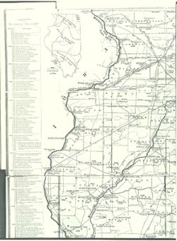
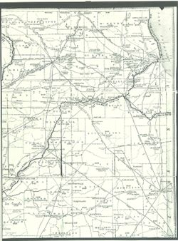
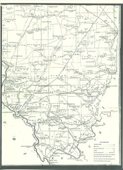
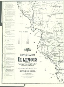
- Historical map of Illinois showing early discoveries, explorations, Indian Villages, missions, trails, battle fields, forts, block houses, first settlements and mail routes, also a chronological tablet of Illinois history arranged in centuries and decades.
- Call Number
- GLV187
- Copyright Holder
- Public Domain
- Country
- United States
- Source Identifier
- VAD5944-000078
- Subject
- American Indians
- Indians of North America
- Illinois
- United States--Maps
- Holding Location
- Bloomington - Indiana University Museum of Archaeology and Anthropology
416 North Indiana Avenue
Bloomington, IN 47408
Contact at iumaa@iu.edu, 812-855-6873
- Bloomington - Indiana University Museum of Archaeology and Anthropology
- Campus
- IU Bloomington
- Source Metadata Identifier
- Title
- Historical Map of Illinois Showing Early Discoveries
- Creator
- Blanchard, Rufus
- Date Created
- 1883
- Persistent URL
Relationships
Relationships
Items
Show Item Images
| Thumbnail | Title | Date Uploaded | Visibility | Actions |
|---|---|---|---|---|
|
VAD5944-000078.tif | 2023-04-18 | Public |
|
|
VAD5944-U-00078.tif | 2023-04-18 | Public |
|
|
VAD5944-U-00079.tif | 2023-04-18 | Public |
|
|
VAD5944-U-00080.tif | 2023-04-18 | Public |
|