
Image
Map of Indiana Public Deposited
- Genre
- Thematic maps
- Location
- Coordinates: W0880500 W0844700 N0414500 N0374600
- Related URL
- Abstract
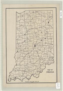
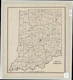
- "R." Shows counties, county seats, rivers and railroads.
- Call Number
- G4091.F7 1930 .M37
- Caption
- Imprint: Indianapolis, Ind.? : [publisher not identified], 1930?
- Filename
- VAC3073-M-00010
- Subject
- Geographic Subject: Indiana
- Topical Subject: Administrative and political divisions
- Title
- Map of Indiana
- Physical Description
- Dimensions: 47 x 32 cm
- Scale: 1:1,000,000
- Item Identifiers
- Title Control Number: a8087637
- Persistent Identifier
- Campus
- IU Bloomington
- Date Created
- Circa 1930
- Publisher
- [publisher not identified]
Relationships
Relationships
- In Collection:
Items
Show Item Images
| Thumbnail | Title | Date Uploaded | Visibility | Actions |
|---|---|---|---|---|
|
VAC3073-M-00010.jp2 | 2023-09-21 | Public |
|
|
VAC3073-00901.jp2 | 2023-09-21 | Public |
|