
Image
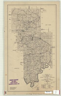
Lost River, Patoka, and Lafayette purchase units, Indiana, 2nd principal meridian : [Hoosier National Forest] Public Deposited
- Genre
- Maps
- Location
- Coordinates: W0870012 W0862757 N0385951 N0374952
- Related URL
- Abstract
- "Compiled at the Regional Office, Milwaukee, Wisconsin form G.L.O. and Forest Service Surveys, also state and county maps by W.F. Last.
- Call Number
- G4092.H6 1936 .U5
- Caption
- Imprint: Milwaukee, Wisc. : U. S. Dept. of Agriculture, Forest Service, Regional Office, 1936.
- Filename
- VAC3073-M-00204
- Subject
- Geographic Subject: Hoosier National Forest (Ind.)
- Title
- Lost River, Patoka, and Lafayette purchase units, Indiana, 2nd principal meridian : [Hoosier National Forest]
- Producer
- United States. Forest Service
- Physical Description
- Dimensions: 55 x 31 cm
- Scale: 1:250,000
- Item Identifiers
- Title Control Number: a6948726
- Persistent Identifier
- Campus
- IU Bloomington
- Date Created
- 1936
- Publisher
- United States. Forest Service. Regional Office
Relationships
Relationships
- In Collection:
Items
Show Item Images
| Thumbnail | Title | Date Uploaded | Visibility | Actions |
|---|---|---|---|---|
|
VAC3073-M-00204.jp2 | 2023-09-22 | Public |
|