
Image
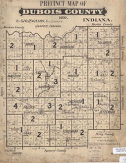
Precinct map of DuBois County, Indiana Public Deposited
- Genre
- Thematic maps
- Location
- Coordinates: W0870400 W0864100 N0383200 N0381200
- Related URL
- Call Number
- G4093.D8F7 1900 .W55
- Caption
- Imprint: [Birdseye, Ind.] : Birdseye News, 1900
- Filename
- VAC3073-M-00424
- Subject
- Topical Subject: Administrative and political divisions
- Geographic Subject: Dubois County (Ind.)
- Title
- Precinct map of DuBois County, Indiana
- Producer
- Wilson, George R., 1863-1941
- Physical Description
- Scale: 1:150,000
- Dimensions: 34 x 26 cm
- Item Identifiers
- Title Control Number: CAQ2770BB
- Persistent Identifier
- Campus
- IU Bloomington
- Date Created
- 1900
- Publisher
- Birdseye News
Relationships
Relationships
- In Collection:
Items
Show Item Images
| Thumbnail | Title | Date Uploaded | Visibility | Actions |
|---|---|---|---|---|
|
VAC3073-M-00424.jp2 | 2023-09-25 | Public |
|