
Image
Soil map, Indiana, Porter County Public Deposited
- Genre
- Thematic maps
- Location
- Coordinates: W0871300 W0865600 N0414300 N0411400
- Related URL
- Abstract
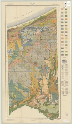
- "A. Hoen & Co. Lith. Baltimore, Md." Includes legend in margins.
- Call Number
- G4093 .P5J3 1916 .B87
- Caption
- Imprint: [Washington, D.C.] : U.S. Dept. of Agriculture, Bureau of Soils, 1916.
- Filename
- VAC3073-M-00955
- Subject
- Geographic Subject: Porter County (Ind.)
- Topical Subject: Soils
- Topical Subject: Classification
- Title
- Soil map, Indiana, Porter County
- Producer
- Bushnell, T. M. (Thomas Mark), 1889-1976
- Physical Description
- Dimensions: 87 x 42 cm
- Scale: 1:63,360
- Item Identifiers
- Title Control Number: CAQ7485BB
- Persistent Identifier
- Campus
- IU Bloomington
- Date Created
- 1916
- Publisher
- United States. Bureau of Soils
Relationships
Relationships
- In Collection:
Items
Show Item Images
| Thumbnail | Title | Date Uploaded | Visibility | Actions |
|---|---|---|---|---|
|
VAC3073-M-00955.jp2 | 2023-09-27 | Public |
|