
Image
Montgomery County Indiana Public Deposited
- Genre
- Cadastral maps
- Location
- Coordinates: W0870600 W0864200 N0401300 N0395200
- Related URL
- Abstract
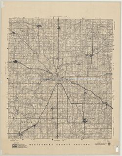
- Cadastral map showing landowners. "1940-1941."
- Call Number
- G4093.M8 G46 1941 .D66
- Caption
- Imprint: [Crawfordsville, Ind.] : Roy E. Donica and Karl M. Laurimore, [1941].
- Filename
- VAC3073-M-00217
- Subject
- Topical Subject: Landowners
- Topical Subject: Real property
- Geographic Subject: Montgomery County (Ind.)
- Title
- Montgomery County Indiana
- Producer
- Donica, Roy E.
- Physical Description
- Dimensions: 125 x 125 cm
- Scale: 1:31,680
- Item Identifiers
- Title Control Number: a5383100
- Persistent Identifier
- Campus
- IU Bloomington
- Date Created
- 1941
- Publisher
- Roy E. Donica and Karl M. Laurimore
Relationships
Relationships
- In Collection:
Items
Show Item Images
| Thumbnail | Title | Date Uploaded | Visibility | Actions |
|---|---|---|---|---|
|
VAC3073-M-00217.jp2 | 2023-10-18 | Public |
|