
Image
Map of Marion, Ind. Public Deposited
- Genre
- Cadastral maps
- Location
- Coordinates: W0854353 W0853222 N0403527 N0402844
- Related URL
- Abstract
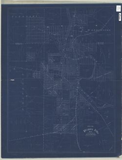
- Blueprint. Partial cadastral map showing landowners.
- Call Number
- G4094.M3 G46 1888 .B35
- Caption
- Imprint: [Marion, Ind.?] : [Frank M. Baldwin?], [1888?]
- Filename
- VAC3073-M-00317
- Subject
- Topical Subject: Real property
- Topical Subject: Landowners
- Geographic Subject: Marion (Ind.)
- Title
- Map of Marion, Ind.
- Producer
- Baldwin, Frank M.
- Physical Description
- Scale: 1:7,920
- Dimensions: 83 x 63 cm
- Item Identifiers
- Title Control Number: a7172426
- Persistent Identifier
- Campus
- IU Bloomington
- Date Created
- 1888
- Publisher
- Baldwin, Frank M.
Relationships
Relationships
- In Collection:
Items
Show Item Images
| Thumbnail | Title | Date Uploaded | Visibility | Actions |
|---|---|---|---|---|
|
VAC3073-M-00317.jp2 | 2023-09-25 | Public |
|