
Image
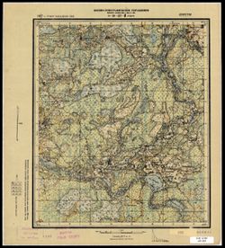
O-36-137-B Рудня Public Deposited
- Original Publication Date
1927
- Genre
- Military Maps
- Topographic Maps
- Location
- Coordinates: 56.0, 32.0, 56.16667, 32.25
- Related URL
- Abstract
- Modern area represented: Рудня (Rudnya), Tverskaya oblast, Russia
- Call Number
- G7000 s50 .S68 sheet O-36-137-C
- Caption
- Секретно
- City
- Рудня (Rudnya)
- Copyright Owner
- No Copyright - United States
- Country
- СССР (USSR)
- Filename
- VAC9619-003497
- Subject
- Topical Subject: Soviet Union
- Topical Subject: Maps
- Geographic Subject: Rudnya
- State/Region
- Западная область (Western oblast)
- РСФСР (RSFSR)
- Title
- O-36-137-B Рудня
- Physical Description
- Scale: 1:50,000
- Language
- Russian
- Persistent Identifier
- Campus
- IU Bloomington
- Date Created
- 1931
- Provenance
- CIA Map Branch -- Received
- Publisher
- Военно-топографическое управление
Relationships
Relationships
- In Collection:
Items
Show Item Images
| Thumbnail | Title | Date Uploaded | Visibility | Actions |
|---|---|---|---|---|
|
VAC9619-003497.jp2 | 2024-02-02 | Public |
|