
Image
Map of Monroe County, Indiana Public Deposited
- Genre
- Road maps
- Thematic maps
- Location
- Coordinates: W0864108 W0862436 N0392120 N0385926
- Related URL
- Abstract
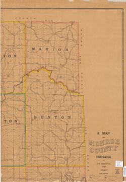
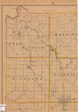
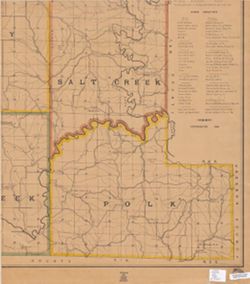
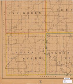
- Shows townships, sections, drainage, roads, schools, post offices, quarries, and stone mills. Includes "Stone directory" listing quarries and the companies that operate them. Includes "Stone directory" listing quarries and the companies that operate them.
- Call Number
- G4093 .M7P2 1895 .S54
- Caption
- Imprint: [New York] : Julius Bien & Co., 1895.
- Filename
- VAC3073-M-00084
- Subject
- Geographic Subject: Monroe County (Ind.)
- Topical Subject: Roads
- Topical Subject: Quarries and quarrying
- Title
- Map of Monroe County, Indiana
- Producer
- Siebenthal, C. E. (Claude Ellsworth), 1869-1930
- Physical Description
- Scale: 1:31,680
- Dimensions: 129 x 103 cm
- Item Identifiers
- Title Control Number: a5101345
- Persistent Identifier
- Campus
- IU Bloomington
- Date Created
- 1895
- Publisher
- Julius Bien & Co.
Relationships
Relationships
- In Collection:
Items
Show Item Images
| Thumbnail | Title | Date Uploaded | Visibility | Actions |
|---|---|---|---|---|
|
VAC3073-M-00084.jp2 | 2023-09-21 | Public |
|
|
VAC3073-00359.jp2 | 2023-09-21 | Public |
|
|
VAC3073-00360.jp2 | 2023-09-21 | Public |
|
|
VAC3073-00361.jp2 | 2023-09-21 | Public |
|