
Image
diana transportation map, 2001 Public Deposited
- Genre
- Road maps
- Location
- Coordinates: W0880500 W0844700 N0414500 N0374600
- Related URL
- Abstract
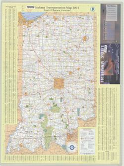
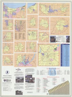
- Panel title: Indiana 2001. Includes indexes and note. Text, indexed map of "Downtown Indianapolis," 16 local route maps, distance table, index to points of interest, lists of interstate rest areas and state police phone numbers, and color illustrations on verso.
- Call Number
- G1403 .S7 2001
- Caption
- Imprint: Indianapolis, Ind. : Indiana Dept. of Transportation, [2001]
- Filename
- VAC3073-M-01228
- Subject
- Geographic Subject: Indiana
- Topical Subject: Roads
- Topical Subject: Central business districts
- Geographic Subject: Indianapolis (Ind.)
- Title
- diana transportation map, 2001
- Producer
- Indiana. Department of Transportation. Graphic Engineering Division
- Physical Description
- Dimensions: 94 x 59 cm
- Scale: Approximately 1:560,000
- Item Identifiers
- Title Control Number: a18406168
- Persistent Identifier
- Campus
- IU Bloomington
- Date Created
- 2001
- Provenance
- Indiana state highway system
- Publisher
- Indiana. Department of Transportation
Relationships
Relationships
- In Collection:
Items
Show Item Images
| Thumbnail | Title | Date Uploaded | Visibility | Actions |
|---|---|---|---|---|
|
VAC3073-M-01228.jp2 | 2023-09-27 | Public |
|
|
VAC3073-00582.jp2 | 2023-09-27 | Public |
|