
Image
Marion County, Indiana [map] : [aerial photographs, 1 inch=100 feet] Public Deposited
- Genre
- Aerial photographs
- Location
- Coordinates: W0862000 W0855700 N0395600 N0393800
- Related URL
- Abstract
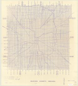
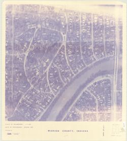
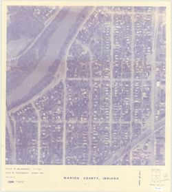
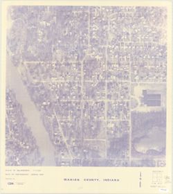
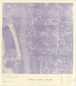
- Blue line print. "Date of photography: Spring 1985, Fall 1985"--Index map. Subtitle supplied by cataloger.
- Call Number
- G4093 .M3 A4 s1 .C559
- Caption
- Imprint: [Indianapolis] : [State Land Office], [198-?]
- Filename
- VAC3073-M-00698
- Subject
- Geographic Subject: Marion County (Ind.)
- Topical Subject: Aerial photographs
- Title
- Marion County, Indiana [map] : [aerial photographs, 1 inch=100 feet]
- Producer
- Clyde E. Williams & Associates
- Physical Description
- Dimensions: 77 x 77 cm
- Scale: 1:1,200
- Item Identifiers
- Title Control Number: a4948281
- Persistent Identifier
- Campus
- IU Bloomington
- Date Created
- 1985
- Publisher
- [State Land Office]
Relationships
Relationships
- In Collection:
Items
Show Item Images
| Thumbnail | Title | Date Uploaded | Visibility | Actions |
|---|---|---|---|---|
|
VAC3073-M-00698.jp2 | 2023-09-25 | Public |
|
|
VAC3073-00619.jp2 | 2023-09-25 | Public |
|
|
VAC3073-00620.jp2 | 2023-09-25 | Public |
|
|
VAC3073-00621.jp2 | 2023-09-25 | Public |
|
|
VAC3073-00622.jp2 | 2023-09-25 | Public |
|