
Image
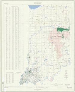
Map showing oil, gas, and gas storage fields in Indiana Public Deposited
- Genre
- Thematic maps
- Location
- Coordinates: W0880000 W0850000 N0414500 N0380000
- Related URL
- Abstract
- "Base modified from U.S. Geological Survey base map of Indiana, 1950". "Compiled from Indiana Geological Survey Petroleum Exploration Maps of Indiana counties". Includes "Names and locations of oil and gas fields", "Underground storage sites for liquified petroleum gas".
- Call Number
- G4091 .H8 1976 .C3
- Caption
- Imprint: 1) [Indianapolis, Indiana] : [State of Indiana, Department of Natural Resources], 1976 2) Bloomington, Indiana : Publications Section, Indiana Geological Survey, 1976 3) Washington, D.C.: Williams & Heintz Map Corporation, 1976.
- Filename
- VAC3073-M-00117
- Subject
- Geographic Subject: Indiana
- Topical Subject: Gas fields
- Topical Subject: Oil fields
- Topical Subject: Natural gas--Storage
- Title
- Map showing oil, gas, and gas storage fields in Indiana
- Producer
- Carpenter, G. L. (Gerald Leon), 1924-2012
- Physical Description
- Scale: 1:500,000
- Dimensions: 92 x 76 cm
- Item Identifiers
- Title Control Number: a5363901
- Persistent Identifier
- Campus
- IU Bloomington
- Date Created
- 1976
- Publisher
- Indiana. Department of Natural Resources
Relationships
Relationships
- In Collection:
Items
Show Item Images
| Thumbnail | Title | Date Uploaded | Visibility | Actions |
|---|---|---|---|---|
|
VAC3073-M-00117.jp2 | 2023-09-21 | Public |
|