
Image
Illinois-Indiana, Watseka quadrangle [1939 printing] Public Deposited
- Genre
- Quadrangle maps
- 15 minute topographic maps
- Topographic maps
- Location
- Coordinates: W0874500 W0873000 N0410000 N0404500
- Related URL
- Abstract
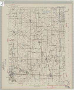
- Topography by J.T. Schultz, R.G. Shirley, T.B. McNeill, and H. McDermith. Filing title: Watseka, Ill.-Ind. Polyconic projection. Relief shown by contours and spot heights. Shows portions of Iroquois County, Illinois, and Newton County, Indiana. Surveyed in 1934-1935.
- Call Number
- G4090 s62 .G4 Wateska 1939
- Caption
- Imprint: [Washington, D.C.] : Geological Survey, [1939]
- Filename
- VAC3073-M-01413
- Subject
- Geographic Subject: Iroquois County (Ill.)
- Geographic Subject: Newton County (Ind.)
- Title
- Illinois-Indiana, Watseka quadrangle [1939 printing]
- Producer
- Schultz, J. T. (Jack Thurman), 1899-1972
- Geological Survey (U.S.)
- Physical Description
- Dimensions: 45 x 42 cm or smaller
- Scale: 1:62,500
- Item Identifiers
- Title Control Number: a18416003
- Persistent Identifier
- Campus
- IU Bloomington
- Date Created
- 1939
- Provenance
- Part of Geological Survey (U.S.). Indiana 1:62,500.
- Publisher
- Geological Survey (U.S.)
Relationships
Relationships
- In Collection:
Items
Show Item Images
| Thumbnail | Title | Date Uploaded | Visibility | Actions |
|---|---|---|---|---|
|
VAC3073-M-01413.jp2 | 2023-09-28 | Public |
|