
Image
Edinburg Quadrangle Indiana : 15 minute series (topographic) [1950 printing without vegetation] Public Deposited
- Genre
- Photogrammetric maps
- Quadrangle maps
- Topographic maps
- 15 minute topographic maps
- Location
- Coordinates: W0860000 W0854500 N0393000 N0391500
- Related URL
- Abstract
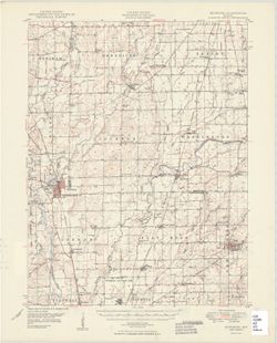
- Filing title: Edinburg, Ind. Edition of 1950. Polyconic projection. Relief shown by contours and spot heights. Contour interval 20 feet. Shows Shelby County, and portions of Bartholomew and Johnson counties in Indiana. At head of map: United States, Department of the Army, Corps of Engineers. Some copies have forest areas colored green. "Topography from aerial photographs by multiplex methods and by plane-table surveys 1947. Aerial photographs taken 1941 and 1944. Field check 1947." "This area is also covered by 1:24000 scale maps of Marietta, Lewis Creek, Edinburg and Hope 7.5 minute quadrangles." "N3915--W8545/15."
- Call Number
- G4090 s62 .G4 Edinburg 1950
- Caption
- Imprint: Washington, D.C. : Geological Survey, [1950]
- Filename
- VAC3073-M-01280
- Subject
- Geographic Subject: Bartholomew County (Ind.)
- Geographic Subject: Johnson County (Ind.)
- Geographic Subject: Shelby County (Ind.)
- Title
- Edinburg Quadrangle Indiana : 15 minute series (topographic) [1950 printing without vegetation]
- Producer
- United States. Army. Corps of Engineers
- Geological Survey (U.S.)
- Physical Description
- Scale: 1:62,500
- Dimensions: 45 x 42 cm or smaller
- Item Identifiers
- Title Control Number: a18412275
- Persistent Identifier
- Campus
- IU Bloomington
- Date Created
- 1950
- Provenance
- Part of Geological Survey (U.S.). Indiana 1:62,500.
- Publisher
- Geological Survey (U.S.)
Relationships
Relationships
- In Collection:
Items
Show Item Images
| Thumbnail | Title | Date Uploaded | Visibility | Actions |
|---|---|---|---|---|
|
VAC3073-M-01280.jp2 | 2023-09-28 | Public |
|