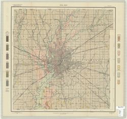
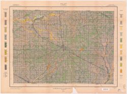
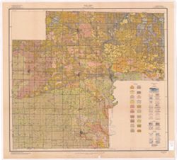
Geographic Subject: Lake County (Ind.), Topical Subject: Soils, and Topical Subject: Classification
Creator:
Bushnell, T. M. (Thomas Mark), 1889-1976
Publisher:
United States. Bureau of Soils
Date Created:
1917
Identifier:
VAC3073-M-00896
Genre:
Thematic maps
Geographic Location:
Coordinates: W0873100 W0871330 N0374230 N0411000
Related URL:
Catalog URL: https://iucat.iu.edu/catalog/2871165
Abstract:
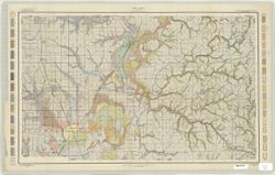
Map shows distribution of soil types by color and symbol. Soils surveyed by T.M. Bushnell of the U.S. Department of Agriculture, and Wendell Barret of the In...
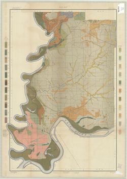
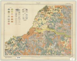
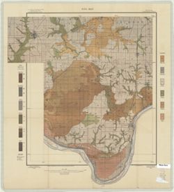
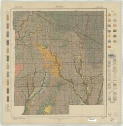
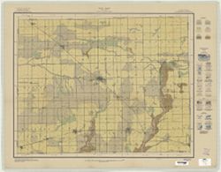
Topical Subject: Soils, Geographic Subject: Spencer County (Ind.), Geographic Subject: Warrick County (Ind.), Geographic Subject: Boonville (Ind.), and Topic...
Creator:
Mangum, A. W.
Publisher:
United States. Bureau of Soils
Date Created:
1904
Identifier:
VAC3073-M-00804
Genre:
Thematic maps
Geographic Location:
Coordinates: W0871000 W0870000 N0380500 N0374600
Related URL:
Catalog URL: https://iucat.iu.edu/catalog/2874208
Abstract:
Relief shown by contours. Map covers portions of Spencer and Warrick Counties in Indiana. Shows soil types classification by colors and symbols. "Field ...
Call Number:
G4093 .S5J3 1904 .M36
Caption:
Imprint: [Washington, D.C.?] : The Bureau, [1904?]