
Search Constraints
You searched for:
Publisher
Geological Survey (U.S.)
Remove constraint Publisher: Geological Survey (U.S.)
Search Results
-
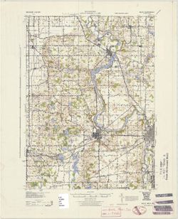
![Indiana Oolitic quadrangle : 15-minute series [1942 printing]](https://iiif.uits.iu.edu/iiif/2/7s75fh88q%2Ffiles%2Fe8a0e666-2e63-48ce-8d73-08ed262f4fa1/full/250,/0/default.jpg)
- Subject:
- Geographic Subject: Monroe County (Ind.), Geographic Subject: Greene County (Ind.), Geographic Subject: Lawrence County (Ind.), and Geographic Subject: Marti...
- Creator:
- Geological Survey (U.S.) and McKinley, W. K. (William Klett), 1891-1964
- Publisher:
- Geological Survey (U.S.)
- Date Created:
- 1942
- Identifier:
- VAC3073-M-01371
- Genre:
- Quadrangle maps, Topographic maps, and 15 minute topographic maps
- Geographic Location:
- Coordinates: W0864500 W0863000 N0390000 N0384500
- Related URL:
- Catalog URL: https://iucat.iu.edu/catalog/18413867
- Abstract:
- Topography by W.K. McKinley, W.F. Chenault, J.O. Kilmartin, G.F. Westinghouse, Shirley Waggener, W.H. Austin, A.G. Kirk, and K.R. Garmong. Culture and draina...
- Call Number:
- G4090 s62 .G4 Oolitic 1942
- Caption:
- Imprint: Washington, D.C. : U.S. Dept. of the Interior, Geological Survey, 1942
- Physical Description:
- Dimensions: 45 x 42 cm or smaller and Scale: 1:62,500
- Alternate Identifier:
- Title Control Number: a18413867
- Persistent URL:
- https://purl.dlib.indiana.edu/iudl/images/VAC3073/VAC3073-M-01371
- Provenance:
- Part of Geological Survey (U.S.). Indiana 1:62,500.
-
![Indiana Oolitic quadrangle : 15-minute series [1968 reprint with vegetation]](https://iiif.uits.iu.edu/iiif/2/pz50hz89x%2Ffiles%2Fd3212cc7-1b0e-44f5-858a-94b51d9080b5/full/250,/0/default.jpg)
- Subject:
- Geographic Subject: Lawrence County (Ind.), Geographic Subject: Greene County (Ind.), Topical Subject: Vegetation mapping, Geographic Subject: Monroe County ...
- Creator:
- McKinley, W. K. (William Klett), 1891-1964 and Geological Survey (U.S.)
- Publisher:
- Geological Survey (U.S.)
- Date Created:
- 1968
- Identifier:
- VAC3073-M-01370
- Genre:
- Topographic maps, 15 minute topographic maps, and Quadrangle maps
- Geographic Location:
- Coordinates: W0864500 W0863000 N0390000 N0384500
- Related URL:
- Catalog URL: https://iucat.iu.edu/catalog/18413831
- Abstract:
- Topography by W.K. McKinley [and seven others]. Polyconic projection. Relief shown by contours and spot heights. Contour interval 20 feet. Shows portion of L...
- Call Number:
- G4090 s62 .G4 Oolitic 1935 rep 1968 V
- Caption:
- Imprint: Washington, D.C. : Interior--Geological Survey, 1968
- Physical Description:
- Dimensions: 45 x 42 cm or smaller and Scale: 1:62,500
- Alternate Identifier:
- Title Control Number: a18413831
- Persistent URL:
- https://purl.dlib.indiana.edu/iudl/images/VAC3073/VAC3073-M-01370
- Provenance:
- Part of Geological Survey (U.S.). Indiana 1:62,500.
-
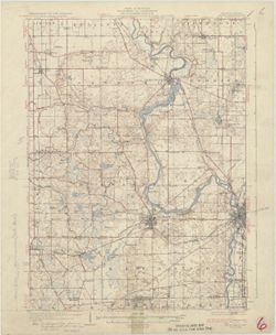
![Indiana Oolitic quadrangle : 15-minute series [1964 reprint with vegetation]](https://iiif.uits.iu.edu/iiif/2/6d571070c%2Ffiles%2Fdc8b2d50-211d-4276-b12f-039d6a003463/full/250,/0/default.jpg)
- Subject:
- Geographic Subject: Martin County (Ind.), Topical Subject: Vegetation mapping, Geographic Subject: Lawrence County (Ind.), Geographic Subject: Monroe County ...
- Creator:
- Geological Survey (U.S.) and McKinley, W. K. (William Klett), 1891-1964
- Publisher:
- Geological Survey (U.S.)
- Date Created:
- 1964
- Identifier:
- VAC3073-M-01369
- Genre:
- 15 minute topographic maps, Quadrangle maps, and Topographic maps
- Geographic Location:
- Coordinates: W0864500 W0863000 N0390000 N0384500
- Related URL:
- Catalog URL: https://iucat.iu.edu/catalog/18413831
- Abstract:
- Topography by W.K. McKinley [and seven others]. Polyconic projection. Relief shown by contours and spot heights. Contour interval 20 feet. Shows portion of L...
- Call Number:
- G4090 s62 .G4 Oolitic 1935 rep 1964 V
- Caption:
- Imprint: Washington, D.C. : Interior--Geological Survey, 1964
- Physical Description:
- Scale: 1:62,500 and Dimensions: 45 x 42 cm or smaller
- Alternate Identifier:
- Title Control Number: a18413831
- Persistent URL:
- https://purl.dlib.indiana.edu/iudl/images/VAC3073/VAC3073-M-01369
- Provenance:
- Part of Geological Survey (U.S.). Indiana 1:62,500.
-
![Indiana Oolitic quadrangle : 15-minute series [1964 reprint without vegetation]](https://iiif.uits.iu.edu/iiif/2/jq086p51r%2Ffiles%2F48bb3637-851a-4213-a31e-70cd1a0b6332/full/250,/0/default.jpg)
- Subject:
- Geographic Subject: Lawrence County (Ind.), Geographic Subject: Monroe County (Ind.), Geographic Subject: Martin County (Ind.), and Geographic Subject: Green...
- Creator:
- McKinley, W. K. (William Klett), 1891-1964 and Geological Survey (U.S.)
- Publisher:
- Geological Survey (U.S.)
- Date Created:
- 1964
- Identifier:
- VAC3073-M-01368
- Genre:
- 15 minute topographic maps, Topographic maps, and Quadrangle maps
- Geographic Location:
- Coordinates: W0864500 W0863000 N0390000 N0384500
- Related URL:
- Catalog URL: https://iucat.iu.edu/catalog/18413831
- Abstract:
- Topography by W.K. McKinley [and seven others]. Polyconic projection. Relief shown by contours and spot heights. Contour interval 20 feet. Shows portion of L...
- Call Number:
- G4090 s62 .G4 Oolitic 1935 rep 1964
- Caption:
- Imprint: Washington, D.C. : Interior--Geological Survey, 1964
- Physical Description:
- Scale: 1:62,500 and Dimensions: 45 x 42 cm or smaller
- Alternate Identifier:
- Title Control Number: a18413831
- Persistent URL:
- https://purl.dlib.indiana.edu/iudl/images/VAC3073/VAC3073-M-01368
- Provenance:
- Part of Geological Survey (U.S.). Indiana 1:62,500.
-
- Subject:
- Geographic Subject: Berrien County (Mich.), Topical Subject: Vegetation mapping, and Geographic Subject: Saint Joseph County (Ind.)
- Creator:
- United States. Army Map Service
- Publisher:
- Geological Survey (U.S.)
- Date Created:
- 1943
- Identifier:
- VAC3073-M-01364
- Genre:
- 15 minute topographic maps, Quadrangle maps, Topographic maps, and Photogrammetric maps
- Geographic Location:
- Coordinates: W0863000 W0861500 N0420000 N0414500
- Related URL:
- Catalog URL: https://iucat.iu.edu/catalog/18413123
- Abstract:
- Prepared under the direction of the Chief of Engineers, U. S. Army, 1943. Army Map Service, Quincy unit. At head of map: Michigan 1:62,500. Filing title: Nil...
- Call Number:
- G4090 s62 .G4 Niles 1943
- Caption:
- Imprint: Washington, D.C. : Army Map Service, U.S. Army, 1943
- Physical Description:
- Scale: 1:62,500 and Dimensions: 45 x 42 cm or smaller
- Alternate Identifier:
- Title Control Number: a18413123
- Persistent URL:
- https://purl.dlib.indiana.edu/iudl/images/VAC3073/VAC3073-M-01364
- Provenance:
- Part of Geological Survey (U.S.). Indiana 1:62,500.
-
- Subject:
- Geographic Subject: Berrien County (Mich.) and Geographic Subject: Saint Joseph County (Ind.)
- Creator:
- Gehres, W. S. (Wilmer Sherman), 1887-1963, Geological Survey (U.S.), Plushnick, A. W. (Andrew Winfield), 1898-1980, U.S. Lake Survey, Michigan. Geological Su...
- Publisher:
- Geological Survey (U.S.)
- Date Created:
- 1930
- Identifier:
- VAC3073-M-01363
- Genre:
- 15 minute topographic maps, Quadrangle maps, and Topographic maps
- Geographic Location:
- Coordinates: W0863000 W0861500 N0420000 N0414500
- Related URL:
- Catalog URL: https://iucat.iu.edu/catalog/18413855
- Abstract:
- Topography by W.S. Gehres and A.W. Plushnick. Filing title: Niles, Mich.-Ind. Edition of 1930. Polyconic projection. Relief shown by contours and spot height...
- Call Number:
- G4090 s62 .G4 Niles 1930
- Caption:
- Imprint: Washington, D.C. : Dept. of the Interior, U.S. Geological Survey, 1930
- Physical Description:
- Dimensions: 45 x 42 cm or smaller and Scale: 1:62,500
- Alternate Identifier:
- Title Control Number: a18413855
- Persistent URL:
- https://purl.dlib.indiana.edu/iudl/images/VAC3073/VAC3073-M-01363
- Provenance:
- Part of Geological Survey (U.S.). Indiana 1:62,500.
-
![Kentucky-Indiana Newburg quadrangle [1944 reprint]](https://iiif.uits.iu.edu/iiif/2/2227ns88j%2Ffiles%2Ffa6f73de-96dc-4cea-88ae-5a429c8c2522/full/250,/0/default.jpg)
- Subject:
- Geographic Subject: Vanderburgh County (Ind.), Geographic Subject: Henderson County (Ky.), Geographic Subject: Warrick County (Ind.), Geographic Subject: Spe...
- Creator:
- Geological Survey (U.S.), Wilson, Herbert M. (Herbert Michael), 1860-1920, Lovell, W. H. (William H.), Renshawe, John H., and Goodlove, C. W.
- Publisher:
- Geological Survey (U.S.)
- Date Created:
- 1944
- Identifier:
- VAC3073-M-01362
- Genre:
- Quadrangle maps, 15 minute topographic maps, and Topographic maps
- Geographic Location:
- Coordinates: W0873000 W0871500 N0380000 N0374500
- Related URL:
- Catalog URL: https://iucat.iu.edu/catalog/18413843
- Abstract:
- H.M. Wilson and Jno. H. Renshawe, geographers in charge, topography by W.H. Lovell and Chas. W. Goodlove , control by Geo. T. Hawkins , engraved Mar. 1905 by...
- Call Number:
- G4090 s62 .G4 Newburg 1905 rep 1944
- Caption:
- Imprint: [Washington, D.C.] : U.S. Geological Survey, [1905]
- Physical Description:
- Scale: 1:62,500 and Dimensions: 45 x 42 cm or smaller
- Alternate Identifier:
- Title Control Number: a18413843
- Persistent URL:
- https://purl.dlib.indiana.edu/iudl/images/VAC3073/VAC3073-M-01362
- Provenance:
- Part of Geological Survey (U.S.). Indiana 1:62,500.
-
![Kentucky-Indiana Newburg quadrangle [1921 reprint]](https://iiif.uits.iu.edu/iiif/2/xd07hx325%2Ffiles%2F7f7773e3-968f-4af7-8c0f-2cfd86527969/full/250,/0/default.jpg)
- Subject:
- Geographic Subject: Warrick County (Ind.), Geographic Subject: Daviess County (Ind.), Geographic Subject: Henderson County (Ky.), Geographic Subject: Vanderb...
- Creator:
- Wilson, Herbert M. (Herbert Michael), 1860-1920, Renshawe, John H., Lovell, W. H. (William H.), Goodlove, C. W., and Geological Survey (U.S.)
- Publisher:
- Geological Survey (U.S.)
- Date Created:
- 1921
- Identifier:
- VAC3073-M-01361
- Genre:
- Topographic maps, Quadrangle maps, and 15 minute topographic maps
- Geographic Location:
- Coordinates: W0873000 W0871500 N0380000 N0374500
- Related URL:
- Catalog URL: https://iucat.iu.edu/catalog/18413843
- Abstract:
- H.M. Wilson and Jno. H. Renshawe, geographers in charge, topography by W.H. Lovell and Chas. W. Goodlove , control by Geo. T. Hawkins , engraved Mar. 1905 by...
- Call Number:
- G4090 s62 .G4 1905 rep 1921
- Caption:
- Imprint: [Washington, D.C.] : U.S. Geological Survey, 1921.
- Physical Description:
- Scale: 1:62,500 and Dimensions: 45 x 42 cm or smaller
- Alternate Identifier:
- Title Control Number: a18413843
- Persistent URL:
- https://purl.dlib.indiana.edu/iudl/images/VAC3073/VAC3073-M-01361
- Provenance:
- Part of Geological Survey (U.S.). Indiana 1:62,500.
-
![Indiana, 15 minute series (topographic), New Haven quadrangle [1958 printing with vegetation]](https://iiif.uits.iu.edu/iiif/2/2514pp79t%2Ffiles%2F0d5ff364-2218-4a66-8b60-6f38aa96fe7f/full/250,/0/default.jpg)
- Subject:
- Topical Subject: Vegetation mapping, Geographic Subject: Posey County (Ind.), Geographic Subject: Gallatin County (Ill.), Geographic Subject: White County (I...
- Creator:
- Geological Survey (U.S.)
- Publisher:
- Geological Survey (U.S.)
- Date Created:
- 1958
- Identifier:
- VAC3073-M-01360
- Genre:
- Topographic maps, 15 minute topographic maps, and Quadrangle maps
- Geographic Location:
- Coordinates: W0881500 W0880000 N0380000 N0374500
- Related URL:
- Catalog URL: https://iucat.iu.edu/catalog/18413861
- Abstract:
- United States, Department of the Interior, Geological Survey , State of Illinois, Department of Registration and Education, Geological Survey Division , Stat...
- Call Number:
- G4090 s62 .G4 New Haven 1949 rep 1958 V
- Caption:
- Imprint: Washington, D.C. : Interior--Geological Survey, 1958
- Physical Description:
- Scale: 1:62,500 and Dimensions: 45 x 42 cm or smaller
- Alternate Identifier:
- Title Control Number: a18413861
- Persistent URL:
- https://purl.dlib.indiana.edu/iudl/images/VAC3073/VAC3073-M-01360
- Provenance:
- Part of Geological Survey (U.S.). Indiana 1:62,500.
-
![Illinois-Indiana-Kentucky, New Haven quadrangle [1939 reprint without vegetation]](https://iiif.uits.iu.edu/iiif/2/qj72qc053%2Ffiles%2Fbde64e1d-6659-4d18-a8c8-db54ce923770/full/250,/0/default.jpg)
- Subject:
- Geographic Subject: Union County (Ky.), Geographic Subject: Gallatin County (Ill.), Geographic Subject: White County (Ill.), and Geographic Subject: Posey Co...
- Creator:
- Geological Survey (U.S.)
- Publisher:
- Geological Survey (U.S.)
- Date Created:
- 1939
- Identifier:
- VAC3073-M-01359
- Genre:
- Quadrangle maps, Topographic maps, and 15 minute topographic maps
- Geographic Location:
- Coordinates: W0881500 W0880000 N0380000 N0374500
- Related URL:
- Catalog URL: https://iucat.iu.edu/catalog/18413859
- Abstract:
- United States, Department of the Interior, Geological Survey , State of Illinois, Department of Registration and Education, Geological Survey Division , Stat...
- Call Number:
- G4090 s62 .G4 New Haven 1906 rep 1939
- Caption:
- Imprint: [Washington, D.C.] : U.S. Geological Survey, [1939]
- Physical Description:
- Dimensions: 45 x 42 cm or smaller and Scale: 1:62,500
- Alternate Identifier:
- Title Control Number: a18413859
- Persistent URL:
- https://purl.dlib.indiana.edu/iudl/images/VAC3073/VAC3073-M-01359
- Provenance:
- Part of Geological Survey (U.S.). Indiana 1:62,500.
