
Search Constraints
You searched for:
Country
Германия (Germany)
Remove constraint Country: Германия (Germany)
Date Created
1941
Remove constraint Date Created: 1941
Search Results
-
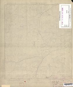
- Description:
- 1887
- Subject:
- Geographic Subject: Legnica, Topical Subject: Soviet Union, and Topical Subject: Maps
- Publisher:
- Генеральный штаб Красной Армии
- Language:
- Russian
- Date Created:
- 1941
- Identifier:
- VAC9619-002607
- Genre:
- Topographic Maps and Military Maps
- Geographic Location:
- Coordinates: 51, 16, 51.333, 16.5
- Related URL:
- DataCORE Dataset Download: https://datacore.iu.edu/concern/data_sets/j098zc00p
- Abstract:
- Modern area represented: Legnica, Lower Silesia province, Poland
- Call Number:
- G7000 s100 .S7 sheet M-33-33
- City:
- Лигниц (Legnica)
- Copyright Holder:
- No Copyright - United States
- Country:
- Германия (Germany)
- Physical Description:
- Scale: 1:100,000
- Persistent URL:
- http://purl.dlib.indiana.edu/iudl/images/VAC9619/VAC9619-002607
- Provenance:
- Geographic Names Branch, DMA Topographic Center, Army Map Service Library
-
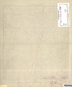
- Description:
- 1869
- Subject:
- Topical Subject: Soviet Union, Topical Subject: Maps, and Geographic Subject: Vysoké Mýto
- Publisher:
- Генеральный штаб Красной Армии
- Language:
- Russian
- Date Created:
- 1941
- Identifier:
- VAC9619-002708
- Genre:
- Military Maps and Topographic Maps
- Geographic Location:
- Coordinates: 49.667, 16, 50, 16.5
- Related URL:
- DataCORE Dataset Download: https://datacore.iu.edu/concern/data_sets/bk128b66f
- Abstract:
- Modern area represented: Vysoké Mýto, Pardubice region, Czech Republic
- Call Number:
- G7000 s100 .S7 sheet M-33-81
- City:
- Високе Мито (Vysoké Mýto)
- Copyright Holder:
- No Copyright - United States
- Country:
- Германия (Germany)
- State/Province:
- Протекторат Богемии и Моравии (Protectorate of Bohemia and Moravia)
- Physical Description:
- Scale: 1:100,000
- Persistent URL:
- http://purl.dlib.indiana.edu/iudl/images/VAC9619/VAC9619-002708
- Provenance:
- DMA Topographic Center, Army Map Service Library, Library of Congress Geography & Map Division, Auswärtiges Amt. Geographischer Dienst, OMAHA
-
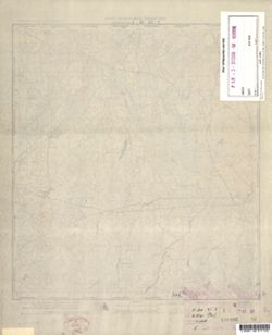
- Subject:
- Geographic Subject: Janowo, Topical Subject: Soviet Union, and Topical Subject: Maps
- Publisher:
- Генеральный штаб Красной Армии
- Language:
- Russian
- Date Created:
- 1941
- Identifier:
- VAC9619-000369
- Genre:
- Military Maps and Topographic Maps
- Geographic Location:
- Coordinates: 53.1667, 20.5, 53.3333, 20.75
- Related URL:
- DataCORE Dataset Download: https://datacore.iu.edu/concern/data_sets/wm117p673
- Abstract:
- Modern area represented: Janowo, Poland
- Call Number:
- G7000 s50 .S68 sheet N-34-102-A
- Caption:
- Captured map
- City:
- Яново (Janowo)
- Copyright Holder:
- No Copyright - United States
- Country:
- Германия (Germany), Восточная Пруссия (East Prussia), and Область государственных интересов Германии (Region of German state interest)
- Physical Description:
- Scale: 1:50,000
- Persistent URL:
- http://purl.dlib.indiana.edu/iudl/images/VAC9619/VAC9619-000369
- Provenance:
- DMA Topographic Center, Army Map Service Library, OMAHA, Library of Congress Geography & Map Division
-

- Subject:
- Topical Subject: Soviet Union, Geographic Subject: Chorzele, and Topical Subject: Maps
- Publisher:
- Генеральный штаб Красной Армии
- Language:
- Russian
- Date Created:
- 1941
- Identifier:
- VAC9619-000370
- Genre:
- Military Maps and Topographic Maps
- Geographic Location:
- Coordinates: 53.1667, 20.75, 53.3333, 21
- Related URL:
- DataCORE Dataset Download: https://datacore.iu.edu/concern/data_sets/k930bx80r
- Abstract:
- Modern area represented: Chorzele, Poland
- Call Number:
- G7000 s50 .S68 sheet N-34-102-B
- City:
- Хожеле (Khozhele)
- Copyright Holder:
- No Copyright - United States
- Country:
- Область государственных интересов Германии (Region of German state interest), Германия (Germany), and Восточная Пруссия (East Prussia)
- Physical Description:
- Scale: 1:50,000
- Persistent URL:
- http://purl.dlib.indiana.edu/iudl/images/VAC9619/VAC9619-000370
- Provenance:
- DMA Topographic Center, Army Map Service Library, OMAHA, Library of Congress Geography & Map Division
-
- Subject:
- Topical Subject: Soviet Union, Geographic Subject: Ruciane-Nida, and Topical Subject: Maps
- Publisher:
- Генеральный штаб Красной Армии
- Language:
- Russian
- Date Created:
- 1941
- Identifier:
- VAC9619-000368
- Genre:
- Topographic Maps and Military Maps
- Geographic Location:
- Coordinates: 53.5, 21.5, 53.6667, 21.75
- Related URL:
- DataCORE Dataset Download: https://datacore.iu.edu/concern/data_sets/h989r406g
- Abstract:
- Modern area represented: Ruciane-Nida, Poland
- Call Number:
- G7000 s50 .S68 sheet N-34-92-A
- Caption:
- Captured map
- City:
- Рудшанни (Rudczanny)
- Copyright Holder:
- No Copyright - United States
- Country:
- Восточная Пруссия (East Prussia) and Германия (Germany)
- Physical Description:
- Scale: 1:50,000
- Persistent URL:
- http://purl.dlib.indiana.edu/iudl/images/VAC9619/VAC9619-000368
- Provenance:
- DMA Topographic Center, Army Map Service Library, OMAHA, Library of Congress Geography & Map Division
-
- Subject:
- Topical Subject: Soviet Union, Geographic Subject: Myszyniec, and Topical Subject: Maps
- Publisher:
- Генеральный штаб Красной Армии
- Language:
- Russian
- Date Created:
- 1941
- Identifier:
- VAC9619-000367
- Genre:
- Topographic Maps and Military Maps
- Geographic Location:
- Coordinates: 53.3333, 21.25, 53.5, 21.5
- Related URL:
- DataCORE Dataset Download: https://datacore.iu.edu/concern/data_sets/td96k338w
- Abstract:
- Modern area represented: Myszyniec, Poland
- Call Number:
- G7000 s50 .S68 sheet N-34-91-D
- Caption:
- Captured map
- City:
- Мышинец (Myszyniec)
- Copyright Holder:
- No Copyright - United States
- Country:
- Германия (Germany), Область государственных интересов Германии (Region of German state interest), and Восточная Пруссия (East Prussia)
- Physical Description:
- Scale: 1:50,000
- Persistent URL:
- http://purl.dlib.indiana.edu/iudl/images/VAC9619/VAC9619-000367
- Provenance:
- DMA Topographic Center, Army Map Service Library, Library of Congress Geography & Map Division
-
- Subject:
- Topical Subject: Soviet Union, Geographic Subject: Spychowo, and Topical Subject: Maps
- Publisher:
- Генеральный штаб Красной Армии
- Language:
- Russian
- Date Created:
- 1941
- Identifier:
- VAC9619-000366
- Genre:
- Topographic Maps and Military Maps
- Geographic Location:
- Coordinates: 53.5, 31.25, 53.6667, 21.5
- Related URL:
- DataCORE Dataset Download: https://datacore.iu.edu/concern/data_sets/cz30pt42j
- Abstract:
- Modern area represented: Spychowo, Poland
- Call Number:
- G7000 s50 .S68 sheet N-34-91-B
- Caption:
- Captured map
- City:
- Пуппен (Puppen)
- Copyright Holder:
- No Copyright - United States
- Country:
- Германия (Germany) and Восточная Пруссия (East Prussia)
- Physical Description:
- Scale: 1:50,000
- Persistent URL:
- http://purl.dlib.indiana.edu/iudl/images/VAC9619/VAC9619-000366
- Provenance:
- DMA Topographic Center, Army Map Service Library, OMAHA, Library of Congress Geography & Map Division
-
- Subject:
- Topical Subject: Maps, Topical Subject: Soviet Union, and Geographic Subject: Świętajno
- Publisher:
- Генеральный штаб Красной Армии
- Language:
- Russian
- Date Created:
- 1941
- Identifier:
- VAC9619-000365
- Genre:
- Topographic Maps and Military Maps
- Geographic Location:
- Coordinates: 53.5, 21, 53.6667, 21.25
- Related URL:
- DataCORE Dataset Download: https://datacore.iu.edu/concern/data_sets/5d86p0976
- Abstract:
- Modern area represented: Świętajno, Poland
- Call Number:
- G7000 s50 .S68 sheet N-34-91-A
- Caption:
- Captured map
- City:
- Швентайнен (Schwentainen)
- Copyright Holder:
- No Copyright - United States
- Country:
- Германия (Germany) and Восточная Пруссия (East Prussia)
- Physical Description:
- Scale: 1:50,000
- Persistent URL:
- http://purl.dlib.indiana.edu/iudl/images/VAC9619/VAC9619-000365
- Provenance:
- DMA Topographic Center, Army Map Service Library, OMAHA, Library of Congress Geography & Map Division
-
- Description:
- 1909
- Subject:
- Geographic Subject: Wielbark, Topical Subject: Maps, and Topical Subject: Soviet Union
- Publisher:
- Генеральный штаб Красной Армии
- Language:
- Russian
- Date Created:
- 1941
- Identifier:
- VAC9619-000364
- Genre:
- Military Maps and Topographic Maps
- Geographic Location:
- Coordinates: 53.3333, 20.75, 53.5, 21
- Related URL:
- DataCORE Dataset Download: https://datacore.iu.edu/concern/data_sets/ns064670p
- Abstract:
- Modern area represented: Wielbark, Poland
- Call Number:
- G7000 s50 .S68 sheet N-34-90-D
- Caption:
- Captured map
- City:
- Вилленберг (Willenberg)
- Copyright Holder:
- No Copyright - United States
- Country:
- Восточная Пруссия (East Prussia) and Германия (Germany)
- Physical Description:
- Scale: 1:50,000
- Persistent URL:
- http://purl.dlib.indiana.edu/iudl/images/VAC9619/VAC9619-000364
- Provenance:
- DMA Topographic Center, Army Map Service Library, OMAHA, Library of Congress Geography & Map Division
-
- Subject:
- Topical Subject: Soviet Union, Topical Subject: Maps, and Geographic Subject: Muszaki
- Publisher:
- Генеральный штаб Красной Армии
- Language:
- Russian
- Date Created:
- 1941
- Identifier:
- VAC9619-000362
- Genre:
- Military Maps and Topographic Maps
- Geographic Location:
- Coordinates: 53.33333, 20.5, 53.5, 20.75
- Related URL:
- DataCORE Dataset Download: https://datacore.iu.edu/concern/data_sets/n870zr54m
- Abstract:
- Modern area represented: Muszaki, Poland
- Call Number:
- G7000 s50 .S68 sheet N-34-90-C
- Caption:
- Captured map
- City:
- Мушакен (Muschaken)
- Copyright Holder:
- No Copyright - United States
- Country:
- Германия (Germany) and Восточная Пруссия (East Prussia)
- State/Province:
- Область государственных интересов Германии (Region of German state interests)
- Physical Description:
- Scale: 1:50,000
- Persistent URL:
- http://purl.dlib.indiana.edu/iudl/images/VAC9619/VAC9619-000362
- Provenance:
- DMA Topographic Center, Army Map Service Library, OMAHA, Library of Congress Geography & Map Division
