
Search Constraints
You searched for:
Country
Германия (Germany)
Remove constraint Country: Германия (Germany)
Date Created
1941
Remove constraint Date Created: 1941
« Previous |
1 - 50 of 80
|
Next »
Search Results
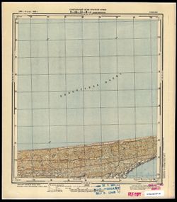
-
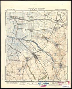
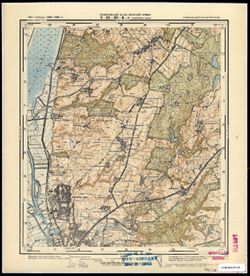
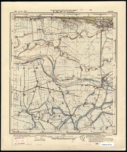
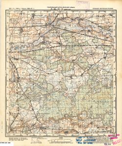
- Subject:
- Geographic Subject: Jelonki, Topical Subject: Soviet Union, and Topical Subject: Maps
- Publisher:
- Генеральный штаб Красной Армии
- Language:
- Russian
- Date Created:
- 1941
- Identifier:
- VAC9619-003794
- Genre:
- Topographic Maps and Military Maps
- Geographic Location:
- Coordinates: 54.0, 19.5, 54.083333, 19.625
- Related URL:
- Download GeoTIFF: https://drive.google.com/file/d/1lTM0VLznEr2rkz5aWONT4uGWUShBFUf3/view?usp=sharing and Catalog URL: https://iucat.iu.edu/catalog/14701157
- Abstract:
- Modern area represented: Jelonki, Poland
- Call Number:
- G7063.K2 s25 .S6 sheet N-34-64-C-c
- City:
- Гиршфельд (Hirschfeld)
- Copyright Holder:
- No Copyright - United States
- Country:
- Восточная Пруссия (East Prussia) and Германия (Germany)
- Physical Description:
- Scale: 1:25,000
- Persistent URL:
- http://purl.dlib.indiana.edu/iudl/images/VAC9619/VAC9619-003794
- Provenance:
- M. I. Map Library, G000-30, GS, RA
-
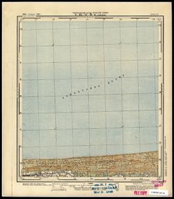
- Subject:
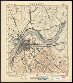
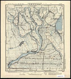
- Geographic Subject: Malbork, Topical Subject: Maps, and Topical Subject: Soviet Union
- Publisher:
- Генеральный штаб Красной Армии
- Language:
- Russian
- Date Created:
- 1941
- Identifier:
- VAC9619-003786
- Genre:
- Military Maps and Topographic Maps
- Geographic Location:
- Coordinates: 54, 19, 54.083, 19.125
- Related URL:
- Download GeoTIFF: https://drive.google.com/file/d/1Xzrws6cS9eLG23FZwKy0nV4LiGJBCcRv/view?usp=sharing and Catalog URL: https://iucat.iu.edu/catalog/14701157
- Abstract:
- Modern area represented: Malbork, Poland
- Call Number:
- G7063.K2 s25 .S6 sheet N-34-63-C-c
- City:
- Мариенбург
- Copyright Holder:
- No Copyright - United States
- Country:
- Германия (Germany)
- Physical Description:
- Scale: 1:25,000
- Persistent URL:
- http://purl.dlib.indiana.edu/iudl/images/VAC9619/VAC9619-003786
- Provenance:
- M. I. Map Library
-
- Subject:
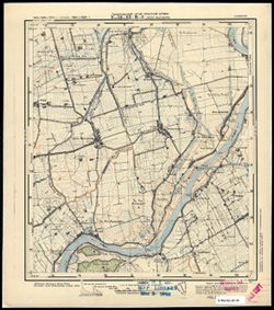
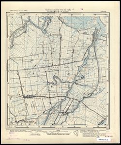
- Topical Subject: Maps, Topical Subject: Soviet Union, and Geographic Subject: Myszewo
- Publisher:
- Генеральный штаб Красной Армии
- Language:
- Russian
- Date Created:
- 1941
- Identifier:
- VAC9619-003785
- Genre:
- Topographic Maps and Military Maps
- Geographic Location:
- Coordinates: 54.083, 19.125, 54.167, 19.25
- Related URL:
- Catalog URL: https://iucat.iu.edu/catalog/14701157 and Download GeoTIFF: https://drive.google.com/file/d/1XadLTRStSNFshiBzZCO9r5wCAhaLTYqy/view?usp=sharing
- Abstract:
- Modern area represented: Myszewo, Poland
- Call Number:
- G7063.K2 s25 .S6 sheet N-34-63-C-b
- City:
- Гросс Маусдорф (Gross Mausdorf)
- Copyright Holder:
- No Copyright - United States
- Country:
- Германия (Germany)
- Physical Description:
- Scale: 1:25,000
- Persistent URL:
- http://purl.dlib.indiana.edu/iudl/images/VAC9619/VAC9619-003785
- Provenance:
- M. I. Map Library
-
- Subject:
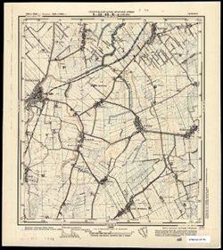
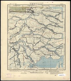
- Topical Subject: Soviet Union, Geographic Subject: Nowy Staw, and Topical Subject: Maps
- Publisher:
- Генеральный штаб Красной Армии
- Language:
- Russian
- Date Created:
- 1941
- Identifier:
- VAC9619-003784
- Genre:
- Topographic Maps and Military Maps
- Geographic Location:
- Coordinates: 54.083, 19, 54.167, 19.125
- Related URL:
- Download GeoTIFF: https://drive.google.com/file/d/1Sq9fVMvDmaoAlre3-zP3AuGktROnmii9/view?usp=sharing and Catalog URL: https://iucat.iu.edu/catalog/14701157
- Abstract:
- Modern area represented: Nowy Staw, Poland
- Call Number:
- G7063.K2 s25 .S6 sheet N-34-63-C-а
- City:
- Нойтайх (Neuteich)
- Copyright Holder:
- No Copyright - United States
- Country:
- Германия (Germany)
- Physical Description:
- Scale: 1:25,000
- Persistent URL:
- http://purl.dlib.indiana.edu/iudl/images/VAC9619/VAC9619-003784
- Provenance:
- CIA Map Branch -- Received
-
- Subject:
- Topical Subject: Maps, Geographic Subject: Elbląg, and Topical Subject: Soviet Union
- Publisher:
- Генеральный штаб Красной Армии
- Language:
- Russian
- Date Created:
- 1941
- Identifier:
- VAC9619-003783
- Genre:
- Military Maps and Topographic Maps
- Geographic Location:
- Coordinates: 54.167, 19.375, 54.25, 19.5
- Related URL:
- Download GeoTIFF: https://drive.google.com/file/d/1b2kxp8Acq6JkNcncigxWSdLSKx7IK959/view?usp=sharing and Catalog URL: https://iucat.iu.edu/catalog/14701157
- Abstract:
- Modern area represented: part of Elbląg, Poland
- Call Number:
- G7063.K2 s25 .S6 sheet N-34-63-B-d
- City:
- Пангриц-Кол (Pangritz-Kolonie)
- Copyright Holder:
- No Copyright - United States
- Country:
- Германия (Germany)
- Physical Description:
- Scale: 1:25,000
- Persistent URL:
- http://purl.dlib.indiana.edu/iudl/images/VAC9619/VAC9619-003783
- Provenance:
- M. I. Map Library
-
- Subject:
- Topical Subject: Maps, Geographic Subject: Kępki, and Topical Subject: Soviet Union
- Publisher:
- Генеральный штаб Красной Армии
- Language:
- Russian
- Date Created:
- 1941
- Identifier:
- VAC9619-003782
- Genre:
- Military Maps and Topographic Maps
- Geographic Location:
- Coordinates: 54.167, 19.25, 54.25, 19.375
- Related URL:
- Catalog URL: https://iucat.iu.edu/catalog/14701157 and Download GeoTIFF: https://drive.google.com/file/d/1SrLG238zrF6AKeHeXm0-yTy5GoRnwpno/view?usp=sharing
- Abstract:
- Modern area represented: Kępki, Poland
- Call Number:
- G7063.K2 s25 .S6 sheet N-34-63-B-c
- City:
- Цайер (Zeyer)
- Copyright Holder:
- No Copyright - United States
- Country:
- Германия (Germany)
- Physical Description:
- Scale: 1:25,000
- Persistent URL:
- http://purl.dlib.indiana.edu/iudl/images/VAC9619/VAC9619-003782
- Provenance:
- CIA Map Branch -- Received
-
- Subject:
- Topical Subject: Soviet Union, Geographic Subject: Marzęcino, and Topical Subject: Maps
- Publisher:
- Генеральный штаб Красной Армии
- Language:
- Russian
- Date Created:
- 1941
- Identifier:
- VAC9619-003781
- Genre:
- Military Maps and Topographic Maps
- Geographic Location:
- Coordinates: 54.167, 19.125, 54.25, 19.25
- Related URL:
- Download GeoTIFF: https://drive.google.com/file/d/1JHrB-S1z6MKK7fLMd5GRB8hrFkmk1RN5/view?usp=sharing and Catalog URL: https://iucat.iu.edu/catalog/14701157
- Abstract:
- Modern area represented: Marzęcino, Poland
- Call Number:
- G7063.K2 s25 .S6 sheet N-34-63-A-d
- City:
- Йюнгфер (Jungfer)
- Copyright Holder:
- No Copyright - United States
- Country:
- Германия (Germany)
- Physical Description:
- Scale: 1:25,000
- Persistent URL:
- http://purl.dlib.indiana.edu/iudl/images/VAC9619/VAC9619-003781
- Provenance:
- CIA Map Branch -- Received
-
- Subject:
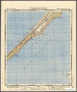
- Topical Subject: Soviet Union, Geographic Subject: Sztutowo, and Topical Subject: Maps
- Publisher:
- Генеральный штаб Красной Армии
- Language:
- Russian
- Date Created:
- 1941
- Identifier:
- VAC9619-003780
- Genre:
- Topographic Maps and Military Maps
- Geographic Location:
- Coordinates: 54.25, 19.125, 54.333, 19.25
- Related URL:
- Catalog URL: https://iucat.iu.edu/catalog/14701157 and Download GeoTIFF: https://drive.google.com/file/d/17dUXkuv4YY_CfvlhoYiPN_RG1L-Ds0QT/view?usp=sharing
- Abstract:
- Modern area represented: Sztutowo, Poland
- Call Number:
- G7063.K2 s25 .S6 sheet N-34-63-A-b
- City:
- Штуттхоф (Stutthof)
- Copyright Holder:
- No Copyright - United States
- Country:
- Германия (Germany)
- Physical Description:
- Scale: 1:25,000
- Persistent URL:
- http://purl.dlib.indiana.edu/iudl/images/VAC9619/VAC9619-003780
- Provenance:
- CIA Map Branch -- Received
-
- Subject:
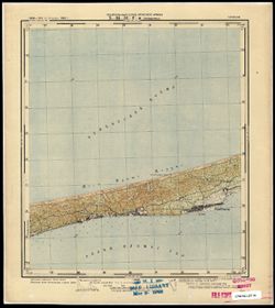
- Topical Subject: Soviet Union, Topical Subject: Maps, and Geographic Subject: Stegna
- Publisher:
- Генеральный штаб Красной Армии
- Language:
- Russian
- Date Created:
- 1941
- Identifier:
- VAC9619-003779
- Genre:
- Military Maps and Topographic Maps
- Geographic Location:
- Coordinates: 54.25, 19, 54.333, 19.125
- Related URL:
- Download GeoTIFF: https://drive.google.com/file/d/1OFTh9I5r9YumGdP0hxH4-EX_CYTQVLfu/view?usp=sharing and Catalog URL: https://iucat.iu.edu/catalog/14701157
- Abstract:
- Modern area represented: Stegna, Poland
- Call Number:
- G7063.K2 s25 .S6 sheet N-34-63-A-а
- City:
- Штееген (Steegen)
- Copyright Holder:
- No Copyright - United States
- Country:
- Германия (Germany)
- Physical Description:
- Scale: 1:25,000
- Persistent URL:
- http://purl.dlib.indiana.edu/iudl/images/VAC9619/VAC9619-003779
- Provenance:
- CIA Map Branch -- Received
-
- Subject:
- Geographic Subject: Bagrationovsk, Topical Subject: Maps, and Topical Subject: Soviet Union
- Publisher:
- Генеральный штаб Красной Армии
- Language:
- Russian
- Date Created:
- 1941
- Identifier:
- VAC9619-003746
- Genre:
- Military Maps and Topographic Maps
- Geographic Location:
- Coordinates: 54.3333, 20.625, 54.416667, 20.75
- Related URL:
- Download GeoTIFF: https://drive.google.com/file/d/1_09K1x3iGG35_Uo2XQW8nQtB_a94SkR8/view?usp=sharing and Catalog URL: https://iucat.iu.edu/catalog/14701157
- Abstract:
- Modern area represented: Bagrationovsk, Kaliningrad oblast, Russia
- Call Number:
- G7063.K2 s25 .S6 sheet N-34-54-C-d
- Caption:
- Captured map
- City:
- Прейсиш-Айлау (Preussisch-Eylau)
- Copyright Holder:
- No Copyright - United States
- Country:
- Восточная Пруссия (East Prussia) and Германия (Germany)
- Physical Description:
- Scale: 1:25,000
- Persistent URL:
- http://purl.dlib.indiana.edu/iudl/images/VAC9619/VAC9619-003746
- Provenance:
- Army Map Service Library, OMAHA, Library of Congress Geography & Map Division
-
- Subject:
- Topical Subject: Soviet Union, Geographic Subject: Narmeln, and Topical Subject: Maps
- Publisher:
- Генеральный штаб Красной Армии
- Language:
- Russian
- Date Created:
- 1941
- Identifier:
- VAC9619-003731
- Genre:
- Topographic Maps and Military Maps
- Geographic Location:
- Coordinates: 54.416667, 19.625, 54.5, 19.75
- Related URL:
- Catalog URL: https://iucat.iu.edu/catalog/14701157 and Download GeoTIFF: https://drive.google.com/file/d/1w6KAMpQmrtgzeErO2wKjNC0BH-hcU1W5/view?usp=sharing
- Abstract:
- Modern area represented: Narmeln, Kaliningrad oblast, Russia
- Call Number:
- G7063.K2 s25 .S6 sheet N-34-52-C-b
- City:
- Нармельн (Narmeln)
- Copyright Holder:
- No Copyright - United States
- Country:
- Германия (Germany) and Восточная Пруссия (East Prussia)
- Physical Description:
- Scale: 1:25,000
- Persistent URL:
- http://purl.dlib.indiana.edu/iudl/images/VAC9619/VAC9619-003731
- Provenance:
- CIA Map Branch -- Received
-
- Subject:
- Topical Subject: Maps, Topical Subject: Soviet Union, and Geographic Subject: Przebrno
- Publisher:
- Генеральный штаб Красной Армии
- Language:
- Russian
- Date Created:
- 1941
- Identifier:
- VAC9619-003726
- Genre:
- Military Maps and Topographic Maps
- Geographic Location:
- Coordinates: 54.333, 19.25, 54.417, 19.375
- Related URL:
- Download GeoTIFF: https://drive.google.com/file/d/1CLV6-QjLkr3uyiNtmTa1PIy0iQBKYM80/view?usp=sharing and Catalog URL: https://iucat.iu.edu/catalog/14701157
- Abstract:
- Modern area represented: Przebrno, part of the town of Krynica Morska, Poland
- Call Number:
- G7063.K2 s25 .S6 sheet N-34-51-D-c
- City:
- Преббернау (Pröbbernau)
- Copyright Holder:
- No Copyright - United States
- Country:
- Германия (Germany)
- Physical Description:
- Scale: 1:25,000
- Persistent URL:
- http://purl.dlib.indiana.edu/iudl/images/VAC9619/VAC9619-003726
- Provenance:
- M. I. Map Library
-
- Subject:
- Geographic Subject: Kąty Rybackie, Topical Subject: Soviet Union, and Topical Subject: Maps
- Publisher:
- Генеральный штаб Красной Армии
- Language:
- Russian
- Date Created:
- 1941
- Identifier:
- VAC9619-003725
- Genre:
- Topographic Maps and Military Maps
- Geographic Location:
- Coordinates: 54.333, 19.125, 54.417, 19.25
- Related URL:
- Download GeoTIFF: https://drive.google.com/file/d/1nthUYSIAKdjoclMMA8ArWuM2ha_r6Ch6/view?usp=sharing and Catalog URL: https://iucat.iu.edu/catalog/14701157
- Abstract:
- Modern area represented: Kąty Rybackie, Poland
- Call Number:
- G7063.K2 s25 .S6 sheet N-34-51-C-d
- City:
- Боденвинкель (Bodenwinkel)
- Copyright Holder:
- No Copyright - United States
- Country:
- Германия (Germany)
- Physical Description:
- Scale: 1:25,000
- Persistent URL:
- http://purl.dlib.indiana.edu/iudl/images/VAC9619/VAC9619-003725
- Provenance:
- M. I. Map Library
-
- Subject:
- Geographic Subject: Jantar, Topical Subject: Soviet Union, and Topical Subject: Maps
- Publisher:
- Генеральный штаб Красной Армии
- Language:
- Russian
- Date Created:
- 1941
- Identifier:
- VAC9619-003724
- Genre:
- Military Maps and Topographic Maps
- Geographic Location:
- Coordinates: 54.333, 19, 54.417, 19.125
- Related URL:
- Catalog URL: https://iucat.iu.edu/catalog/14701157 and Download GeoTIFF: https://drive.google.com/file/d/1XRXsOHSWk3V6ILdyPhcAPZc9s4tg6S4w/view?usp=sharing
- Abstract:
- Modern area represented: Jantar, Poland
- Call Number:
- G7063.K2 s25 .S6 sheet N-34-51-C-c
- City:
- Пазеварк (Pasewark)
- Copyright Holder:
- No Copyright - United States
- Country:
- Германия (Germany)
- Physical Description:
- Scale: 1:25,000
- Persistent URL:
- http://purl.dlib.indiana.edu/iudl/images/VAC9619/VAC9619-003724
- Provenance:
- M. I. Map Library
-
- Subject:
- Topical Subject: Maps, Geographic Subject: Gremyachye, and Topical Subject: Soviet Union
- Publisher:
- Генеральный штаб Красной Армии
- Language:
- Russian
- Date Created:
- 1941
- Identifier:
- VAC9619-003694
- Genre:
- Military Maps and Topographic Maps
- Geographic Location:
- Coordinates: 54.667, 21.625, 54.75, 21.75
- Related URL:
- Catalog URL: https://iucat.iu.edu/catalog/14701157 and Download GeoTIFF: https://drive.google.com/file/d/1KT2GrHhSTHNWfNPmFbtHfwPNejcPiMKa/view?usp=sharing
- Abstract:
- Modern area represented: Gremyachye, Kaliningrad oblast, Russia
- Call Number:
- G7063.K2 s25 .S6 sheet N-34-44-C-d
- City:
- Гросс Бершкаллен (Gross Berschkallen)
- Copyright Holder:
- No Copyright - United States
- Country:
- Восточная Пруссия (East Prussia) and Германия (Germany)
- Physical Description:
- Scale: 1:25,000
- Persistent URL:
- http://purl.dlib.indiana.edu/iudl/images/VAC9619/VAC9619-003694
- Provenance:
- M. I. Map Library, G000-30
-
- Description:
- 1869
- Subject:
- Geographic Subject: Týniště nad Orlicí, Topical Subject: Soviet Union, and Topical Subject: Maps
- Publisher:
- Генеральный штаб Красной Армии
- Language:
- Russian
- Date Created:
- 1941
- Identifier:
- VAC9619-002677
- Genre:
- Topographic Maps and Military Maps
- Geographic Location:
- Coordinates: 50.0, 16.0, 50.3333, 16.5
- Related URL:
- Download GeoTIFF: https://drive.google.com/file/d/1DVUpsS9Unf_spFh6JK77AQKXw7ADjRAS/view?usp=sharing and Catalog URL: https://iucat.iu.edu/catalog/5020129
- Abstract:
- Modern area represented: Týniště nad Orlicí, Hradec Králové Region, Czech Republic
- Call Number:
- G7000 s100 .S7 sheet M-33-69
- City:
- Тыниште (Týniště)
- Copyright Holder:
- No Copyright - United States
- Country:
- Германия (Germany)
- State/Province:
- Протекторат Богемии и Моравии (Protectorate of Bohemia and Moravia)
- Physical Description:
- Scale: 1:100,000
- Persistent URL:
- http://purl.dlib.indiana.edu/iudl/images/VAC9619/VAC9619-002677
- Provenance:
- DMA Topographic Center, Army Map Service Library, Geographic Names Branch
-
- Description:
- 1881
- Subject:
- Topical Subject: Soviet Union, Topical Subject: Maps, and Geographic Subject: Broumov
- Publisher:
- Генеральный штаб Красной Армии
- Language:
- Russian
- Date Created:
- 1941
- Identifier:
- VAC9619-002673
- Genre:
- Military Maps and Topographic Maps
- Geographic Location:
- Coordinates: 50.3333, 16.0, 50.6667, 16.5
- Related URL:
- Catalog URL: https://iucat.iu.edu/catalog/5020129 and Download GeoTIFF: https://drive.google.com/file/d/1vL-_2yzJz51i8Sl-L7gVn481HG8bylvt/view?usp=sharing
- Abstract:
- Modern area represented: Broumov, Hradec Králové region, Czech Republic
- Call Number:
- G7000 s100 .S7 sheet M-33-57
- City:
- Браунау (Braunau)
- Copyright Holder:
- No Copyright - United States
- Country:
- Германия (Germany)
- State/Province:
- Протекторат Богемии и Моравии (Protectorate of Bohemia and Moravia)
- Physical Description:
- Scale: 1:100,000
- Persistent URL:
- http://purl.dlib.indiana.edu/iudl/images/VAC9619/VAC9619-002673
- Provenance:
- DMA Topographic Center, Army Map Service Library
-

- Description:
- 1881
- Subject:
- Topical Subject: Soviet Union, Topical Subject: Maps, and Geographic Subject: Wałbrzych
- Publisher:
- Генеральный штаб Красной Армии
- Language:
- Russian
- Date Created:
- 1941
- Identifier:
- VAC9619-002669
- Genre:
- Topographic Maps and Military Maps
- Geographic Location:
- Coordinates: 50.667, 16, 51, 16.5
- Related URL:
- Download GeoTIFF: https://drive.google.com/file/d/1dqILe5GxCSjBkAQ_koaLdjUsoxZylSen/view?usp=sharing and Catalog URL: https://iucat.iu.edu/catalog/5020129
- Abstract:
- Modern area represented: Wałbrzych, Lower Silesian province, Poland
- Call Number:
- G7000 s100 .S7 sheet M-33-45
- City:
- Вальденбург (Waldenburg)
- Copyright Holder:
- No Copyright - United States
- Country:
- Германия (Germany)
- Physical Description:
- Scale: 1:100,000
- Persistent URL:
- http://purl.dlib.indiana.edu/iudl/images/VAC9619/VAC9619-002669
- Provenance:
- DMA Topographic Center, Army Map Service Library
-
- Description:
- 1881
- Subject:
- Topical Subject: Maps, Geographic Subject: Wałbrzych, and Topical Subject: Soviet Union
- Publisher:
- Генеральный штаб Красной Армии
- Language:
- Russian
- Date Created:
- 1941
- Identifier:
- VAC9619-002612
- Genre:
- Topographic Maps and Military Maps
- Geographic Location:
- Coordinates: 50.66667, 16.0, 51.0, 16.5
- Related URL:
- Download GeoTIFF: https://drive.google.com/file/d/1kFsiMhki6AQE-SCAeAGcI3MVKvGeIKR4/view?usp=sharing and Catalog URL: https://iucat.iu.edu/catalog/5020129
- Abstract:
- Modern area represented: Wałbrzych, Lower Silesian province, Poland
- Call Number:
- G7000 s100 .S7 sheet M-33-45
- City:
- Вальденбург (Waldenburg)
- Copyright Holder:
- No Copyright - United States
- Country:
- Германия (Germany)
- Physical Description:
- Scale: 1:100,000
- Persistent URL:
- http://purl.dlib.indiana.edu/iudl/images/VAC9619/VAC9619-002612
- Provenance:
- DMA Topographic Center, Army Map Service Library, Library of Congress Geography & Map Division
-
- Description:
- 1881
- Subject:
- Topical Subject: Maps, Geographic Subject: Wałbrzych, and Topical Subject: Soviet Union
- Publisher:
- Генеральный штаб Красной Армии
- Language:
- Russian
- Date Created:
- 1941
- Identifier:
- VAC9619-002611
- Genre:
- Military Maps and Topographic Maps
- Geographic Location:
- Coordinates: 50.667, 16, 51, 16.5
- Related URL:
- Catalog URL: https://iucat.iu.edu/catalog/5020129 and Download GeoTIFF: https://drive.google.com/file/d/1YmxgsSmD507KrgT3JLU_e4j1QXzzCA3Y/view?usp=sharing
- Abstract:
- Modern area represented: Wałbrzych, Lower Silesian province, Poland
- Call Number:
- G7000 s100 .S7 sheet M-33-45
- City:
- Вальденбург (Waldenburg)
- Copyright Holder:
- No Copyright - United States
- Country:
- Германия (Germany)
- Physical Description:
- Scale: 1:100,000
- Persistent URL:
- http://purl.dlib.indiana.edu/iudl/images/VAC9619/VAC9619-002611
- Provenance:
- DMA Topographic Center, Library of Congress G & M Division, Army Map Service Library, OMAHA
-
- Description:
- 1887
- Subject:
- Geographic Subject: Legnica, Topical Subject: Soviet Union, and Topical Subject: Maps
- Publisher:
- Генеральный штаб Красной Армии
- Language:
- Russian
- Date Created:
- 1941
- Identifier:
- VAC9619-002607
- Genre:
- Topographic Maps and Military Maps
- Geographic Location:
- Coordinates: 51, 16, 51.333, 16.5
- Related URL:
- Catalog URL: https://iucat.iu.edu/catalog/5020129 and Download GeoTIFF: https://drive.google.com/file/d/1KXLiwoAPM5wGtb60iFqkF_oom1IK570X/view?usp=sharing
- Abstract:
- Modern area represented: Legnica, Lower Silesia province, Poland
- Call Number:
- G7000 s100 .S7 sheet M-33-33
- City:
- Лигниц (Legnica)
- Copyright Holder:
- No Copyright - United States
- Country:
- Германия (Germany)
- Physical Description:
- Scale: 1:100,000
- Persistent URL:
- http://purl.dlib.indiana.edu/iudl/images/VAC9619/VAC9619-002607
- Provenance:
- Geographic Names Branch, DMA Topographic Center, Army Map Service Library
-
- Description:
- 1869
- Subject:
- Topical Subject: Soviet Union, Topical Subject: Maps, and Geographic Subject: Vysoké Mýto
- Publisher:
- Генеральный штаб Красной Армии
- Language:
- Russian
- Date Created:
- 1941
- Identifier:
- VAC9619-002708
- Genre:
- Military Maps and Topographic Maps
- Geographic Location:
- Coordinates: 49.667, 16, 50, 16.5
- Related URL:
- Download GeoTIFF: https://drive.google.com/file/d/1bxbg0QA-Bm4ku60mqvTMMgwr5Qr1bXw2/view?usp=sharing and Catalog URL: https://iucat.iu.edu/catalog/5020129
- Abstract:
- Modern area represented: Vysoké Mýto, Pardubice region, Czech Republic
- Call Number:
- G7000 s100 .S7 sheet M-33-81
- City:
- Високе Мито (Vysoké Mýto)
- Copyright Holder:
- No Copyright - United States
- Country:
- Германия (Germany)
- State/Province:
- Протекторат Богемии и Моравии (Protectorate of Bohemia and Moravia)
- Physical Description:
- Scale: 1:100,000
- Persistent URL:
- http://purl.dlib.indiana.edu/iudl/images/VAC9619/VAC9619-002708
- Provenance:
- DMA Topographic Center, Army Map Service Library, Library of Congress Geography & Map Division, Auswärtiges Amt. Geographischer Dienst, OMAHA
-
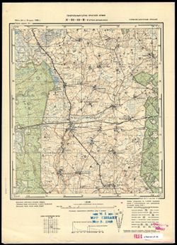
- Subject:
- Geographic Subject: Janowo, Topical Subject: Soviet Union, and Topical Subject: Maps
- Publisher:
- Генеральный штаб Красной Армии
- Language:
- Russian
- Date Created:
- 1941
- Identifier:
- VAC9619-000369
- Genre:
- Military Maps and Topographic Maps
- Geographic Location:
- Coordinates: 53.1667, 20.5, 53.3333, 20.75
- Related URL:
- Catalog URL: http://iucat.iu.edu/catalog/5020131 and Download GeoTIFF: https://drive.google.com/open?id=1UYLIVjiuM5rVviviizhQkKcRS6_koE_z
- Abstract:
- Modern area represented: Janowo, Poland
- Call Number:
- G7000 s50 .S68 sheet N-34-102-A
- Caption:
- Captured map
- City:
- Яново (Janowo)
- Copyright Holder:
- No Copyright - United States
- Country:
- Германия (Germany), Восточная Пруссия (East Prussia), and Область государственных интересов Германии (Region of German state interest)
- Physical Description:
- Scale: 1:50,000
- Persistent URL:
- http://purl.dlib.indiana.edu/iudl/images/VAC9619/VAC9619-000369
- Provenance:
- DMA Topographic Center, Army Map Service Library, OMAHA, Library of Congress Geography & Map Division
-
- Subject:
- Topical Subject: Soviet Union, Geographic Subject: Chorzele, and Topical Subject: Maps
- Publisher:
- Генеральный штаб Красной Армии
- Language:
- Russian
- Date Created:
- 1941
- Identifier:
- VAC9619-000370
- Genre:
- Military Maps and Topographic Maps
- Geographic Location:
- Coordinates: 53.1667, 20.75, 53.3333, 21
- Related URL:
- Download GeoTIFF: https://drive.google.com/open?id=1eT_SRLdiphOMmD85IKw1gqQJSPCLmqJ_ and Catalog URL: http://iucat.iu.edu/catalog/5020131
- Abstract:
- Modern area represented: Chorzele, Poland
- Call Number:
- G7000 s50 .S68 sheet N-34-102-B
- City:
- Хожеле (Khozhele)
- Copyright Holder:
- No Copyright - United States
- Country:
- Область государственных интересов Германии (Region of German state interest), Германия (Germany), and Восточная Пруссия (East Prussia)
- Physical Description:
- Scale: 1:50,000
- Persistent URL:
- http://purl.dlib.indiana.edu/iudl/images/VAC9619/VAC9619-000370
- Provenance:
- DMA Topographic Center, Army Map Service Library, OMAHA, Library of Congress Geography & Map Division
-
- Subject:
- Topical Subject: Soviet Union, Geographic Subject: Ruciane-Nida, and Topical Subject: Maps
- Publisher:
- Генеральный штаб Красной Армии
- Language:
- Russian
- Date Created:
- 1941
- Identifier:
- VAC9619-000368
- Genre:
- Topographic Maps and Military Maps
- Geographic Location:
- Coordinates: 53.5, 21.5, 53.6667, 21.75
- Related URL:
- Catalog URL: http://iucat.iu.edu/catalog/5020131 and Download GeoTIFF: https://drive.google.com/open?id=1cqfVzcKVjXpLIWrub-fJQ-nPwWYVhexU
- Abstract:
- Modern area represented: Ruciane-Nida, Poland
- Call Number:
- G7000 s50 .S68 sheet N-34-92-A
- Caption:
- Captured map
- City:
- Рудшанни (Rudczanny)
- Copyright Holder:
- No Copyright - United States
- Country:
- Восточная Пруссия (East Prussia) and Германия (Germany)
- Physical Description:
- Scale: 1:50,000
- Persistent URL:
- http://purl.dlib.indiana.edu/iudl/images/VAC9619/VAC9619-000368
- Provenance:
- DMA Topographic Center, Army Map Service Library, OMAHA, Library of Congress Geography & Map Division
-
- Subject:
- Topical Subject: Soviet Union, Geographic Subject: Myszyniec, and Topical Subject: Maps
- Publisher:
- Генеральный штаб Красной Армии
- Language:
- Russian
- Date Created:
- 1941
- Identifier:
- VAC9619-000367
- Genre:
- Topographic Maps and Military Maps
- Geographic Location:
- Coordinates: 53.3333, 21.25, 53.5, 21.5
- Related URL:
- Catalog URL: http://iucat.iu.edu/catalog/5020131 and Download GeoTIFF: https://drive.google.com/open?id=1FYXXnu6YQ3Mr7ySKdf7m7E2v6f7ARySH
- Abstract:
- Modern area represented: Myszyniec, Poland
- Call Number:
- G7000 s50 .S68 sheet N-34-91-D
- Caption:
- Captured map
- City:
- Мышинец (Myszyniec)
- Copyright Holder:
- No Copyright - United States
- Country:
- Германия (Germany), Область государственных интересов Германии (Region of German state interest), and Восточная Пруссия (East Prussia)
- Physical Description:
- Scale: 1:50,000
- Persistent URL:
- http://purl.dlib.indiana.edu/iudl/images/VAC9619/VAC9619-000367
- Provenance:
- DMA Topographic Center, Army Map Service Library, Library of Congress Geography & Map Division
-
- Subject:
- Topical Subject: Soviet Union, Geographic Subject: Spychowo, and Topical Subject: Maps
- Publisher:
- Генеральный штаб Красной Армии
- Language:
- Russian
- Date Created:
- 1941
- Identifier:
- VAC9619-000366
- Genre:
- Topographic Maps and Military Maps
- Geographic Location:
- Coordinates: 53.5, 31.25, 53.6667, 21.5
- Related URL:
- Download GeoTIFF: https://drive.google.com/open?id=1qNjA3RB4RaacgakVhP6dvQxEKhBfNvbo and Catalog URL: http://iucat.iu.edu/catalog/5020131
- Abstract:
- Modern area represented: Spychowo, Poland
- Call Number:
- G7000 s50 .S68 sheet N-34-91-B
- Caption:
- Captured map
- City:
- Пуппен (Puppen)
- Copyright Holder:
- No Copyright - United States
- Country:
- Германия (Germany) and Восточная Пруссия (East Prussia)
- Physical Description:
- Scale: 1:50,000
- Persistent URL:
- http://purl.dlib.indiana.edu/iudl/images/VAC9619/VAC9619-000366
- Provenance:
- DMA Topographic Center, Army Map Service Library, OMAHA, Library of Congress Geography & Map Division
-
- Subject:
- Topical Subject: Maps, Topical Subject: Soviet Union, and Geographic Subject: Świętajno
- Publisher:
- Генеральный штаб Красной Армии
- Language:
- Russian
- Date Created:
- 1941
- Identifier:
- VAC9619-000365
- Genre:
- Topographic Maps and Military Maps
- Geographic Location:
- Coordinates: 53.5, 21, 53.6667, 21.25
- Related URL:
- Download GeoTIFF: https://drive.google.com/open?id=1L4ZCvNRBgzhq9zdxWkZu89gYSYTCE_sL and Catalog URL: http://iucat.iu.edu/catalog/5020131
- Abstract:
- Modern area represented: Świętajno, Poland
- Call Number:
- G7000 s50 .S68 sheet N-34-91-A
- Caption:
- Captured map
- City:
- Швентайнен (Schwentainen)
- Copyright Holder:
- No Copyright - United States
- Country:
- Германия (Germany) and Восточная Пруссия (East Prussia)
- Physical Description:
- Scale: 1:50,000
- Persistent URL:
- http://purl.dlib.indiana.edu/iudl/images/VAC9619/VAC9619-000365
- Provenance:
- DMA Topographic Center, Army Map Service Library, OMAHA, Library of Congress Geography & Map Division
-
- Description:
- 1909
- Subject:
- Geographic Subject: Wielbark, Topical Subject: Maps, and Topical Subject: Soviet Union
- Publisher:
- Генеральный штаб Красной Армии
- Language:
- Russian
- Date Created:
- 1941
- Identifier:
- VAC9619-000364
- Genre:
- Military Maps and Topographic Maps
- Geographic Location:
- Coordinates: 53.3333, 20.75, 53.5, 21
- Related URL:
- Download GeoTIFF: https://drive.google.com/open?id=1HHdbX7E0cnMrubYxnxEpGa4wh1SbJai_ and Catalog URL: http://iucat.iu.edu/catalog/5020131
- Abstract:
- Modern area represented: Wielbark, Poland
- Call Number:
- G7000 s50 .S68 sheet N-34-90-D
- Caption:
- Captured map
- City:
- Вилленберг (Willenberg)
- Copyright Holder:
- No Copyright - United States
- Country:
- Восточная Пруссия (East Prussia) and Германия (Germany)
- Physical Description:
- Scale: 1:50,000
- Persistent URL:
- http://purl.dlib.indiana.edu/iudl/images/VAC9619/VAC9619-000364
- Provenance:
- DMA Topographic Center, Army Map Service Library, OMAHA, Library of Congress Geography & Map Division
-
- Subject:
- Topical Subject: Soviet Union, Topical Subject: Maps, and Geographic Subject: Muszaki
- Publisher:
- Генеральный штаб Красной Армии
- Language:
- Russian
- Date Created:
- 1941
- Identifier:
- VAC9619-000362
- Genre:
- Military Maps and Topographic Maps
- Geographic Location:
- Coordinates: 53.33333, 20.5, 53.5, 20.75
- Related URL:
- Catalog URL: http://iucat.iu.edu/catalog/5020131 and Download GeoTIFF: https://drive.google.com/open?id=1a9K-7XWGpL0pJuHj2-wg3Zvnn1eboqY6
- Abstract:
- Modern area represented: Muszaki, Poland
- Call Number:
- G7000 s50 .S68 sheet N-34-90-C
- Caption:
- Captured map
- City:
- Мушакен (Muschaken)
- Copyright Holder:
- No Copyright - United States
- Country:
- Германия (Germany) and Восточная Пруссия (East Prussia)
- State/Province:
- Область государственных интересов Германии (Region of German state interests)
- Physical Description:
- Scale: 1:50,000
- Persistent URL:
- http://purl.dlib.indiana.edu/iudl/images/VAC9619/VAC9619-000362
- Provenance:
- DMA Topographic Center, Army Map Service Library, OMAHA, Library of Congress Geography & Map Division
-
- Subject:
- Geographic Subject: Straduny, Topical Subject: Maps, and Topical Subject: Soviet Union
- Publisher:
- Генеральный штаб Красной Армии
- Language:
- Russian
- Date Created:
- 1941
- Identifier:
- VAC9619-000361
- Genre:
- Military Maps and Topographic Maps
- Geographic Location:
- Coordinates: 53.83333, 22.25, 54.0, 22.5
- Related URL:
- Catalog URL: http://iucat.iu.edu/catalog/5020131 and Download GeoTIFF: https://drive.google.com/open?id=1UwjaufrFOne5qki5XFLfUIWw3FZPIj-P
- Abstract:
- Modern area represented: Straduny, Poland
- Call Number:
- G7000 s50 .S68 sheet N-34-81-B
- Caption:
- Captured map
- City:
- Штрадаунен (Stradaunen)
- Copyright Holder:
- No Copyright - United States
- Country:
- Германия (Germany) and Восточная Пруссия (East Prussia)
- Physical Description:
- Scale: 1:50,000
- Persistent URL:
- http://purl.dlib.indiana.edu/iudl/images/VAC9619/VAC9619-000361
- Provenance:
- DMA Topographic Center, Army Map Service Library, OMAHA, Library of Congress Geography & Map Division
-
- Subject:
- Geographic Subject: Orzysz, Topical Subject: Maps, and Topical Subject: Soviet Union
- Publisher:
- Генеральный штаб Красной Армии
- Language:
- Russian
- Date Created:
- 1941
- Identifier:
- VAC9619-000360
- Genre:
- Military Maps and Topographic Maps
- Geographic Location:
- Coordinates: 53.66667, 21.75, 53.83333, 22.0
- Related URL:
- Download GeoTIFF: https://drive.google.com/open?id=1quIH8WkLZVQZYEz_078ctuyofRyy58SG and Catalog URL: http://iucat.iu.edu/catalog/5020131
- Abstract:
- Modern area represented: Orzysz, Poland
- Call Number:
- G7000 s50 .S68 sheet N-34-80-D
- City:
- Арис (Arys)
- Copyright Holder:
- No Copyright - United States
- Country:
- Восточная Пруссия (East Prussia) and Германия (Germany)
- Physical Description:
- Scale: 1:50,000
- Persistent URL:
- http://purl.dlib.indiana.edu/iudl/images/VAC9619/VAC9619-000360
- Provenance:
- DMA Topographic Center, Army Map Service Library, OMAHA, Library of Congress Geography & Map Division
-
- Subject:
- Geographic Subject: Mikołajki, Topical Subject: Soviet Union, and Topical Subject: Maps
- Publisher:
- Генеральный штаб Красной Армии
- Language:
- Russian
- Date Created:
- 1941
- Identifier:
- VAC9619-000359
- Genre:
- Military Maps and Topographic Maps
- Geographic Location:
- Coordinates: 53.66667, 21.5, 53.83333, 21.75
- Related URL:
- Catalog URL: http://iucat.iu.edu/catalog/5020131 and Download GeoTIFF: https://drive.google.com/open?id=1DQd01x2fJlk5Q0yiKB68j2ko90olJ8WE
- Abstract:
- Modern area represented: Mikołajki, Poland
- Call Number:
- G7000 s50 .S68 sheet N-34-80-C
- Caption:
- Captured map
- City:
- Николайкен (Nikolaiken)
- Copyright Holder:
- No Copyright - United States
- Country:
- Восточная Пруссия (East Prussia) and Германия (Germany)
- Physical Description:
- Scale: 1:50,000
- Persistent URL:
- http://purl.dlib.indiana.edu/iudl/images/VAC9619/VAC9619-000359
- Provenance:
- DMA Topographic Center, Army Map Service Library, OMAHA, Library of Congress Geography & Map Division
-
- Subject:
- Topical Subject: Soviet Union, Geographic Subject: Miłki, and Topical Subject: Maps
- Publisher:
- Генеральный штаб Красной Армии
- Language:
- Russian
- Date Created:
- 1941
- Identifier:
- VAC9619-000358
- Genre:
- Military Maps and Topographic Maps
- Geographic Location:
- Coordinates: 53.83333, 21.75, 54.0, 22.0
- Related URL:
- Download GeoTIFF: https://drive.google.com/open?id=1hbiMvb4V4nlVuqDWuTMru_ccs90KZXjf and Catalog URL: http://iucat.iu.edu/catalog/5020131
- Abstract:
- Modern area represented: Miłki, Poland
- Call Number:
- G7000 s50 .S68 sheet N-34-80-B
- Caption:
- Captured map
- City:
- Милькен (Milken)
- Copyright Holder:
- No Copyright - United States
- Country:
- Восточная Пруссия (East Prussia) and Германия (Germany)
- Physical Description:
- Scale: 1:50,000
- Persistent URL:
- http://purl.dlib.indiana.edu/iudl/images/VAC9619/VAC9619-000358
- Provenance:
- DMA Topographic Center, Army Map Service Library, OMAHA, Library of Congress Geography & Map Division
-
- Subject:
- Topical Subject: Maps, Geographic Subject: Kobułty, and Topical Subject: Soviet Union
- Publisher:
- Генеральный штаб Красной Армии
- Language:
- Russian
- Date Created:
- 1941
- Identifier:
- VAC9619-000357
- Genre:
- Military Maps and Topographic Maps
- Geographic Location:
- Coordinates: 53.66667, 21.0, 53.83333, 21.25
- Related URL:
- Catalog URL: http://iucat.iu.edu/catalog/5020131 and Download GeoTIFF: https://drive.google.com/open?id=1wVPptpjJn0xl6Lucnjw4Sz9mhkRXGojw
- Abstract:
- Modern area represented: Kobułty, Poland
- Call Number:
- zsheet N-34-79-C and G7000 s50 .S68
- City:
- Кобультен (Kobulten)
- Copyright Holder:
- No Copyright - United States
- Country:
- Германия (Germany) and Восточная Пруссия (East Prussia)
- Physical Description:
- Scale: 1:50,000
- Persistent URL:
- http://purl.dlib.indiana.edu/iudl/images/VAC9619/VAC9619-000357
- Provenance:
- DMA Topographic Center, Army Map Service Library, OMAHA, Library of Congress Geography & Map Division
-
- Subject:
- Geographic Subject: Biskupiec, Topical Subject: Soviet Union, and Topical Subject: Maps
- Publisher:
- Генеральный штаб Красной Армии
- Language:
- Russian
- Date Created:
- 1941
- Identifier:
- VAC9619-000356
- Genre:
- Topographic Maps and Military Maps
- Geographic Location:
- Coordinates: 53.83333, 20.75, 54.0, 21.0
- Related URL:
- Download GeoTIFF: https://drive.google.com/open?id=1DBPYnmIWIDWzPCZzhriD1LGjqvp8SUyY and Catalog URL: http://iucat.iu.edu/catalog/5020131
- Abstract:
- Modern area represented: Biskupiec, Poland
- Call Number:
- G7000 s50 .S68 sheet N-34-78-B
- City:
- Бишофсбург (Bischofsburg)
- Copyright Holder:
- No Copyright - United States
- Country:
- Восточная Пруссия (East Prussia) and Германия (Germany)
- Physical Description:
- Scale: 1:50,000
- Persistent URL:
- http://purl.dlib.indiana.edu/iudl/images/VAC9619/VAC9619-000356
- Provenance:
- DMA Topographic Center, Army Map Service Library, OMAHA, Library of Congress Geography & Map Division
-
- Subject:
- Geographic Subject: Jeziorany, Topical Subject: Soviet Union, and Topical Subject: Maps
- Publisher:
- Генеральный штаб Красной Армии
- Language:
- Russian
- Date Created:
- 1941
- Identifier:
- VAC9619-000355
- Genre:
- Military Maps and Topographic Maps
- Geographic Location:
- Coordinates: 53.83333, 20.5, 54.0, 20.75
- Related URL:
- Catalog URL: http://iucat.iu.edu/catalog/5020131 and Download GeoTIFF: https://drive.google.com/open?id=1FPb0JvKp0XiYP1vAss1DbrLTRKBkv4WD
- Abstract:
- Modern area represented: Jeziorany, Poland
- Call Number:
- G7000 s50 .S68 sheet N-34-78-A
- Caption:
- Captured map
- City:
- Зеебург (Seeburg)
- Copyright Holder:
- No Copyright - United States
- Country:
- Германия (Germany) and Восточная Пруссия (East Prussia)
- Physical Description:
- Scale: 1:50,000
- Persistent URL:
- http://purl.dlib.indiana.edu/iudl/images/VAC9619/VAC9619-000355
- Provenance:
- DMA Topographic Center, Army Map Service Library, OMAHA, Library of Congress Geography & Map Division
-
- Subject:
- Geographic Subject: Olecko, Topical Subject: Soviet Union, and Topical Subject: Maps
- Publisher:
- Генеральный штаб Красной Армии
- Language:
- Russian
- Date Created:
- 1941
- Identifier:
- VAC9619-000354
- Genre:
- Topographic Maps and Military Maps
- Geographic Location:
- Coordinates: 54.0, 22.5, 54.166667, 22.75
- Related URL:
- Download GeoTIFF: https://drive.google.com/open?id=1WNDxDhKCEjUwfDRkE1jGhIeQso3c6ZO4 and Catalog URL: http://iucat.iu.edu/catalog/5020131
- Abstract:
- Modern area represented: Olecko, Poland
- Call Number:
- G7000 s50 .S68 sheet N-34-70-C
- City:
- Тройбург (Treuburg)
- Copyright Holder:
- No Copyright - United States
- Country:
- Область государственных интересов Германии (Region of German state interest) and Германия (Germany)
- Physical Description:
- Scale: 1:50,000
- Persistent URL:
- http://purl.dlib.indiana.edu/iudl/images/VAC9619/VAC9619-000354
- Provenance:
- DMA Topographic Center, Army Map Service Library, Library of Congress Geography & Map Division
-
- Subject:
- Topical Subject: Soviet Union, Topical Subject: Maps, and Geographic Subject: Sterławki Wielkie
- Publisher:
- Генеральный штаб Красной Армии
- Language:
- Russian
- Date Created:
- 1941
- Identifier:
- VAC9619-000351
- Genre:
- Topographic Maps and Military Maps
- Geographic Location:
- Coordinates: 54.0, 21.5, 54.166667, 21.75
- Related URL:
- Download GeoTIFF: https://drive.google.com/open?id=1T5B4PuXgchawYSMbnezcqCR7dder-sx2 and Catalog URL: http://iucat.iu.edu/catalog/5020131
- Abstract:
- Modern area represented: Sterławki Wielkie, Poland
- Call Number:
- G7000 s50 .S68 sheet N-34-68-C
- City:
- Гросс Штюрлак (Gross Stürlack)
- Copyright Holder:
- No Copyright - United States
- Country:
- Восточная Пруссия (East Prussia) and Германия (Germany)
- Physical Description:
- Scale: 1:50,000
- Persistent URL:
- http://purl.dlib.indiana.edu/iudl/images/VAC9619/VAC9619-000351
- Provenance:
- DMA Topographic Center, Army Map Service Library, OMAHA, Library of Congress Geography & Map Division
-
- Subject:
- Geographic Subject: Gołdap, Topical Subject: Maps, and Topical Subject: Soviet Union
- Publisher:
- Генеральный штаб Красной Армии
- Language:
- Russian
- Date Created:
- 1941
- Identifier:
- VAC9619-000352
- Genre:
- Topographic Maps and Military Maps
- Geographic Location:
- Coordinates: 54.16667, 22.25, 54.3333, 22.5
- Related URL:
- Catalog URL: http://iucat.iu.edu/catalog/5020131 and Download GeoTIFF: https://drive.google.com/open?id=1IbAgvZRp84NPgyJq2AVDuXc8tRsaj-mw
- Abstract:
- Modern area represented: Gołdap, Poland
- Call Number:
- G7000 s50 .S68 sheet N-34-69-B
- City:
- Гольдап (Gol'dap)
- Copyright Holder:
- No Copyright - United States
- Country:
- Германия (Germany) and Восточная Пруссия (East Prussia)
- Physical Description:
- Scale: 1:50,000
- Persistent URL:
- http://purl.dlib.indiana.edu/iudl/images/VAC9619/VAC9619-000352
- Provenance:
- DMA Topographic Center, Army Map Service Library, OMAHA, Library of Congress Geography & Map Division
-
- Subject:
- Topical Subject: Soviet Union, Geographic Subject: Duły, and Topical Subject: Maps
- Publisher:
- Генеральный штаб Красной Армии
- Language:
- Russian
- Date Created:
- 1941
- Identifier:
- VAC9619-000353
- Genre:
- Topographic Maps and Military Maps
- Geographic Location:
- Coordinates: 54.0, 22.25, 54.16667, 22.5
- Related URL:
- Catalog URL: http://iucat.iu.edu/catalog/5020131 and Download GeoTIFF: https://drive.google.com/open?id=1YR0L9oMlB9OyNXWAaEG2NnDhyNheIX4d
- Abstract:
- Modern area represented: Duły, Poland
- Call Number:
- G7000 s50 .S68 sheet N-34-69-D
- Caption:
- Captured map
- City:
- Дуллен (Dullen)
- Copyright Holder:
- No Copyright - United States
- Country:
- Восточная Пруссия (East Prussia) and Германия (Germany)
- Physical Description:
- Scale: 1:50,000
- Persistent URL:
- http://purl.dlib.indiana.edu/iudl/images/VAC9619/VAC9619-000353
- Provenance:
- DMA Topographic Center, Army Map Service Library, OMAHA, Library of Congress Geography & Map Division
-

- Subject:
- Geographic Subject: Węgorzewo, Topical Subject: Maps, and Topical Subject: Soviet Union
- Publisher:
- Генеральный штаб Красной Армии
- Language:
- Russian
- Date Created:
- 1941
- Identifier:
- VAC9619-000349
- Genre:
- Topographic Maps and Military Maps
- Geographic Location:
- Coordinates: 54.16667, 21.5, 54.33333, 21.75
- Related URL:
- Catalog URL: http://iucat.iu.edu/catalog/5020131 and Download GeoTIFF: https://drive.google.com/open?id=10TxC6z7YjlBDxHuZ1907hiBu7PKzG2q7
- Abstract:
- Modern area represented: Węgorzewo, Poland
- Call Number:
- G7000 s50 .S68 sheet N-34-68-A
- Caption:
- Captured map
- City:
- Ангербург (Angerburg)
- Copyright Holder:
- No Copyright - United States
- Country:
- Восточная Пруссия (East Prussia) and Германия (Germany)
- Physical Description:
- Scale: 1:50,000
- Persistent URL:
- http://purl.dlib.indiana.edu/iudl/images/VAC9619/VAC9619-000349
- Provenance:
- DMA Topographic Center, Army Map Service Library, Library of Congress Geography & Map Division, OMAHA
-
- Subject:
- Topical Subject: Soviet Union, Geographic Subject: Sępopol, and Topical Subject: Maps
- Publisher:
- Генеральный штаб Красной Армии
- Language:
- Russian
- Date Created:
- 1941
- Identifier:
- VAC9619-000348
- Genre:
- Military Maps and Topographic Maps
- Geographic Location:
- Coordinates: 54.16667, 21.0, 54.33333, 21.25
- Related URL:
- Catalog URL: http://iucat.iu.edu/catalog/5020131 and Download GeoTIFF: https://drive.google.com/open?id=1CQ6z3n7Hz-nmQ_YPHezuKLb0zuuoqDJd
- Abstract:
- Modern area represented: Sępopol, Poland
- Call Number:
- G7000 s50 .S68 sheet N-34-67-A
- Caption:
- Captured map
- City:
- Шиппенбайль (Schippenbeil)
- Copyright Holder:
- No Copyright - United States
- Country:
- Германия (Germany) and Восточная Пруссия (East Prussia)
- Physical Description:
- Scale: 1:50,000
- Persistent URL:
- http://purl.dlib.indiana.edu/iudl/images/VAC9619/VAC9619-000348
- Provenance:
- DMA Topographic Center, Army Map Service Library, OMAHA, Library of Congress Geography & Map Division
-
- Subject:
- Topical Subject: Soviet Union, Topical Subject: Maps, and Geographic Subject: Yasnaya Polyana
- Publisher:
- Генеральный штаб Красной Армии
- Language:
- Russian
- Date Created:
- 1941
- Identifier:
- VAC9619-000344
- Genre:
- Military Maps and Topographic Maps
- Geographic Location:
- Coordinates: 54.5, 22.25, 54.66667, 22.5
- Related URL:
- Catalog URL: http://iucat.iu.edu/catalog/5020131 and Download GeoTIFF: https://drive.google.com/open?id=1MDrpt44prhXuK4E8OU_JVTamJCLT7FT_
- Abstract:
- Modern area represented: Yasnaya Polyana, Kaliningrad oblast, Russia
- Call Number:
- G7000 s50 .S68 sheet N-34-57-B
- Caption:
- Captured map
- City:
- Гросс Тракенен (Gross Trakehnen)
- Copyright Holder:
- No Copyright - United States
- Country:
- Восточная Пруссия (East Prussia) and Германия (Germany)
- Physical Description:
- Scale: 1:50,000
- Persistent URL:
- http://purl.dlib.indiana.edu/iudl/images/VAC9619/VAC9619-000344
- Provenance:
- DMA Topographic Center, Army Map Service Library, OMAHA, Library of Congress Geography & Map Division
-
- Subject:
- Topical Subject: Maps, Topical Subject: Soviet Union, and Geographic Subject: Judino
- Publisher:
- Генеральный штаб Красной Армии
- Language:
- Russian
- Date Created:
- 1941
- Identifier:
- VAC9619-000343
- Genre:
- Military Maps and Topographic Maps
- Geographic Location:
- Coordinates: 54.33333, 21.75, 54.5, 22.0
- Related URL:
- Catalog URL: http://iucat.iu.edu/catalog/5020131 and Download GeoTIFF: https://drive.google.com/open?id=10KWkMdR8i6HpfdJ26dLbE1cxEuP4LLRO
- Abstract:
- Modern area represented: Judino, Kaliningrad oblast, Russia
- Call Number:
- G7000 s50 .S68 sheet N-34-56-D
- City:
- Йургайтшен (Jurgaitschen)
- Copyright Holder:
- No Copyright - United States
- Country:
- Германия (Germany) and Восточная Пруссия (East Prussia)
- Physical Description:
- Scale: 1:50,000
- Persistent URL:
- http://purl.dlib.indiana.edu/iudl/images/VAC9619/VAC9619-000343
- Provenance:
- M. I. Map Library, G000-30, GS, RA
-
- Subject:
- Geographic Subject: Zheleznodorozhnyy, Topical Subject: Maps, and Topical Subject: Soviet Union
- Publisher:
- Генеральный штаб Красной Армии
- Language:
- Russian
- Date Created:
- 1941
- Identifier:
- VAC9619-000341
- Genre:
- Topographic Maps and Military Maps
- Geographic Location:
- Coordinates: 54.33333, 21.25, 54.5, 21.5
- Related URL:
- Catalog URL: http://iucat.iu.edu/catalog/5020131 and Download GeoTIFF: https://drive.google.com/open?id=1LimnLvW5ElDVv2vPTyB4hYr0k2GCR5Fr
- Abstract:
- Modern area represented: Zheleznodorozhnyy, Kaliningrad oblast, Russia
- Call Number:
- zsheet N-34-55-D and G7000 s50 .S68
- City:
- Гердауен (Gerdauen)
- Copyright Holder:
- No Copyright - United States
- Country:
- Восточная Пруссия (East Prussia) and Германия (Germany)
- Physical Description:
- Scale: 1:50,000
- Persistent URL:
- http://purl.dlib.indiana.edu/iudl/images/VAC9619/VAC9619-000341
- Provenance:
- M. I. Map Library, Justus Perthes Kartensammlung, GS, RA, G000-30
-
- Subject:
- Topical Subject: Maps, Geographic Subject: Pravdinsk, and Topical Subject: Soviet Union
- Publisher:
- Генеральный штаб Красной Армии
- Language:
- Russian
- Date Created:
- 1941
- Identifier:
- VAC9619-000339
- Genre:
- Military Maps and Topographic Maps
- Geographic Location:
- Coordinates: 54.3333, 21, 54.5, 21.25
- Related URL:
- Download GeoTIFF: https://drive.google.com/open?id=1F7e0tjF21LjXhwHivl4lLg65HzBdgmlG and Catalog URL: http://iucat.iu.edu/catalog/5020131
- Abstract:
- Modern area represented: Pravdinsk, Kaliningrad oblast, Russia
- Call Number:
- G7000 s50 .S68 sheet N-34-55-C
- City:
- Фридланд (Friedland)
- Copyright Holder:
- No Copyright - United States
- Country:
- Восточная Пруссия (East Prussia) and Германия (Germany)
- Physical Description:
- Scale: 1:50,000
- Persistent URL:
- http://purl.dlib.indiana.edu/iudl/images/VAC9619/VAC9619-000339
- Provenance:
- DMA Topographic Center, Army Map Service Library, OMAHA, Library of Congress Geography & Map Division
-
- Subject:
- Geographic Subject: Sukhodol'ye, Topical Subject: Maps, and Topical Subject: Soviet Union
- Publisher:
- Генеральный штаб Красной Армии
- Language:
- Russian
- Date Created:
- 1941
- Identifier:
- VAC9619-000338
- Genre:
- Topographic Maps and Military Maps
- Geographic Location:
- Coordinates: 54.5, 21.25, 54.6667, 21.5
- Related URL:
- Download GeoTIFF: https://drive.google.com/open?id=1WksLkri0YT250-jkkIckJXvsvIa0UixN and Catalog URL: http://iucat.iu.edu/catalog/5020131
- Abstract:
- Modern area represented: Sukhodolye, Kaliningrad oblast, Russia
- Call Number:
- G7000 s50 .S68 sheet N-34-55-B
- City:
- Клайн Нур (Klein Nur)
- Copyright Holder:
- No Copyright - United States
- Country:
- Германия (Germany) and Восточная Пруссия (East Prussia)
- Physical Description:
- Scale: 1:50,000
- Persistent URL:
- http://purl.dlib.indiana.edu/iudl/images/VAC9619/VAC9619-000338
- Provenance:
- M. I. Map Library, Justus Perthes Kartensammlung, GS, RA, G000-30
-
- Subject:
- Geographic Subject: Gvardeysk, Topical Subject: Maps, and Topical Subject: Soviet Union
- Publisher:
- Генеральный штаб Красной Армии
- Language:
- Russian
- Date Created:
- 1941
- Identifier:
- VAC9619-000337
- Genre:
- Topographic Maps and Military Maps
- Geographic Location:
- Coordinates: 54.5, 21, 54.6667, 21.25
- Related URL:
- Catalog URL: http://iucat.iu.edu/catalog/5020131 and Download GeoTIFF: https://drive.google.com/open?id=1kuZbMY8p5lBSNdi69QTcfeayeyva52h6
- Abstract:
- Modern area represented: Gvardeysk, Kaliningrad oblast, Russia
- Call Number:
- G7000 s50 .S68 sheet N-34-55-A
- City:
- Тапиау (Tapiau)
- Copyright Holder:
- No Copyright - United States
- Country:
- Германия (Germany) and Восточная Пруссия (East Prussia)
- Physical Description:
- Scale: 1:50,000
- Persistent URL:
- http://purl.dlib.indiana.edu/iudl/images/VAC9619/VAC9619-000337
- Provenance:
- DMA Topographic Center, Army Map Service Library, OMAHA, Library of Congress Geography & Map Division
-
- Subject:
- Topical Subject: Soviet Union, Geographic Subject: Domnovo, and Topical Subject: Maps
- Publisher:
- Генеральный штаб Красной Армии
- Language:
- Russian
- Date Created:
- 1941
- Identifier:
- VAC9619-000333
- Genre:
- Topographic Maps and Military Maps
- Geographic Location:
- Coordinates: 54.3333, 20.75, 54.5, 21
- Related URL:
- Catalog URL: http://iucat.iu.edu/catalog/5020131 and Download GeoTIFF: https://drive.google.com/open?id=1zg6Rmm_fuNw0noNee5jq17_5Myp5fwTL
- Abstract:
- Modern area represented: Domnovo, Kaliningrad oblast, Russia
- Call Number:
- G7000 s50 .S68 sheet N-34-54-D
- City:
- Домнау (Domnau)
- Copyright Holder:
- No Copyright - United States
- Country:
- Восточная Пруссия (East Prussia) and Германия (Germany)
- Physical Description:
- Scale: 1:50,000
- Persistent URL:
- http://purl.dlib.indiana.edu/iudl/images/VAC9619/VAC9619-000333
- Provenance:
- DMA Topographic Center, Army Map Service Library, OMAHA, Library of Congress Geography & Map Division
